Israel's Good Name

Archive for June, 2015|Monthly archive page

Tel Afeq (Antipatris)

In Central Israel, Israel on June 28, 2015 at 4:45 AM

After leaving the site of my previous blog post, Migdal Afeq (Mirabel), I found myself at the bus stop on the main road just outside of Rosh HaAyin, heading for my next location: Tel Afeq (Antipatris). The summer heat was rather getting to me so I made a quick decision and flagged down a taxi to take me to the nearby national park of Tel Afeq.

Binar Bashi fortress at Tel Afeq

Binar Bashi fortress at Tel Afeq

Dropping me off at the picnic areas, I took the shaded tables as an opportunity to dip into the pastries I had bought earlier that morning in Ramat Gan. It was then that I noticed that my third destination of the day, Yarkon National Park, was actually considered a joined park with Tel Afeq and that the two of them were somewhat connected by a trail through some fields. And so I started my explorations at the dry rain pond and headed for the Roman cardo.
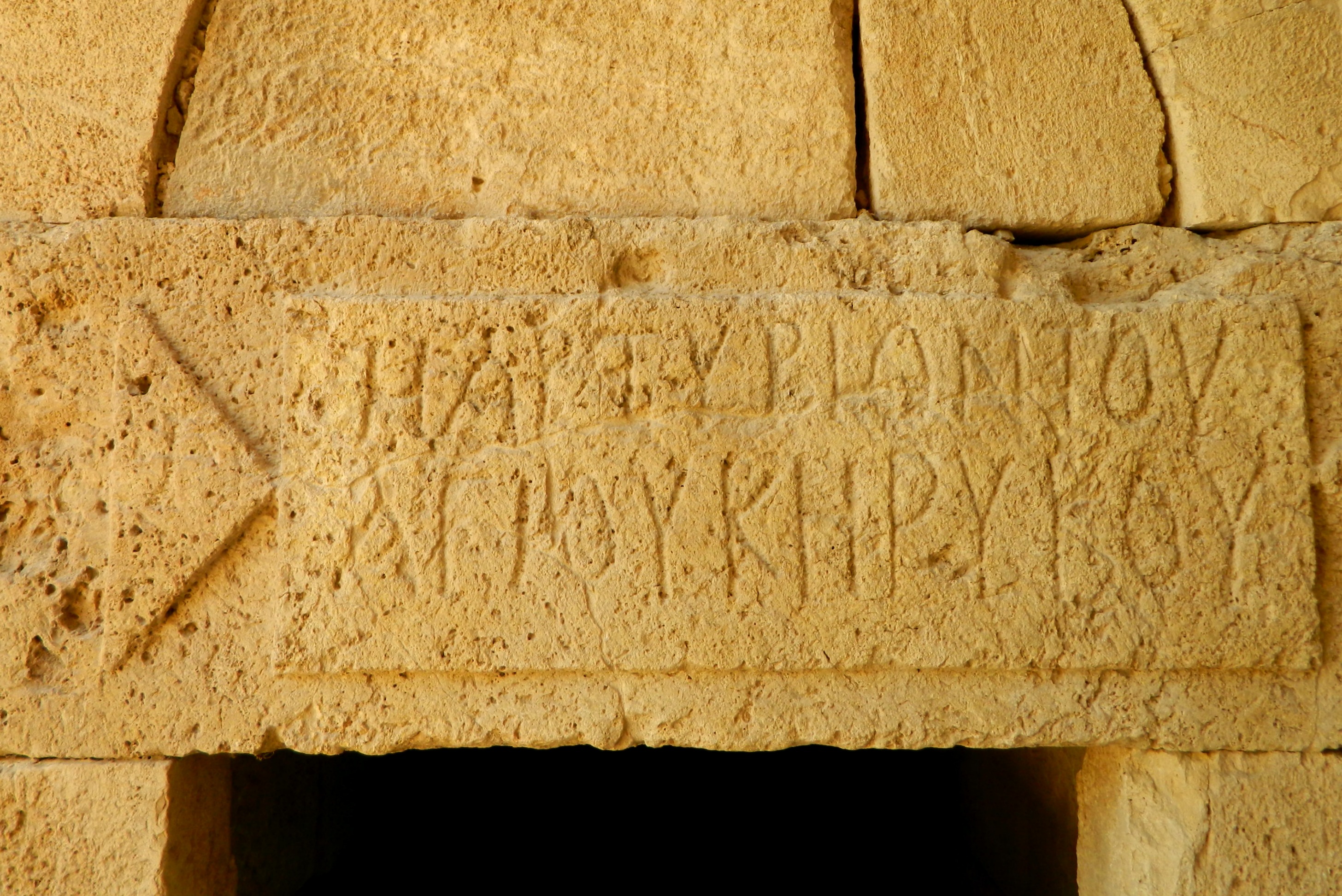
Antipatris' cardo

Antipatris’ cardo

Along the cardo, an ancient main street, I came upon an odeum (a small Greek and Roman theatre building) and then a memorial for the 41 Jewish lives lost to the Alexandroni Brigade is offensive attacks on the Iraqi forces entrenched at both Tel Afeq and the Migdal Afeq area in 1948.

Roman odeum

Roman odeum

Historical remains on the tel extend back to the Chalcolithic period with notable ruins from the Egyptian/Canaanite times and the Roman era. Biblical Aphek is mentioned as well, having been the location of the Philistine camp during two disastrous battles with the Israelites, resulting in the Philistines capturing the Aron (or, Holy Ark of the Covenant). In the Greek period a city by the name of Pagae (“Springs”) was founded, just one of many in a historical timeline, all coveting control over the important Via Maris trade route. Herod created the city of Antipatris, named after his father, during his rule of the Holy Land in the Roman era. Antipatris as he knew it, filled with Jews, was destroyed by Vespasian during the Great Revolt some fifty-odd years later.

Binar Bashi seen from the air in the early 1930's (photo: Library of Congress)

Binar Bashi seen from the air in the early 1930’s (photo: Library of Congress)

Next along the cardo is the Roman forum and then the crown of the tel – the impressive Ottoman fortress known as Binar Bashi.

The southwest tower

The southwest tower

Built between 1572 and 1574, Binar Bashi was the first really important development on Tel Afeq since the existence of Antipatris. During the Crusader period, the land was part of a gift parceled out to Balian of Ibelin by King Fulk of Jerusalem, with castle Mirabel being the regional stronghold. Tel Afeq was reduced to a district estate for the knights of the House of Ibelin. Binar Bashi (originally called Pinar Basi in Turkish, meaning “Head of the Springs”) was a fortified khan commissioned by the son of Suleiman the Magnificent.

Turkish soldier watching me from the window

Turkish soldier watching me from the window

I was rather impressed with the standing of the fortress, especially the octagonal southwest corner tower. As I reached the northwest tower I spotted a raptor sitting on the ruined wall a little ways away. The bird you see below is none other than a steppe buzzard and minutes later he took off and was immediately heckled midair by some crows. Thank you master ornithologist Yoav Perlman for identification, for I am hopeless at Old World raptors.

Steppe buzzard

Steppe buzzard

Returning to the stony ruins, I walked around the excavated and restored remains of what once was an Egyptian governor’s palace lording over the Canaanite royal city after the Egyptian conquest of the Holy Land (which culminated in their victory at Tel Megiddo). The size and quantity of Egyptian-era winepresses at Tel Afeq suggests trade significance for importing wine to the Nile Delta area.

Egyptian governor's palace

Egyptian governor’s palace

Leaving the fortress and its blisteringly hot and mostly unshaded courtyard, I then walked over to the British pumping station complex. Pockmarked by bullet holes in the concrete walls, this building was used by Iraqi soldiers, and subsequent to local victory, by Israeli troops during the War for Independence. Built in the 1930’s, this pumping station was used to provide water for Jerusalem, as well as other local cities, sending the water to the water station in Latrun. With the Yarkon springs being the second most prosperous source of fresh water (after the springs at Tel Dan in the north), the British tapped into it and so do we – the discharge rate being some 200 million cubic metres a year.

British water pumping station

British water pumping station

Looping around the water station, I walked along the slightly overflooded rain pool and enjoyed myself photographing the incredible lush view and the plentiful waterfowls.

Spying on a grey heron through the plants

Spying on a grey heron through the plants

Ready to move on to the next destination, I said farewell to the pied kingfisher near the back gate of the park and began my walk through the adjacent fields alongside the springs and streams at the source of the Yarkon.

Pied kingfisher

Pied kingfisher

Next stop: Yarkon National Park!

Migdal Afeq (Mirabel)

In Central Israel, Israel on June 21, 2015 at 4:18 AM

This past Thursday I went on a three-pronged trip while down in the centre of the country. I began my adventure in Ramat Gan, just outside of Tel Aviv, buying pastries and an iced coffee before hopping on a bus out of the city. I then took another bus which dropped me off near the entrance of Rosh HaAyin, a city bordering the Shomron (Samaria), where I walked a little ways through a construction site, heading for the Crusader castle of Mirabel.

Migdal Afeq (Mirabel)

Migdal Afeq (Mirabel)

Known as either Migdal Afeq or Migdal Tzedek nowadays, the national park is named for either the nearby Biblical Aphek or the Bedouin sheikh al-Sadiq, respectively. I climbed the hill and approached the castle from the south, walking the dirt road. This aerial photo of the castle was taken by Biblewalks, and they graciously allowed me to use it in my post (see also the aerial video tour HERE):

Migdal Afeq from above (photo: Biblewalks)

Migdal Afeq from above (photo: Biblewalks)

I had heard from a friend that the site was under construction and closed to visitors, and hoped that there would be nobody there when I arrived, but, there was, in fact, a lone man holding watch over the ruins.

Inside the castle courtyard

Inside the castle courtyard

I passed the scaffolding-decorated walls and entered the castle’s interior. The following conversation was short and successful with the man returning to sit in a doorway, leaving me to explore Mirabel unhindered. The first thing to really catch my eye was a large lintel stone inscribed with Greek lettering delineating a Byzantine church.

Greek-inscribed lintel

Greek-inscribed lintel

Migdal Afeq served an important role in protecting the ancient trade route from Egypt to Syria, known as the Via Maris. However, whatever stood at Migdal Afeq in those times was only ever a satellite to the much more important Tel Afeq, just a few kilometres to the northwest (although not to be confused with Tel Afeq at Ein Afeq between Akko and Haifa). During the Roman period a Jewish village existed, and during the Great Revolt, was destroyed by Cestius Gallus and the 12th Legion.

Israeli flag flying proud

Israeli flag flying proud

In Crusader times the castle known as Mirabel was constructed after the land was gifted to Balian of Ibelin, the founder of the Ibelin dynasty, by King Fulk of Jerusalem. Interestingly enough, Ibelin is just a corruption of the ancient Jewish Yavne and to this day there is an Arab village near Haifa called I’billin and I wonder if it’s not named after the once-powerful Frankish family. Mirabel was captured by Saladin’s brother in 1187 and the castle was used by the Ayyubid forces until 1191 when Saladin ordered the castle destroyed in preparation for the Third Crusade. Most of the ruins seen today were built by the Ottomans, although some parts (including the keep seen in the photo below) are original Crusader construction – identifiable by the larger ashlars used in building.

The Crusader keep flanked by arched Ottoman rooms

The Crusader keep flanked by arched Ottoman rooms

In the 1800’s, Bedouins settled around the fortress and called their village Majdal al-Sadiq, named after their leader whose domed tomb surrounded by other graves still stands on an adjacent hill.

Sheikh al-Sadiq's tomb

Sheikh al-Sadiq’s tomb

When I was finished exploring the site, being careful around the construction areas, I asked the watchman when he imagined the archaeologists would arrive. I waited around for a bit, taking the time to explore the outside of the castle, passing what seemed to be a water cistern just outside the castle wall. One interesting thing that I saw was this set of old lime kilns with an old quarry in the background. Apparently, the limestone quarried from here was used to build the white stoned-buildings of old Tel Aviv from the 1920’s through the 1940’s.

Old lime kilns with quarries in the background

Old lime kilns with quarries in the background

Returning to the castle’s interior, I greeted some arriving men only to find out that they were the construction crew and their foreman. Just blending in to the environment I was able to learn a little about the reconstruction process of ancient castles.

The healing process

The healing process

At last, I fretted over time lost waiting for the archaeologists to show so I left, headed for the second site on my day’s itinerary: Tel Afeq (Antipatris)

Outskirts of Parod

In Galilee, Israel on June 14, 2015 at 4:53 AM

The other week I took a bus to Karmiel one morning and then another bus heading east to Kibbutz Parod. I had a whole slew of places to visit and explore, starting with a megalithic mound known as Jethro Cairn (or Gal Yitro, in Hebrew). Approximately 500 feet (150 metres) long and 66 feet (20 metres) wide, this crescent-shaped pile of lichen-spotted rocks made news last year when findings were announced by Hebrew University PhD student Ido Wachtel, naming it older than the Pyramids and Stonehenge, as seen HERE in an article by Live Science.

Jethro Cairn from above

Jethro Cairn from above

Believing the site to be a monument consecrated to the pagan moon god Sin, there is also a religious connection to the Druze people who live locally in the Galilee and Golan. Historically, if a Druze had trouble making the annual pilgrimage to the shrine of al-Nabi Shu’ayb (what they believe is the Biblical Jethro’s tomb located not far from Mount Arbel), he would make do with visiting Jethro Cairn. Starting from the fragrant pine forest along the road, I climbed up the hill in search for the cairn. Up and up I went, even crossing through an inconvenient barbed wire fence – the first of many to hamper my explorations that day. At last I reached the large mound of rocks, and walked the entire length of the crescent, taking in the view including a Tegart fort in the distance to the east.

Jethro Cairn with the Tegart fort far off to the upper left

Jethro Cairn with the Tegart fort far off to the upper left

That irksome barbed wire fence even found its way cutting across the cairn. When I reached the other end I found an easier way down the hill and made my way to the dry streambed of Nachal Tzalmon. Following the trail I passed the access road to Parod and found a sign naming the path as the Parod Falls Trail, with a series of things to see. Starting with a small aqueduct I came across two keverim (graves) of sages: R’ Nechemya HaAmusi and R’ Yishmael.

Kever of R' Yishmael on the banks of the stream

Kever of R’ Yishmael on the banks of the stream

Both having lived in the Roman period when the Second Temple was destroyed, these Tannaim likely lived in the nearby ancient Jewish villages that I came to see. After some quick prayers I carried on, walking along the stream which, at this time of year, only had small puddles of water between the numerous tiny would-be falls. I passed two caves, ancient agricultural terraces and an ancient flour mill before reaching a gate on a dirt road. Climbing it, I turned out of the stream’s valley to hike up a hill to the west – Tel Be’er Sheva of the Galilee. Not to be confused with Tel Be’er Sheva in the Negev, this hill in the Galilee was once the home of a vibrant Jewish village prior to the Great Revolt against the Romans. And so I fought my way through the thorns and brambles, the hill’s peak coming ever closer. At last I reached the top and after surveying the peak, realised that the remains were hardly anything to be seen, just meagre wall bits beside a cow carcass.

Meagre wall ruins of Tel Be'er Sheva

Meagre wall ruins of Tel Be’er Sheva

As I made my way towards the southern slope of the hill I found this mysterious insect that I haven’t yet identified, which I had seen and mentioned on my last post, Nachal Ga’aton.

Mysterious insect

Mysterious insect

Walking down the southern side proved to be much nicer and I even found an interesting crystal nodule that caught my eye by glinting in the sun. At the near-bottom of the hill I found a pit that was partially closed off with fence and barrels, and, when I went inside turned out to be a necropolis with so many bones (and even a mummified puppy). Escaping the cistern of death, I then explored the nearby Ottoman-era vaulted building of unknown purposes.

Inside the Ottoman structure

Inside the Ottoman structure

Finished with that hill, I crossed Nachal Tzalmon once again and attempted to visit another kever or two as well as the ruins of Kfar Hannania on the opposing slope. Believed to have been a just a support satellite of the fortified Be’er Sheva during the Great Revolt, eventually the populations settled in the more convenient location of Kfar Hannania, abandoning the strategic hilltop. Heading for a few visible rock walls I encountered a barbed wire fence that was too difficult to get through. I continued along the fence heading south, along the natural curve of the hill, but eventually gave up and walked back to Road 85. Crossing at the junction, I paid a visit to the keverim of R’ Abba Khalafta and his sons, R’ Yossi and R’ Shimon.

Keverim of R' Abba Khalafta and sons

Keverim of R’ Abba Khalafta and sons

There I met the friendly caretaker who offered me cold water and drove me over to a nearby group of keverim, sparing me from the walk in the heat. I first visited the kever of R’ Eliezer ben Ya’akov – a very interesting two-floored grave with a shallow cave where people light memorial candles. Next I walked up and nearly missed the kever of R’ Ya’akov – just a few blue painted rocks beneath a small tree covering a tiny cave. Just a few feet further I entered the mausoleum of R’ Chananya ben Akashia and his family and students.

Kever of R' Chananya ben Akashia

Kever of R’ Chananya ben Akashia

I spent a little while there and then left, passing some stone wall ruins of Kfar Hannania before reaching the bus stop that I needed to take me back to Karmiel and then back home.