Israel's Good Name

Archive for the ‘Judea’ Category

University Trip: Nachal Chever & the Southern Judean Desert

In Israel, Judea on May 22, 2022 at 7:30 AM

Following my university department’s field trips to various sites in the northern and central regions of the Judean Desert, we set out in the middle of January for the final trip of the series led by Dr Dvir Raviv, destined for the desert’s southern third. It was a long sleepy bus ride from the BIU campus to our first stop of the day, some obscure location in the arid desert. Deposited at the side of the road near the Bedouin sprawl of Az-Zuweidin, we began to hike over rocky, jagged hills in the direction of Nachal Chever.

The first hike of the day

The first hike of the day

It was a nice morning hike through the arid land, passing a few Bedouin women engaged in agricultural labour and a clumping of their houses, as we made our way to the first lookout. There, perched over Nachal Chever, we learned about the geological makeup of the region, and made note of the nearby Sela Cave, a few unassuming holes on the opposing hillside.

The winding Nachal Chever

The winding Nachal Chever

We were joined by some curious Bedouins and their hounds, two of the youths sitting down alongside us on the craggy rocks. After the educational overview, we took leave of our Bedouin hosts and began the slow descent towards the winding wadi.

Curious Bedouin hounds

Curious Bedouin hounds

Our hike took an easternly direction, passing a few flushed larks and mourning wheatears as our party traversed the dried streambed with purposeful speed. The land opened up to a relatively flat plateau with a few conical peaks up ahead, and then our trail turned due southeast.

The end of the easy hiking

The end of the easy hiking

The leisurely hike became a great deal more difficult as we huffed our way up the steep dirt road in the direction of one of the nearby ridges. The ascent was challenging, but awaiting us at the top was respite at an interesting graffiti-marked hull of an old building. It was the ruins of Umm Daraj, an abandoned Jordanian military police station from the pre-1967 period, which commanded the entire region during Jordanian rule.

The ruins of Umm Daraj

The ruins of Umm Daraj

We were not there for the recent history lesson, but rather for the incredible, panoramic view of the surrounding area. It was the heat of the day, and we were all alone in the wilderness but for a few shepherds and their flock, grazing on the ridge behind us. We drank in the deep desert scenery, resting in the shade of the vanquished walls, as Dvir taught us more about the importance of our current location from a topographical standpoint.

Peering out at the vista

Peering out at the vista

Hiking our way back down and towards the waiting bus, we passed a few brown-necked ravens and desert larks, which were added to my current year list. As we drove along the rough roads, I happened to glance out of the bus window to see a rather dark little owl perched on a pipe that ran parallel to the road. It was unfazed by our rumbling presence, but seeing it filled me with an indescribable joy which can hardly be put into words.

An inquisitive mourning wheatear

An inquisitive mourning wheatear

Driving along, passing some grazing camels, the bus then brought us to Mitzpe Yair, a Jewish village nearby, where we looked out at the geological formations of the surrounding area. From there we drove down to the city of Arad, and had a small break at a gas station where I found some delightful canned honey and salt peanuts.

Mesmerising desert landscapes

Mesmerising desert landscapes

Looping back north a bit, the bus deposited us once again at the side of the road, this time at a sign announcing the Judean Desert Nature Reserve. We were headed for Givat Gorni, a flat ridge that overlooks a small valley of sorts and affords a picturesque view of the surroundings. It was getting late and Givat Gorni was just a bit too far to reach given the time that we had left before dusk, so we walked alongside an established biking path, and settled down at a spot where we could enjoy the view comfortably.

Walking the plateau towards Givat Gorni

Walking the plateau towards Givat Gorni

However, it wasn’t really all that comfortable; there was a howling, bitterly cold wind that cut into us, despite our attempts to avoid it. The sun was slowly sinking towards the opposing landscape, and it was time to head back. Descending from the ridge, the hike was easier now and we moved at a fast clip, the bus waiting for us patiently down at the roadside.

Dvir lecturing in the howling winds

Dvir lecturing in the howling winds

Trotting down, we passed the last few wheatears still visible and boarded the bus for the long drive back. It was an incredible three days of intense desert hiking, and despite how tiring it was, we all had a rewarding time as we traversed the remarkable Judean Desert. From a personal perspective, I gained appreciation for the geological aspect, something that I had generally ignored in the past, and was thankful for the opportunity to see so many new places in Israel.

The end of a series

The end of a series

Delightful as this series was, there is always more to do in life and this coming summer, Dr Dvir Raviv is launching a new archaeological excavation at a yet-unexcavated biblical site, Tel Timna in the Shomron. I don’t know yet if I will be attending, but everyone is welcome to join in on the excitement – more information can be seen HERE.

University Trip: Wadi Murabba’at & Dead Sea Forts

In Israel, Judea on February 12, 2022 at 8:38 PM

Continuing with the three-part series of field trips to the Judean Desert in January, this expedition focused on sites in the central desert region. Our tour bus departed from the BIU campus in the morning and we enjoyed a long drive through the misty countryside and bustling urban areas until we reached the Dead Sea. Our first site of the day was Khirbet Mazin, a fortified anchorage on the coast, one of eight anchorages that lined the Dead Sea in antiquity. It was a hot winter day, surprisingly enough, but we settled down on an elevated ridge above the ruins to hear from our guide, Dr Dvir Raviv.

Our first stop of the day

The site of Khirbet Mazin (also known as Qasr al-Yehud, yet not to be compared to the baptismal site on the Jordan as seen HERE) originally dated back to the Iron Age, and was rebuilt during the Hasmonean and Roman periods. Due to the difficulty of transporting people and cargo by land in the craggy Dead Sea area, passage was easier over the salty waters. A system of anchorages was developed, with Khirbet Mazin being one of the more important ones. By the Hasmonean and Roman periods, the independent anchorage structure was grand and likely served as the official local shipyard. With the water levels fluctuating over the past millennia, the site was temporarily covered over with sand and gravel, only to be re-exposed and excavated in the 1960s and 1970s.

Khirbet Mazin (and our bus) at the Dead Sea

We finished our visit there, said goodbye to the Arabian green bee-eaters flying around us and got back on the bus. From there we continued down the Dead Sea coast, along the high cliffs of the Dead Sea Fault Escarpment, until we reached the road to the Dragot Cliffs and began the snaking ascent. Our loyal bus driver drove us as far as he possibly could on the rocky road, yielding only when one of his tires was no longer touching terra firma. We dutifully disembarked at that point and began hiking in the direction of Wadi Murabba’at.

Hiking to Wadi Murabba’at

Interestingly enough, the weather was cooler up atop the fault escarpment, and the hiking was pleasing as we traversed the hilly land. We turned off the main trail in the direction of the wadi, and began the slow descent to the cliff edge. I was amazed at the raw beauty of the place, surrounded by pleasantly gentle hilltops to the north and craggy cliffs to the south. As we stood overlooking the next leg of our hike, I spotted a small herd of Nubian ibexes nestled in the cliffside as they took shelter from the sun.

Watching me watching you with a Nubian ibex

As we walked down, I saw a few more fun creatures including sand partridges, a streaked scrub warbler, some white-crowned wheatears and a small-spotted lizard. Yet, when we reached the cliff descent, I had to focus on my personal safety and less on the winged wonders around me. The hike down was glorious, each step leading to an even more exciting view of the gorge below us.

Descending into Wadi Murabba’at

We climbed further down, at times aided by metal safety bars as we navigated our way to a ledge overlooking the wadi. The ledge offered relatively easy hiking, yet one false move and we’d be tumbling some twenty-five metres down into the unwelcoming arms of Wadi Murabba’at. Then we reached a sign that pointed to the caves above us, and the trail became apparent.

Hiking along the ledge to the caves

Little metal handles (or footholds) were embedded in the cliffside for us to use to reach a higher ledge. Climbly deftly, we reached the upper ledge and saw the mouths of two caves before us, cleverly named Murabba’at Cave 1 and 2. These caves hold particular interest to me in my research, and so visiting them was rather exciting. We began with Cave 2, and settled inside the spacious interior that was littered by giant slabs and blocks of fallen stone.

Climbing up to the right ledge

Situated comfortably, we then learned the importance of the cave from an archaeological perspective, after the site was explored starting in the early 1950s. Similar to the more famous caves of Qumran, over a hundred manuscripts were found, most of them dating to the Roman period. Jewish rebels, hiding from the Roman army during the rebellion, found shelter in the remote caves of Wadi Murabba’at. It was from one of these ancient manuscripts that we in modernity learned the first name of Bar Kokhba, the daring rebel leader during the eponymous Bar Kokhba Rebellion.

Outside the Wadi Murabba’at caves

A letter was written from Shimon Bar Kokhba to the rebel leader of Herodium and, once received, it was then brought to the cave – likely when the Jewish rebels fled the burning Herodium. However, it wasn’t just this letter that proved fascinating. Of the decipherable manuscripts, some turned out to be biblical and other religious texts, and others were important life documents such as marriage and divorce papers (see HERE).

Peering into the depths of Cave 2

Remains from the more recent medieval period were even more interesting to me, and I was delighted when we slipped down into the dark recesses of the cave. Aided with my phone’s flashlight, as well as light sources provided by other intrepid explorers, we crawled and slithered through the cave’s narrow passageways, encountering potsherds, bones and even a squeaking lesser mouse-tailed bat.

A lesser mouse-tailed bat within the cave

Even though the cave hasn’t been excavated for some time, I found it interesting that most of the cumbersome tools and accoutrements such as buckets and sifters had been simply stowed away in dark corners within the cave.

Exploring the cave chambers

When I had reached one of the deepest passages I decided that pressing further would just be too messy, and with my camera lens suffering from the kicked-up dust, I began my slow exit. The climb out was a mite precarious, so I had to hand my camera off to safely make the ascent without harming body or gear.

Making our way out of the cave

Leaving Cave 2, I realised that I still had the neighbouring Cave 1 to explore, yet some of our party was already hiking back via the rock ledges. So, dashing in quickly, I surveyed the interior which was a lot larger and partially covered over in pigeon droppings. This was the less exciting cave, but it had still been in human use during troubled times, so I took my time to properly appreciate the long, dark cavern.

Looking out of Cave 1

Back outside, the few stragglers that had joined me raced to keep up with the rest of our group, scuttling along the precarious cliff edge. The way up the cliff to the dirt road was arduous, and we hiked in relative silence, preserving our breath as we pushed onward. Before long we were in sight of our faithful bus, and ready to be shuttled to our next destination.

Winding Wadi Murabba’at

This next destination was the ancient synagogue section of Ein Gedi, but being as though I had already written about it, the next pertinent site was Tel Goren. Located within the confines of the national park, Tel Goren was originally an Iron Age settlement that thrived due to the lushness of the nearby springs. Also being that Ein Gedi was one of the eight Dead Sea anchorages, the settlement rose in importance during the Hasmonean period, when local crops such as balsam were capitalised upon.

Atop Tel Goren

It was during this time period that a large fortress was built on top of the tel, and was somewhat wrecked and rebuilt in the Roman period. The rebuilt fortress was then permanently destroyed during the Great Revolt, and subsequently the village itself decreased in size and importance until falling into disuse. As we approached the tel, we learned about the few lone roads in antiquity which allowed passage through the daunting landscape, another reason why sea travel would have been preferred.

Ruins of Tel Goren

Nearing the fortress ruins I spotted a few sparrow-sized birds that looked interesting, and upon taking their picture, I realised that they were striolated buntings – a species that I had never seen before. Filled with joy, I climbed the fortress ruins until we were standing beside the fortress’ western tower. To complete the scene, the sun was slowly setting over the fault escarpment, the wispy white clouds decorating the rich blue skies.

Arugot Fort

Looking in the direction of Wadi Arugot, which slices through the tall mountain ridge to the west, we laid eyes on another small ancient fortification overlooking the land. This was Arugot Fort and was likely connected to the region’s important and lucrative balsam industry. We didn’t have the time nor energy to explore it, but it was enlightening to see how much effort went into building up this remote and relatively arid area of the country in ancient times.

Enjoying my time in the desert

Heeding to the park ranger’s beckoning, we made our way back to our bus for the long drive back to the BIU campus. We had successfully explored a nice assortment of important sites in the central Judean Desert, and it was time to mentally and physically prepare for the third, and last instalment of the Judean Desert trips which was to take place in one week’s time.

University Trip: Doq & the Good Samaritan Museum

In Israel, Jordan River Valley, Judea on January 26, 2022 at 10:20 AM

Riding on the coattails of my excursion to some fascinating sites around Nachal Tirza, I embarked on another trip with my university department at the very end of December. This was to be the first of three sequential field trips to the Judean Desert with Dr Dvir Raviv, each of the days dealing in turn with the northern, central and southern regions of the desert.

Looking out over Tariq Abu George

Looking out over Tariq Abu George

Being as this was the first day, our first destination was a small hillock overlooking Tariq Abu George, an important road that was paved by the Jordanians on the remains of an old Roman road. It was named after British army officer Edwin G. Bryant, previous superintendent of the Akko prison, who was nicknamed “Abu George” by his Arab admirers.

Golden eagle being mobbed by a common raven

Golden eagle being mobbed by a common raven

The reason we were visiting this hillock was to take note of the geographical divide between the southern end of Samaria, and the subsequent start of the Judean Desert. While we surveyed our arid surroundings, I made note of some bird activity around me. First, I spotted a pair of buzzards far off over a ridge to the west, and then a small flock of alpine swifts. Next, much to my surprise, I noticed two somewhat rare golden eagles being mobbed by a few gregarious northern ravens. I had only ever seen golden eagles twice before – and both of those had also been on field trips with Dr Raviv (HERE and HERE)!

Hiking in the direction of Doq

Hiking in the direction of Doq

Hiking back down the hill to our bus, we then headed for our first real destination of the day, the Hasmonean fortress of Doq. However, getting there was no small challenge, and our bus took a meandering route that led us through a Magav (Israel’s gendarmerie) training base and subsequent firing zones. As we drove I looked out the windows and noticed quite a nice amount of great grey shrikes, black redstarts and other birds. At last, our bus reached the vicinity of Doq and we all got out for a nice hike.

Under the watchful gaze of the Arabian green bee-eater

Under the watchful gaze of the Arabian green bee-eater

Overlooking the ancient city of Jericho, Doq was built during the Hasmonean period, and served as a fortress commanding the region. According to the Book of Maccabees, it was built by Ptolemy son of Abubus, the local governor appointed by Antiochus VII Euergetes, ruler of the Seleucid Empire some thirty years after the story of Hannukah. While the land was still in conflict between the different regional players, Doq was depicted as being the site of treachery against the Hasmoneans during a power struggle over Jerusalem.

Making our way to Doq

Making our way to Doq

Our visit to Doq (also referred to as Dagon by Josephus) began alongside the dry Wadi el-Mefjer, where an Umayyad-built dam once stood to keep the seasonal flooding from destroying the crops down in the vicinity of Jericho. We hiked up and down the rocky slopes of the Qarantal ridge as we approached the first lookout, where we were able to survey our surroundings.

Approaching Doq from the southwest

Approaching Doq from the southwest

From the lookout we pressed onward, climbing the zigzagging path that leads to Doq. Along the way we could see the restored Qarantal Monastery, also known as the Monastery of the Temptation, which was built on the cliffside overlooking Jericho. The monastery was initially built during the Byzantine period, when monasticism swept through the arid regions of the Holy Land, and then rebuilt in 1895 by the Greek Orthodox Church.

The more recent ruins atop Doq

The more recent ruins atop Doq

At last we reached the peak and we entered the ruins of Doq via a small, yet enchanting doorway that provided a break in the long western wall. However, these ruins were not of the original Doq, but rather also part of a revival attempt by the Greek Orthodox Church in the late 1800s.

Corinthian capstone from the original Doq

Corinthian capstone from the original Doq

Within, we saw that there was a large rectangular area, marked by a cross-shaped collection of low walls, and a series of arched rooms along the southern wall. We climbed to the roof of the rooms and took in the magnificent view that spread out before us of Jericho and the Qarantal beside us.

Dr Dvir Raviv backdropped by ancient Jericho

Dr Dvir Raviv backdropped by ancient Tel Jericho

Dr Raviv then gave us an geological survey of the surrounding area, and pointed out the various archaeological landmarks in the city, including the original Tel Jericho, the Shalom Al Yisrael Synagogue, the Herodian hippodrome, an Early Islamic sugar mill and other sites.

The large cave complex of the Qarantal

The large cave complex of the Qarantal

Turning to the Qarantal ridge, he then pointed out a series of caves marking the craggy cliffside. These were the Caves of the Spies, where it is believed the Israelite spies of the biblical story of Jericho had fled to, as well as other caves that were used in antiquity.

Inside the vaulted rooms

Inside the vaulted rooms

Wandering off to explore the vaulted rooms below us, I found something that intrigued me greatly. Upon the stone walls were written the names of past visitors, many of which were either in Arabic or in plain English. Some of the English graffiti was clearly signed by British soldiers who were likely stationed in the country. One particularly legible scrawl was by one Ernie J Brice, noting his time in Mandate Palestine from 1938 until unknown.

Graffiti left inside Doq's lonely rooms

Graffiti left inside Doq’s lonely rooms

I happened to search this name and found that apparently he was the transmitter operator at the British consulate when Israel was established. His name came up in a 1948 Palestine Post write-up about Israel’s first espionage case, the fledgling government against a British citizen named Frederick William Sylvester who was spying for Israel’s enemies (see more HERE and HERE).

Hiking down to examine the water system

Hiking down to examine the water system

We then explored the remains of the to-be Greek Orthodox Church which incorporated what it believed to be a key shape in the construction, with scattered regal column capitals that bear testament to the grandeur that once was two thousand years ago. From there we left the confines of the wall and began to explore the ancient water system that joined a hewn channel with numerous cisterns.

Walking along the water channel on the eastern slope

Walking along the water channel on the eastern slope

Clinging to the craggy cliffside, we walked down the channel and examined the hard work that it took to create such an intricate system in such an arid place – only discovered in 1972. That, and the increasingly breathtaking views of Jericho spread out before us, with the aforementioned Qarantal Monastery just below.

Peering inside one of the system's cisterns

Peering inside one of the system’s cisterns

Hiking the way back was via the same channel, continuing along the northern slope until we reached the adjacent ridge where a practically indiscernible small fort crowned the peak. We stopped there to catch our breaths, looking back at Doq and the areas we had just hiked. Refreshed, we then hiked back to the bus to be shuttled to our next destination of the day.

Hiking up to the small fort

Hiking up to the small fort

Arriving at a place that I have had my eyes on for years, I was eager to get out and explore. We were at the Good Samaritan Museum, a mosaic museum housed on the ruins of a 2,000-year old wayfarers station, and later as a Byzantine-era inn from where its name originates. I had seen the museum site back in early 2018 when I had visited Castellum Rouge, a Crusader fortress built just across Road 1, and now was its time to shine.

The Good Samaritan Museum

The Good Samaritan Museum

Immediately inside the site’s gates we saw the showcased underground dwelling cave that dates back to the Second Temple period as well as a grand mosaic from the ancient synagogue at Gaza featuring a fine collection of artistic fauna. Many, if not all of the mosaics on display at the museum are those found in archaeological sites that wouldn’t otherwise be able to support the conservation on-site. Thus, when need be, the Israel Antiquities Authority systematically transplants and preserves these fragile works of art to be displayed for all.

The outdoor exhibits of the museum

The outdoor exhibits of the museum

It’d take a long time to list all of the magnificent mosaics that I saw that day, but there are some that stand out for several reasons. The mosaic that excited me most was the one found at Khirbet el-Lattatin, an interesting site just a kilometre or so away from my parents-in-law’s home in Givat Ze’ev. But there were those that impressed with their sheer beauty, such as the mosaics of the church narthex and the Roman fortress at Deir Qal’a, both stunning in their geometric patterns.

The Roman fortress floor from Deir Qal'a

The Roman fortress floor from Deir Qal’a

These were all part of the outdoor exhibits, where mosaics are incorporated among the ruins of structures from the Second Temple and Byzantine periods, as well as a water cistern from the Crusader period. I enjoyed seeing capitals from Nabi Samuel, as well as hewn sarcophagi from Shechem (Nablus), but I was also eager to see inside the museum’s central building, originally built during the Ottoman period to serve as a police station guarding the treacherous road outside.

Capitals from Nabi Samuel on display

Capitals from Nabi Samuel on display

Entering, and rejoicing in the respite from the cold winds outside, I quickly became overwhelmed at the sheer quantity of mosaics on display. The six consecutive rooms, each full of mosaics and other accompanying artefacts, was almost too much to be properly enjoyed in one brief visit. Some did stand out, especially the inscription mosaic from the aforementioned Shalom Al Yisrael Synagogue in Jericho.

The eponymous mosaic from the Shalom Al Yisrael synagogue of Jericho

The eponymous mosaic from the Shalom Al Yisrael synagogue of Jericho

During the Byzantine period, when mosaic floors became an integral component to religious structures, the art was used by all faiths. I became impressed with the quantity and quality of the Samaritan mosaics, hailing from sites such as Mount Gerizim, El-Khirbe and Sha’alavim. However, it was the Samaritan synagogue at Khirbet Samara that took the proverbial cake, the mosaic remains showcased in a large glass-walled room.

Within the room dedicated to Khirbet Samara

Within the room dedicated to Khirbet Samara

I looked around until it was time to get back on the bus for one last stop. The sun was slowly sinking, and Dr Raviv had one last place he wanted us to see before bringing this first field day to an end. Thankfully, it was not far and before we knew it, we were back outside again and climbing up a short hill to an excellent observation point looking out over Wadi Qelt and the Monastery of St George.

Ending our day at the Monastery of St George lookout

Ending our day at the Monastery of St George lookout

Evening was setting over the picturesque desert, marked by a flock of alpine swifts calling overhead as they welcomed the dusk. Plus, to boost our high spirits even more, a tiny birthday celebration for one of the students was held. The enchanting calls of Tristram’s starlings echoing in the wadi was our last audible memory of the day, accompanying us as we scurried back to our bus for the long ride back home.

Horvat Hanut & Salvatio Abbey

In Israel, Judea on January 9, 2022 at 9:08 AM

Continuing with my explorations with friend and fellow archaeologist Avner Touitou, we were so inspired by the rich archaeological finds of the region of our last trip – Beit ‘Itab – that we decided to go back. However, this time we fancied the scattered ruins just over two kilometres south, namely Horvat Hanut and the Salvatio Abbey, also known as Khirbet Matta or Horvat Tanur. And so, in early December, we took another Friday morning trip out to the Bet Shemesh region and zeroed in on the collection of intriguing sites.

An adventure with Avner

An adventure with Avner

Parking at the KKL-JNF lot for the Matta Forest, we made our morning preparations and promptly began to explore the first site, Horvat Hanut. Also known as Khirbet el-Khan, the site was primarily occupied during the Byzantine period, following the local road being paved during the Roman period, and then rebuilt as a khan (caravanserai) during the Ottoman period.

The Byzantine church turned Ottoman khan

The Byzantine church turned Ottoman khan

Of interest was a large plastered pool, a sizable winepress and a church that likely belonged to a monastery. While the Ottomans built their khan over the ruins of the church, the original ornate mosaic floor is still somewhat intact (after extremist vandalisation in 2012), and is wholly impressive.

Detail of the Byzantine mosaic floor

Detail of the Byzantine mosaic floor

On one end of the mosaic there’s a Greek commemoration text stating that the floor was laid when Theodoros was head of the monastery, sometime in the 500s CE. Making our way to the far side of the church ruins, we found the crypt where a single sarcophagus was probably stored.

The large Byzantine pool

The large Byzantine pool

Just outside of the church is the extensive winepress installation, a collection of pools and treading floors which were used to help fund the monastery. In true Byzantine fashion, the floors of the winepress were also covered in a mosaic, albeit the simpler, less costly white one that is quite common.

The Byzantine winepress

The Byzantine winepress

From the ruins of Horvat Hanut we began our descent of the hill, towards the other exciting destinations that awaited us. It had recently rained, and the rocks were particularly slick combined with the mud, so the going was slow. Hiking carefully, we breathed in the fresh mountain air and admired the various winter blossoms that had bloomed between the rocks and the trees. As we walked we could spot the various ruins of interest on the opposing slope, which we were soon to explore.

Hiking through the woods

Hiking through the woods

At last we made it to the valley, where Nachal Zanoach flows thanks to the numerous little springs. The first of these is Ein Matta, with its tiny pool of gurgling spring water. But, we did not come for the watery delights, for an old house commanded our attention and awakened our curiosity.

Outside the old house next to Ein Matta

Outside the old house next to Ein Matta

After a bit of research, this house appears to have been Crusader/Mamluk in origin, with visible signs of continued use and reconstruction in later, more modern periods. On site, we explored it and made note of its charming look and location, the idyllic home beside the bubbling brook.

Inside the old house next to Ein Matta

Inside the old house next to Ein Matta

Poking up over the native trees, watching us tiny creatures below, towered the grove of robust washingtonia palms. These behemoths beckoned us closer, to be enchanted by their unnatural appearance in this cold, drippy valley. As we climbed over the bramble and onto the tiny clearing before the grove, I instantly was taken back into the spellbinding novels of Jules Verne, where primordial worlds still exist. We walked slowly through the grove, feeling miniature between the rows of blackened trucks, and proclaimed our wonderment of this place.

The towering washingtonia palms

The towering washingtonia palms

As we pondered as to why these trees were planted, and how they looked so ridiculous when they collapsed in a state of shriveled death, I felt another presence join us. I turned around to see an unsuspecting jackal loping towards us, yet when I saw him, he saw me and both of us reacted in alarm. I tried firing off a picture and it about-faced and fled from the scene, scarcely giving me time to even alert Avner of our furry visitor.

Salvatio Abbey from the outside

Salvatio Abbey from the outside

When we finished with the grove, we carried on and headed for the next attraction – the ruins of Salvatio Abbey. Built as a Cistercian Catholic monastery in 1161, it is believed that the several houses surrounding the grand central structure served as community housing, despite being built prior to the abbey. Our first glimpse of the complex was the great eastern wall of the abbey, built of ashlars and flanked by rubble walls on either side. With the onset of the Mamluk rule, and the European Christians leaving the land, the small village was resettled by Arabs and renamed ‘Allar al-Sifla, and then eventually abandoned permanently in more recent years.

Avner admiring the fine masonry of the abbey chapel wall

Avner admiring the fine masonry of the abbey chapel wall

We gained entrance to the complex just outside the abbey, climbing over the fallen walls from where we surveyed our surroundings. The overgrown grass obscured some of our visibility, but we could clearly see the more elaborate architecture that the abbey boasted. We entered the ruined chapel, where elegant arched windows and a finely-cut ovolo corbel captivated our attention. Despite the vegetation and the rubble, the nearly untouched ruins filled us with imaginative ideas of excavations and discoveries – naturally, we both lament the general lack of interest in medieval archaeology in the country.

The overgrown ruins of the Salvatio complex

The overgrown ruins of the Salvatio complex

As Avner examined the grand wall with more detail, I climbed past the dried golden henbane and cactus to the top of the western wall, where I could see the other side of the chapel’s wall. Avner located a cistern, and we made a final sweep of the abbey area before making our way to the northern side. There, we admired the great walls once again and set off to find the final site of interest for the day, the arched tunnel of Ein Tanur.

Within Ein Tanur's arched tunnel

Within Ein Tanur’s arched tunnel

Simply hiking down the gentle slope back to the bottom of the wadi, we chanced upon the spring in a tight cluster of fig and other fruit trees. While the water was solely located inside the expertly-crafted arched tunnel, we appreciated the amount of work that went into making the spring more usable for the local inhabitants in times of old. With that final thought, we headed back to the trail and made our laborious way back up the slippery path to the car lot. Unfortunately, we had no time to explore the delightful “Caesar Trail”, a Roman road with hewn steps believed to have been built during the reign of Hadrian, so that will have to be saved for another day.

Beit ‘Itab

In Israel, Judea on November 30, 2021 at 4:08 PM

In the beginning of October, I embarked on yet another Crusader ruins-themed adventure with my friend Avner Touitou, this particular trip highlighting the lesser-known fortified manor called Beit ‘Itab located in the mountains between Jerusalem and Bet Shemesh. The name itself actually belongs to the village that existed before, during and after the fortress, as the estate’s name was not preserved (to the best of my knowledge). It was believed to have belonged to Crusader knight Johannes Gothman, who owned nice properties in the Kingdom of Jerusalem, and who was later captured and had his land sold by his wife to pay for his ransom. Avner and I had encountered this Johannes when researching manuscripts, and his name had rung a bell because he was believed to have owned the fortified manor of Khirbet Luza, a site we had visited back in December of 2019.

The ruins of Beit 'Itab

The ruins of Beit ‘Itab

Our journey to Beit ‘Itab began in the early morning with a drive out of the urban centre of the country and into the scenic mountain roads which brought us to the USA Independence Park, where we found a little lot to leave the car. Leaving the shade of the Greek strawberry tree, we started down the Beit ‘Itab trail with its picturesque mountain views and signage that pointed us in the right direction.

Setting out on the scenic trail

Setting out on the scenic trail

We passed a few vineyards along the rocky terra rossa road, seeing not much other than one or two shrikes. Suddenly, I stopped Avner in his tracks and took some quick photos of a beautiful female semi-collared flycatcher which we had caught unawares. She flew up and we continued down to the natural spring system of Ein Hod, which marks the lower end of the archaeologically interesting part of our adventure.

Semi-collared flycatcher on a gnarly fence wire

Semi-collared flycatcher on a gnarly fence wire

Shaded from the morning sun by oaks and a particularly gnarly fig tree, we examined the constructed spring pool and channel, built sometime in antiquity. We were far too excited to see the fortress ruins, so we hurriedly continued on the trail, pausing only briefly as a cacophony of throaty bird calls were heard, followed by a sleek sparrowhawk which apparently failed a sneak attack on some unsuspecting prey-to-be. The trail up the slope was rough and flanked with loads of cactus plants, threatening to puncture us as we plodded upwards. At last, the fortress came into view as we approached it from the northeast.

The springs of Ein Hod

The springs of Ein Hod

There was a dry moat of sorts which prevented us from entering the ruins willy-nilly, so we continued on the trail to the southern side where the official entrance is. Great views of the coastal region made it immediately clear to us why one would build on such a hill, although lugging water up the slope must have been exhausting work. The manor of Beit ‘Itab was renovated and added to during the later Ottoman period, so it was a bit of a challenge for us discerning what belonged to our period of interest, and what was “modern”.

Looking into the vaulted chamber

Looking into the vaulted chamber

Upon entry we embarked on a circular tour of the site, starting with a crudely built vaulted chamber of unknown purposes. The fortified manor was, in essence, a rectangular enclosure of buildings that ultimately formed a secure courtyard. We exited via the other side of the vaulted chamber and began walking along the semi-ruined western walls in the direction of the Ottoman building which was erected in the middle of the courtyard. We could plainly see that there were different stages of development in many sections of the ruins, and even the materials and quarrying efforts varied from here to there.

Admiring the arches

Admiring the arches

As we attempted to unravel some of these mysteries, we enjoyed the simple pleasures of appreciating the architecture and craftsmanship that went into building this remote fortress. A narrow staircase on the northern end of the ruins excited us temporarily, as we were also looking for the upper semi-collapsed entrance of an enigmatic escape tunnel that was carved through the mountain side, ending in a columbarium near the springs below. Alas, it was not the tunnel, and we continued on, treading carefully along the overgrown walls flanked by sumac and palm trees.

Sneaking into the columbarium cave

Sneaking into the columbarium cave

The eastern side proved to be the least interesting, and we made it back to the southern gate without having spotted the tunnel entrance – perhaps it was overgrown with vegetation. We had our final looks at the ruins from atop the vaulted chamber’s roof and then began the hike back down the slope in search of the lower tunnel entrance. This too proved to be a difficult task, and time was ticking away rapidly. We found a tiny cave, but not the right cave, yet it was the thread that unraveled into the proverbial ball of yarn. Scrambling uphill, we then found a promising looking cave with a warning sign outside. We had found the lower entrance, so we quickly nipped inside.

The joy of finding the secret tunnel

The joy of finding the secret tunnel

The cave itself was small, and was used at some point as a sparsely-populated columbarium, relegated now to the usage of wild animals. A pile of fresh porcupine droppings intrigued us, yet no porcupine was to be seen. There was no time to actually enter the tunnel, no matter how much we wanted to, so we gathered ourselves and scooted back out. We hiked back to the car quickly, pleased with what we had found, yet full of wonder as to the lore of this once-majestic manor which had commanded the local village and surrounding lands.

NB I have opened a new blog – Israel’s Good Bird – dedicated just to my birding trips. These posts are written more as a cursory summary with additional important information, as well as obligatory pictures. Feel free to check it out, and subscribe if it interests you!

University Trip: Nizzana Dunes

In Israel, Judea, Negev on July 11, 2019 at 10:00 AM

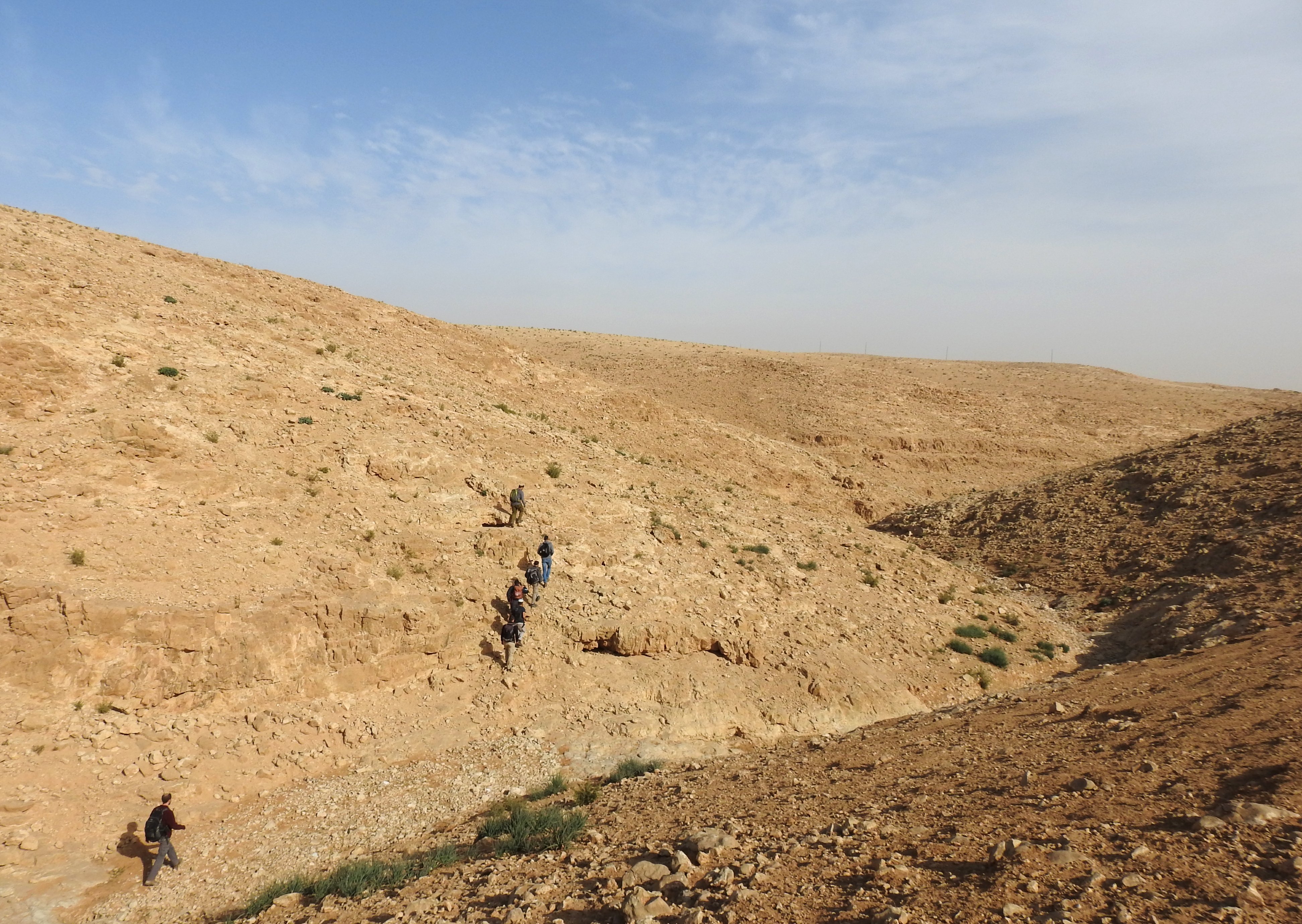
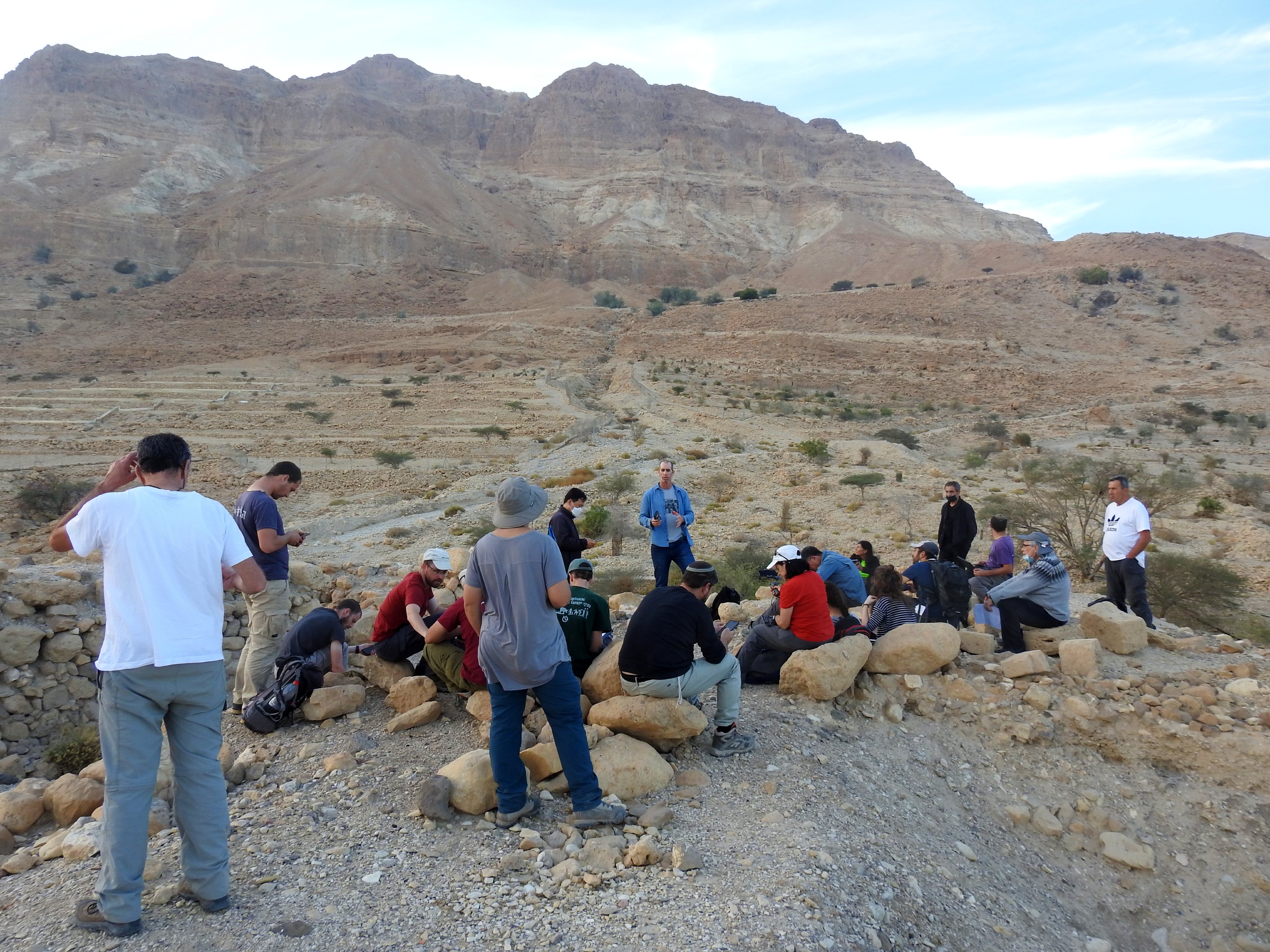
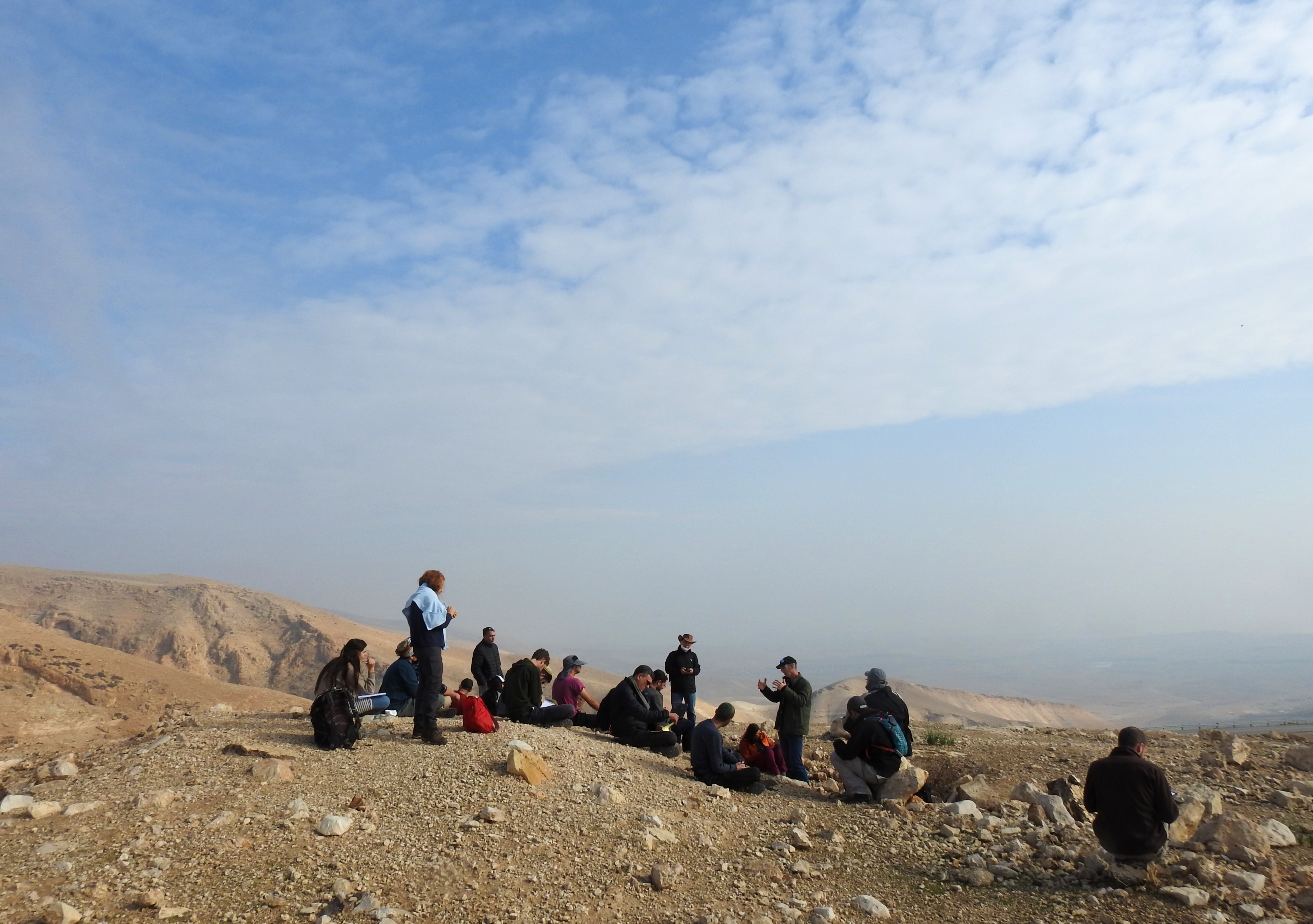
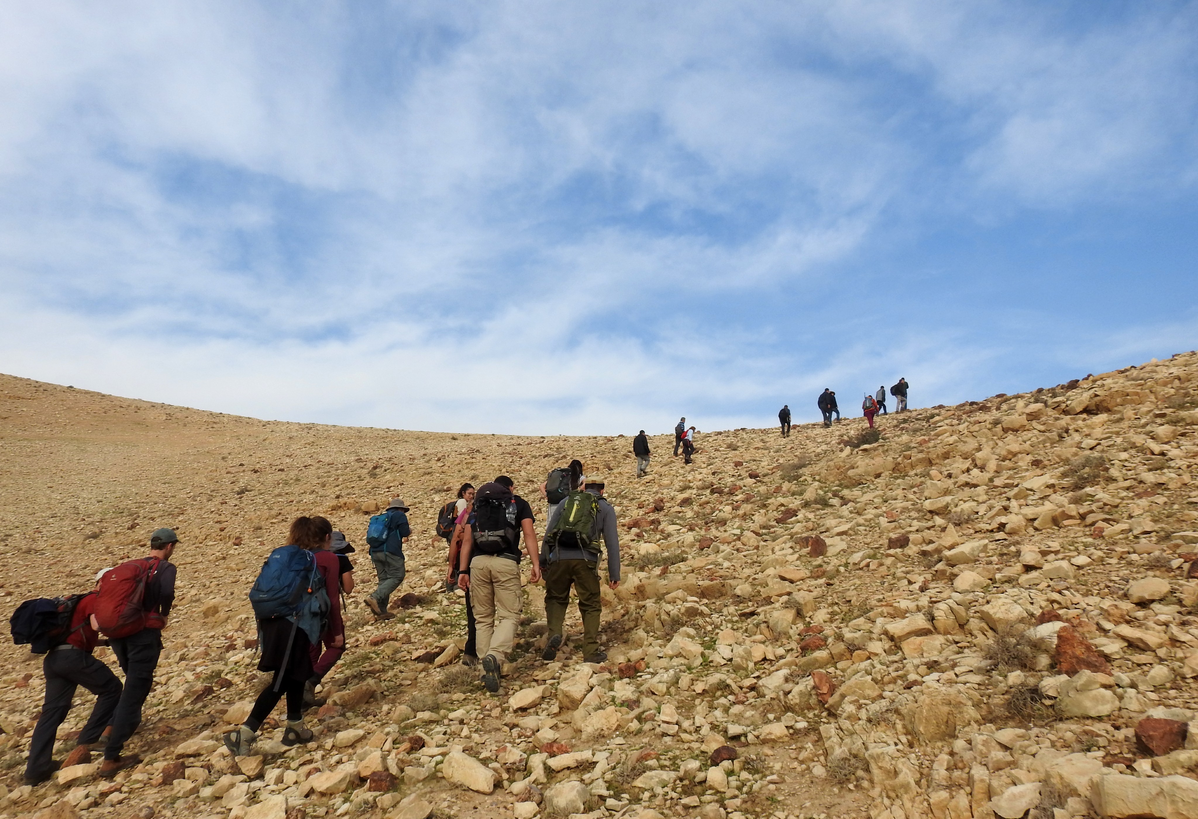
Mere days after my interestingly scheduled ecological fieldwork trip to Yatir Forest with my friend Levi Burrows, I took part in another departmental field trip. This semester hasn’t worked out so well for me in regards to field trips; life can just be so busy even without gallivanting around in the wilderness. However, when a night trip to the famed Nizzana Dunes presented itself, I signed up with great anticipation.

Beautiful sandscape of the famed Nizzana Dunes

Guided by Dr Moshe Natan, who led many of the university trips featured in this blog last year, the trip was one dedicated to wildlife – perfect for me. Our tour mini-bus departed from Bar Ilan University, shortly after I finished work, and off we went in the direction of the Negev desert. The first site of interest that we passed was the Ashalim solar thermal power station – a fantastic creation of mirrors that light up a tall central tower. The visual effect is quite reminiscent of Lord of the Rings, and can be seen from many tens of miles away. Marvel at this photo taken from the media room of Ashalim’s buildings:

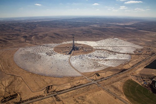
Ashalim solar thermal power station (credit Brightsource)

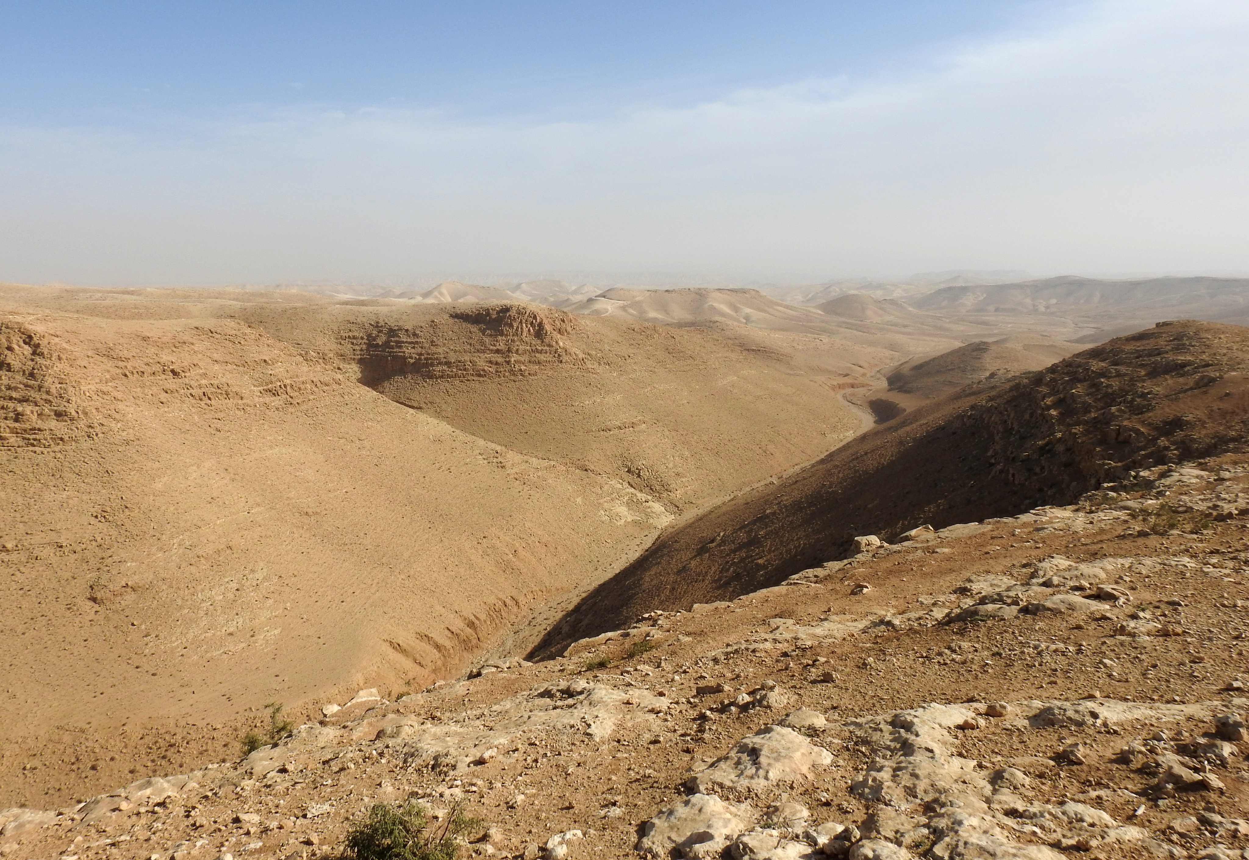
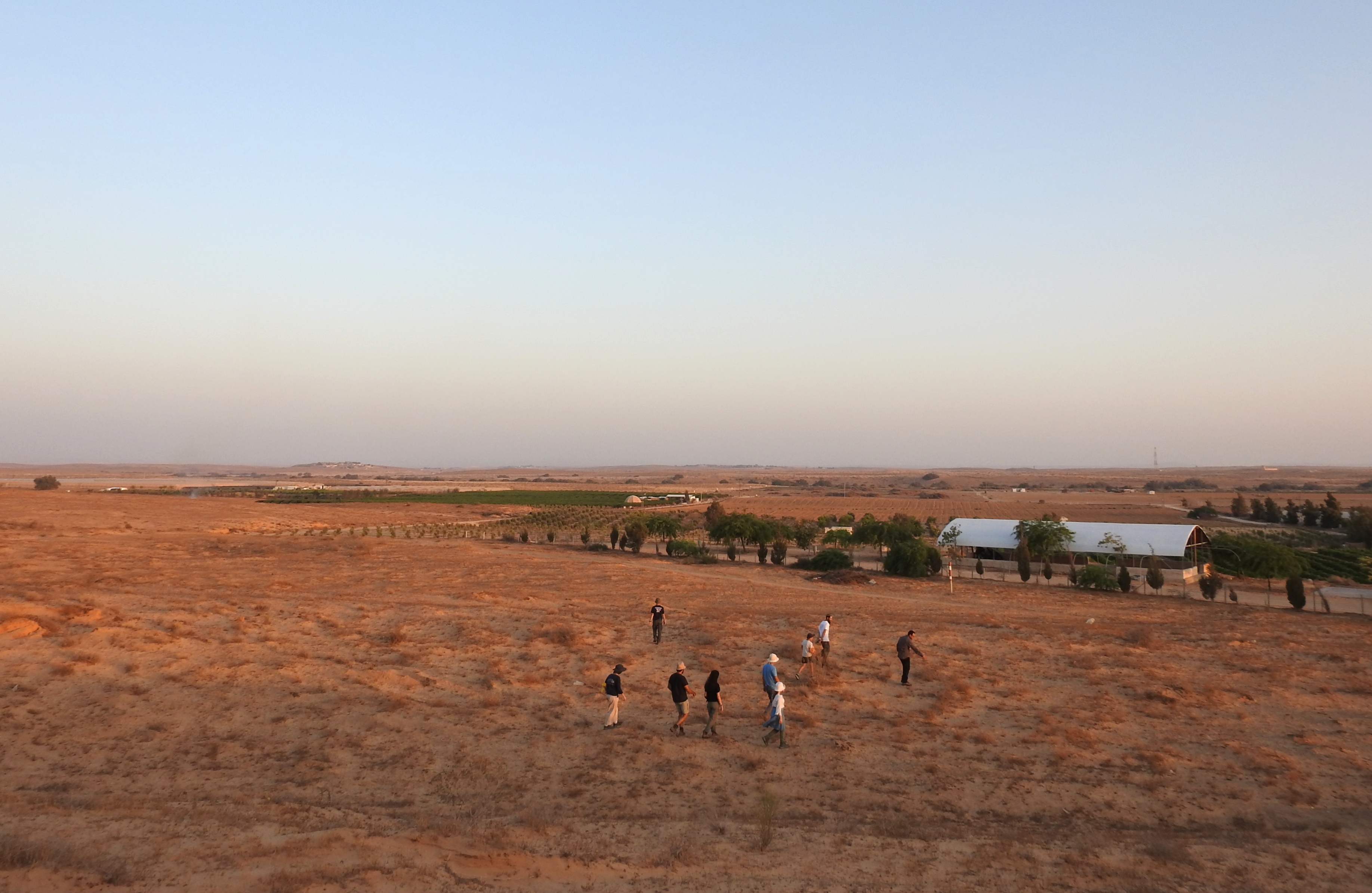
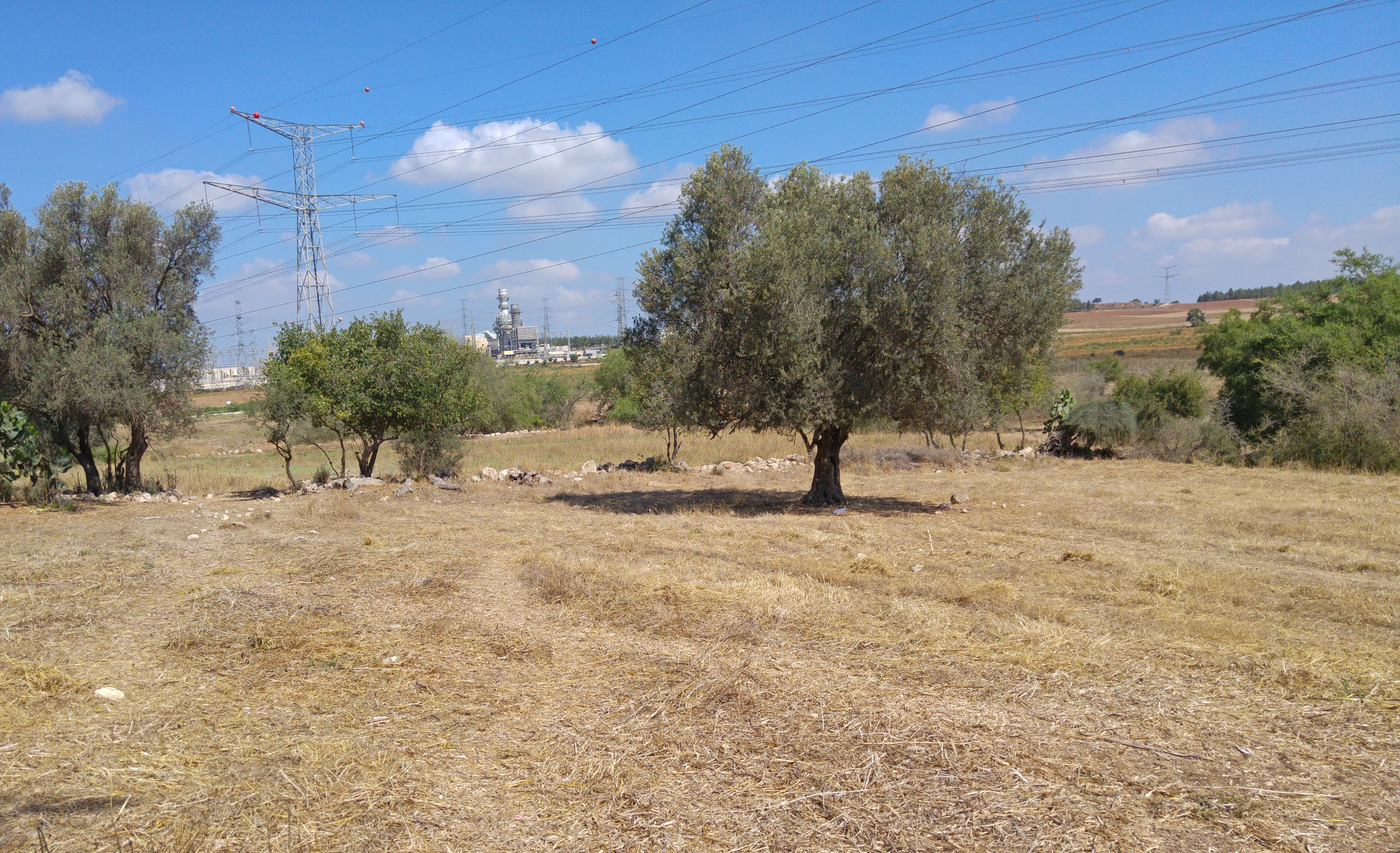
Well within the Negev desert, on Road 211, we drove west towards the Israel-Egypt border until with a particular destination in mind. Moshe wanted to show us desert monitors, the largest lizards in Israel, and he had leads on a particular dunes area between Beer Milka and the border. We went a bit off-road as we traversed agricultural access roads until we reached an open area with low hills. Disembarking, we began our slow sweep of the land before us, keeping a sharp eye out for desert monitors.

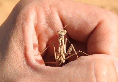
Making friends with a Rivetina sp. mantis

No monitors were seen, only tracks and droppings, but we weren’t discouraged. The dunes were beautiful, the strong winds creating that rippled look on the monochromatic surface. In addition, I was excited by the large amount of praying mantises (all of the genus Rivetina) which were running helter-skelter underfoot. Finished with our pursuit of monitors, we got back into our tour bus and made our way to our purposed camping site. However, surprise surprise, there were hundreds of teenagers pouring out of buses – this group also intending on staying the night.
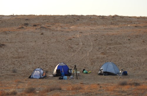
Our campsite

So, we made some quick changes to the grand plan and headed back to the dunes where the monitors were meant to be seen. Moshe showed us where we should set up our base camp and we commenced to pitch our tents and other necessary tasks that campers do. Getting back to wildlife, Moshe took out a collection of traps to harmlessly secure us some dune-living rodents for inspection. We spent quite a while setting up traps in the vicinity of burrow openings, baiting them with tasty and nutritious bamba.

Setting out the rodent traps

Sunset came and went, leaving us in the darkness of the Negev sky, the air quickly cooling around us. It was time to embark on an exploratory tour of the dunes around us, and we were more than ready. I had recently purchased a powerful new flashlight, with intents on making all nighttime exploring easier. We set out, keeping an eye out for distinguishing tracks to help us locate our quarry. My target was anything I could find in the suborder Serpentes – snakes!
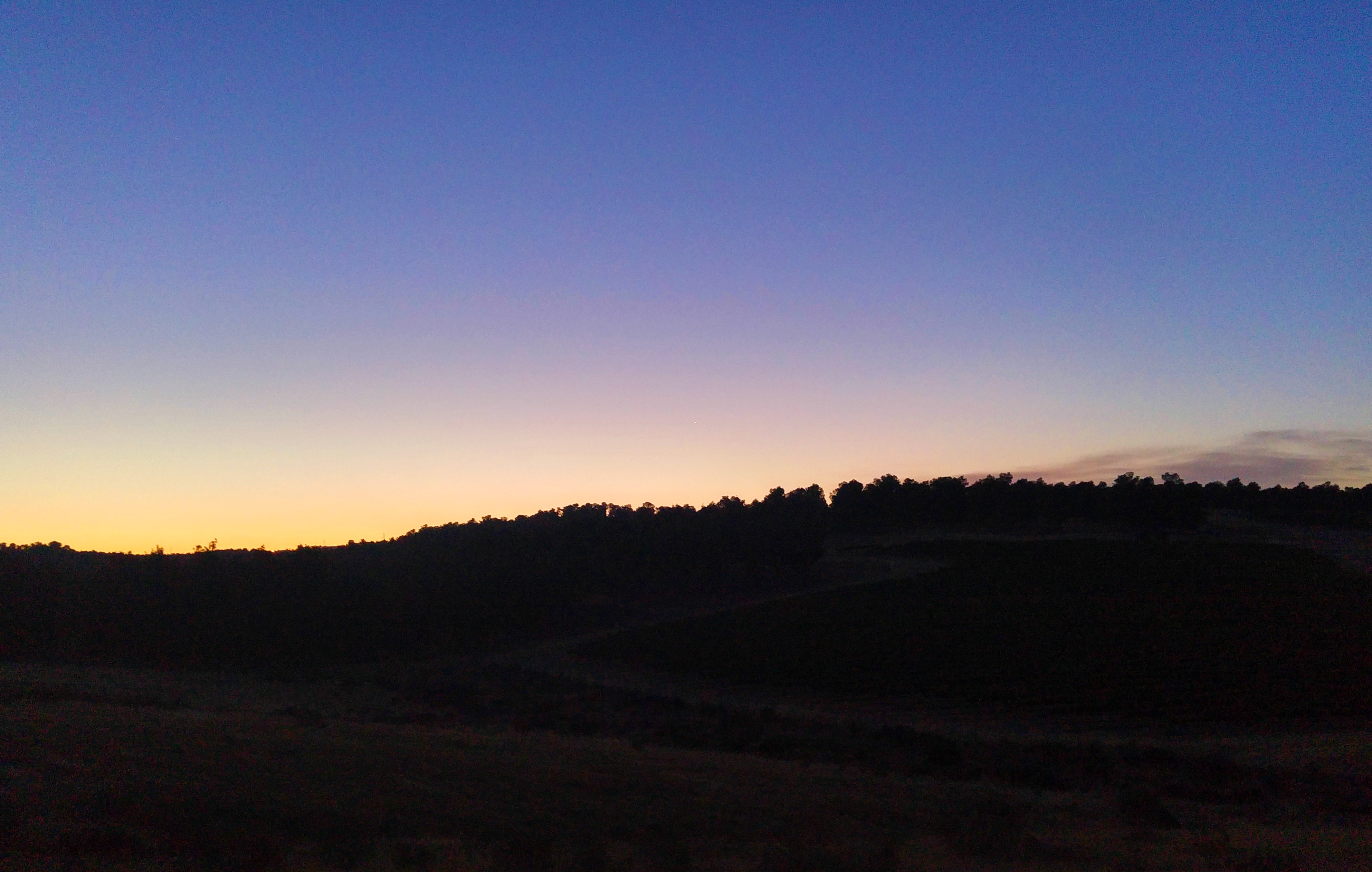
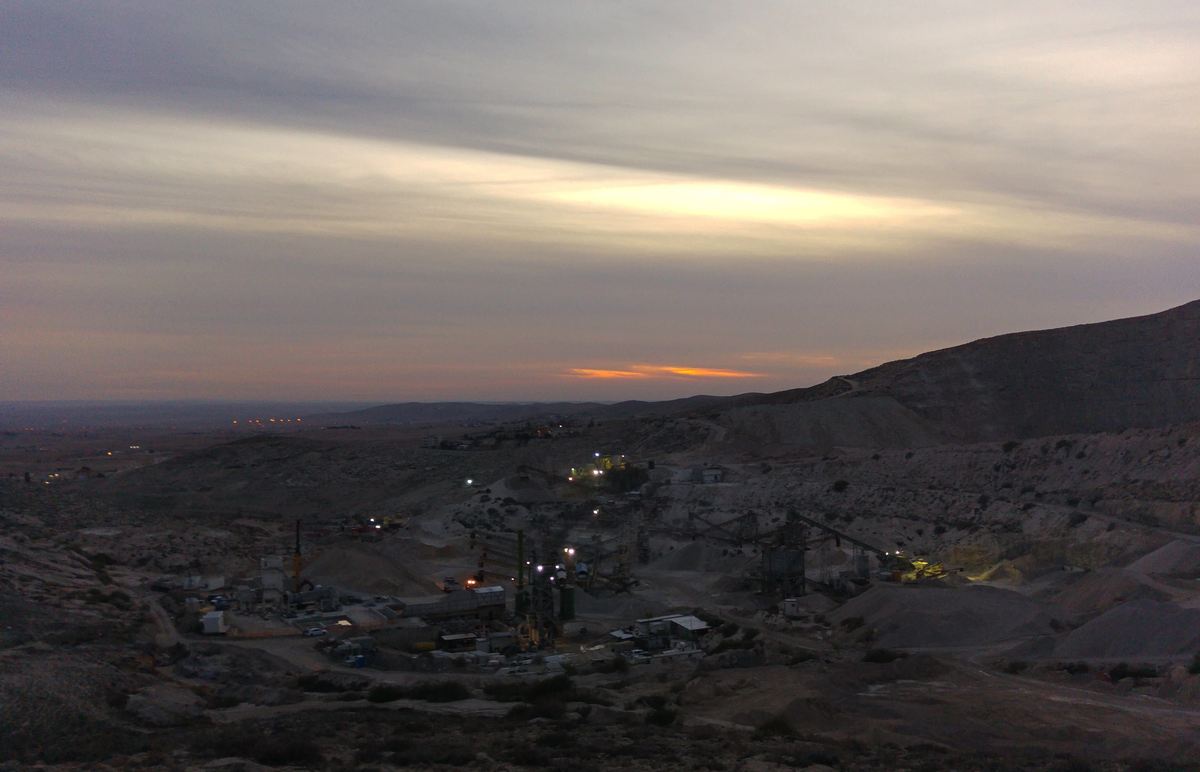
Sunset over Egypt

Believe it or not, just walking along the sandy trail, flicking my flashlight’s powerful beam hither and thither, I found my first snake of the night. I almost couldn’t comprehend what my eyes were showing me, and I was nervous that it’d slither off into the unknown before proper attention was given. I called out loudly, telling the group to come over quick. It was a crowned leafnose snake, less than a foot long and completely harmless.

Crowned leafnose snake

We spent a long time with the crowned leafnose snake, taking photos and talking about its distinct tracks. Excited as we were to see this snake, we knew that there was more to be seen, and continued our exploring.

Holding the crowned leafnose snake

We climbed a large, vegetation-free dune and caught sight of the even more distinct tracks of a horned desert viper. Long hooked lines carved out of the sand, showing the direction the snake was traveling. We followed suit, and tracked it a hundred or so metres until suddenly we saw it.

Following the tracks

Bigger than the previous snake, this viper is venomous and couldn’t be approached the same way. With caution, we edged closer and Moshe unloaded a great amount of pertinent information.

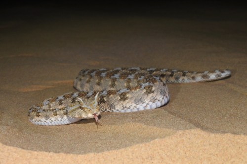
Horned desert viper coming my way

Eventually the serpent decided to move on, and so we followed it back up the dune from whence it came. Atop the dune it decided to settle down, and burrow itself in the sand.

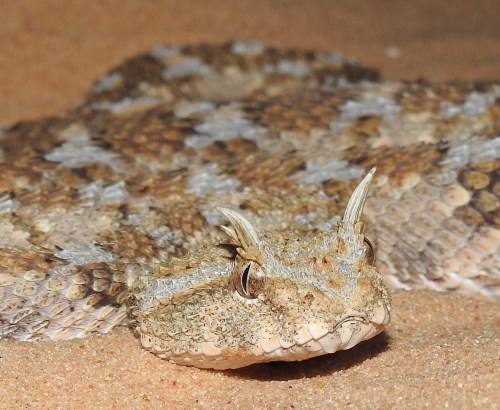
Up close to the horned desert viper

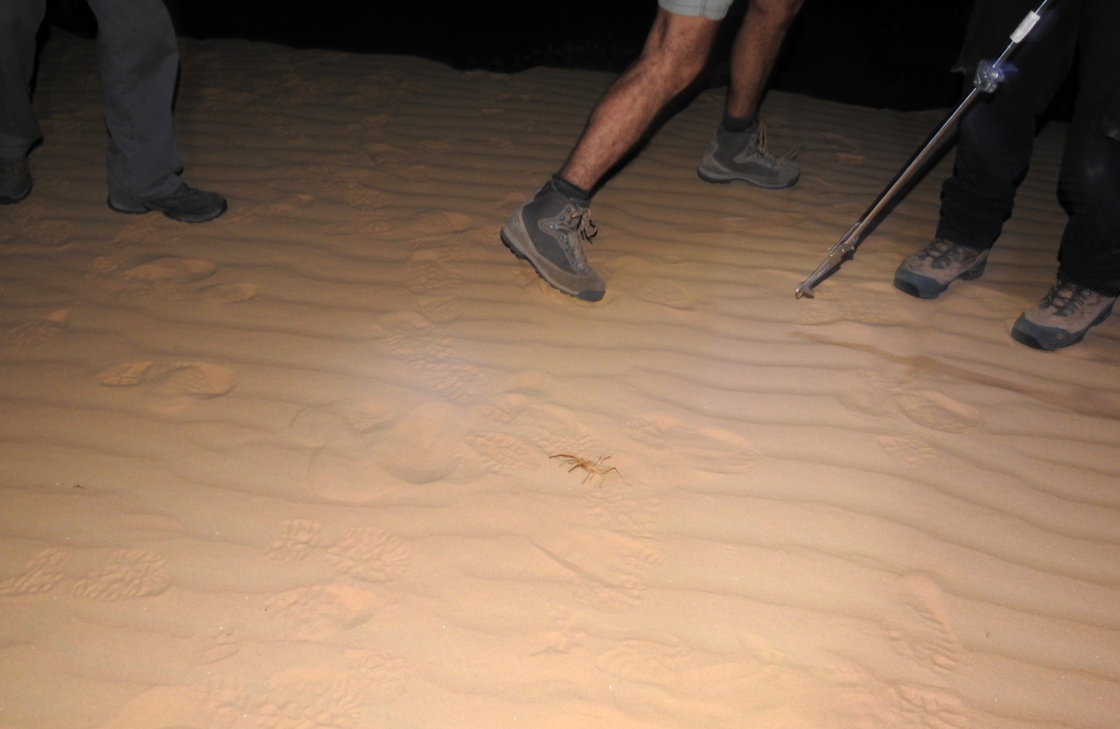
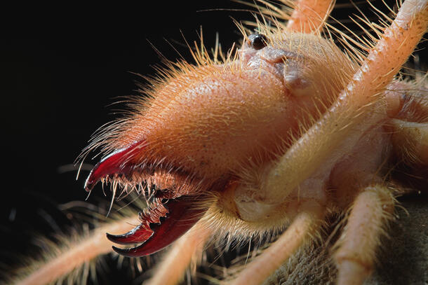
As we watched its rippling body shimmy itself into the sand, we heard a loud clicking noise and I spotted something running towards us from out of the darkness.

Reaction shot to the camel spider attack

Quite literally like a scene out of a horror movie, a large camel spider was running at us at top speed, flailing its long pedipalps and clicking its fearsome teeth at us. It was quite alarming, even if the creature is “only” the size of a large adult human hand. We scattered, avoiding the devilish arachnid as it raced around underfoot threatening to slash us with its powerful jaws (see close-up HERE).

Camel spider

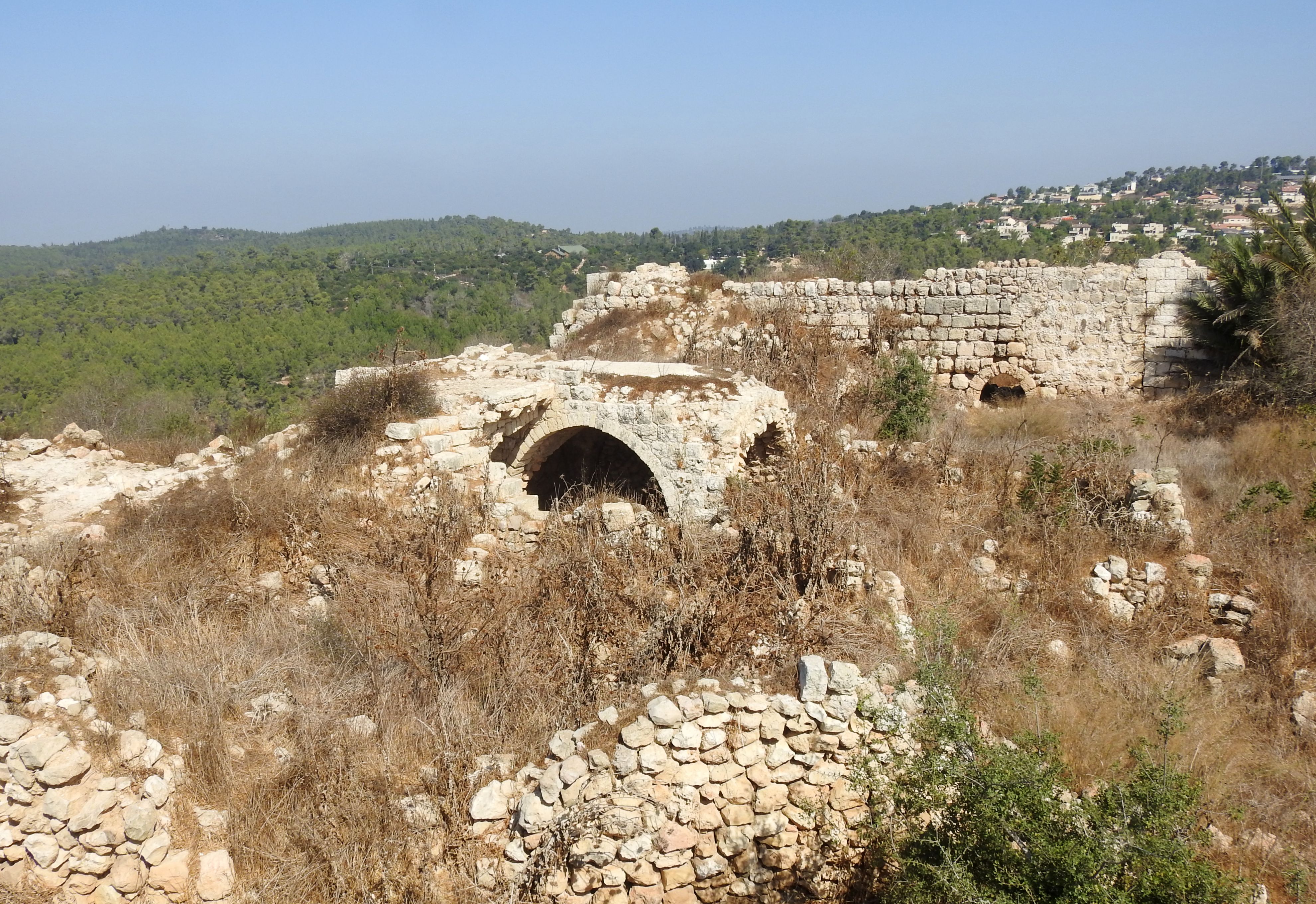
We relocated, leaving the horned desert viper and eventually losing the restless camel spider as well. The next item of interest was a large female lobed agriope spider, quite impressive both in size and appearance. I had already seen one of these on a trip to the fields near the fortress of Mirabel (see blog post HERE and photo HERE), so I felt the need to continue exploring.

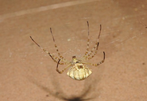
Lobed agriope spider

Not far away, I spotted something small moving – a dune gecko. I called the group over, let them take over, and then continued exploring. Over the next little while all we saw were repeats: camel spiders and dune geckos. Incidentally, those two are predator and prey, respectively. Then something exciting happened: The few individuals taking the lead caught sight of a small rodent dashing about in the sparse vegetation. We circled the area and closed in, eventually finding the cute lil’ fella hiding out in an abandoned burrow.

Gerbil hiding in a burrow

What we had found was a gerbil of sorts, unidentifiable without getting a closer look at the footbeds which would require capture. Leaving the gerbil to his business, we carried on with our roving search. A pair of eyes watched us from a nearby dune – a curious Arabian red fox – yet refused to be approached. With all these impressive finds under our figurative belts, we had yet to see a scorpion, so the UV flashlight was taken out. No matter how purple-blue the ground below us looked under the illumination, there was no scorpion to be found, just more camel spiders.

Ultraviolet camel spider blur

However, we did find another four crowned leafnose snakes, as well as some more dune geckos. Walking and walking, we eventually decided to bring an end of our exploration and navigated ourselves back to our campsite aided by the twinkling lights on the horizon as well as the time-honoured stellar constellations.
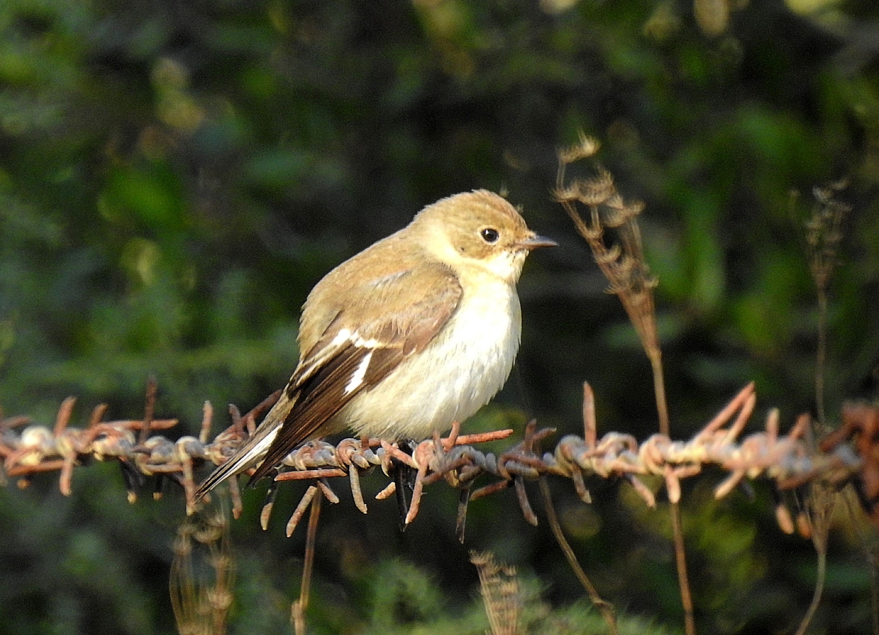
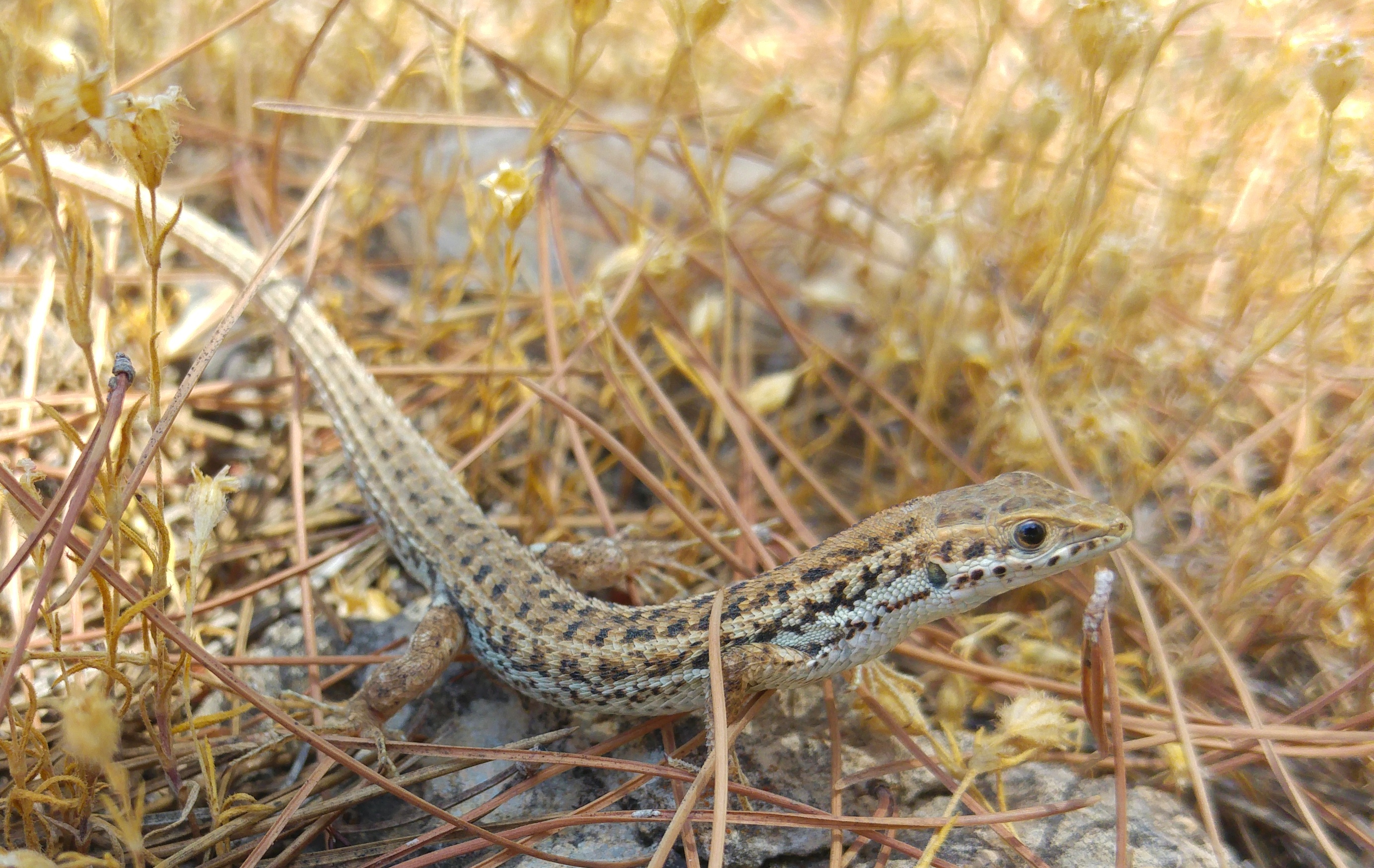
Dune gecko

Back at the campsite we took out our food and had dinner while watching a nature video brought by Moshe. I feasted on schnitzel with rice and tehina, and had the pleasure of hearing and identifying an eagle owl – which I have yet to lay eyes on. When we had all eaten our fill, people began to get ready for bed. It was about midnight and we were to wake up before dawn for another excursion.

Examining a dune gecko

I had a conundrum: I had brought a sleeping bag, but with those devilish camel spiders racing about willy-nilly, I felt a little apprehensive of sleeping on the ground. I resigned to relaxing on a chair, and letting sleep’s warm embrace envelop me whenever it shall. Dressed in a fleece jacket, I was cosy and relatively comfortable perched on the chair. To make life a bit more exciting, and to perhaps ease myself to sleep, I cracked open a can of Murphy’s Irish Stout which I had brought with me.

Bathed in the soft golden light of morning

I dozed on and off throughout the night, safe from the roving camel spiders (in fact, I didn’t see or hear any the whole time at the campsite). The birds began to call before first light, mostly crested larks from what I was able to identify audibly. When the sun’s light lit up the sky to the east of us I rose and explored a little, hoping to maybe see something of interest. True to my hopes, I found a male mountain gazelle grazing far off on a distant dune, oblivious to my presence.

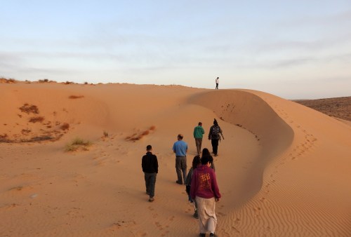
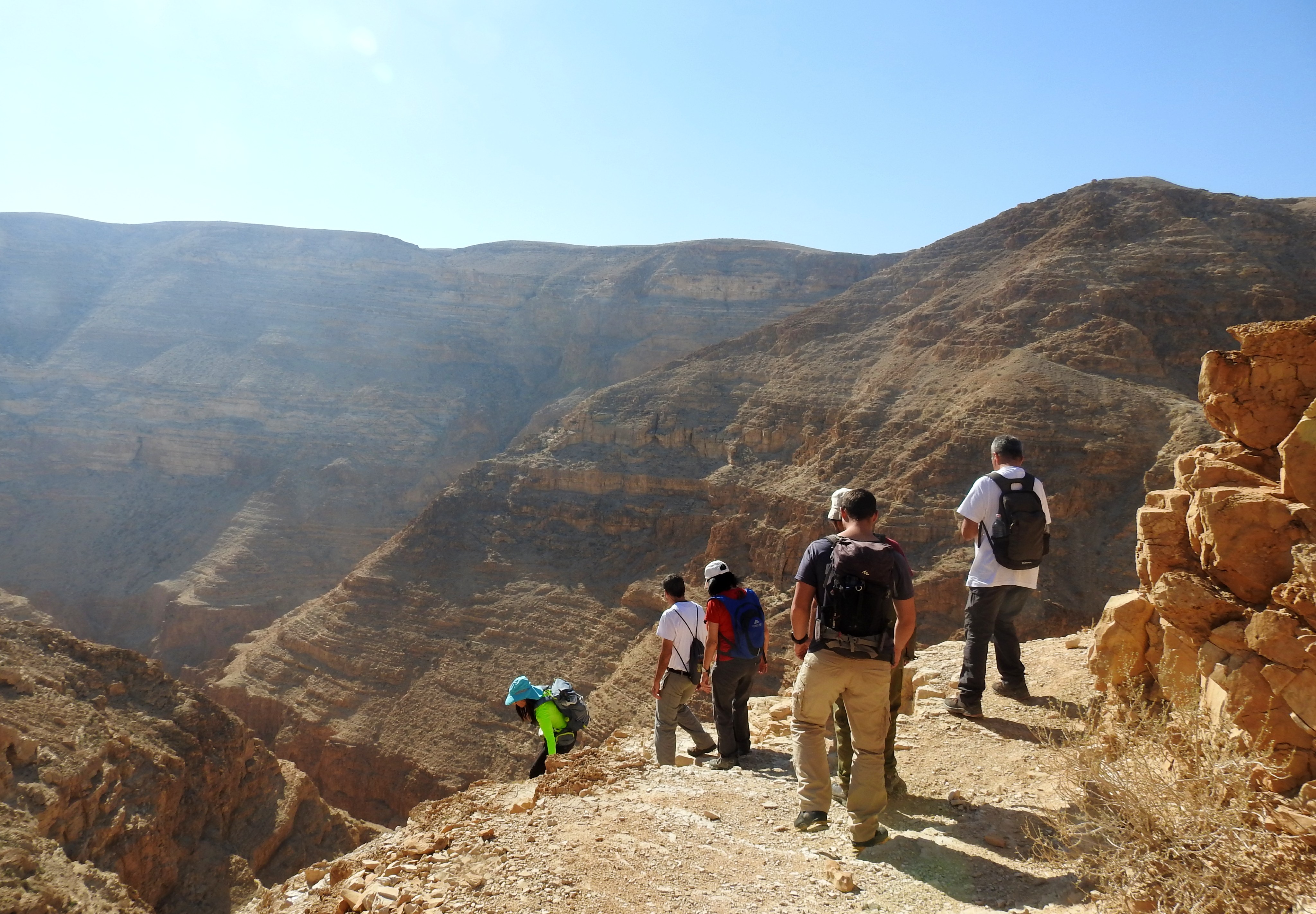
Exploring the dunes in the early morning

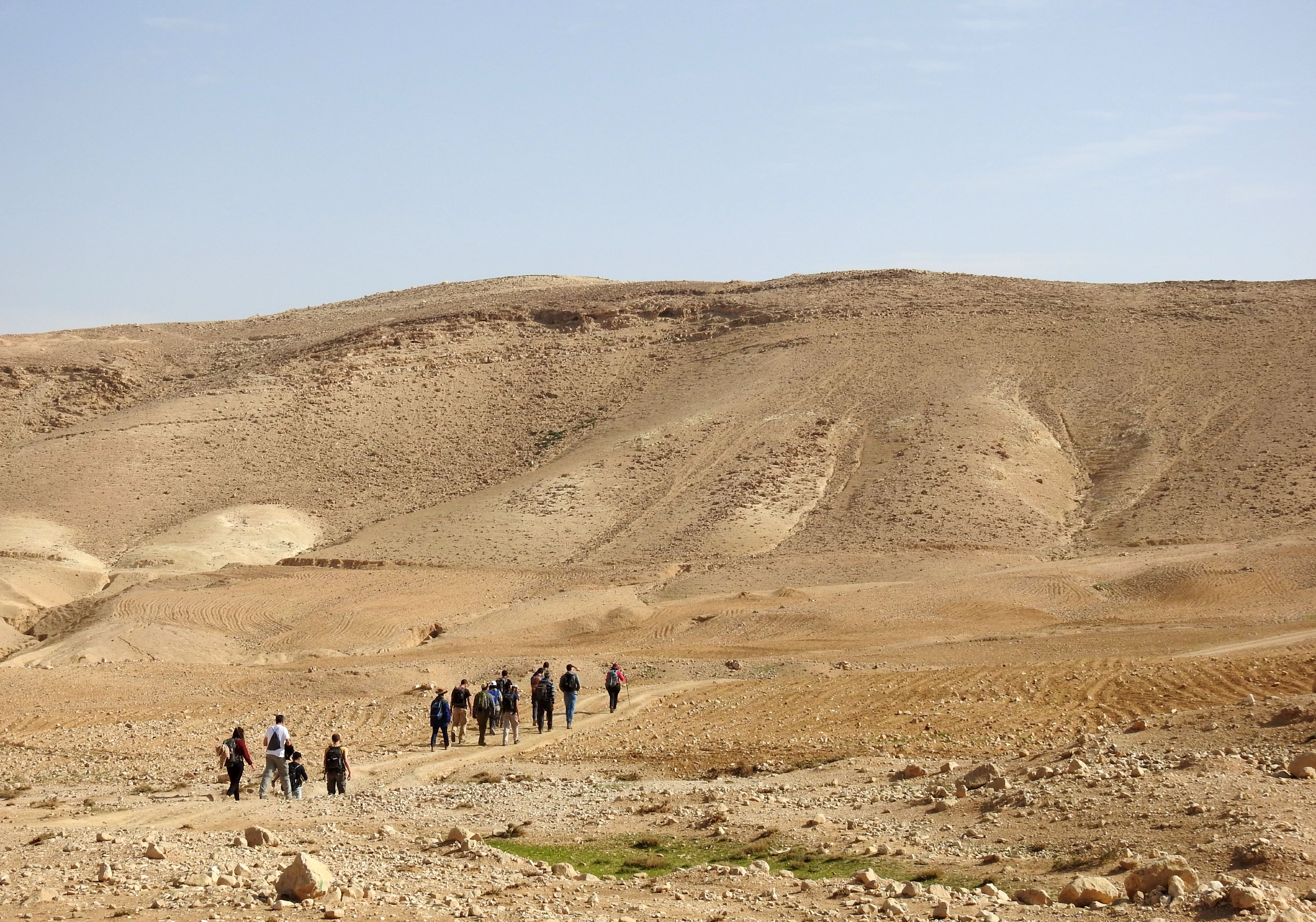
The rest of our merry band of explorers joined in, and we explored the dunes under the early morning’s golden light. We found plenty of tracks, but nothing that we hadn’t seen during the night. It was rather scenic though, and the sweeping sands of the dune coupled with the partially overcast skies created a stunning pastel vista. The traps, which had been set the evening before, provided us with nothing – although one of the traps’ bamba-bait was looted by a sneaky rodent. We returned to our campsite, packed up everything and made our way to the bus that came for us. The adventure wasn’t over yet, we had a bit of a drive to the final trip destination.

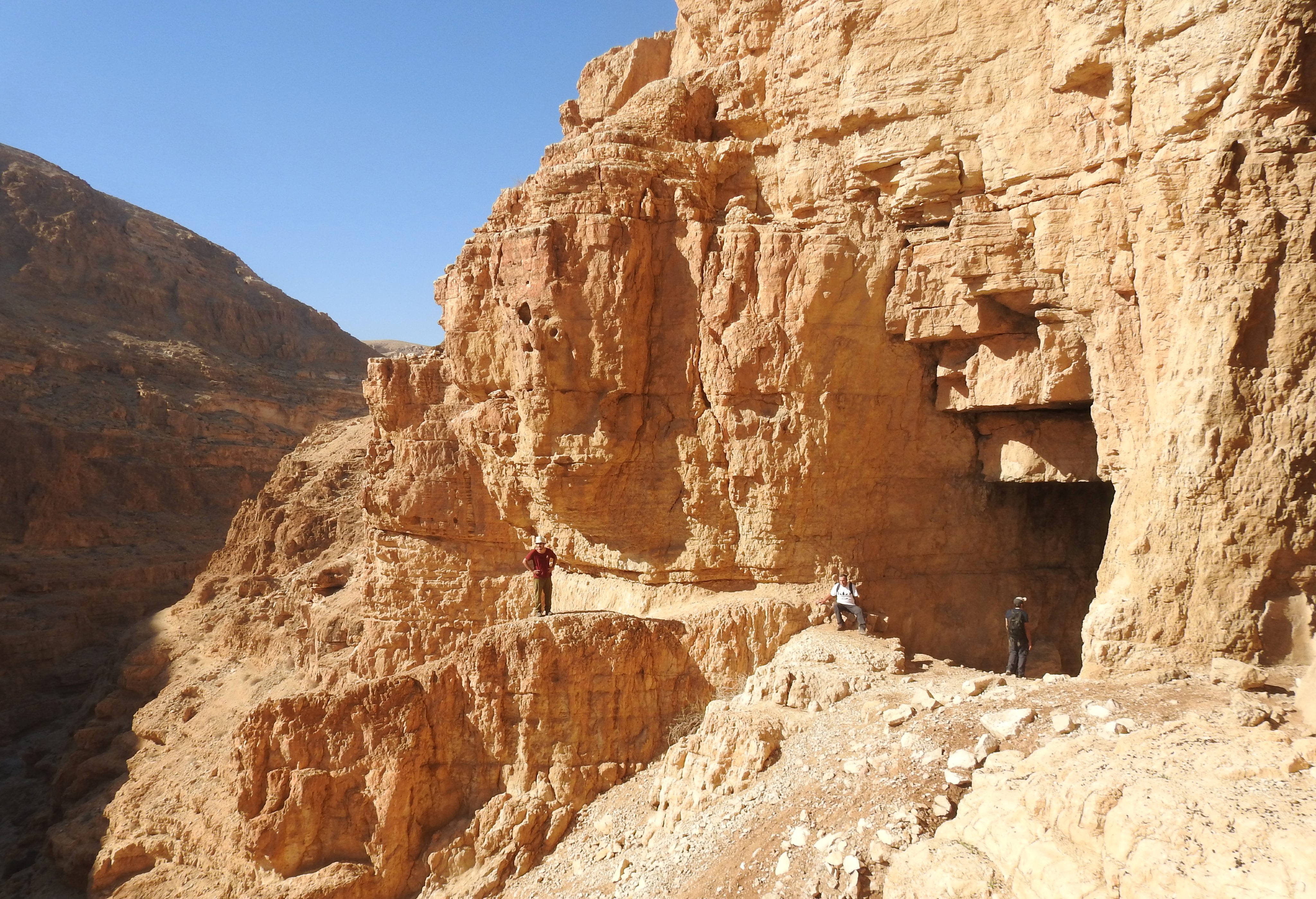
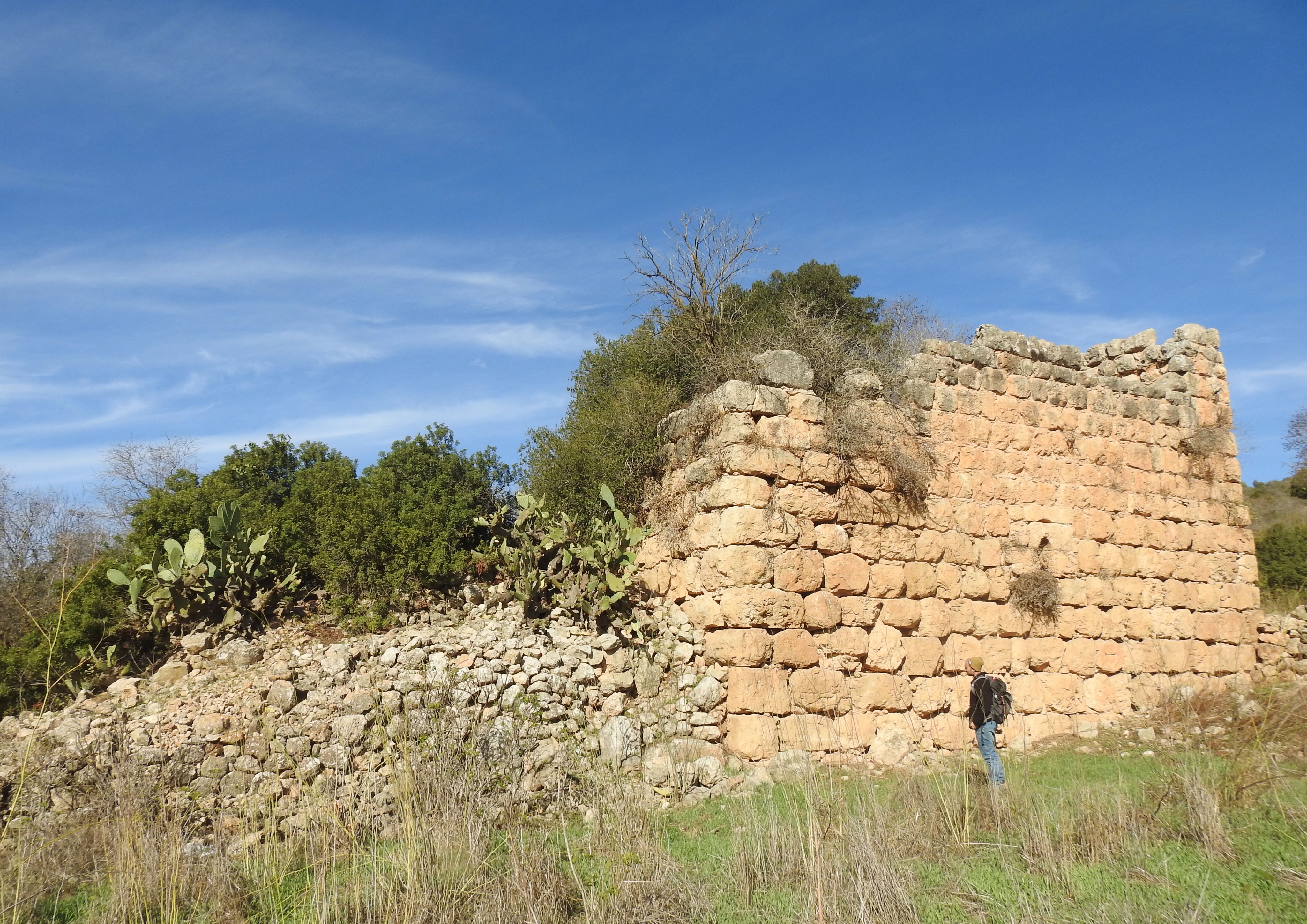
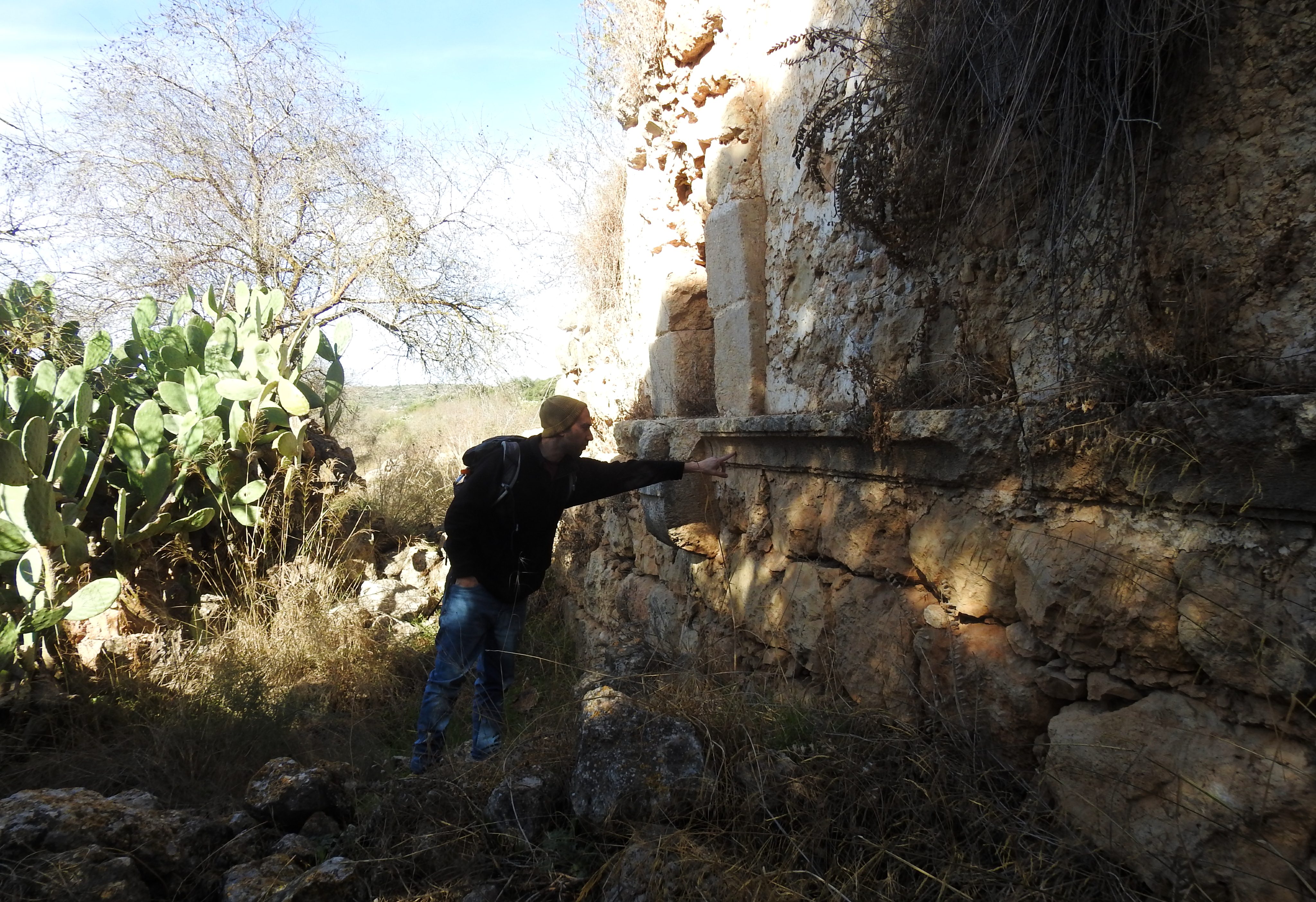
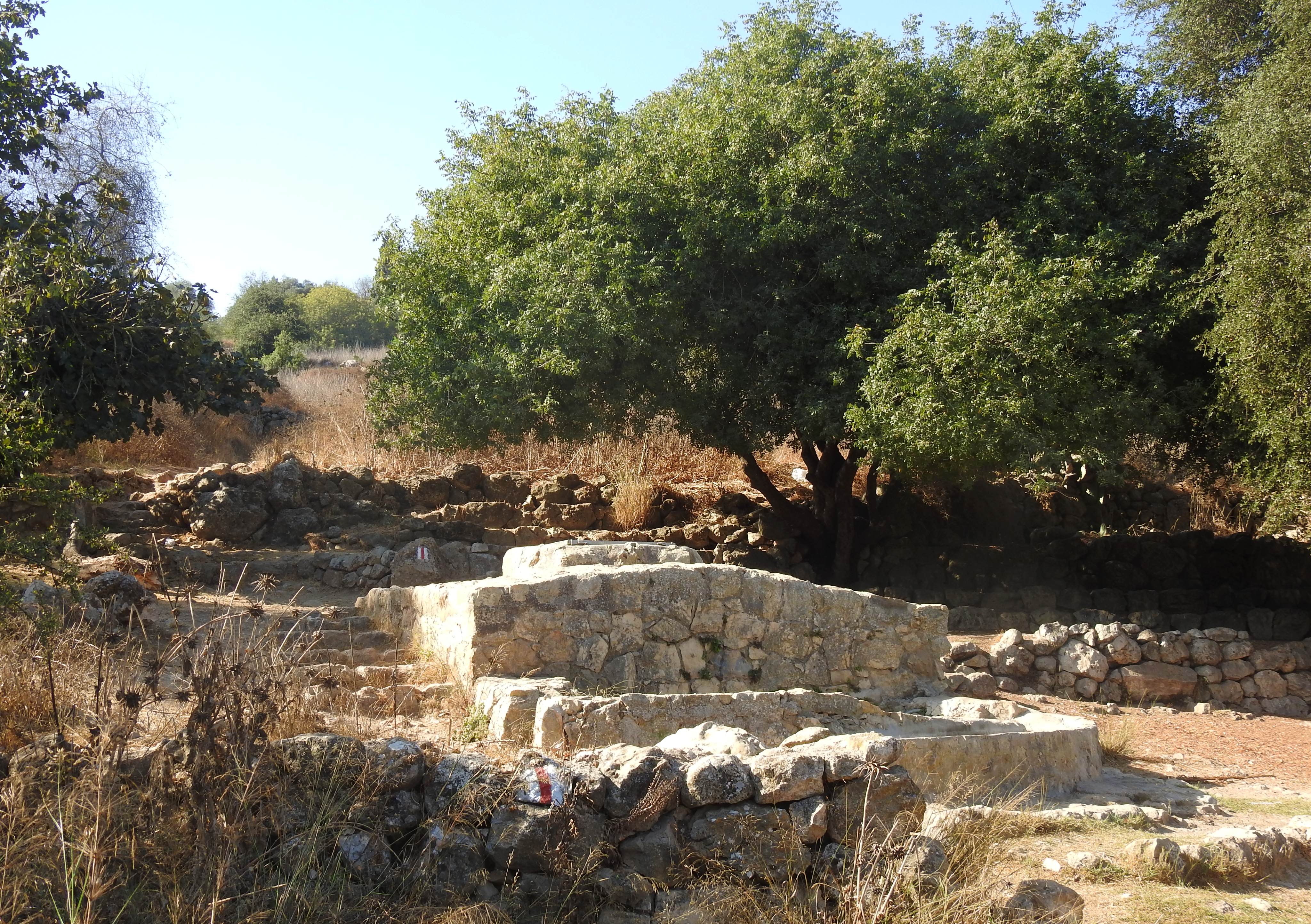
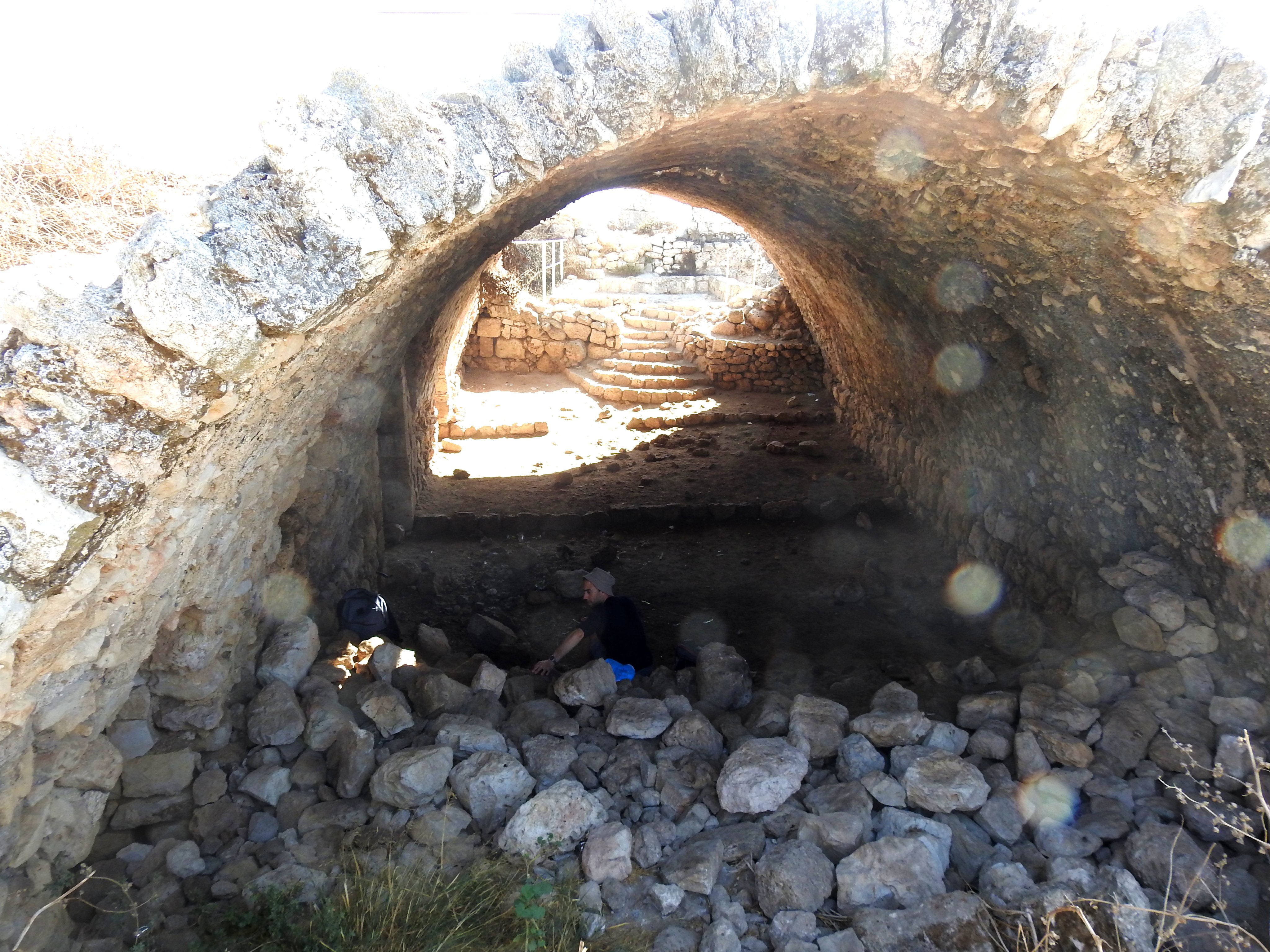
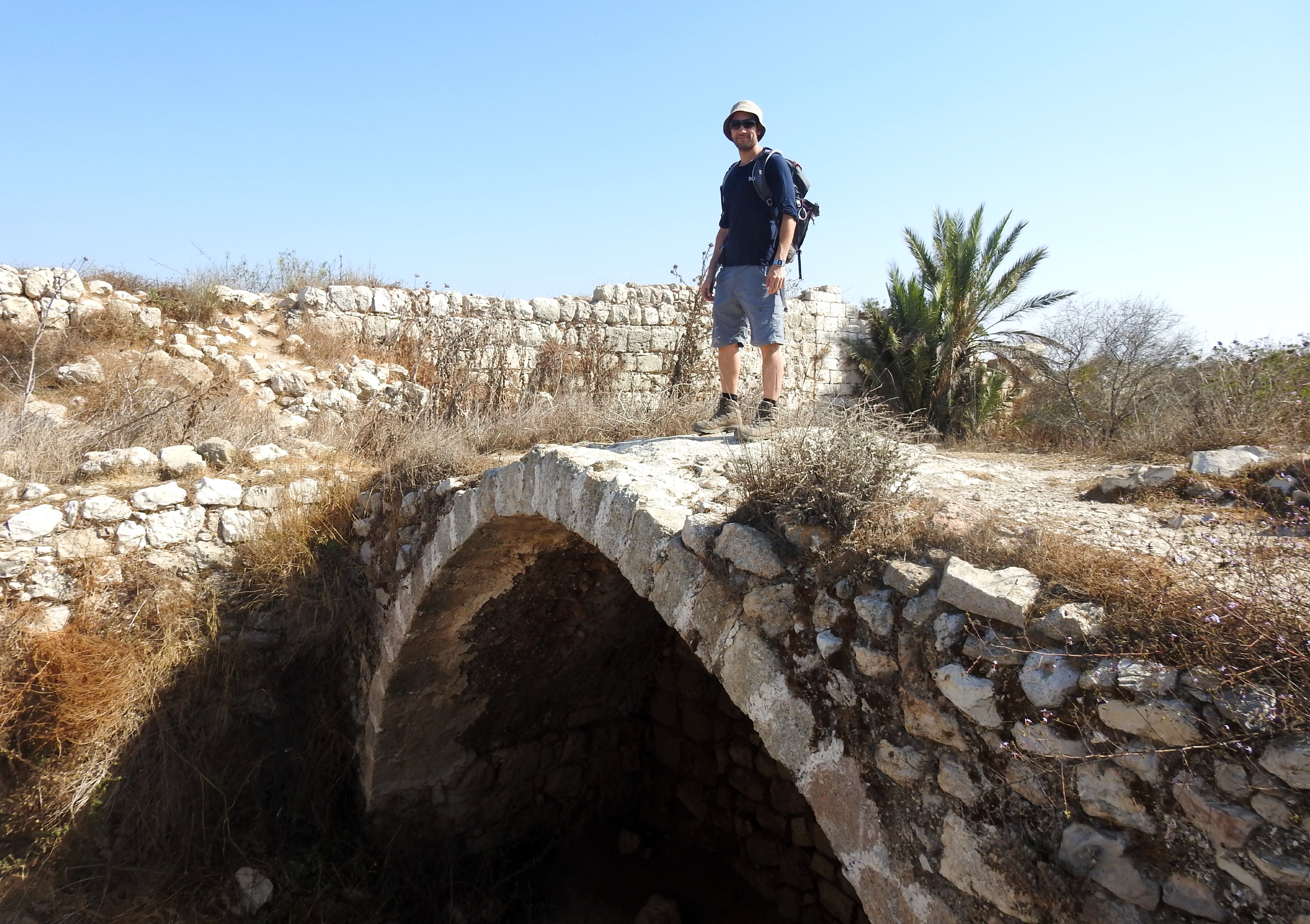
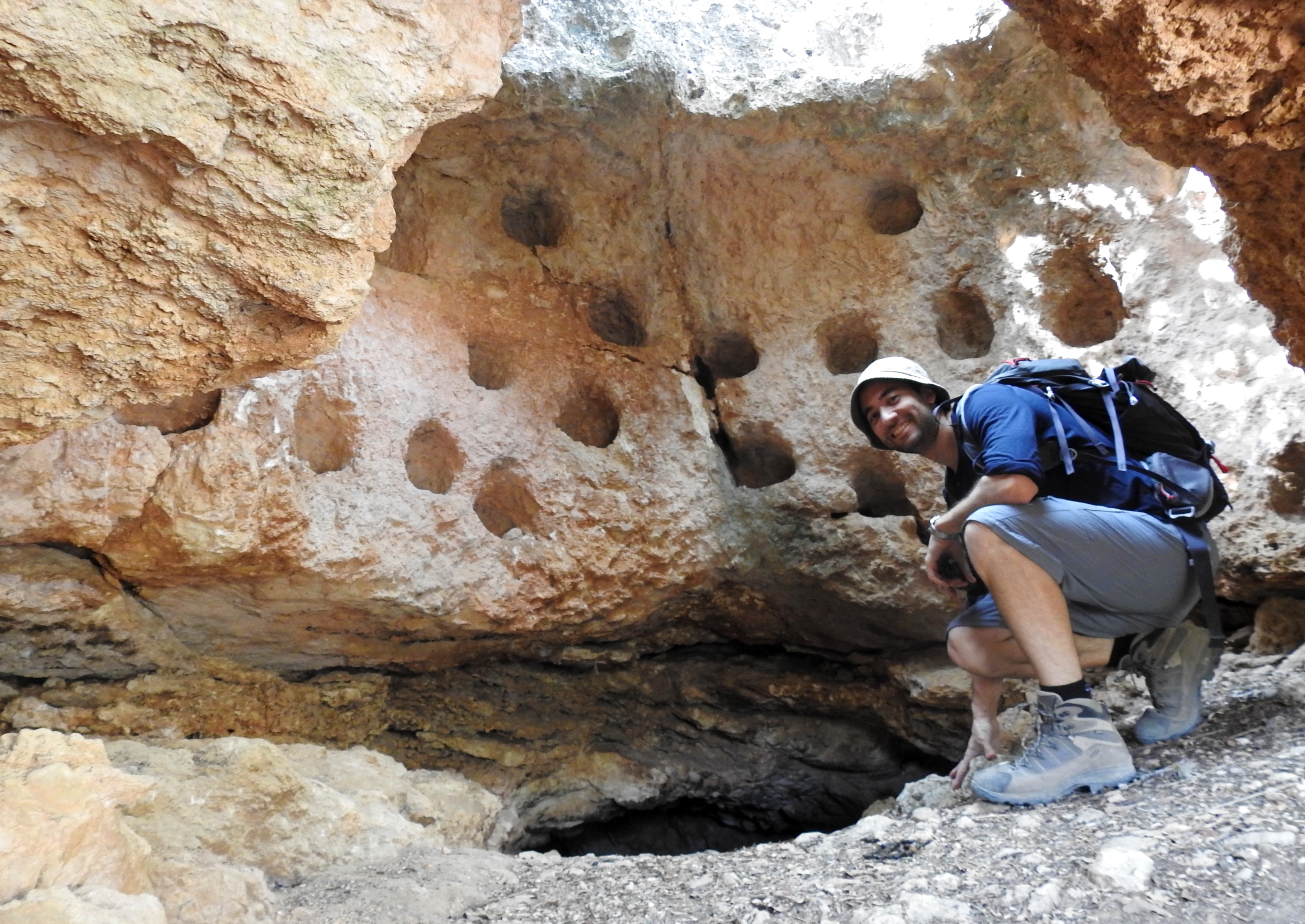
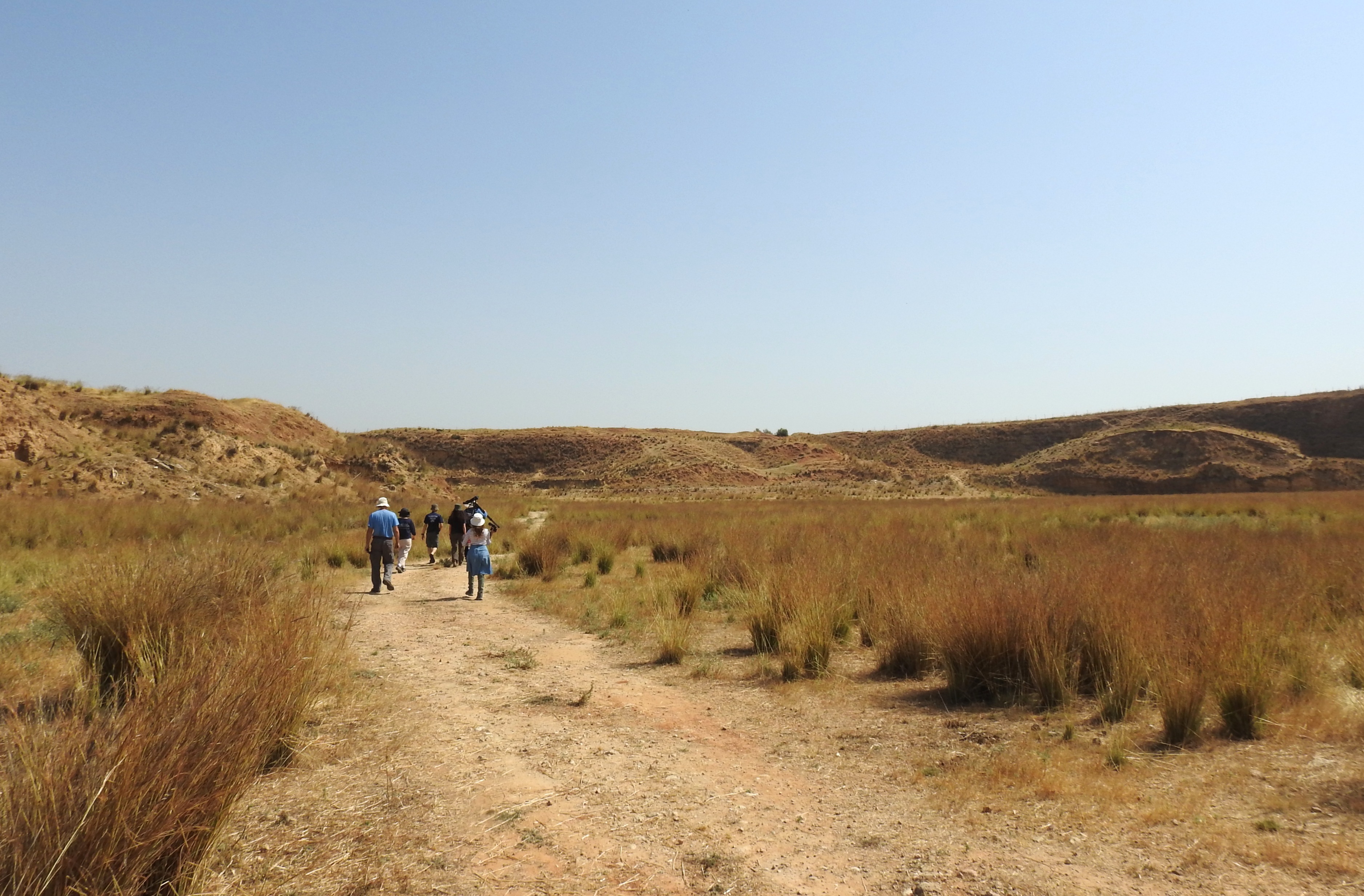
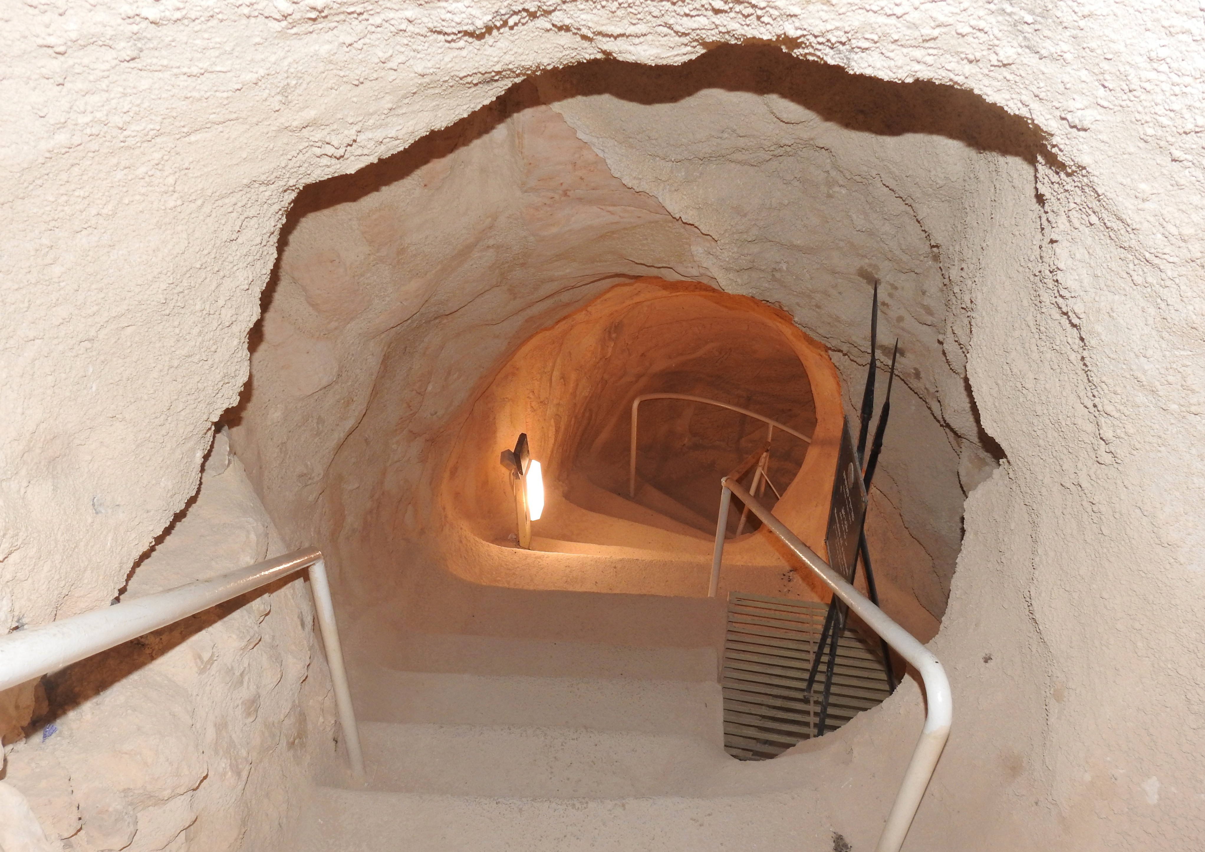
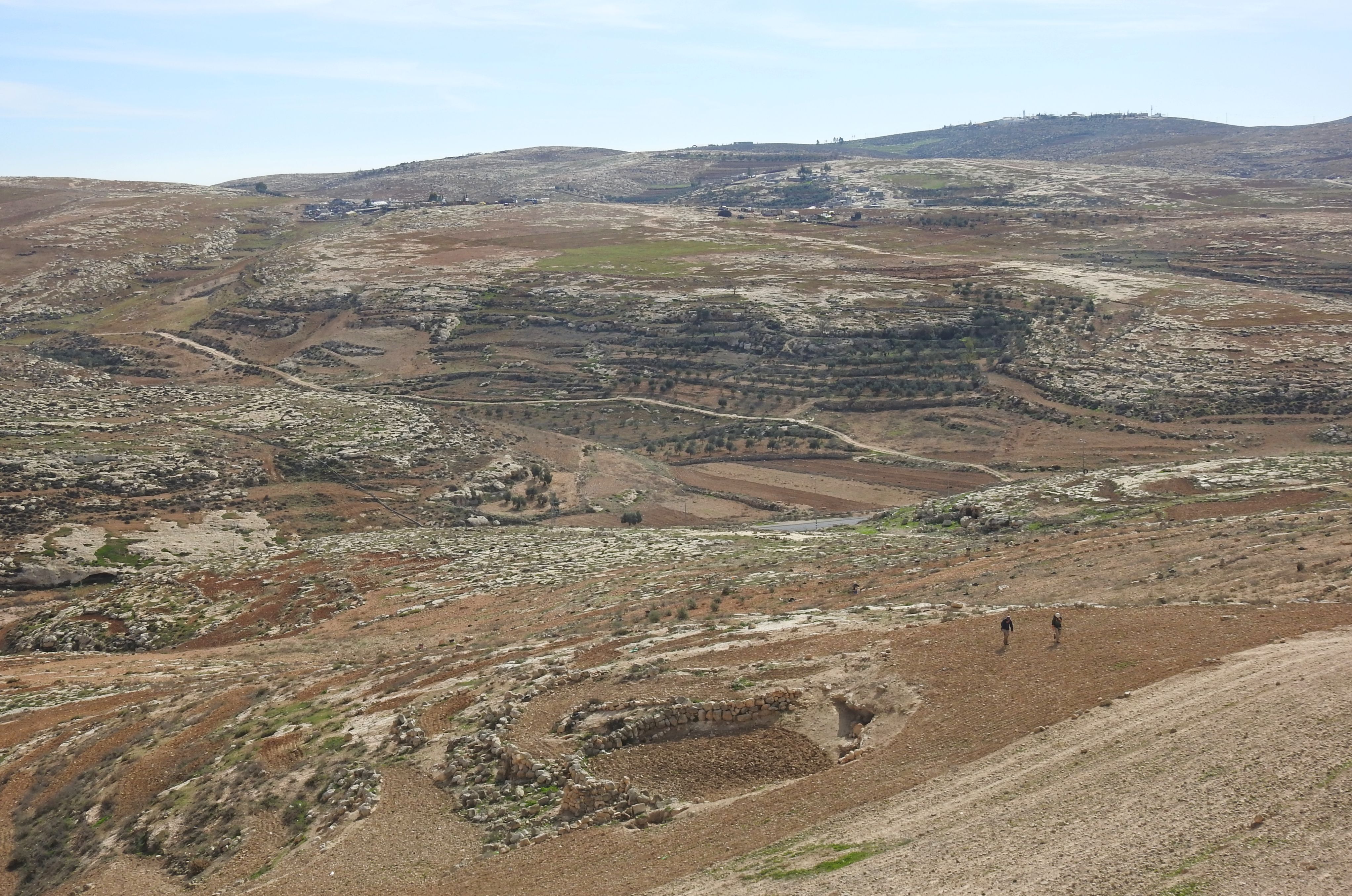
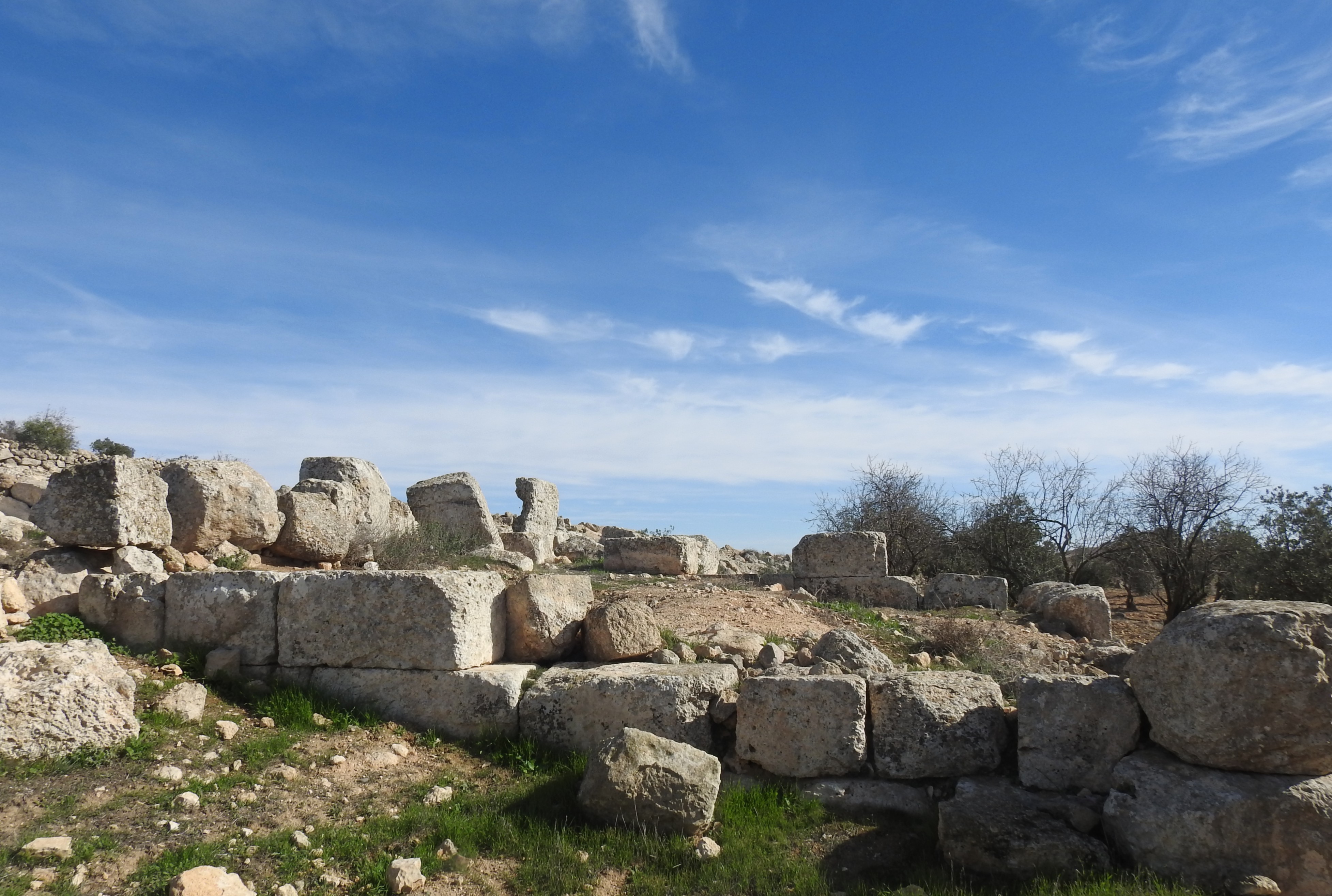
Within the old quarry basin

Driving north, and nearing Tel es-Safi, we took a slight detour in the vicinity of Moshav Nahala. Our destination was an old quarry, always a good place to find cool stuff, where we were deposited. Entering the quarry I immediately discerned a bird of prey sitting atop a short tree – a long-legged buzzard. I was excited, no doubt, but there was more to see and the open field in front of us (the basin of the quarry) was alive with the twittering of crested larks.

Little owl

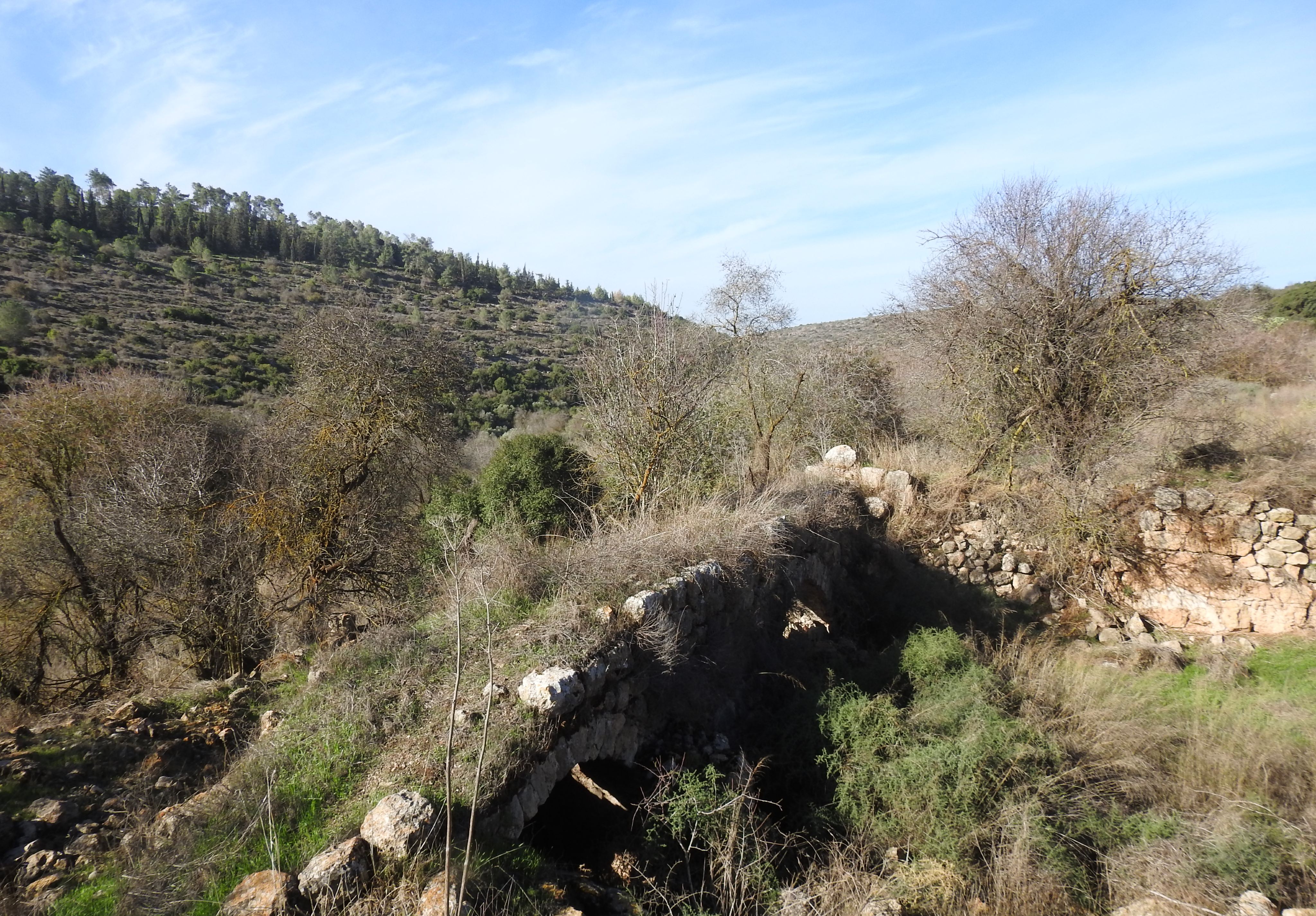
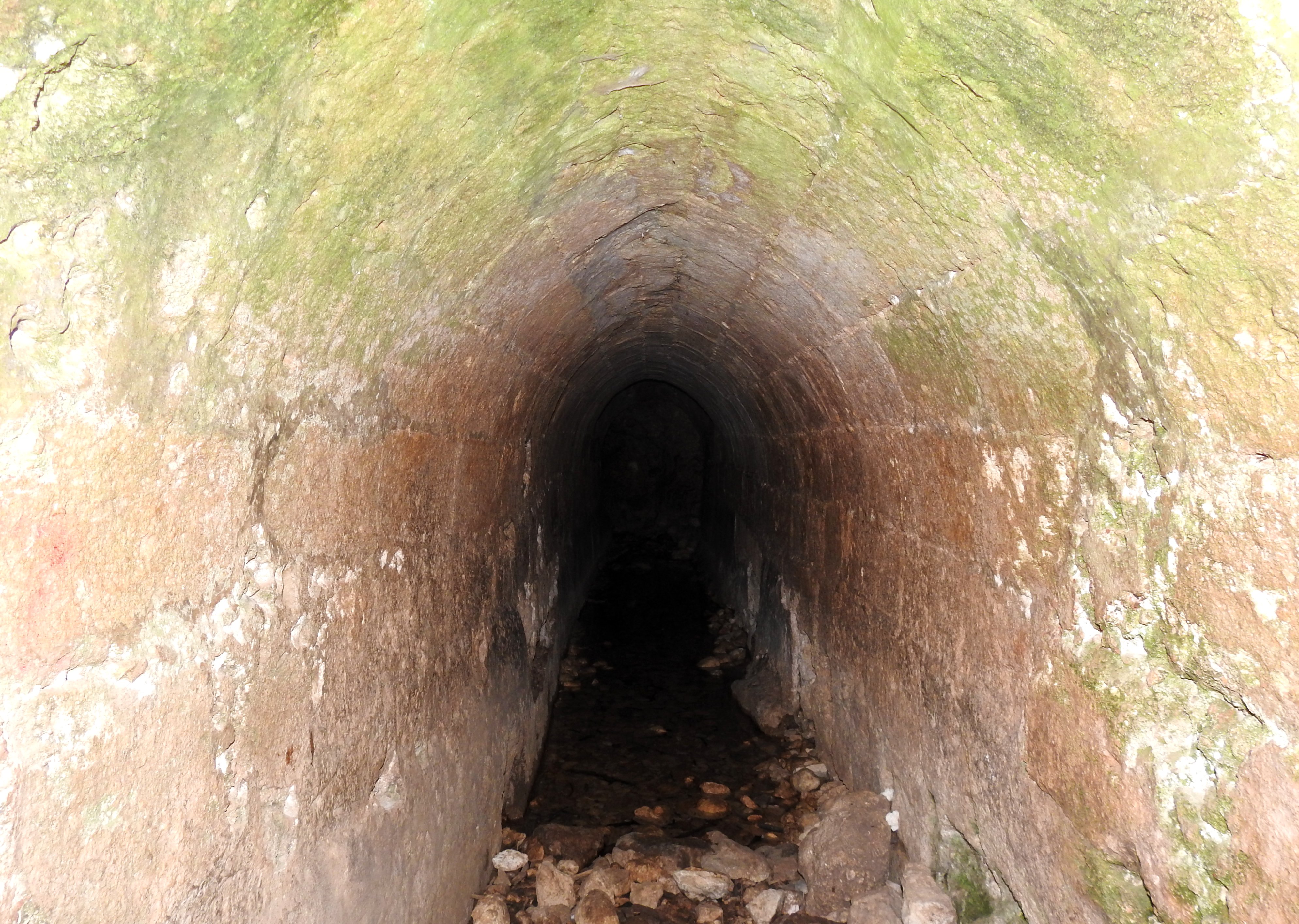
Overhead I could see jackdaws and bee-eaters, but there was something far more exciting watching us from the other side of the quarry. Moshe set up his spotting scope and showed us what he had brought us there for: a little owl was sitting at the mouth of a hewn tunnel, watching us with large yellow eyes. I adore owls, and felt bent on getting a decent picture of this particular specimen.

Juvenile short-toed eagle

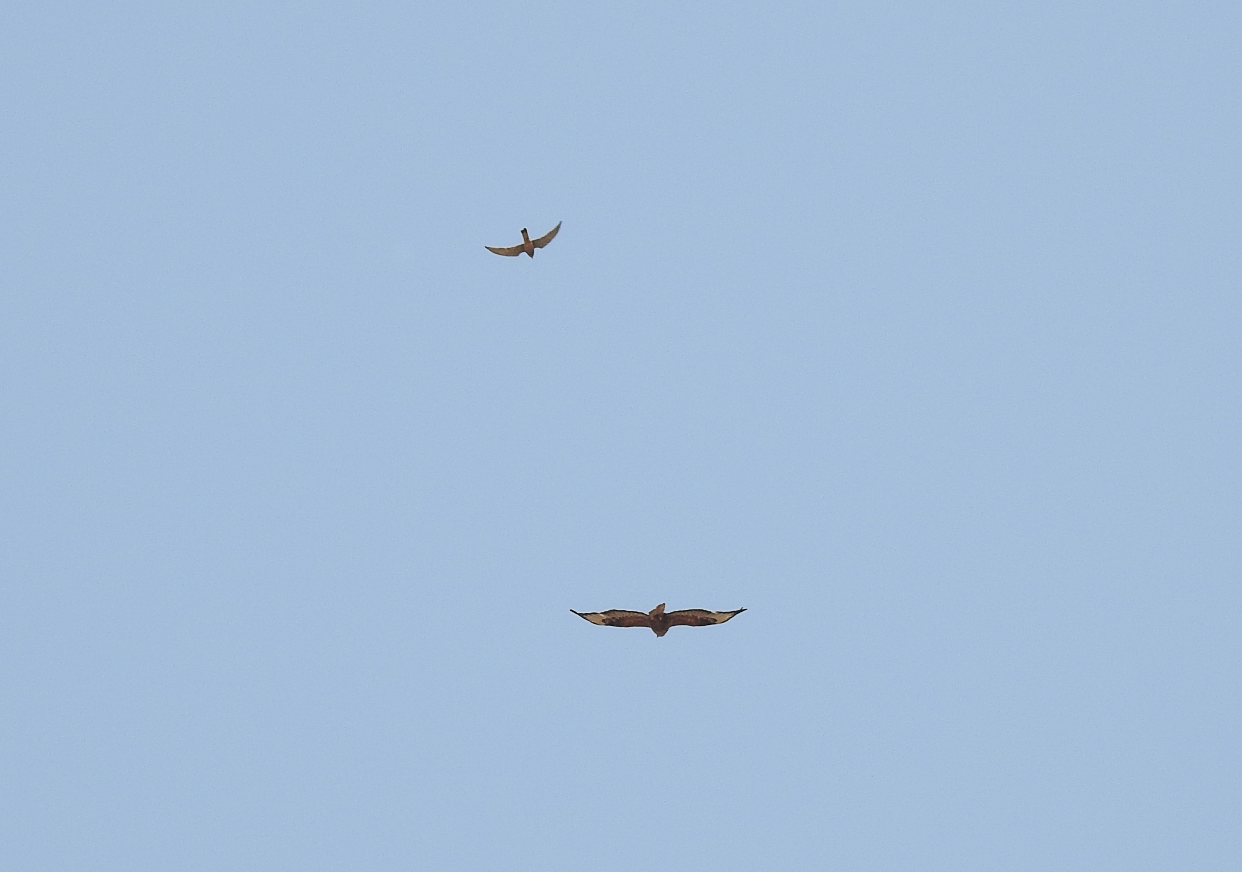
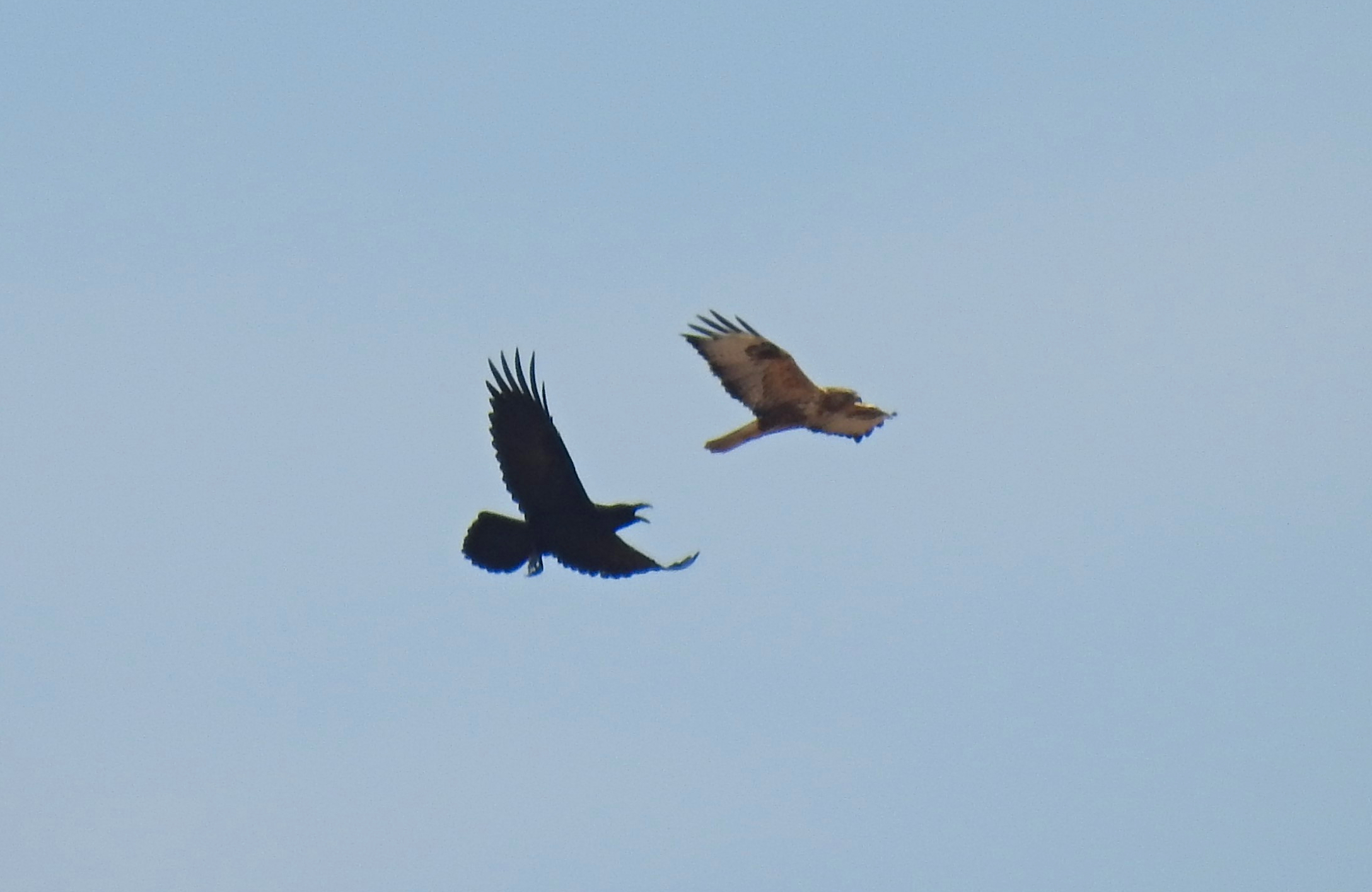
We walked the dirt path until we reached the perched long-legged buzzard and inevitably scared him off. To our excitement, a juvenile short-toed eagle had just perched on a nearby tree, and the rousted buzzard made it return to the air. We watched as the two birds of prey climbed the hot air thermals, all while the owl watched us. Then, if the scenario wasn’t thrilling enough as is, suddenly a male lesser kestrel came out of nowhere and started harassing the buzzard, dive-bombing it with aerial superiority.

Lesser kestrel harassing a long-legged buzzard

It was during the intensity of all these sightings, and the desperation to capture it all in photographic form, that my camera’s battery exhausted itself. I tried to revive the little black cuboid, but to no avail. It was just my misfortune that directly thereafter we had two day-time fox sightings, as well as a handful of other great photographic opportunities. Alas, there was nothing I could do, so I took a photograph of myself in the fly-filled heat and just enjoyed the outing for what it was.

Quarry selfie

It wasn’t long before we climbed back into the bus and made our way back to Bar Ilan University, bringing to an end one of the most enjoyable departmental field trips I’ve ever been on. Hopefully I’ll be able to attend next year’s dune trip as well, but in the meantime I have the more centrally-located dunes of Holon and Rishon LeZion to explore.

Yatir Forest: Ecological Fieldwork

In Israel, Judea on June 18, 2019 at 7:26 AM

The other week I had the privilege of taking part in something slightly out of the ordinary. My friend Levi Burrows had invited me to participate in some fieldwork for his MA at Hebrew University. Specialising in ecology at the Faculty of Agriculture, Food and Environment, Levi is contributing to an ongoing research project spearheaded by two professors – Dr José Grünzweig at Hebrew University and Dr Yagil Osem at the Agricultural Research Organisation – Volcani Center. Plans were set into motion and I found myself heading his way for a day of ecological fieldwork.

Welcome to Yatir Forest!

Levi picked me up that evening outside the Volcani Center and together we entered the compound, located the storage room and loaded his rental car – a Peugeot 301 – with the necessary gear. Pretty much set for the next day, we drove over to his apartment in Rehovot and had a nice relaxed evening. We made sure to go to sleep extra early, because fieldwork days start just after 2am. My alarm clock rang shortly after 2am and together we made the last necessary preparations before heading out. Our destination was Yatir Forest, located near Mount Amasa, south of Hevron, where the KKL-JNF had planted Aleppo pine trees starting back in 1964. Levi’s research sites are marked off plots of land, each plot containing an interior plot fenced off by razor-wire.

Arboreal spectres

We drove on main roads for over an hour, then made the rest of our way on a side road passing scattered Bedouin villages. We arrived shortly after 4am and immediately began to work. Our first task was to take sprig clippings from particular, numbered trees, bagging them for later use. As we dashed about in the chilly darkness, our headlamps illuminating big patches in front of us, I heard the first of many scops owl calls. I was tempted to try and lure the scops owls with calls from my Collins birding app, but there was work to be done and we had to finish this stage before the sun’s rays peek over the mountainous horizon.

Sunrise

Our only real distraction was a large praying mantis found on a tree trunk, and aside from that we worked with alacrity gathering sprigs from four separate plots. When we were done, the first rays appeared and we began setting ourselves up for the next stage. Levi’s research involves comparing the water potential of trees both in and out of grazing areas.

Scientifically examining the sprigs

The way we were to find out was to measure the trees’ thirst by checking the pressure it takes to force stored water out of the sprig’s freshly snipped twig. To do this we employed the use of a PMS Instrument Model 1505D “Pressure Bomb” which applies nitrogen to pressurise the leaves in a little pressure tank. Levi hooked up the machine to a nitrogen tank and we began to take measurements of the greatly aromatic sprigs.

Hammering out soil samples

The sun climbed up and began warming us with its friendly rays. We finished up with the final sprigs of the pre-dawn harvest and then set out to do our second task: taking core samples of soil from the two sections of each plot. This was performed with two sledgehammers, a pipe-stake and a bucket. We went from plot to plot taking samples, and only getting a little bit distracted by the many praying mantises – these ones belonging to the species Rivetina baetica.

Rivetina baetica mantis

This was hot and tiring work, especially with the exposed bedrock in many places, so we were happy when we finally bagged our final sample. The happiness increased when, as we were making our way out of one fenced off area, we spotted a jackal do an about-face and run off downhill. Apparently the jackal was curious as to what we were doing and came up check us out.

Snake-eyed lizard

With the jackal gone there were still some more cool stuff to see. A pair (or more) of common kestrels kept appearing now and again, and a pale-morph snake-eyed lizard was spotted near the car. We drove back to our temporary base camp and began to figure lunch out.

Basecamp

Levi had packed a bunch of cooked foods and snacks for us, but we also wanted to do some fresh cooking of our own. We decided that building a fire to roast kabanos sausages would be a great experience, and set out to do it posthaste. When the small fire was up and burning, the fuel being the dead bark, sticks and pinecones from the fragrant Aleppo pines, we hunkered down and got comfortable. Skewering the sausages on sharpened sticks, we set about making a delicious snack to accompany the food we brought.

Relaxing beside the fire

When the feasting finished we kicked back to rest a bit, with the intention to do another round of sprig-picking at noon. A few kestrels screeched from the nearby treetops, and some ticks ran unchecked over the pine-needle forest floor, but aside from that silence reigned. When noon finally came around we urged ourselves back to work, and began the sprig-picking one plot at a time.

Snipping sprigs

When the 96 fragrant sprigs were all successfully bagged, we drove back to our base camp and began the nitrogen-pressurising process again under the shade of an Aleppo pine. We worked quickly and diligently, and cracked open a bottle of Leffe Bruin when we were finishing.

Driving back

When our work was finished we loaded up all the gear into the Peugeot and bid the pine forest farewell as we made our way to the main road. It was a bit of a drive back, but eventually we made it to Rishon Lezion where Levi dropped me off. He continued on to the Volcani Center whereas I bused to my girlfriend’s place near Jerusalem to enjoy a home-cooked dinner.

University Trip: Herodium Survey & Tour

In Israel, Judea on April 18, 2019 at 9:35 AM

This post harkens back to the late fall and winter months, when I participated in a series of archaeological explorations with Prof Boaz Zissu and other students. These explorations were part of my “Survey Basics” class with the Land of Israel Studies and Archaeology department at Bar Ilan University, taught by Prof Zissu (see also HERE). The first and third tours, having taken place back in October and December, were to Khirbet ‘Arak Hala. Located just north of Beit Guvrin, this site is largely comprised of a flattened enclosure, bathhouse and ancient settlement – all dated to the Roman period.

SUV of happiness at Khirbet ‘Arak Hala

The second survey, back in November, was to Khirbet Amudim, located in an active military firing zone, in the Judean foothills. Our duty that day was primarily to locate and map out caves and underground expanses, and it was very rewarding with fascinating caves and many interesting species of wildlife, including horseshoe bats and hungry cave ticks.

Ben, Nohar and myself surveying at Khirbet Amudim

However, this post is about the fourth survey day, to Herodium – or more precisely, to the hilltop adjacent to the mountain-top fortress. It was Dec 27th, and there was rain in the forecast for most of the country, but being that Herodium is located in the Judean Desert where rainfall is less common, it was decided that the survey day will continue as planned. Thus, our tour bus transported us first thing in the morning to Herodium where the rest of the team was waiting patiently.

Herodium

The very first thing that we noticed was the biting cold wind which penetrated our clothing and chilled us to the bone. We found shelter within the visitors centre, and were briefed on the history and archaeology of Herodium by both Prof Zissu and the site’s resident archaeologist, Roi Porat.

Winter skies over Judea

Properly briefed, we then headed outside and made our way to the hilltop northeast of Herodium. It was chilly, with rain clouds in the distance, but a full rainbow appeared before us and life was looking great. We were divided into two teams, each tasked with scanning a particular area for potsherds and other archaeological evidences.

Itamar Berko gathering surface finds

Within a half hour, as the teams were gathering the many scattered potsherds, a cold biting rain began. Blown by powerful gusts of mountain wind, the freezing rain made surveying quite difficult. We continued the best we could, but then, as we were finishing up, the rain intensified. We beat a hasty retreat to the visitors centre, but the downpour was quicker than we were and we returned soaking and cold.

Rainbow preceding the rain

After laying out some of our clothes to dry in a heated room, we gathered around to take stock of the potsherds we had found. The bags were spilled out and divided up, the indicative pieces (such as rims and handles) analysed and identified. We made an estimation of the typologies, factoring in the age of the sherds, and developed a rough picture of the site’s age. When we were finished, we had a debrief, and then ventured out into the park to explore Herodium’s ruins.

Examining the ceramics

Herodium, the iconic mountaintop fortress, was constructed by Herod the Great before the turn of the millenium during the Roman period. The site is divided into three main areas: the fortress, the slopes and the lower region. The fortress was designed to have four towers, the eastern one being most prominent, and the interior of the palace complete with a courtyard nestled within. Towards the end of the construction, dirt was added to the outer walls of the round fortress, giving the appearance of a luxuriously-filled volcano. When Herod died, in the year 4 BCE, he was buried on the slopes of Herodium, in a monumental structure built in his honour.

Looking down on Lower Herodium

Later, during the Jewish revolts against the Romans, Herodium was occupied by the rebels and refuge tunnels were dug beneath the fortress. After the final tunnels were burned out in battle, Herodium laid waste until Christian monasteries was built during the Byzantine times. From the Arab conquest onward, dating back some 1,400 years, Herodium laid in ruins with just a few local Bedouins keeping the site company. Following surveys starting in 1873, archaeological work began in 1962 and have been continuing on-and-off since then.

Entering the fortress

We climbed the hill via the footpath, and entered the fortress complex from the western side, passing various archaeological features and the view of Lower Herodium along the way. The palace remains came into sight as we crested the slope’s top, entering into the ancient courtyard. Raindrops had begun to fall, and we were ushered into the belly of the palace-fortress, entering chambers generally off-limits to the public until the restorative work in complete. Roi Porat led us down a perilous staircase, and into a quaint vaulted room where we set down our bags and got comfortable.

Inside the vaulted room

Some of the team joined the department’s patron, Yehuda Mizrahi, in preparing a hearty lunch while the rest of us gathered around to hear more about the ongoing excavations. After an overview, we set out to see the emptied storage rooms that once housed the Jewish rebels during the Roman era. Fallen stones, blackened ceilings and bone-dry logs illustrated the scene frozen in time, as the tunnels were set aflame to burn out the trapped Roman soldiers.

Exploring the scorched chambers

We spent a good half hour in the tunnel-like chambers, discussing archaeological technique and theories with Prof Zissu and Roi Porat. When we had had our fill, a concept that was hard to imagine, we headed back outside, via the vaulted room, for another gander now that the sun had come back out.

Herodium’s ancient synagogue

With so much to see, from the curved internal walls to the many columns and other architectural features, it’s hard to fully relate the true wonder of the site. I passed from the southern portico to the reception hall and ancient synagogue, and then from the weapons foundry and the Byzantine chapel to the bathhouse and northern exedra.

Bathhouse ceiling

Throughout the fortress’ interior, signs delineated both the Herodian-era ruins and the later ruins, often times occupying the same space. I spent time in each spot, taking pictures and admiring the construction before moving on.

Northern portico

Minutes later, when I entered the underground tunnel system, I was truly blown away. The white tunnels, carved from the soft rock, seemed endless and I descended deeper and deeper into the mountain.

Entering the tunnel system

I passed water shafts and retaining walls, keeping to the main path as I pressed onward. Several of the side passages were fenced off, accessible only to the site excavators, but I was happy enough with the prepared tunnels. Deeper and deeper the tunnel went, until at last it leveled out and I found myself headed towards one of the exits not far from the elegant theatre and Herod’s tomb.

Deep inside the tunnels

Breaking down the underground system, the cisterns date to the Herodian period, where as the tunnels date both to the Jewish War and the Bar Kochba Revolt several dozen years later. I emerged from the tunnel via a large room, and made my way around the slope ruins. Not wanting to miss lunch, I headed back into the bowels of the mountain and back up into the fortress courtyard to rejoin my group in the quaint vaulted room.

Final chamber

Everyone had reconvened from their exploration ventures and lunch was being served from the makeshift kitchen. We sat down to hot soup, freshly made pitas, breads, salads and preserved meat. It was a kingly feast, and we felt downright special eating it in the quaint stone room. As lunch winded down, we sat around about swapping amusing stories until it was time to clean up and head back out into the cold wind.

Freshly made soup and pita

We exited via the tunnels and began to explore the slope ruins, but first, a Finsch’s wheatear popped into view and I snapped a handful of sub-par pictures before it flew off. Walking the slope path, we came upon the theatre which once hosted great entertainment during the Herodian period. Next, the two sets of ancient steps that head up the slope towards the peak, each built in a different time period.

Underground retaining walls

From there we continued on to the area of the royal tomb, where Herod was buried. During the Jewish War, some of the Jewish population didn’t take too kindly to his burial place and proceeded to tear it down. Today, foundations, architectural elements and many of the ashlars have been found – signs of a monumental structure – but that’s about it. Citing physical and historical evidence, a miniature version of the ornate tomb was reconstructed, and provided us an idea of what the original structure looked like.

Rain-splattered staircase

As we enjoyed the views from the slope, the rain and bitterly cold winds picked up again. The walk back to the visitors centre wasn’t necessarily far, but with the rain and cold it was quite the trek. I particularly enjoyed seeing the falling raindrops flying upwards at my face as the wind changed the standards of gravity. Eventually we made it back to the visitor centre and prepared ourselves to head back to Bar Ilan University.

Model of Herod’s tomb

This was the final survey day of the survey class, but due to the relative success of the adjacent hilltop’s surface find collection, another survey day was immediately scheduled. Unfortunately I was unable to attend the second day, but I heard that it was absolutely delightful. Having finished my survey requirements for my BA, I hope that maybe next year I’ll be able to take part in a survey as part of my MA – time will tell.

University Trip: Mount Hevron Area

In Israel, Judea on December 9, 2018 at 6:31 AM

The other week I participated in the annual two-day hiking trip (known as the “Campushetach”) provided by my Land of Israel Studies and Archaeology department at Bar Ilan University. Geared towards relatively fit hikers, this trip takes a rugged approach to geography, history and archaeology and is offered to both students and staff of the department. Last year we spent two days in the Wadi Qelt area (posts I and II), and this year we spent the two days in two different places: the first day in the Mount Hevron area, and the second day at Nachal Kina in the Negev.

Starting off the trip with a grand view

The first day began at BIU where the majority of us boarded a tour bus to be taken to the Mount Hevron area, making a few stops on the way to pick up the other trip members. We drove through the Judean Lowlands, spotting some gazelles on the side of the road, and then entered Judea. We passed by Hevron and had our first real stop at a site called Nabi Yakin, home to a burial cave and Muslim maqam (shrine), as Dr Dvir Raviv gave us the trip’s introductory talk.

Maqam of Nabi Yakin

The maqam, known as Nabi Yakin, was built to house a pair of “footprints” in the bedrock, which, according to Muslim belief, belong to the patriarch Abraham. Outside the maqam, surrounded by stones, is another pair of “footprints” that are associated with Lot. A quick visit inside the burial cave revealed a whole lot of collapsed rock and a lone Sinai fan-fingered gecko that was hiding out near the painted gate. Back outside, blossoming Steven’s meadow saffrons dotted the ground here and there.

Steven’s meadow saffron

Our next stop was to the yishuv Ma’ale Hever where we enjoyed the lookout and had breakfast. F-16 fighter jets screamed in the skies overhead, dropping flares as they engaged in exercise maneuvers. From the yishuv we drove over to Tel Zif, where we had a short walk to some recently excavated Roman ruins.

Mediterranean spur-thighed tortoise

There was also some interesting wildlife to be seen, including some ravens flying in the distance, a flock of woodlarks, a baby tortoise and my very first Ameles heldreichi praying mantis. In addition, a nice bunch of Crocus pallasii was flowering and providing nectar for a hungry honeybee.

Crocus pallasii

The ruins at Tel Zif are quite fascinating, with the Classical architecture of fine masonry with a fancy tiled floor and carven columns. Heading back to the bus after some final photographs, we were then driven to the access road to Tel Ma’on. We disembarked and began the walk to the tel, where we were to enjoy the views and the site of an ancient synagogue dated to the Roman era.

Ruins at Tel Zif

Accompanied by a trio of soldiers, we entered the Arab settlements and passed plowed fields and ancient water cisterns. One of the cisterns we passed is still in-use, with a couple local children standing over it and the nearby sign of rehabilitation on behalf of the Canadian government. At one point up the slope, someone noticed an interesting flower – identified as a Tuvia’s autumn crocus, and then my friend Adam captured my attention.

Common northern raven chasing a long-legged buzzard

Off to the east there were two large shapes flying through the air. Seeing the rear one relatively clearly, I assumed the other to be the same species – a common northern raven. Only with the help of my camera’s 83x zoom was I able to get a series of photos which showed me that the raven was chasing (or mobbing, as it is known) a long-legged buzzard. Up at the lookout atop the tel there were more interesting birds, including a male black redstart who lingered in the nearby trees, giving us quite the show.

Judean landcape from Tel Ma’on

On the north side of the tel, just below the top, we came across the ruins of the ancient synagogue. There wasn’t too much to see but the remains of a few walls and a partially collapsed escape tunnel/chamber dug out of the bedrock. Continuing back down the slope via the western side, we amassed a large number of curious local Arab children who began to follow us on our way out. Another set of ruins, this time larger walls of well-dressed ashlars, intrigued us, but unfortunately we were on a tight schedule and didn’t stop.

Tel Ma’on ruins

Back on and then off the bus, we stopped at the yishuv Susiya for lunch and a break, and then back to the bus to be driven to Mount Amasa. For the past year or so I’ve wanted to visit Mount Amasa, largely due to a video I saw of it filmed by Amir Balaban (see HERE). Last winter a Persian wheatear, a rare bird for Israel, had been spotted and scores of birders sojourned to Mount Amasa to see it. This year it returned, and while the excitement has died down, I thought it’d be fun to spot it. Alas, no Persian wheatear was spotted, but a great number of other interesting birds were.

Group photo on Mount Amasa

From the very moment we stepped onto the trail, part of an ancient Roman road, Adam and I saw birds everywhere. There were stonechats, wheatears, chukars and crested larks galore, and it was hard to keep up with the group’s unconcerned progress. At the peak of Mount Amasa, a very gently-sloped mountain, we were gifted with an incredible view of the Arad Valley below us.

Walking the Mount Amasa trail at sunset

After hearing from a couple of the lecturers we began the long and slow descent towards Nachal Dragot. The sun began to sink behind the nearby ridge and the 6 kilometre long walk seemed to go on forever – which, in some ways was most excellent. It was a lovely hike and I look forward to returning one day and possibly even camping somewhere on the mountain.

Dusk at the quarry

Passing an enormous quarry on the western side of the slope, we at last reached the near bottom and then cut across to find our bus waiting faithfully for us on the access road. We boarded and made our way to Susiya, where we were to spend the night in a large, separated communal tent. Dinner was pizza and fresh soup made by the department’s patron Yehuda Mizrahi, and then we all enjoyed some relaxed social time. Friends Ben and Adam joined me on a small walk around the yishuv (where we saw a fox) and then got a bonfire going back at our home-base. Staying up a wee later than we should have, we eventually got into our sleeping bags and passed out, only to be woken up a few hours later for the second half of the annual “Campushetach”.

Tel es-Safi Archaeological Dig 2018

In Israel, Judea on August 26, 2018 at 9:27 AM

Following my last season at the Tel es-Safi/Gath archaeological dig (as can be read in parts I and II) a year later, I returned this summer for another four weeks of fun in the sun. Having garnered some experience, I was promoted to assistant area supervisor, which, in my case, made me a supervisor of five squares, a step up from last year’s single square. Excited to tackle the job, I reunited with Dr Jill Katz of Yeshiva University (my immediate superior), Prof Aren Maeir of Bar Ilan University (the dig director) and other staff members to prepare the field for the dig.

Area Y before the dig began

This year brought change to the long-running Tel es-Safi dig as the efforts were concentrated only on the lower city area. Last year had us in both the upper and lower city of the tel, with our Area J being on the slope – the upper city wall from the Early Bronze era. Dr Katz and I had been designated a new area, Area Y, at the northern side of the tel and close to Nachal Elah, the outer regions of the lower city. Using some nifty magnetometry technology to detect physical anomalies under the surface, we picked out some squares to excavate out of Israel’s national land grid.

Lodgings at Kibbutz Kfar Menachem

This year our expedition was to be based out of a school in nearby Kibbutz Kfar Menachem, just a fifteen minute drive from the tel itself. Staff and volunteers met and exchanged pleasantries as we set ourselves up for the four-week program. Dr Katz had brought some Yeshiva University students and other volunteers, which made the bulk of our core group, and it was a pleasure to get acquainted before setting out the following morning to the tel.

Sunrise and Area D

Our first week began with clearing Area Y from rocks, dead grass and other vegetation, as well as setting up the shade tent that would serve us the rest of the season. Our neighbours were also preparing their areas: the Bar Ilan team at Area M just across the dirt road on the side closer to the tel was also opening up fresh squares on virgin land. Over to the west, Area D and D2 were setting up as well, cleaning their aging baulks from the ravages of time and winter’s rains.

Prof Boaz Zissu lending a hand

Back at Area Y, we struck into the dry soil with a hunger for finds, each of the first four squares occupied by three or four volunteers. I was given boxes of supplies, a table, and a chair where I was to spend the majority of my time in the field. I was charged with making sure that everything was properly registered and accounted for, and that everything that was taken back to the field lab was tagged and labeled correctly. It was an interesting yet mostly cushy job and I was almost always shaded from the fierce sun by the large jujube tree that adorned the eastern side of our area.

Jill giving a briefing

Each day the routine was the same: we’d arrive, set up the shade tent, gather all the necessary tools, have a quick briefing on what the objectives of the day were, dig, dig, dig, write, write, write, and then pack it all up at the end of the day, which was at one o’clock in the afternoon.

Rebecca Zami preparing the daily top plan

Back at the kibbutz we processed all the finds, which included washing, reading, and writing on pottery, as well as attending lectures and filling out paperwork (each to their own in accordance to their job). Of course, we also enjoyed meals and had leisure time to fraternise with the many interesting folks from around the world who had come for the summer.

Annie Brown with a tiny lizard jawbone

Clearing away the topsoil is both laborious and frustrating, yet sometimes really interesting finds from more recent periods can be found. In our case, we found several pieces of Ottoman pipes and a few broken glass bracelet pieces from the Mamluk/Ottoman period. While these finds have very little significance to an excavation dedicated to Bronze and Iron Age settlements, they do brighten up the day.

Mouthpiece of an Ottoman pipe

Being a lover of nature and wildlife, I was always excited to see interesting species both in and above ground. During the first week we found a few ocellated skinks and some green toads, while seeing a recurring presence of a pair of short-toed eagles who reside at the tel each summer. It’s always satisfying to hear an aquiline cry in the distance and to then looking out at where it was expected to be; I had begun to learn their habits and that provided me much joy as a birder.

Avraham Penso running a wheelbarrow

The first week went by quickly, the topsoil being stripped away and decanted on nearby dirt ramps that were constructed under the guidance of Prof David Kotter of Colorado Christian University, a man educated in the art of engineering. With the start of the second week our core team was bolstered by some experienced members from last year’s Area J, including Itamar Berko, Shani Guterman, Avraham Penso and Rebecca Zami. We needed more diggers with experience to manage all the progression made below topsoil–when things start getting interesting.

Henry Kronenberg in Square 93A

In fact, in one of our squares (93A), a curious clumping of fired mudbricks was being exposed from under the earth, prompting much discussion amongst the staff. Each square had its charm, a combination of the physical contents and the personalities of those working in it. While one square’s team was hard at work pickaxing a mysterious layer of chalk in relative silence, another would be clamouring about some painted pottery they had found. Though not properly digging in any of the squares for the bulk of my day, I had the pleasure of appreciating it all, even if from afar.

Fine specimen of a Philistine mudbrick

With the onset of the second week I had also brought some of my home-brewed beer to the kibbutz, the vulture-decorated bottles of our successful batch of Arx Meles IPA II proving to be quite a hit with both the local and foreign students. Unfortunately, my co-brewer, Ben Yablon, was unable to attend this year’s dig and thereby missed out on the accolades that he well-deserved.

Drone view of Area Y (photo Aren Maeir)

Back at the digsite, the expedition’s drone began to made sporadic visits to the three areas, providing us with a much-appreciated bird’s-eye view of the work we were doing. There wasn’t much in terms of isolated special finds during the second week, but the squares were coming along nicely, and some of them caused much intrigue. For one, the clumping of mudbricks in square 93A was beginning to appear like a structure, albeit somewhat collapsed, and the square with the chalk refused to move on – the chalk layer getting deeper and deeper with every passing day.

Tiny Kotschy’s gecko on my table

It’d be uncharacteristic for me to leave out the wildlife, so on the second week I was treated to a special guest at my table. A tiny Kotschy’s gecko, that I assume lives in the jujube tree, came running all over my paperwork and top-plan. I had never seen one of these amazingly camouflaged lizards so it was quite an experience. Another curious find shortly thereafter was the remains of a little owl, found flat as a pancake in the grass beside the dirt road. I just hope it wasn’t the same little owl from last summer (see photograph HERE).

Yeshiva University students with Dr Jill Katz

The second week went by quickly, and a handful of Bar Ilan students left our area. Our crew was cut down a bit, but on the third week we had a lot of volunteer groups who came to help for a day. A large contingency of Yeshiva University students doing a summer program in Bar Ilan’s laboratories came to help out one morning, bringing with them a YU flag for us to hang from our shade tent.

Area M supervisor Maria Enukhina taking photographs from a cherry-picker

Good progress was made on the third week, and the squares were looking more and more impressive. In order to handle the influx of volunteers with no field experience, we opened up another square (93C) which provided a fresh working space for fun topsoil finds. Sure enough, a piece of a glass bracelet from the Mamluk/Ottoman period was uncovered, as well as a few obscure metal pieces probably dating back to the early to mid-1900s.

Progression at Area Y

Despite the fact that we had five squares open, and that we were digging in Iron I territory (land of the Philistines), we had a remarkable lack of small finds. Even pottery, which is so common everywhere on and around the tel, was scarce and our daily pottery buckets were always scant. It became a bit of a joke during the expedition, especially as Area M’s findings were so incredibly rich. They had uncovered the destruction level from the Aramean King Hazael’s attack, and were knee-deep in both broken and complete vessels.

Rebecca Zami examining some potsherds

We had to finish the bulk of our digging by the end of the third week, as the fourth week focuses on cleaning up the area and photographically documenting the season’s work. Most of Area D’s workers, including the valued CCU team who helped us out a lot in Area Y, had left the expedition by the end of the third week. Our team shrunk as well, and it was mostly the core members who were left to hold the torch to the very end. We came back from the weekend, some of us having spent Shabbat together in Jerusalem, refreshed and ready to finish off the season with a bang.

Taking elevation readings with the Total Station

However, I had a different calling. That Sunday I was to report to my old army base just outside of Haifa for reserve duty. Being that I was still tied down with my responsibilities at Tel es-Safi, I was released upon talking to my captain, but it was fun revisiting my old base after so many years. Taking public transportation back to the kibbutz, I rejoined my dig friends and got right back into the swing of things.

Dr Jill Katz at Tel Miqne

The following day we took a field trip to Tel Miqne/Ekron, guided by our very own Prof Jeff Chadwick, who was a supervisor there during the excavations in the 1990s. We toured the agricultural installations, which had since become impressively overgrown, and learned about the ancient city’s gates. It was a short trip, with the intense afternoon sun beating mercilessly down upon us, and we took what we could from it.

Area Y completed for the season

The next few days were dedicated to cleaning and photographing, yet while cleaning, the base of a vessel became visible on the floor of Square 92B. We were filled with excitement, thinking that we had at last come across a possible whole vessel. So, after taking the final photographs of the season, we gathered around as a few team members excavated it. Not quite what we expected, we discovered that this base was just a base, and a broken one at that. Later, we learned that it was a homemade vessel – a cool find for that reason alone.

Area Y group photo (photo Aren Maeir)

Thus ended the 2018 season of the Tel es-Safi Archaeological Dig for the Area Y team. We shared a grand time together, most having a once-in-a-lifetime experience that will be forever cherished. For the archaeology students among us, there’s next summer to look forward to – be it at Tel es-Safi again, or perhaps one of the many other archaeological digs throughout the country.

End-of-the-season photograph (photo Aren Maeir)

To read more about Tel es-Safi’s official (and unofficial) updates, as well as old posts from this summer’s season, please check out Prof Maeir’s blog HERE.