Israel's Good Name

Archive for April, 2018|Monthly archive page

Nachal Metzar

In Golan, Israel on April 29, 2018 at 9:11 AM

When the first day of Pesach (Passover) ended it was time to take advantage of the vacation days and to go somewhere exciting. I had access to a car and was accompanied by frequent guest star Adam, so we decided on a day trip to the Golan. We had just been to the Golan on a university field trip so our appetites were properly whetted, allowing us to leave at an early 4:45am with much excitement. Our trip was geared towards birding and exploring, and, with so much content, will thereby be divided into two posts.

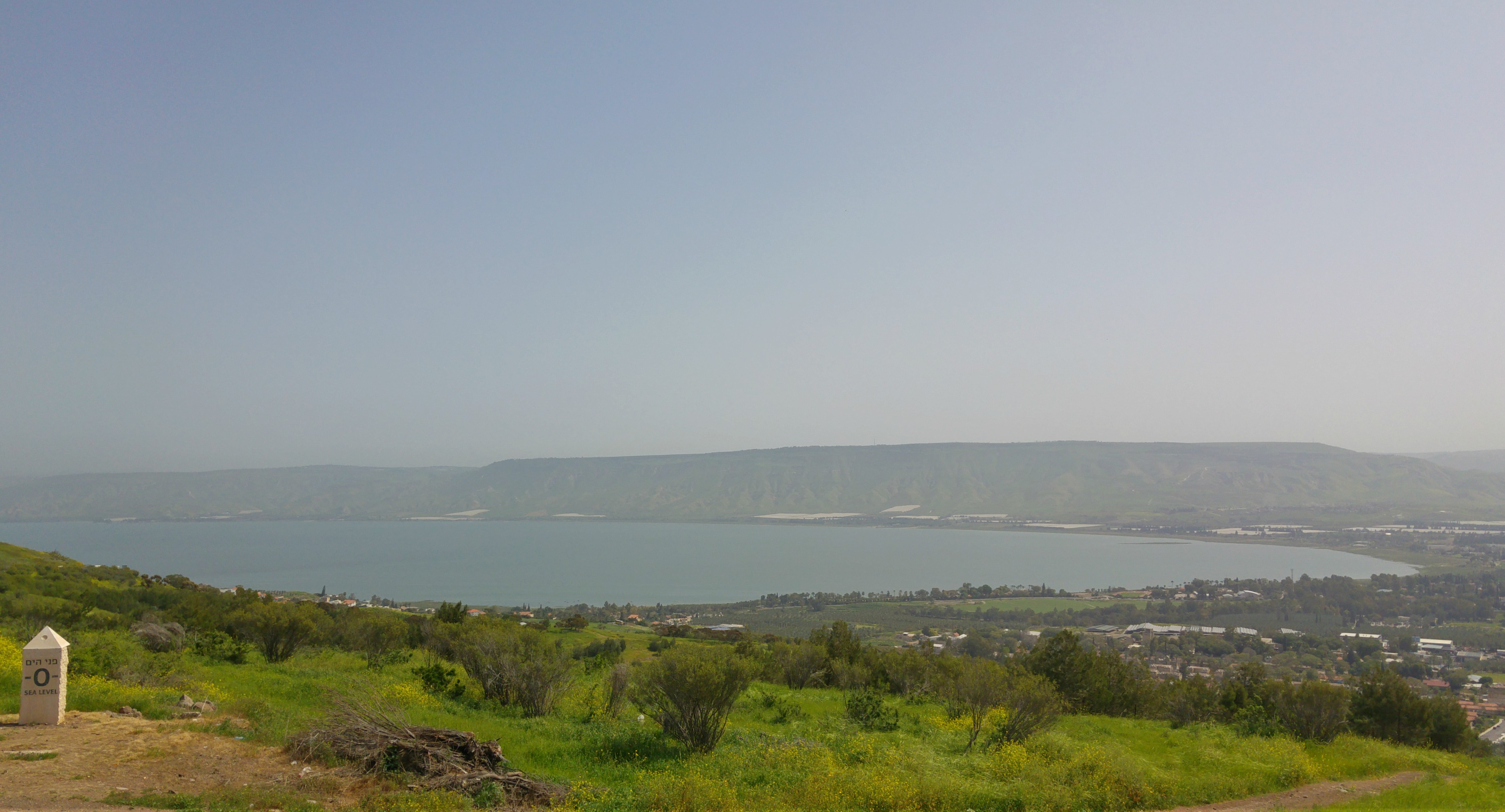
Early morning’s light over the Golan

We drove eastward from Ma’alot and began to see the day’s first light as we reached the valley area between the Galilee and the Golan. Entering the Golan on Road 87, we headed for the first intended site of the day: the mountaintop ruins of Susita. Unfortunately we found that the access road seen on the map is not actually accessible for vehicular traffic and therefore ditched Susita in favour for the next intended destination: Nachal Metzar.

Nachal Metzar

We drove through the very picturesque area of Road 789 – on which I have never been – as the sun began to shine light onto the gentle mountains, and spotted a golden jackal dashing across the road which started our sightings off great. We pulled over at a lookout stop on Road 98, and noticed how unexpectedly cold it was, before making our way to the Nachal Metzar trailhead.

Corn bunting (photo Adam Ota)

There wasn’t any intended hiking plan, we were just going to get out, walk around and see what there was to see. Armed with our cameras, monocular and a bird guide, we stepped into the nature wonderland ready to be impressed.

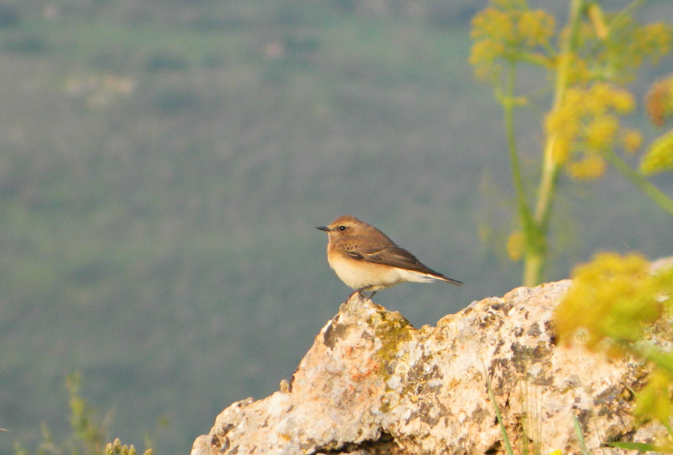
Black-eared wheatear

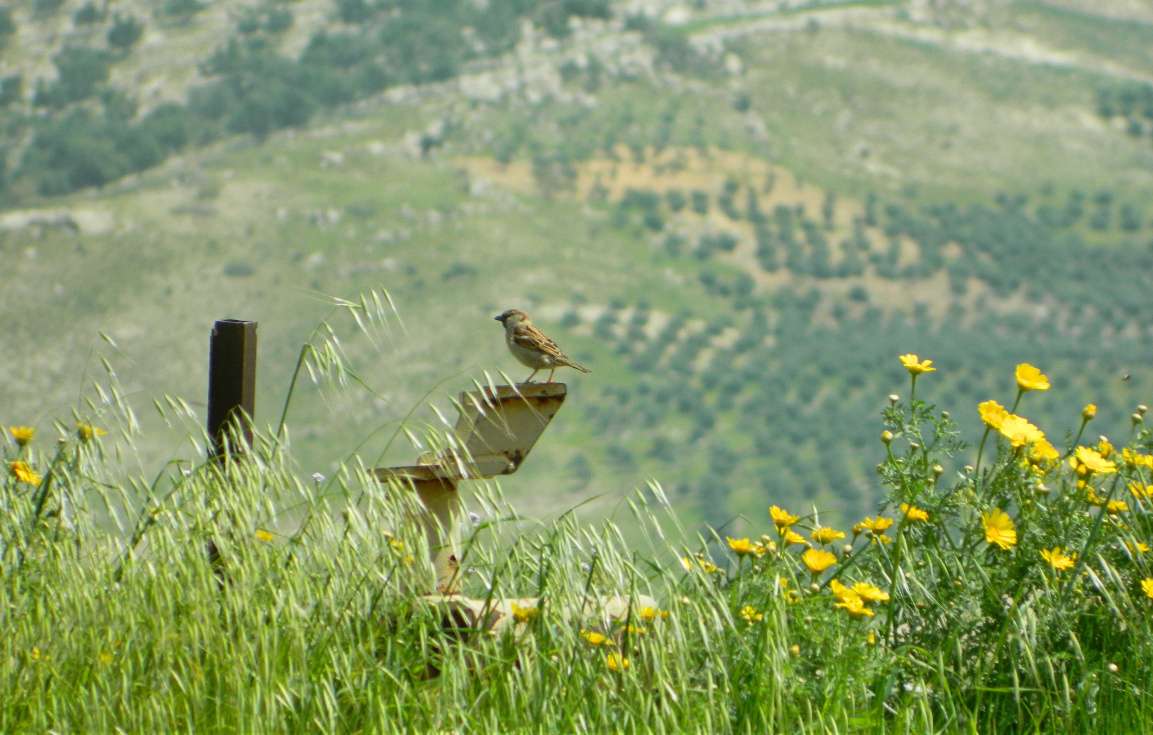
From the very beginning, there were white storks crossing the small valleys and corn buntings perched out in the open, singing loudly. We took pictures willy-nilly, not wanting to miss an birding identification or a great photographic opportunity. Progress along the blue-marked trail was very slow, as we turned in circles capturing the scene around us. The tall grasses, thistles and occasional bush provided cover for dozens of species of birds and insects and we wanted to see it all.

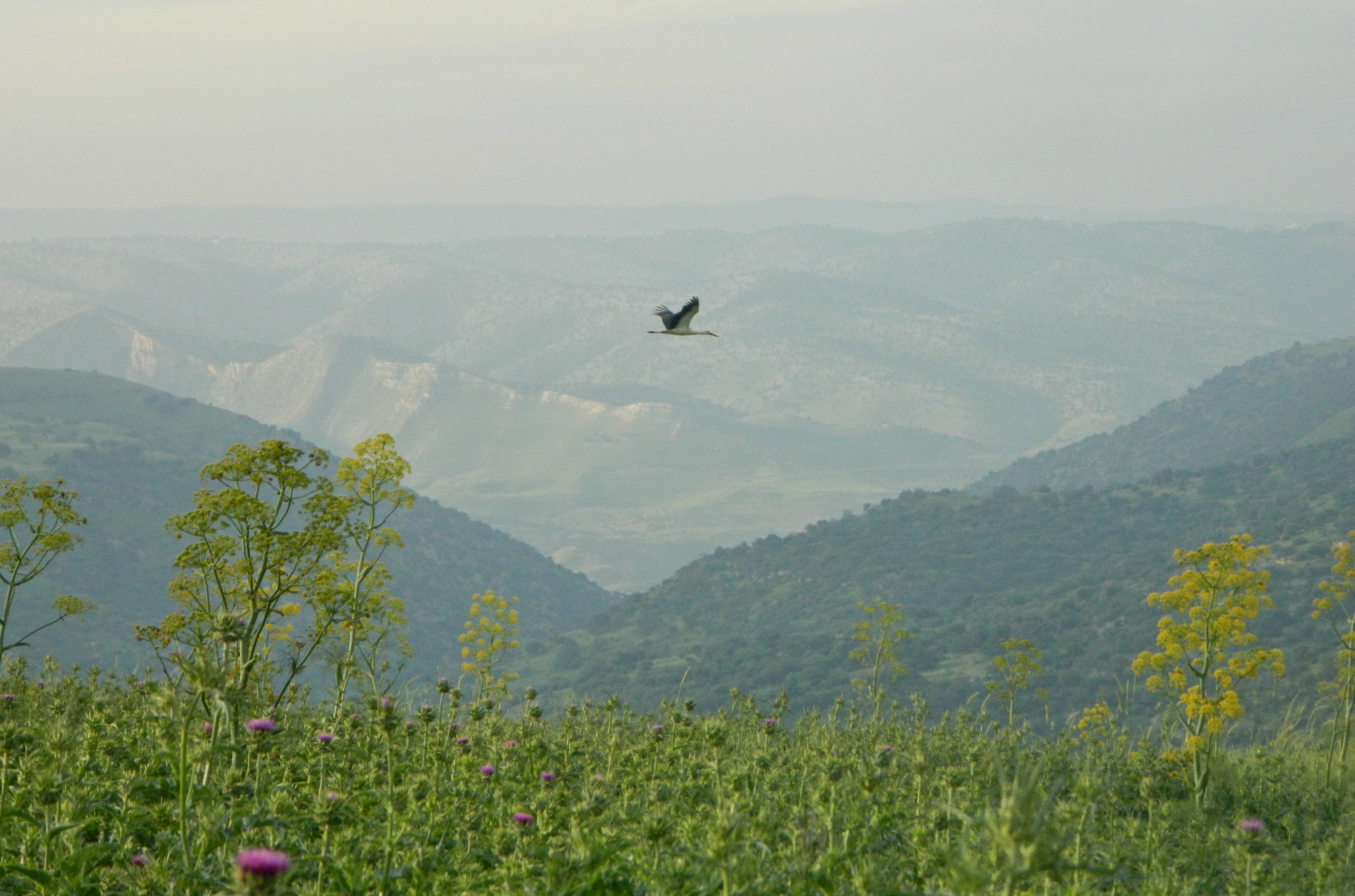
White stork passing by at the right moment

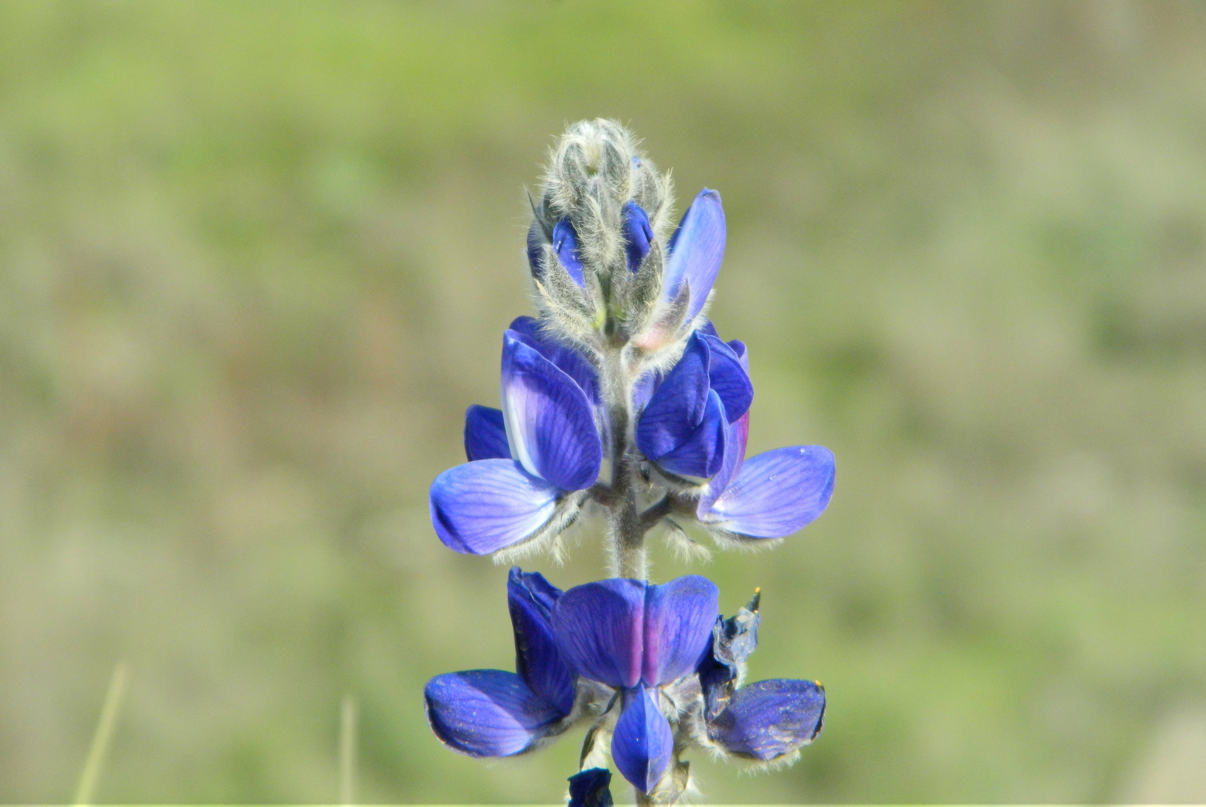
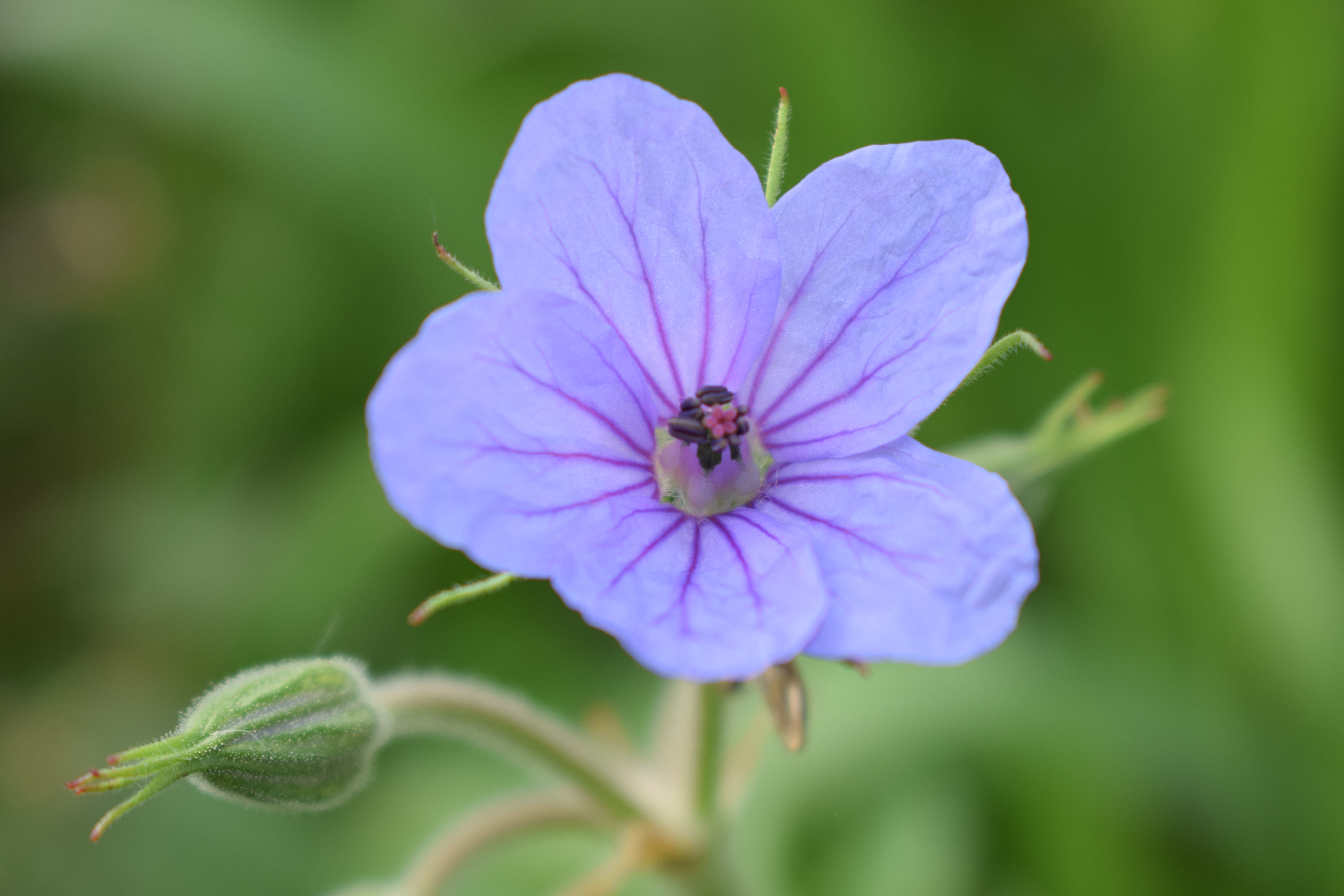
If the wildlife wasn’t enough, the view of the green slopes in morning’s light was absolutely stunning. And, as usual with the spring, the wildflowers made for great optical enjoyment. But it was the birds that captured our attention the most. We switched between keeping an eye on the songbirds to scanning the skies for soaring birds of prey. The first was a short-toed eagle, followed forty minutes later by a lesser spotted eagle who circled above us repeatedly.

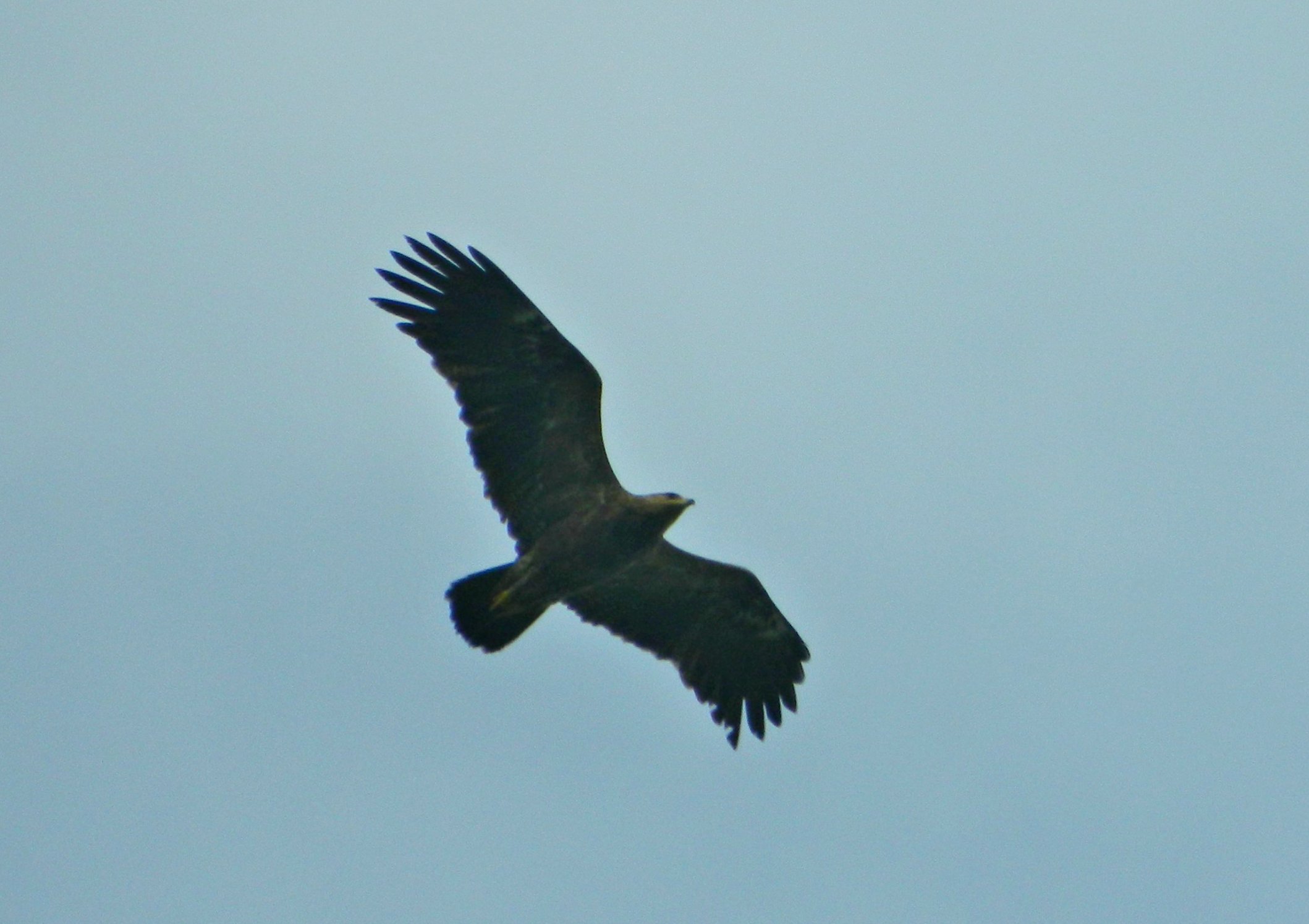
Lesser spotted eagle

We made our way downhill towards the streambed, keeping an eye out for unsuspecting white storks on the ground. Another short-toed eagle made an appearance overhead, as well as a bunch of red-rumped swallows, and we reached the wooded streambed. Almost immediately we spotted a small warbler that looked a little different than the usual ones we see, and upon verification, was identified as our very first eastern Bonelli’s warbler.

Adam vs. the eastern Bonelli’s warbler

Ten minutes was all we needed along the dry streambed, as we didn’t see anything else of interest and there was still more places to visit. We made our way back up, passing a procession of caterpillars and an entertaining little squabble between a yellow-vented bulbul and a woodchat shrike (with the smaller shrike emerging as the victor). The white storks continued to accompany us, however some of them now on the ground, hunting for small living things to eat.

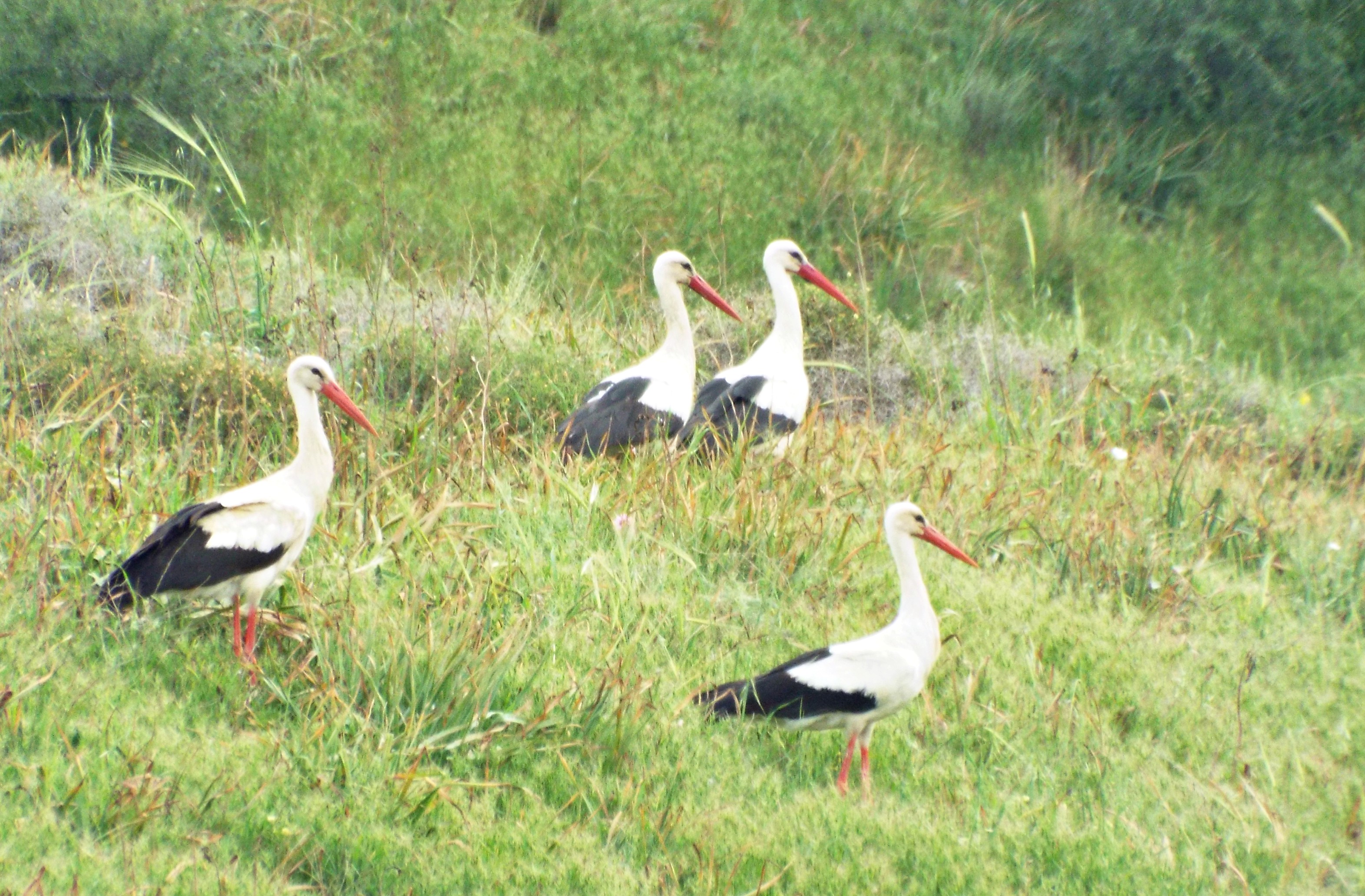
White storks (photo Adam Ota)

Casting our eyes to the skies, we spotted a lone black kite making its way northwest, and shortly thereafter, another short-toed eagle and then a booted eagle. We made it back up to the entrance and got into the car after some morning praying and food. Our next stop was Ein Pik, just a minute away to the northeast.

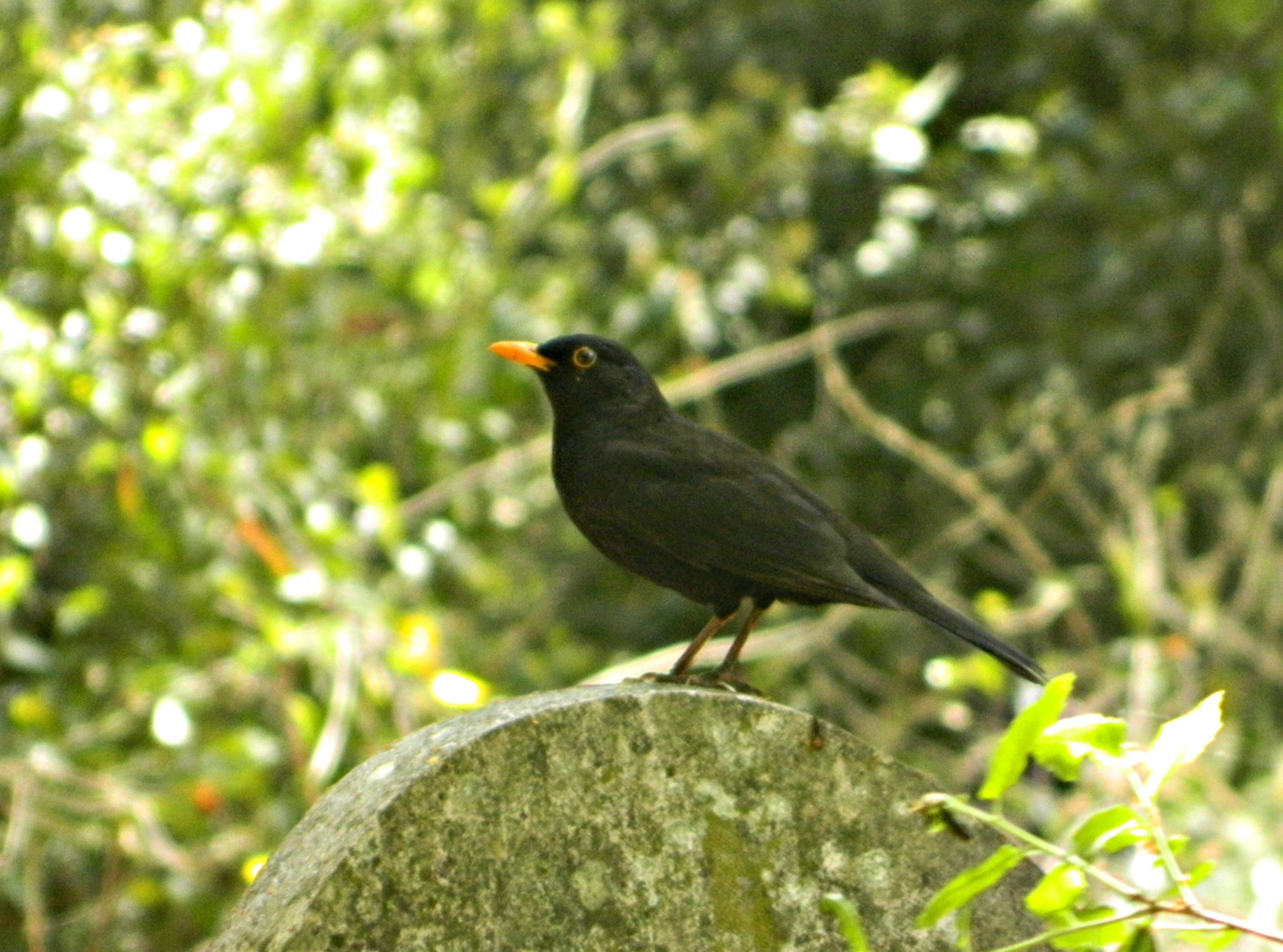
Hoopoe (photo Adam Ota)

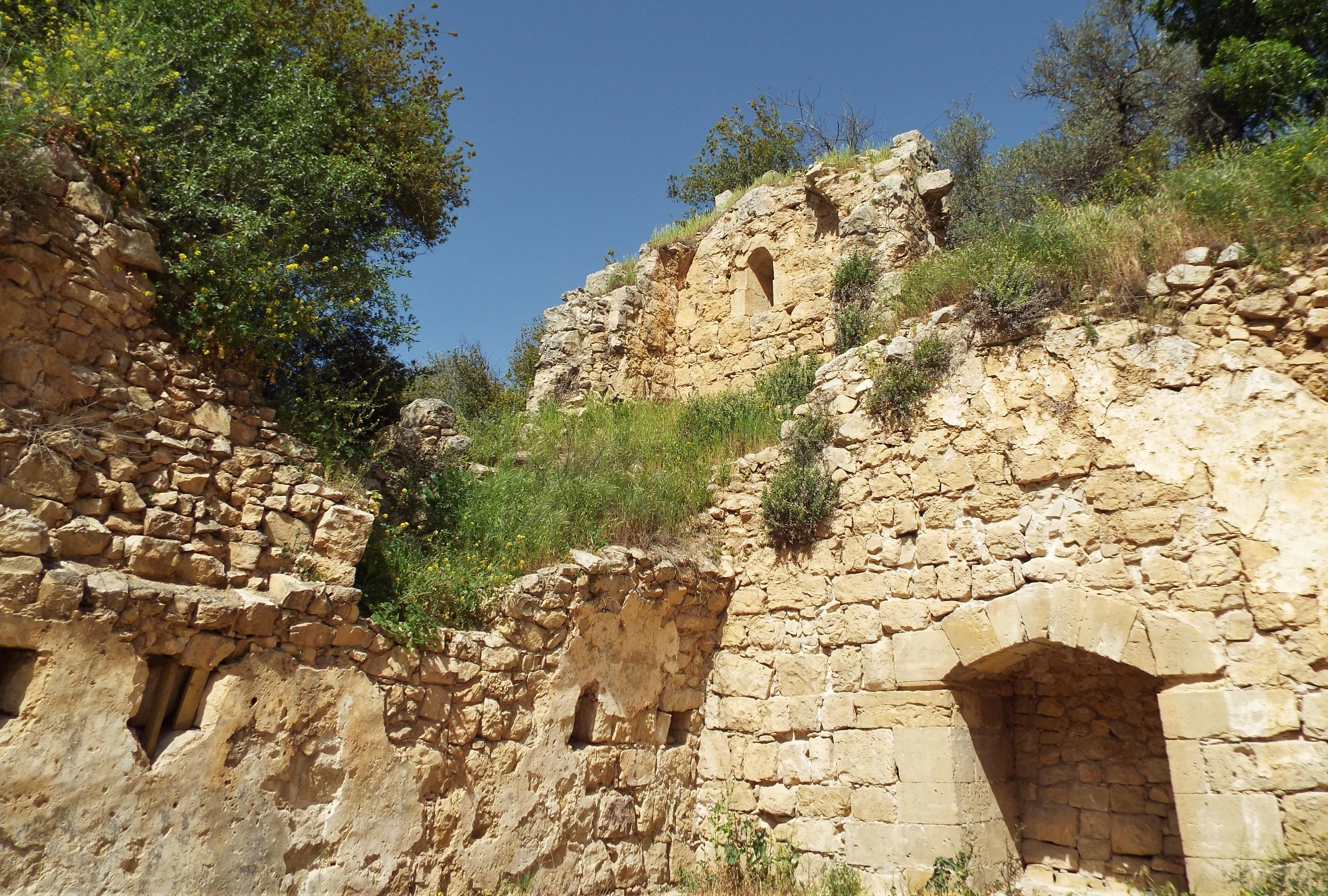
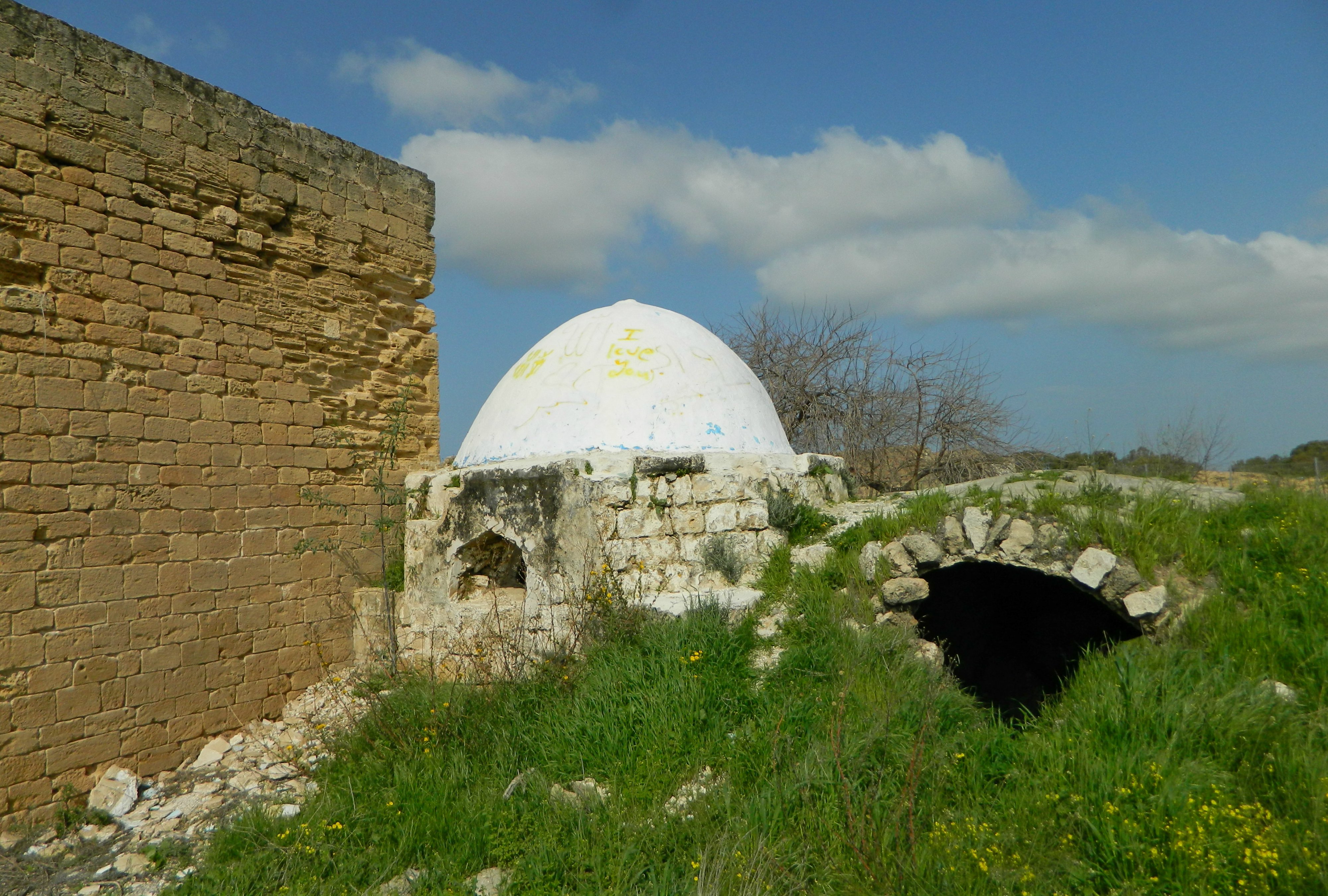
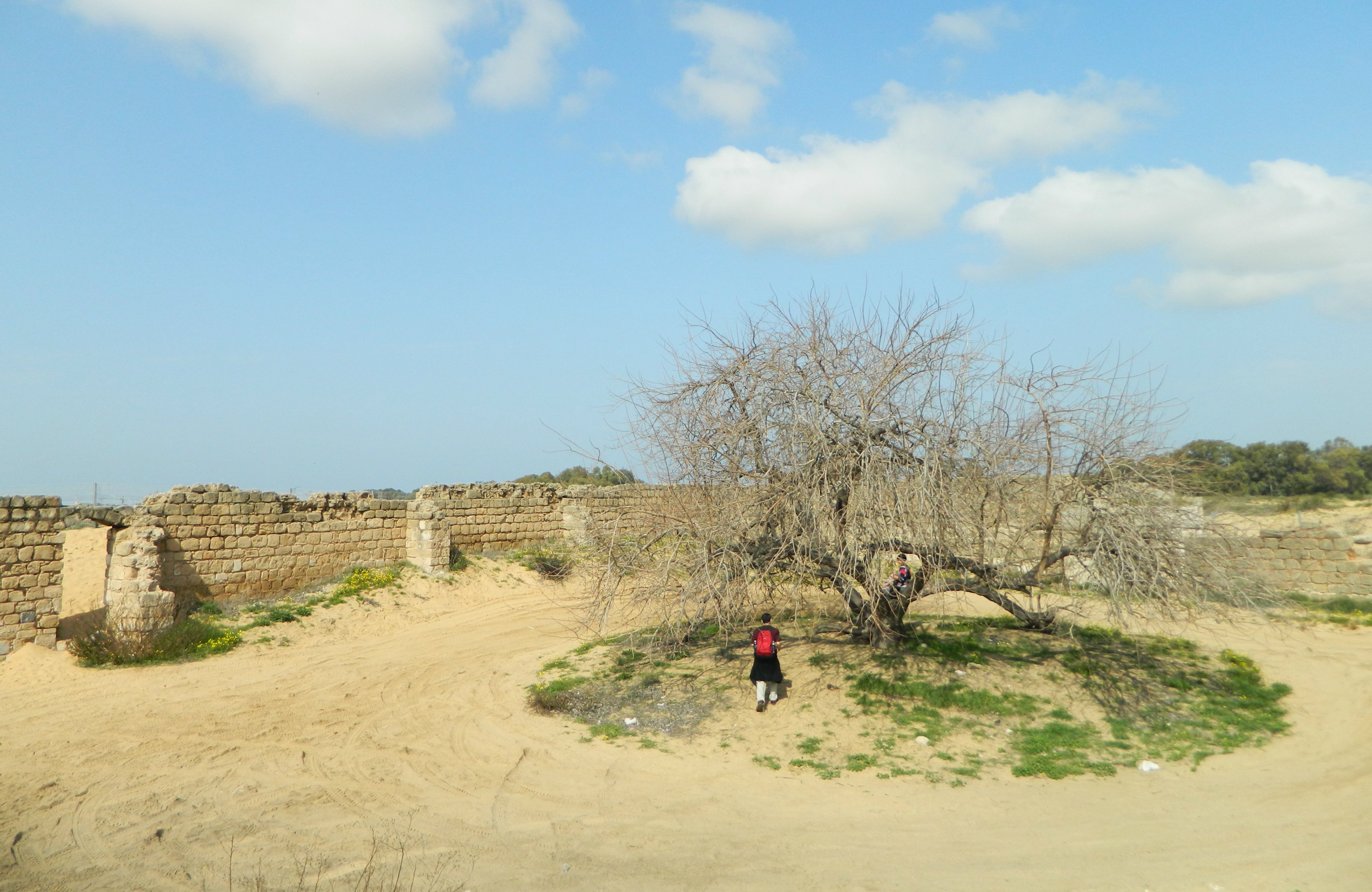
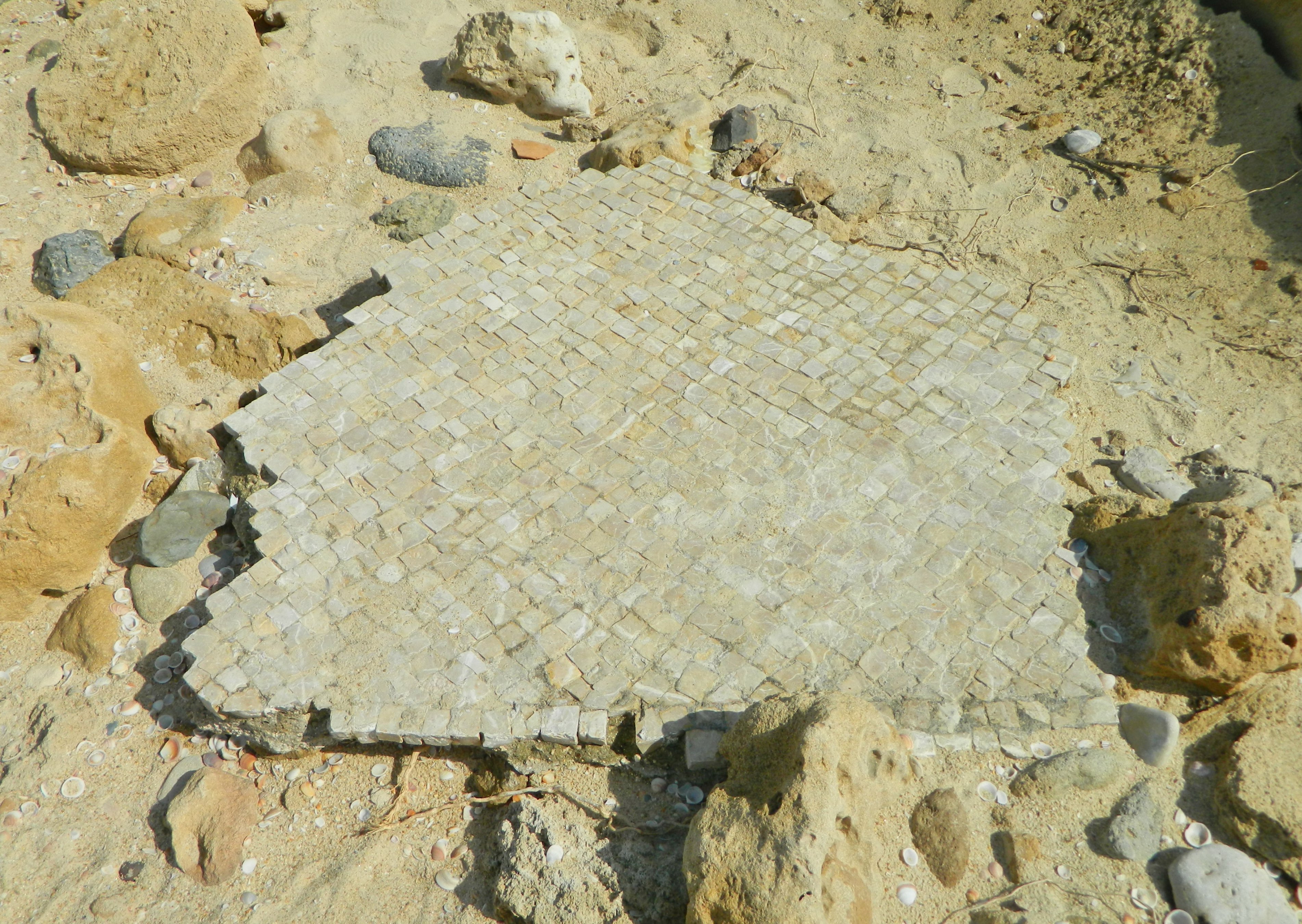
Pik was originally the site of a Jewish village during the Roman times some 1,800 years ago, which possibly traces its name to the biblical site of Afek where the kingdoms of Aram and Israel fought a decisive battle to stem the Aramean invasion. Today, the ruins that can be seen, are remains of the Syrian village Pik which preserved the ancient name. Archaeological findings from the ancient Jewish village have been since carted off to sit in museum, such as the Golan Archaeological Museum that I had visited towards the end of my army service in 2015.

View from Ein Pik (photo Adam Ota)

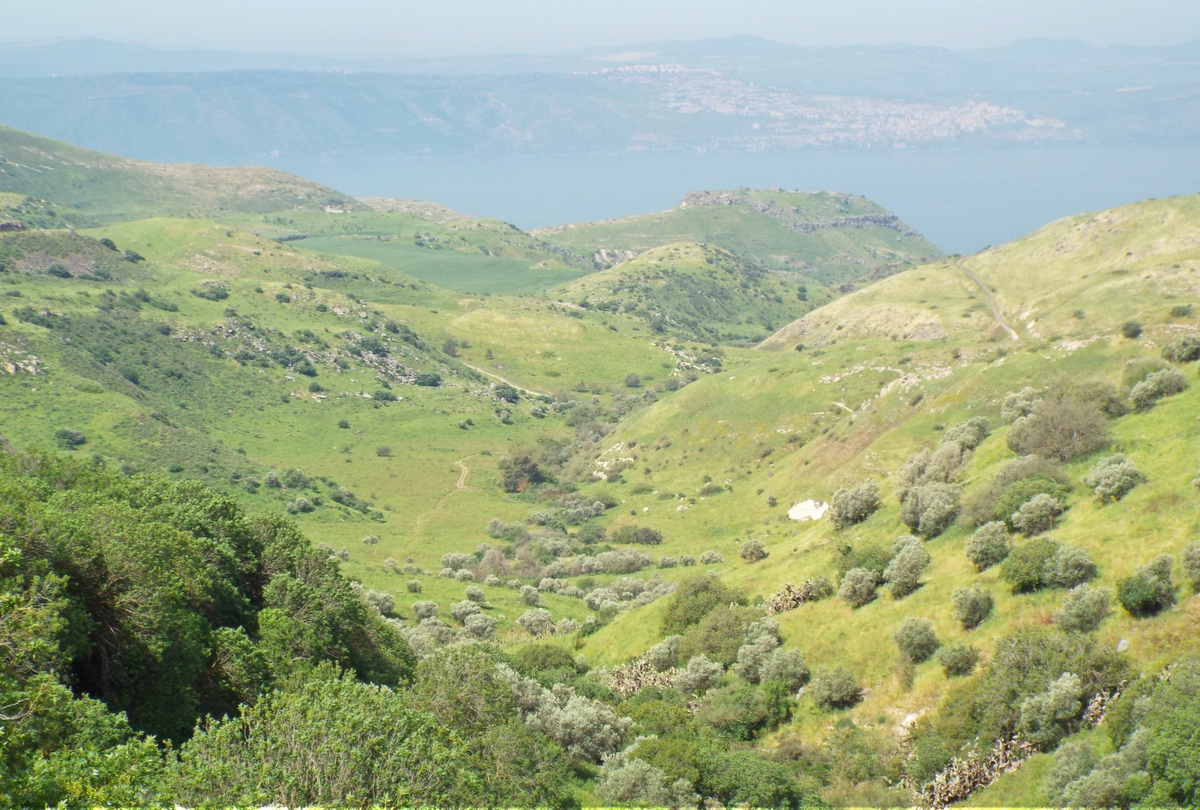
We examined the small basalt ruins, and enjoyed the lookout over the valley below, with the famous site of Susita (Hippos) dead centre, backdropped by the Kinneret. Seeking the spring that contributes the “ein” to the name, we made our way down the slope below us where we found a concrete trough filled with spring water.
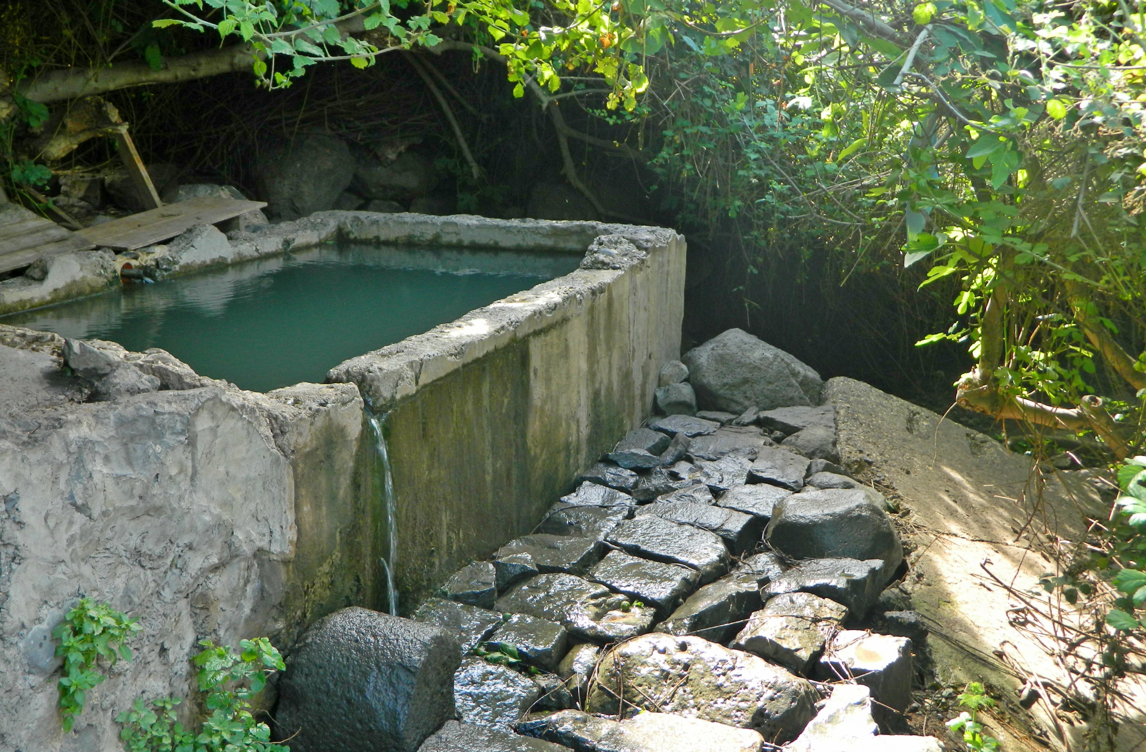
Ein Pik

Typical of mountain springs, a hardy fig tree was growing on-site and small, unripe figs had met their end landing in the water. Quite unexpectedly, I noticed that there were tadpoles of different sizes feasting on the bobbing figs. A full-grown frog watched us from the end of the trough, kept company by a large river crab.

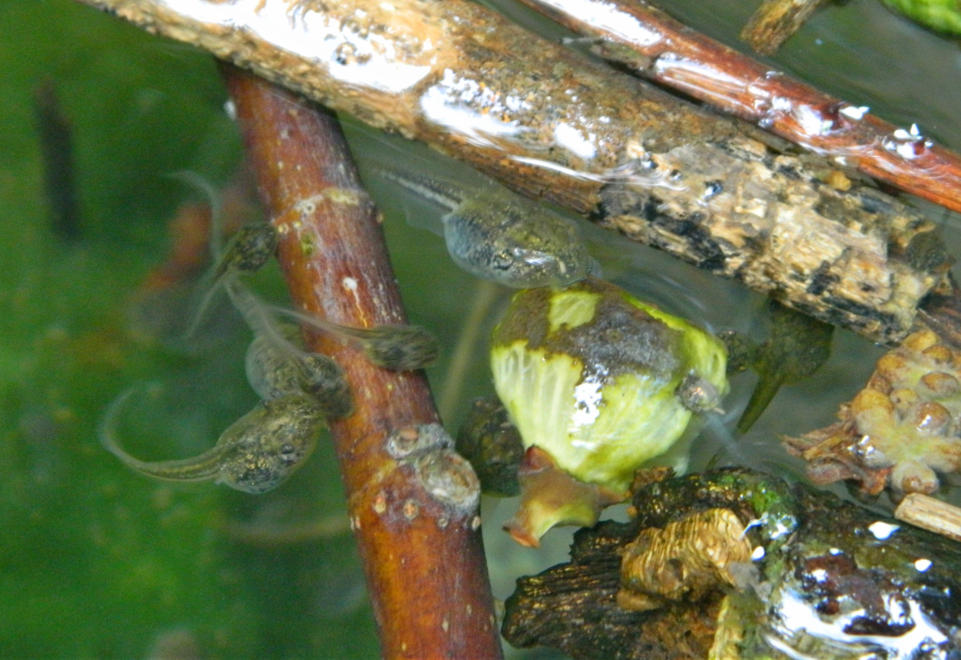
Tadpoles feasting on an unripe fig

Several steps away we found the main source of the spring, captured in modernity by a large concrete tub which entices hot, sweaty hikers. We stood for a few minutes in the shade, the trickling water sounds mixing with the chirping of the great tits and sparrows.

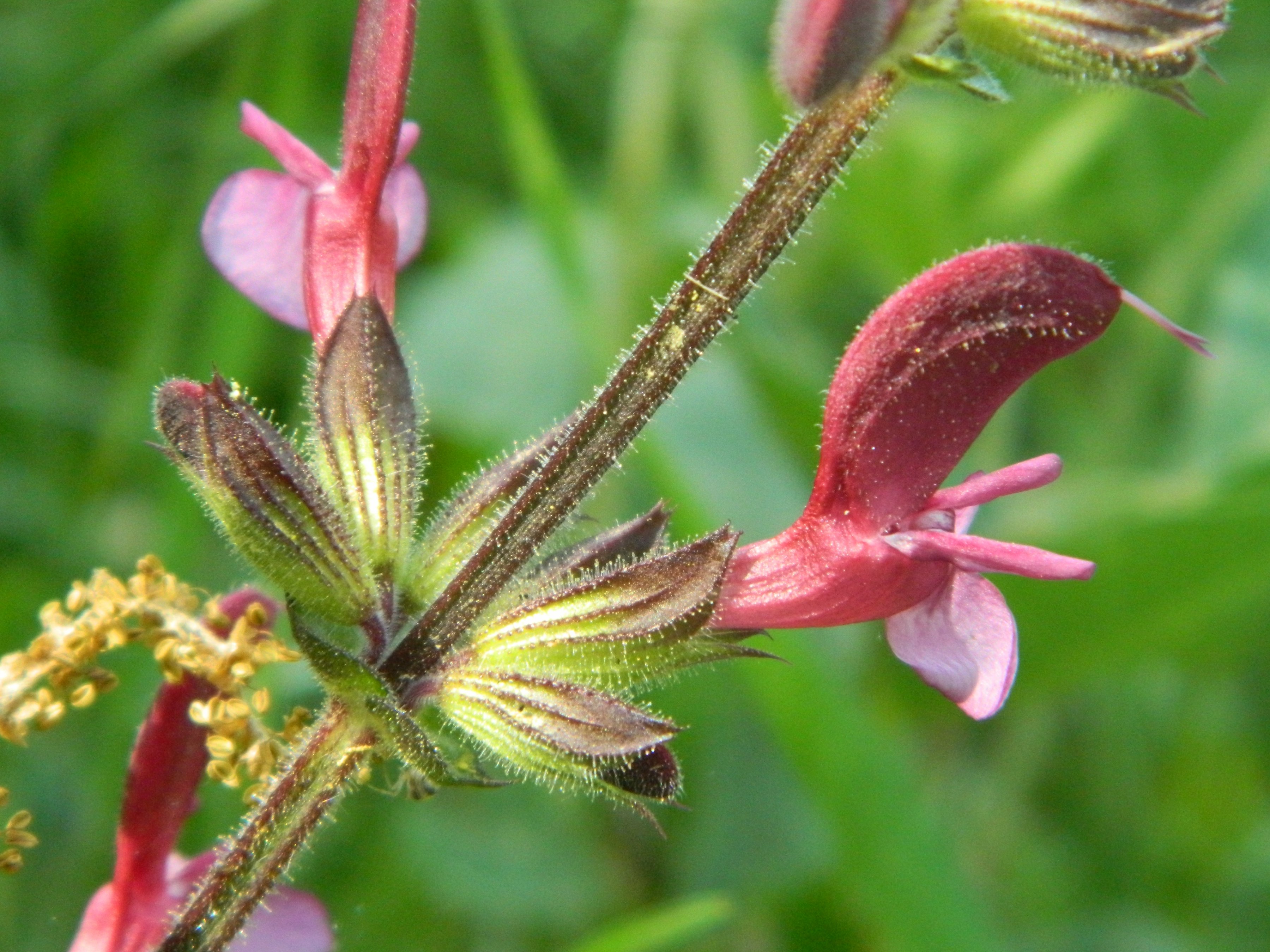
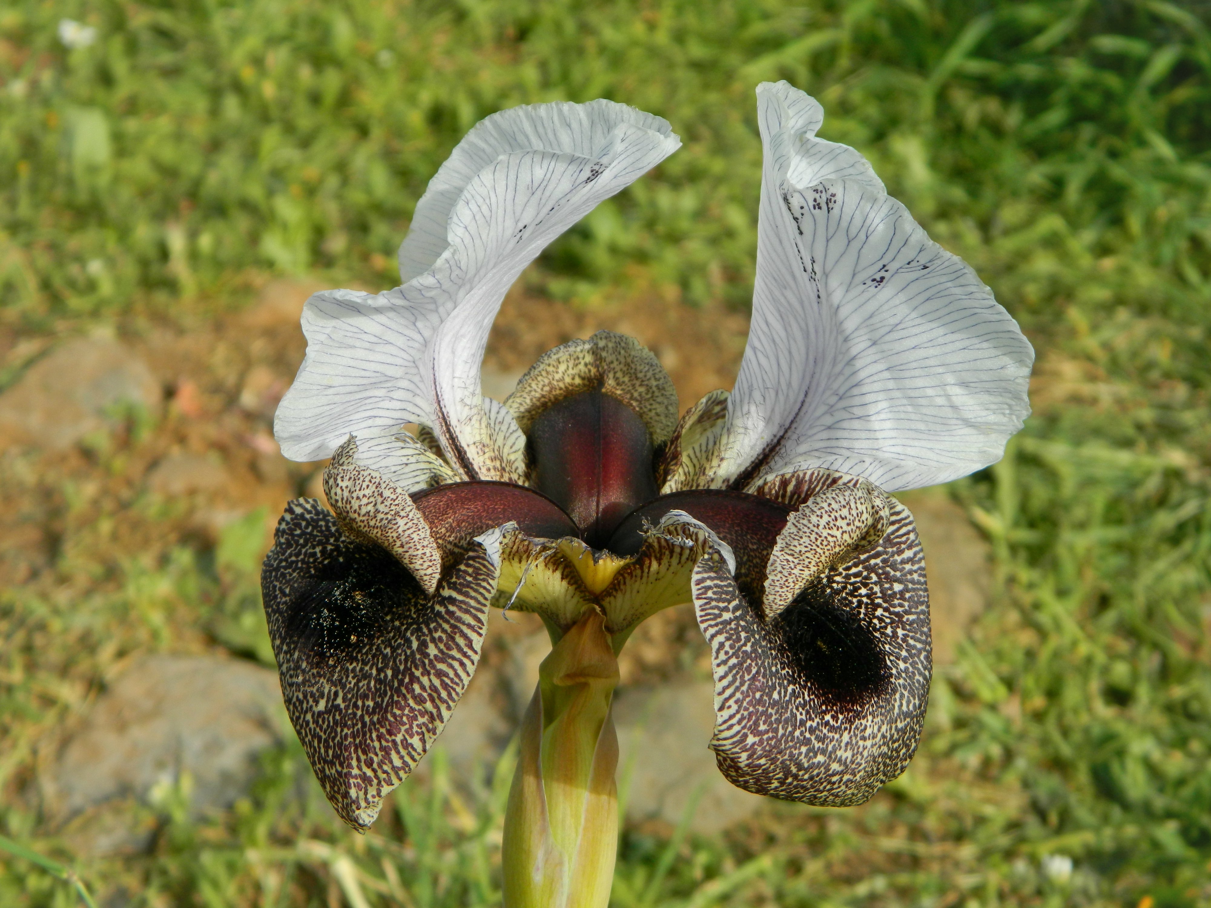
Silene oxyodonta flower

When we left, climbing back up to the ruins, we were surprised by a black kite that flew right over our heads. With that excitement we got back into the car to drive over to the next location on our list, Gamla, which will be covered in the next blog post.

Ein Hemed (Aqua Bella)

In Israel, Jerusalem on April 24, 2018 at 8:27 AM

Taking the most of our Pesach (Passover) break, my friend Adam and I went on yet another adventure, this time to a national park a few kilometres outside Jerusalem: Ein Hemed. Many years have past since I first set my eyes on the Crusader ruins of Aqua Bella, and I’ve been waiting patiently to get the chance to visit. Adam and I set out via bus from Givat Shmuel heading for Jerusalem, getting off along the way at Hemed Interchange. The park’s entrance was just a short walk away, and after shelling out the entrance fee, we entered the park.

Nachal Kesalon

We were a little perturbed by the fact that there were hundreds of schoolchildren running around, making noise as children are wont to do. But, thankfully, there was more to see than just wildlife and we began straight away on the short trail along the Nachal Kesalon. The spring in the park, that feeds into the stream, was called Aqua Bella (or, “beautiful water”) in Latin, and, in translation, Ein Hemed in Hebrew.

Jerusalem sage flowering

The waters were sluggish, and overrun with algae, which provided a good opportunity to find interesting water-living creatures. We peered into the green mess and found hundreds of tadpoles, which are always cool to see. In addition, several species of waterbugs such as water boatmen and water scavenger beetle larvae made appearances. Continuing along, parallel with the trickling waters, we enjoyed the spring flowers including hyacinth squill, arum and the carob trees’ pink blossoms.

Approaching from the north

As we separated from the stream we came upon the impressive Crusader ruins, but kept onward to see what was beyond it. What we found was an old Arab cemetery, still in use by the inhabitants of the nearby village Ein Nakuba. There apparently is an old sheikh’s tomb, known as Maqam al-Ajami, but we were unable to locate it. Instead we birdwatched, seeing some greenfinches in the trees and a blackbird perching on tombstones.

Blackbird on a tombstone

From there we turned back and made our way into the ruins of the Crusader building. Built sometime between 1140 and 1160, this building was a fortified farmhouse which served to protect over both the neighbouring lands and the old Roman road that passed by, connecting Emmaus and Latrun (the Toron des Chevaliers castle) with the capital of Jerusalem.

Fortress ruins (photo Adam Ota)

We descended from the northern half of the building, walking on the floor of the upper floor which is now covered in grasses and wildflowers. Admiring the strong architecture, with its arched windows and doors and large vaulted rooms, we made our way to the southern half of the building, skirting the courtyard down below.

Within the fortified farmhouse

Better preserved than the northern half, the upper level featured a line of arched windows, and one small room. I love the influence of Gothic architecture in Crusader ruins, and it was truly enjoyable just to admire the handiwork. Whilst looking at one of the arched windows I noticed a mason’s mark etched into one of the large ashlars. Mason’s marks were very common in the Crusader period; they were a way of keeping track of a mason’s work when it was time to get paid.

Mason’s mark

This discovery set us off on a quest for mason’s marks, and we found plenty. Adam was particularly sharp-eyed at finding the obscure, yet unique, carven markings on the stones. This quest took us down to the ground floor of the farmhouse, via the main staircase.

Yours truly (photo Adam Ota)

Standing in the courtyard we found that there were two rooms to enter, as well as the farmhouse’s main entrance, with recreated wooden doors to match the arched opening. We decided to explore the northern side first, and found a large barrel-vaulted room with flour mill tools in the corner. We took some pictures and then made our way to the room at the northern side, which is said to be the dining hall of the farmhouse.

Weevil going on a stroll (photo Adam Ota)

Outside, via the reconstructed wooden doors, we decided to sit down to eat the lunch we brought. As to be expected, we were distracted by some birds, including a beautiful grey wagtail dashing about the stream’s gentle currents and a pair of nesting great tits, busy with preparing their nest in the trunk of a nearby tree. When lunch was over we got back up and continued along the stream, when suddenly we spotted a few small, yellow birds. Only a few record shots of them drinking enabled us to identify them as siskins, and this was the first time either of us was seeing them. When they disappeared we moved on and enjoyed the sights of the Jerusalem sage and pink garlic flowers.

Songbird paradise (photo Adam Ota)

But then, when sitting at a picnic table near the stream, just waiting for the birds to return now that all the schoolchildren were gone, it began to get interesting. First, Adam filmed a white-breasted kingfisher eating a lizard in its entirety. Next, a small flock of siskins showed up and began to eat from the fruit tree that was in front of us (see the video below). Other songbirds joined in, including chaffinches and warblers, and then the kingfisher came back. This time he had a small snake in his bill, which to me looked like a Dahl’s whip snake, and we scrambled to take pictures. Unfortunately for us (and the snake), the kingfisher decided to take his meal in the cover of a thick bush and our photographic wishes were thus rejected.

While we were enjoying the siskins, we joked that there were probably eagles soaring overhead. With true comical timing, we saw two lesser spotted eagles migrating north, flying high up in the thermals. If that wasn’t enough, two short-toed eagles made an appearance shortly thereafter, soaring in circles above us.

Outside Ein Hemed

With that we decided that it was time to leave our pleasant little birding spot and continue on, with hopes of more birds of prey sightings. As we left the park we indeed saw another bird of prey, a steppe buzzard soaring far, far away to the east. We found a trail to take us eastward, as we were hoping to reach the nearby Castel, even though it was getting late in the day. The trail was nice and we saw plenty of birds and a handful of knapweed fritillary butterflies flying about.

Knapweed fritillary

There was, however, a surprise up ahead: a female goat had just given birth to her second kid beneath the shade of a tree and the somewhat gruesome scene was just there for us to see. It was an interesting moment, being kind of turned away by the bloody sight yet fascinated by the tender gift of life. We took some pictures and continued on. Nothing of much interest happened until we found ourselves fenced in on some guy’s property. We tried leaving through the front gate but it was locked, and there wasn’t any simple way of getting out. Laughing at our absurd situation, we even tried the house door, hoping there’d be someone to let us out. In the end, left to our own devices, we decided to hop the gate and continued merrily along our way.

Specks in the sky (photo Adam Ota)

Castel was closed for the day and so we wandered on in search for food, keeping a constant eye out for birds of prey in the skies. Adam spotted a few tiny black dots in the sea of blue, and with his 40x optical zoom we were able to identify them as another steppe buzzard and a booted eagle.

Here comes the moon…

We found a decent restaurant to get schwarma at (my first time in a long while) and ate with our eyes to the sky. I’d be lying if I said that we didn’t have a moment of panic when an eagle passed by overhead, as we put down our food in favour of our cameras. But the food was delicious and we felt reinvigorated to continue our birding pursuit. We succeeded in spotting some greater spotted eagles migrating northward as the sun slowly set, the day coming to an end for both us and the eagles.

University Trip: Southern Golan

In Golan, Israel on April 15, 2018 at 10:17 AM

Returning to the academic field trips offered by Bar Ilan University’s Land of Israel Studies and Archaeology department, I signed up for a fun trip focusing on geography to the southern half of the Golan. I was joined by my friend Adam Ota, a member of the class, and together we joined the other tour members and the guide, Mr Moty Rubinstein, at the entrance of the campus. Our minibus set off on its course, taking us along the long ride to our first stop, which happened to be in the Galilee.

Hod Lookout

We disembarked at the Hod Lookout, a site that I had visited during the department’s two-day trip around the Kinneret two years ago. There we looked out over the Kinneret (or Sea of Galilee) and the rise of the Golan’s plateau. From a geographical standpoint, it’s easy to understand the rift in tectonic plates between the Galilee and the Golan. But we weren’t just enthralled by slowly shifting land masses, a short-toed eagle soared right overhead, impressing us all with its size.

Lookout over the bridge

From there we made our way down to the Golan, taking the scenic route through the old settlements which I had seen on a previous field trip (HERE). We crossed over the Jordan River and made our way through the picturesque green and yellow slopes towards the Yarmouk River, the border between Israel and Jordan. Our destination was the El Hama Bridge Lookout with its view of the broken El Hama Bridge over the Yarmouk. The bridge was destroyed, along with nine others, in a nighttime sabotage operation by the Palmach in 1946.

The broken El Hama Bridge

The view from the lookout was incredible overall, with the old military trenches, nice birding (including my first woodchat shrike for the season) and impressive wildflowers. We could have spent the entire day there, but there was more to see so we climbed back into our minibus and continued along Road 98 until we reached the next destination, HaShalom Lookout.

Just a house sparrow…

With its view to the west, this lookout provided a different scene than the two previous ones, and at last we were seeing the high concentrations of volcanic basalt rock that the Golan is famous for. We looked out over the Kinneret and enjoyed the view, whilst keeping an eye on possible birds of prey soaring below. Adam’s sharp eyes picked up on a small flock of black storks spiraling in the heat thermals, joined by two buzzards.

View from HaShalom Lookout (photo Adam Ota)

We joined others in going down to the nearby spring, a ten minute hike downhill, seeing a few songbirds on the way. There were an abundance of wildflowers as well, such as mallow, wild mustard and the interestingly named musk deadnettle. The spring that we found was a rectangular concrete pool with a small amount of fresh mountain water trickling in.

Lupine blossom

Back up at the lookout we had lunch and prayed mincha (the afternoon prayer) with a group of Hasidic lads who were also enjoying the beauty of the Golan. Getting back into our bus, we took a short detour to a field where a sign declared it to be the Nov Grant-Duff’s Iris Nature Reserve. We didn’t find any irises, as we had hoped, but we did see some distinct-looking yellow asphodels as well as a handful of corn buntings singing their hearts out.

Mr Moty Rubenstein at the volcanic crater

Continuing on Road 98, we made our way eastward towards the Israel-Syria border. We were to see the natural volcanic crater of Mount Peres (or Tel Fares), one of the most southern extinct volcanoes in a line of sixteen that dot the eastern Golan. We passed the basalt khan (caravanserai) of Juchader, which I had visited at the end of my army service several years ago, and turned right onto the access road to the small mountain.

Volcanic rock

It was slightly surprising to see that part of the mountain was cut away, which we learned was actually the “harvesting” of tuff and scoria, types of volcanic ash rock used in construction, landscaping and more. Atop the mountain, we pulled over at the side of the road and got out to admire the grassy crater. Just across us was an IDF outpost, and together we enjoyed the view and the spring blossoms.

Golan iris

With that we were nearly done with the trip, there was just one more stop, and it was strictly for pleasure. We were going to see the Golan irises blooming at a random junction along Road 87, and this time we were not disappointed. The irises were in bloom and it made a lovely last stop in the beautiful Golan. Getting back into our minibus, we then began the long drive back to Givat Shmuel, bringing the end to yet another amazing field trip.

A video of this trip, which I made for the department’s YouTube channel, can be found HERE.

Nachal Soreq & Palmachim

In Central Israel, Israel on April 8, 2018 at 5:25 AM

Just over a month ago I went on a Friday adventure with my friends Adam and Efrat. We had four destinations planned, covering interests such as botany and archaeology. Adam and I set out from Givat Shmuel and were picked up by Efrat in Rishon L’Tzion, and together we began the trip. Our first destination was the wildflower-covered Chumra Hill located on Road 4311 just before reaching Road 4.

Tel Aviv stork’s bill (photo Efrat Guli)

We pulled onto the dirt access road and parked atop the hill, surrounded by the spring blossoms. Knowing that it was the height of iris season, we came to see the dark purple coastal irises, and we were not disappointed. Here and there we spotted clusters of dark iris flowers, looking quite distinct in the blanket of red, yellow and blue flowers. We briefly explored the graffitied ruins of what seems to be a British Mandate-era house and made a circular loop of the hill, admiring and photographing the many species of wildflowers.

Coastal iris (photo Efrat Guli)

Leaving Chumra Hill, we headed over to Nachal Soreq, just minutes away on the other side of Road 4. We first attempted to explore the northern side, but were informed by some official-looking folk that the site was undergoing an ecological renovation and is temporarily closed. Instead, we parked at the southern side and began our walk alongside the calm, murky-watered stream.

Syrian woodpecker (photo Adam Ota)

It had rained earlier in the week, so the trails were rather muddy, which provided tell-tale signs of the wildlife visiting the area in the form of footprints. Even the occasional frog provided entertainment, jumping into the trail puddles as we approached.

Walking the sandy trails (photo Efrat Guli)

We continued along the stream until the rushes blocked our view of the water and the trail morphed into a dry, sandy path set among plant-covered dunes. It was quite a drastic change of scenery but we stuck with it knowing that there are some interesting ruins to see further along the way. There wasn’t much nature to see, other than some stonechats and other regular birds for the time and place, but the location was interesting enough.

Old well (photo Adam Ota)

Before long we reached the first ruins, which appear to be Ottoman-era antilia wells, long since filled in with sand. These wells would have served to provide water for pilgrims to the nearby holy site, the tomb of Nabi Rubin. Even though I had researched the area a wee bit in advance and knew that there was this tomb, it wasn’t until I was staring at the building and the painted Hebrew name “Reuven ben Yaakov,” that I realised this was meant to be the grave of Reuben, the eldest of the Children of Israel.

Reverse side of the grave

We entered the rectangular complex from the northeast corner, and explored the interior. Having the appearance of a traditional Muslim maqam (shrine), with the courtyard, large trees, arched structures and mihrab (prayer niche), it makes sense that this complex was a Muslim holy site for many hundreds of years. In fact, it was only in 1991 that the minoret was torn down, and the site became a kever (grave) of Jewish importance. Looking for a nice place to eat lunch, we climbed up into the large tree that adorns the centre of the courtyard and pulled out our food.

Courtyard of the complex

Sated, we put our backpacks back on and left the Nabi Rubin complex, heading back toward the car, but taking a slightly different route through the dunes. This was a wise decision because it led to us seeing a very cool dung beetle racing over the sand ripples, a business of little flies resting on its back waiting for some dung to be found.

Dung beetle with hitchhikers

That excitement carried us over to the next destination, just a few minutes drive: the famous beach area of Palmachim.

Palmachim Beach (photo Efrat Guli)

We parked and got out to explore, starting with some ancient quarries (which sound more exciting than they were in person) and the incubation cage for sea turtle eggs. To add a touch of macabre to the story, we found a semi-decomposed sea turtle far up on the beach, a sad sight to say the least. Next we walked along the surf, heading southbound and pulling interesting shells and potsherds out from underfoot.

Part of a mosaic floor

Before long we reached the beginnings of the ruins of Yavne Yam, an ancient port city which was abandoned during the Crusader period some 900 years ago. Wall portions and even part of a mosaic floor are exposed to the elements and visitors. Signs warning people to stay away from the beach’s cliff edge due to the danger of falling stones, many of which belong to the ancient structures.

Fortress of Yavne Yam

We didn’t just enjoy the archaeological aspects; there were a few jellyfish to be admired as well as some great cormorants and some gulls, including lesser black-backed gulls and a Heuglin’s gull. Having fun in the sun, we eventually pulled ourselves away from the waves and headed back to the car to our very last destination, the fortress ruins of Yavne Yam, inaccessible from the beach due to its location on the craggy promontory. With only a little bit of time to spare before we had to get going (since Shabbat was approaching) we parked outside the ruins and took a quick tour of the site.

View from the ruins

Crossing into the ruins of the Early Arab fortress, built over a thousand years ago, we encountered the bathhouse, built in Roman style with the double floors and heat piping. The other ruins were unmarked, though interesting nonetheless, and the view afforded from the end of the promontory was rather enjoyable as well. Although we could have spent longer, time was running out and we called it a day, pleased with the fact that we managed to visit all four places on our list and already looking forward to exploring even more in the future.