Israel's Good Name

Archive for June, 2017|Monthly archive page

Nachal Hermon & Ein Tina

In Galilee, Golan, Israel on June 28, 2017 at 8:37 AM

We woke up the morning after our hike through Nachal El Al in our country lodging room in Moshav Keshet. I was joined by fellow school instructors, and the lads were camping outside. We had a leisurely morning routine, packing sandwiches for lunch later that day. A heat wave had hit the Golan and so our plans were altered to accommodate. It was decided that we’d hike a portion of Nachal Hermon, also known as Banias – but not the famous part with the picturesque falls and the Greek temple complex. It was a bit of a drive from Keshet to our hike and along the way I saw some fine looking white storks perched on rock cairns/walls in the rocky fields.

Hiking at Nachal Hermon

We began at the trail-head outside of Kibbutz Snir, our tour guide explaining how the Jordan River is fed by the waters of three streams: Dan, Snir and Hermon. Descending into the ravine, we had a very short walk before we encountered water – where the youth decided to go swimming. Due to the heat the birding was poor and I found myself perched on a rock with another instructor as we watched the rushing water, when I noticed something peculiar. Nearly fully obscured by a mass of teenage bodies, there was an overturned Syrian tank laying at the water’s edge, remnants of past wars. I waited for everyone to clear the area then took a few photos before bringing up the rear on the continuation of the hike.

Overturned Syrian tank

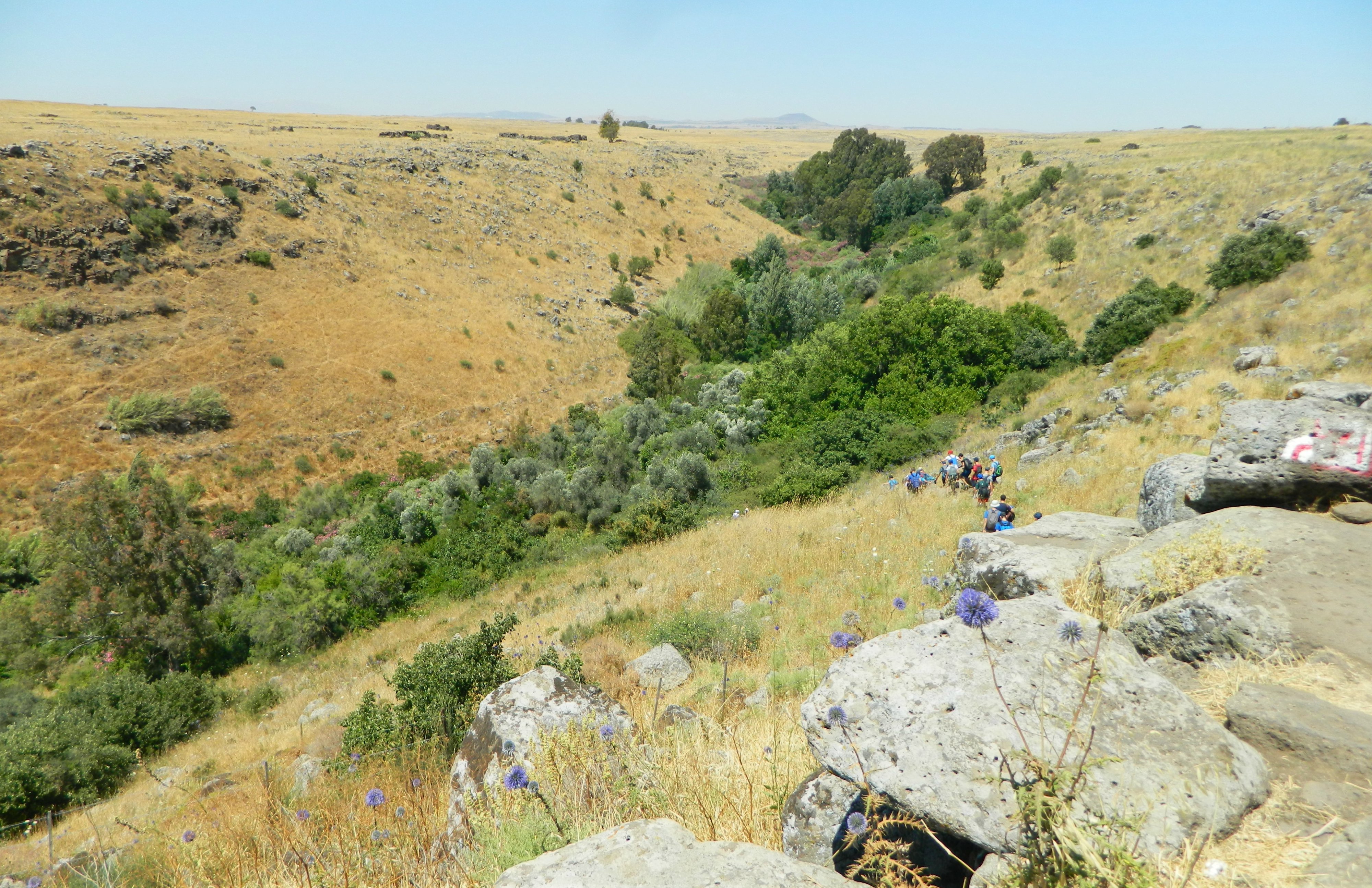
Having climbed back out of the ravine, we walked exposed to the roasting sun, admiring the likable Golan landscape. We switched between the red and black trails as we alternated between hillside and streambed hiking – the lads pausing to splash about in the cold mountain water at every given moment.

Nachal Hermon

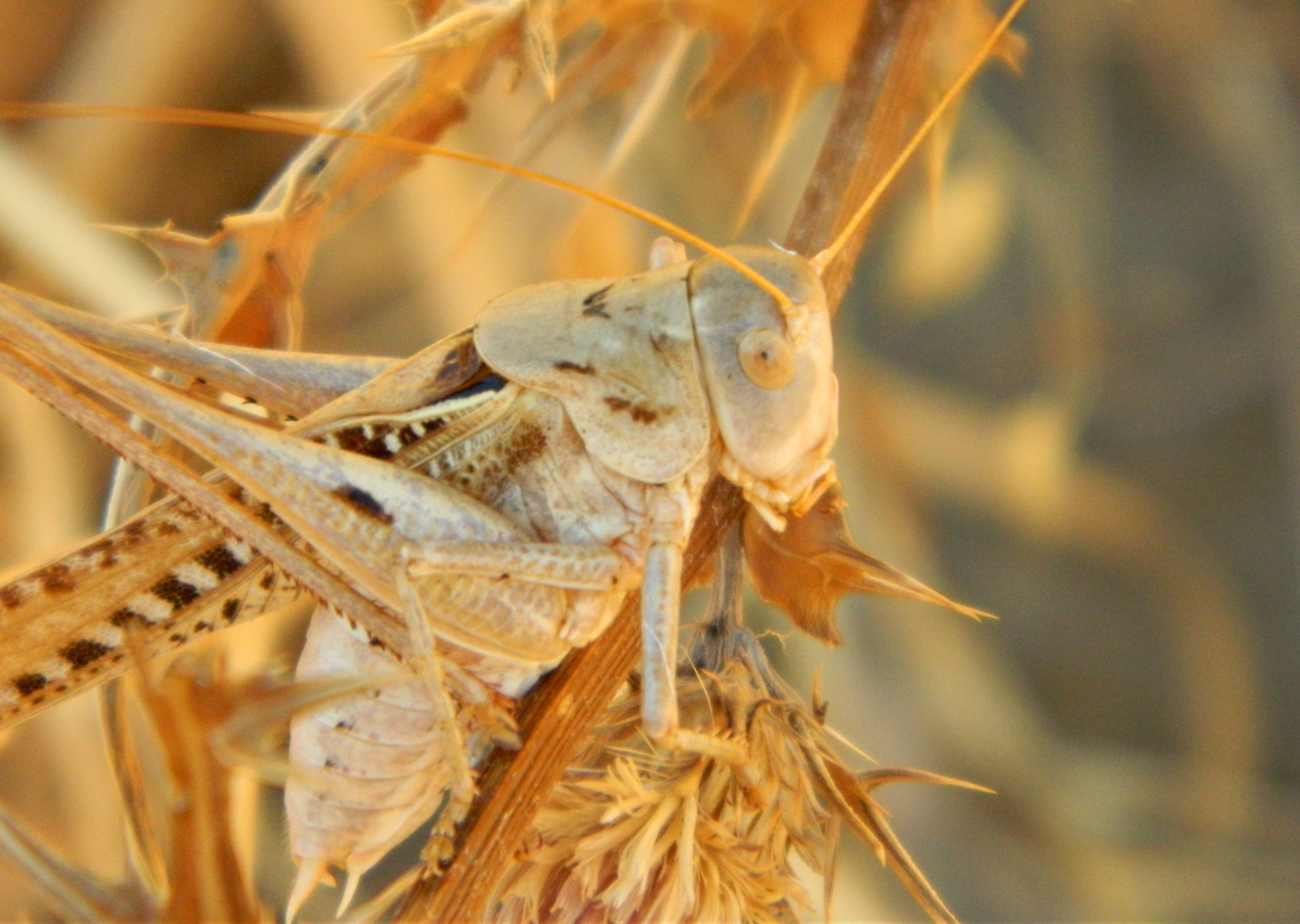
Along the way I spotted a relatively common bird species, but perhaps my first of the year, the collared dove. Shortly thereafter, while taking a brief break under the welcome shade of a tree, I saw a macabre sight of ants dismantling a flesh-pink katydid. Next, after passing a citrus grove we took another long break at the banks of the Hermon. A can of peanuts was produced, reminding me of my time in the army, and then a tour guide came over to offer us some freshly made kolo, a traditional Ethiopian snack made of toasted grain.
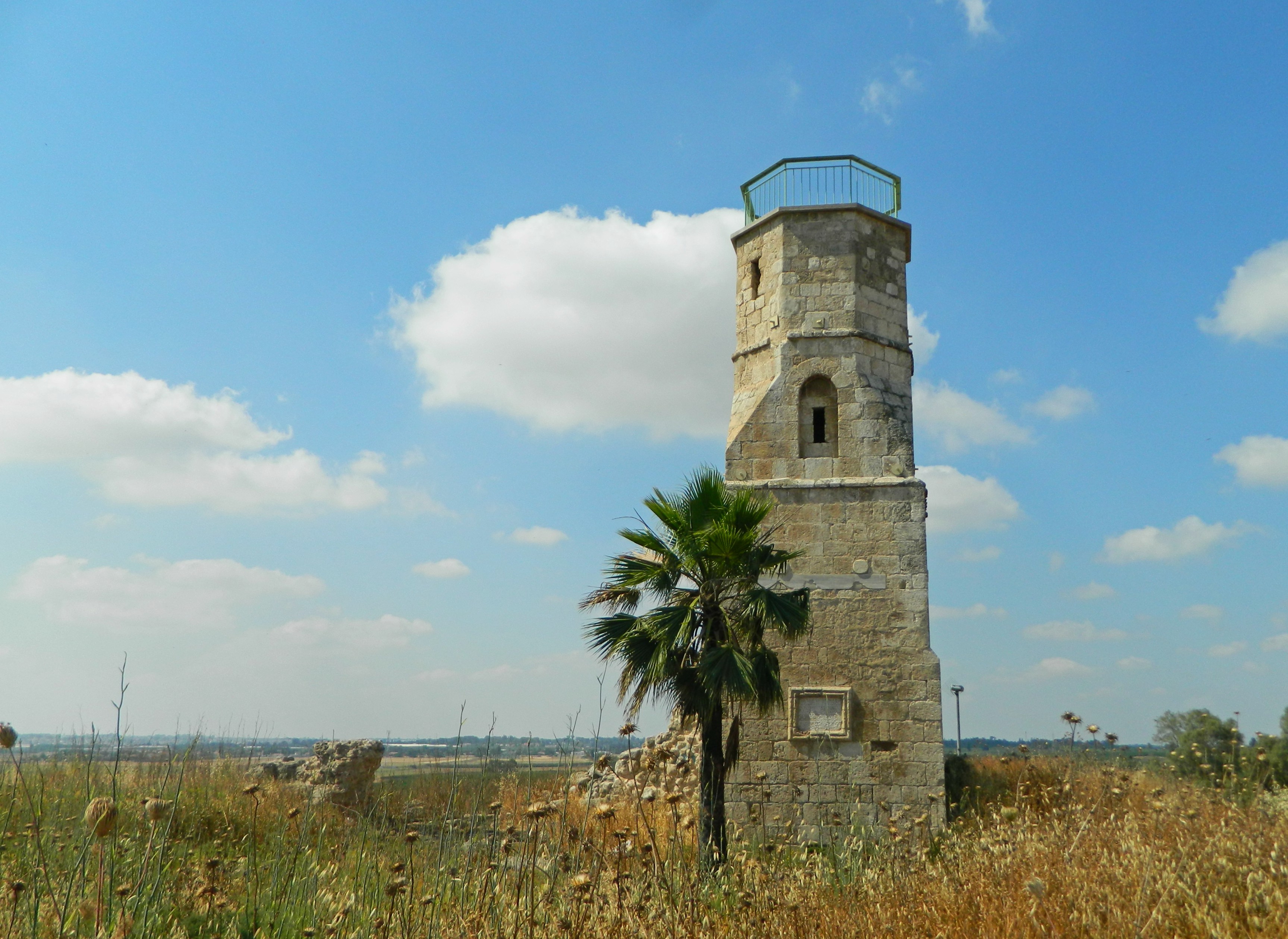
Beware of mines

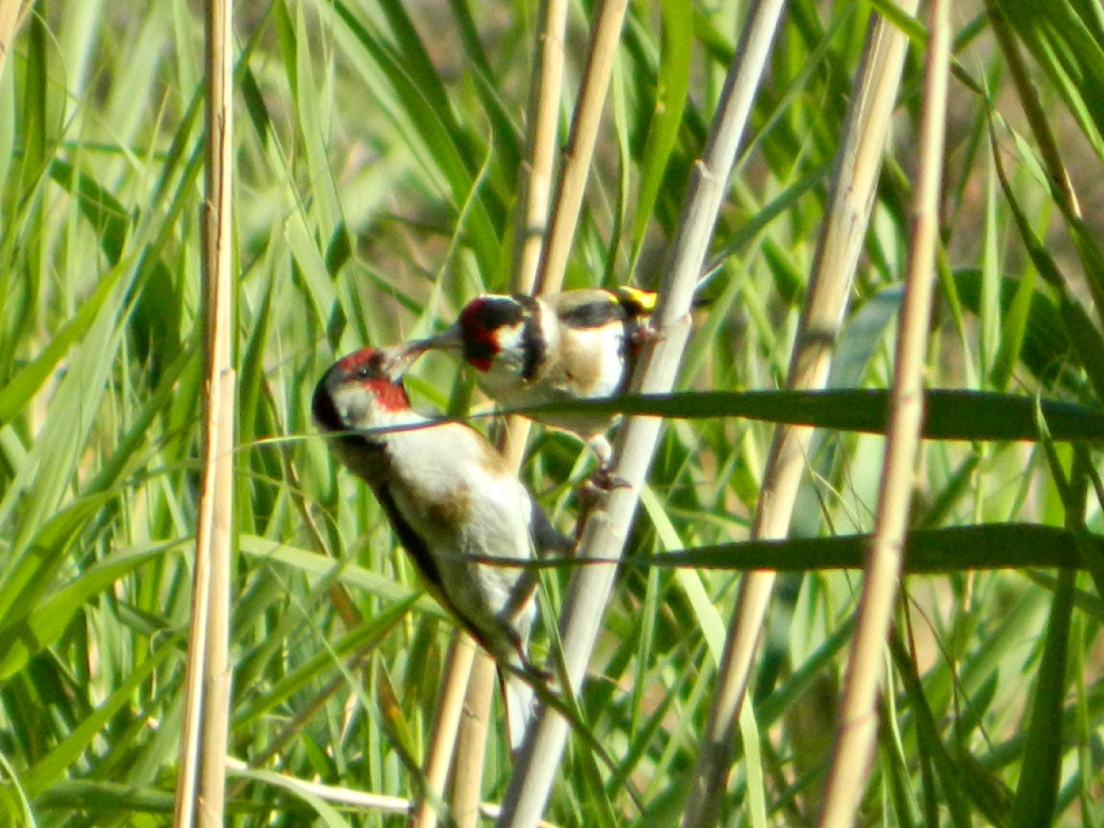
From this final water break it was just a short walk to the end where the buses were to meet us, and we rested at shaded picnic tables until we were ready to leave for the next destination of the day. Located at the foot of the Golan, beside the Hula Valley, is the mountainside spring of Ein Tina with its continual discharge of cold mountain water. From the very start of the short trail there was water to bypass, unless one was walking with water-friendly footwear. To the left, at the base of the mountains, great swathes of dead milk thistle covered the land, a sanctuary for songbirds. To the right, dodder – a parasitic plant that looks like spaghetti – covering both fence and vegetation in its messy tangles.

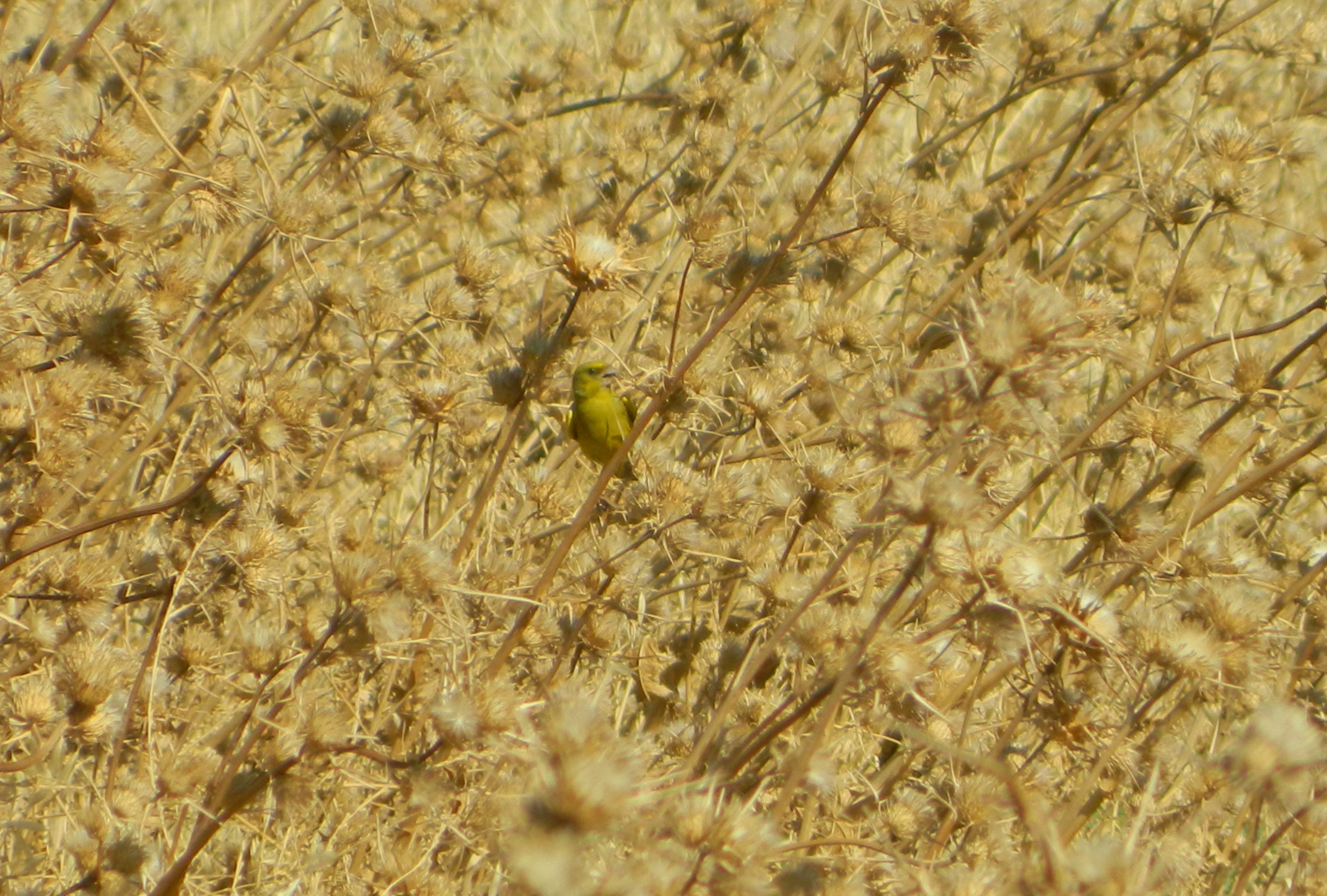
Greenfinch in a sea of dead milk thistle

We reached the first pool of water and Chanan, a fellow instructor, asked me if I’d like to climb up to the top of the stream. Not one to turn down adventurous opportunities, I said yes and gestured for him to lead the way. We walked uphill, atop a bed of sun-baked grey stones that covered the flow of spring water.
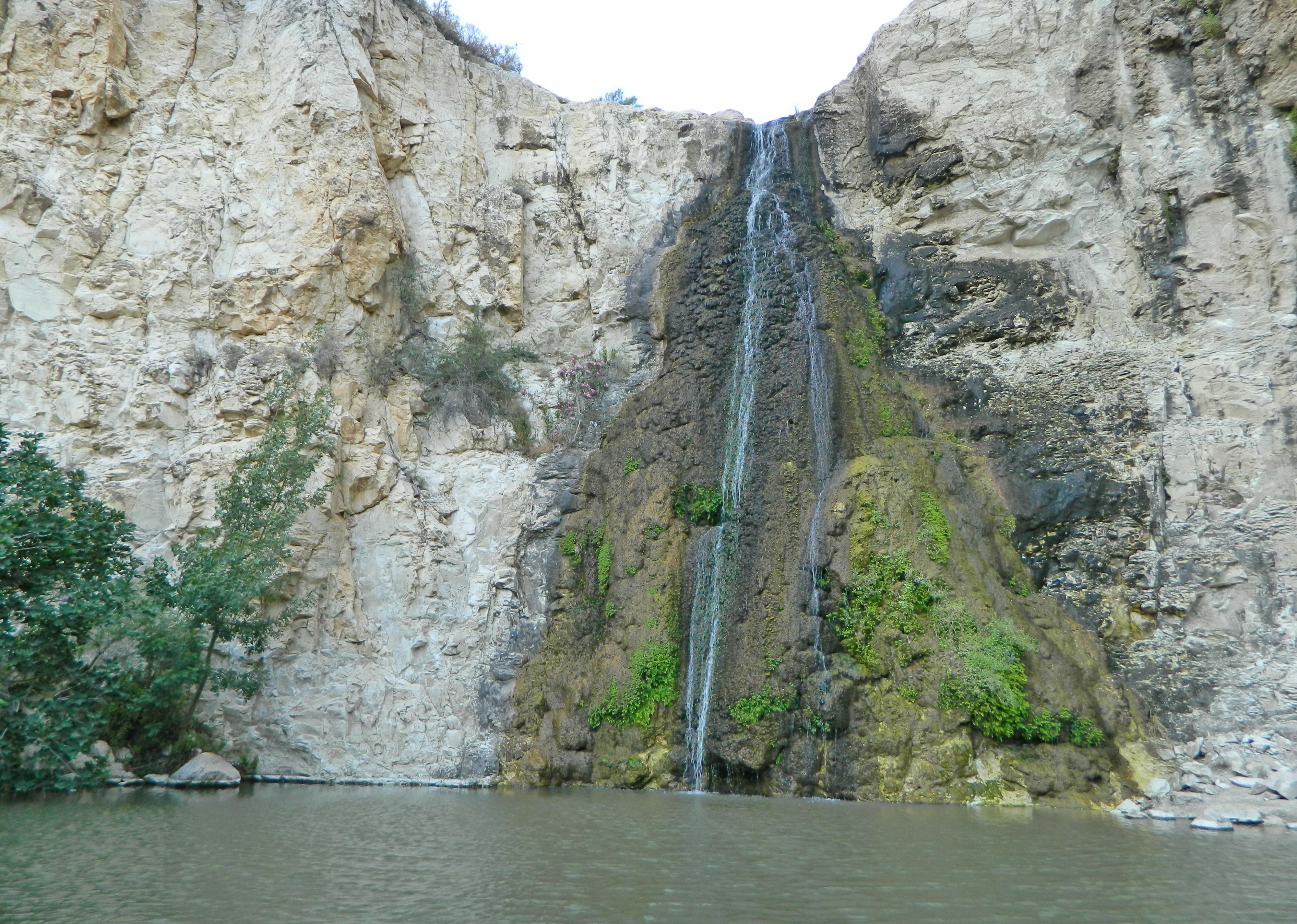
Ein Tina

Shortly we broke through to the tree line and climbed among reeds and trees, stepping gingerly to avoid the flowing water. At last we reached the top, where the water burst from a cement wall via two open pipes (I’m not sure why the water source has been manipulated by man, perhaps it was used for something or perhaps to regulate flow). I sat beneath a fig tree and enjoyed the view, letting the cold droplets splash me from time to time.
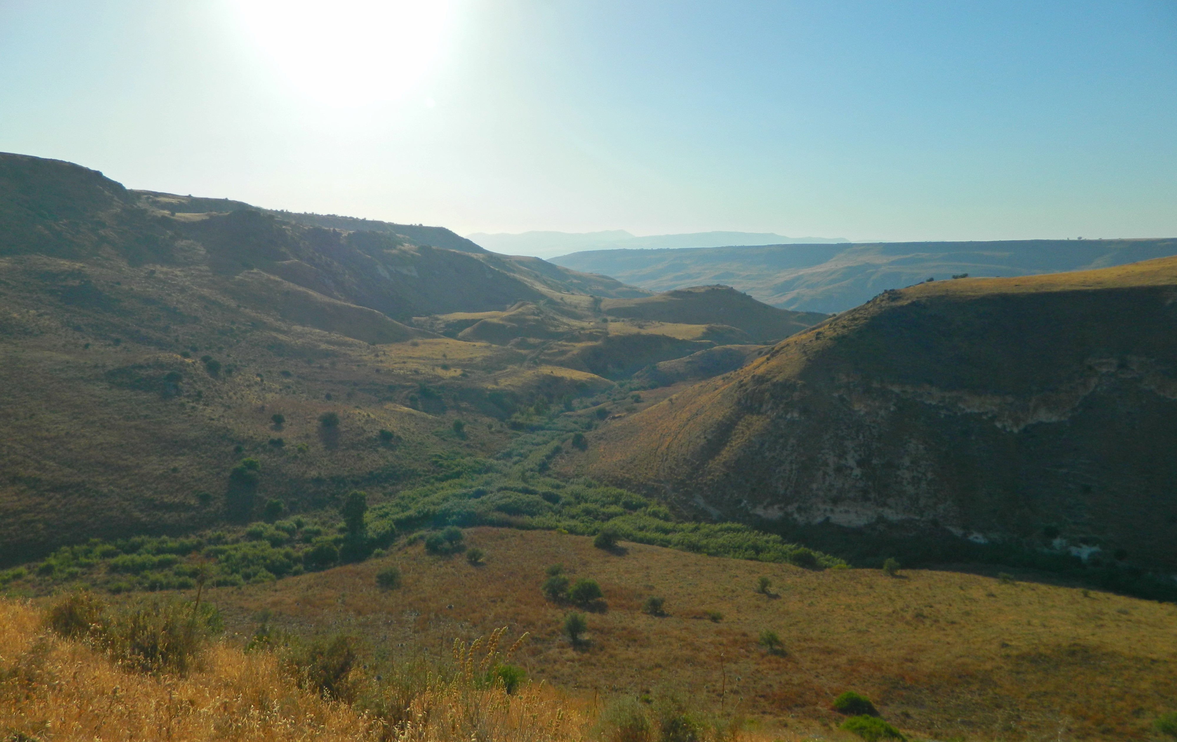
View from Ein Tina

A perfect vantage point, nearly invisible to those below, I was prepared to spend hours there. However, all good things must come to an end and we had yet a full evening schedule. And so we hiked back down the hill, passed the pool and down the path – where I found this little crab hiding in a small pool in the stream.

Crab

We boarded the buses and were driven down alongside the Kinneret towards the site of our night accommodations, Tzemach Beach at the southern tip of the sea/lake. Along the way, when I was distracted with text-messaging a friend, our bus hit a medium-sized bird on the long country – the driver claiming it to be a chukar. We reached the beach where we had dinner and found sleeping arrangements under a canopy of stars, fruit bats and mosquitoes. But before we retired, some of us instructors stole away to the beachfront where the schoolchildren were not allowed. There we had a leisurely night swim in the placid lake, only cutting our poor feet once or twice on sharp rocks hidden in the depths. The night passed and we awoke the next morning for yet more adventure!

Nachal El Al

In Golan, Israel on June 25, 2017 at 10:37 AM

This is the first of three posts that took place on three consecutive days in early June when I was fulfilling my capacity of instructor at a school where I work. A few other instructors and I were accompanying the 9th graders on their multi-day tiyul shnati (an annual trip), this time to the Golan and Upper Galilee. The first day started off with a long bus ride from Givat Shmuel, near Tel Aviv, to the first hike of the trip, Nachal El Al in the lower Golan. The buses took us to a staging ground behind the moshav of Avnei Eitan and we promptly began our hike along the red-marked trail, descending into the ravine.

Descending into Nachal El Al

From the very beginning both flora and fauna showed promise, as I photographed a crested lark, a red and black leaf beetle, globethistle, bugloss and oleander which grows plentifully along the streambed. It wasn’t long before we reached the first of the two waterfalls that this hike is famous for, the Black Waterfall. Named such because of the black basalt stones that are so typical of the Golan’s geology, the second fall is called the White Waterfall due to its white chalk setting.

The Black Waterfall

As I was looking over the edge of the cliff beside the pool drama hit. First there was the sound of rumbling and something falling, then confused shouts and through the gaps between the leaves I was witness to a terrible accident. A young schoolgirl from another group, also on her annual trip, was victim to a fallen rock which smashed her thigh, breaking the bone badly, and as she fell, her head hit rock. Their accompanying paramedics, as well as ours, rushed to her aid and the atmosphere was grim. She had lost consciousness and her thigh was bent unnaturally, swollen and discoloured. Climbing back up to regain cellular service, emergency calls were made and it was decided that they were going to wait for Unit 669, an elite IDF commando unit, to rescue her via helicopter.

Unit 669 helicopter to the rescue

We stayed for some time at the Black Waterfall, some of the students frolicking in the pool, and I spotted a Levant green frog escaping human presence. When we left the Black Waterfall the poor girl was still awaiting extraction and so we paused further ahead along the trail and prayed together for her health and well-being. As we continued southwest we heard the distinct noise of a chopper incoming, and we got to spectate the rescue until the adjacent hilltop obscured our view (she was since rescued successfully and taken to Rambam Hospital in Haifa).

Closer look at the helicopter

Hiking along, we passed a neat wildflower named annual pink as well as a handful of goldfinches flying amongst the waving reeds, with alpine swifts and a lone short-toed eagle patrolling the skies above us. I took care to photograph as many craggy cliff holes as I could, hoping that maybe I’d catch a little or eagle owl on my display screen – both of which have eluded me thus far – but with no success.

The kiss of goldfinches

We had passed a neat pool down below, with metal handles affixed in the rock wall to facilitate access to the continuation of the trail which was lined with thick reeds. Next we came upon an area where the water flow slowed down as it caressed the smooth white rock, reminding me of the natural waterworks at Nachal Kziv. This calm water would presently spill over the side of a cliff to form the White Waterfall, a 14-metre drop of cold mountain water. I waited for a while at the spillover spot, letting the sun progress over the adjacent mountain to give me more favourable lighting for photography.

The White Waterfall

It’s on the crest of that mountain to the west that ancient ruins can be found. Marked on the map as Qasr Bardwil, which, according to what I have found online, can either be an Arabic name giving tribute to Crusader king Baldwin who conquered the Golan area, or “bardwil” which may be Arabic for cattails. Either way, the site dates to the early Bronze Era and is composed of great walls of small stones at the edge of the cliff overlooking the stream. When the children were goaded out of the waterfall pool I made my pilgrimage down to properly document the falls, and then I continued on the trails.

Late afternoon over the Golan

From this point onward it was all dry, the trail running along the side of the eastern slope with only lone trees here and there to shield us from the scorching sun. But I found distraction in spotting a noisy katydid in the dead vegetation, a fan-fingered gecko and my very first woodchat shrike, also called a butcher bird for their barbaric feeding methodology.

Noisy katydid

At last, I reached the end of the trail and spotted a mother rock hyrax with two of her young on a nearby rock. Over the next half hour or so the entire class made their way to the end where the buses waited, and during this wait we watched the entertaining aeronautics of a kestrel avoiding a mobbing hooded crow. When the buses were loaded with our sweaty and tired bodies we were taken to Moshav Keshet where we, the staff, were introduced to our rooms and then had dinner in the dining room. The day had come to an end, but the trip was only one third of the way done…

Yavne

In Central Israel, Israel on June 18, 2017 at 10:37 AM

The Friday after our wonderful Ramla adventure, Adam Ota and I were joined by more friends, Ben Yablon and Efrat Guli, to take a trip to the Yavne area. I had never been to Yavne so I enjoyed searching for interesting places to visit in advance using the remarkably useful Amud Anan map. Adam, Ben and I boarded an early bus out of Givat Shmuel and met up with Efrat and her car in Rehovot. We popped over to a local bakery to grab some baked goods for breakfast and from there drove to Yavne, a few minutes away to the southwest. On the road we made note of the first site of interest – the old Yavne train station – and before long we were at Tel Yavne located at the southern end of the city.

View of Tel Yavne

Parking not far from the House of Arches, which was the house of the local sheikh in the 1930s, we looped around the tel to find the unmarked trail leading upwards. Pausing to examine a dirt wall rich in potsherds and other archaeological treats, we found ourselves greatly distracted in the pursuit of antiquated trinkets. Other than some pottery vessel handles and bases, some of us pulled out ancient glass shards, the age indicated by the silver weathering which leaves an iridescent coating – something I had learned about at a special glass exhibition at the Israel Museum. Browsing the Antiquities Authority’s reports, I found that the glass samples found at Tel Yavne during a salvage excavation in 2008 were dated to the Late Roman and Byzantine periods. As we reached the top of the hill that is Tel Yavne, we noticed the lone stone tower at the far end of the hill – a Mamluk minaret belonging to a bygone Mamluk mosque.

Mamluk minaret

But presently we were to examine the stony ruins of houses and other buildings possibly dating further back, to the times when Yavne was an important ancient city. Biblically, the city was known as Yavne’el and it was subsequently conquered by the Philistines who ruled the southern coastal area of the Holy Land, including important cities such as Ashkelon, Gaza and Gath – where, God willing, I will be excavating this summer. Fast-forward to the Roman times, when the city was known by its Hellenised name of Jamnia, the Sanhedrin (Jewish supreme council) found its sanctuary upon the destruction of Jerusalem in 70 CE.

Yours truly examining the ground amongst the ruins (photo Efrat Guli)

Later, during the Crusader period, Yavne/Jamnia was conquered by the Europeans and the castle built thenceforth was named Ibelin, the name synonymous with one of the most powerful Christian families in the Kingdom of Jerusalem. The Mamluks, in their pursuit of conquest of the eastern Mediterranean lands, converted the Ibelin church into a mosque and a minaret was constructed. Interestingly enough, most of the sites of interest that we were to explore that day date to the Mamluk period.

Purported Crusader ruins

However, the aforementioned old train station, and a concrete pillbox located beside the train tracks, were constructed during the British Mandate period. Alas, despite the Antiquities Authority reports and other source materials online, I am unable to provide exact dating to the stone ruins located on the hilltop and so we move on. Passing the large swathes of bone-dry milk thistle and blooming wild carrot, we approached the minaret and made notice of a fine Arabic inscription which dates the construction to 1337.

Climbing back down the tower

Ben, an intrepid member of our small party, decided to climb the ruined wall and check whether or not we’d be able to explore the inside of the tower. Finding the small green gate open, we took turns climbing up and subsequently mounting the circular staircase to the roof, quite reminiscent of the Mamluk-built White Tower in Ramla that Adam and I had visited shortly before. Breaking through to daylight, we surveyed our surroundings from the safety of the tower and I borrowed Efrat’s DSLR camera to try and capture swifts in flight overhead.

Common swift flying overhead

Climbing back down the tower, and then back down the hill, we came upon a delightful scene of red-rumped swallows gathering mud for nest building. As I was creeping forward to get better shots, an unsuspecting greenfinch landed mere metres from me for a quick drink and, noticing me looming overhead, flew away in a great panic which elicited a mischievous smile on my bearded face.

Red-rumped swallows gathering mud for nest building

Leaving the tel, we drove into modern Yavne for a cold treat at the Ben & Jerry’s factory. I enjoyed three scoops of ice cream in a cup, of the following flavours: salted caramel, peanut butter cup, and my favourite flavour, chocolate chip cookie dough. When our sweet break was over we appreciated the brand-associated cow bench outside and got back into the car for a very short drive to our next destination: the kever (grave) of Rabban Gamliel, one of the leaders of the aforementioned Sanhedrin.

Kever of Rabban Gamliel

The tombstone is contained within a Mamluk period mosque commemorating the tomb of Abu Hurairah, a companion of Muhammad whose purported grave is also a hilltop in the northwest Negev (as we saw during an academic tour earlier in the school year). We were at the Yavne grave in Jewish capacity but it was interesting to note the clearly Mamluk construction with added Corinthian columns, an extensive inscription over the kever room’s doorway and a mihrab (prayer niche) on the southern wall (facing Mecca). I recently had a class that dealt with Mamluk architecture and building design which made me wish that I had paid better attention to detail in these sites when we visited.

Elaborate Arabic inscription over the door

Inside, beside the tombstone, I said a chapter of Tehilim (Psalms), as is tradition, and rejoined our party outside where we examined the rear of the mosque and then an ancient sarcophagus at the edge of the park.

Kever of Rabban Gamliel from behind (photo Efrat Guli)

From there, leaving Yavne, we passed by the arched Mamluk bridge spanning Nachal Soreq and then back to a Rehovot bus stop after we had a quick glance at an old IAI Mirage jet on display near the public library. I was pressed for time because later that Friday afternoon I was to be taking a bus to Yerucham in the Negev. As part of my job working at a school in Givat Shmuel, I was to accompany the 8th graders for the duration of Shabbat – but in the afternoon I braved the heat and sun to walk over to Yerucham Lake for some lens-less birding. Unfortunately, because I was lens-less, I missed out on possibly spotted a pink-backed pelican that was reported there the day before – a rarity in Israel, ordinarily living in southern Africa. Pelican or no pelican, great trips were had and there are many more to be had in the future!

Ramla

In Central Israel, Israel on June 11, 2017 at 8:30 AM

This past Yom Yerushalayim (Jerusalem Day), commemorating the reunification of the capital city at the culmination of the Six Day War, I debated whether to go to Jerusalem or perhaps somewhere else less crowded. In the end I decided to visit Ramla, an oft neglected city in Central Israel neighbouring Lod and Rehovot, and I invited my friend Adam Ota to once again join me on the adventures-to-be. It was late morning when we boarded the bus for Ramla with a vague understanding of several sites that I mapped out in advance. Disembarking in the middle of the city, we first examined a sculpture park including a depiction of General Yitzhak Sadeh, whose house and mobile HQ we had visited the week prior on our trip to Yafo (Jaffa) for the Open House Tel Aviv event. From there we walked down a side street to the first site on our list, the famous White Tower, passing an ancient Arab cemetery and an old parked Studebaker on the way.

White Tower of Ramla

Greeted by a custodian, we paid for multi-pass tickets to include the other sites on our list and gained entrance to the site. Standing lonesome in a plaza, the White Tower loomed over us as we first previewed the archaeological ruins of the White Mosque and intricate water system of cisterns and aqueducts. These ruins date back to the early 700s when Ramla was first built, by the Umayyad Caliphate – in fact, the first Arab-built city in the Holy Land. The 30-metre tower is a minaret, which was added to the mosque at a later date (during the Mamluk period), and there is a long Arabic inscription etched into grey marble over the doorway. Entering, we climbed the 111 steps passing arrowslits and interesting windows until we reached the top where we joined a few tourists surveying the view around us.

View of ruins and modern Ramla

Enjoying the view, but knowing that there was a lot more to be seen, we took leave of the majestic tower and, passing the skull of a mole rat, we made our way to the next site. The Pool of Arches is one of the most curious sites in Israel to see photos of, and I have been wanting to visit for many years for obvious reasons. An underground cistern, the arch-roofed structure is large enough to accommodate rowboating which we did gleefully. On the way down into the cistern’s humid belly, we passed an Arabic inscription with fancy lettering carved into the rock wall.

The Pool of Arches

Getting into our rowboat, we got acquainted with the other boat drifting about and settled down to explore the cistern by boat. According to the PEF survey from the late 1800s the cistern measures approximately 25×23 metres and a schematic can be seen HERE. After a good amount of paddling to and fro, crashing gently into the thick columns every few minutes, we returned our rowboat and departed from the site our faces likely flushed with excitement.

Paddling underground

Boarding a bus to take us to the southeast end of the city, we got off at the shuk (open market) area where the famous weekly Wednesday shuk was closing up in the dusty area beside the Great Mosque. We passed through, inspecting briefly the huge amounts of items for sale and their unique salesmen. With the mosque in the background the scene looked decidedly Arabian. Interestingly enough, the Great Mosque was originally a church built by the Crusaders – Ramla being the first Holy Land city conquered on their quest for Jerusalem. In 1266 Ramla was reconquered by the Mamluks and the church was converted into a mosque, but retaining some of its Frankish architectural characteristics such as the Gothic doorway.

Ramla’s Great Mosque

From the Great Mosque we made our way to the regular Ramla shuk where stalls and open-fronted  shops lined a long covered alleyway hawking goods, but largely fresh produce and food. Adam paused at one street food restaurant to get a quick Turkish borekas – a heavy filled pastry sliced open and filled with hardboiled egg and served with a spicy sauce.

Ramla city shuk

We then continued until we had seen the entirety of the shuk and found ourselves in search of a very small tourist attraction, a British Mandate post box painted bright red with the letters GR clearly visible (standing for Georgious Rex, or King George). Missing it, we ended up exploring a neglected, yet curious, area near Emile Zola street full of rubble, broken buildings, old churches, stray dogs and a barn swallow perched on an electrical line. Seeking help from the locals, we were directed to the post box and, upon having set our gaze upon it, we left the shuk area.

Within the Ramla Museum

Next up was the Ramla Museum located inside of an old British administrative building. Inside we found an orderly description of the city’s chronology as well as an exhibition of old coins found in and around the city. Ending at the museum just minutes before closing time we decided to walk a bit along the main street of Ramla in hopes of chancing upon something interesting.

Hoard of gold coins

We passed the Tegart fort police station and a few churches, including the Franciscan Terra Sancta church which was built in 1902 after hundreds of years of Franciscan presence in the city – in fact, stemming from the purges of the local populace due to the Black Plague in 1347. With that we agreed that our adventure was to come to an end, but not without murmurs of yet another adventure ere long.

Open House Tel Aviv

In Central Israel, Israel on June 4, 2017 at 10:39 AM

Some Fridays ago my friend Adam and I took part in the annual Open House event in the sprawling metropolis of Tel Aviv. The concept of Open House is to make available houses and buildings that are generally closed to the public, and I knew I had to seize the opportunity. And so, I mapped out a feasible day-trip incorporating a handful of interesting sites all located in the Yafo (Jaffa) area, more or less. Leaving Givat Shmuel early in the morning, we arrived by bus at Jaffa Port for the first item on our list – a guided tour of the port. Having arrived early we were free to explore the area before the tour began, so we watched a night heron fiddle with a fish he had caught while a jealous little egret and an opportunistic hooded crow attempted to steal his catch.

Night heron with fish

After some exploring, we joined the tour gathered together beside Hangar 2 and we began the day in its official capacity. The guide proceeded to give us explanations of the port, its location and its historical importance – being one of the oldest cities in the world. Unfortunately, I had already visited and researched Jaffa Port, as seen HERE, so there wasn’t too much insight for me.

Jaffa Port

But I still found great interest in wooden downers built on the flat-faced seaside buildings, something that makes me think of 18th century Commonwealth towns and pirates. Also, when peering over the edge of the seawall I managed to get a nasty fishing hook embedded in the sole of my shoe – which was removed by the deft hand of Adam. The final thing that intrigued me was the old British national height point, from which they measured elevation for the rest of the country when engaging in cartography and other sciences involving such specifications.

Tour at the port

Leaving the tour shortly before it ended, Adam and I headed for a nearby street in the neighbourhood of Ajami to catch a bus to a location somewhat further south within Yafo. We were headed for the French Ambassador’s Residence, however, when we approached the walled villa we were dismayed to see that there was a ridiculously long line waiting to gain entrance. The patrolling gendarmerie did not seem to wish to slip us inside so we gave up and headed for the next site on our list – even further south within Yafo.

Overlooking the Mediterranean

Disembarking from the bus we popped into a curious Arab mini-market with an array of interesting imported products, such as Fayrouz Pineapple, a non-alcoholic fruit beer from Saudi Arabia and Sultan Cola from Austria, with a special halal certification mark on the bottle. Continuing along, we arrived at the old house of General Yitzhak Sadeh, the old commander of the Palmach and one of the founders of the IDF.

The Sadeh living room

There was a small crowd forming outside the house’s gate and after some drama the homeowners flung open the gate and gave us a special tour of the house and grounds. We began with an introductory speech by son Yoram Sadeh in the front garden and then moved inside to see select rooms in the carefully preserved house. Outside again we toured the cliff garden overlooking the beach and the Mediterranean Sea, and visited Gen Sadeh’s old wartime caravan which served as his mobile headquarters.

General Sadeh’s mobile HQ

Bidding farewell to the Sadehs, we headed back for the bus and made our way back to the northern part of Yafo where there were still several locations to visit. First up was the Saraya, the Ottoman house of government – of which there are several scattered throughout the Holy Land. The Saraya was built in 1880, blown up by Lehi operatives in 1948, restored and now open to the public thanks to Turkish government who reclaimed ownership in recent years. It was enjoyable to sit in the luxuriously appointed great room with the Turkish flag hanging limply beside the wall.

Saraya great room

Leaving the Saraya we paused to admire the famous clocktower (of which there are several scattered throughout the Holy Land), the main post office (built in 1934) and then found a nice Tripolitan restaurant by the name of Gueta where we had delicious plates of savoury Libyan food for lunch. Sated and ready for more adventure, we then headed for the next sites in the American-German Colony. First up was the Maine Friendship House, one of the original pre-fab wooden houses brought over from Maine in 1866 by a group of Christian would-be colonist settlers.

Jean Holmes of the Maine Friendship House

Heading first downstairs, we watched a short video about the trials and tribulations that this group had once disembarking off the Nellie Chapin on the coast of Tel Aviv. What was left of the American colony was eventually sold to a wave of German Templers who added new houses and public buildings to create the German colony. The British deported most of the German colonists with the events of the First and Second World Wars and the colony fell to disrepair. The house we were visiting was purchased, restored and renamed by Jean Holmes and her late husband, Dr Reed. It was Jean herself who took us on the tour of the house and gave us a glimpse of a history that few know.

Jaffa German Colony as seen inside the Immanuel House

From the Maine Friendship House we walked across the street to examine the archives room in the Immanuel House, a building that was once a luxury hotel, a hospital and now a missionary guest house. From there we passed the neo-gothic Immanuel Church and other historical buildings from the American and German colony periods.

House in the American-German Colony

Despite being in the heart of the city, these few streets were charmingly hushed and seemingly detached from the urban symphony of the big city. Leaving the area we boarded a bus to take us back to Givat Shmuel, bringing an end to our Open House adventure.