During Chanukah, while I was home, several members of my family and I took a little drive down to Tel Megiddo, in the Jezreel Valley area not far from Haifa. Herein lies the story of our adventure to the ancient city conquered and reconquered over twenty times, a city whose Greek name is Armageddon (a corruption of Har Megiddo, or Mount Megiddo).
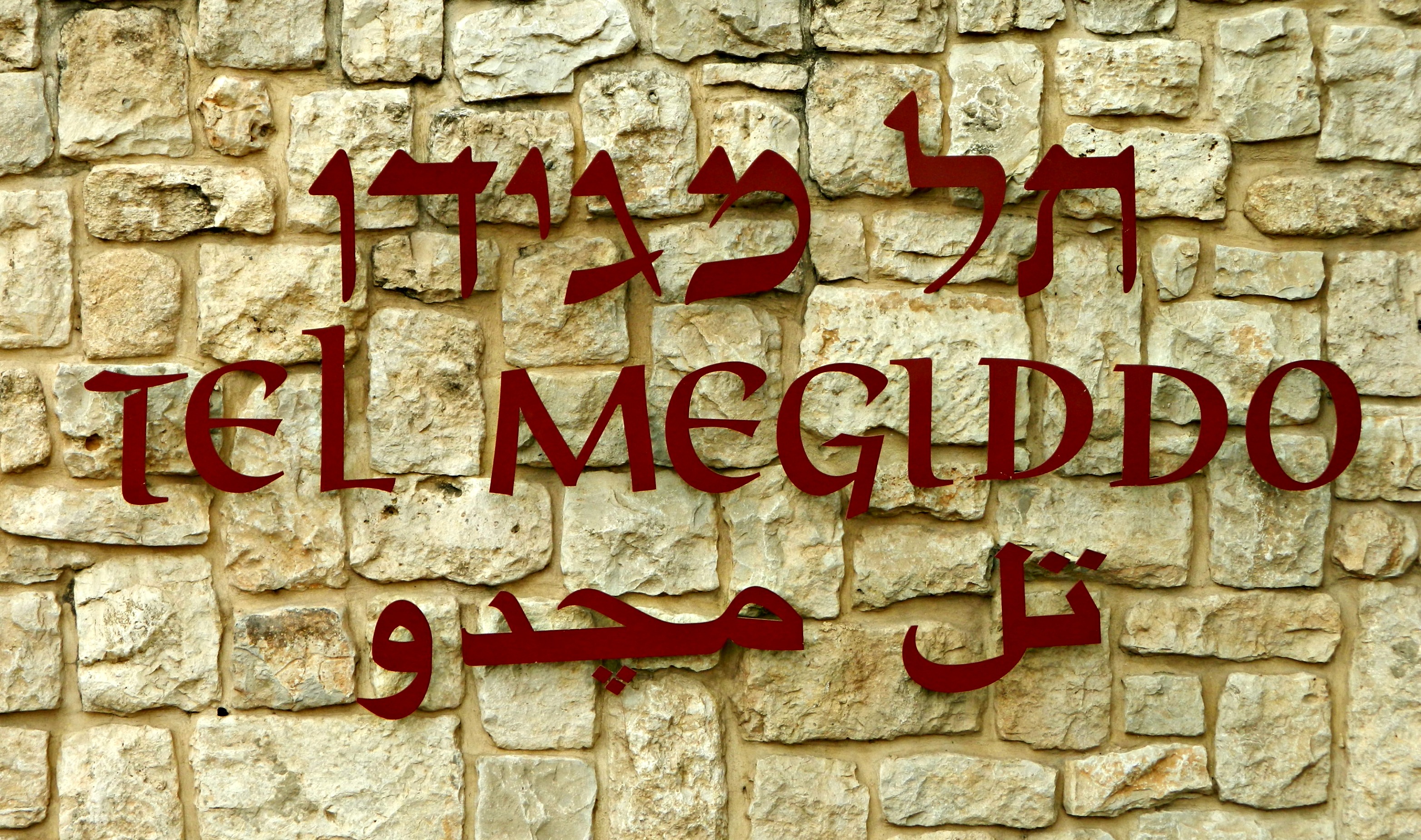
Tel Megiddo
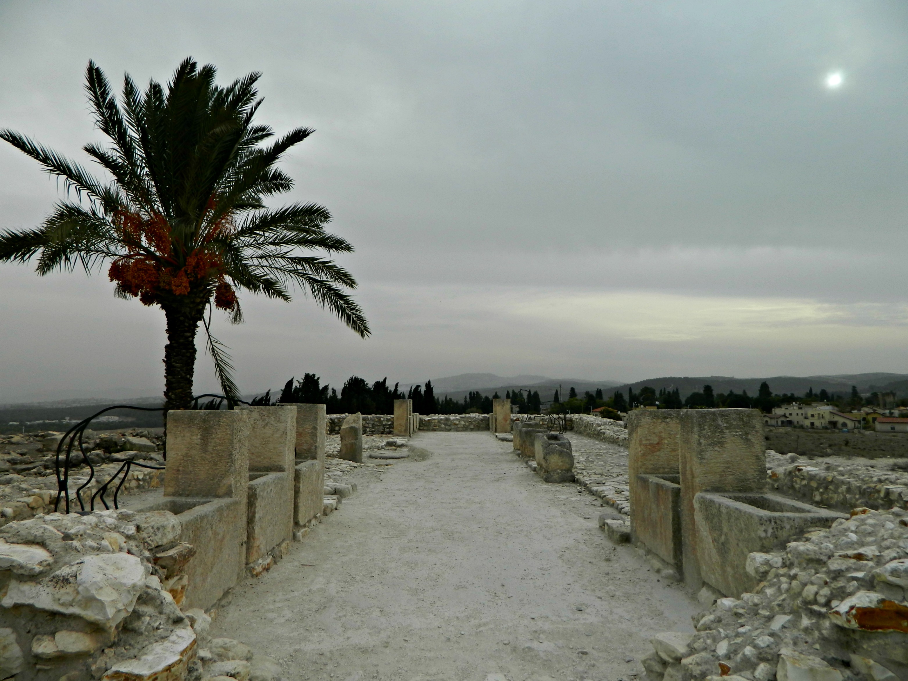
The day we visited happened to have been overcast and, despite the faint sunshine sneaking through the clouds, there wasn’t much to be done to improve the photographic element. Thus, my photos are rather lackluster and so I often used the many date palm trees on premise to liven up the scene, as seen here:
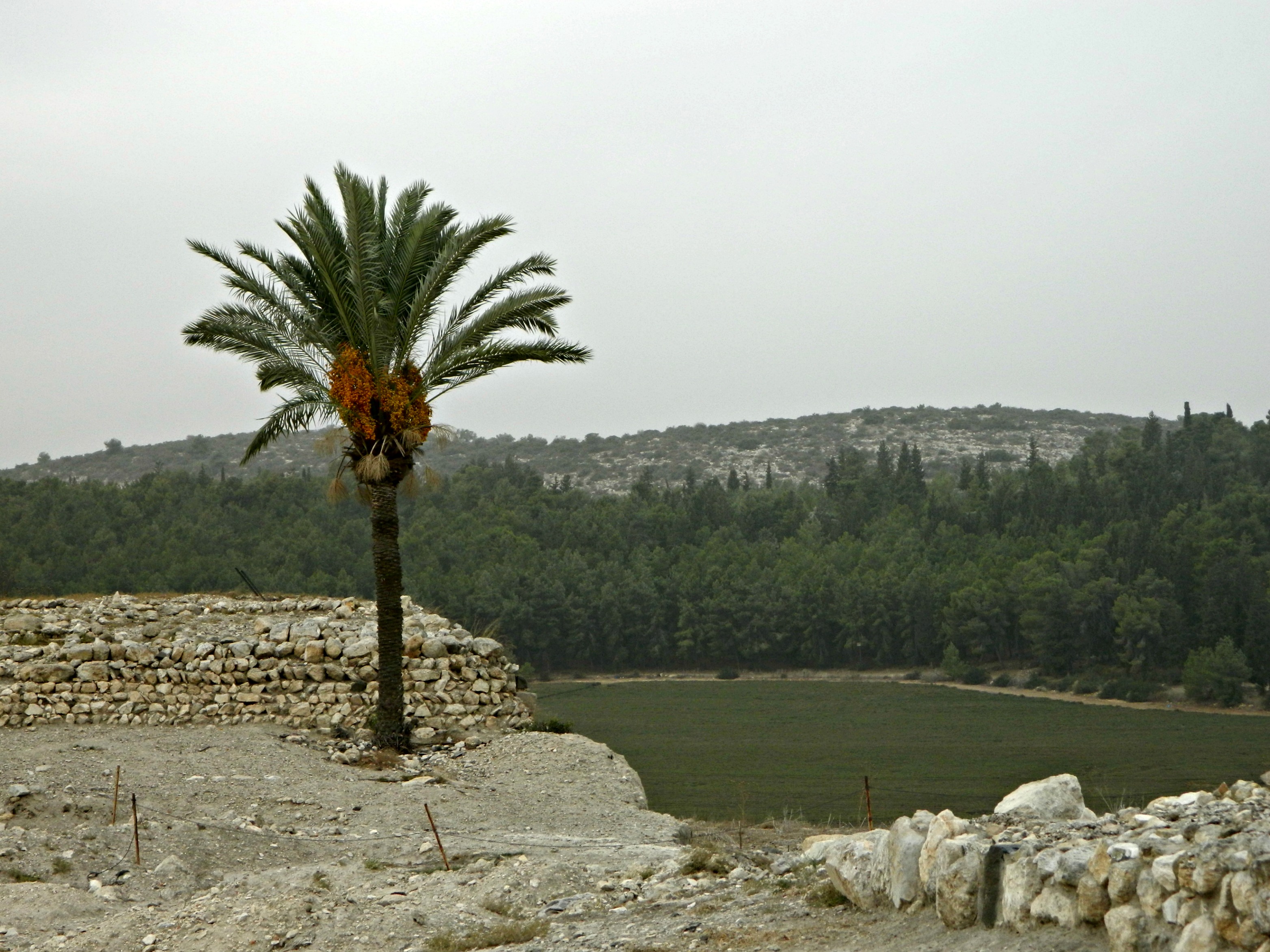
Tel Megiddo ruins and a date palm
We began with watching a short video on the history of Megiddo and the important archaeological site it has become now. While the video played I noticed this great photo taken sometime between 1925 and 1939 of the Oriental Institute Expedition of the University of Chicago, funded by John D. Rockefeller, Jr:

Oriental Institute Expedition at Tel Megiddo
Later, in the 1960’s, further excavations were conducted by famed Israeli archaeologist Yigael Yadin for the Hebrew University. Unearthing twenty-six layers of ruins, from the Jews to the Egyptians to the Romans, the same small area was built and rebuilt time and time again over thousands of years. Some of the very interesting historical battles that took place in and around Megiddo include: the Egyptians under Pharaoh Thutmose III vs. the Canaanites of Megiddo and Kadesh (1478 BCE), the Egyptians under Pharaoh Necho II vs. the Kingdom of Judah under King Yoshiyahu (609 BCE) and more recently, the Allied Forces under General Allenby vs. the Ottoman Empire (1918).
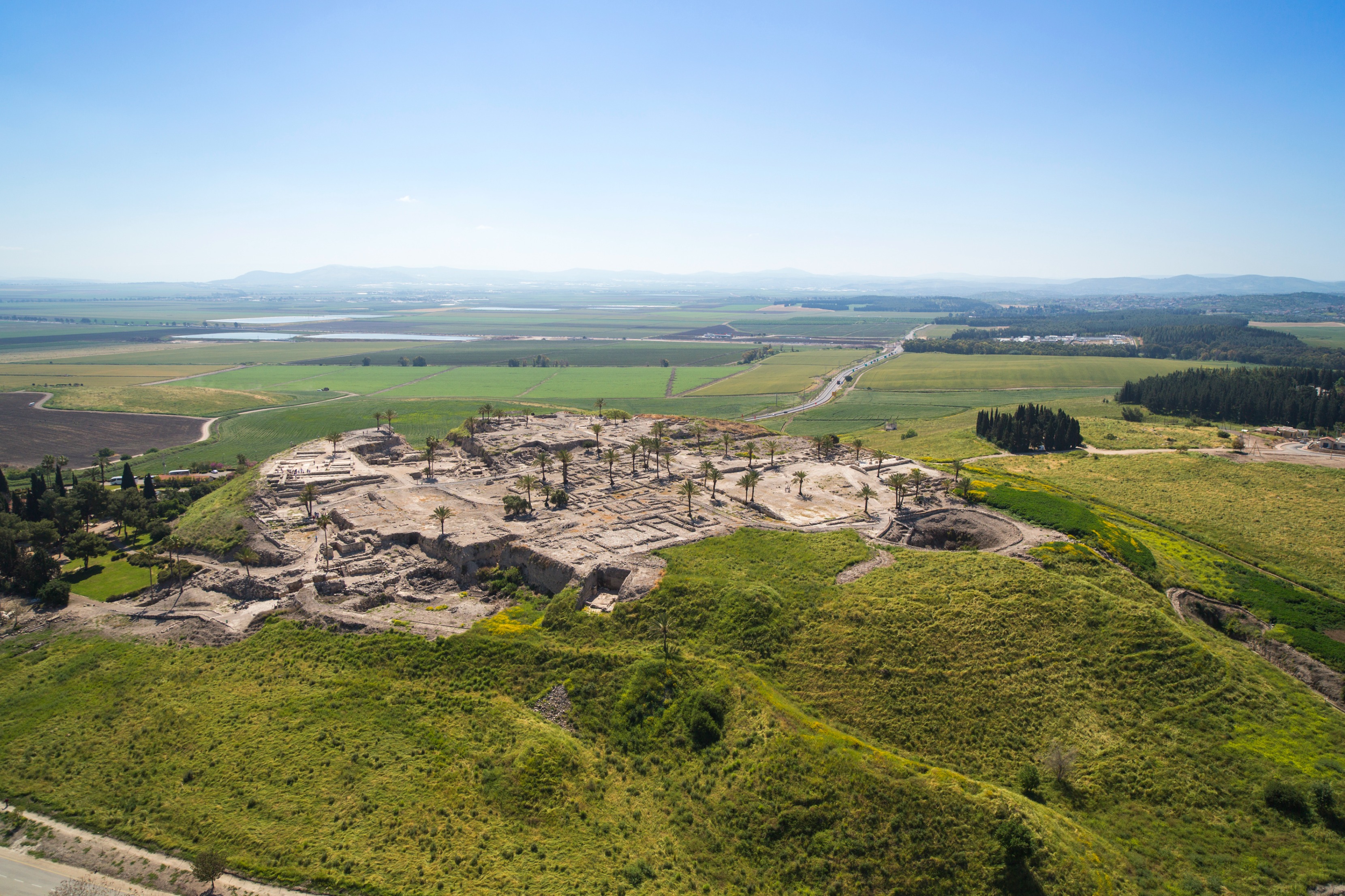
Tel Megiddo (photo by IsraelTourism, Flickr)
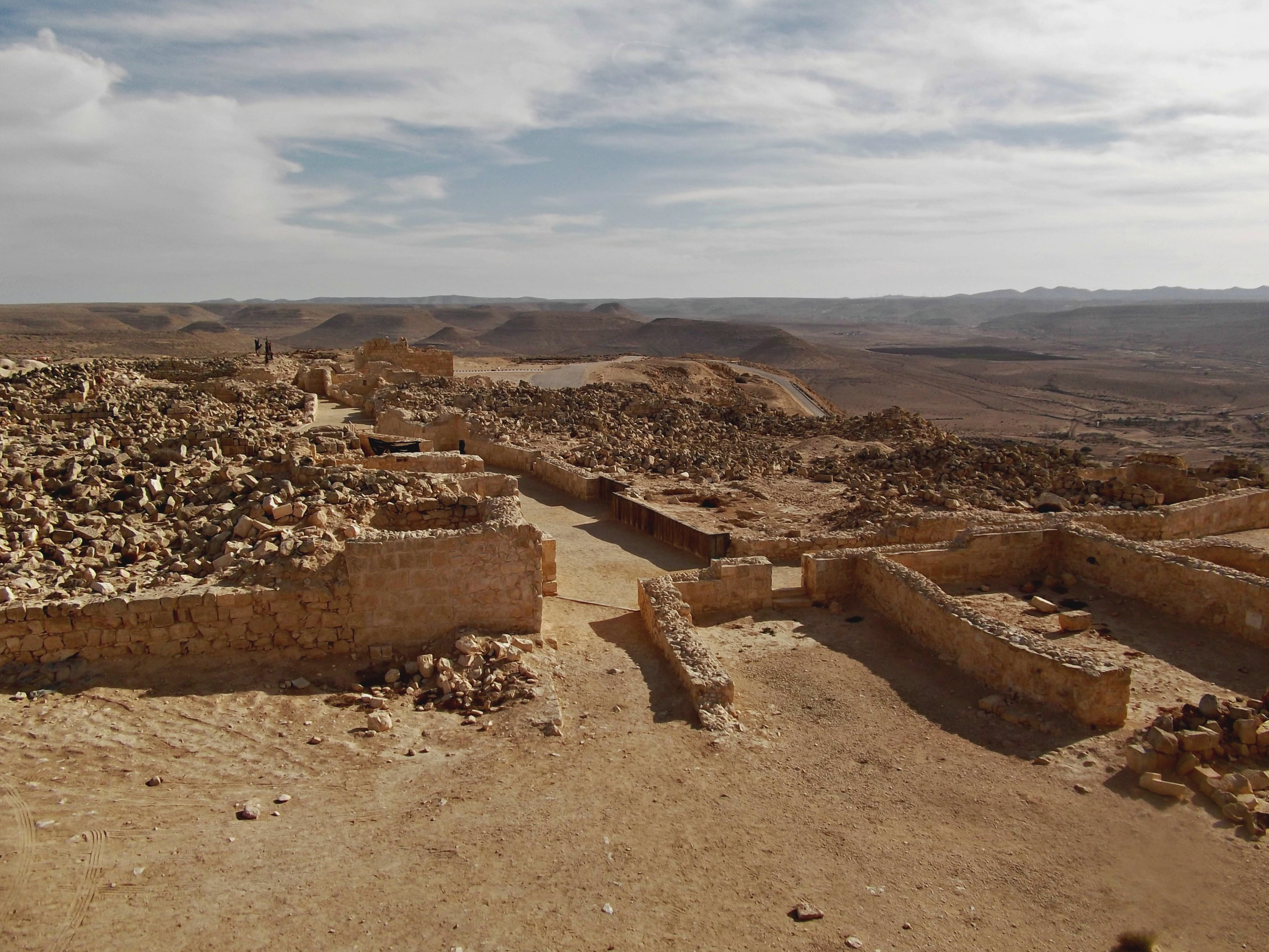
Entering through the Solomonic gateway, the path winds to and fro with little signs explaining what certain areas are and from what period they come from. Here, amidst a vast spread of short stone walls and partially excavated ruins is more modern looking “northern palace”. Finely cut masonry, the thick walls of the “palace” were originally thought to be from the time of King Solomon, however it is now believed to be dated from the time of King Ahab:
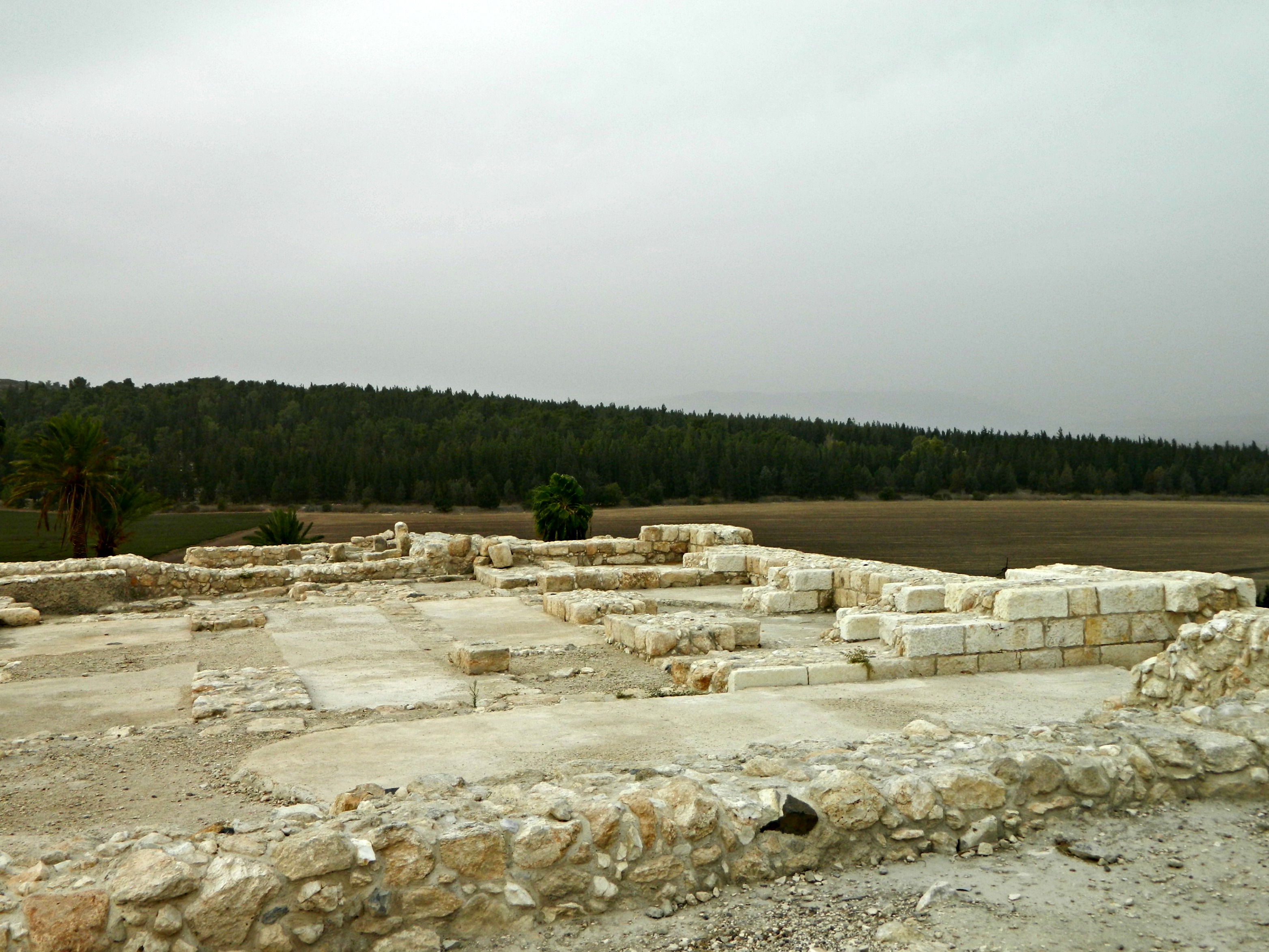
The ”northern palace”
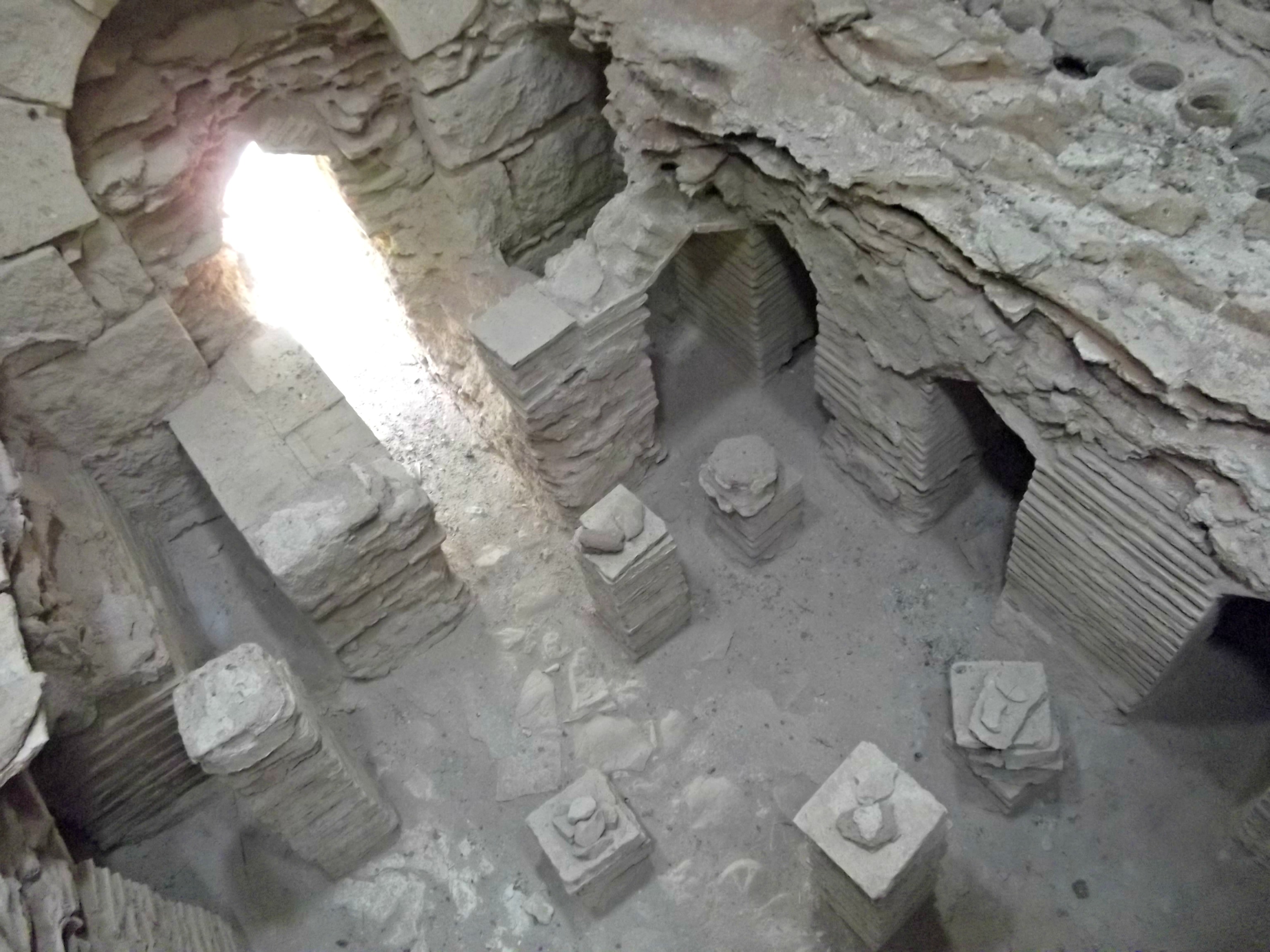
One of the big discoveries was of a Canaanite altar, a large circular mound composed of smaller rocks, buried numerous layers down:
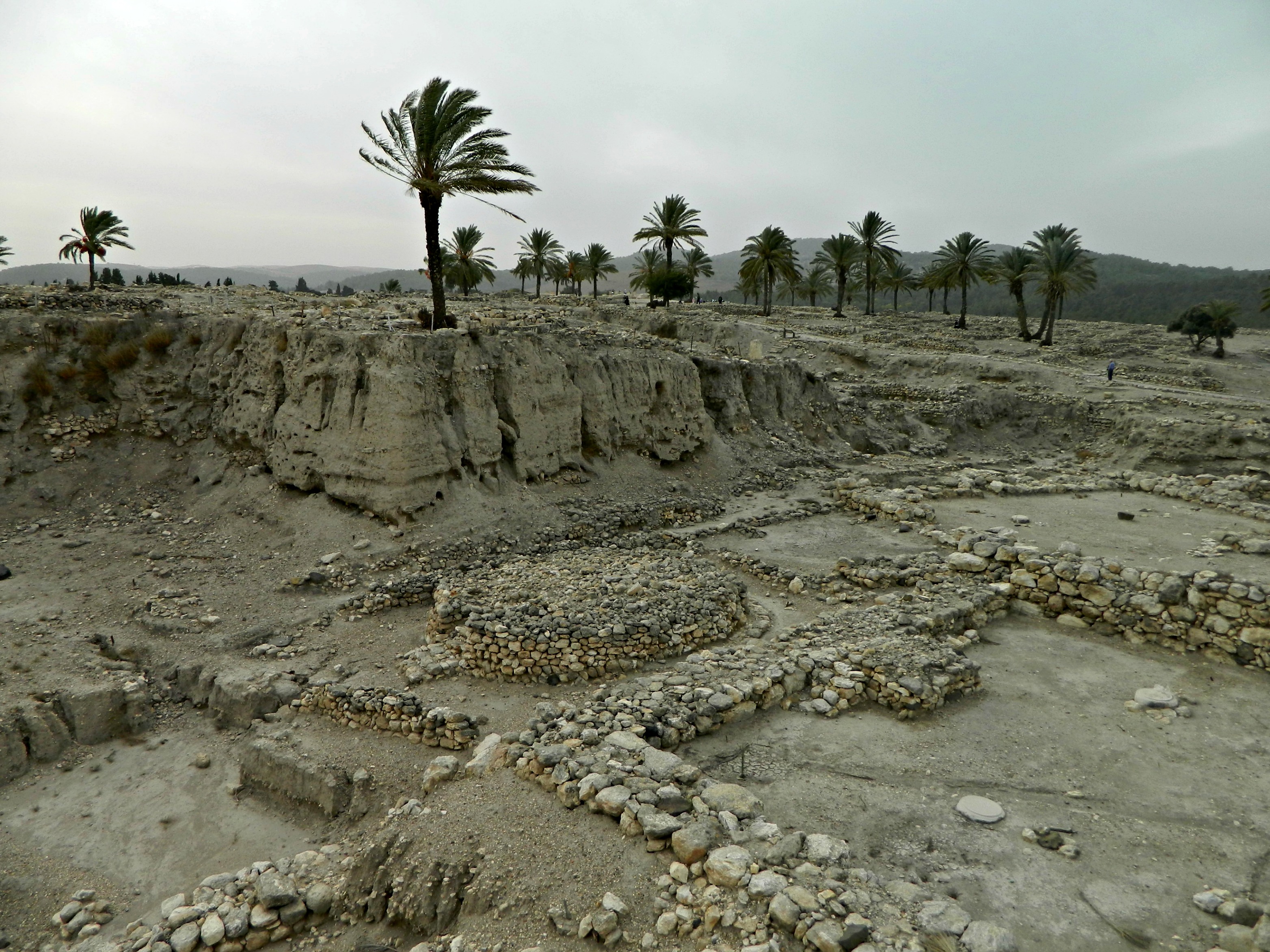
Ruins including a Canaanite altar (centre)
At the far eastern side of the ruins, looking over the Jezreel Valley towards Mount Tavor, the wind played a haunting tune as it whipped through the thin reed-like awning covering the lookout. There, gouged deep through the archaeological mound, many time periods can be looked upon at once – layers built up on the bedrock. Not far is the 450-cubic metre grain pit, lined with stone and straw, believed to be from the days of King Yeruvam (Jeroboam) II some 2,700 years ago. And then, on the western side of the hilltop are the stable complexes. Large to hold nearly 500 horses, the early excavators in the 1920’s and 1930’s believed the lot to be stables however more recent archaeologists suggest that the stables are actually warehouses or barracks. I personally like the stables version, and so does the Israel Parks Authority because many metal horses can be seen on premises, such as the one hiding under the date palm:
The stables
At the very western edge, where the trail seems to lead to nowhere, is the water system – an “L”-shaped shaft cut out of the bedrock to supply the city with water in time of siege. Built during the time of the Israelite kings, the 36-metre (120-foot) deep vertical shaft and the 70-metre (230-foot) long horizontal shaft hooked up to a freshwater spring emerged in a natural cave. They then blocked the cave’s other entrance, the one visible to those outside the city, and camouflaged it.
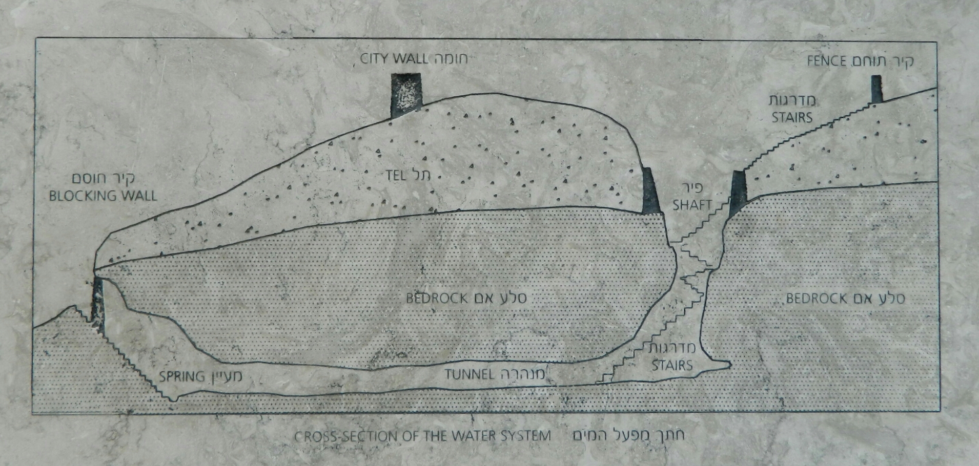
A stone etching cross-section of the water system tunnel
Here is the renovated tunnel, complete with electrical illumination and a safe wooden walkway:

The 70-metre long tunnel
And here, the modern stairs leading down to the spring from outside the city:

Coming up from the spring
At the top of the staircase coming up from the dank spring, we took the long path back to the park entrance – along the extremely black asphalt road – and returned to our car. From the park we attempted to visit the Juara Museum but when we got there we discovered it was inside an army base and required reservation – maybe I’ll get to visit it one day on my army explorations. After the failed museum visit we headed into Yokneam and got dinner at a popular hummus restaurant, Hummus Eliyahu – highly recommended. Then we went home and lit the chanukiyah.