Israel's Good Name

Archive for August, 2017|Monthly archive page

Tel es-Safi Archaeological Dig I

In Israel, Judea on August 27, 2017 at 6:20 AM

The first Sunday of July, nearly a week after my day at the Tel Kabri Archaeological Dig, I began my month-long stint at the Bar Ilan University archaeological dig at Tel es-Safi (the Biblical city of Gath) under Prof Aren Maeir. Currently there are only two active excavations, Tel es-Safi and Tel ‘Eton (the lab I worked in last year), yet this year only Tel es-Safi was offered. Since I am working on getting my archaeologist’s licence, I was slated as being the assistant of Dr Jill Katz of Yeshiva University. I was joined by fellow BIU student and friend Itamar Berko and together we served as square supervisors for Jill’s area, the newly opened Area J.

Area J pre-excavation – note the line of stones

Being that this event took place over the course of four weeks, I have decided to cover it in two long blog posts, reporting the events of the first two and last two weeks. A separate blog post will cover two fun field trips that we took, one on the first week and one on the third. But first, a quick summary of Tel es-Safi and its historical and geographical significance.
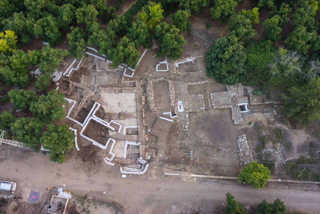
Area J from above

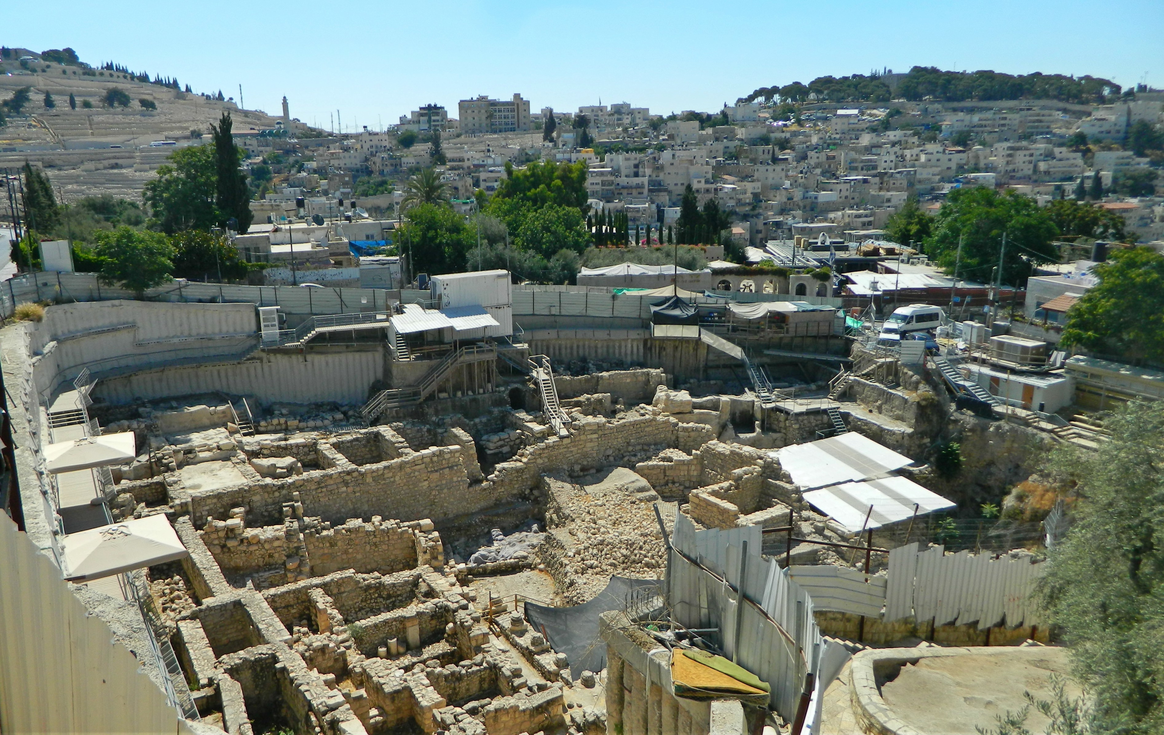
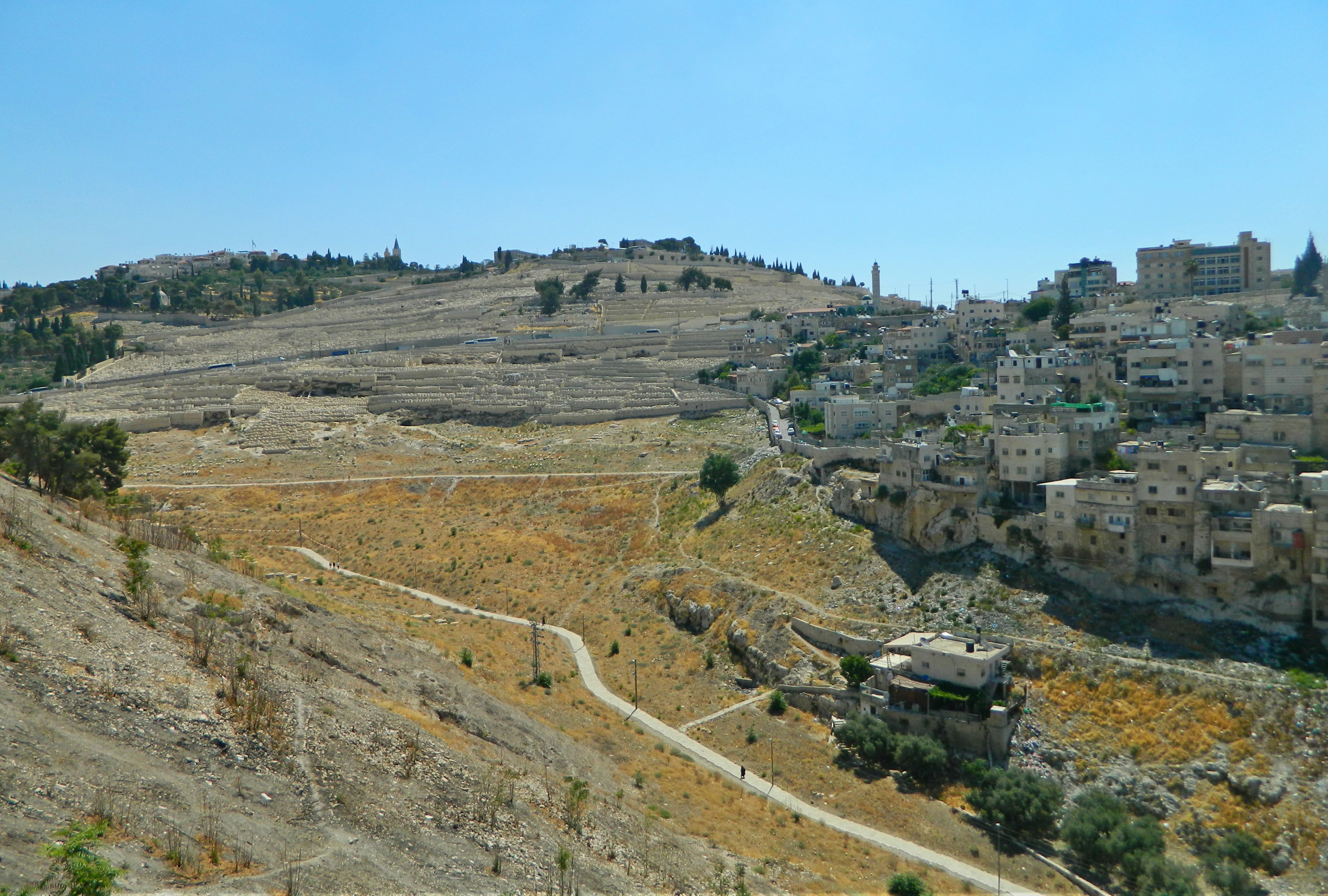
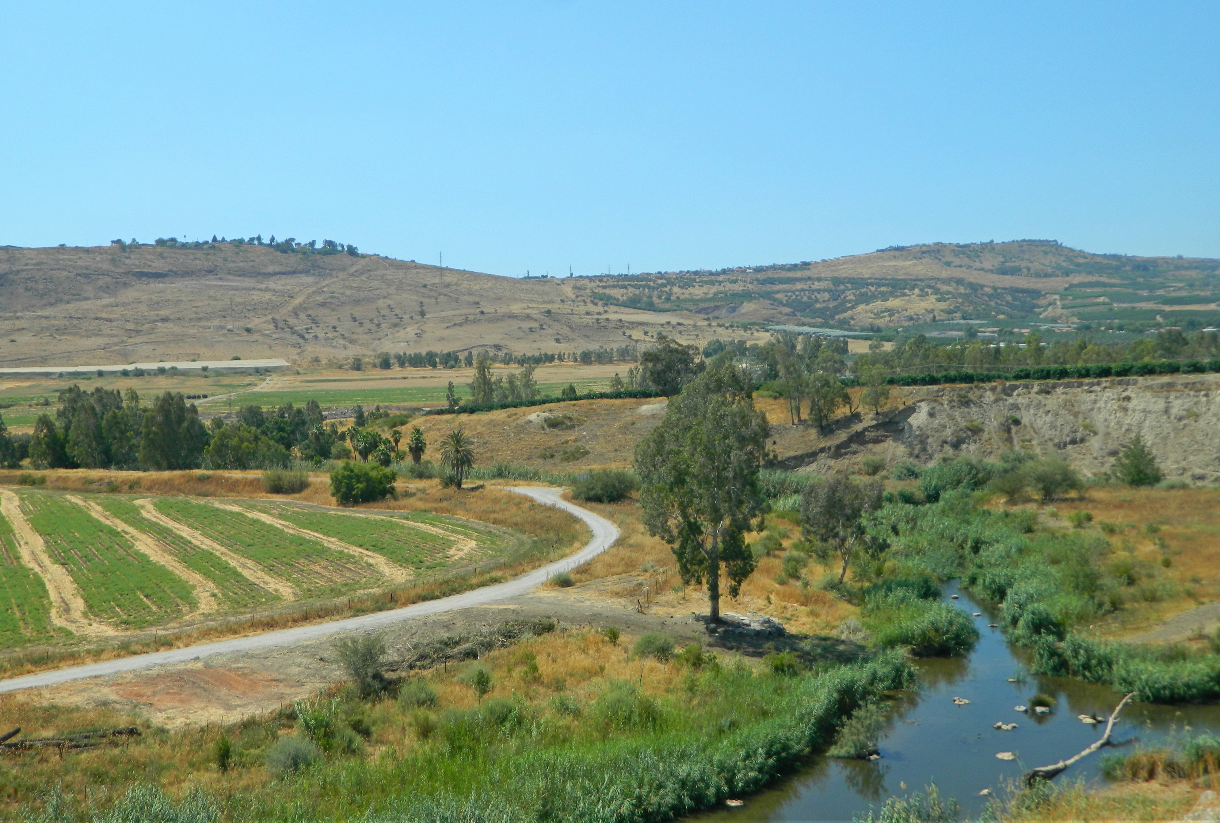
Located in the Judean lowlands not far from Road 6 and Tel Azeka, Tel es-Safi was once the capital of the Philistine kingdom which included cities such as Gaza, Ashkelon and Ashdod. At that time, in the Iron Age some 3000 years ago, the Israelites established their kingdom further inland, controlling mostly the mountainous regions. The Philistines didn’t get along so well with their neighbours and thus the Israelite Kingdom erected fortified cities (such as Azeka) along the virtual border, in hopes to stave off invasion. Goliath, the villainous giant in the famous biblical story of David and Goliath, hailed from Gath (the city later sheltering David himself at a later point). Eventually, after the Israelite kingdom was split into two, King Hazael of Aram-Damascus made his way southeast and conquered the both of them. Swinging eastward towards the Mediterranean, Hazael then conquered Gath after a siege, critical to the archaeological research of the city.

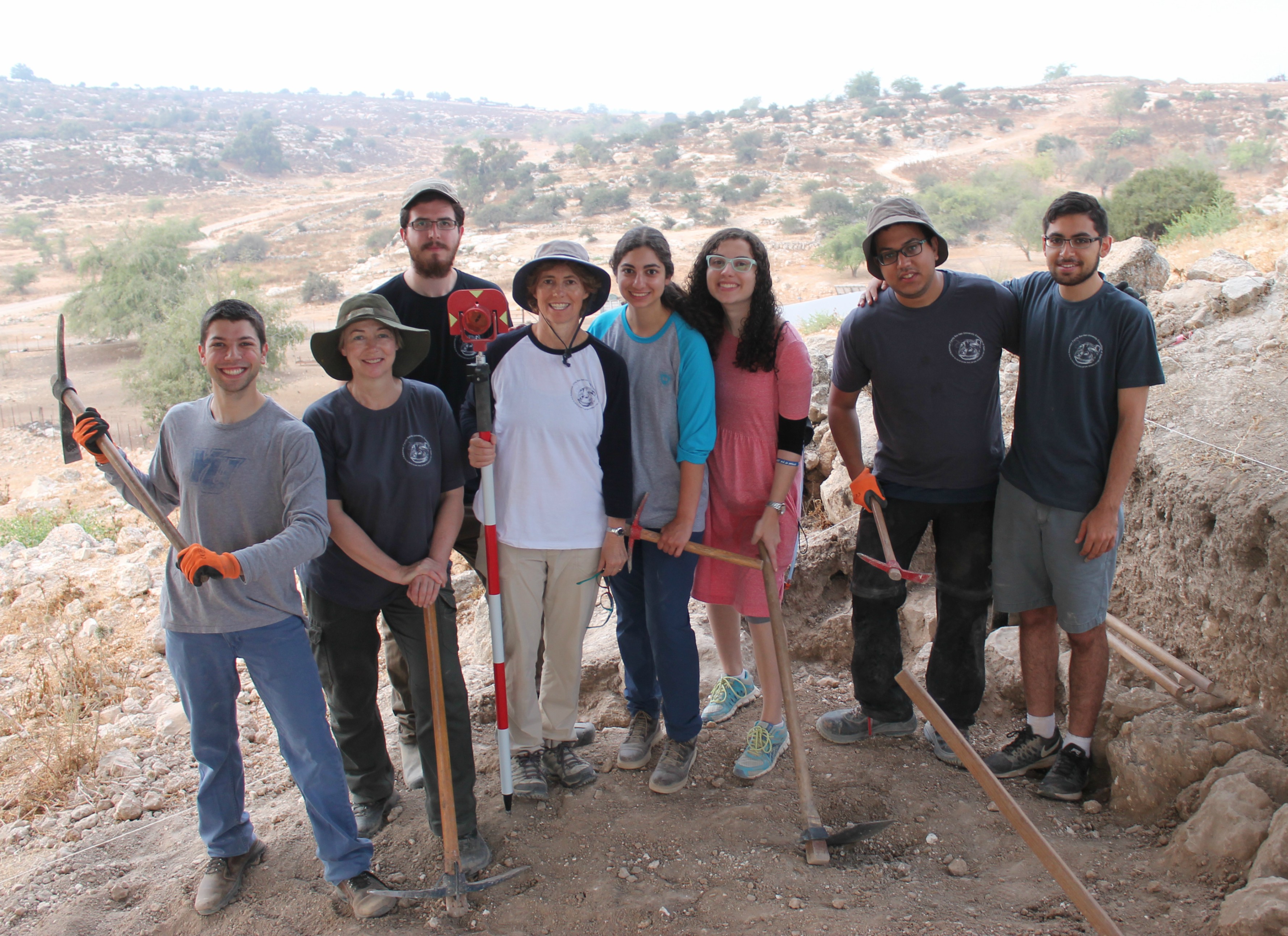
Most of the Area J team

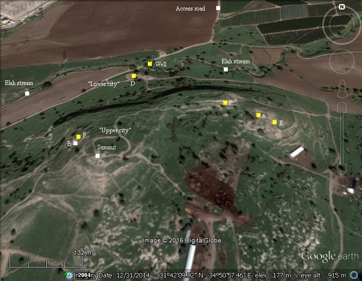
While the Philistines may have been the most famous inhabitants of Tel es-Safi, the goal of Area J was to find the Early Bronze era city wall that encompassed the original upper city. Heavily fortified by the Canaanites, the city was quite large for its time, and it was our job to find the city wall on the eastern slope. The best clue that the Safi think tank used was a straight line of large stones partially exposed following the sensible curvature of a wall. I had gone ahead the Thursday before the dig season began with other staff members to set up the shade tent and establish the borders of our two squares. Because 2017 marks the year that the Upper City excavations will finally be closed after nearly twenty years of digging, this was to be the first and last year for Area J – a rather unusual practice in modern archaeology. Because it rested on our shoulders alone, it was pertinent that we achieve our goals before the end of the season.

Jill our fearless leader

I joined other dig members, from BIU and foreign universities, on the bus to be driven to our home for the next month, Neve Shalom, just a few minutes away from Latrun Junction (and in eyeline of the Crusader ruins of Toron des Chevaliers). Disembarking at the hotel, we mingled in the lobby with the other students and staff members as we waited to receive our room keys. I joined my roommates and we got acquainted with our new home, preparing ourselves for the dig season. Going to sleep early because dig schedule starts early (the bus leaves at 5am), we spent our first night impatiently waiting to break out the tools.

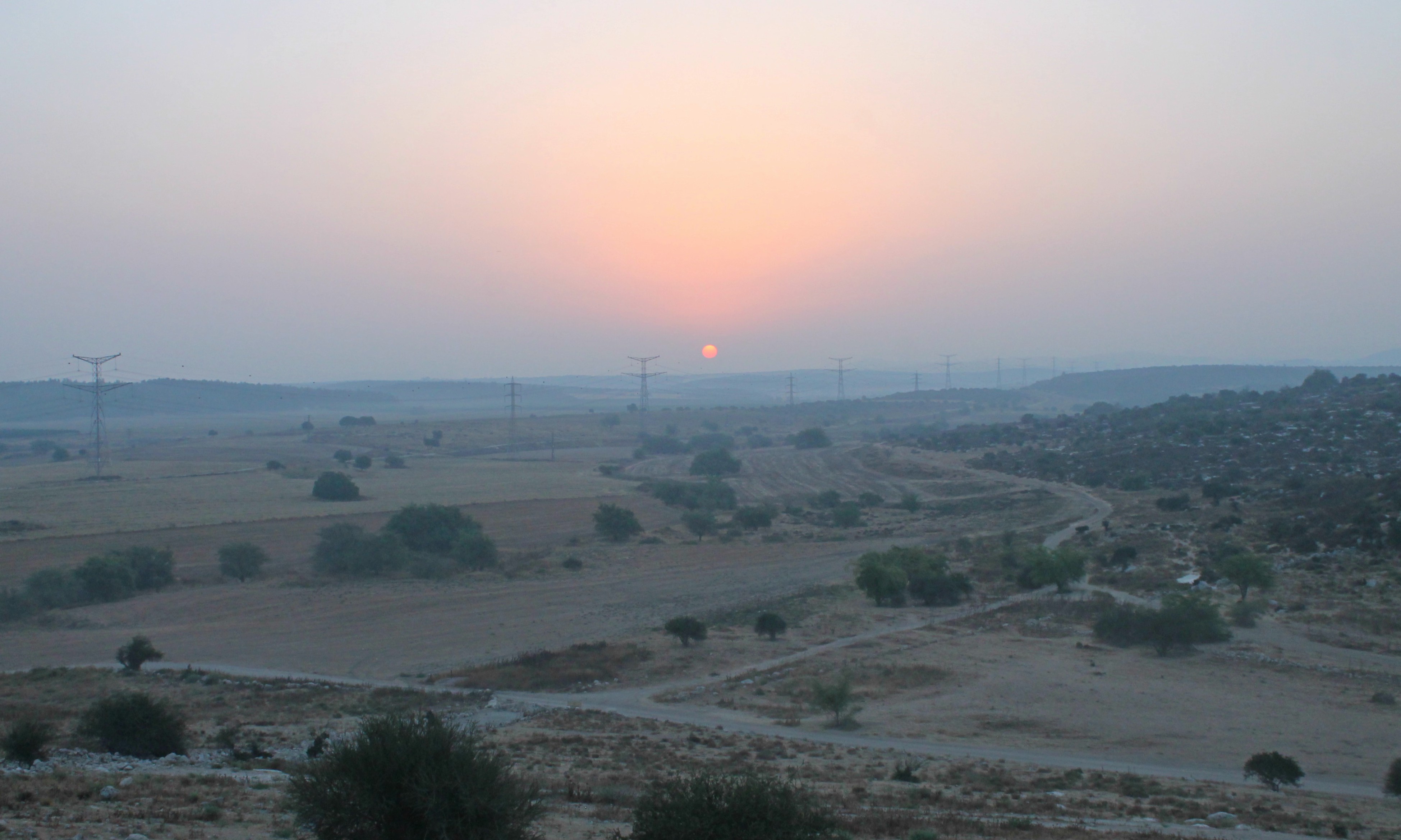
Sunrise from Area J (photo Jill Katz)

The next morning, before the sun’s rays peeked over the horizon, we boarded the bus and were driven to Tel es-Safi some forty minutes away. With dawn breaking, we examined the white chalk-paneled hill as we approached from the north, one bus stopping at the Lower City areas and our bus continuing around the eastern side of the tel to dispense us beside a Bedouin sheep and goat enclosure. From there we took the tools that we needed and walked towards our area, just downhill from Area E, run by Prof Haskel Greenfield of the University of Manitoba. A marked satellite photo of the dig sites can be seen HERE, with Area J just to the right of Area E. The very first day we were a small crew: Jill, Itamar and myself with two YU students, Meredith and Moshe, and a volunteer from South Africa, Suzanne. A third YU student, Rebecca, was en route and joined us shortly thereafter.

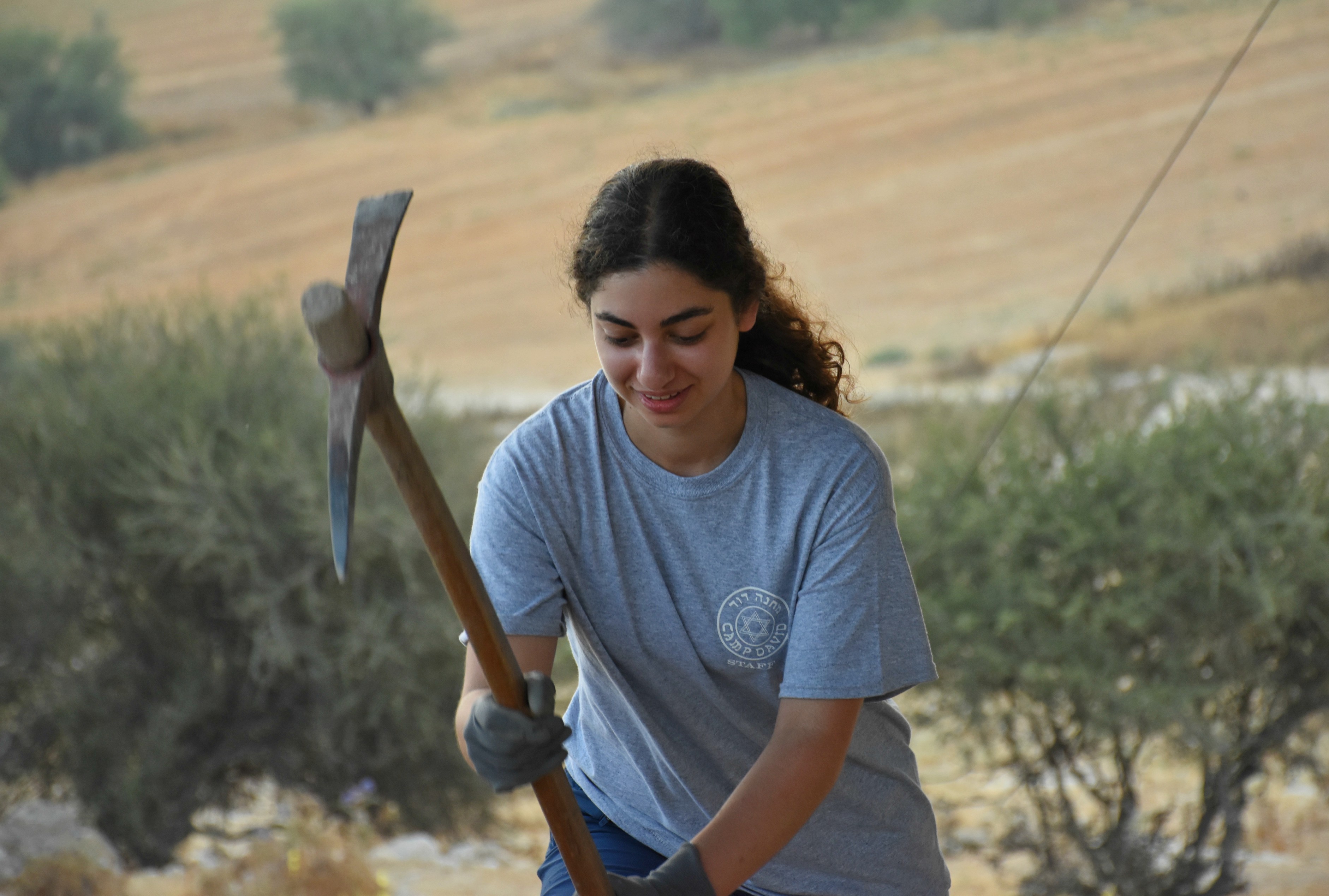
Rebecca with a pickaxe

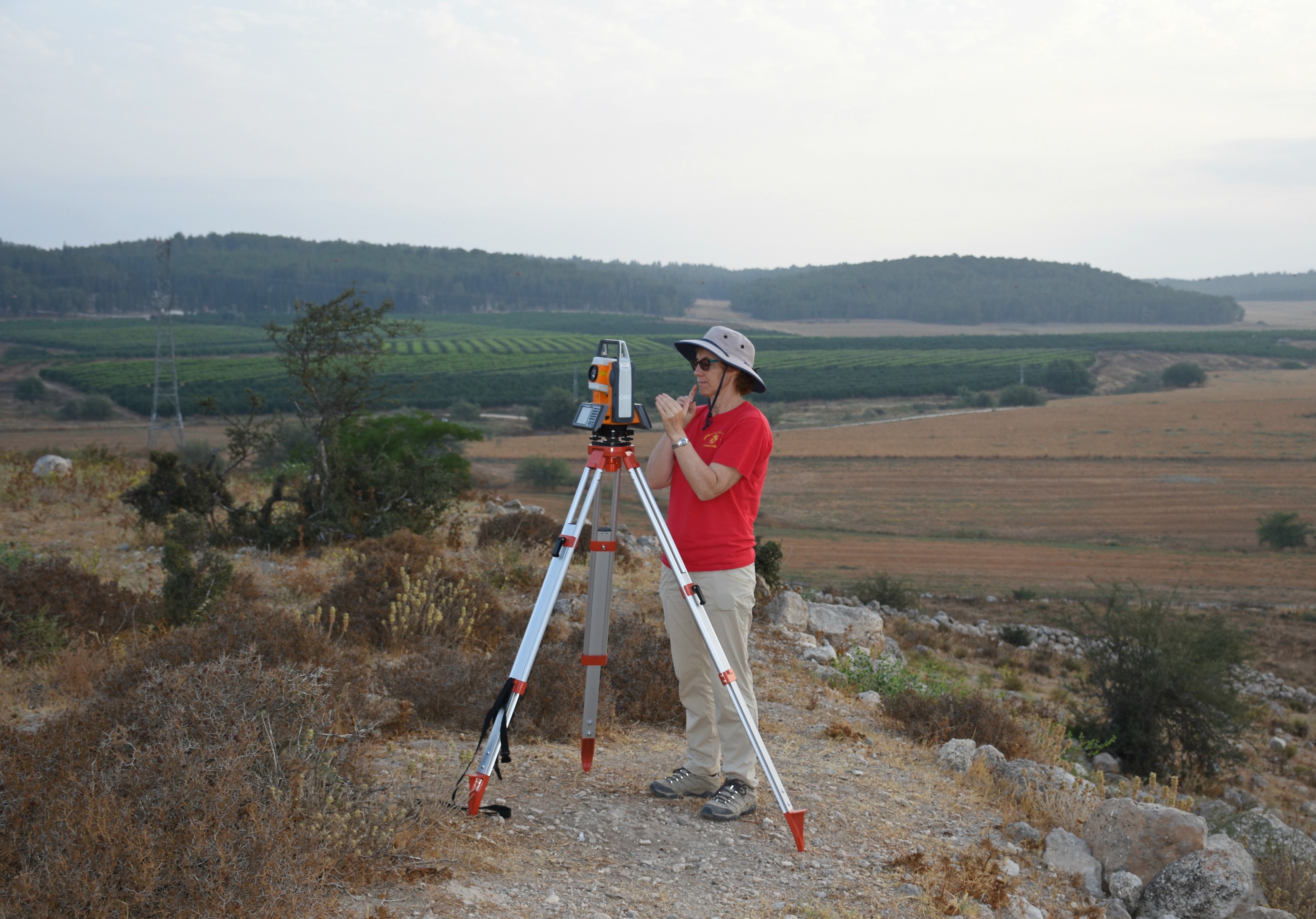
The morning began with Jill’s game plan briefing and, feeling updated, we got straight to work. From setting up the total station to read and register elevation points to clearing out the two squares, we started off on the right foot. Most days started exactly the same way, and we worked efficiently knowing what was expected as we progressed in the dig. The square that I supervised was named 100A and Itamar’s was 100C, side-by-side facing eastward.

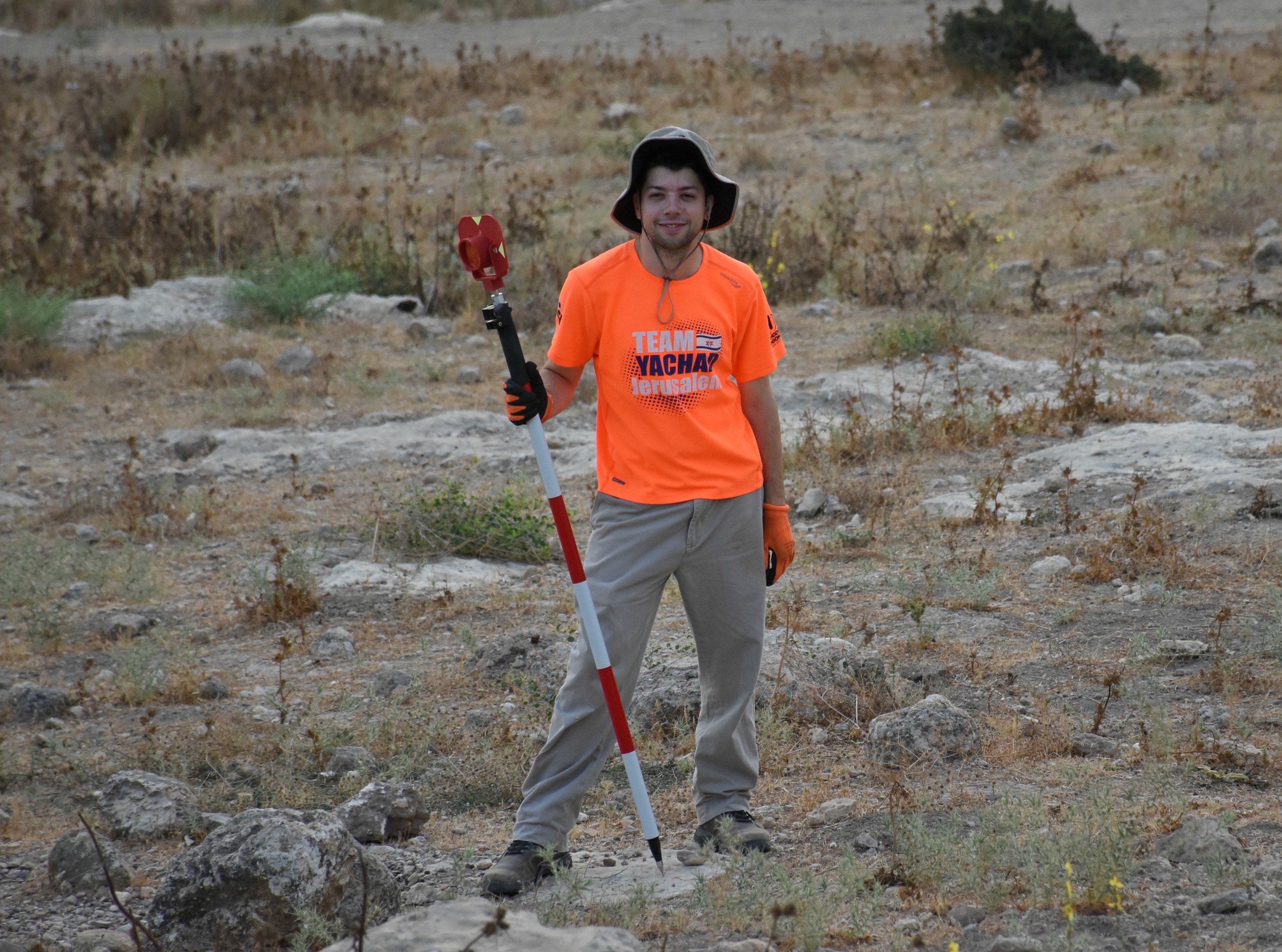
Moshe with the prism (photo Rebecca Zami)

One of the things that really excited me, especially during the first few days, was the incredible birding on the tel. I haven’t much experience exploring the Judean lowlands so I had the pleasure of getting to see some interesting birds (and reptiles) up close. I opened a note on my phone to keep track of the birds, and species that I’d never seen before, including European rollers, which have bright blue feathers, and the little owl which perched on the Bedouin fence below semi-regularly.

Photographing my first little owl

On a trip to the storage container some kilometres away I saw two more new birds: the great spotted cuckoo, which I tracked excitedly to a nearby tree to confirm identity, and a hobby, a small, dark type of falcon. Large flocks of jackdaws would fly overhead every morning and the large short-toed eagles would swing by every so often. In addition, there was a lone white-breasted kingfisher that made an appearance from time to time, and bunch of woodchat shrikes that would hunt from their perches on thorny bushes. Reptilian and amphibian sightings included a bold Schneider’s skink that lived near the breakfast shade, the dried up body of a blind worm snake and a green toad that a girl over at Area E found. All-in-all, rather exciting for a nature lover.

Short-toed eagle

The days came and went and, slowly but surely, we removed the topsoil of the upper sides of the squares, as we were working on a slope. Countless buckets were filled and poured into the trusty wheelbarrow, which, in turn, was dumped countless times over the small ridge just metres away. Every morning we delighted in watching the Bedouin feed his sheep and goats, and we learned to be wary of his attentive and protective dogs. We never failed to find amusement in listening to his donkey bray, the fun noise always ending so anti-climatically.

Itamar holding a piece of a Cypriot milk bowl (photo Suzanne Myburgh)

Within a few days, while working around a stubborn stump, we hit treasure – scorpions! When Aren swung by later that morning we told him that we found scorpions and, in response, he jokingly told us that we’d get a beer if we found twenty-five. Needless to say, we surpassed that goal and he came through with a six-pack of beer, which we enjoyed one evening at a special Area J “scorpion party”.

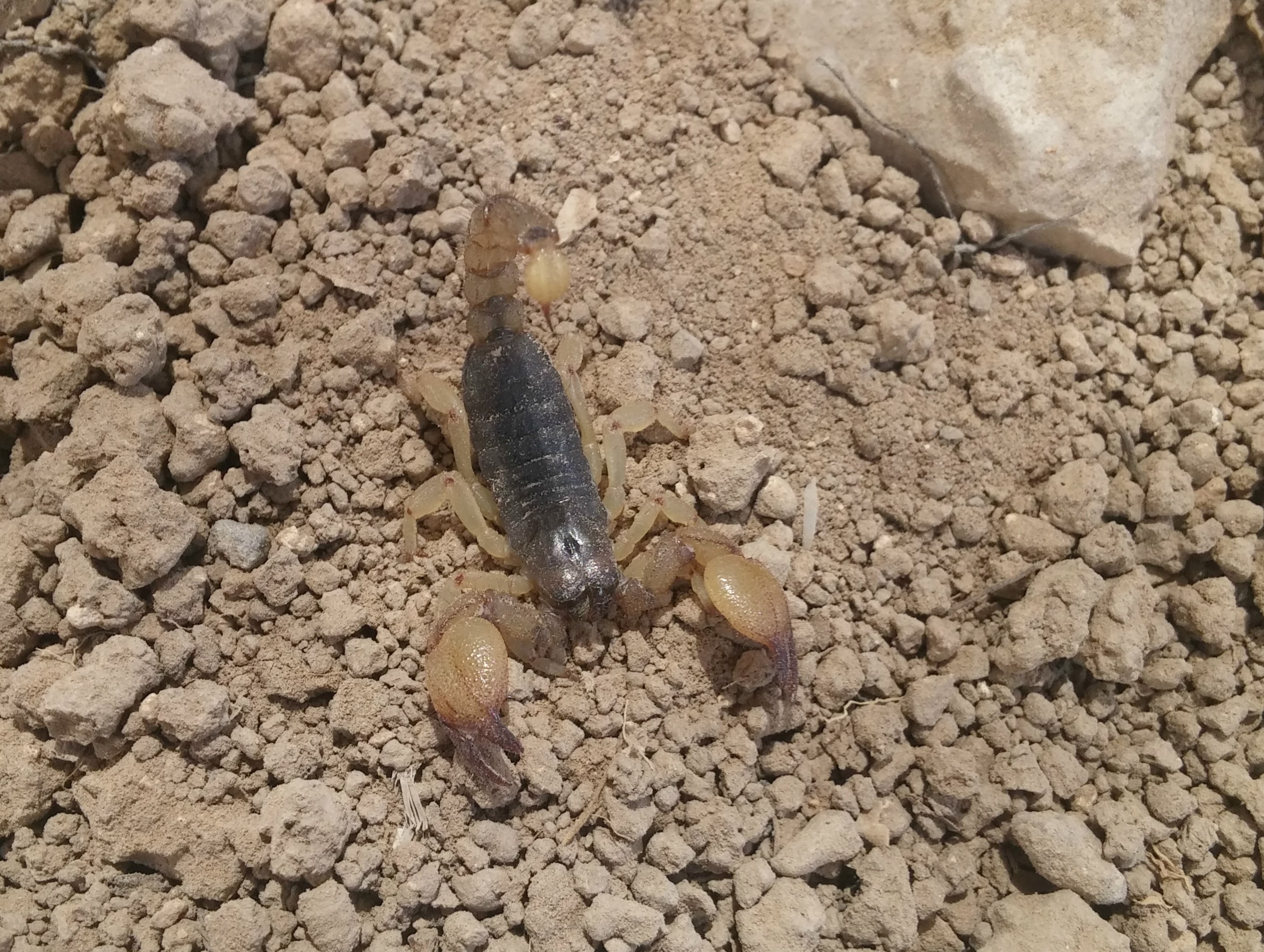
Israeli gold scorpion

The mornings were full of hard work and intense laughter; my square’s chemistry was truly astounding as we humoured ourselves senseless daily. At breakfast, taken just up the tel beside Area A, we’d take a break from the toil and hilarity as we’d feed on the offerings brought from Neve Shalom. Just to make things interesting, Prof Louise Hitchcock would call for breakfast to end with two quotes from The Ten Commandments, telling us “dogs” and “mud turtles” to get back to work. Not long after breakfast we’d have a fruit break, which usually consisted of watermelon and cantaloupe sliced up at Area E.

Suzanne hard at work (photo Jill Katz)

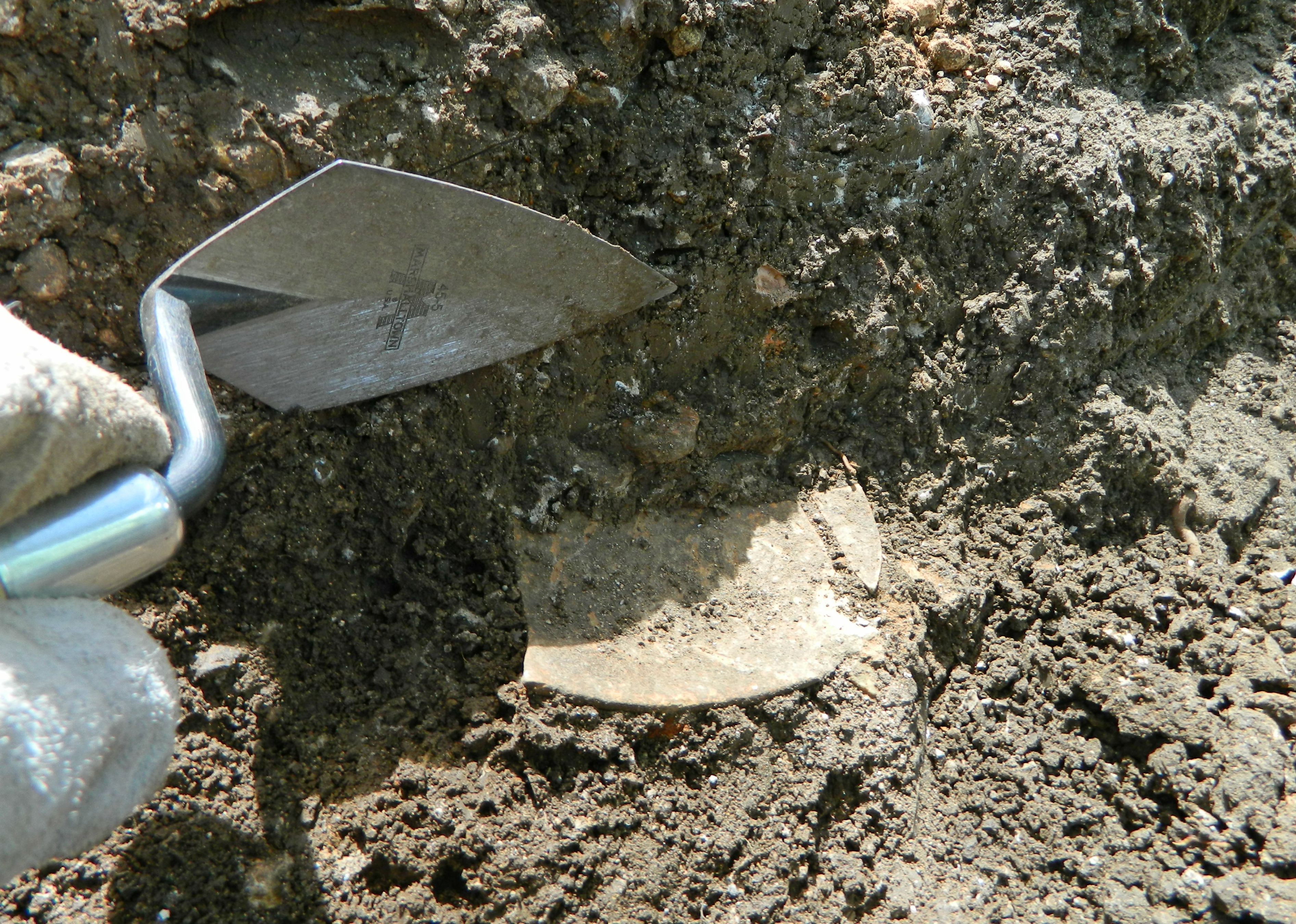
The end of the first week proved interesting as we went on a tour of the Stalactites Cave near Beit Shemesh (to be covered in a different blog post) and spent the night at Ramot Shapira in Beit Meir. The next morning, while scraping the dirt away to define the dirt shelf we had made to work our way down through the topsoil, I made an interesting discovery. My trowel struck metal and, working my way carefully around it, I realised that there was a vessel of sorts laying upright on its side. Because we were still not that far down, it was the general assumption that whatever we found was either modern or old but washed downhill and therefore out of context. So, assuming that it was modern, this largely-intact vessel was removed and examined. When Aren came over he examined the vessel and got visibly excited, telling us that it looks like an bronze bowl of Assyrian or Phoenician design from the Iron Age (3000 years old or so). It got even more exciting when we added that we found a metal disk of the same or similar material with a rosette motif the day before. After the fun in-field talk of ancient metal vessels, we carefully packaged the pieces as instructed and gave them over to Aren to take to a lab in Jerusalem later that day. I recently popped into the Tel es-Safi lab on campus to see if there’s any news on the bowl but, unfortunately, no word yet.

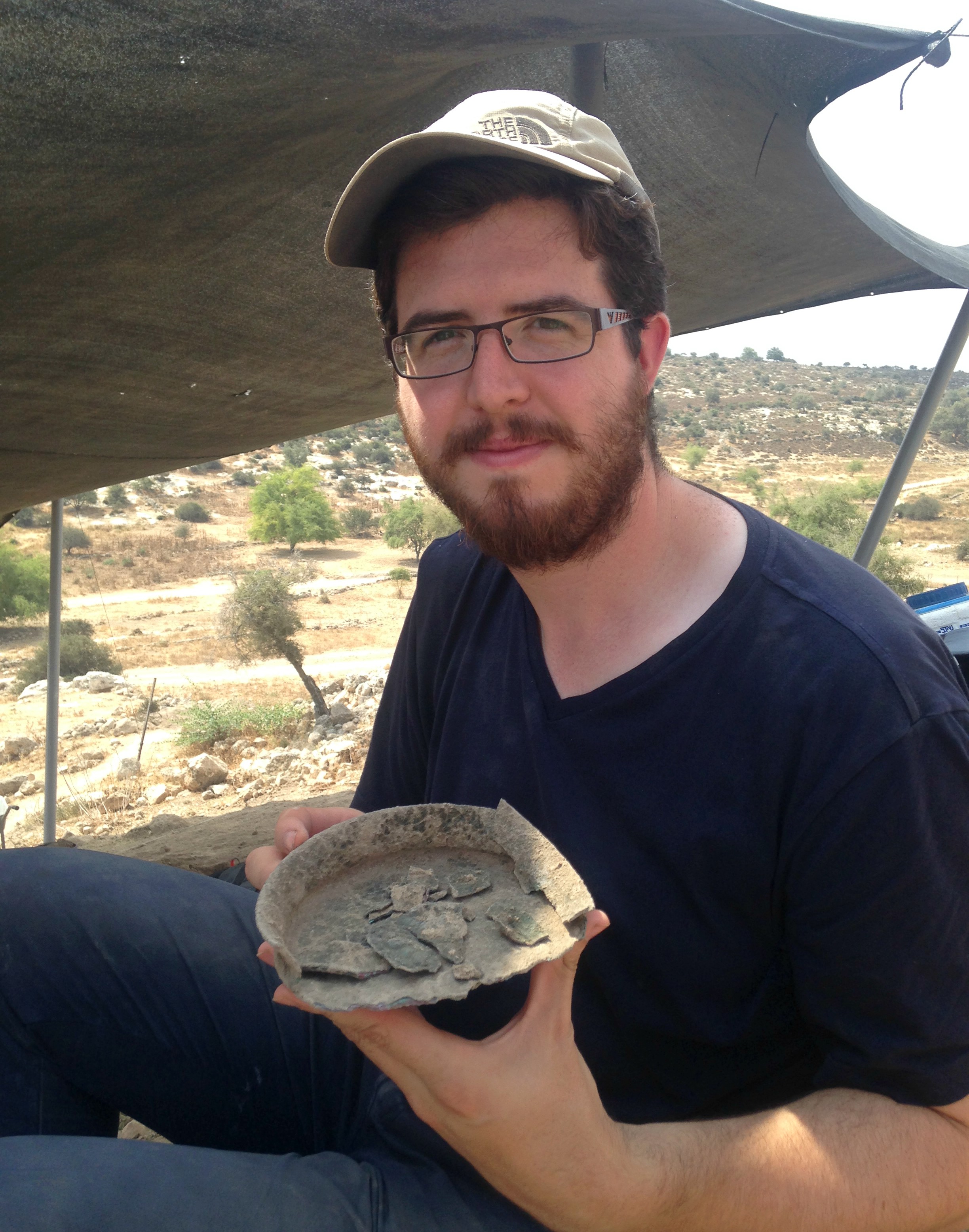
Posing with the bronze bowl (photo Aren Maeir)

With our first week ending on such a high, we were excited to return the next Sunday and be back on the tel early Monday morning. We were joined by a new member, Avraham from Brandeis University, a Safi veteran who was eager to be put to work. Continuing with our excavation, we had other swell finds such as a finger-shaped stone with a hole at the end, a metal pin of sorts and a ceramic spinning whorl. One thing that’s really cool about where we were digging is the huge amount of pottery, a lot of it interesting – with painted Philistine sherds all over, even on the surface. Due to the fact that we were excavating on a slope and had to clear away a huge amount of dirt, there was a lot of work that was pretty ho-hum, made exciting and fun by the incredible “J Crew” (as we sometimes called ourselves).

Meredith manning the sifter (photo Rebecca Zami)

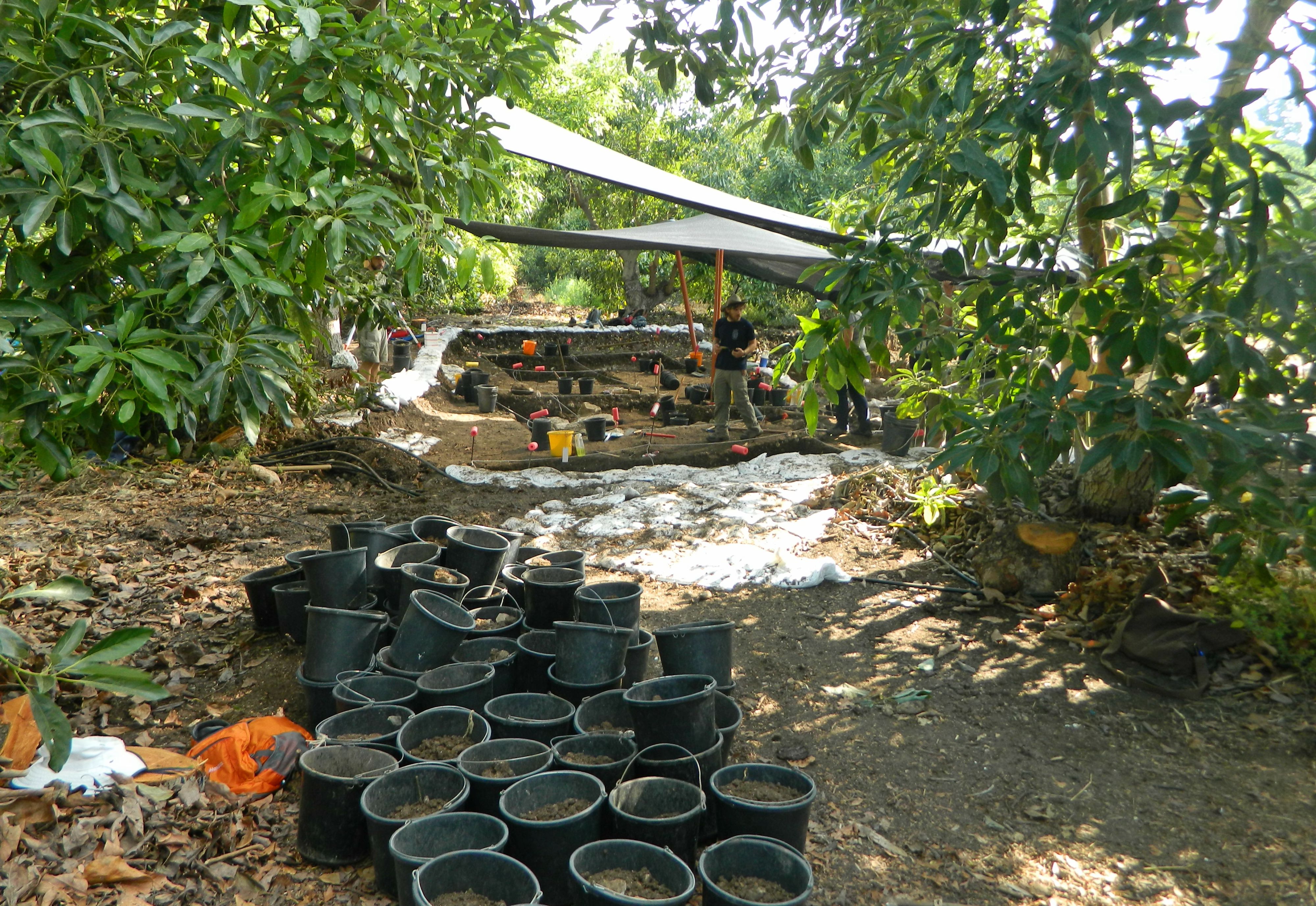
Life back at Neve Shalom usually comprised of us eating heartily, washing/reading/writing on potsherds, fraternising with the other dig members, doing the paperwork of the day’s events in-field, preparing the next day’s top plan and occasionally visiting the pool. There was also a fun activity called “heavy fractioning” which involves sitting in front of a tray of sediment and having to pick through it with tweezers to remove valuable bits such as bone, shell, organic material. During my turn at heaving fractioning, we found a cool miniscule fish jaw complete with teeth and what I believe was a tiny black bead, which I unfortunately lost when I squeezed my tweezers just a tad too much.

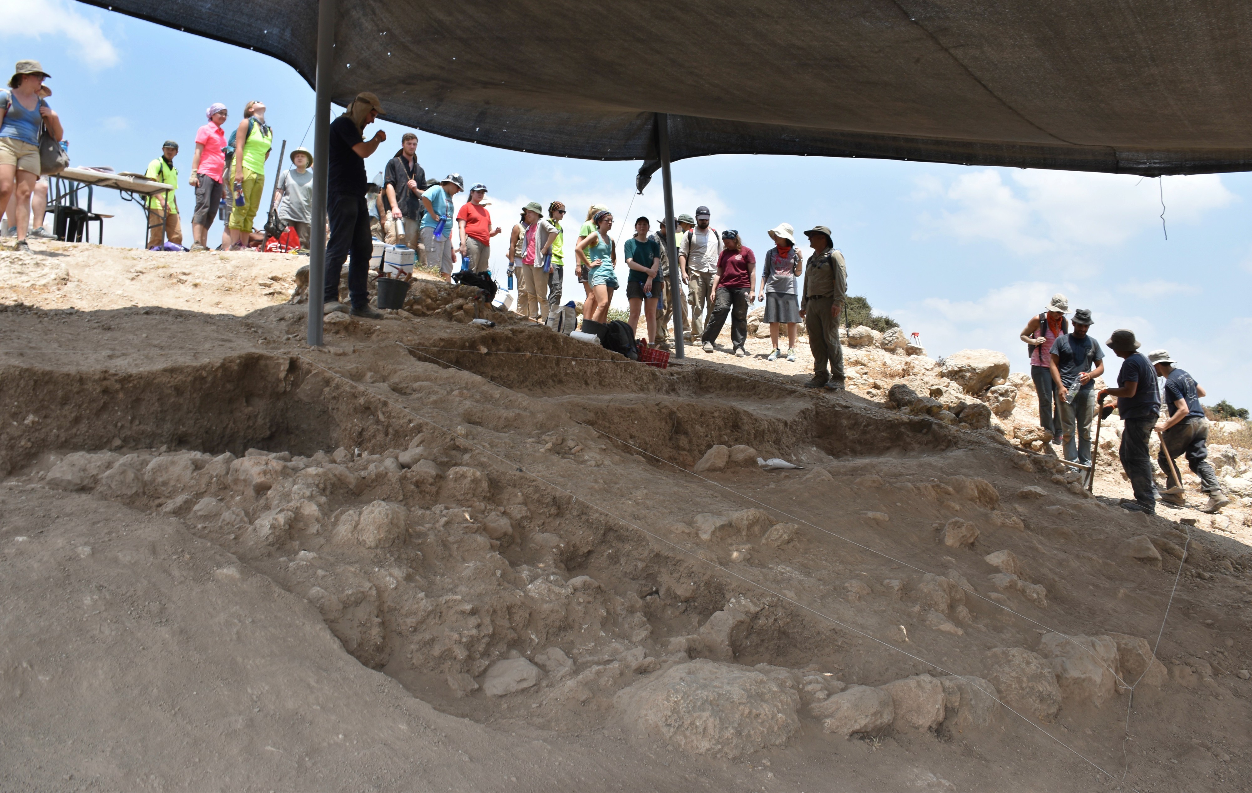
Weekly tel tour visitors (photo Rebecca Zami)

The rest of the second week went by quickly and, towards the end of it, we had a farewell party for Meredith and Suzanne who were leaving us. We gave them a parting gift of a discarded potsherd signed by the other “J Crew” members for them to take back to New York and South Africa, respectively. The dig was then halfway over with, but we had two new members coming for the third week and we were excited. To be continued…

Tel Kabri Archaeological Dig

In Galilee, Israel on August 20, 2017 at 7:12 AM

The Monday following my trip to the City of David I found myself back home in Ma’alot and excited for a day at the Tel Kabri Archaeological Dig. My own month-long dig at Tel es-Safi was to start the following week, classes were ending – the timing couldn’t be more perfect. Being that Tel Kabri is just a few minutes from the Mediterranean Sea along Road 89, it was just a few minutes away by car and, even with getting lost and confused, my brother Nissim and I arrived at the dig site unscathed and ready for adventure.

Tel Kabri Archaeological Dig (photo Griffin Aerial Imaging Ltd Skyview Photography Ltd.)

We were greeted by Prof Eric H Cline of George Washington University and other members of the staff and were then introduced to the site. First settled in prehistoric times, the city’s original name is still unknown and eventually became known as Rechov (perhaps one of two cities in the region with that name) under Canaanite rule. The Tel Kabri palace, which was recently discovered, dates to the Middle Bronze era and is the largest of its kind in Israel. Two things that are particularly interesting are the Minoan-style fresco fragments (which indicate cultural influence at such an early age) as well as the vast wine cellar that was found a few years ago. Fast-forward to the Roman era and the city became known as Kabrita which then became el-Kabira in the Early Arab period, names becoming naturally corrupted over time. El-Kabira morphed into al-Kabri, and, in 1949, an Israeli kibbutz by the name of Kabri was founded nearby.

Excavation underway

Today the Canaanite palace and surrounding ruins that have yet to be excavated are surrounded by an avocado plantation. To the northwest is Achziv and Rosh HaNikra and to the southwest is the magnificent port city of Akko and Haifa, all fascinating sites. Finished with our little tour of the dig area, we were introduced to Jim, our to-be square supervisor. He provided us with the necessary tools to work – pickaxes, hoes and trowels – and we settled in the far northwestern corner of the dig site which is named Area D-west Square 1.

Nissim digging away

Our task was a simple one that day, to deepen the square so that it was as deep as the adjacent one. In archaeology it’s important to work on a level plane, so that everything is potentially uncovered at the same time instead of random pits here and there. Due to the fact that the dig site is located in an avocado plantation, the ground is damp from the irrigation and the digging was more or less pleasant.

Scraping away at the baulk for the potsherd

We found small amounts of pottery which went into the specially-marked pottery bucket, as well as a bone fragment, which was placed in Jim’s “schwarma bag” – a cute name for the small paper bags obtained at Israeli street food joints. The bag was properly labeled and in went the bone. Similar procedures were taken to secure flint and shell fragments found in the dirt.

Bag o’ bones

Apparently, on the very first day of the season, an Ottoman coin was found in an adjacent square but unfortunately we found no coins that day. Our square partners, McKay, MJ and Russell, helped pass the time making the labour fun with interesting discussions and funny jokes. The general atmosphere at the dig was very jovial and humourous despite the humid heat, with trance music playing in the background for our enjoyment. Then, when least expected, the call for the bucket brigade would sound out and diggers would form lines outside the dig area bringing full buckets with them. When the buckets of dirt to be discarded became overwhelmingly numerous it was deemed that having a unified effort to dispose of them would be best for morale and efficiency. Thus, the bucket brigade would form and full buckets of dirt would be thrown down the assembly line of diggers until it reached the large dirt hill where the dirt was dispensed.

Awaiting the bucket brigade

Breakfast came and went, as did the fruit break and a surprising moment when staff members appeared out of the trees armed with waterguns and sprayed the sweaty dig crew to liven them up. I was left unsprayed, but my own sweat kept me lively enough. I made contact with the small group of Israelis, led by Dr. Assaf Yasur-Landau of Haifa University, and spoke to them for a bit about matters of academia and archaeology. Other dig members proved to be interesting as well, and the time flew by. It wasn’t long before the dig day was coming to an end and we cleared away all the tools.

Nissim within the square

While we hadn’t found anything too exciting that day, we succeeded in taking the square’s height down a wee bit which would be of help in the following days. We packed up our bags and bid farewell to Eric, Assaf, Matt (our area supervisor), Jim and the others, driving back out of the avocado plantation.

Avocado

The sun was still high in the sky and I still had energy for more adventure so we turned into a small collection of interesting sites just across Road 70. Parking the car under some eucalyptus trees, we got out into the heat and made our way to the ruins of an old flour mill, powered by water channeled in via a small aqueduct which is still preserved.

Old flour mill

We then walked along the aqueduct until we reached the old local Muslim cemetery where painted vehicle hulls are displayed. In 1948, during the War of Independence, the members of Kibbutz Yehiam were holed up and surrounded by Arab forces, in desperate need of support. Supplies and reinforcements were scheduled to be driven in from the Haifa area – yet disaster loomed. Arab forces were waiting in ambush at this cemetery and opened fire on the incoming convoy, effectively stopping it and killing forty-seven Haganah members. We examined the vehicles, even entering one, and then returned to our car to drive back home. Nissim ended up returning to the dig for the remainder of the season, having the time of his life, but I headed back to Givat Shmuel and then to my own university’s excavation, the Tel es-Safi Archaeological Dig. Additional information about the dig and participation options can be found on the Tel Kabri website, found HERE.

University Trip: City of David

In Israel, Jerusalem on August 13, 2017 at 7:29 AM

The day following our Bar Ilan University academic tour to “Moshavot” of the Galilee took us on another tour, this time of the famous City of David in Jerusalem – where we all had to meet at the given time. But, my morning was wrought with strange inconveniences, for when I disembarked at Jerusalem’s Central Bus Station and attempted to then board the light rail, I discovered that my RavKav public transportation pass had disappeared – stolen or dropped. It was an hour or so after the prearranged start time for the tour when I was issued a new RavKav and so I made my way to the City of David in hopes of salvaging what I could of the tour. Located just outside the Old City’s walls on the southern side, I elected to walk through the Old City – a pleasant walk. Making my way through the Armenian Quarter, I then passed the small and obscure archaeological park called Gan HaTekuma and I exited the Old City via the Dung Gate next to the Kotel (Western Wall). Turning east, I laid eyes upon the Givati Parking Lot Excavation site for the first time and then continued to the City of David.

Givati Parking Lot excavations

Entering the national park for the first time since 2008, I passed myriads of tourists and approached the ticket counter to explain my predicament that I was part of a group which had already entered. Believing my story, I was given a stamped ticket and allowed into the park – but it took a few minutes of confused wandering before I located my group in the excavation area of the “Large Stone Structure” (suggested to be King David’s palace) beneath the floor of park’s entrance area. I caught myself up as best as I could perusing the signs concerning the important finds uncovered thus far after which I focused my attention on our guide for the day, Dr Eyal Meiron, an expert on the City of David. We briefly inspected the Royal Quarter (Area G), a complex dating to the First Temple period, and then made our way to a nice lookout spot where we stood/sat beneath a sun umbrella to learn more about the city. The city is built on a mountain ridge in a mountainous area with the Arab village of Silwan on the adjacent ridge and the Mount of Olives slightly further away to the northeast.

Lookout towards Silwan and the Mount of Olives

To give a brief summary of the City of David, the excavated region was the original city of Jerusalem before it slowly expanded outward, from the revolutionary expansions of King Hezekiah in the 7th century BCE to its famous city walls of today, built in the mid 1500s by the Ottomans. It is believed that the first walled city was built during the Middle Bronze age, and then passed ownership a few times until King David conquered it in the Iron Age, approximately 3,000 years ago. King Solomon, the son of David, expanded the city and built the First Temple where the Dome of the Rock now stands. A couple hundred years later, after the Jewish kingdoms split, the Assyrians attempted to conquer ancient Jerusalem but failed. The Babylonians, however, succeeded and razed the city to the ground, destroying the Temple as well. In the Hasmonean and Roman times the city experienced a rebirth of sorts, until it was once again destroyed (along with the Second Temple) by the Romans in response to the Great Revolt. Eventually the city limits changed and the City of David, which found itself outside of Jerusalem, was largely forgotten about. Excavations in the late 1800s revealed the forgotten city and since then the City of David has been one of the most important archaeological sites in Israel.

Ottoman wall of the Old City

We left our lookout area to go underground to the Warren’s Shaft System, a carven well in the rock which was believed to be used to draw water from the Gihon Spring. An important part of every city, fresh water was readily available to the inhabitants of the City of David gushing from the Gihon Spring, yet due to its low setting the defensive walls were built excluding the spring. The issue of providing water under times of siege during the Canaanite times was answered first by the Warren’s Shaft System and later by a tunnel and fortified pool which jutted out from the city walls. While we were stopped at the top of the shaft it was curious to note how many of the passing tour guides both knew and admired our guide, who had apparently educated many of them in matters concerning the site.

Dr Eyal Meiron pointing beside the shaft

Continuing along underground along the Secret Tunnel, we reached a large open area which housed the remains of the Canaanite Pool and surrounding fortifications. Walking on metal walkways with the occasional glass panel to view the ruins below, we skirted the excavated area and marveled at the size. Unfortunately, due to the cramped angles and low lighting, none of the photographs that I took properly document the sights that I saw underground. I thus turned to Eyal who has been so kind as to share this illustration of how he imagines the pool and fortifications to have looked during the Canaanite era.

Canaanite pool fortifications (reconstruction: Eyal Meiron, illustration: Leonardo Gurevich)

Emerging into the sunlight for a few brief moments, we quickly headed for the Canaanite Tunnel – one of two parallel passages that cut through the karst bedrock from the Gihon Spring underground to the Shiloah (Siloam) Pool at the far southern end of the City of David. The famous Shiloah (Siloam) Inscription that was found in 1880 towards the end of the other passage, the Hezekiah Tunnel, has been kept in Turkey’s Istanbul Museum after being cut out of the rock wall despite Israel’s repeated requests for its returned ownership. The three-dimensional aspect of our tour makes it somewhat complicated to explain but in essence we were more-or-less heading south and down in elevation from the beginning of the tour till the end. Within the 115 metre long Canaanite Tunnel, we encountered tight squeezes and small amounts of flooding – which I later found out was sewage water!

Within the Canaanite Tunnel

Being as that we chose the shorter, “dry” route through the bedrock, we emerged once again into the blessed sunlight and found ourselves looking at the original walls of Jerusalem – a truly ancient construction.

Walls of ancient Jerusalem

The tour officially ended there but some of us carried on along the cobbled road towards the Shiloah Pool, passing several sites of interest along the way including the Amanah House and the Meyuhas House – some of the first modern Jewish houses outside the Ottoman walls of Jerusalem. Before long we reached the Shiloah Pool and waited there for the shuttle to take us back up to the Old City wall.

The Shiloach (Siloam) Pool

Deposited at the Dung Gate, I thanked my Arab driver and entered the Old City, making my way back along the same road toward the Jaffa Gate. Seeing the Tower of David, and feeling inspired to finally visit this long-overdue site, I quickly learned that I had come too late. Angling for just a little bit more adventure, I contemplated visiting the area where the Hospitaller Knights of Crusades were headquartered but decided against it due to the fact that it was the end of Ramadan and prayers had just let out – I didn’t want to venture off alone through the crowds.

Harpist in Jaffa Gate

Leaving the Old City, I settled with taking a quick visit to a Jerusalem beer and beer supply store where I enjoyed a cold glass of Lindemans Cassis Lambic, a naturally fermented Belgian beer flavoured with blackcurrants – quite tasty and quite refreshing! A short ride on the light rail and I was back on a bus to Givat Shmuel, ending yet another successful adventure.

University Trip: “Moshavot” of the Galilee

In Galilee, Israel on August 6, 2017 at 7:40 AM

The week after visiting Tel Aroma & Mount Gerizim in the Shomron I participated in another academic tour offered by Bar Ilan University’s Archaeology department. This time we were traveling to the north of Israel with Dr Einat HaLevi Attia to examine early “Moshavot” of the Galilee, settlements established in the late 1800s and early 1900s by the first waves of immigrants to the Holy Land. We boarded a tour minibus at the university and made our way to the first site of the day, Kibbutz Merchavia, after a short rest stop in neighbouring Afula.

Merchavia

We sat outside the “Great Courtyard” and learned about Merchavia’s founding in 1911 and their distinct organisational style as being a “co-operative”. Interestingly enough, they created the first dairy in modern-day Israel. Our subsequent tour of the courtyard’s buildings included the “Big House”, the “Produce Granary”, the Haganah Radio Station and later Israeli prime minister Golda Meir’s house. Getting back into the minibus, we then took a very short drive to the edge of the moshav version of Merchavia where admired a large manor built during those formative years and nicknamed the “Castle of the Jezreel Valley” due to its size and position overlooking the valley. Returning to our trusty minibus, we then drove over to where the agricultural establishment of Sejara once stood, founded in 1900. Today the remains are within a military base by the name of Chavat HaShomer (which I visited once several years ago but didn’t see the ruins).

Rose-ringed parakeet inspecting me from above

So, we stayed outside under a large tree and learned about the site before walking over to see Ilaniya, the successor of the Sejara settlement. There we were afforded up-close and plentiful views of the still-existent site – a settlement of one main street lined with agriculturally involved houses. I distracted myself trying to photograph singing goldfinches, but with limited success. Walking to a rooftop lookout, we passed farming equipment on display and then admired a large wall that was originally made with white chalk and then added to with blocks of dark grey basalt. From Ilaniya we got back into the minibus and drove to see a handful of ruined basalt buildings in Poriya, established in 1912.

Basalt ruins of Poriya

From there we took a short break at a strip mall where I purchased a bottle of semi-sweet hard cider for Shabbat and then on to the next site on our list: the Kinneret Courtyard just south of the ruins of Bet Yerach. A rectangular collection of well-kept basalt buildings, the courtyard was founded in 1908 as a defensible frontier close to the Sea of Galilee. We were greeted by our local guide, Asaf, who gave us a hurried yet sincere overview on the early history of the settlement and the difficulties that encumbered the settlers in those times. Inside the exhibits room of the courtyard, located within the old khan (roadside inn), we inspected items that belonged to that era, as well as signs depicting the important figures who played roles in the sites formation.

Kinneret Courtyard

Taking leave of the courtyard, with some noisy kestrels passing overhead, we got back into the minibus to be taken to Degania, which I had already visited in 2012. We met up with our next local guide, witty Moshe, who took us on an interesting tour, including the following site which I had not known about beforehand. Driving alongside the agricultural date groves at the edge of the kibbutz, we reached the place where the first building was constructed in 1909 – at a place once known as Umm Juni. This structure was featured in the famous photo of the settlement members in mostly Arab garb posing that can be seen HERE.

Original structure of Degania

Beyond the structure is a wildly windy lookout overlooking fields and the dry wilderness beyond. Directly below the gentle Jordan River flows, nimble swallows (both barn and red-rumped) darting back and forth in the hot air overhead. I stalked a bird along the basalt rocks only to discover that it was a crested lark, nothing to get too excited over.

Picturesque view from Umm Juni

From there we went to the regular part of Degania, where the courtyard (a common theme this trip) beckons, with its basalt stone structures. Overhead we got glimpses of cormorants flying to and from the Kinneret’s banks, and the occasional goldfinch snacking in a pine tree. We entered the small museum just outside the courtyard’s domain and examined the collection of photographs taken over the years, including a particularly interesting aerial shot with the shadow of the German airplane that took it. I signed the guestbook, plugging my blog shamelessly, and we bid farewell to both Degania and our guide Moshe.

Cemetery beside the Kinneret

We had one last place to visit – a cemetery overlooking the peaceful blue Kinneret. Having discussed so much of the early years, it was time, at last, to see what has become of the valiant members of such noble efforts. We were there to pay our respects, and to have one or two last things to reflect upon before we returned to the urban sprawl of the centre of the country. Leaving the cemetery, we ritually washed our hands and boarded the minibus for the long drive back, another interesting trip under our belts.