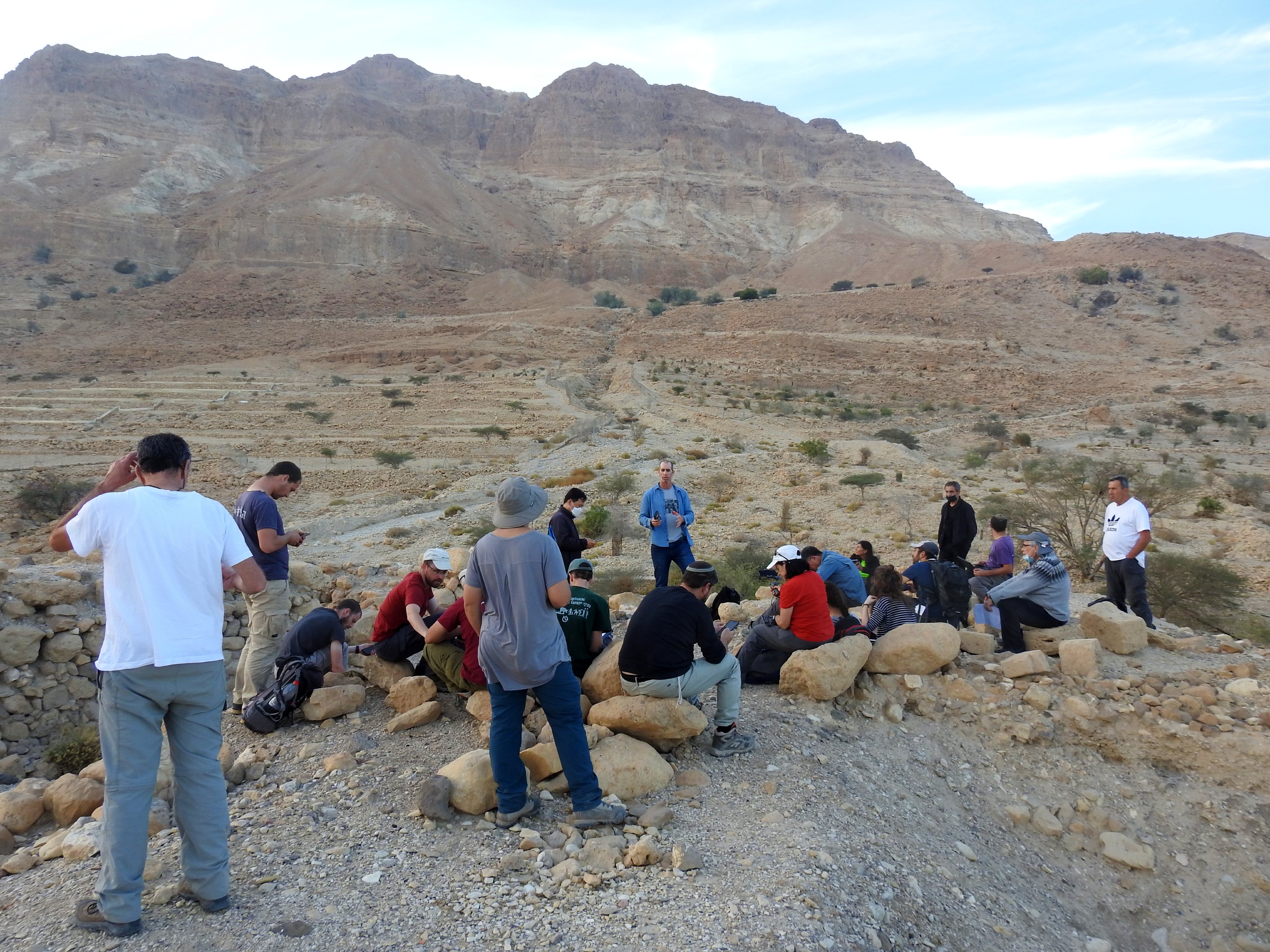
Continuing with the three-part series of field trips to the Judean Desert in January, this expedition focused on sites in the central desert region. Our tour bus departed from the BIU campus in the morning and we enjoyed a long drive through the misty countryside and bustling urban areas until we reached the Dead Sea. Our first site of the day was Khirbet Mazin, a fortified anchorage on the coast, one of eight anchorages that lined the Dead Sea in antiquity. It was a hot winter day, surprisingly enough, but we settled down on an elevated ridge above the ruins to hear from our guide, Dr Dvir Raviv.

Our first stop of the day
The site of Khirbet Mazin (also known as Qasr al-Yehud, yet not to be compared to the baptismal site on the Jordan as seen HERE) originally dated back to the Iron Age, and was rebuilt during the Hasmonean and Roman periods. Due to the difficulty of transporting people and cargo by land in the craggy Dead Sea area, passage was easier over the salty waters. A system of anchorages was developed, with Khirbet Mazin being one of the more important ones. By the Hasmonean and Roman periods, the independent anchorage structure was grand and likely served as the official local shipyard. With the water levels fluctuating over the past millennia, the site was temporarily covered over with sand and gravel, only to be re-exposed and excavated in the 1960s and 1970s.
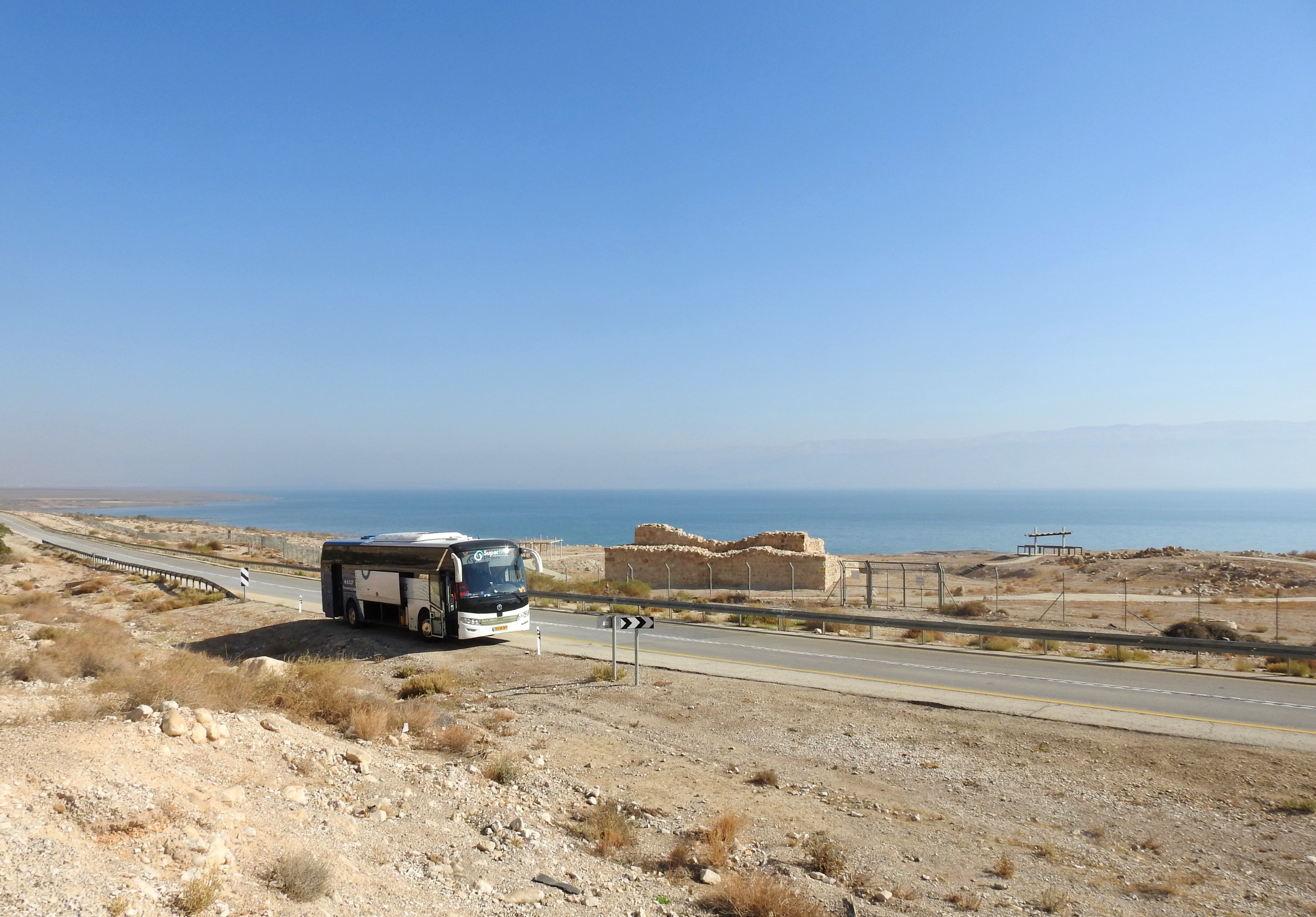
Khirbet Mazin (and our bus) at the Dead Sea
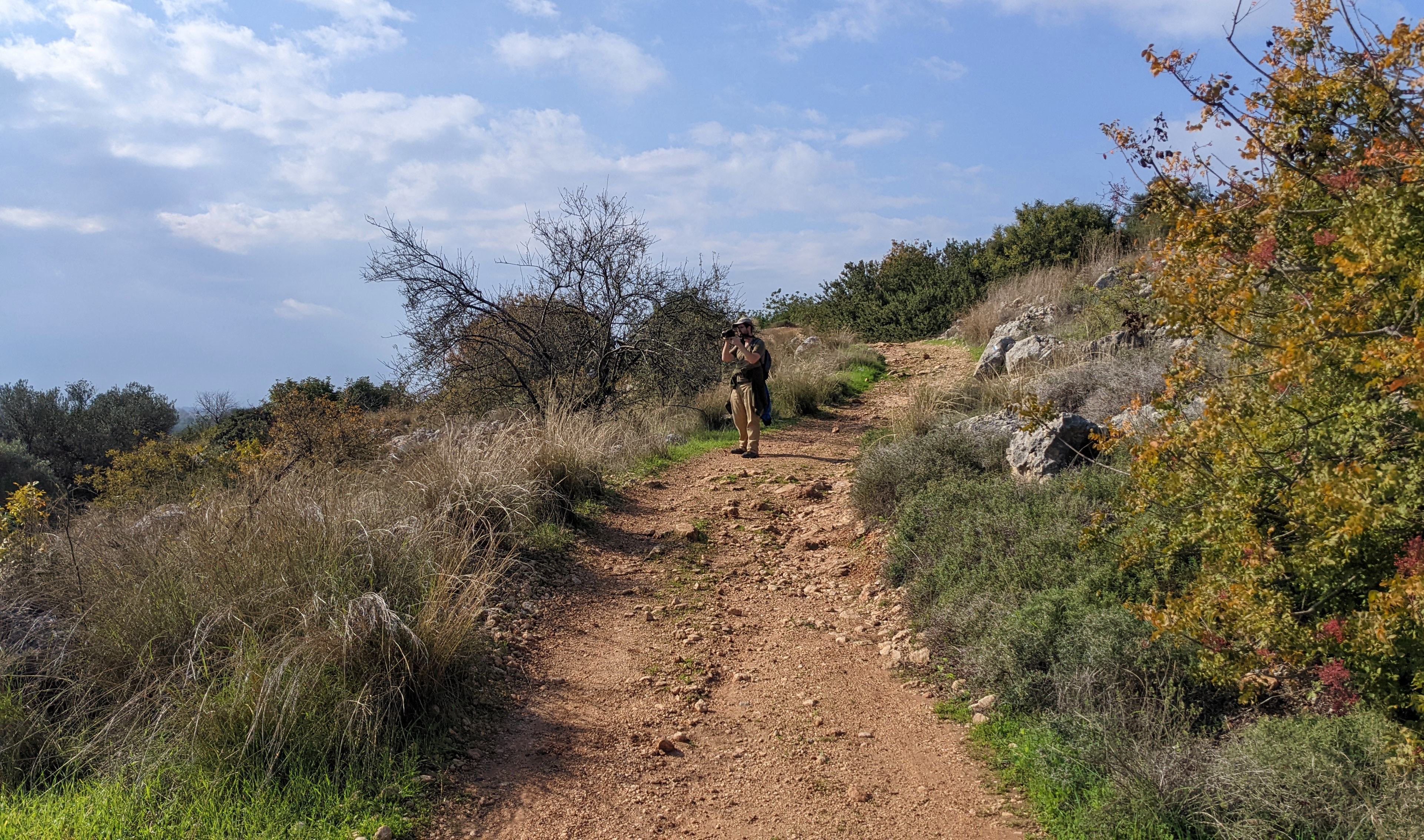
We finished our visit there, said goodbye to the Arabian green bee-eaters flying around us and got back on the bus. From there we continued down the Dead Sea coast, along the high cliffs of the Dead Sea Fault Escarpment, until we reached the road to the Dragot Cliffs and began the snaking ascent. Our loyal bus driver drove us as far as he possibly could on the rocky road, yielding only when one of his tires was no longer touching terra firma. We dutifully disembarked at that point and began hiking in the direction of Wadi Murabba’at.

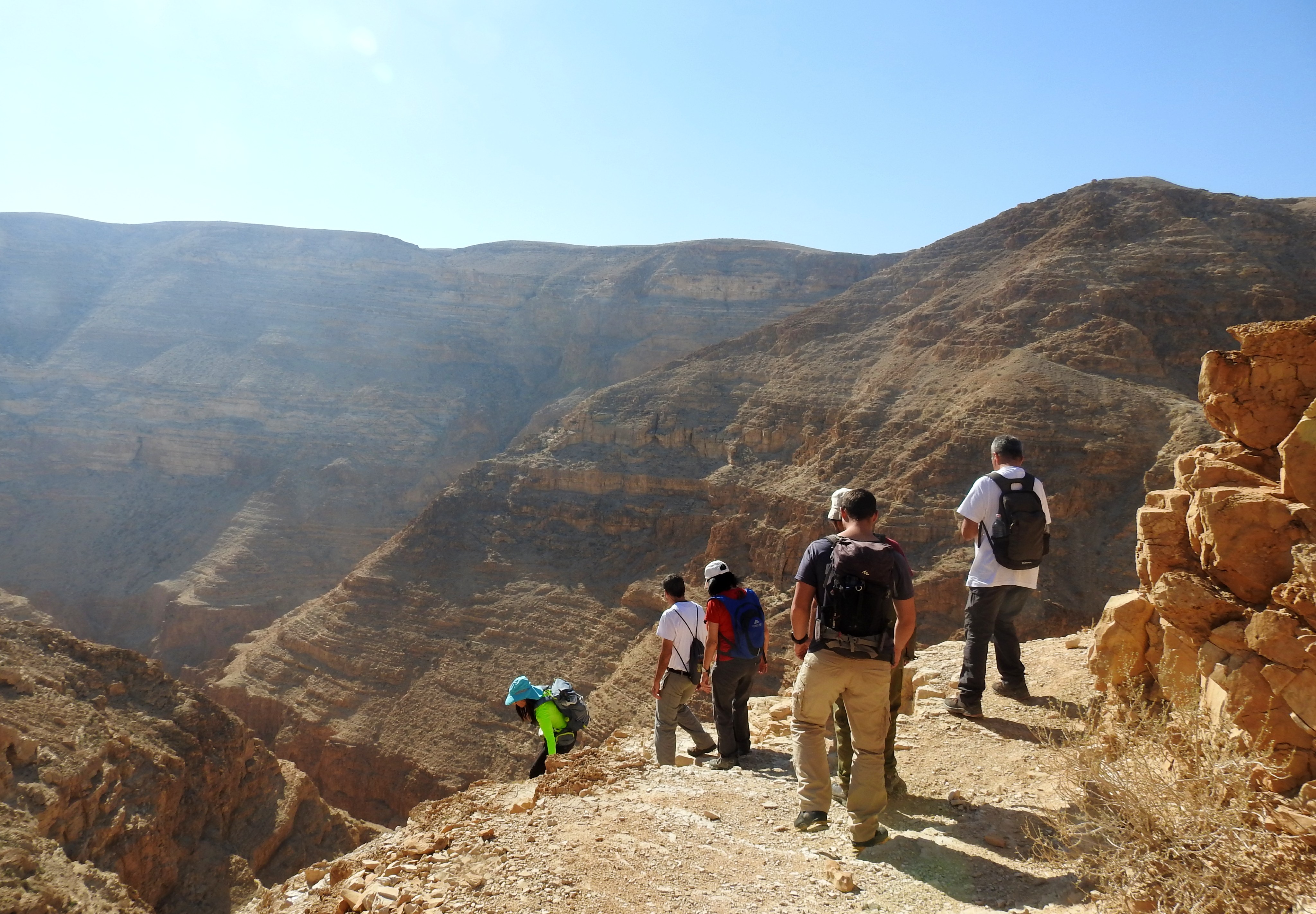
Hiking to Wadi Murabba’at
Interestingly enough, the weather was cooler up atop the fault escarpment, and the hiking was pleasing as we traversed the hilly land. We turned off the main trail in the direction of the wadi, and began the slow descent to the cliff edge. I was amazed at the raw beauty of the place, surrounded by pleasantly gentle hilltops to the north and craggy cliffs to the south. As we stood overlooking the next leg of our hike, I spotted a small herd of Nubian ibexes nestled in the cliffside as they took shelter from the sun.

Watching me watching you with a Nubian ibex
As we walked down, I saw a few more fun creatures including sand partridges, a streaked scrub warbler, some white-crowned wheatears and a small-spotted lizard. Yet, when we reached the cliff descent, I had to focus on my personal safety and less on the winged wonders around me. The hike down was glorious, each step leading to an even more exciting view of the gorge below us.
Descending into Wadi Murabba’at
We climbed further down, at times aided by metal safety bars as we navigated our way to a ledge overlooking the wadi. The ledge offered relatively easy hiking, yet one false move and we’d be tumbling some twenty-five metres down into the unwelcoming arms of Wadi Murabba’at. Then we reached a sign that pointed to the caves above us, and the trail became apparent.

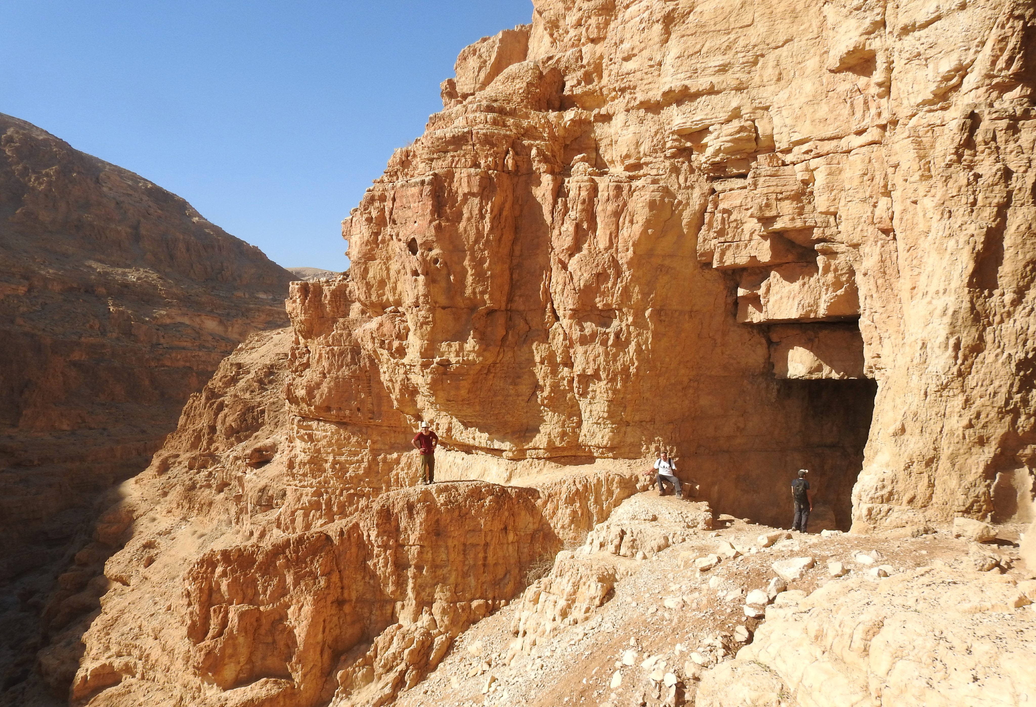
Hiking along the ledge to the caves
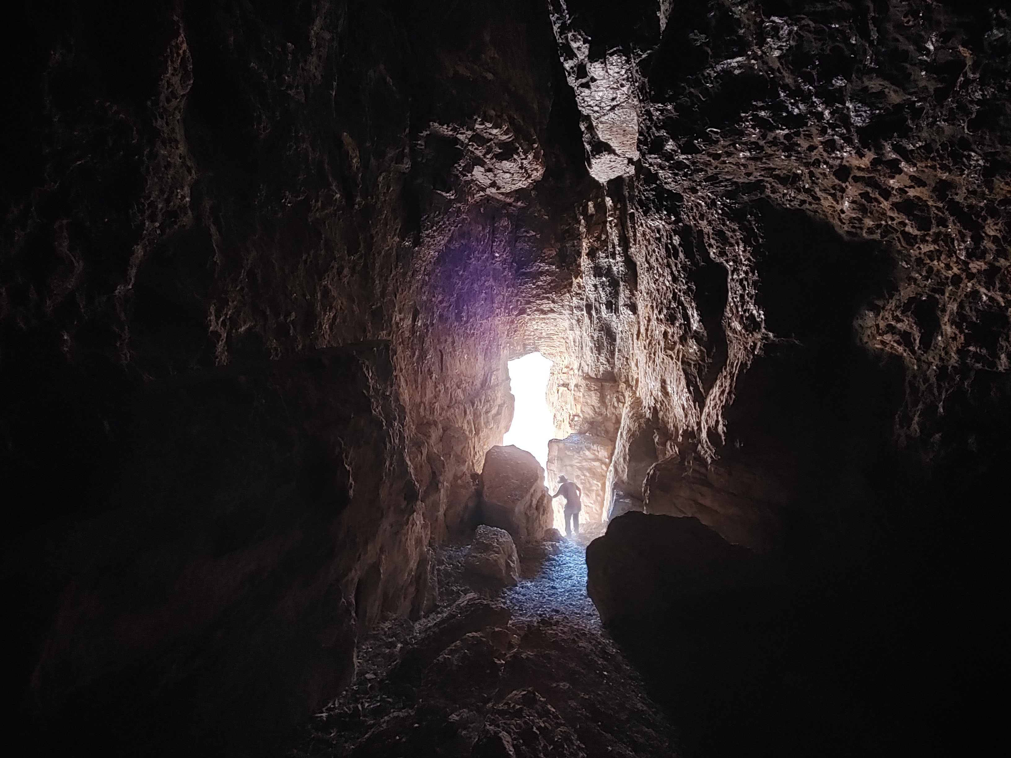
Little metal handles (or footholds) were embedded in the cliffside for us to use to reach a higher ledge. Climbly deftly, we reached the upper ledge and saw the mouths of two caves before us, cleverly named Murabba’at Cave 1 and 2. These caves hold particular interest to me in my research, and so visiting them was rather exciting. We began with Cave 2, and settled inside the spacious interior that was littered by giant slabs and blocks of fallen stone.

Climbing up to the right ledge
Situated comfortably, we then learned the importance of the cave from an archaeological perspective, after the site was explored starting in the early 1950s. Similar to the more famous caves of Qumran, over a hundred manuscripts were found, most of them dating to the Roman period. Jewish rebels, hiding from the Roman army during the rebellion, found shelter in the remote caves of Wadi Murabba’at. It was from one of these ancient manuscripts that we in modernity learned the first name of Bar Kokhba, the daring rebel leader during the eponymous Bar Kokhba Rebellion.
Outside the Wadi Murabba’at caves
A letter was written from Shimon Bar Kokhba to the rebel leader of Herodium and, once received, it was then brought to the cave – likely when the Jewish rebels fled the burning Herodium. However, it wasn’t just this letter that proved fascinating. Of the decipherable manuscripts, some turned out to be biblical and other religious texts, and others were important life documents such as marriage and divorce papers (see HERE).
Peering into the depths of Cave 2
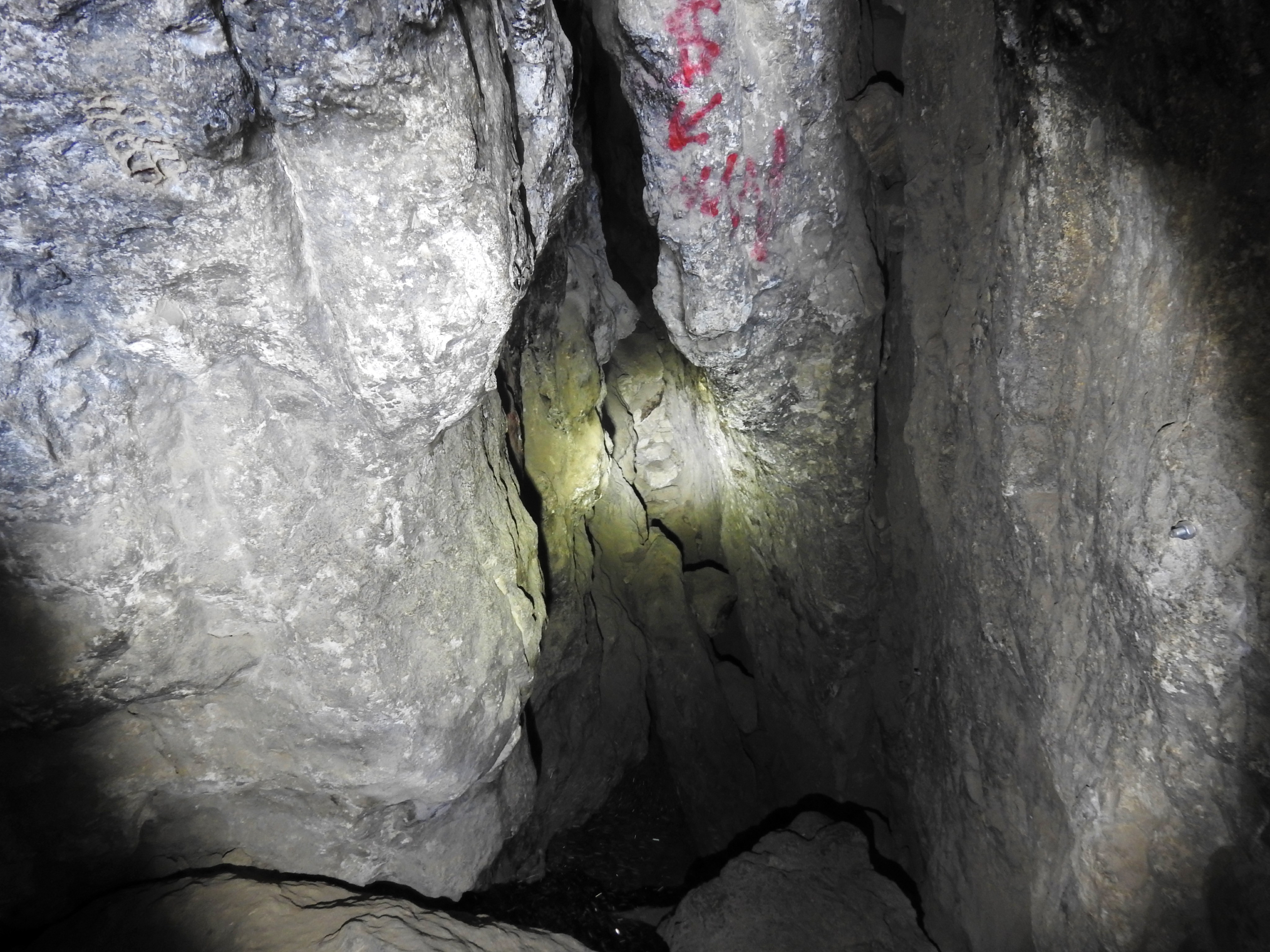
Remains from the more recent medieval period were even more interesting to me, and I was delighted when we slipped down into the dark recesses of the cave. Aided with my phone’s flashlight, as well as light sources provided by other intrepid explorers, we crawled and slithered through the cave’s narrow passageways, encountering potsherds, bones and even a squeaking lesser mouse-tailed bat.

A lesser mouse-tailed bat within the cave
Even though the cave hasn’t been excavated for some time, I found it interesting that most of the cumbersome tools and accoutrements such as buckets and sifters had been simply stowed away in dark corners within the cave.

Exploring the cave chambers
When I had reached one of the deepest passages I decided that pressing further would just be too messy, and with my camera lens suffering from the kicked-up dust, I began my slow exit. The climb out was a mite precarious, so I had to hand my camera off to safely make the ascent without harming body or gear.

Making our way out of the cave
Leaving Cave 2, I realised that I still had the neighbouring Cave 1 to explore, yet some of our party was already hiking back via the rock ledges. So, dashing in quickly, I surveyed the interior which was a lot larger and partially covered over in pigeon droppings. This was the less exciting cave, but it had still been in human use during troubled times, so I took my time to properly appreciate the long, dark cavern.
Looking out of Cave 1
Back outside, the few stragglers that had joined me raced to keep up with the rest of our group, scuttling along the precarious cliff edge. The way up the cliff to the dirt road was arduous, and we hiked in relative silence, preserving our breath as we pushed onward. Before long we were in sight of our faithful bus, and ready to be shuttled to our next destination.

Winding Wadi Murabba’at
This next destination was the ancient synagogue section of Ein Gedi, but being as though I had already written about it, the next pertinent site was Tel Goren. Located within the confines of the national park, Tel Goren was originally an Iron Age settlement that thrived due to the lushness of the nearby springs. Also being that Ein Gedi was one of the eight Dead Sea anchorages, the settlement rose in importance during the Hasmonean period, when local crops such as balsam were capitalised upon.
Atop Tel Goren
It was during this time period that a large fortress was built on top of the tel, and was somewhat wrecked and rebuilt in the Roman period. The rebuilt fortress was then permanently destroyed during the Great Revolt, and subsequently the village itself decreased in size and importance until falling into disuse. As we approached the tel, we learned about the few lone roads in antiquity which allowed passage through the daunting landscape, another reason why sea travel would have been preferred.

Ruins of Tel Goren
Nearing the fortress ruins I spotted a few sparrow-sized birds that looked interesting, and upon taking their picture, I realised that they were striolated buntings – a species that I had never seen before. Filled with joy, I climbed the fortress ruins until we were standing beside the fortress’ western tower. To complete the scene, the sun was slowly setting over the fault escarpment, the wispy white clouds decorating the rich blue skies.

Arugot Fort
Looking in the direction of Wadi Arugot, which slices through the tall mountain ridge to the west, we laid eyes on another small ancient fortification overlooking the land. This was Arugot Fort and was likely connected to the region’s important and lucrative balsam industry. We didn’t have the time nor energy to explore it, but it was enlightening to see how much effort went into building up this remote and relatively arid area of the country in ancient times.

Enjoying my time in the desert
Heeding to the park ranger’s beckoning, we made our way back to our bus for the long drive back to the BIU campus. We had successfully explored a nice assortment of important sites in the central Judean Desert, and it was time to mentally and physically prepare for the third, and last instalment of the Judean Desert trips which was to take place in one week’s time.


