Israel's Good Name

Archive for the ‘Samaria’ Category

Outskirts of Elkana

In Israel, Samaria on January 20, 2026 at 11:10 PM

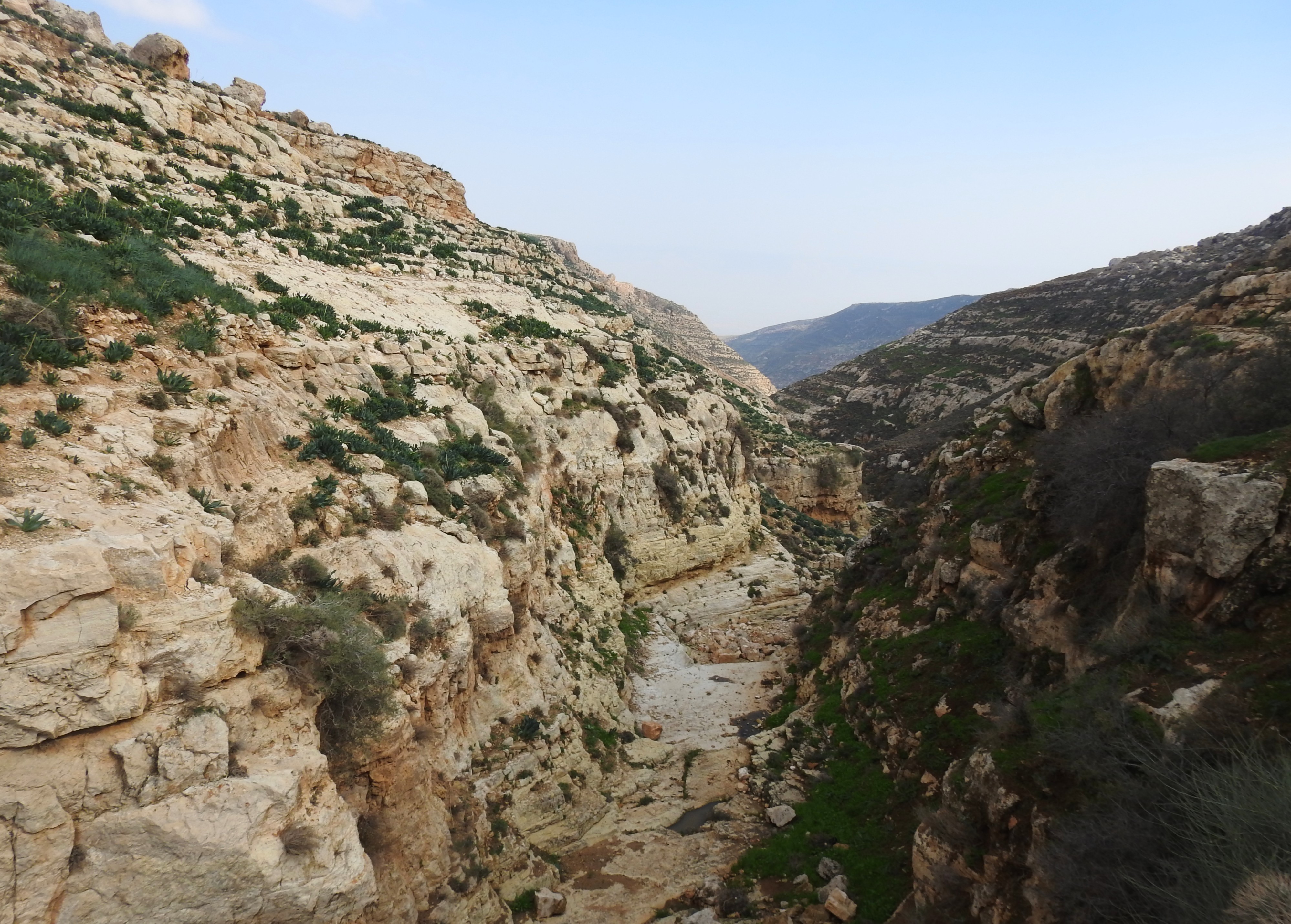
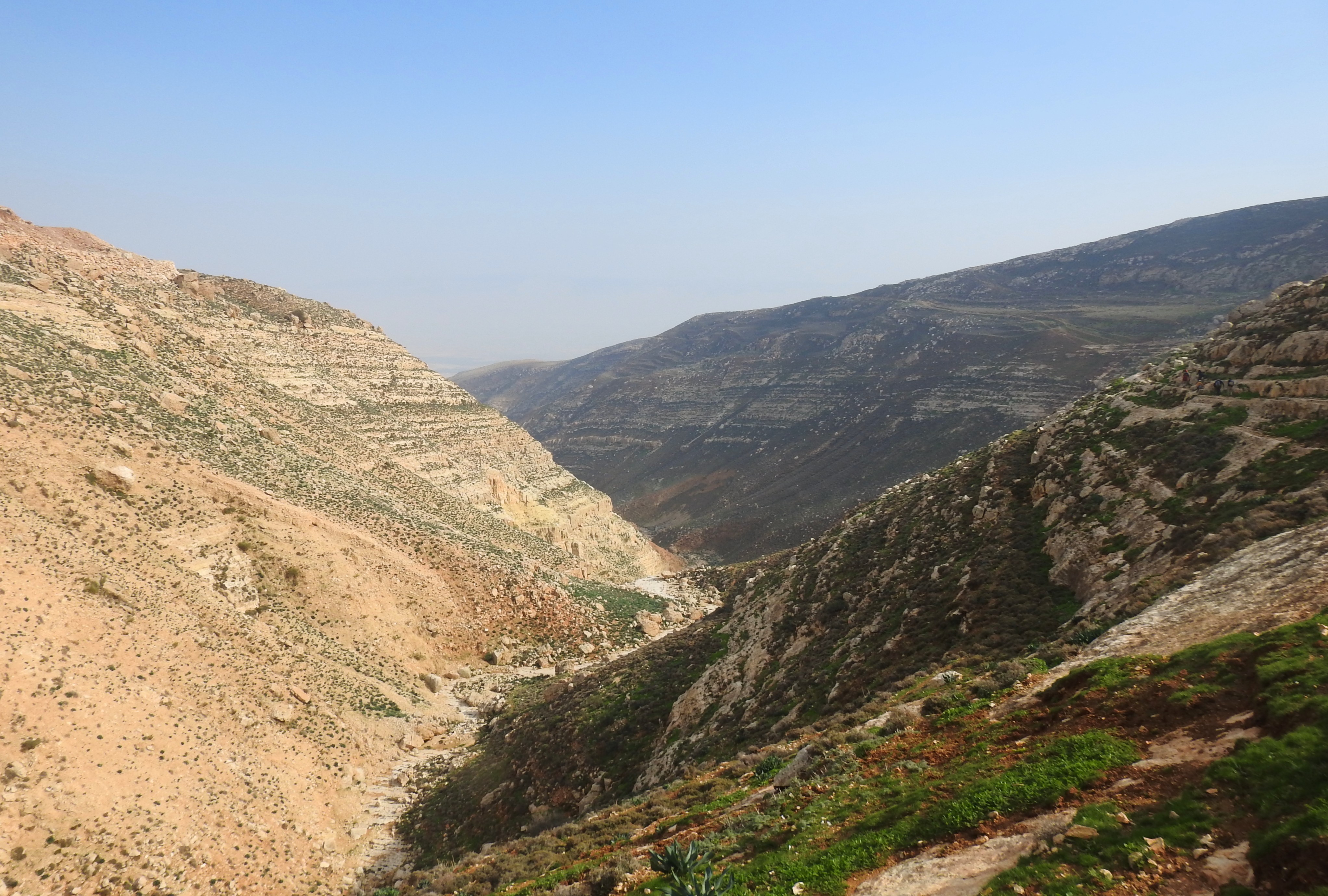
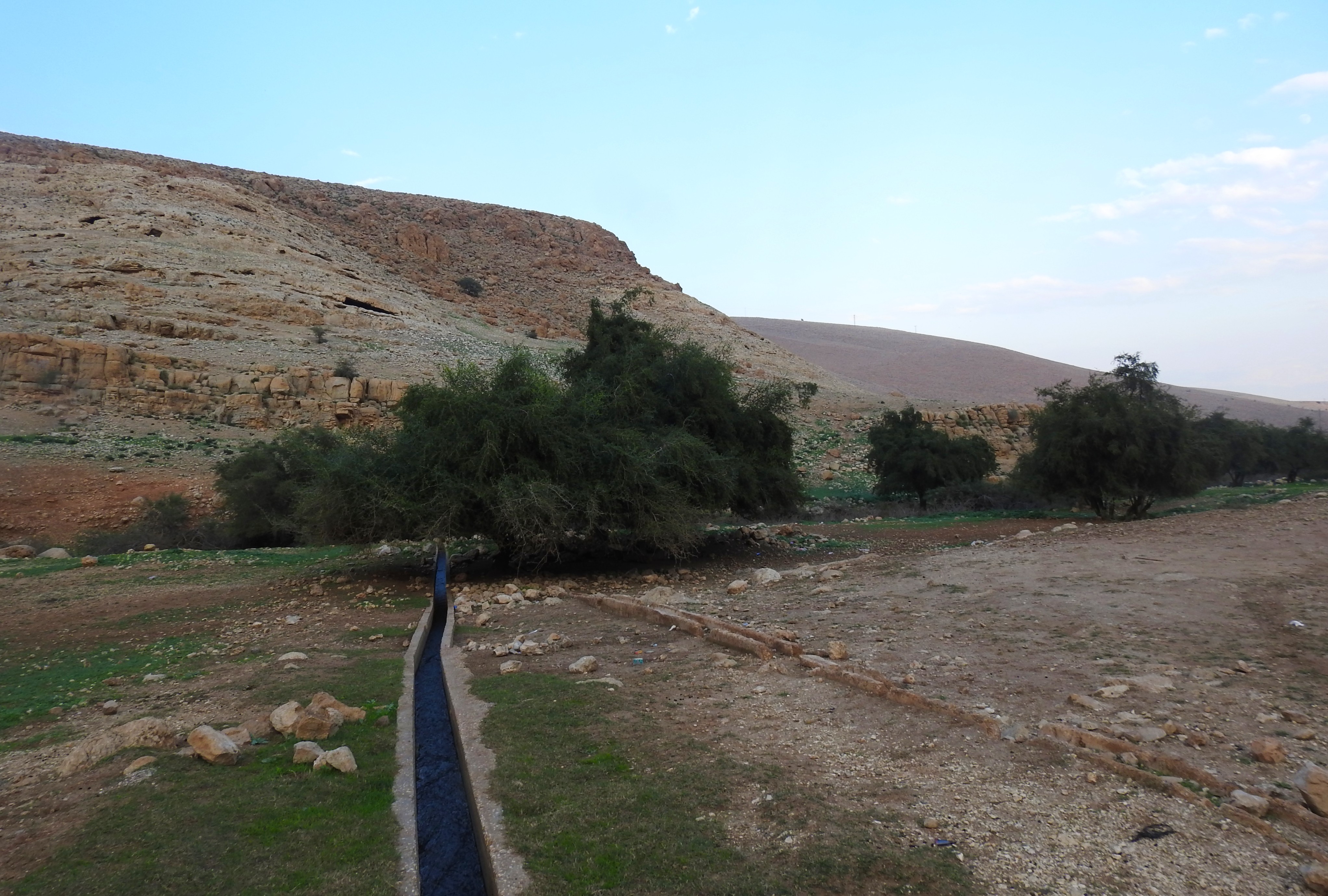
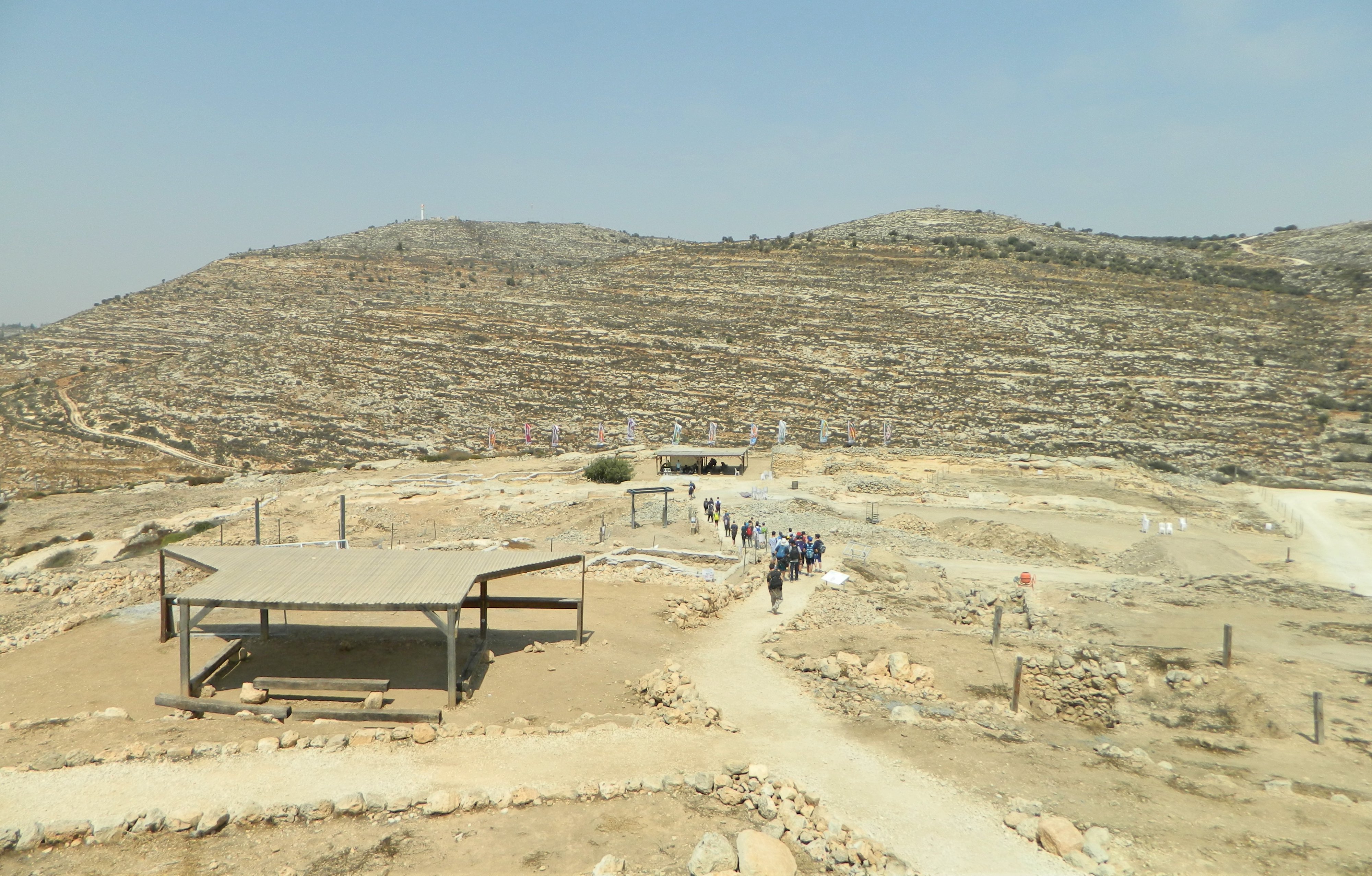
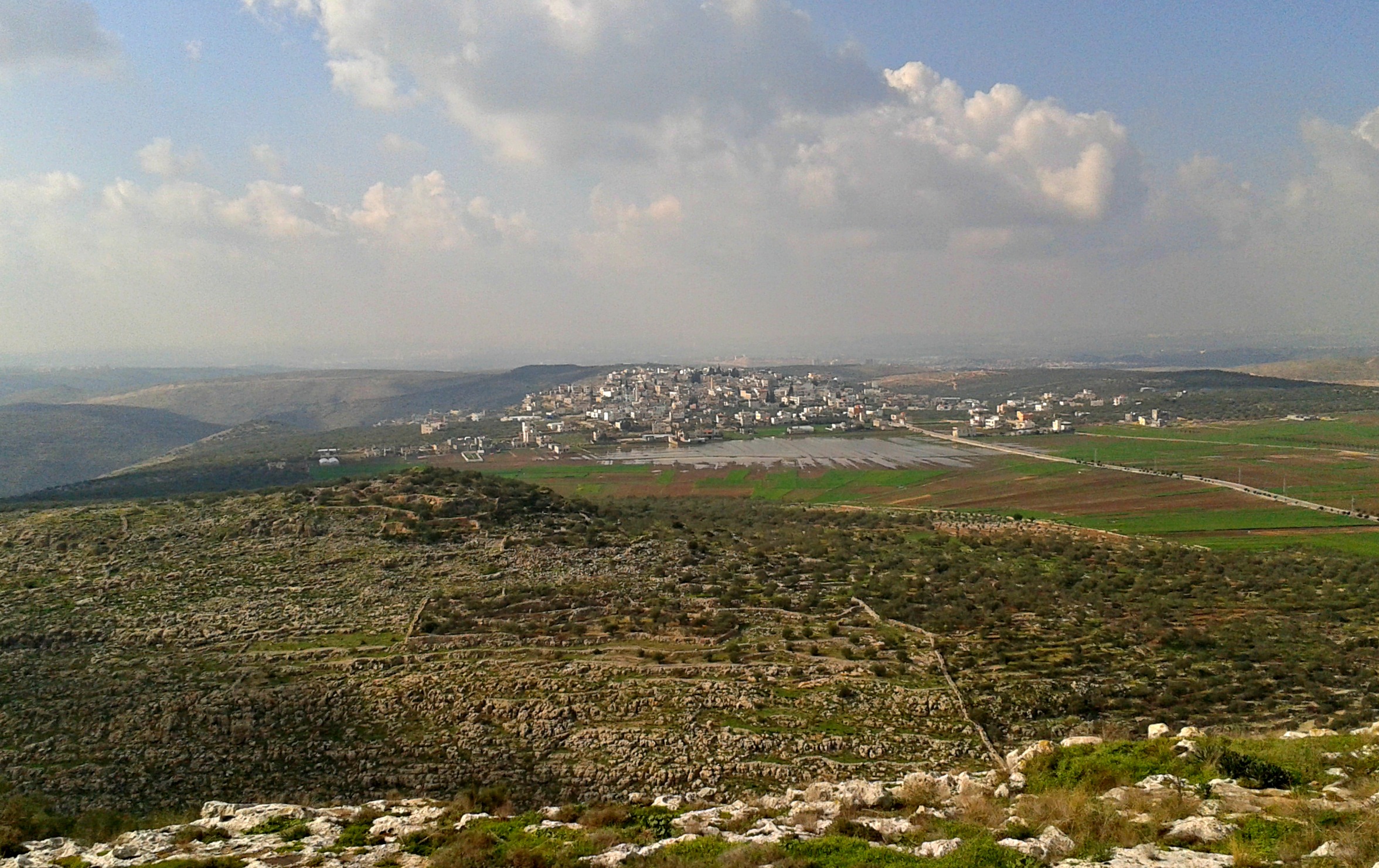
The final chapter in the adventures of summer 2025 took place closest to home, just outside the security fence of Elkana, about 500 metres from our front door. Being at the edge of the Shomron (Samaria), the topography is of low stony hills with a fair amount of short greenery, much of which turns golden brown in the heat of the summer. I invited steadfast travel partner Adam along to explore the open land just west of Elkana, where a questionable blackwater stream flows between the gentle hills.

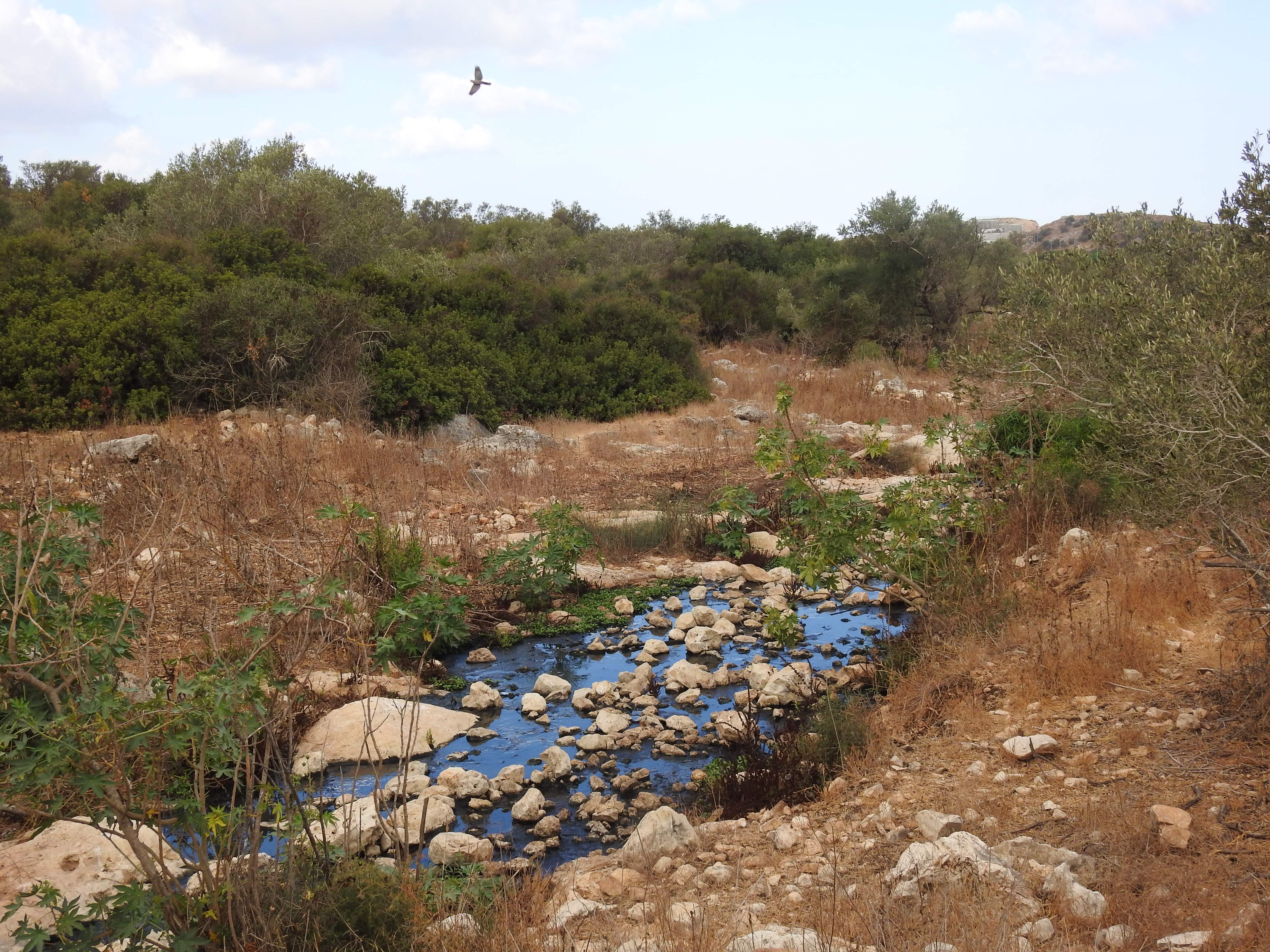
Blackwater stream flowing west

Having explored a bit of the area closest to us over the months of operating a trail camera, I had a rough idea of how to make the most of our chosen Friday morning, the first day of August. My initial plan was to hike parallel to the stream for as long as we could, and then cross over and hike back on the other side. Little did I know, there was much to see along the way, and a whole lot more that was left yet-unexplored for another time, whenever that may be.

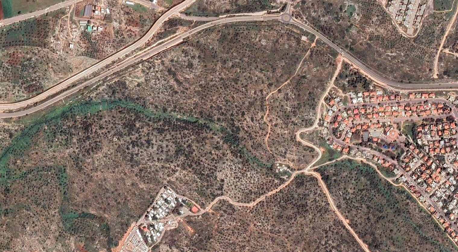
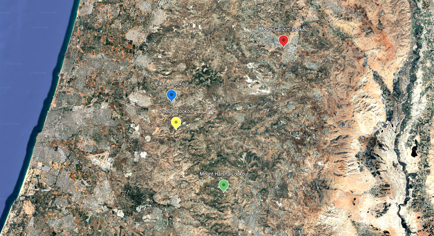
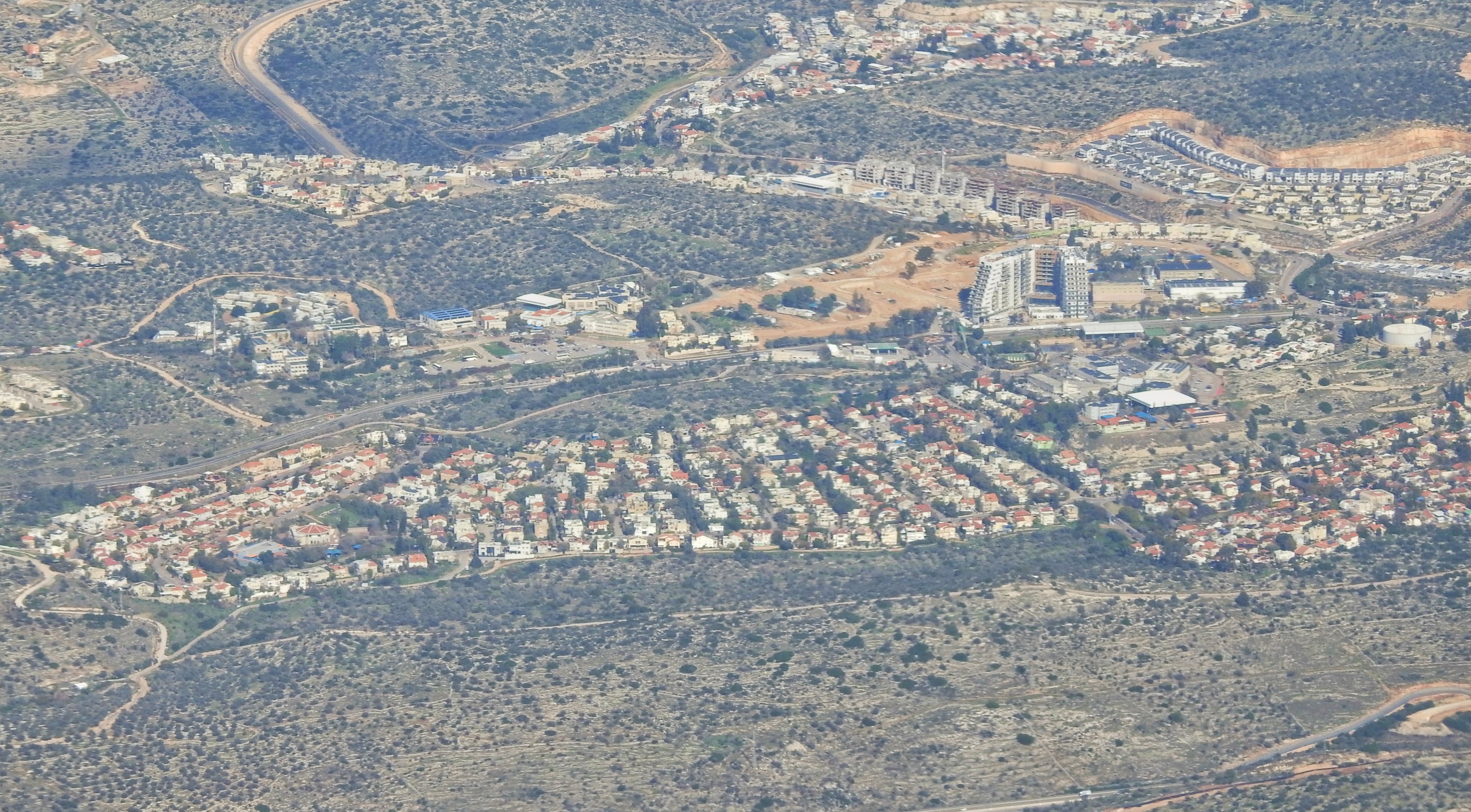
Aerial map of the region with Elkana to the right (photo Google Maps)

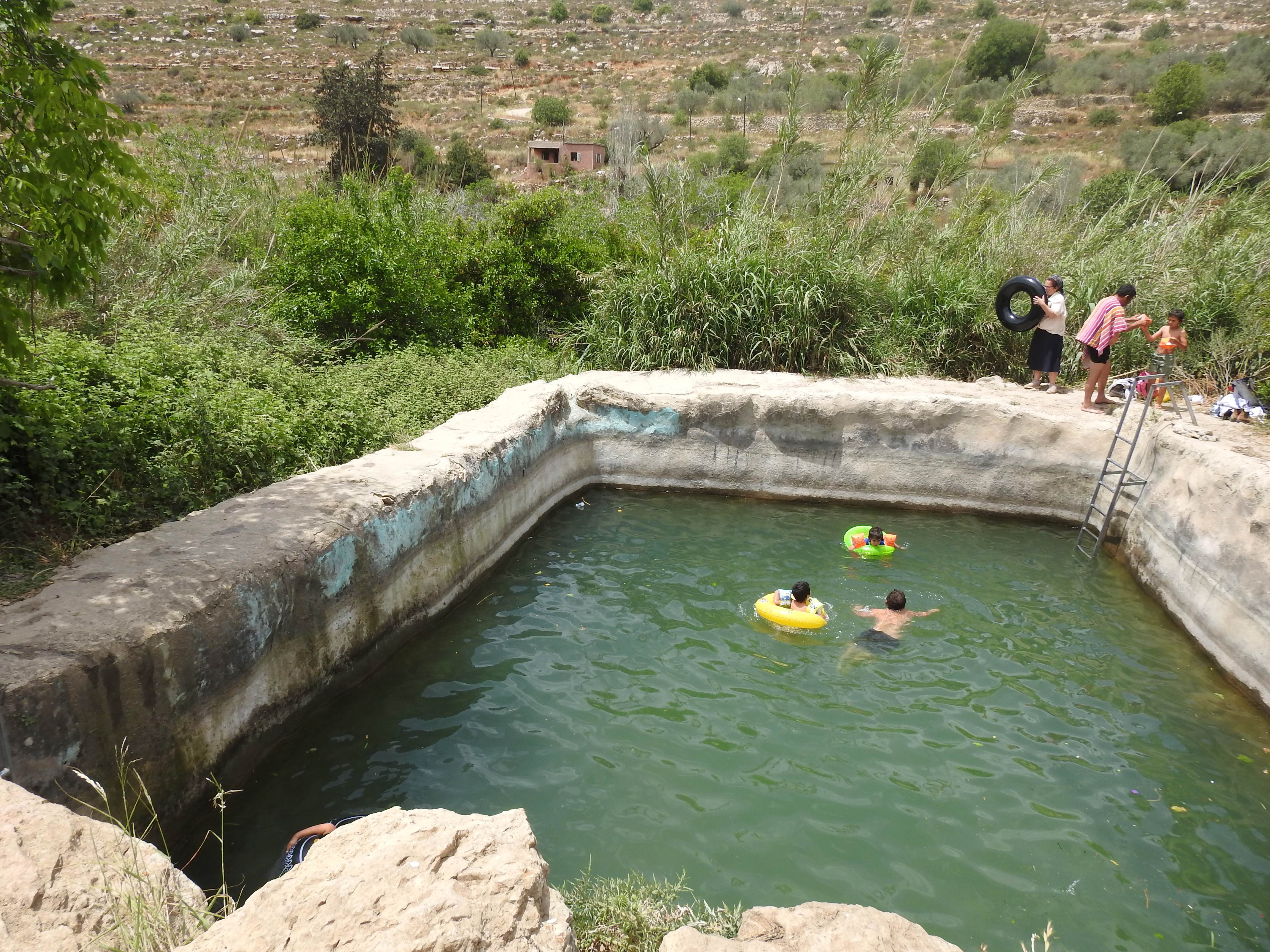
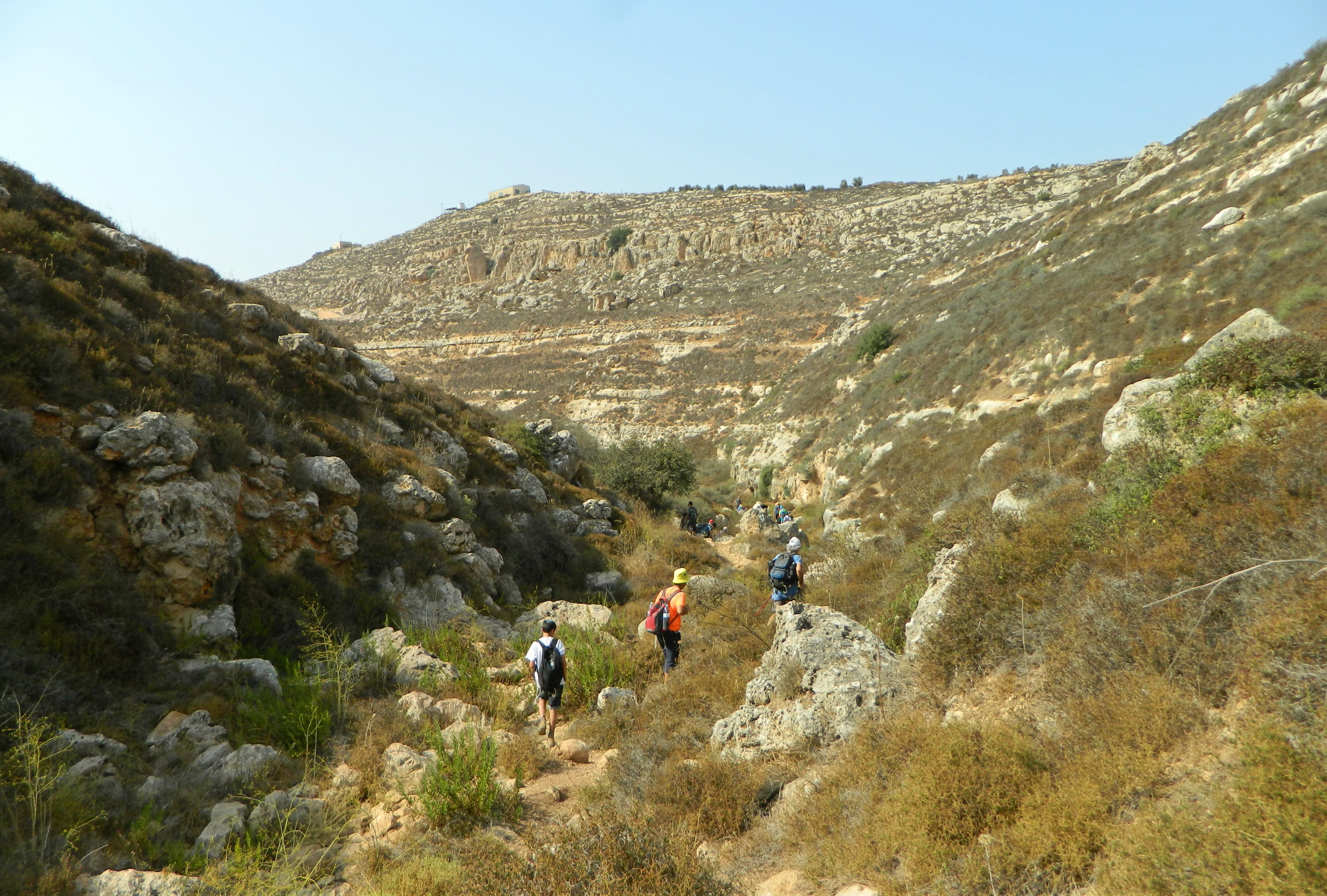
We parked beside the water treatment structure between Elkana and Magen Dan and began our little hike with gusto. As always, there was a particularly unappealing odour that emanated from the semi-processed sewage water but we steeled our resolve and stuck as close to the stream as we could. There were multitudes of glossy ibises and European bee-eaters to keep us company, to say nothing of the many Lycaenidae (or gossamer-winged) butterflies that distracted us plenty.
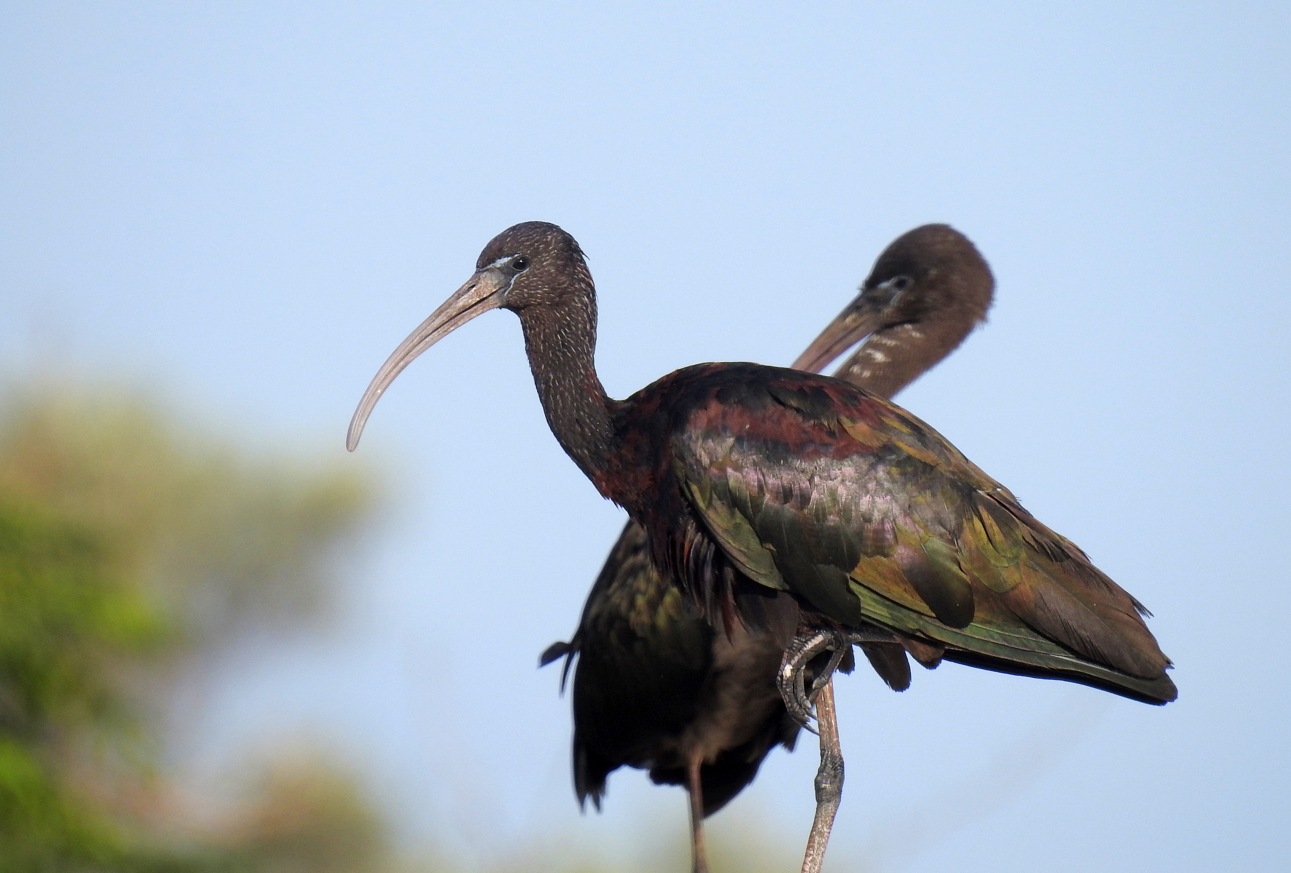
Glossy ibises

After just a few minutes, we reached the tree which my trail camera was strapped to – a video from the location can be seen HERE. From that point onward, it was new territory for me and I constantly kept my eyes peeled for a suitable location to film from. Over the span of a few months, an impressive eight compilation videos were produced from the nature content gleaned around the fetid stream – clearly the animals don’t mind it! 

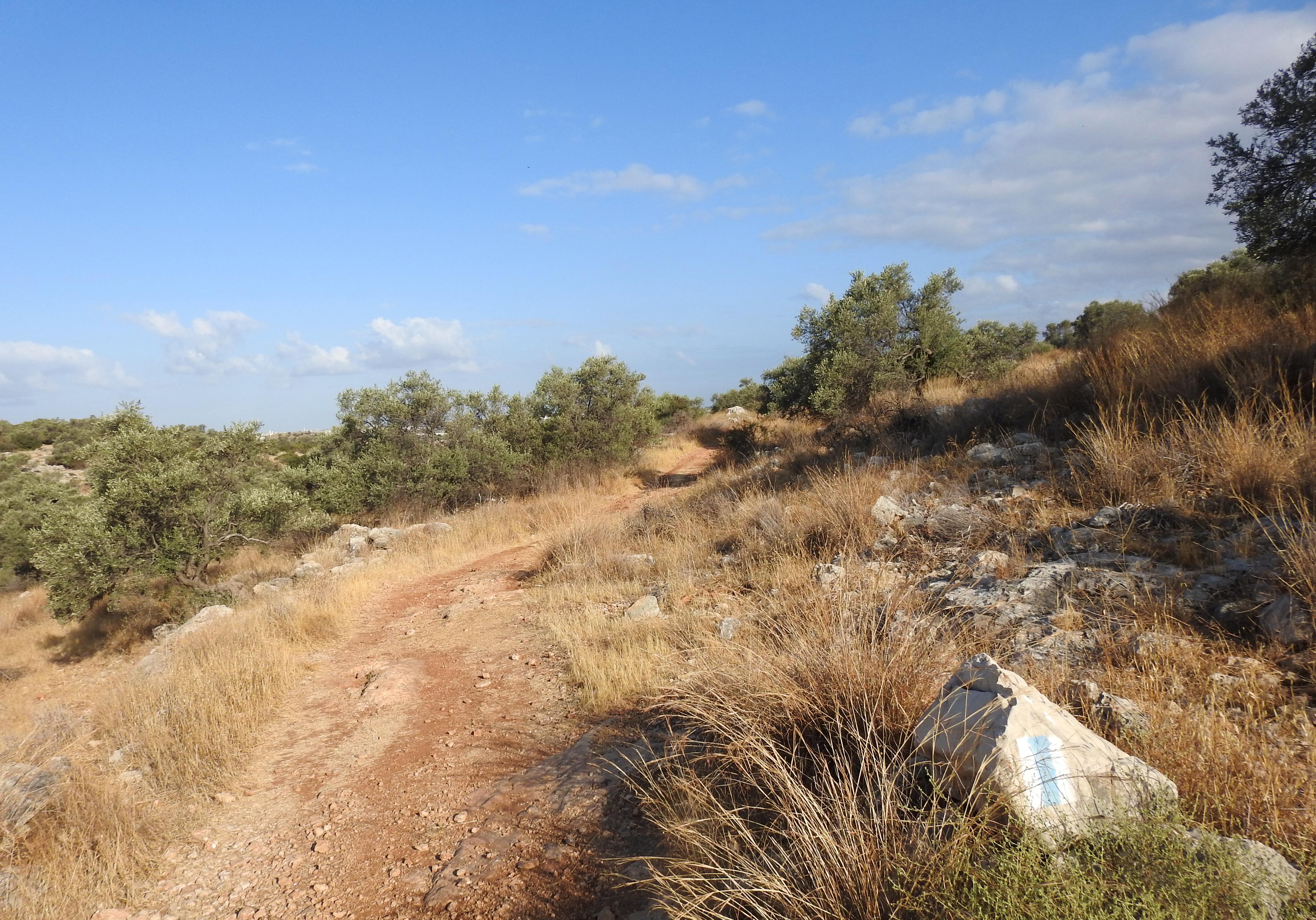
Entering my local nature patch

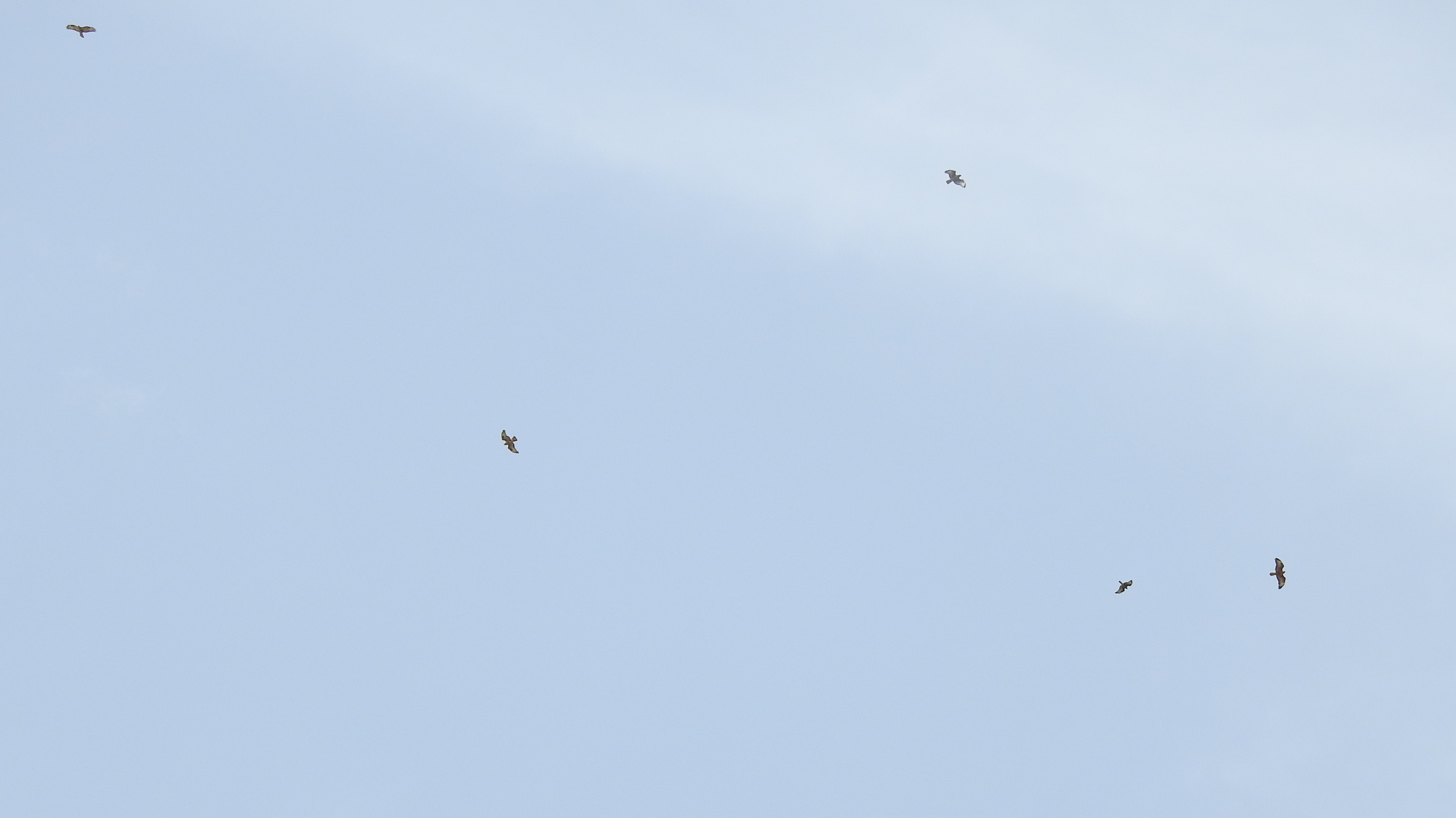
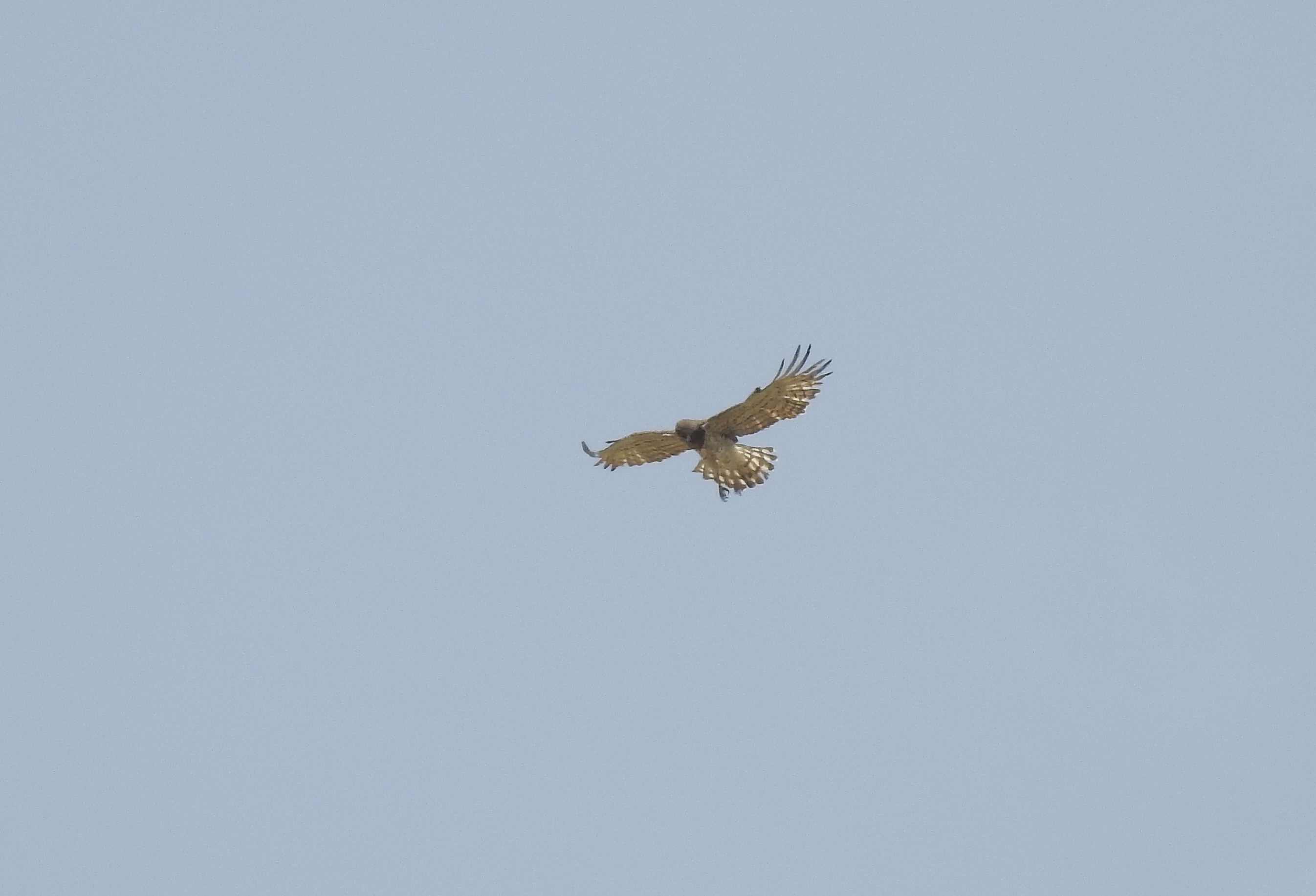
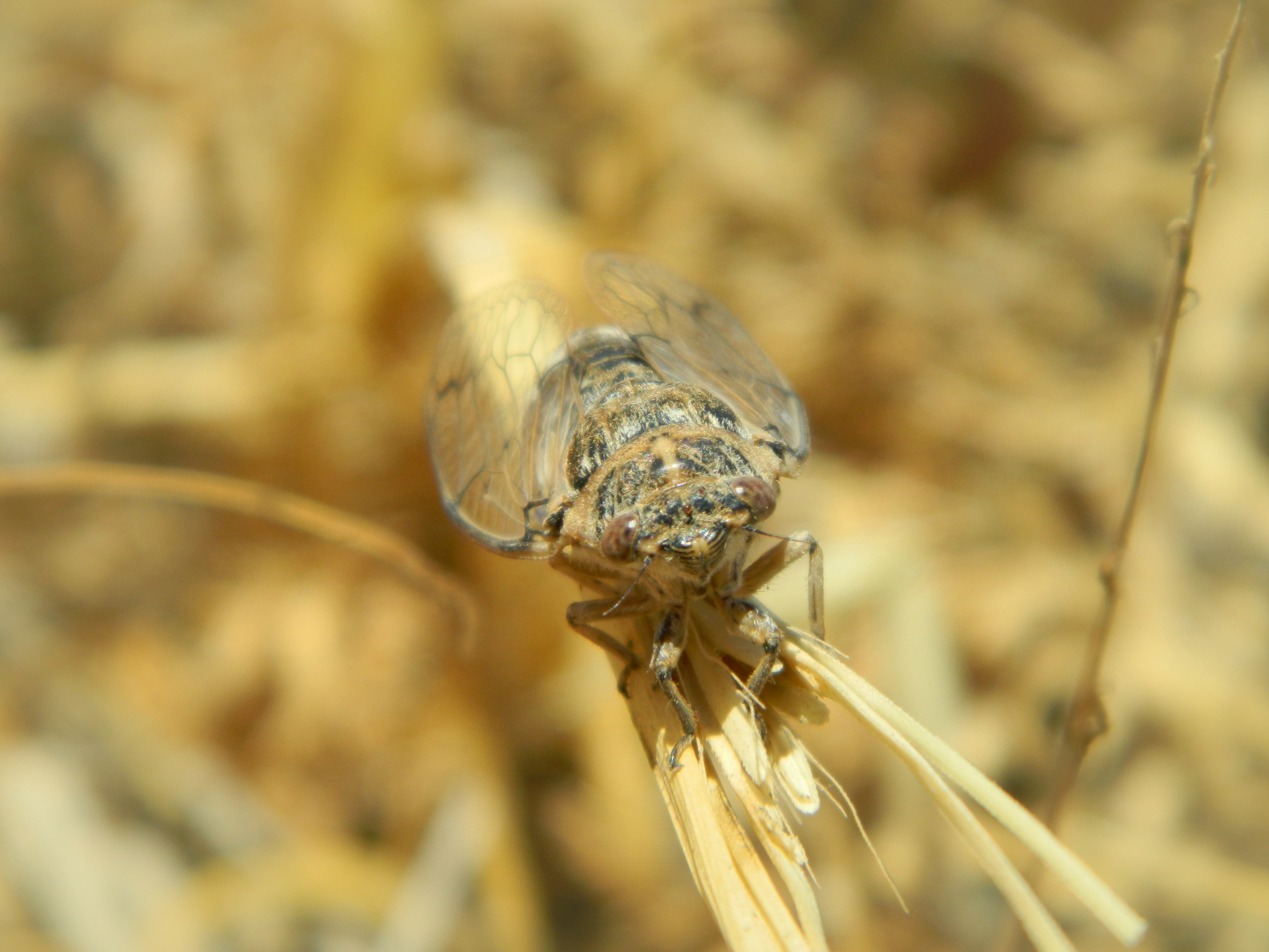
Adam found a very unique-looking leafhopper, one that I had never seen before, identified later as a Dictyophara xiphias. Some chukars were flushed and a short-toed eagle made a rather close appearance as we pushed westward, following the lush streamside. Indeed, while the surrounding area is rocky with intermittent olive trees, the streambed is flush with greenery including oleander, willow and the occasional fig tree.

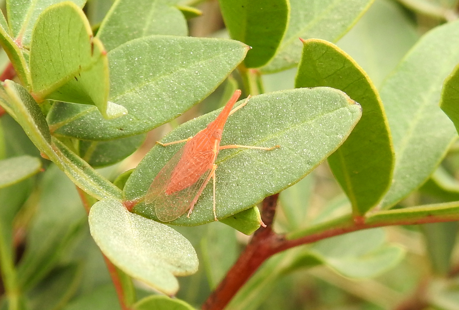
Cute little leaphopper

At some point we flushed a green sandpiper, which flew off to a further segment of the stream to then be flushed again – quite incidentally, I assure. As we reached closer to the main road, the 505, the landscape changed a bit. The land became flatter and the grasses were thick and dried by the harsh summer heat. We stumbled upon some interesting painted green glass, perhaps Ottoman, perhaps more modern. A giant argiope spider, waiting patiently in her web, gave us a bit of a shock, but then something even more startling occurred.
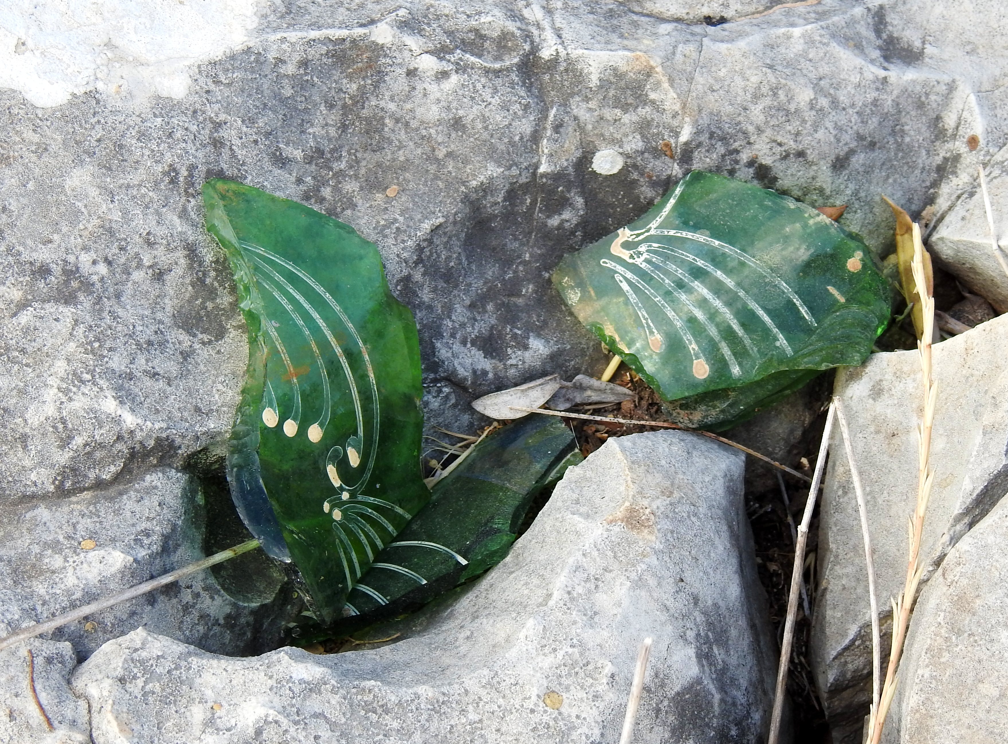
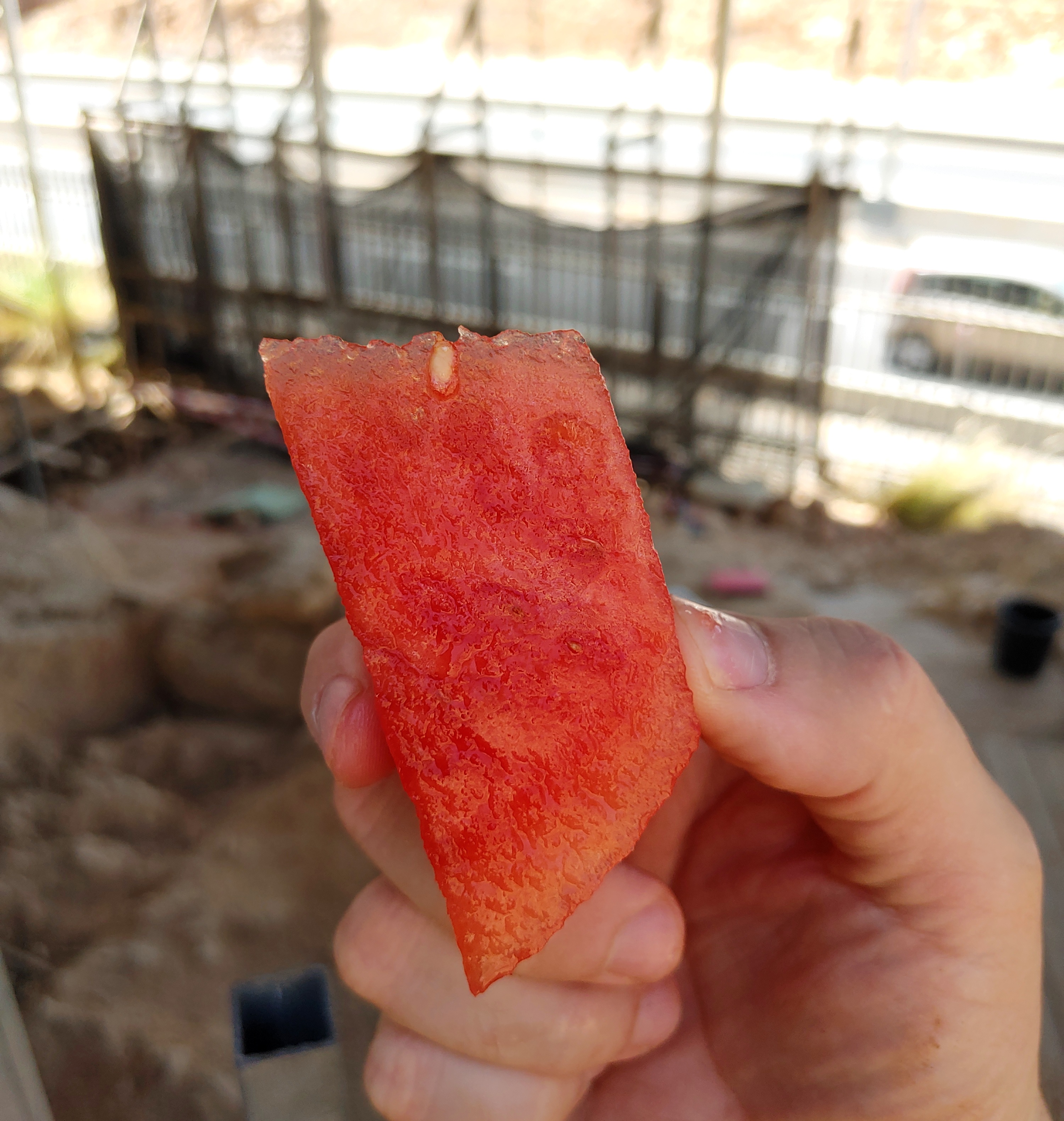
Hand-painted glass

There was a large crash in the vegetation beside us as a muscular male mountain gazelle leapt up from his resting place and bolted across the stream in panic. I’ve become accustomed to the gazelles around Elkana but this made me think of the dreaded wild boars which also inhabit the natural area. Loud crashing sounds in foliage is often associated with the imposing boars, probably the local animal I least want to have a run-in with.

Argiope spider lurking beside us

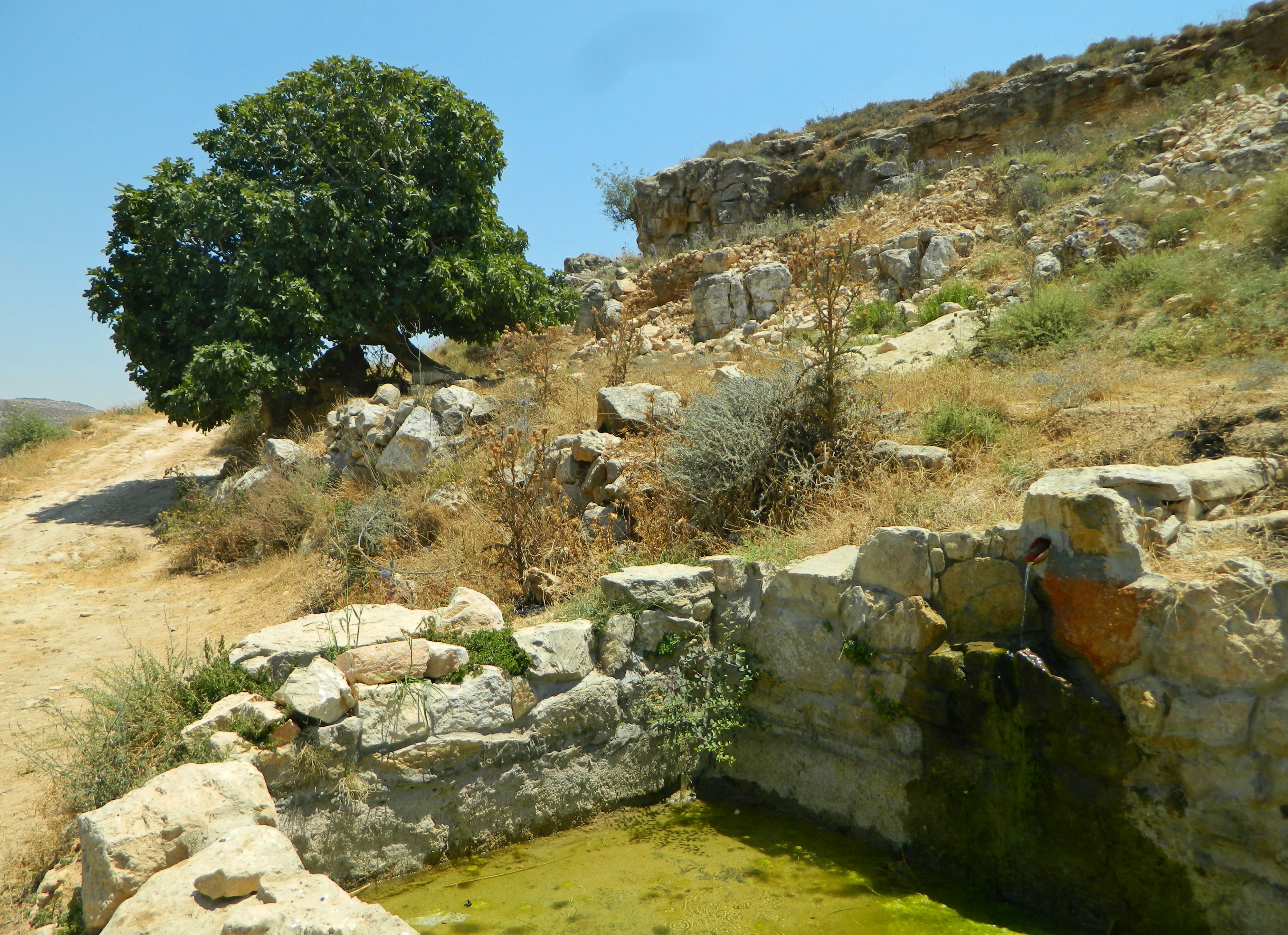
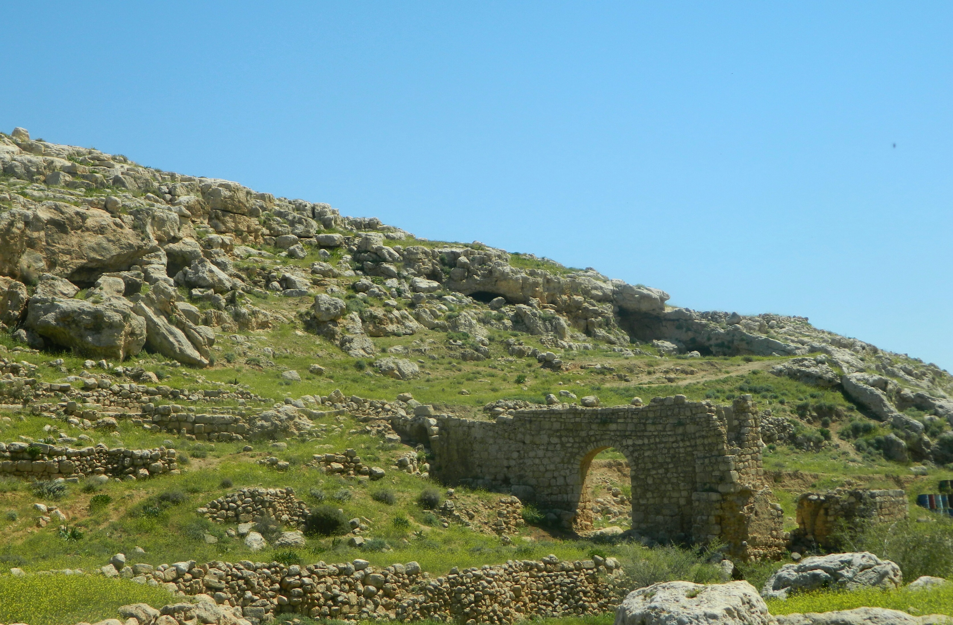
We too crossed over and found some old encampment where some people seem to have stayed. Among the rubbish were some faded food wrappers which were mostly in Arabic, one being a tomato paste produced in or distributed from Hevron (Hebron). Leaving the refuse behind, we began to hike uphill in an easternly direction. There were many fieldstone walls, acting as terraces on the slope, and then something interesting came into sight.

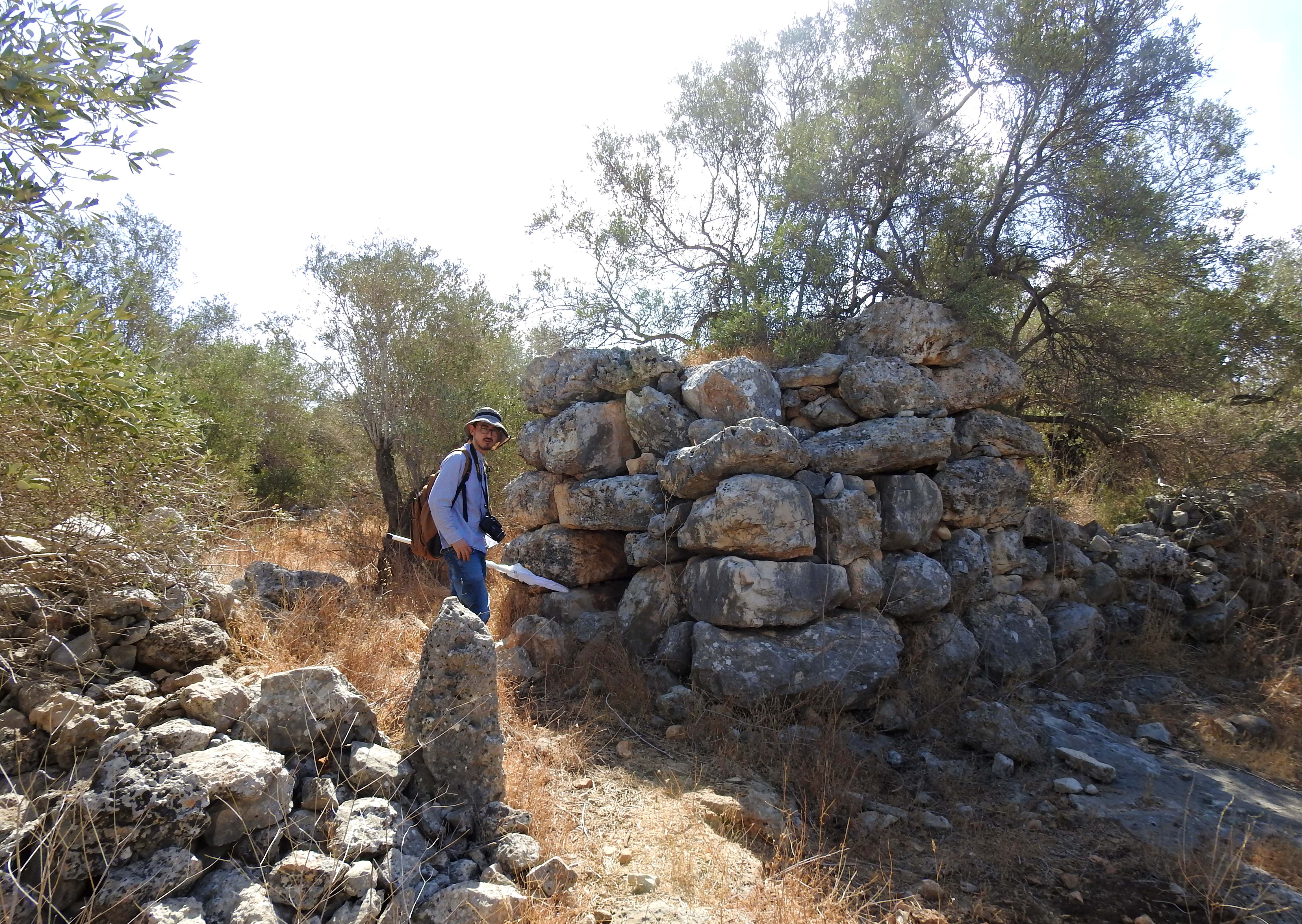
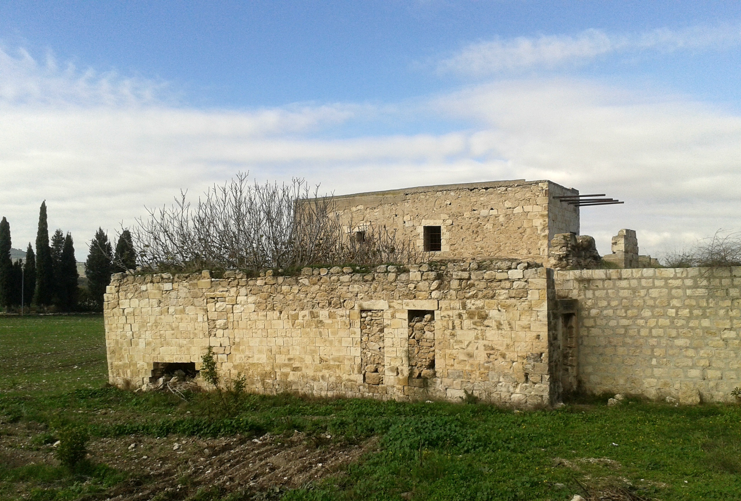
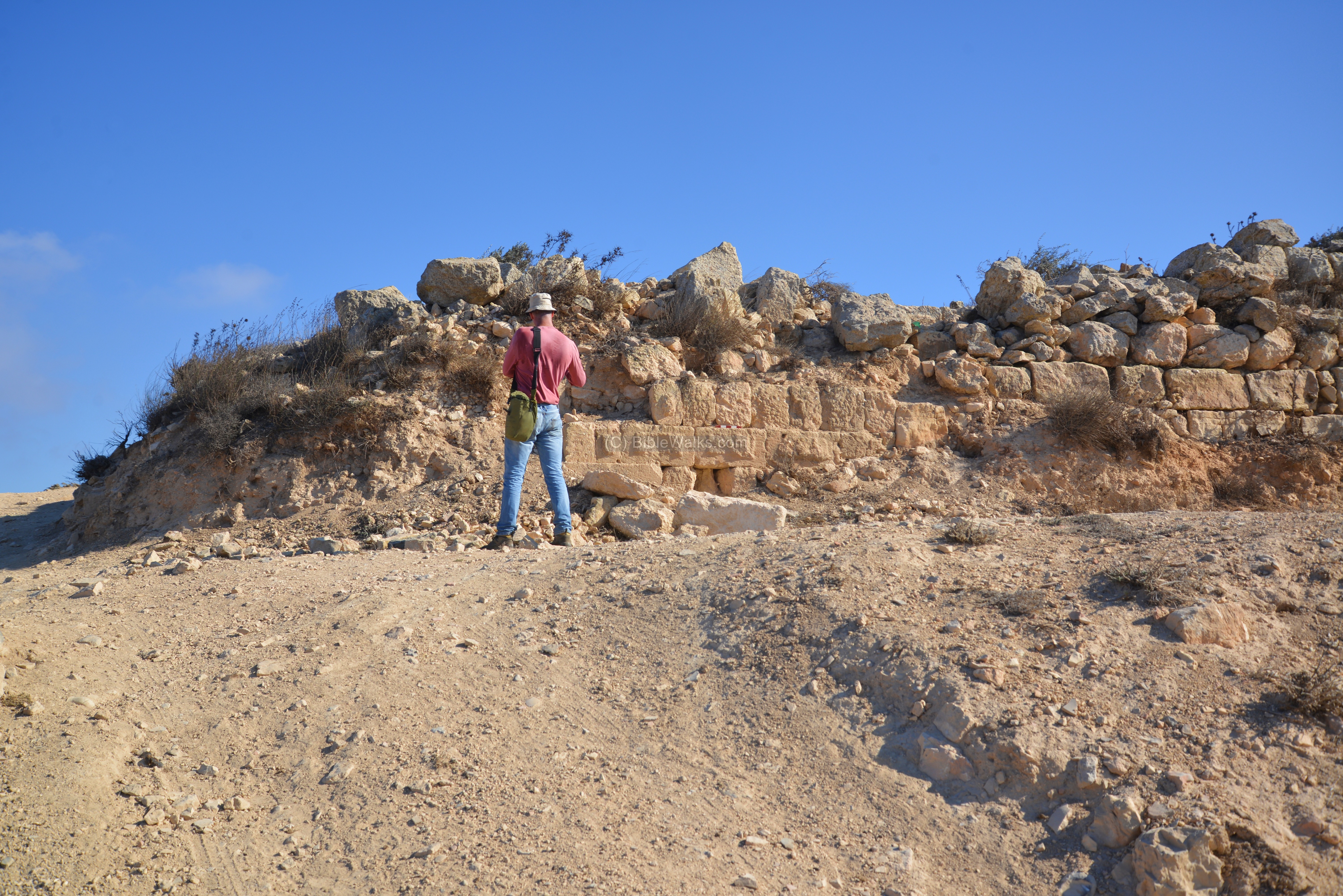
Exploring the shomera-like structure

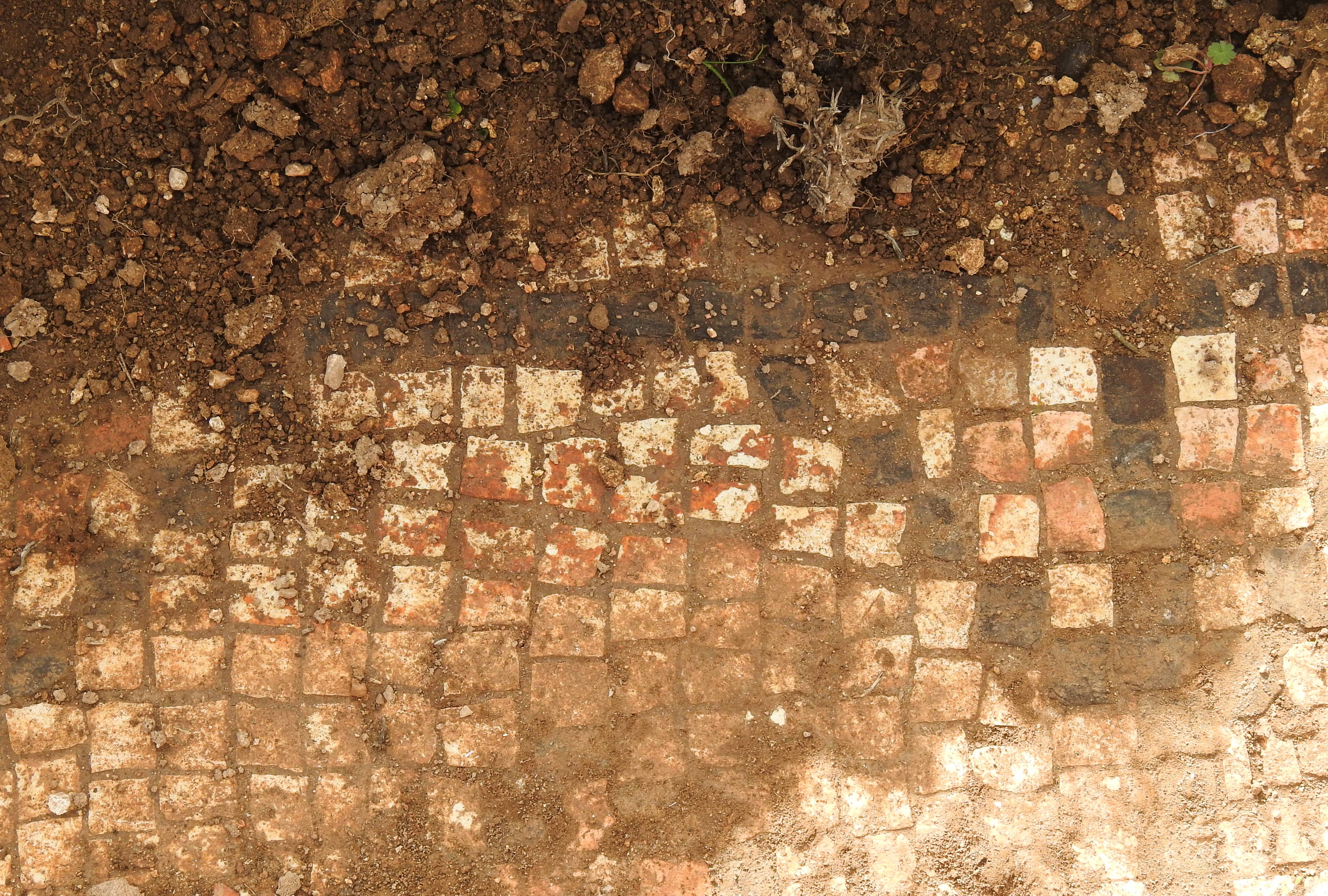
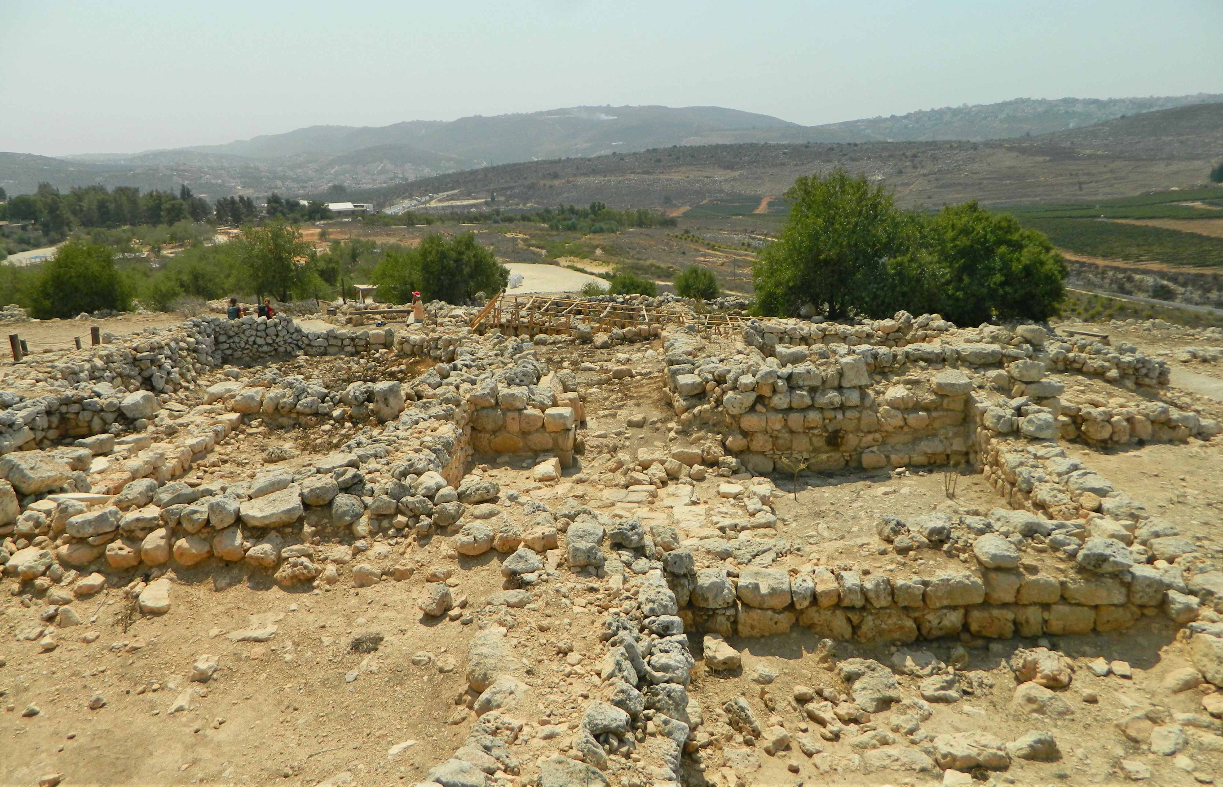
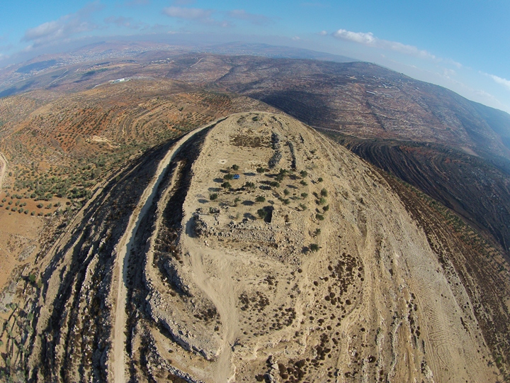
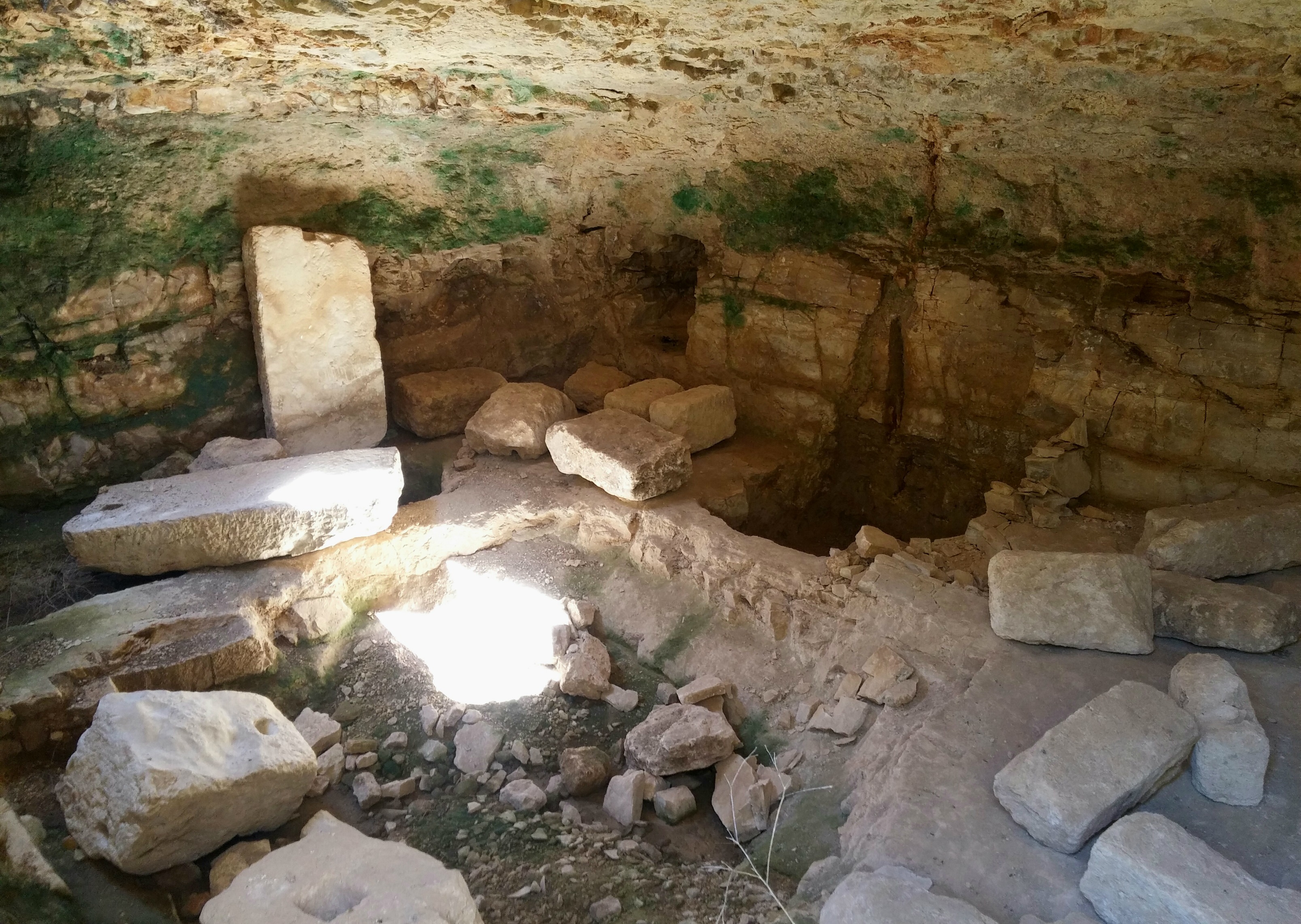
There was a small stone structure before us, with a very cramped interior, similar to the shomera-style watchtowers that were used to safeguard agricultural resources in days of old. I haven’t seen anything online explaining this particular structure, but some research revealed that we were within the confines of an old village called Sirisia, the ruins of which are referred to as Khirbet Sirisia.
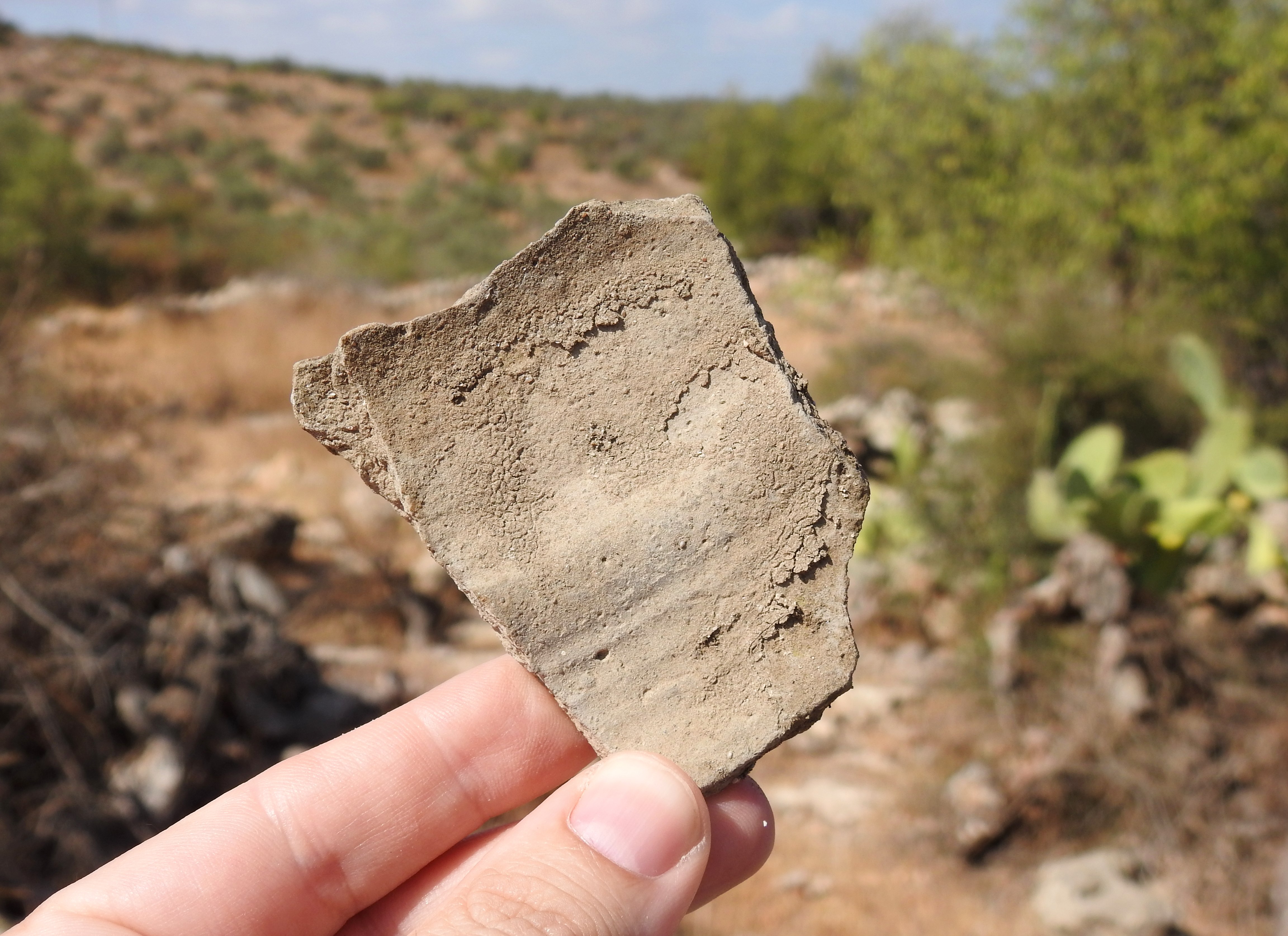
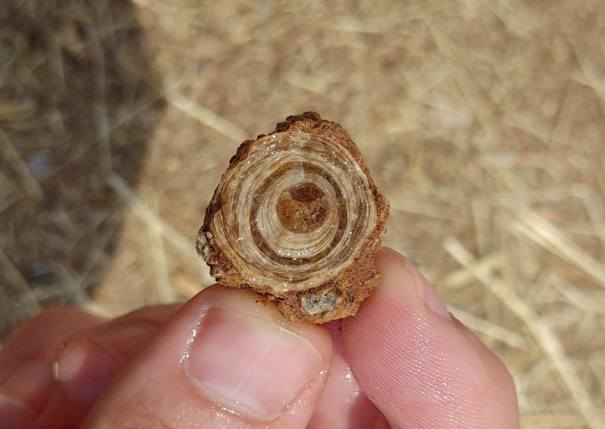
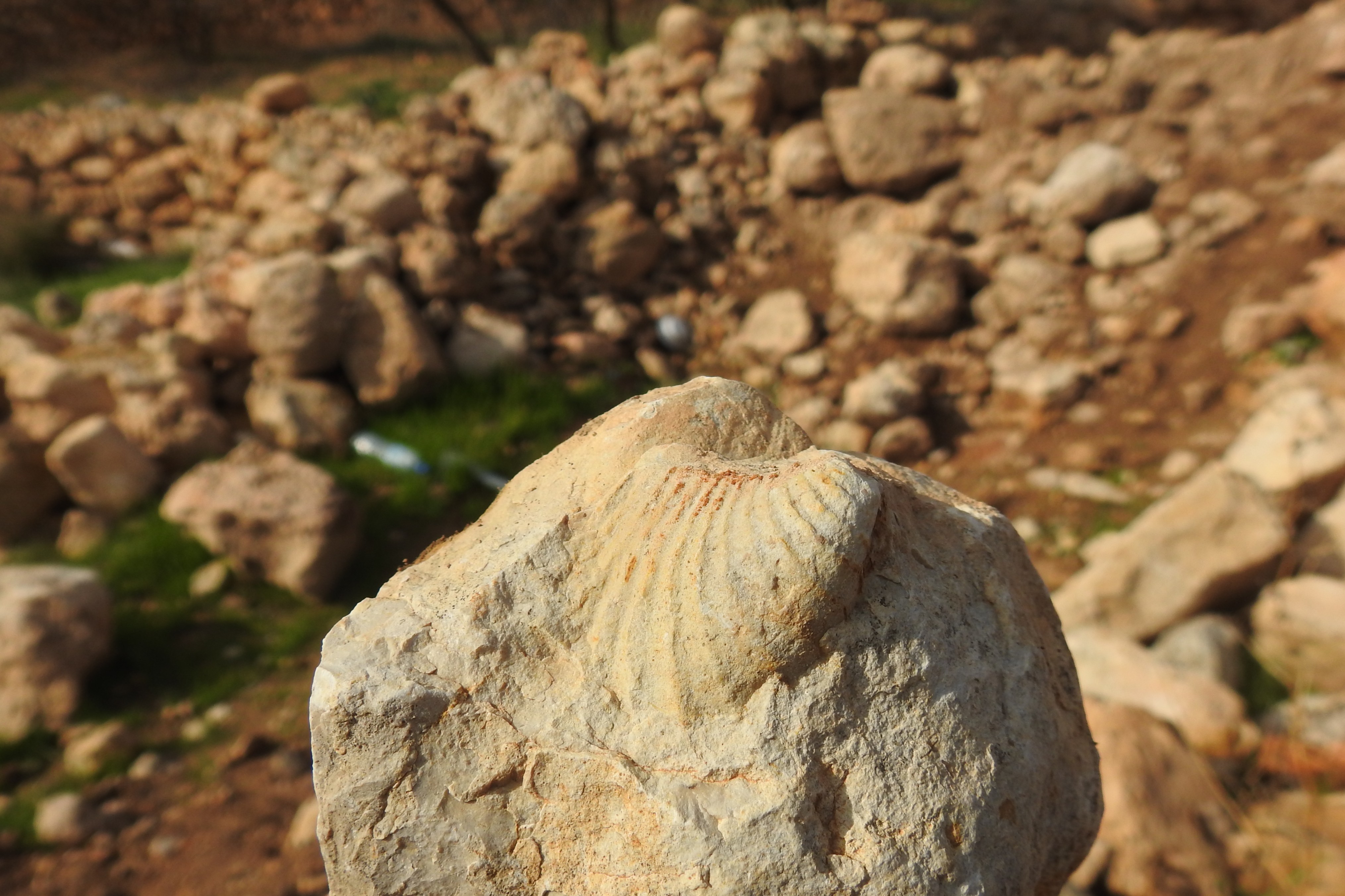
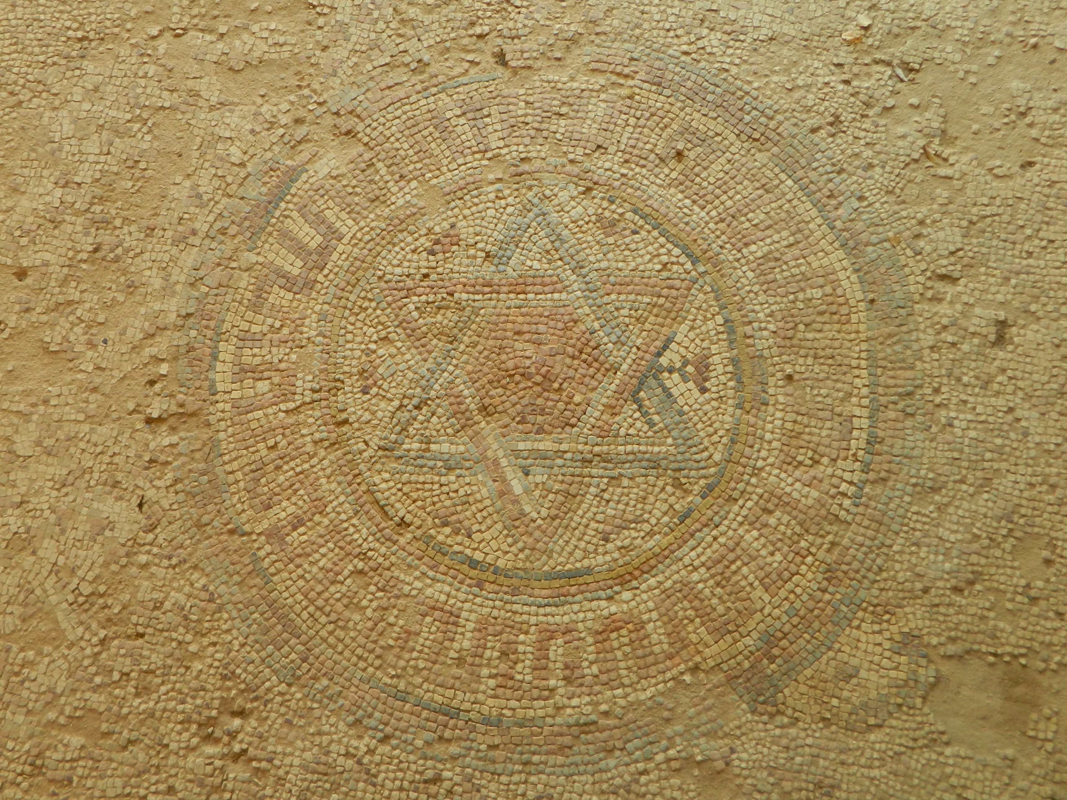
Old potsherd

In fact, in the brief research I did when writing this, I hadn’t managed to find anything about the village’s total timeline of existence; Archaeological reports mention ruins dating to the Roman period and potentially being the Bethsarisa site mentioned by Eusibius in his Onomasticon. The delightful, and ever-useful, Palestine Exploration Fund map from 1880 has the location marked as Khirbet Sirisia (implying ruins) just north of Wady el-Bahûteh.

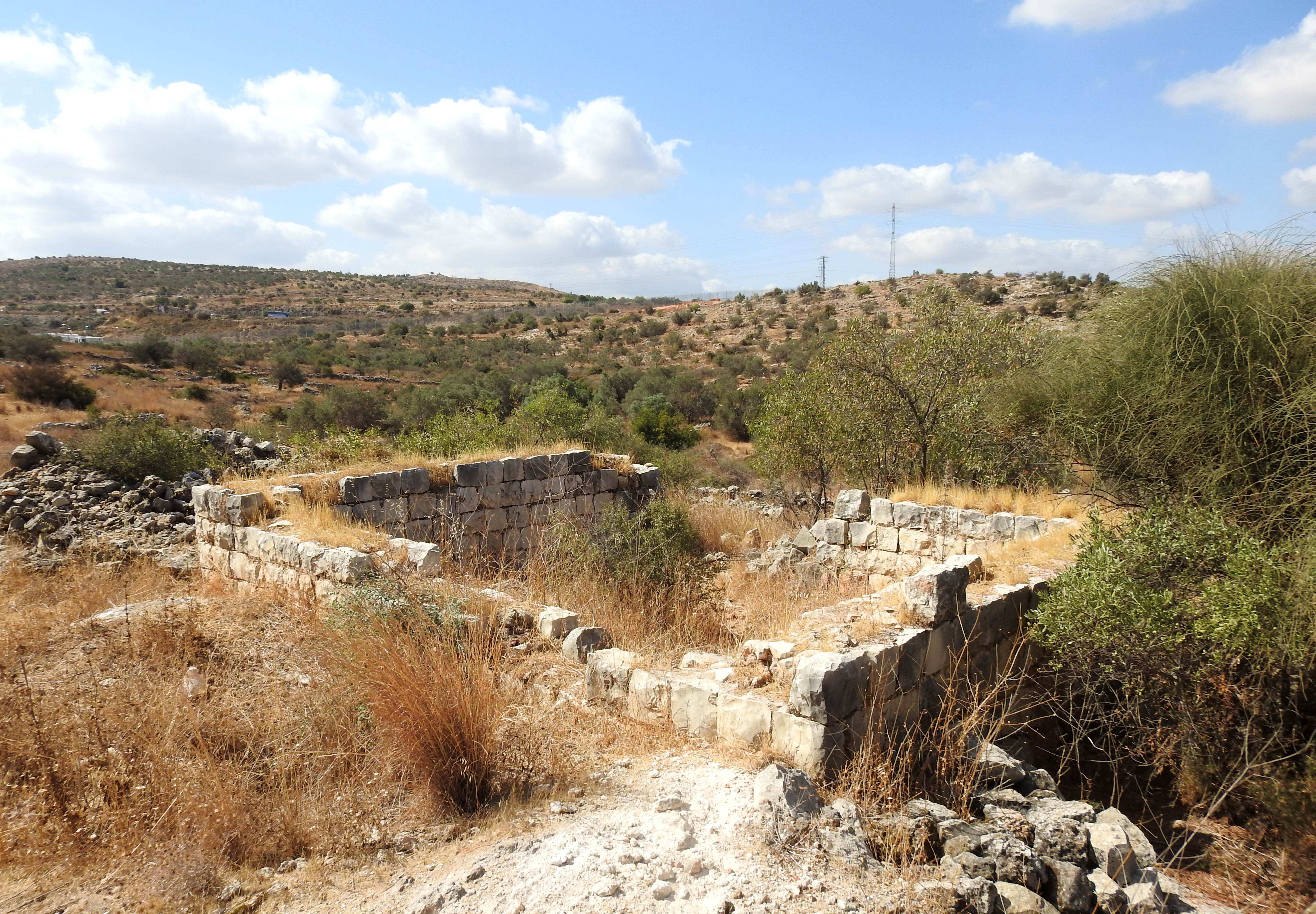
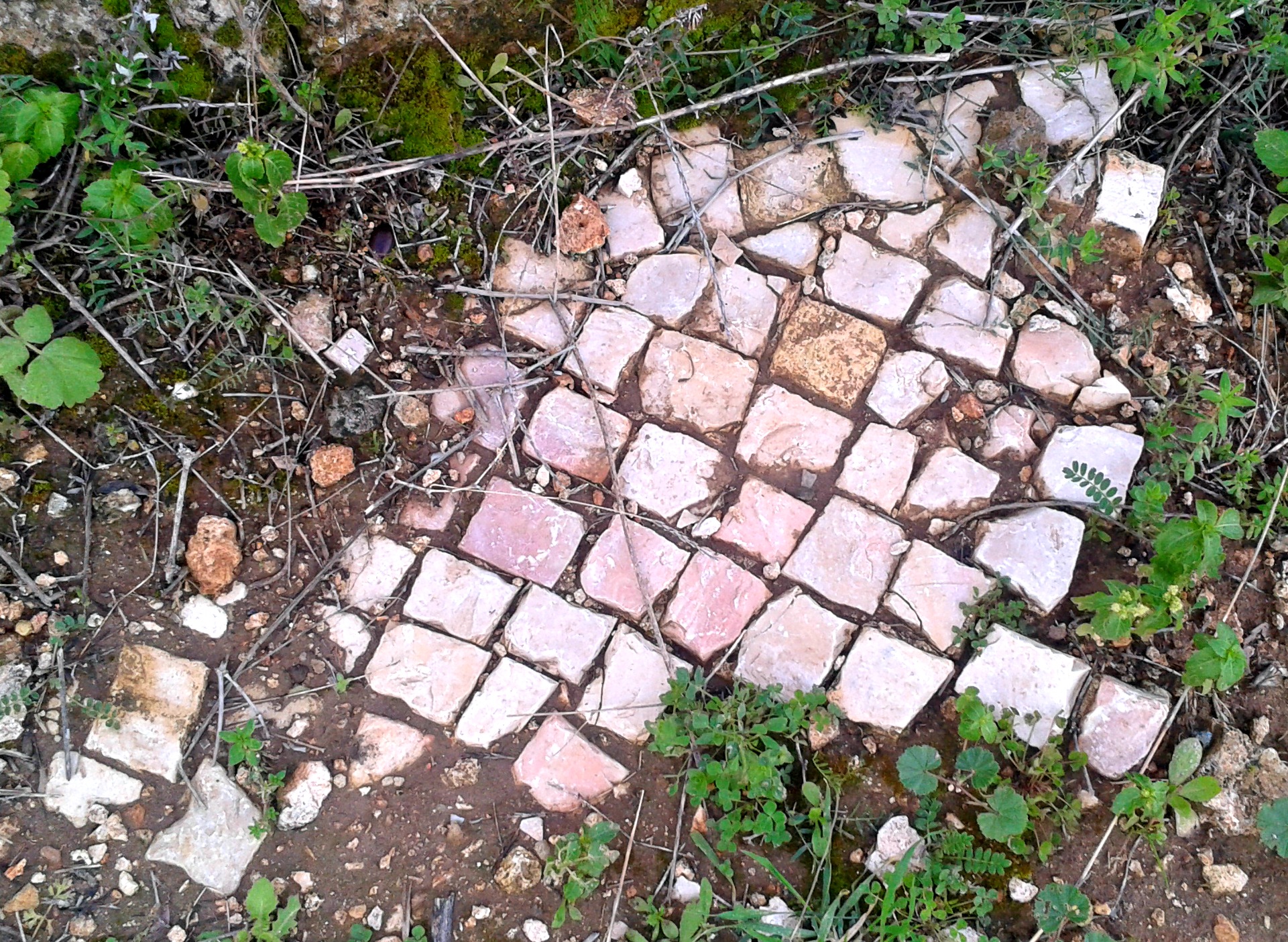
Fine masonry work in Khirbet Sirisia

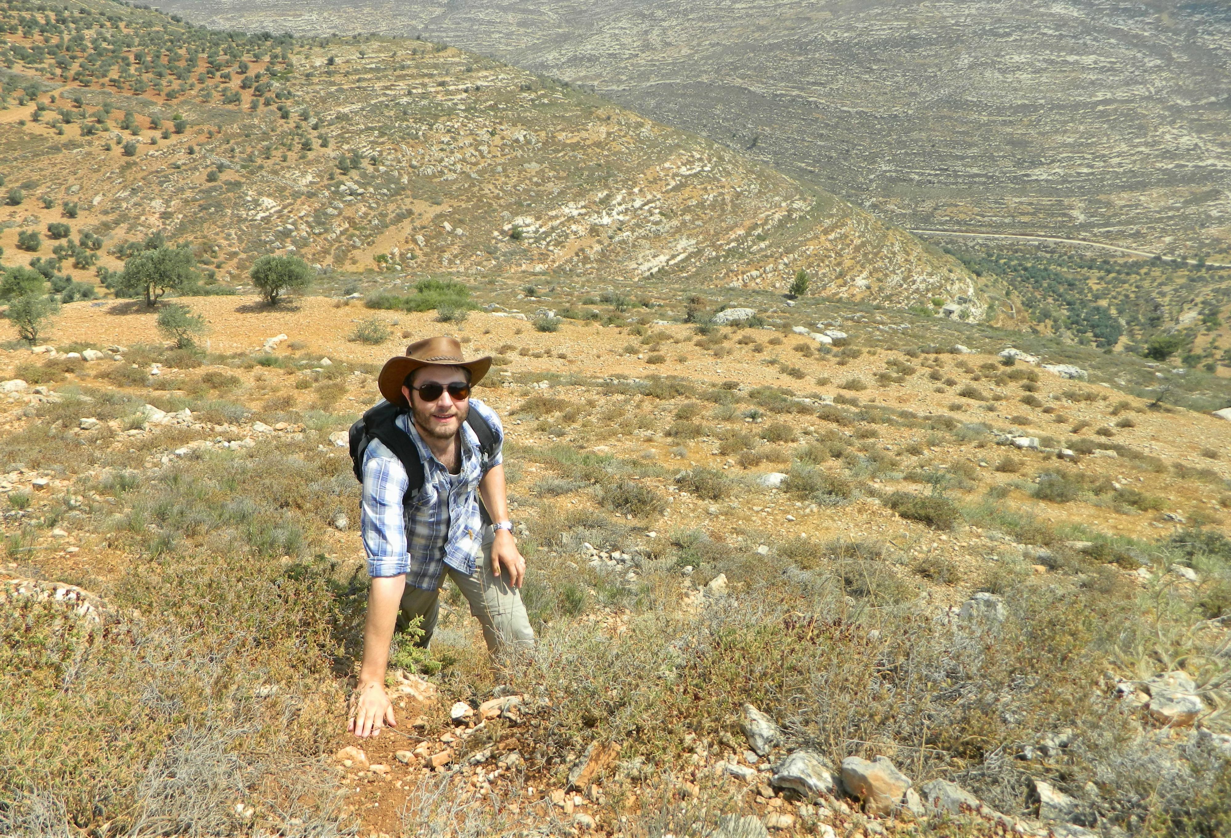
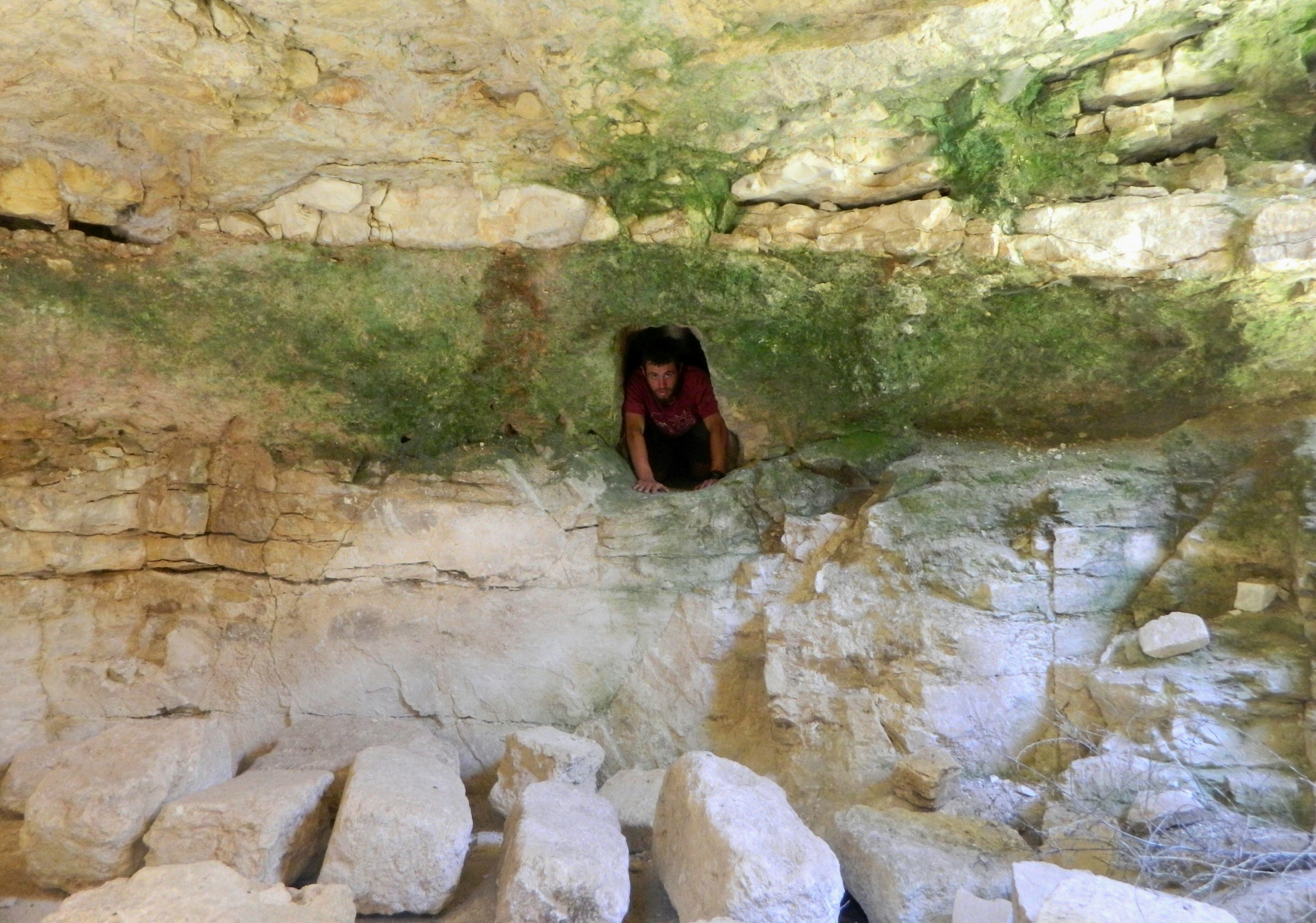
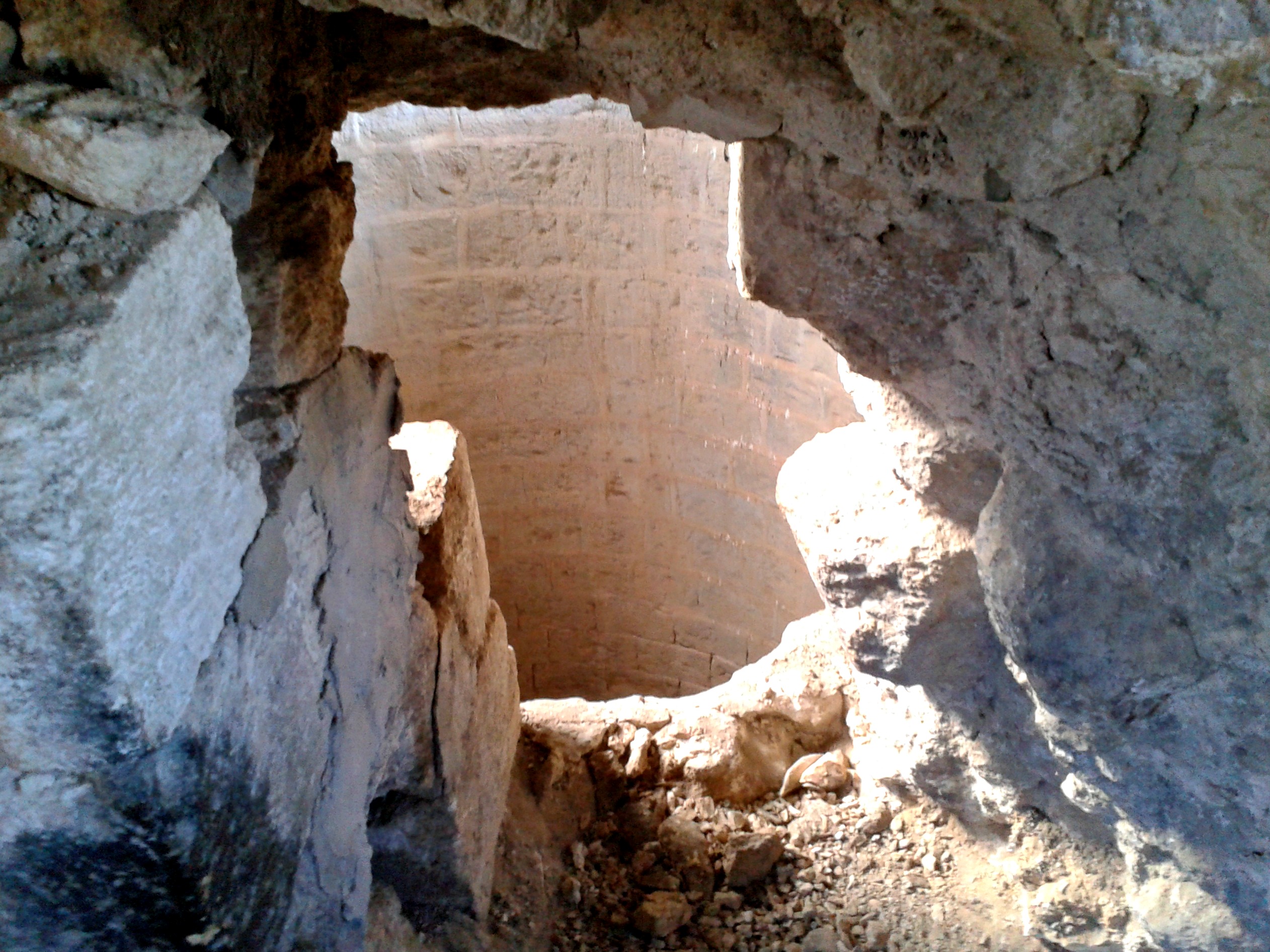
Wandering about the terraced ruins, we found some more architectural remains including one particularly impressive rectangular structure built with ashlars as opposed to fieldstones. Immediately outside the thick walls, we found the mouth of an underground cistern overgrown with vegetation. Gladdened that we didn’t accidentally fall in, we were subsequently more ginger as we stepped about, checking for other cisterns in the area. Our diligence paid off as we found more cisterns and more structures, even an open stretch that felt like an old street running through the village.

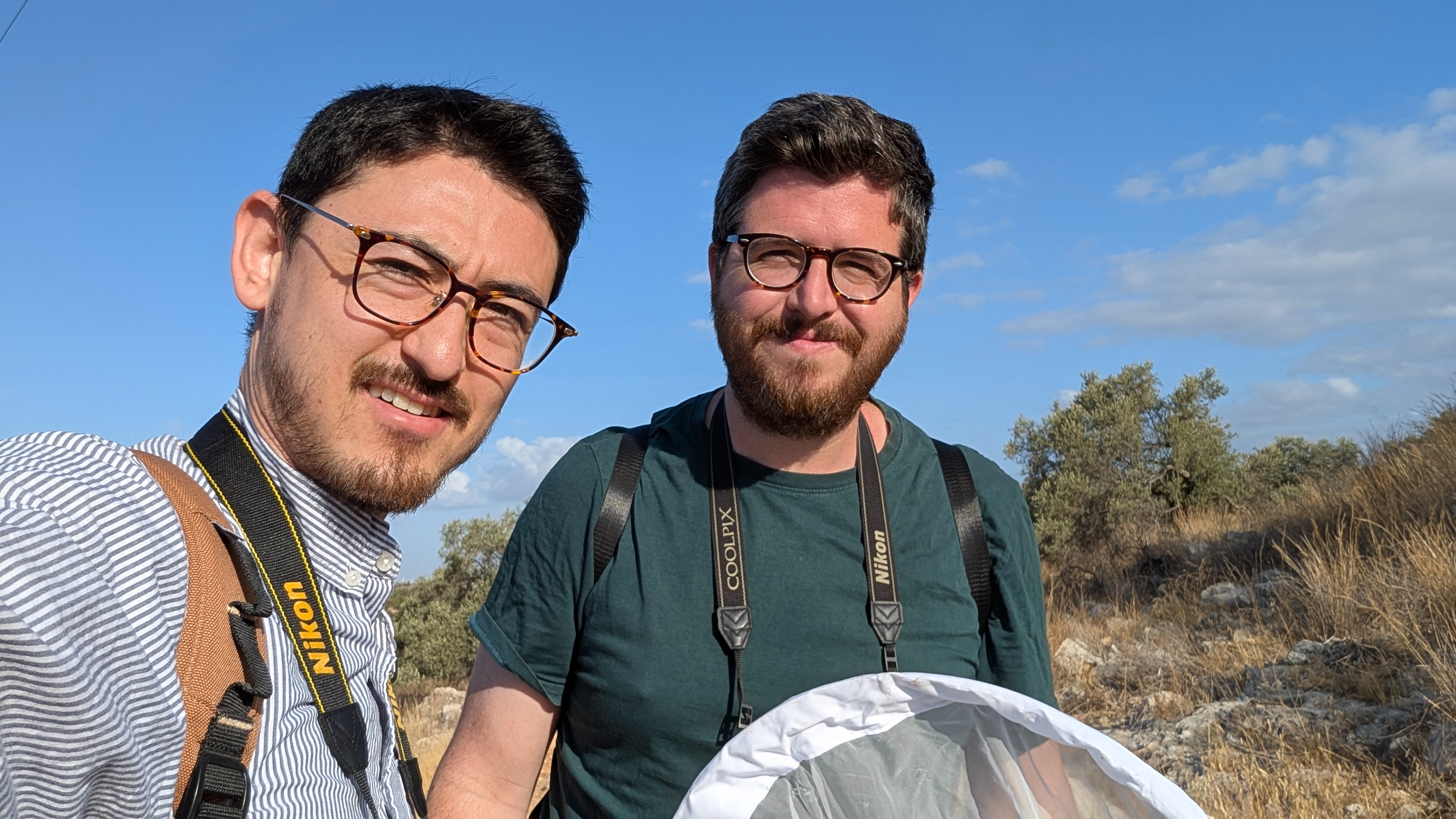
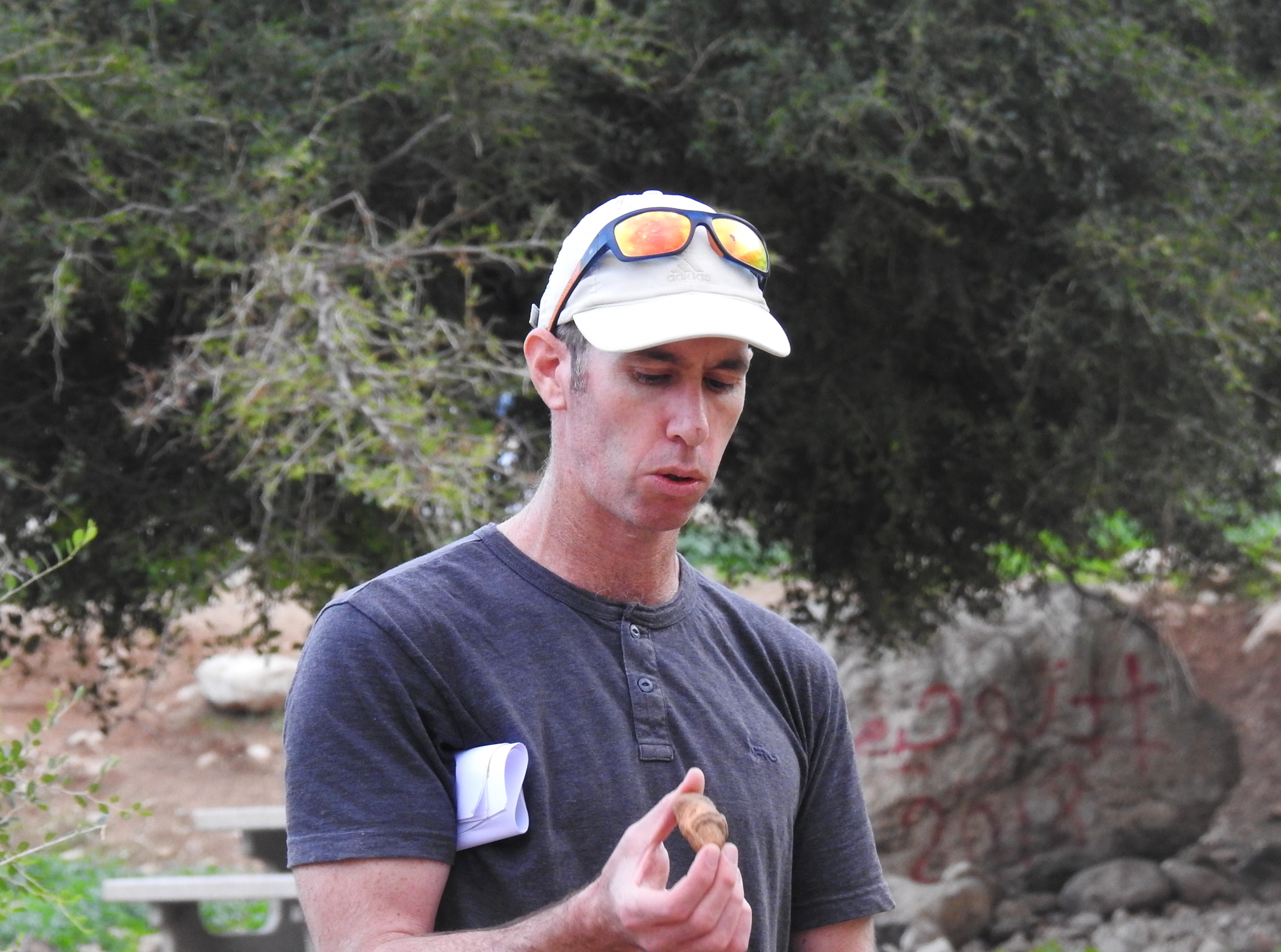
Infrequent explorers (photo Adam Ota)

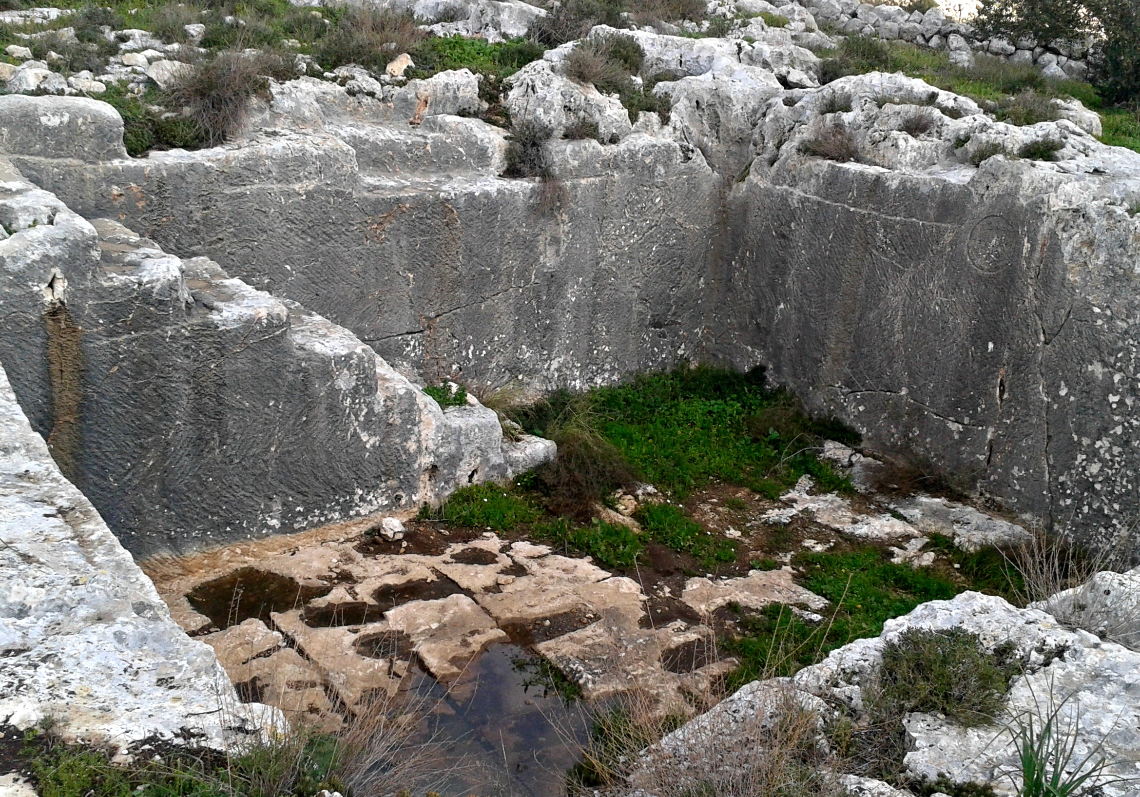
Eventually, as we were leaving the eastern confines of Khirbet Sirisia, we found a mound that showed up as a patch of white in the satellite imagery we consulted as we traveled. It was an old lime kiln, where white quicklime was burnt out of limestone for a variety of industrial and household purposes. We climbed the mound and gazed into the overgrown interior, trying to conjure up images of a raging fire scorching the rocks in the rudimentary kiln. A relatively common feature around ancient settlements, we had seen many limekilns not too far away outside the Crusader ruins of Mirabel (Migdal Afeq).
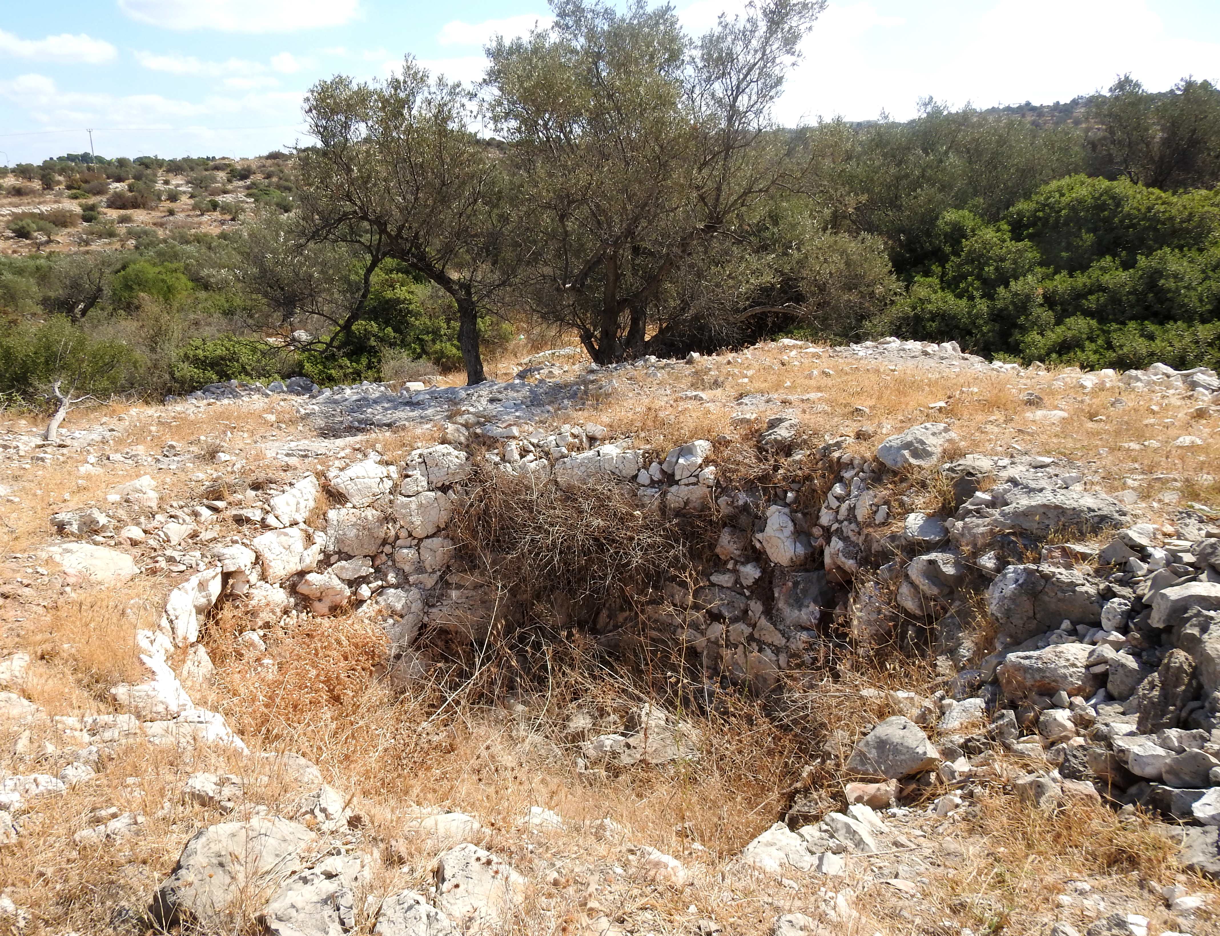
Old limekiln

From the ruins we made our way back towards the stream, and merged onto a marked trail that was maintained and easy to hike on. The sun was starting to become oppressive and the animals were slowly becoming more scarce as the temperature climbed. En route, we found another male mountain gazelle, watching us from the opposing slope, and then a sparrowhawk which graciously entertained us in attempts to hunt some nearby birds.

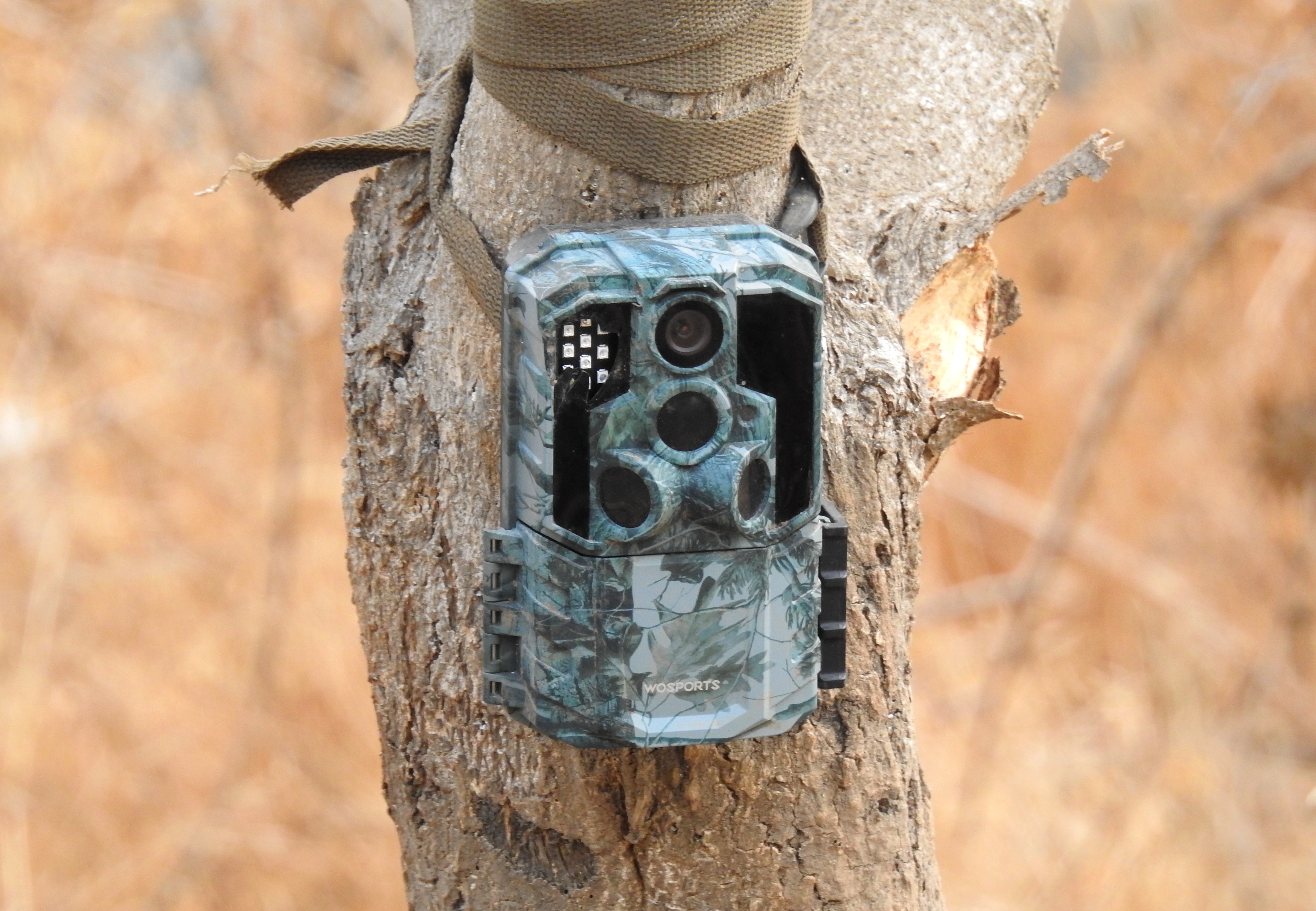
My trusty (yet damaged) trail camera

We reached Adam’s parked car at the water treatment structure and brought our little adventure to a reluctant end. Due to the area’s size, another trip or two will be needed to fully explore the environs, whenever the opportunity arises. Until then, other adventures are forever waiting.

Qesem Cave Archaeogical Dig

In Central Israel, Israel, Samaria on December 23, 2025 at 8:29 AM

The summer of 2025 turned out to be quite productive in the adventure category, even with an intensive two-week war with Iran disrupting the flow. A mere week after my nature trip with Adam Ota to the Sharon Beach Nature Reserve, I found myself on another adventure, and much closer to home. On one morning’s commute, I happened to notice that excavations were being renewed at the famous Qesem Cave, a groundbreaking archaeological site discovered in 2000 that sheds light on prehistoric life in the Levant. A quick Google search put me in contact with Dr Ella Assaf, director of the excavations on behalf of Tel Aviv University, and arrangements were made for me to join the team as a volunteer one day in mid-July. Thankfully, Qesem Cave is only approximately 7 kilometres from my house, and thus an easy drop-off for Bracha on her way to work.

Qesem Cave excavations

One wouldn’t necessarily expect such an important archaeological site to be flush up against busy Road 5, the main artery connecting the Mercaz (or, Central Israel) with the Shomron (Samaria), yet it is. The cave itself was discovered when roadworks were underway, and that led to the road taking a bit of a turn to avoid the ancient, protected site. Today, the cave is housed in a large steel cage where a small team can toil away comfortably – as long as the honking is kept to a minimum. Entering the complex from the east, I found a small team of archaeologists, students and volunteers working quietly. First, I was directed to Ella who greeted me and gave me a little tour of the site.

Looking down at an excavation shelf

While the term “cave” insinuates an underground cavern, Qesem Cave has been reduced to more of a pit. Construction on Road 5 had torn into the roof and initial chambers of the ancient cave, which had already been filled with soil thousands of years ago. Thus, what exists today is simply the excavated sections of the exposed cave interior, or the remains thereof.

Qesem Cave in 2001 (photo Gopher et al 2005*)

Research had learned that the cave was initially settled during the Lower Paleolithic, the stone tools aligning with the Acheulo-Yabrudian culture complex. Recent academic papers have focused on shaped stone balls being used as tools for smashing bones for marrow consumption – certainly an interesting pursuit. Unfortunately, with my academic interests focused on the medieval period, I frankly know little of prehistory and its culture beyond what I had learned in my BA coursework.

Back in the caves

After the short tour of the small dig site, it was time for some breakfast with the hardworking team. Having a gander at the table of food, I found bread, cheeses, cut vegetables, honey and jams, and some nice little borekas filled with either spinach or eggplant. I made myself a little plate and chatted with the friendly Tel Aviv University students as we feasted in unison. 

Ancient horse tooth scraped out of the earth

When breakfast fizzled out it was time for me to earn my keep. Ella handed me off to a young man who was working on sifting the excavated soil. Since I was volunteering on the last full day of the season, actual digging was kept at a minimum so that all of the finds could be properly processed. This being a prehistoric excavation, with soil that filled the cave so long ago, meant that each scoop of dirt might contain something important for research. So, doing our due diligence, we sifted buckets of dirt and picked our way through the larger pieces, pulling out bone fragments, shards of flint and the occasional tooth that belonged to a horse or similar ungulate species. It was an interesting experience, somewhat reminiscent of the sifting work we had done at the Tel es-Safi excavations in 2017 and 2018.

Time for some sifting and washing

After some time, I was redirected to assist a young woman who was washing stones and bones that had been extracted from the cave. Sitting uncomfortably on the uneven ground, we emptied buckets of dirty rocks into a large sieve and washed them in a bucket of muddied water. Working quickly, we did a preliminary cleaning and laid the stones and bones out to dry on newspapers. Some of the flint rocks were quite beautiful but it was one rock with a pattern of concentric circles that really caught our eye – alas, my geology knowledge is lacking.

Interesting find

Getting up from the artefact washing, we broke into a juicy watermelon – the quintessential summertime archaeological excavation snack. Upon having our fair share of the sweet fruit, I shifted back into a sifting role and enjoyed sitting in a chair once again. That went on for twenty minutes or so, and included a visit by some representatives of the Israel Antiquities Authority, until it was time to start packing up.

Quintessential excavation snack

Ella led a short tour for her diligent team, moving from dig site to dig site within the small cave’s confines and summarising the season’s efforts. With that we gathered up all of the relevant tools and supplies and made our way back to the parked cars along the 5. I nabbed a ride with one of the senior volunteers, who graciously dropped me off at Qesem Junction, where I took a bus back home.

*Gopher, A., Barkai, R., Shimelmitz, R., Khalaly, M., Lemorini, C., Hershkovitz, I. & Stiner, M., 2005, “Qesem Cave: An Amudian Site in Central Israel”, Journal of the Israel Prehistoric Society 35, p. 71.

Lookouts of the Western Shomron

In Israel, Samaria on July 22, 2025 at 3:25 PM

This past Yom Haatzmaut, or Israeli Independence Day, we took the opportunity to visit some old friends living a bit deeper into the Shomron (Samaria). It was a lovely morning, the first of May, as we got into the car and left our home in Elkana, driving south past the Crusader castle Mirabel and Mazor Mausoleum before turning back into the Shomron. Our friends, the Yablons, lived at the time in a small, up-and-coming yishuv by the name of Kerem Re’im, nestled in a cluster of Jewish settlements about 7 km northwest of Ramallah.

Map of the lookouts

Passing a checkpoint or two, we reached the small enclave and made our way to their house. Meeting up with Ben and Miriam, and their three kids, was a nice reunion celebrated with pita, spreads, cookies and strong black coffee. We examined our options and decided to have a short drive over to the nearby mountaintop, which overlooks Kerem Re’im and can be seen from their front door. Getting back into the car, it was a nice and windy drive up Mount Harsha – familiar in part from my stint in military reserves.

Panoramic view from Mount Harsha looking north

Atop the mountain is a small community which was established rather recently, in 1999. At the northern edge of Harsha is the lookout which is approximately 740 metres above sea level. It provides excellent views of the surrounding countryside and more, depending on weather conditions and visibility. As exciting as that seems, my attention was drawn elsewhere – to the sky! Dozens of birds of prey were zipping along the strong winds, heading northeast as they migrated back to Eurasia.

A bit of raptor migration overhead

For raptors passing through Israel, spring migration usually takes place further east than it does in autumn, which generally made it difficult for me to witness. Now, I was darting my eyes left and right as I spotted dark figures coursing through the cloudy skies, wings tucked as they soared past. I saw some steppe buzzards, honey buzzards, black kites, lesser-spotted eagles, short-toed eagles and at least one steppe eagle.

Posing atop Mount Harsha

After an agreeable look around, we headed back to the cars to drive down to a local spring, Ein Harsha. It was directly downhill on the southern side of the mountain, the winding road leading us to some fruit trees and an open area to park.

The Yablon child-juggling act

We hadn’t come properly attired for a dip in the spring, nor is that something that ever appeals to me too much, so we had a bit of a gander and enjoyed watching other families splash about gleefully. The spring itself gushes out from the cliffside, obscured from view, and empties into a large concrete basin. Fixed ladders allow swimmers to enter and exit freely, no matter how much water there is at any given moment.

Ein Harsha

Overlooking the spring, I noticed some interesting construction projects which appeared to have been abandoned. A bit of research on AmudAnan told me that this was a housing project for then-PA leader Arafat’s security forces, funded by the EU and abandoned when the funds ran out, one way or another. As I looked up at these structures, I saw bee-eaters and a hovering short-toed eagle hunting in the distance.

Short-toed eagle looking for prey

We tried a local freshly-picked clementine, which proved to be inedibly sour, and then got back into the cars to drive back to Kerem Re’im for the barbecue. While Ben manned the grill, I cracked open one of our old homebrews that we had made together back in Givat Shmuel under the Arx Meles branding. It was a barleywine brewed back in January of 2019, clocking in at an impressive 12.1% ABV. I can’t say that I particularly enjoyed revisiting the potent ale, but it was a fun experience and I wonder what time will do to the other bottles waiting in storage.

Tasting the old barleywine

The barbecue was delicious, a smorgasbord of grilled meats and side dishes, and we ate to our hearts’ content. Finishing off with a chocolate chip cookie or two, I headed outside with Amir for him to play and noticed that I could see – and photograph – the lookout of Mount Harsha from outside the Yablon residence, nearly 1.6 kilometres away as the crow flies.

Mount Harsha lookout from Kerem Re’im (1.59km away)

When we drove home, we passed by the cliffs under Pedu’el, alongside Nachal Shiloh before it drains down into the coastal flatland and becomes a tributary of the Yarkon. I felt quite inspired by the previous lookout, so much so that we formulated a plan to go back again the following day, this time to the Israel’s Lookout at Pedu’el (which I had already been to two or three times before).

Juvenile Sardinian warbler

The very next day, a calm and relaxing Friday, we got out and drove to Bruchin, one of the nearby towns that is close from a geographical sense, but requires quite a drive to physically get there. Bruchin, as I remember it from my army days, was quite a fledgling community and had quite the small settlement vibe to it. Now, an extensive housing project has transformed Bruchin into a much-desired locale for young, orthodox families. With the housing came civil infrastructure, including the popular Hillel’s cafe, which was our first stop for the day.

Some hollyhock backdropped by Deir Balut

We ordered some food and drink for the three of us, delighting myself with the most fantastic balsamic-glazed caprese croissant. It sang into my gullet, each bite more decadent than the last, begging to enslave me to the unsuspecting artisan who crafted the choice morsels. Anyway, once we finished our brunch, we drove on over to the far end of Pedu’el, overlooking the central coastal region of Israel.

Family selfie at Pedu’el’s lookout

This lookout (approximately 380 metres above sea level) has become more popular in recent years, so much so that there is a paved trail with informational signs and even a coffee cart café just outside the entrance. We joined the throngs of visitors, Friday being a national day off for most of the workforce. I was pleased to see the recent developments, and marveled once again at the lovely view. Although, this time, a new landmark jumped out at me. It was none other than the almost-completed Protea assisted living facility, whose behemoth structure rises up from the residential houses of Elkana. 

Elkana as seen from Pedu’el’s lookout (5.6km away)

While the photo certainly captured the Protea building, unfortunately, the Elkana lookout (to be discussed soon) is mostly out of frame – just the winding path up, and a bit of the gazebo is visible right above the gleaming minaret on the far left side of the picture. But, we enjoyed taking photos and walking about the crusty bedrock on the gentle slope to the precipice.

Bracha and Amir having a closer look

Similar to the day before, there was a bit of migration activity – mostly a few buzzards and short-toed eagles. We sat together on the porch swing, rocking ever so gently, as we chatted and admired the views of Deir Balut and the Tel Aviv skyline. The Samaritan monastery ruins of Deir Qal’a were off to the left of us, just a short hike away, but I had already visited the site before.

Mount Harsha from Pedu’el’s lookout (15.84km away)

As we were heading back, still needing to prepare for Shabbat that evening, I realised that I was looking at a familiar mountaintop way off to the southeast. I steadied my camera’s 83x optical zoom and zeroed in on the three short antennas cresting the rounded peak 15.84 kilometres (nearly 10 miles) away. Sure enough, I had spotted Mount Harsha and, although not visible at this distance, the lookout where we had stood the day before. I was overjoyed, and ecstatically shared my discovery with my family, and then with the Yablons once I transferred the photo to my phone.

Pointing out Joshua’s Altar on nearby Mount Ebal

Ending on a high note, we headed back home and resumed our daily lives, until the following Friday. Inspired by our own adventures, and eager to see the famed Har Bracha tehina factory, we got back into our car and drove off in the direction of Shechem (Nablus). Just before we reached the city entrance, we turned left and drove up Har Bracha (or Mount Gerizim). We drove through the Samaritan village and then parked outside the factory. Sadly, the workers are all off on Fridays, so we couldn’t have a production tour, but we managed to buy some wholesale tehina from the big boss and relegated ourselves to enjoying the view atop Mount Gerizim. First we looked towards the northwest, where the urban sprawl of Nablus creeps up the opposing mountain, Mount Ebal. Although I have yet to visit Mount Ebal, there is a famous archaeological site at the very top, believed to be Joshua’s altar from the biblical book of Joshua (8:30–35).

Amir looking out over Shechem (Nablus)

Next, we popped over to Mitzpe Yosef, a mighty fine lookout around 800 metres above sea level, boasting views of Shechem and the Samarian landscape beyond. I had visited the IDF outpost adjacent to the lookout several times during my army service, and remembered the place quite fondly. I enjoyed pointing out the various landmarks in Shechem down below, most notably the ancient Tel Balata and Kever Yosef, where the biblical character Joseph was believed to have been buried.

Practicing my photography skills

I don’t think that we can truly count Mitzpe Yosef as one of the lookouts of the Western Shomron, but Elkana’s lookout certainly does fit the geographical qualification. Generally, when we would go out for a walk on Shabbat afternoons when the weather was better, we either walked around the security fence (near where I had affixed my trailcam in recent months) or up to the lookout. Since every time we had journeyed up to said lookout was on Shabbat, I never had the opportunity to take any pictures – particularly troubling when once we saw some breathtaking cloud iridescence, which just begged to be photographed.

Tel Aviv skyline from Elkana’s lookout

Either way, since we frequent the lookout, I figured it was only fair to include it in this blog post. So, we planned a nice picnic dinner for late afternoon on Thursday, the 12th of June. We greeted the other visitors – including one young man who had a camera set up on a tripod – and settled down for our delicious spaghetti, watching the sun slowly make its way down towards the Levantine coastline.

Layers of pastel beauty

Every now and again I took some photos, hoping to capture a good representation of the nice views we had, albeit being only approximately 290 metres above sea level. From the lookout, one can see as far north as the Hadera power station on the coastline, where sharks frequent. Yet, to the south, I couldn’t quite make out Pedu’el’s lookout, and failed to get any photo of it.

The gazebo lookout at Elkana

That said, I did manage to take a photo of Elkana when flying over, coming back from our little family vacation to Rome in the beginning of February (trip album HERE). When zoomed in, the lookout’s gazebo can be spotted to the left of the giant water tank on the far right side of the photo. Months later, I’m still quite impressed that I was able to get such a clear photo through the thick glass of the airplane window, and considering the speed of a jet in descent.

Elkana from the airplane window

Back at the lookout, Amir and I climbed about the rocky terrain around the gazebo, and ventured towards the old Jordanian military bunker which used to be manned with Jordanian soldiers, facing the old border to the west. In fact, Elkana itself is built on conquered military ground, the current local council building being an old Jordanian police station and/or army outpost.

Exploring the Jordanian bunker area

When sunset came, I was taken back by the beauty, and pleased that I was finally able to capture the rich, warm oranges that painted the horizon. Snapping away furiously, I tried my very best to capture both the lookout itself, and the magnificent culmination of yet another day.

Sunset at Elkana’s lookout

Later that night, we were woken to chaotic alarms coming from our phones, eventually learning that the IDF had launched a full-fledged military operation against the Iranian regime. I was happy that we were able to have that moment of peace as we basked in the sunset, since the next two weeks were a tumultuous turn of events. From dashes to the local bomb shelter (where we met the young photographer from the lookout) and sleepless nights to the morale-boosting reports of our successes in both military and diplomacy, and then back to the tragic news of Iranian missiles landing in densely-populated cities, causing twenty-eight senseless deaths.

Berry Picking in the Shomron

In Israel, Samaria on November 22, 2023 at 1:27 PM

Back in late June, which now feels like eons ago, we had another family outing. For the past year or two, Bracha had been yearning to go fruit picking but for one reason or another, it just hadn’t come to fruition. That was the case until June, when she had seen recommendations of a berry picking place called Bikurei Shiloh, located next to Shiloh in the Shomron (Samaria).

Bikurei Shiloh backdropped by grapevines

Bikurei Shiloh backdropped by grapevines

Tragically, just two days before our scheduled trip, four Israelis were killed in a terror attack just 3.5 kilometres up the road outside of Eli. It was uncomfortable to push through with our plans, but we were as determined as ever not to let terrorism alter our lives (a recurring theme in Israel, sadly). As we drove by the site of the attack, we saw a small grouping of people and what seemed to be a makeshift memorial surrounded by waving flags.

Rows and rows of berry plants

Rows and rows of berry plants

It was already late in the morning when we pulled into the parking lot, the U-pick site nestled between ancient Shiloh and Nachal Shiloh, both of which I had visited back in September 2017. We entered, receiving small baskets and instructions, and then made our way to pick some berries. Our options for the day were strawberries, raspberries and blueberries – the plants located in long netted rows, protecting them from the elements and pests.

Strawberry in the sun

Strawberry in the sun

We started with the strawberries, which were on the cusp of being perfectly ripe. Thus, we had to scour the leafy plants in search for the choicest plump red fruit. I was wearing 10-month old Amir in the baby carrier, which allowed him to also grab at the dangling berries with his pudgy little hands. As an added perk, at that point in time, strawberries were probably his favourite food.

Blueberries galore

Blueberries galore

After a few handfuls of strawberries, we decided to move on to the next berry of choice: blueberries. Entering a separate netted area, we stepped into blueberry heaven. For any strawberry that was lacking, there were thousands of blueberries to make up for it. So much so, that we hardly had to go anywhere to pick all the blueberries we’d want. But we walked around, browsing the berry bushes, choosing only the choicest dark blue orbs. For, as it is known, the darker the berry, the sweeter the juice.

Bracha finding a choice raspberry

Bracha finding a choice raspberry

As per the raspberries, those were less abundant than the blackberries but, when ripe and juicy, exploded merrily in our mouths. When we had finished picking all the berries that we desired, both to eat on site as well as those to take home, we decided to stop for a picnic lunch.

Some berries for the road

Some berries for the road

Wisely, we had picked up some rolls and sliced deli meat, making perfect sandwiches to enjoy in the shade of the olive trees. I sat in a hammock, Amir in my lap, all three of us happily munching away.

Berry bliss

Berry bliss

However, our adventure was not over yet. After we had paid for our berries and completed the journey back home, Bracha decided to make a blueberry pie. It was the perfect, and most decidedly sweet, way to end yet another family outing.

University Trip: Nachal Rash’ash

In Israel, Samaria on January 27, 2019 at 9:16 AM

One month ago, in mid-December of last year, I participated in an adventurous field trip with fellows from Bar Ilan University. This particular trip was the first part of a field class on a range of fields including Geology, Geography and Archaeology, led by Dr Dvir Raviv. Knowing that his trips are always a great success, I signed up eagerly and I was not disappointed. The day began at Kida, where we enjoyed a lookout over the Arab village of Duma and the eastern Shomron, learning about the geography and topography in our view. One curiosity, which only became apparent once our guide pointed it out, was a soccer field delineated by field stones, nearly indistinguishable from the nearby agricultural terraces.

View from the Kida lookout

Returning to our tour bus, we were driven to our next destination, Khirbet Jib’it and its extensive ruins. Starting from the east, we climbed the gentle hill to the top and took in both the characteristic Shomron landscape, and the sprawling ruins of crude ashlars. Crested larks frolicked in the nearby patch of ploughed land, and a lone black redstart hopped from rock to rock as we learned about the site and the archaeological advancements made over the years.

Khirbet Jib’it ruins

We continued on to the more ruins slightly to the north and gazed down at the Roman era hiding complex that we couldn’t enter due to safety and insurance reasons. Scattered around the area were many potsherds, some of them painted and dated to more recent Muslim periods (Mamluk and Ottoman). One fine sherd was nicely glazed and believed to belong to the Crusader period – which interested me greatly. And then there’s this large piece that’s either dated to the Crusader or Mamluk period:

Crusader/Mamluk pottery

Our last stop at Khirbet Jib’it was to the Byzantine church on the northwest corner of the site’s main hill. There, among the local Bedouin sheep, we found some of the church ruins as well as a bit of a newly exposed mosaic. A short walk downhill on the ancient road took us to our waiting bus and then onto the next site.

Exposed mosaic

Pulling over at the side of the road some twenty minutes later, our bus dropped us off near an obscure archaeological site called Khirbet el-Marajim. After a five minute walk, and we were at the outskirts of the site, one of the sharp-eyed members of the class picked something off the ground: a rock with a trigonia fossil.

Trigonia fossil

Within minutes we were gathered around the main attraction of el-Marajim: a large excavated pool with a partially collapsed tower from an earlier period in one corner. Nearly hidden, yet plainly in sight, are the entrances to an underground hiding complex from the Roman era. A quick look at those, and some explanation on the site and we were off to the next part of the trip.

Pool at the waterfall

We hiked down from Khirbet el-Marajim towards the nearby wadi, through the characteristic Shomron terrain and towards the stream that bears the name of this post. It only took fifteen or so minutes before we entered a very different area – from the terraced green slopes to the boulders of the streambed.

Deep gorge of Nachal Rash’ash

We stood at the dry waterfall, where just a large pool of cold water remained from the seasonal rains, and surveyed the land before us. A deep canyon opened up, revealing what would be Nachal Rash’ash, and the two sides reached up higher than before. Several black kites soared overhead relatively low, perhaps hoping that one of us would fall into the ravine and become their next meal.

Black kites circling overhead

But, alas (for the carrion-eaters), none of us slipped and we set out on the trail, progressing along the somewhat muddy southern slope. While the hike felt slightly treacherous, the views were breathtaking and our quick pace kept us rightfully occupied. A half hour later we took a break, sitting down beside the freshwater spring of Ein Rash’ash. We broke for lunch and ate in peace, celebrating the glorious mountain view that sprawled out before us.

View from Ein Rash’ash

There were a handful of birds around us, including the ever-patrolling black kites, a few noisy Tristram’s starlings, a blue rock thrush or two and a lone Syrian woodpecker that perched relatively close-by. Suddenly Adam, who was periodically scanning the horizon with his 10×42 binoculars, cried out and pointed to one of the slopes in the direction of the Jordan River Valley. What followed next was a series of photographs taken at a great distance of a large bird of prey perched on the rocky slope hundreds of metres away.

Golden eagle far, far away

We had found a very first golden eagle, a relatively rare bird in Israel, and there was much rejoicing. It was nearly the end of 2018 and definitely a most welcome sighting to finish off the year. In 2017, I had spotted a white-tailed eagle in the Hula Valley mid-December, so now I just wonder what next big eagle I’ll see in December on 2019. After our lunch break we got back up and continued hiking along the southern slope, learning about the geology and geomorphology of the region as we got closer and closer to the Jordan River Valley. Eventually reaching a ridge, we hiked like kings, the vast land stretched out around us nearly devoid of human presence.

Einot Pazael aqueduct

After the ridge came the slope and we found ourselves entering the valley at Einot Pazael, where springs and a slow, gurgling brook can be enjoyed. When we gathered around the brook, tea was prepared and snacks passed around, for the sun was setting over the mountainous region we’d just hiked and we were all a tad cold and in need of nourishment. A great grey shrike came by to watch us, calling noisily from a nearby jujube tree, as we wolfed down pretzels, crackers and cookies.

Dr Dvir Raviv and a potsherd

When we were done there it was just a short walk to the bus and then the long drive back to Bar Ilan University, bringing the first day of the field class to an end. The second day, scheduled for mid-January, took place in Wadi Dalia and Sartaba and shall be written about posthaste (or something like that).

Shiloh

In Israel, Samaria on October 22, 2017 at 2:57 PM

In the middle of September I took part in a nice day trip as part of my job at the high school where I work. The class I was accompanying was headed for Shiloh, a site I had yet to visit, the longtime resting place of the Jewish Mishkan (Tabernacle), the temporary Temple, in biblical times. Ready for adventure, we boarded our armoured bus to be driven to Shiloh, located in the Shomron, south of Tapuah Junction on Road 60.

Tel Shiloh

As I was passing my old army-time stomping grounds, I enjoyed driving through the Shomron and seeing the daily life just as I had left it years ago. We reached Shiloh and pulled into the small parking lot, disembarking beside a seemingly religiously-oriented Byzantine structure named the Dome of the Divine Presence. Its sloping walls made it quite curious looking, but there was little time for examination as I had school lads to tend to.

Dome of the Divine Presence structure

We gathered within the park, gazing down at a Byzantine reservoir and well, which was once outside a Crusader church, of which there are no remnants. Inside, past the gift shop, we broke into class groups with our own tour guides – ours was Eli Riskin, who exuberantly led us onto the first of the sites that we’d be seeing during our Shiloh trip.

Reconstructed Byzantine basilica

The first site was the reconstructed Byzantine basilica, a rough concrete structure built by a Danish archaeological team sometime between 1926 and 1932. What they were sheltering was an expansive mosaic floor with various designs and motifs, the two most interesting being a Star of David and an inscription in Greek by the doorstep which helped positively identify this site with biblical Shiloh.

Byzantine mosaic

Dillydallying a bit with my camera trying to get nice shots of the mosaics and ruins, I became separated from my group and continued on past a Mamluk mosque, also decorated with mosaic floors from the Byzantine era. A piece of a horned altar from the Second Temple period was found here, fueling the fervor surrounding the site’s religious importance.

Ancient olive oil production

From there I began the climb up the hill, Tel Shiloh, with the ruins of the ancient city exposed all around me. I kept walking uphill heading for HaRoeh Tower, the visitors centre where the lads had congregated. Along the way, at the lookout, I admired modern-day Shiloh and the glimpse of the Tabernacle Memorial synagogue, built to replicate the ancient Tabernacle at least from an architectural standpoint.

HaRoeh Tower

The school lads were watching a short film about Shiloh from a biblical perspective so I took the opportunity to visit the tiny museum by my lonesome. Exhibiting artefacts in a circular fashion in accordance with their timeframe, the museum houses some nice ancient vessels, weapons and coins.

Ruins of Tel Shiloh

At last we went down to the area that is believed to be the site of the Mishkan, based on geographic and topographic calculations. We passed the wall of the original Canaanite city and reached a flat area where the bedrock was hewn in sections. Sitting beneath a shade booth we listened to the tour guides as they explained the site to us, followed by praying Mincha.

Heading down to the supposed site of the Mishkan

Having reached the end of the park we made our way back, taking the scenic route around the western edge of the original city. Back at the entrance I checked out the Roman winepress installation and the hewn-rock graves, dated to the Second Temple period. After lunch of deli sandwiches we made our way to the buses, which afforded me a quick peek at the aforementioned Dome of the Divine Presence structure, and we were driven just across the road.

Dusty grapes

Disembarking, we took a nice hike along Nachal Shiloh, just about four kilometres of classic wadi hiking. At first we passed the Shapiro Family Vineyards of lush, albeit dusty, grapes just waiting to be made into boutique wine. When we dipped down to the trail along the dry streambed, we followed our nimble guides as we traversed the rocks. Along the way I stopped here and there to see if I could find any cool wildlife. At one point, fast movement along the top of the ridge gave away two mountain gazelles which I barely caught with my camera. Later, I found some nice birds, namely a few blue rock thrushes and my very first red-backed shrike.

Hiking Nachal Shiloh

Unfortunately, the spring we were headed to turned out to be quite choked by algae so we kept onwards, re-emerging at the end of the trail where the buses were waiting for us. Upon returning to Givat Shmuel, I met up with my frequent travelmate Adam for a evening out to the Dancing Camel brewery for the annual release party of the acclaimed Doc’s Green Leaf Party IPA, the highest rated Israeli beer according to voters on RateBeer. So ended another successful adventure.

University Trip: Tel Aroma & Mount Gerizim

In Israel, Samaria on July 30, 2017 at 3:42 PM

Towards the end of this past semester, before I was distracted by the wonderfully hectic month of archaeological digging at Tel es-Safi (biblical Gath), I took a day-trip with the legendary Dr Dvir Raviv to some cool sites in the Shomron. Another of Bar Ilan University’s Archaeological department’s academic tours, this was one that I had been looking forward to all year – especially after last year’s fascinating trip to the Southeast Shomron with the same Dr Raviv. Our tour bus departed from the university campus in the morning and we made our way to the Shomron, driving through the ever-entertaining Arab village of Hawara and then passing Shechem (Nablus) before entering Itamar where we disembarked at an army post. Gathering around and applying sunscreen, we were briefed by Dvir who told us the plan of the day. Much to our surprise, he pointed to a conical peak a ways away and announced that we were to climb it – for that is Tel Aroma.

Making our way to Tel Aroma – the central peak

We set off expeditiously, making our way down the slope of the low mountain that we were on, and reached the paved road down below in good time. This was an ancient road that crossed the mountains of the Shomron and we walked it to get to a good spot to climb up to the tel. Along the way, we saw planted olive trees, wild carrot in bloom and my first definite sparrowhawk which flew away before I could squeeze off a shot. Leaving the road, we stopped beneath a gathering of almond trees to learn more about the area. As I looked about I noticed that some of the almond shells had been chewed by one of nature’s hungry inhabitants, and upon proposing the identity question to experts, learned that the nuts were eaten by rose-ringed parakeets (an invasive species in Israel).

Chewed and crystalised almond on a stick

Sitting in the welcoming shade, the peaceful sounds of nature surrounding us, we rested, ate, drank and listened to the mini-lecture. When we rose refreshed and began our ascent of the mountain something interesting happened. The leading members of our party had startled a small sounder of wild boars – some adult females and a handful of striped youngsters. I heard my name being shouted and became aware of the wild boars making their escape, passing an old stone structure as they fled downhill.

Wild boars

With the brief excitement over we returned to the task at hand, scaling the mountain without the use of a marked trail. Dvir led the way, springing lightly up the slope, and we followed behind dutifully. The going was a little tough, but rather invigorating, and we made great time due to our youthful enthusiasm. I stopped at one point and took this great photo of my friend Ben Yablon climbing behind me.

Ben climbing Tel Aroma

At last we reached the top and we laid eyes on a hewn cistern – the first of many, which look like small caves from the outside. Around the cistern, and across the top of the tel, were large amounts of cut ashlars for monumental construction. With the mountaintop first fortified by the Canaanites, the site’s subsequent history is poorer than so many of Israel’s tels largely due to its remoteness and inaccessible nature. Biblically mentioned only once, the tel is referred to as a stronghold near Shechem and it is not until the Hasmonean period that Aroma’s importance came into play. Being in the land of the Samaritans, which we would see in the second half of the day’s tour, the Hasmoneans conquered Shechem and Mount Gerizim from them and took up fortifications at Aroma and Sartaba further to the east. It was during this time that the fortress was built and immense water reservoirs were carved out of the bedrock. The next, and final, period of importance for Aroma was during the time of Herod around 2000 years ago, when it was refortified to keep control over the Shomron roads.

Tel Aroma from above (photo Biblewalks.com)

We made our way to the southern end of the tel and admired both the view and the ruins. The blue sky around us was alive with energetic swifts (mostly common with one or two alpine thrown in), keeping us company as we explored. Suddenly a strange call was heard and fellow tour member Nesia, a more experienced birder than I, informed me that a bee-eater had flown past – of which I saw but a fast-moving blur. We settled down beneath some olive and fig trees to learn more from Dvir and I found myself promptly distracted by a bird flying about among the rocks far below. Using Nesia’s binoculars and my own camera (even with the inferior digital zoom), I couldn’t figure out exactly what I was seeing. Turning to the experts once again, I was informed that I had seen and photographed a black-eared wheatear (my first). From the same vantage point, this time heard but not seen, was the familiar drumming of a Syrian woodpecker. And lastly, some ravens above a distant mountaintop were spotted and added to the list.

Hasmonean fortress ruin

With Tel Aroma never excavated – only having been surveyed – it was sad to see that vandals had destroyed part of a Hasmonean wall that Dvir had found intact only several days prior to our trip. A photo from 2016 of Dvir standing at the wall that had just been destroyed can be seen HERE on Biblewalks, an amazing site which he collaborates with from time to time. He told us an interesting story of his encounter with a band from a nearby Arab village who demanded to know what he was doing, whereas their presence was the one which truly demanded explanations, as antiquity robbing is commonplace in such areas. Leaving the fresh ruination behind, after documentation, we made our way to the line of cisterns along the western side of the tel.

Within the immense cistern

We entered the first of the immense cisterns, lined with plaster to retain water, and marveled at the size. Measuring some 20+ metres long by approximately 10 metres both wide and tall, the cistern was designed to hold a maximum of some 2,500 cubic metres – quite a lot of water! Within the cool dampness of the cistern we learned more about the water system of this and other Hasmonean sites, with comparisons to Sartaba and Herodian Masada (which has even bigger cisterns). Exiting the cistern, we emerged blinking in the bright sun and made our way past the succession of similar cisterns until we reached the northern end, where the barely distinguishable remains of an aqueduct can be seen. At that time a gorgeous swallowtail butterfly floated past me and I spent a few minutes trying to get a good shot but to no avail. We then trotted back down the mountain, heading for the point where we started, but from a different angle. We passed a truly peculiar sight as we walked – a field disturbingly littered with plastic bags, with a fresh delivery drifting over with each fresh gust of wind over a distant garbage pile. Someone said that they spotted a fox but I saw nothing note-worthy until we reached a cool spring with its algae-filled pool.

Lovely little spring

We spent a few minutes at the spring and then carried onward downhill – where I took pause to photograph a very calm cicada that tried deafening me with his calls (cicadas being one of the loudest insects, producing sounds of up to 12o decibels – the same as the report of a shotgun). Note the light-sensing eyes that look like tiny red dots on his forehead between his normal eyes.

Cicada

Dashing our way up the mountain towards Itamar, we boarded the bus hot and breathless, gulping down large quantities of water. But the day was far from over – we had another large site to visit: the ruins on Mount Gerizim overlooking Shechem. Driving back past the southern entrance to Shechem, we drove up Mount Gerizim and turned towards the Samaritan village of Luza – all familiar sights from when I was a soldier stationed in the region. The Samaritans were a sect of Jews that splintered off in antiquity and created their own form of Judaism, replacing several of Judaism’s core foundations with those of their own and naming Mount Gerizim as their holy city in place of Jerusalem. Samaritans have had a history of persecution and intermarriage with the local Arab populations which make them a very interesting portion of today’s Israeli demographic.

Hellenistic ruins of Mount Gerizim overlooking Shechem

Located on the southern of the twin peaks Gerizim and Ebal, as biblically mentioned, our tour was mostly that of the national park that has recently been established to preserve the ruins (aerial photograph can be seen HERE). Passing through Luza, we entered the park and disembarked to begin our trip. We began by breezing past the plentiful Hellenistic age ruins as we made for the lookout over Shechem and the Byzantine monastery complex. It was rather enjoyable pointing out the various sites of interest far below, including Kever Yosef and several houses of Christian and Muslim worship.

Byzantine monastery and sheikh’s tomb

Sitting in the shade beneath the walls of the Byzantine monastery, we learned more about the site from Dvir who prepared us for what we were to see while in the comfort of the shade. Skirting the meagre Persian period ruins, we climbed up into the church complex and gazed about at the Byzantine ruins, with the octagonal church remains in the centre and the sheikh’s tomb built into the northeast corner tower. We admired the fallen architectural details, including Corinthian columns and floor mosaics, as we circled the site. Due to the length of the Tel Aroma part of the trip we were slightly pressed for time and weren’t able to explore too finely all the ruins that were laid out before us.

Mount Gerizim ruins with Luza in the background

It was when we were looking out at the Hellenistic ruins of a mansion that I noticed one of my favourite birds hopping about on the rocks – a male blue rock thrush. Glancing at the rest of the ruins, including some Samaritan holy sites, we headed back for the bus because the park was closing. Thus ended another long but exciting trips to the Shomron with Dr Dvir Raviv, I look forward to next year’s with bated breath!

University Trip: Sites in Southeast Shomron

In Israel, Samaria on April 24, 2016 at 5:35 AM

Shortly after the Bar Ilan University department trip to the Kinneret I signed up for yet another trip, this time to some rather obscure sites in the southeastern corner of the Shomron (Samaria) not far from Jerusalem. I joined my group in Jerusalem and away we drove in a bus with plexiglass windows out of the capital and into the wilderness via Hizme Checkpoint. We drove past Tel Aswan and up the mountain to Mitzpe Dani for a 360° lookout and introductory lecture on the location by our guide Dr Dvir Raviv, a lecturer at BIU.

Dr Dvir Raviv giving the 360° tour at Mitzpe Dani

Dr Dvir Raviv giving the 360° tour at Mitzpe Dani

Spinning in a circle at the observation deck, Dvir pointed out on the horizon the various areas of Jerusalem, the desert fortress of Herodian and, to my amazement, the twin Jordan Gate Towers in Amman, Jordan just barely visible in the haze. As we were located in the semi-arid mountains of the southeastern Shomron, not far from the Judean Desert, we had a brief explanatory run-down on the different topographical and historical borders of this particular region. Regrouping in the bus we drove due north on Road 548 to our next destination, Ein Samia.

Military jeep and Bedouin herd crossing paths

Military jeep and Bedouin herd crossing paths

It was at this point that our trip became a hiking adventure. Our bus left us in the company of an army jeep and a Bedouin goatherd with his four-legged host, all of whom disappeared within mere minutes. We climbed up to a flat rock where a round shaft pit was dug into the stone, an ancient burial chamber excavated by nomads. Walking around the area we saw dozens of these nearly perfectly round shaft graves, some reaching the impressive depth of 7 metres (23 feet), a local oddity of which there are thousands.

Nomadic shaft grave

Nomadic shaft grave

We continued on along the dirt road towards Ein Samia, crossing the old cement dam at the modern pumping station. From there we climbed up into the rocky mountainside of Wadi Auja heading for a very interesting site, Namerim Cave (translated as Leopards Cave).

Climbing the cliff edge at Wadi Auja

Climbing the cliff edge at Wadi Auja

We heard the very unusual calls of the common raven as a pair of them patrolled the cliff edges. I nearly stepped on a tortoise and then took photos of a bizarre praying mantis (Empusa fasciata) and a bush cricket (Isophya savignyi).

Bush cricket (Isophya savignyi)

Bush cricket (Isophya savignyi)

As we finally reached Namerim Cave, having climbed precariously along the cliff side, we sat down at the double-mouthed entrance to hear an entrancing story about the cave’s name – while overhead some crag martins flew.

Approaching Namerim Cave from Wadi Auja

Approaching Namerim Cave from Wadi Auja

If I remember the story correctly, several decades ago there were local goatsherds who complained of a pair of leopards living somewhere in the wadi, venturing out to kill goats and even puppies of their guard dogs. The shepherds followed one of the leopards back to its lair, the cave in the cliff side, and trapped it inside. When the authorities came, answering the call, they reopened the cave and two angry and frightened leopards burst out, running away.

Lecture within Namerim Cave

Lecture within Namerim Cave

We entered the cave from the left mouth and heard about the rich archaeological finds discovered within the multi-roomed grotto, including pottery from many periods. While the academic findings and research have yet to be published (consider this a sneak peek), Namerim Cave is believed to have been a place of refuge during the Hasmonean and Bar Kochba times, perhaps also used by the Samaritans who suffered persecution as well. Inside the cave I found a bone laying in the silty dirt, giving cause to all sorts of fantastic thoughts revolving around the fearsome leopards. Some of our party slithered further into the cave, entering subsequent chambers and even finding indicative potsherds, while I hung back and attempted to photograph a small bat that I was unable to identify.

Namerim Cave map by Boaz Langford

Namerim Cave map by Boaz Langford

Reluctantly leaving the fascinating cave, we climbed up the side of the cliff we hiked along to the plateau of Khirbet Marajama, an ancient fortified Israelite city. Not too much is known about the city but the city walls are said to be historically significant.

Khirbet Marajama

Khirbet Marajama

From Khirbet Marjama we walked down the steep slope on the opposite side, facing an aqueduct, bridge and flour mill which is either Roman or Ottoman, depending who you ask. As we looped back around towards Ein Samia we interrupted some Arab looters who were pilfering the dirt in one of the excavated ruins hoping to find valuable artefacts. They scurried off and a call was made to alert authorities, a very interesting turn of events to happen so quickly.

Roman or Ottoman aqueduct and bridge

Roman or Ottoman aqueduct and bridge

Back on the bus and driving westward to the entrance of Beit El, we disembarked once again to visit the last site on our list for the day, Et-Tell. A fragmented archaeological dig covering a large area, the ruins of Et-Tell are thought to possibly be the ruins of Ai, a very significant Biblical city.

Et-Tell ruins

Et-Tell ruins

Located on a slight hill overlooking the Palestinian village of Deir Dibwan, we first came upon the ruins of a Byzantine monastery and nearby village from the Bronze, Iron and Hellenistic periods, perhaps indicating towards the importance of the site. A nearby complex of excavated structures, including many underground mikvaot (ritual baths) and olive presses, attest to a Jewish village back in Roman times.

Underground olive press cave

Underground olive press cave

Within the large underground olive press room we found small tunnels carved out of the walls, hidey-holes in times of persecution.

Emerging from the hidey-hole

Emerging from the hidey-hole

Rounding off the fantastic trip with one last lecture, alas! the hour was late and we had to head back to the bus (being Friday and all) and then back to Jerusalem… and from there back to Bar Ilan University for Shabbat with my dorm friends.

Deir Qal’a

In Israel, Samaria on March 8, 2015 at 4:36 AM

A few weeks ago I partook in a little “excitement” in the Shomron (Samarian) town of Pedu’el, not too far from Ariel. There was a Palestinian shepherd who was creating disturbances near the security fence that encloses Pedu’el and we, the army, were called in to redirect the wayward man. We disembarked near Pedu’el yeshiva and I couldn’t help but notice signs for an archaeological site called “Deir Qal’a”. While the other soldiers began their descent into the valley in search for the shepherd, I sought after the ruins. Scampering over the rough rocks that cover the landscape, I first came upon what appears to be a vat for wine with a mosaic floor, very much like the one I saw at the Crusader castle of Cafarlet.

An ancient wine vat

An ancient wine vat

Now, these ruins are obscure and there are no signs explaining where or what anything is – even researching Deir Qal’a online is proving a little difficult. From what I’ve gathered is that the site was first a Roman fortress, then a Byzantine fortified farm and then a Christian monastery. Given its great vantage points, including a clear view of the shoreline some 26 kilometres (16 miles) away, the Romans would have built the fortress to guard the ancient road from Tel Afek (Antipatris) to Sebastia in the heart of the Shomron.

Blooming anemone

Blooming anemone

A couple hundred years later, the Christians built a string of fortified monasteries along the northern border of the Christian part of the Shomron, as a defending line against the Samaritans who would often break out in violent revolts against the Byzantine Empire. The Samaritans are still around today, still based out of their “capital” on Mount Gerezim overlooking Shechem (Nablus), but they no longer participate in violent revolts. Monasteries neighbouring Deir Qal’a are Deir El-Mir to the west and Deir Simaan to the northeast – with quite similar ruins, although I have yet to explore them. Getting back to my exploration of Deir Qal’a, it wasn’t long before I reached the first walls of finely cut ashlars jutting out into the air.

Deir Qal'a

Deir Qal’a

Unfortunately, as there is no guide or comprehensive description of the ruins, I can’t really describe the series of rooms that I then saw as I drew closer. While researching this site I came across a reference to a monograph written by the late Professor Yizhar Hirschfeld titled “Deir Qala and monasteries of Western Samaria”, however the only copy I could find is in the Hebrew University’s library in Jerusalem – not too readily available, although I’m sure I could have gleaned some useful information from it. Being as that I was detouring from “operational duty” I couldn’t linger too long and missed noticing that there are tunnels connecting several of the rooms in the ruins complex. What I didn’t miss were the numerous etched Maltese Crosses (as used by the Hospitaller Knights of the Crusades) and the incomplete floor mosaics – in fact, a fully restored mosaic from Deir Qal’a is on display at the Good Samaritan Museum between Jerusalem and Jericho, not far from Nabi Musa.

Close-up of a crude mosaic

Close-up of a crude mosaic

I might have just seen an nondescript scattering of stone walls of varying heights and materials but Deir Qal’a contains stone terraces, rooms, cisterns, an olive press and winepress, underground tunnel, a church with an underground cave/crypt and an apse.

A mess of walls and mosaics

A mess of walls and mosaics

Once I had sufficiently explored the upper areas of the ruins I headed back towards the security fence and saw that my fellow soldiers had not yet returned, so I looped back to enjoy the views. Directly opposite Deir Qal’a to the west is the Palestinian village of Deir Balut and the ruins of Deir El-Mir, with a seasonal marsh at the entrance of the village. I read on the Amud Anan website that the water is home to triops, a type of crustacean also known as “tadpole shrimp”. Looking quite similar to horseshoe crabs, it’s believed that the eggs of the triops can last forever as they go dormant and crystalise when dry. It would definitely be interesting to see these “living fossils” – perhaps one day…

Looking across at Deir El-Mir and Deir Balut

Looking across at Deir El-Mir and Deir Balut

To the south there are the rolling hills of the Shomron with ruins abound, including the remains of Binat-Bar, Zereda, Balata and other historically rich sites, as well as Nachal Shiloh snaking its way across the land.

Historically rich hills of the Shomron - looking south

Historically rich hills of the Shomron – looking south

Someone very thoughtful had installed a swinging bench overlooking Deir Qal’a and Deir Balut and so I found myself there, rocking back and forth, enjoying every moment. At last the soldiers came back from escorting the shepherd away from the fence and we drove back to our outpost, leaving me with the need to come back and explore the other ruins another day.

Joseph’s Pit

In Israel, Samaria on January 11, 2015 at 4:30 AM

After visiting the ancient capital city of Sebastia (also known as Shomron, or Samaria), we drove north headed towards Jenin in our armoured convoy. I was participating in an educational and recreational day out for sergeant commanders of Kfir’s “Netzach Yehuda” Battalion and we were headed for the second stop of the day, Joseph’s Pit. But along the way we had a bit of excitement – entering one Palestinian village we were attacked by handfuls of Arab youth throwing huge rocks, molotov cocktails, fireworks and even small explosive charges. It was a very intense experience and kind of thrilling, mostly because I was driving a large armoured truck weighing approximately 13,000 kgs (28,660 lbs) with bulletproof windows and all. In this picture that a soldier from the command jeep in front of me took, you can see a large rock hitting the metal grate at my front windshield during the onslaught:

Driving the Safaron through a Palestinian village

Driving the Safaron through a Palestinian village

I have uploaded footage from this experience, filmed by the lieutenant in the passenger seat, onto YouTube. It’s no high-definition GoPro video but here it is: http://youtu.be/BFvL0v4XDtE (at 00:09 you can hear the explosion of the TNT charge that was thrown at my right rear tire area). After the excitement in the village we continued north on Road 60 until we came to the turn-off for Tel Dotan and Joseph’s Pit, just past the village of Araba. Driving on the incredibly bumpy dirt road, we approached the hill that is Tel Dotan.

Tel Dotan

Tel Dotan

Unfortunately, we were slightly pressed for time and weren’t able to fully visit the site. So we started with Joseph’s Pit – or shall I say, one of three possible pits – directly beside the dirt road.

Deep inside the first pit

Deep inside the first pit

To review the Biblical story, Jacob and his family had moved to the Holy Land and continued in their shepherding lifestyle. Joseph was sent by Jacob to locate his brothers who had gone out grazing from Hevron to Shechem; he found them at Dotan some twenty kilometres north of Shechem. It was there that they cast him into a pit and then sold him to Ishmaelite traders who took Joseph down to Egypt where he eventually rose in power to become a viceroy. Now, I have heard but cannot verify that there were two pits in the story and that one was filled with snakes and scorpions – the pit that Joseph spent the night in. So here and now there are three pits to choose from, although it’s possible that these aren’t the pits in question at all.

The second pit

The second pit

We had all gathered around these two pits and it was announced that we were waiting for the battalion commander to swing by with his command jeep to give a few words. Seizing this opportunity, as I’m not really involved in their command pyramid, I decided to go check out the third pit alone. Located inside an old stone house of sorts, the third pit is a the furthest from the dirt road, not far from the base of the tel.

The house containing the third pit

The house containing the third pit

I entered the old structure, seeing traditional vaulted rooms, arched doorways and the lone stone staircase built on strong arches. I wonder about the site’s history, but haven’t found anything online about it, especially because according to the Muslims (and agreed upon by the Crusaders), the site of Joseph’s Pit is in the Galilee next to Kibbutz Amiad just a few kilometres north of the Kinneret (Sea of Galilee). The Muslim version is known as Jubb Yussef and a small kahn was built at the site somewhere between the 1200’s and the 1500’s to host pilgrims and passing travelers.

Inside the house

Inside the house

Inside the rooms, there were also more modern machinery – what looked like a pump of sorts; an assortment of pipes and a motor. I looked around for the pit, treading carefully, and then spotted light streaming in from a breach in the wall. Peering into the light, I looked down to see the third pit.

Peering into the third pit

Peering into the third pit

To recap, one of these pits are believed to have taken part in the famous Biblical story although it’s not certain to be any of them. After my look around I headed back to the group and we said goodbye to Jabo our tour guide as he got into the battalion commander’s jeep and headed out. We boarded and departed from the site in our convoy formation, heading back to the outpost of Mevo Dotan – a Jewish town built and named after the ancient region of Dotan – for a continuation of the day’s events. Hopefully one day I’ll have the opportunity to visit Tel Dotan, but as it is located in Palestinian controlled land, only time will tell.