Israel's Good Name

Archive for the ‘Samaria’ Category

Sebastia

In Israel, Samaria on January 4, 2015 at 5:49 AM

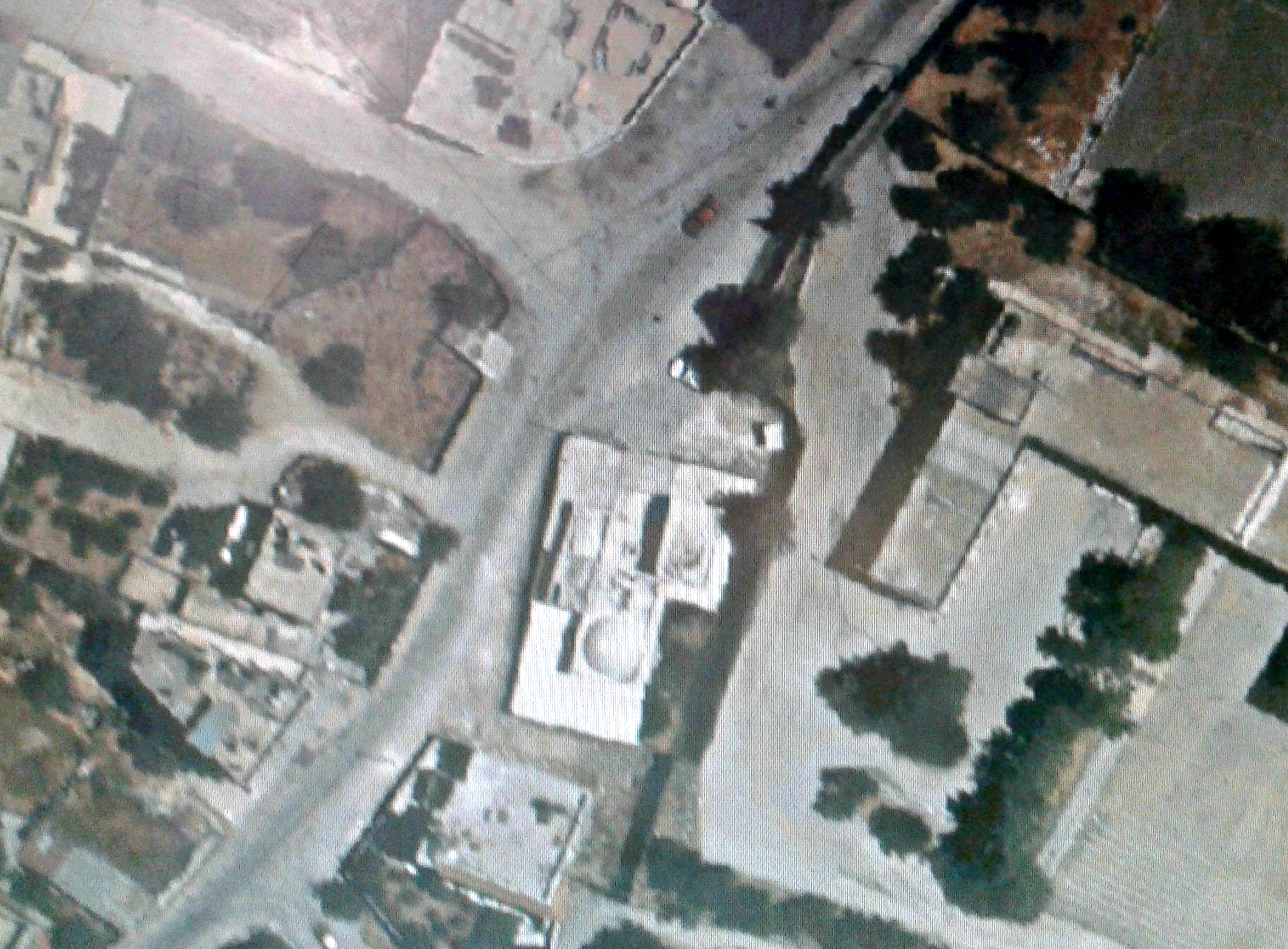
Two weeks ago I found myself in Netanya’s Central Bus Station and had a while to wait for my bus to Outpost 105, bordering Tul Karm, where I was to drive a Safaron. Not familiar with Netanya in the slightest, I glanced at a map and saw that some archaeological ruins were in walking distance. Trudging along, with my heavy backpack and gun, I walked over to what was labeled as “Umm Khalid”, passing an ancient sycamore tree (estimated to be around 1,000 years old). The ruins I came upon is the Crusader Castle of Roger the Lombard, located on top of a little hill looking out over the surrounding cityscape.

Ruins in Netanya

Castle of Roger the Lombard in Netanya

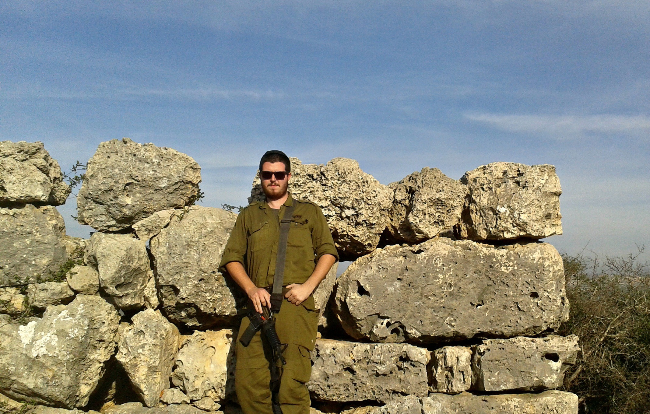
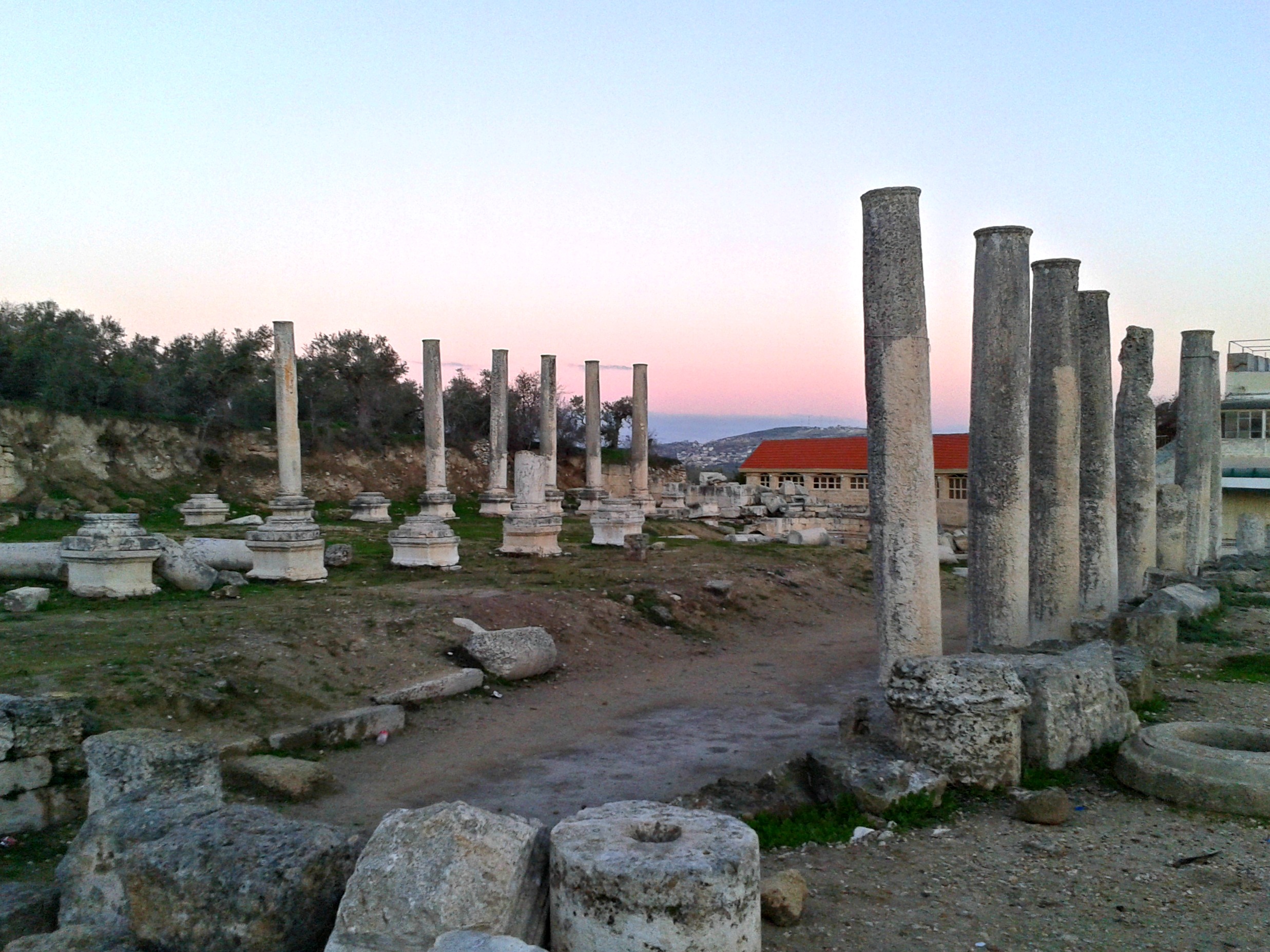
Catching the bus, I made it to Outpost 105 and began driving the Safaron with Kfir’s “Netzach Yehuda” Battalion (and later, Artillery’s “Sky Rider” Unit – which operates surveillance drones). Several days later I participated in an early morning educational and recreational drive with the battalion’s sergeant commanders in the Palestinian area southwest of Jenin. It was early morning when our armoured convoy reached our first destination, the ancient ruins of Sebastia, approaching from the Roman Colonnade with its remains of some 600 monolithic columns flanking us. A soldier in the command jeep in front of my Safaron took this photo and sent it to me:

Safaron driving past the pillars of Sebastia

My Safaron driving past the Roman Colonnade of Sebastia

Also known as the city of Shomron, or Samaria, the ruins are from an array of eras starting with the Kingdom of Israel some 2,900 years ago. Located just a few miles away from Shechem (Nablus), King Omri moved his capital from Tirzah (in the mountains of the Jordan River Valley) to a safer area inland, property which he purchased from a man named Shemer (the origins of the name Shomron). When we parked at the graveled expanse beside the Roman Forum and Basilica, we were introduced to our mustachioed tour guide Jabo and then we began morning prayers. After breakfast we all gathered around Jabo as he gave us an introduction of the site and opened up a Bible to read us passages about ancient Shomron.

Jabo reading ancient texts

Jabo reading ancient texts

We started with the Roman ruins directly before our eyes, noting the Forum, the Basilica and the Tribunal where court cases were held. Unfortunately, although Sebastia is an official national park, the land is mostly controlled by the Palestinians and thus maintenance is at a minimum – resulting in a ridiculous amount of litter including countless Alfa Cola bottles. Additionally, Israeli (and Jewish) visitors can only safely visit by making arrangements which are coordinated with the army, who accompany the scheduled tour. Thankfully, we are the army so we had no issues with scheduling visits, we just drove up.

Roman Basilica

Roman Basilica

To the southern end of the pillared area Jabo pointed out the excavated wall and gate from the original Kingdom of Israel. Stopping abruptly, Jabo called out greeting to an older Arab man opening up his shop. Their Arabic exchange was short and we continued on, passing over partially uncovered length of metal which Jabo explained was part of the old Hedjaz Railway (in fact, the local station is just down the hill). We walked along a bend in the short trail, taking in the views of the Samarian countryside.

Refreshing views

Refreshing views

We regrouped at the Byzantine Church built some 1,600 years ago and then restored in the Crusader era and dedicated to John the Baptist following his beheading. In the main room there is an underground crypt where relics were once stored. A much larger church built by the Crusaders at John the Baptist’s grave, located in the bordering village of Sebaste, was eventually partially destroyed and turned into a mosque.

Byzantine church's southern narthex

Byzantine church’s southern narthex

Passing three semi-recent Christian graves, we reached the excavated ruins of the ancient palaces of the Israelite Kings Omri and Ahab. Seeing the mass of uncovered stone walls reminded me at once of Tel Dan, with its rich Canaanite and Israelite Kingdom history. Archaeologists found scores of ceramic pieces with ancient Hebrew writing on them, Phoenician ivory and other important artefacts which help tell the tale of the palace that once was.

Ruins of the Israelite palace

Ruins of the Israelite palace

We climbed the mound in the above picture’s background and looked down on the Temple of Augustus built by Herod in honour of the Roman Emperor Augustus. The Emperor, born Gaius Octavius, was the heir to Julius Caesar and was referred to as Augustus/Sebastos (Latin/Greek for the Roman imperial title meaning “majestic”, respectively). So, during the Roman era the name “Shomron” was changed to “Sebastia” in honour of the Roman Emperor. The temple was a grand building with a huge staircase and immense columns and statues, but it wasn’t enough so Herod built another temple at Banias and another at Caesarea.

Roman Temple of Augustus

Roman Temple of Augustus

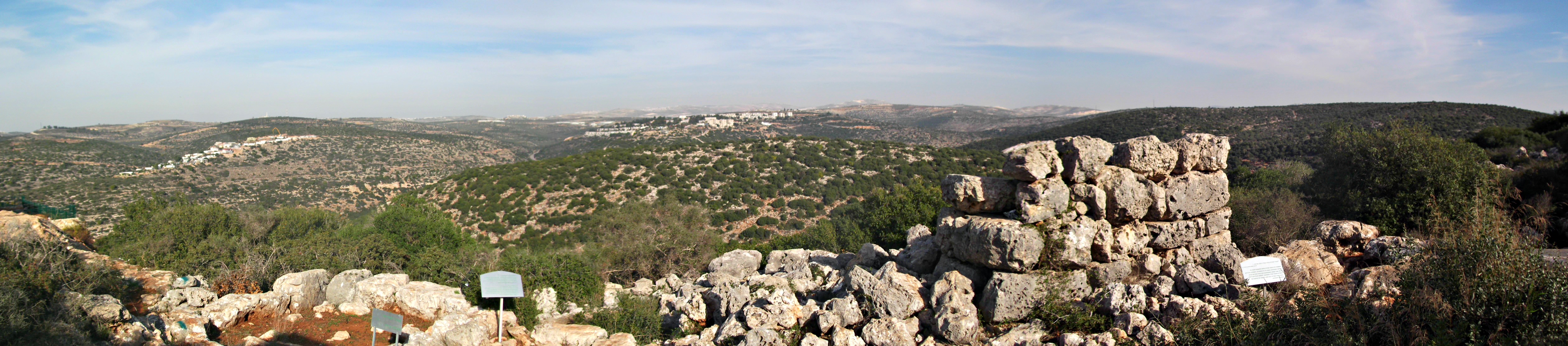
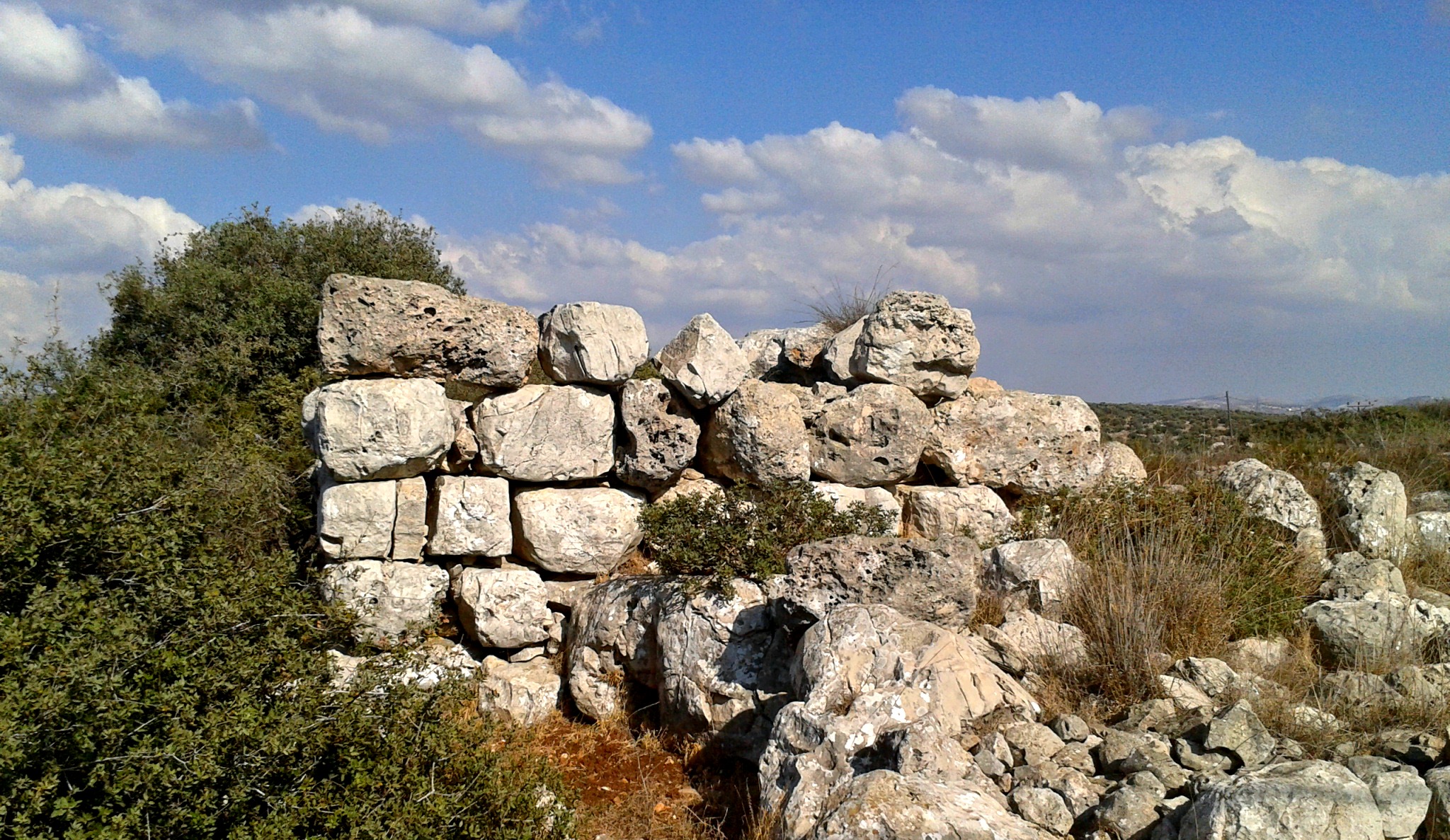
Atop the mound we scoured the horizons as Jabo pointed out innumerable interesting features and sites. One that struck me as fascinating was the placement of the surrounding Arab villages. They are all at the same altitude, roughly, having been built partially up the hill. Jabo explained that this was due to the underground water tables and their placement, something I didn’t fully understand. However, just southeast of Sebastia there is a little village called al-Nakura which bears a strange similarity to Israel’s Rosh HaNikra with its soft white rock and grottos. This al-Nakura is home to an 85-metre (280-foot) deep tunnel which was dug by Herod to provide water for Sebastia, as the city had no fresh water source of its own. Also, there is a house visible on a hill to the east which was built by a Crusader named Stephan. Fascinating stuff, I say! Continuing on, we came across the mess of Israelite fortress walls and a Hellenistic tower, built in Macedonian fashion.

Fortress walls and Hellenistic tower

Fortress walls and Hellenistic tower

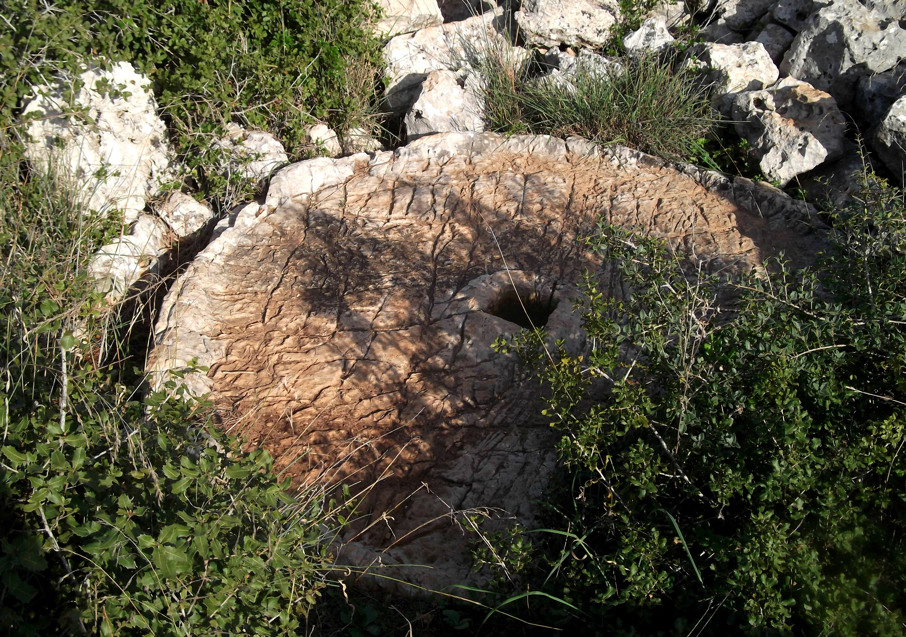
Below these walls, and slightly northwest, is the Roman theatre built some 1,800 years ago comprised of 24 rows and has an external circumference of 65-metres (215-feet). The sergeant commanders and their officers posed with Jabo as I took their photo seated in the theatre:

Commanders from

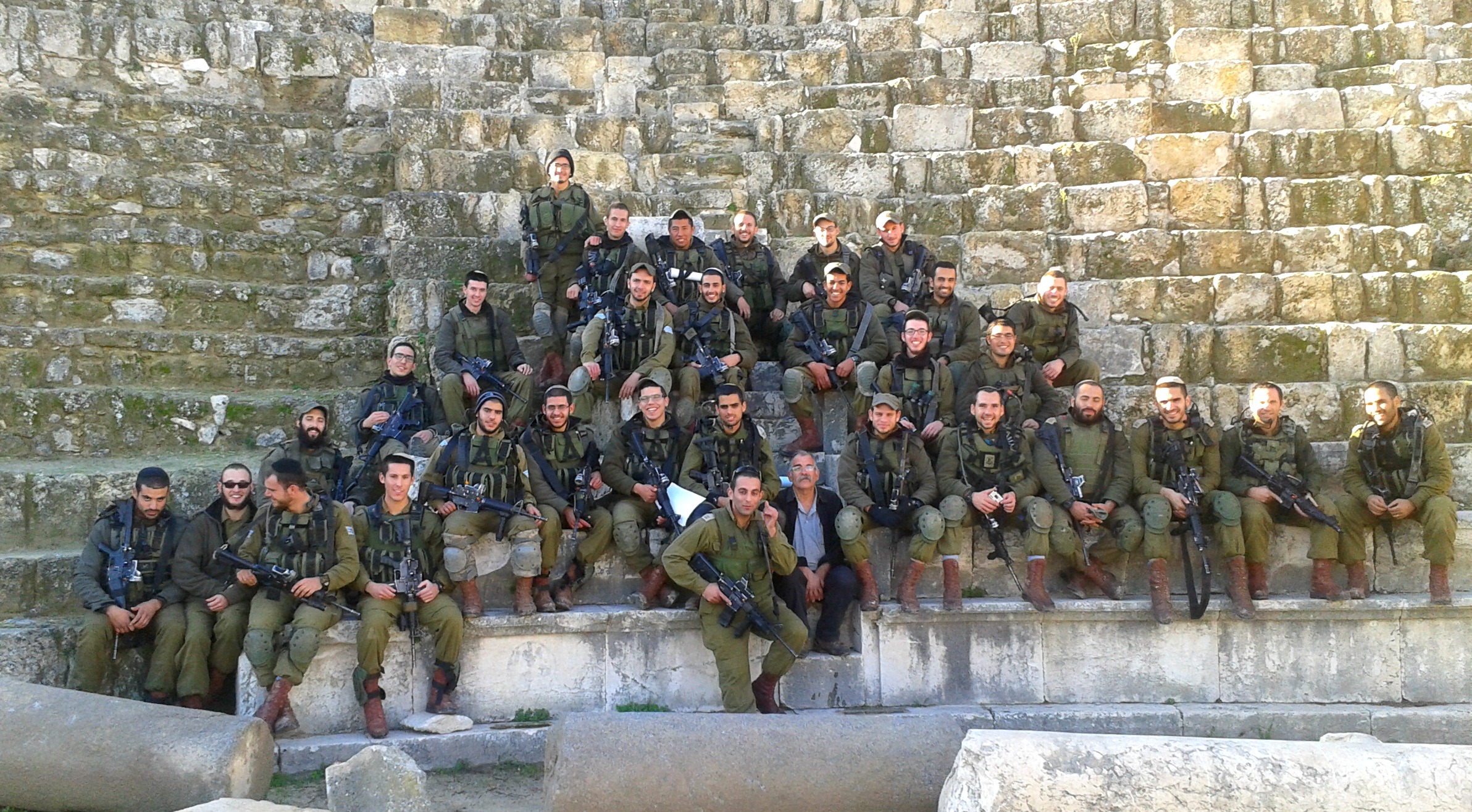
Commanders from “Netzach Yehuda” Battalion

We hurried back to the armoured vehicles and took off in a convoy to our next destination, Joseph’s Pit, but there were complications along the way…

Mitzpe Oded & Kever Yosef

In Israel, Samaria on November 24, 2014 at 4:59 AM

The following two places are found in the heart of the Shomron (also known as Samaria) and I had the pleasure of visiting both on the same day. Due to the fact that I often do the night shift for the Safaron driving, I took a lazy Wednesday afternoon to visit nearby archaeological ruins in the town of Yakir. The military outpost Yakir, where I usually serve, is just a few minutes walk from my destination, Mitzpe Oded.

Sunny at Mitzpe Oded

Sunny at Mitzpe Oded

Mitzpe Oded was founded as an outlook in memory of Oded Fink who died of illness at age 30, a man with an appreciation for the land of Israel, its beauty and heritage. The outlook provides a view of the towns of Karnei Shomron, Immanuel and Yitzhar as well as the famous Biblical twin peaks of Mount Gerezim and Mount Ebal in the far distance and Nachal Kana running directly below. The second portion of this blog post, Kever Yosef, is located in the city of Shechem which is between Mounts Gerezim and Ebal, some 16 kilometres (10 miles) away as the crow flies.

Panoramic view from Mitzpe Oded

Panoramic view from Mitzpe Oded

The first ruin I saw as I approached the lookout was a six-foot tower rectangle of rough ashlars, as can be seen above. The sign declared the structure as a “shomera” which is the Biblical name for an agricultural watchtower and was comprised of two levels – the lower of stone blocks and the upper a wooden hut. Here is another agricultural watchtower that is unmarked and unkempt right outside the entrance of Yakir Outpost. I had been wondering what it was ever since I had first laid eyes on it, now I know.

Ruins outside Yakir Outpost

Ruins outside Yakir Outpost

Beside the agricultural watchtower at Mitzpe Oded is a unique textured millstone that was used for coarse wheat and barley grinding. The grain would be ground into a coarse flour used for porridge, as well as for sacrificial purposes.

Unique millstone

Unique millstone

To the north of the millstone there is the base of a square structure and then a confusing little trail down the slope of the mountain. I ventured down a bit, didn’t see anything fascinating and headed back to the outpost. Later on that evening I got a series of calls and found myself driving the Safaron armoured truck to Tapuach Junction for a fun (and not classified) operation. I was to be working with Border Police in Shechem (Nablus) as that night was predestined to be the night when the IDF allows Israeli visitors to Kever Yosef (Joseph’s Tomb) located in the heart of Shechem.

“Tomb of Joseph at Shechem” (1839) by David Roberts

While today’s Kever Yosef doesn’t look quite like it did back in 1839, it’s now a white-domed structure over the tomb with a few side chambers and a yard surrounded by a tall fence. In this aerial view, the white complex of Kever Yosef is quite distinguishable:

Aerial view of Kever Yosef

Aerial view of Kever Yosef

Driving in one of many armoured military convoys, we entered the city and headed for Kever Yosef on the edge of the Balata refugee camp. I was a little surprised that we didn’t get any stones thrown at us, but figured we’d probably get stoned later on that night. I parked my large vehicle blocking the north-west access alley (see map) and with the entire plaza area locked down and secure we prepared for the busloads of visitors. This was all an eye-opening experience for me and I enjoyed every minute of it. In this panoramic of the “plaza” area just outside the tomb complex, the buses come from the street on the left side while behind me and to the right are completely secured and blockaded by soldiers and military vehicles. I was fortunate enough to partake in the inner circle of defence, so I was able to visit the site rather easily.

Panoramic of the plaza in front of the complex

Panoramic of the plaza in front of the complex

The first batch of buses came and the visitors streamed into the complex, eager to seize a prime praying location as close to the tombstone as possible. Eventually I made my way into the domed chamber but the sheer multitude of people discouraged me. Someone offered me a memorial candle to light, and so I did, lighting it in a niche that had crude swastikas scrawled on the concave wall. The history of Kever Yosef is pretty hairy, and despite considered a holy site for Muslims, finds itself the victim of destruction and hate crimes. I’m not sure how the situation usually is during these late-night visits, but that night was extremely quiet.

Memorial candles

Memorial candles

After about 90 minutes or so, the visitors were herded back onto the buses so that the second batch could come. In between groups, there was a nice quietness about the place and I was able to take a photo of the site without people being in my way.

Kever Yosef

Kever Yosef

The second busloads arrived and I was distracted by a man who fell as he made his way from the bus to the tomb and needed mild medical attention. As the paramedic bandaged him up, the injured man told us that he himself was at once the director of MADA Jerusalem (Israeli version of the Red Cross) during the Yom Kippur War before being sent down to the Sinai to treat injured soldiers. The stories that the “average Joe” on the street has are absolutely fascinating here in Israel, with its extremely short and volatile history. After the second batch of visitors were whisked away, and all the dressings and signs were taken down from the complex, I entered the tomb chamber and was pleasantly surprised to see this raw, yet fresh, look at such a rich historical tomb:

The bare tomb

The bare tomb

When the last of the soldiers and Border Police were aboard their armoured vehicles, we drove back out of the troubled city of Shechem, fully expecting an onslaught of rocks and worse. Again, we passed through unscathed. I’m still astounded at the fact that despite having entered many Palestinian villages and cities, I’ve never once got even as much as a stone thrown at me – what are the odds? Anyhow, such is life in Israel’s “Wild West” and I hope I get more chances to have blog-compatible experiences so that I can document them here.