Over a week and a half ago I got a day off and decided to take a little excursion, one I had planned (but failed to execute) for my birthday a little while back. The idea was to circle the Kinneret (Sea of Galilee) and to stop wherever looked interesting. My sister and a friend joined me, and off we went on the adventure. We were off to a rocky start, unaccustomed to driving a manual and stalling a few times, but before we knew it we were at Capernaum, at the northern end of the Kinneret.

Ancient synagogue at Capernaum
We parked and made our way through the throngs of people, mostly foreign pilgrims with a handful of priests and clergymen. Paying the nominal entrance fee we set out to explore what Capernaum is all about. As we’re not terribly interested in the Christian sites, we breezed through, taking a gander at the ruins of the Octagonal Church, the old Roman town built of basalt and at last, the ancient synagogue as seen above. Built from large white stone blocks, the synagogue dates back to the 4th or 5th century, believed to have been built upon the ruins of an older church – one believed to have been involved in the dawning of Christianity. Here is a stone pillar with a memorial dedication written in Greek (note how the spelled “internet” wrong towards the bottom):
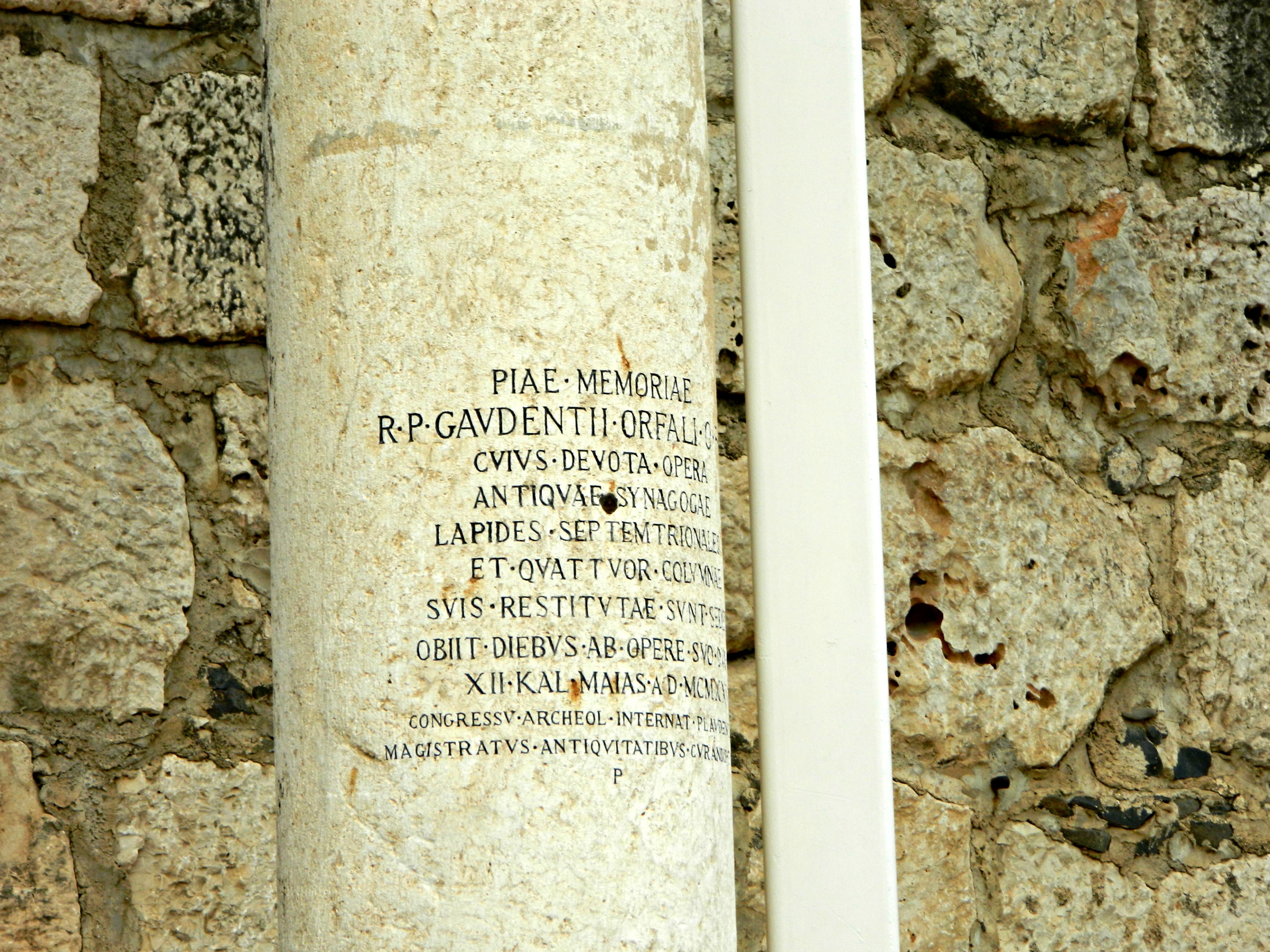
Greek engraved into a pillar
Continuing on to the neighbouring sites, we watched a boatload of pilgrims set sail, figuratively, for a nice boat ride on the Kinneret. I’ve often wondered where to get a Kinneret boat ride, although I believe the general non-pilgrim rides originate somewhere in Teverya (Tiberias).

Pilgrims on a boat
Between the little pier and the Capernaum site we found a eye-catching church, one that is quite visible from the road. Due to the overcast, the vibrancy isn’t quite what it is in person but here is the Church of the Seven Apostles, where we peered into the doorway and then headed back to the car.

Church of the Seven Apostles
With several false leads, and not wanting to spend too long in one particular place to keep good pace, we found ourselves on a straight stretch – the eastern bank of the Kinneret, in the Golan. With the clouds clearing up on the east, the soft mountains/hills on the left side of the road were quite the picture and so I did just so, capturing them for you today:

Rolling yellow mountains of the Golan
Then we spotted an outlook and pulled into the gravel for a look-around. We stood up on the edge of the hill, a marked minefield just before us, and photographed ourselves and the view. The dismal weather didn’t afford us any great views of the opposite bank, this is the best there was to offer:

The Kinneret from a Golan outlook
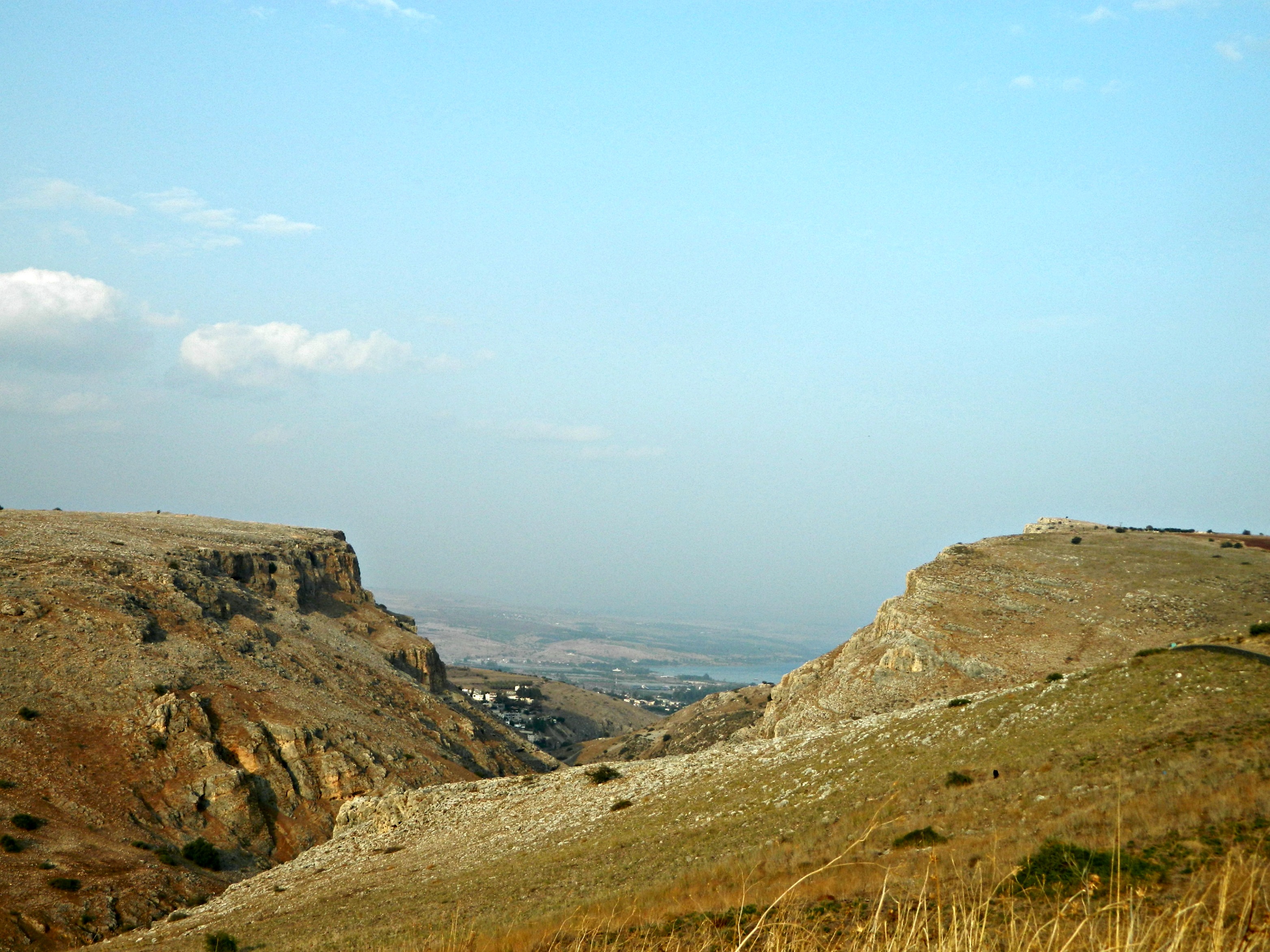
Coming back around the bend, at the southern end of the Kinneret, we pulled into the shopping centre at Tzemach Junction and got schnitzel sandwiches. Sated and ready for more adventure, we got back into the car and passed Kibbutz Degania and then Yardenit. Entering Teverya I once again found myself getting lost, although last time with a laden truck was far more inconvenient. Activating the ever-handy Waze app, we directed ourselves through the congested and complicated city and onto Road 7717 heading for Mount Arbel.

Sharp edge of Mount Arbel and the Kinneret down below
Driving up the mountains on the western side of the Kinneret I was surprised to suddenly see a sign that read “Sea Level” – it’s weird to think of the Kinneret so low in the grand scheme of things. As we looped up to Mount Arbel this is what greeted us, Mount Nitai on the left and Mount Arbel on the right.
Mount Nitai on the left and Mount Arbel on the right
We reached Mount Arbel and then I noticed it was a national reserve, and that they had closed at 3:00 PM, a mere half hour earlier. Ditching the car at the gate, we valiantly strode in and were stopped by a park worker. He uttered words like “no”, “closed”, “tomorrow” but we would hear none of it. We complained that we were Americans and that we couldn’t just come back at the whim of it, that we drove up the mountain to see the view from the peak. More words of negativity but at last, when we were about to give up, he made a compromise. He would allow us five (5) minutes at this lower observation point and then we had to skedaddle. We thanked him, big smiles beaming at him, and hustled off to the observation point. Craggy rocks loomed up out of nowhere and the cliff edge appeared.

The adjacent Mount Nitai
I climbed up on some big precipices and had my sister take my photo. Here is one of them, of which I am rather pleased with:
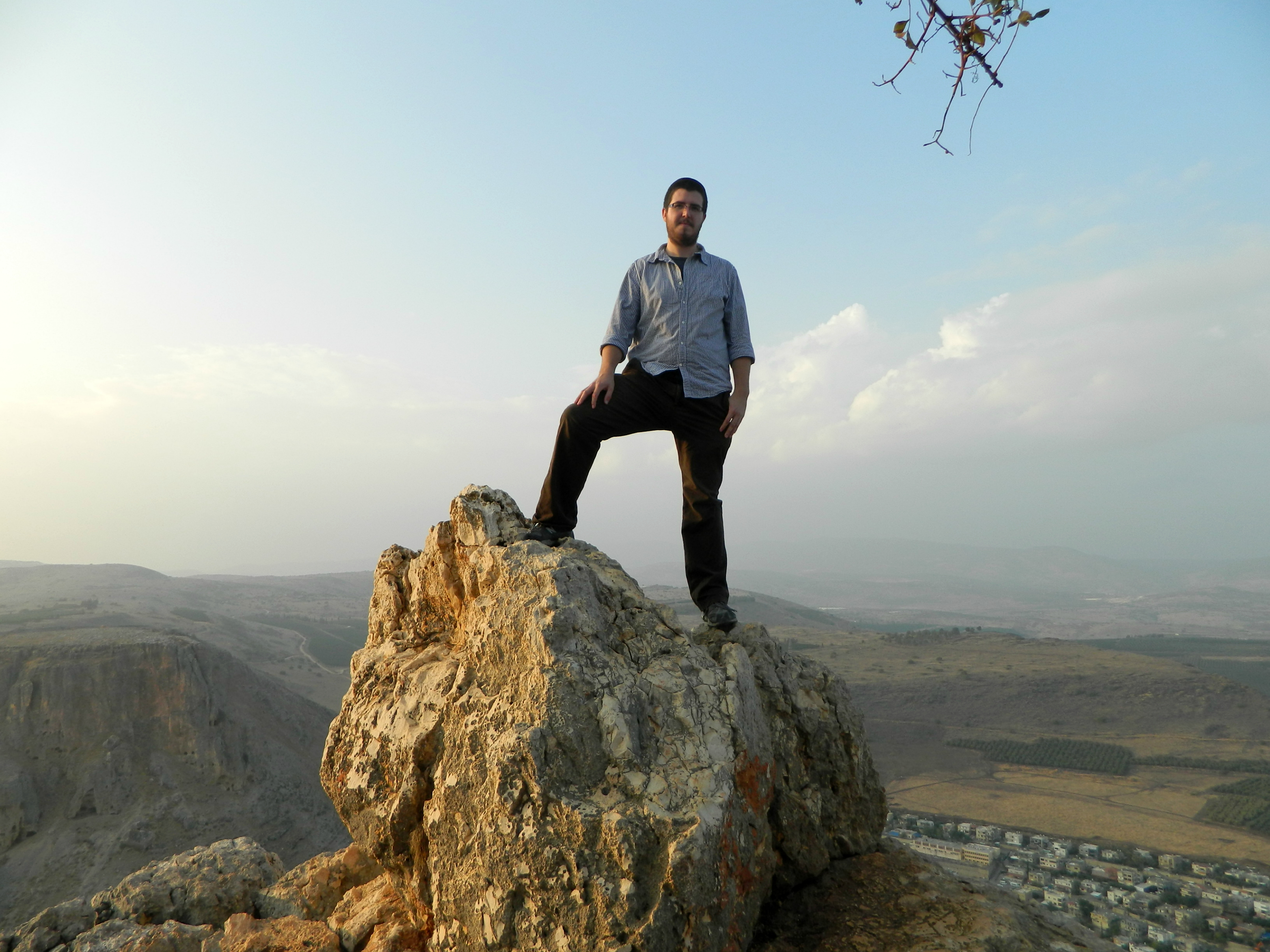
Standing tall
According to Wikipedia the drop from Mount Arbel’s peak is approximately 400 metres (1,300 feet) but that doesn’t seem completely accurate. It also states that the sheer rock drops down 110 metres (360 feet). Regardless, it’s a great drop and is the only place in Israel where thrill-seekers do base jumping. However impressed we were with the view, when we returned to the park worker he told us that it was nothing compared to the real Mount Arbel observation point. That just means that I have to go back one day… But the day was not done yet. On the way back down we pulled into a tiny parking lot and walked a few hundred feet to the ruins of the ancient Arbel synagogue. Columns and square building stones still remain but the general structure has been knocked down.
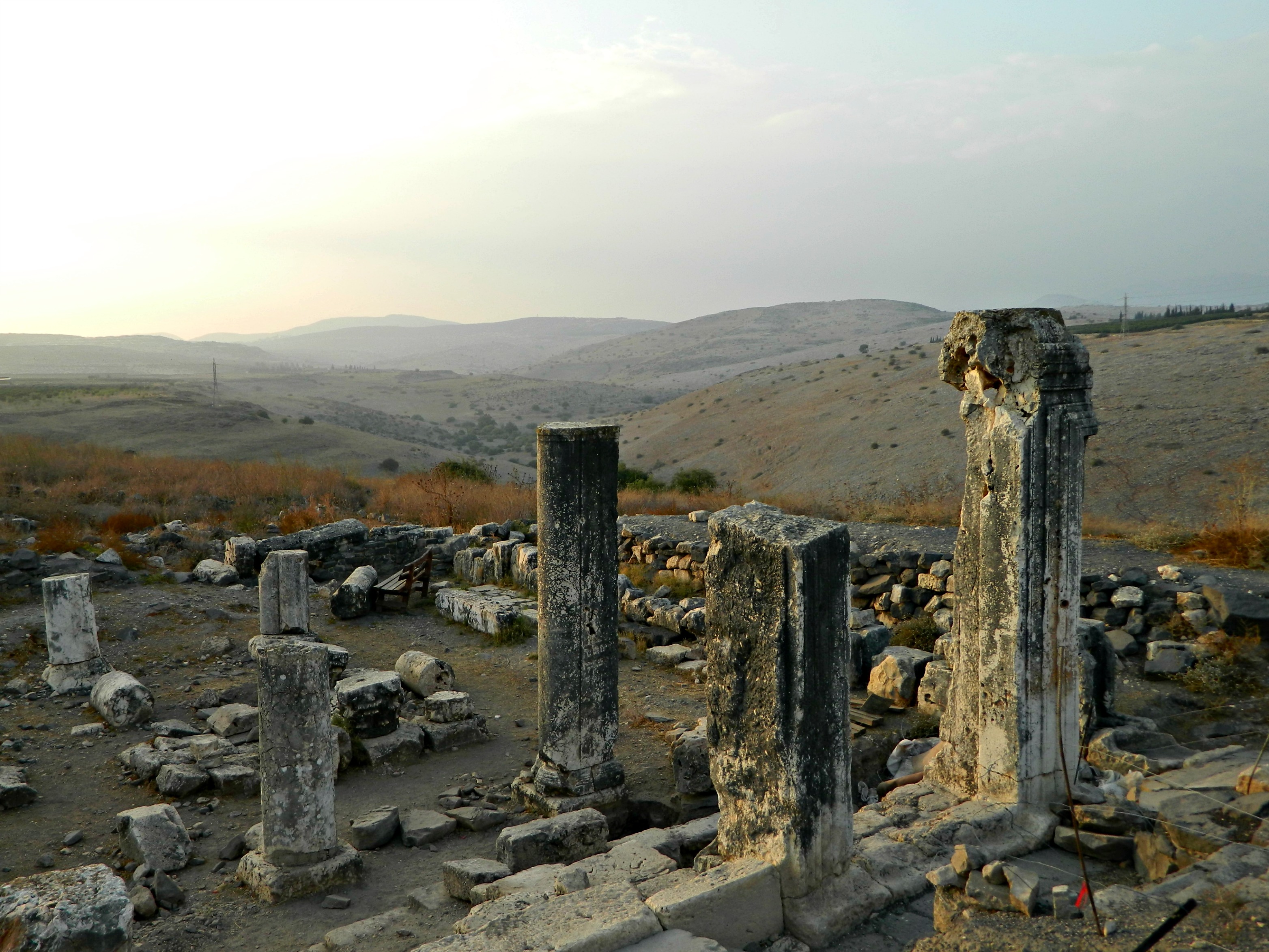
Ancient synagogue at Arbel
We spent a few minutes at the synagogue, basking in the waning sun’s golden rays, and then headed back home. Just a few sites checked off from circling the Kinneret this time around, but yet so many remain and as such, so many more adventures await.

[…] the Templars and the Hospitallers) in the decisive Battle of Hattin which actually took place near Mount Arbel. Here is a modern painting by Syrian artist Said Tahsine (1954) depicting the capitulation of the […]
[…] Shu’ayb (what they believe is the Biblical Jethro’s tomb located not far from Mount Arbel), he would make do with visiting Jethro Cairn. Starting from the fragrant pine forest along the […]
[…] reservoir. A percentage of that water is then pumped up at the Sapir Pumping Station not far from Capernaum, and then sent along its south-bound path via pressure pipes and the Jordan Canal. Passing several […]
[…] below, a photograph from the 1890s listed in the Library of Congress as the Mount of Beatitudes (Capernaum) which has since been “historically relocated” to the area where the Jordan River […]
[…] modern Tiberias we turned off Road 90 under the shadow of Mount Arbel, an impressive cliff edge that claims a 110 metre (360 foot) drop. Disembarking across from the […]
[…] quarter. Continuing on Road 8277 we then reached the Kinneret and turned onto Road 87 passing Capernaum before turning onto Road 90 – Israel’s longest road. Our next destination was the Yigal […]
[…] small flocks of white storks here and there alongside us. Our destination that day was the peak of Mount Arbel, with its gorgeous vista over the Kinneret (or, Sea of Galilee). We pulled into the parking lot of […]
[…] entered the Golan from the area of Capernaum and, even as we neared Qatsrin, the veritable capital of the region, we couldn’t see any […]