After visiting Sde Boker and Midreshet Ben Gurion, the home and burial place of Israel’s first Prime Minister David Ben Gurion, I drove a few kilometres south to Avdat, a national park preserving an ancient mountain-top city. I had once passed this extraordinary ruins, seeing it from the road, and now I had the time and opportunity to explore it.

The mountaintop city from the road
Using my handy “year park pass” I gained entrance and watched an interesting video about the site and about the Incense Route, an ancient trade route extending from the southern Arabian Peninsula (Yemen and Oman on our maps) and ending in Gaza, a port city on the Mediterranean Sea.

The Incense Route
The Nabateans, a nomadic people which expanded into a powerful kingdom, ruled the area of the Incense Route some 2,200 years ago. As they became more and more organised they built fortresses and waystations for the convoys making the journey from the Arabian Peninsula to the Mediterranean Sea. After Petra, the famous tourist destination in Jordan (also the filming location of key parts in Indiana Jones and the Last Crusade), Avdat was one of the most important stop along the Incense Route – station #62. As such, the city was further expanded and built up by the Romans and Byzantines after the Nabateans were annexed by the Roman Empire, polytheism turning to Christianity.

Bathhouse ceiling
With nothing but my gun swinging at my side, I started my journey at the Byzantine bathhouse. There I found an nearly fully intact structure with a great domed ceiling (above) and these reconstructed tile pillars arranged on the depressed floor:
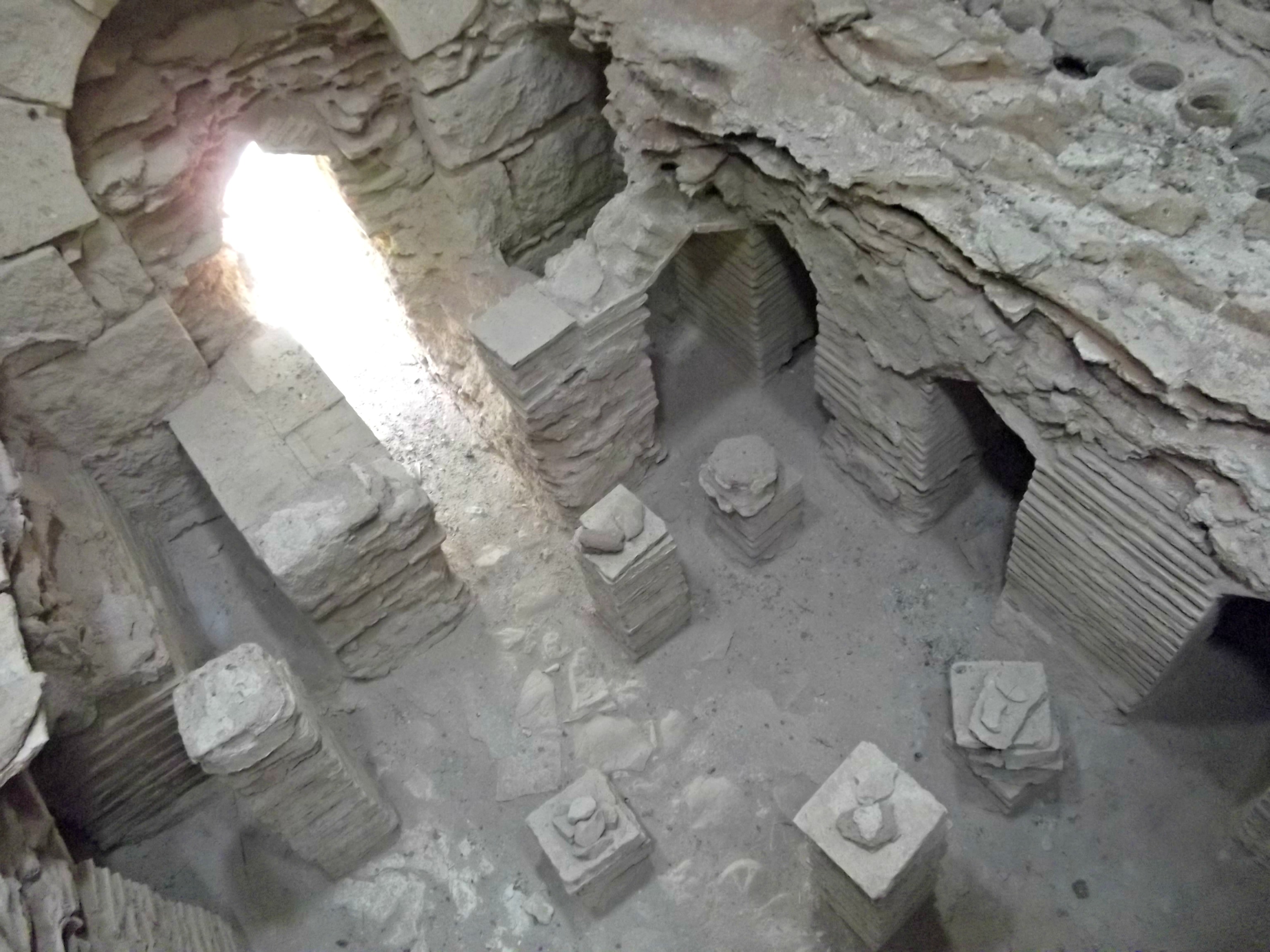
The floor of the bathhouse
Next I trekked up the mountain to the base of the ancient Nabatean city, which was believed to have been called Ovdat or Obodat named after the Nabatean king Obodas II. Half-way up I came across the first tier of ruins, a Byzantine house likely belonging to a middle-class citizen, perhaps a wine merchant.

Byzantine house
After winding in and out of the ruins, passing through and around little caves in the bedrock, I climbed further upwards and made my way through some more Byzantine ruins up to a Nabatean temple, the pillared edge of the acropolis. Here is looking down at the aforementioned Byzantine ruins, the desert and Road 40 down below:

Looking down at the ruins
The main expanse, a developed plateau comprised of numerous houses of worship and more, starts with the Nabatean temple on the western edge and continues eastward to the two Byzantine churches (St. Theodoros’ Church and the “northern church”). Here are the pillared ruins of the “northern church” and then the pillars of the Nabatean temple in the background:

The ”northern church” and the Nabatean temple behind
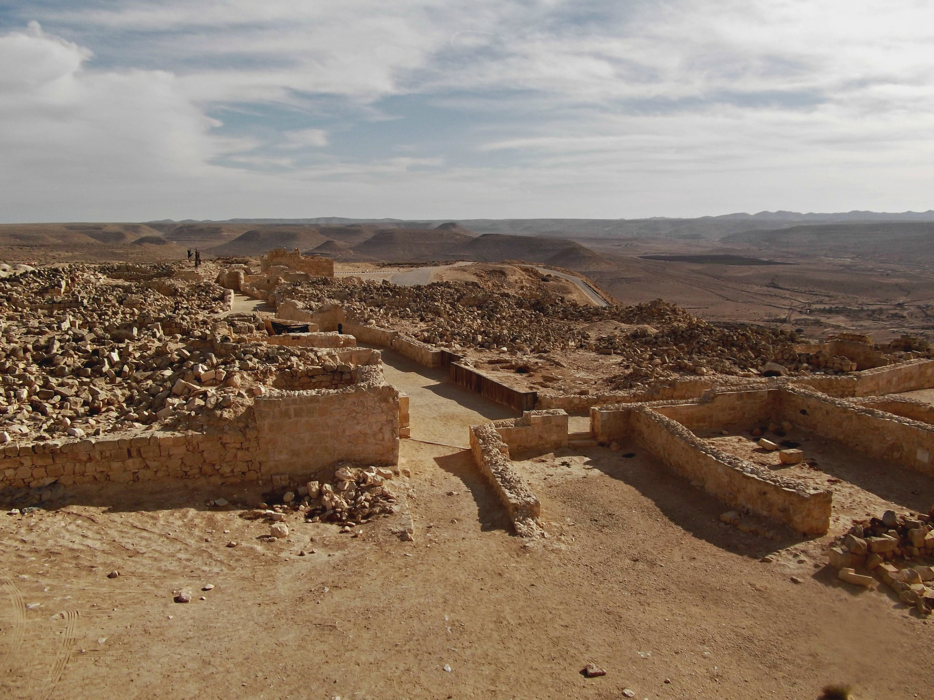
As I passed through, crossing over from Byzantine to Nabatean and Roman, I became well-aware of the midday desert sun beating down on me. I walked in the shade of the great walls and entered the city fortress. A large open plot (just under 30,000 sq. feet), the inhabitants during the Byzantine era used the fortress for numerous purposes – a prayer chapel was even constructed on the north side. In the centre of the fortress is a cistern, fed by runoff channeled through the floor, and outside a little ways northeast is an large army camp (110,000 sq. feet). Here is the fortress and the temples/churches complex beyond the wall, as seen from the guard tower:

The city fortress
Having finished exploring the northern complex I moved on over to the southern complex, partially seen here:
The Byzantine Quarter
I walked through the Byzantine Quarter, a residential area first built during the Roman period. Mostly fallen ruins, the neighbourhood was basically destroyed in an earthquake sometime around 630 CE. I climbed the Roman Tower, complete with Greek inscriptions, and then, after a quick drink from a faucet, headed for the Roman Villa. Seeing the acropolis from the south, I took this photo:

Avdat acropolis
After the Roman Villa I entered the Roman burial cave, dug into the bedrock and containing more than twenty burial niches. Here is the entrance, with depictions of the sun, moon and an altar on the lintel (and a glimpse of the burial niches inside):

Roman burial cave
After leaving the cave I walked the rest of the way down the mountain and headed back for my truck. Next stop, Mitzpe Ramon!

A very interesting, well-written post! The photos are quite nice, too. Now that I have free time I hope to catch up with some of what I have been missing.
Thank you! Feel free!
[…] the three-part “desert adventure” (of which only Ben Gurion: Life and Death and Avdat have already been published, to date) to focus on an event which threw some of the country into […]
[…] of blog posts… Aftering visiting Sde Boker, Midreshet Ben Gurion and the ancient ruins of Avdat I pushed southwards and stopped at Mitzpe Ramon. A town on the northern ledge of Ramon Crater, […]
[…] I found chambers with burial spots dug out of the rock, as seen in the ancient catacombs of Avdat and Cafarlet. The burial cave’s heavy stone door is propped up to the side, off its […]
[…] I had seen the same construction in a small Byzantine bathhouse outside the mountaintop ruins of Avdat in the Negev, and here the technology was explained in […]
[…] Roman Era stronghold) and the Lost City before reaching the rest stop under the Nabatean ruins of Avdat. As incredible place as Avdat is, we were quickly back on the road heading for the Arava, a […]