A few weeks back I was way down in the southern Negev, about an hour’s drive from Eilat, and was called back north for a driving mission. On the way up I decided to take my time and explore roadside attractions. I often stop off places to explore, but usually don’t have enough material to make a blog post about (sites such as the Mazor Mausoleum, the Maqam of Nabi Musa and the Ayit Waterfall). This particular time I had the chance to visit three interesting sites.
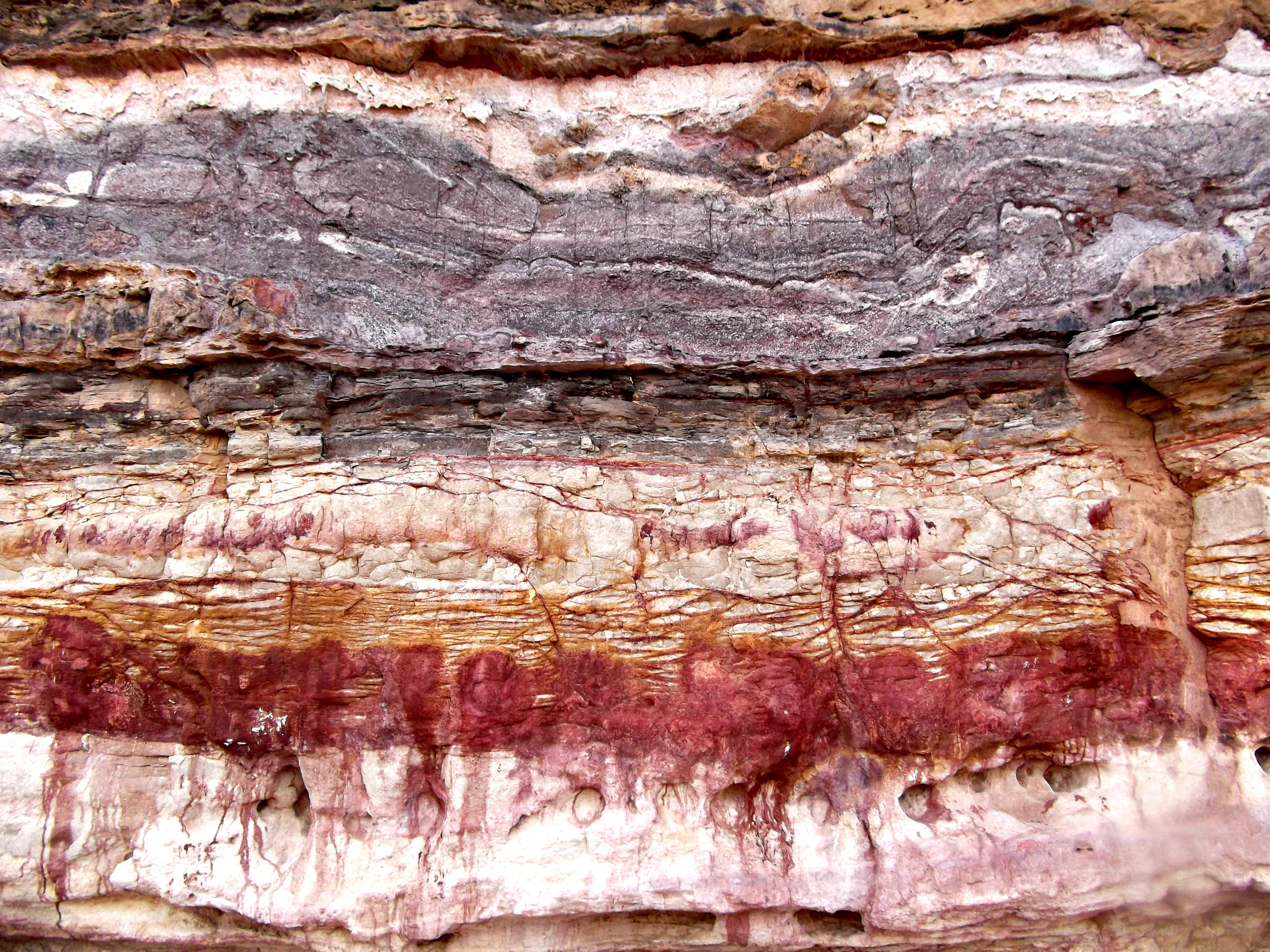
Close-up of the coloured sandstone wall
The first I came across was Wadi Ramon in the Ramon Crater, one of two streams which drain the enormous erosion crater. I had heard about some very interesting “coloured rock” formations, and that they are just a few minutes from the road. Leaving my truck, I climbed down into the dry streambed with just my camera and gun and began walking. Wondering if I’d see any snakes or scorpions, I scoured the sandy streambed with my camera ready as I tread. True to my source’s word, the coloured sandstone rock wall was very visible after just a minute walk.
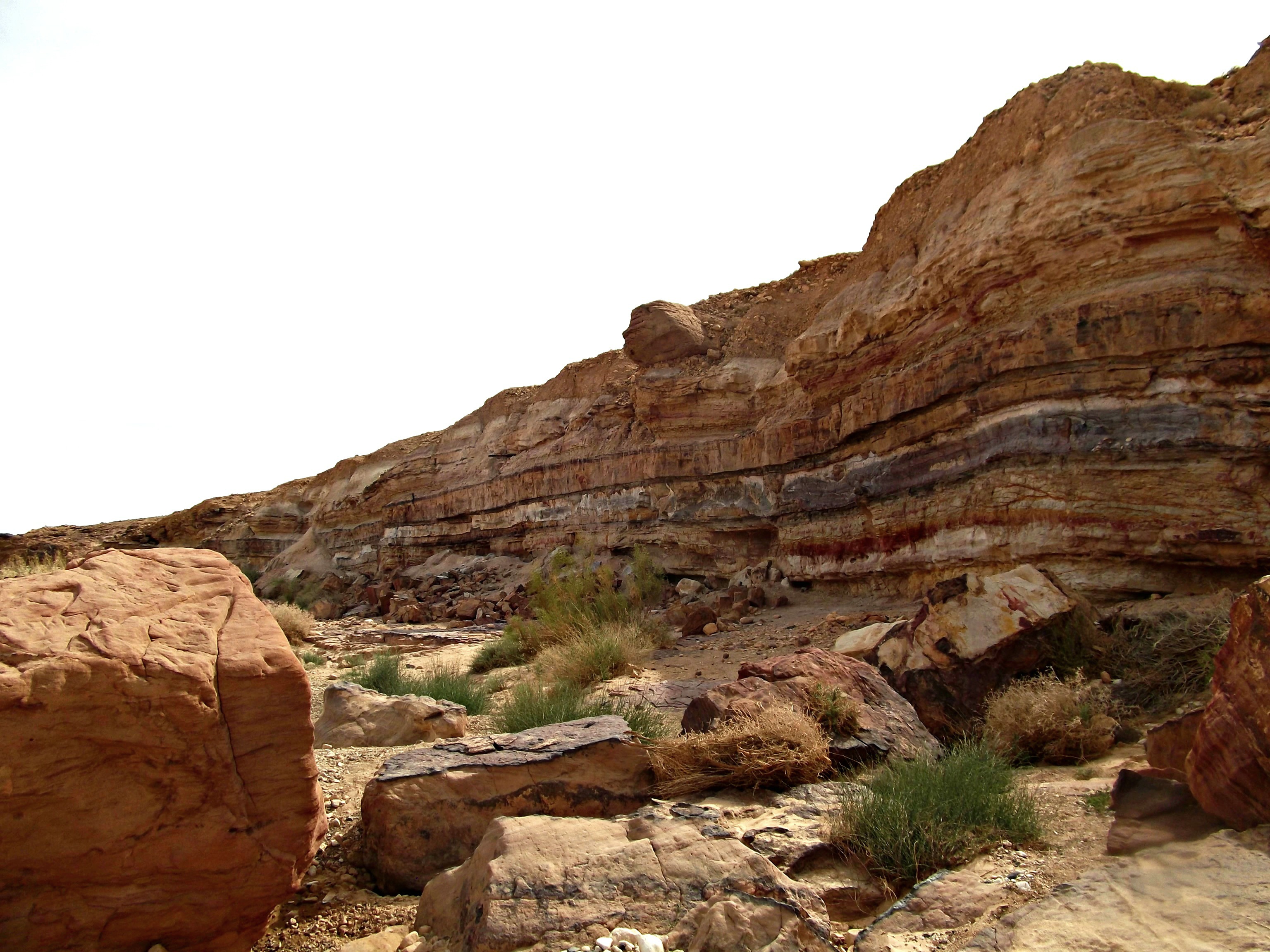
Coloured wall of Wadi Ramon
Researching more online, I found a fascinating fact about the Ramon Crater: gypsum, a mineral, is heavily mined in the crater and there are underground galleries stretching out for 16 miles – that I’d like to see!
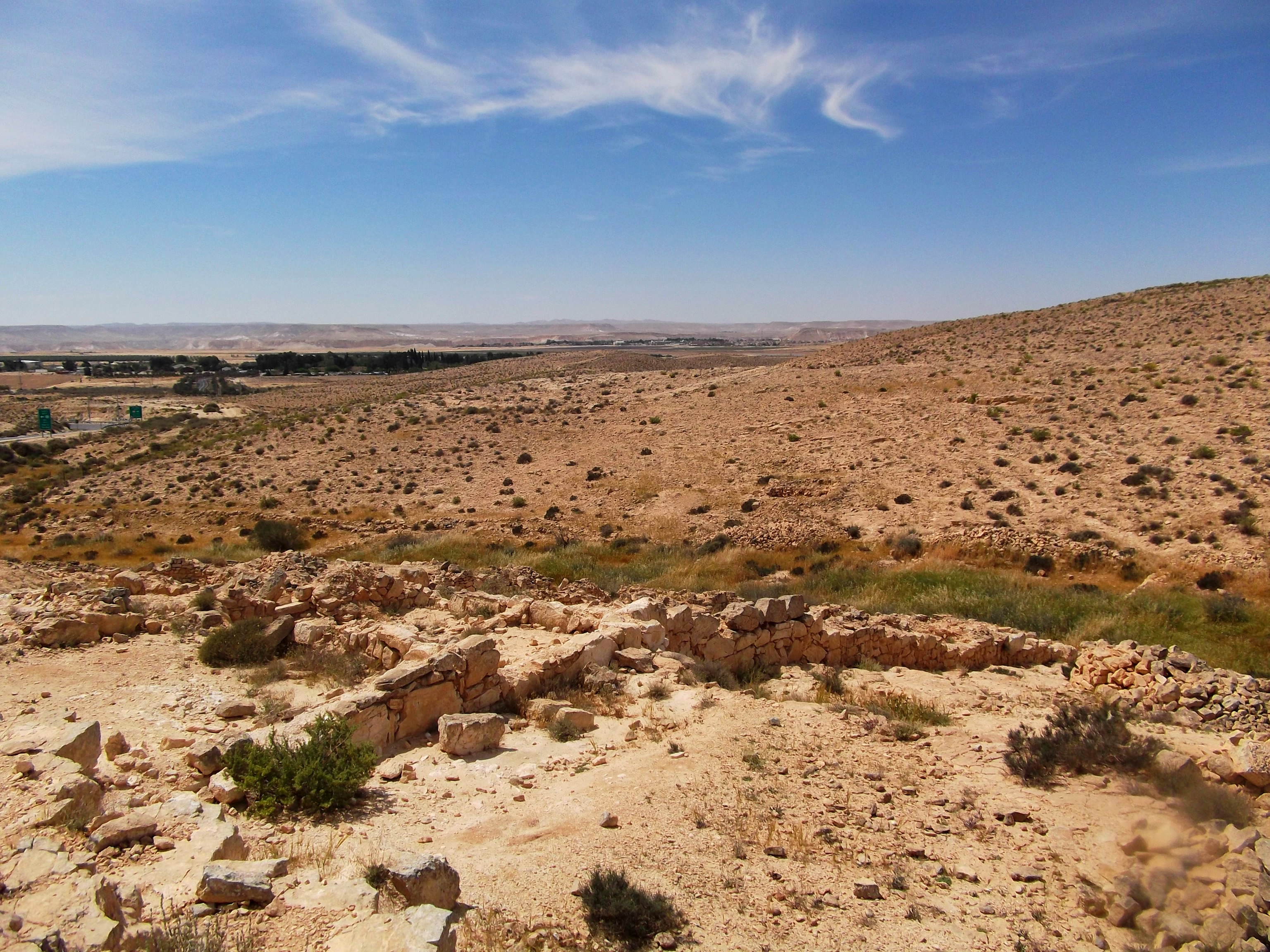
Looking down at the ”Lost City”
Driving further north, I stopped just after Sde Boker (where Ben Gurion lived and died) and happened upon a place I’ve never even heard of: the “Lost City”. What I’ve gleaned from online sources (including my absolute favourite: Biblewalks) is that this “Lost City” was a late Byzantine farming settlement dating back to the 6th-9th centuries CE. However, its history and identification was a mystery for many years, thus earning the name “Lost City”.
The ”Lost City”
Being on the ancient trade route, this farming village would have had prime access to the Levantine, Arabian and perhaps even further markets. After extensive excavations, and a little reconstruction, the “Lost City” is comprised of some 350 rooms along a little valley where vegetation would grow, irrigated by a rudimentary terraced construction aimed to preserve as much of the scarce water as possible. In this slightly panoramic shot, the ruins and agricultural terraces can be seen:
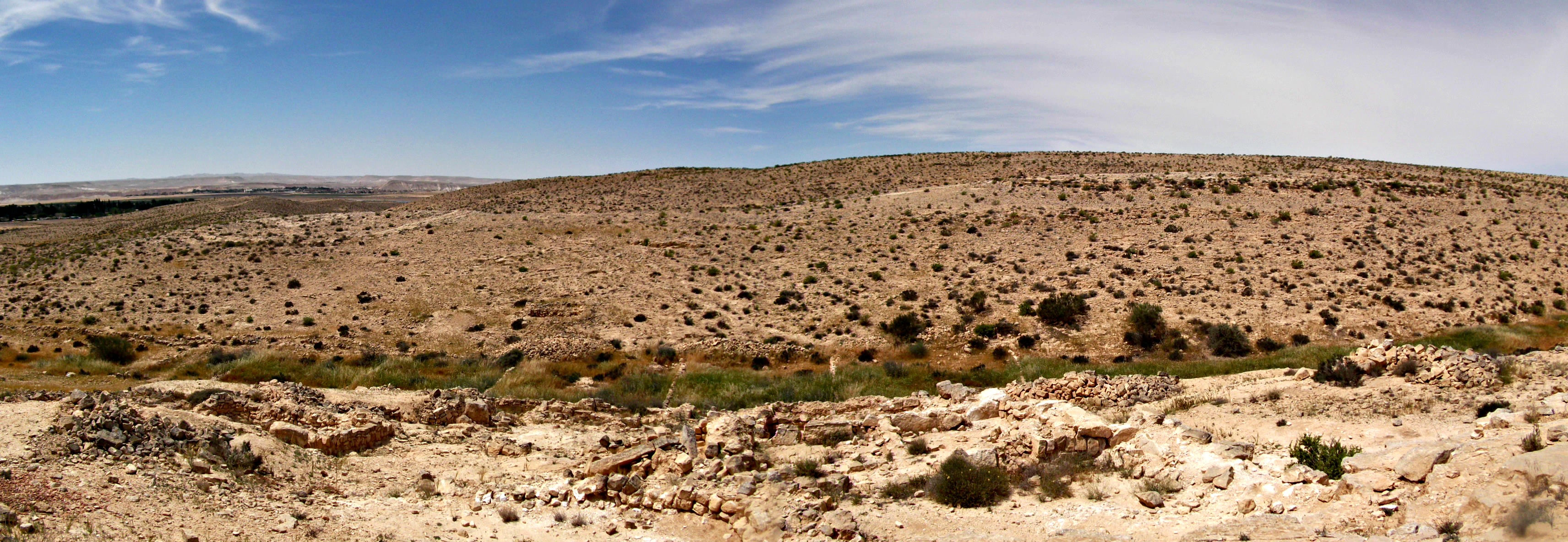
Panoramic of the ruins and the agricultural terraces
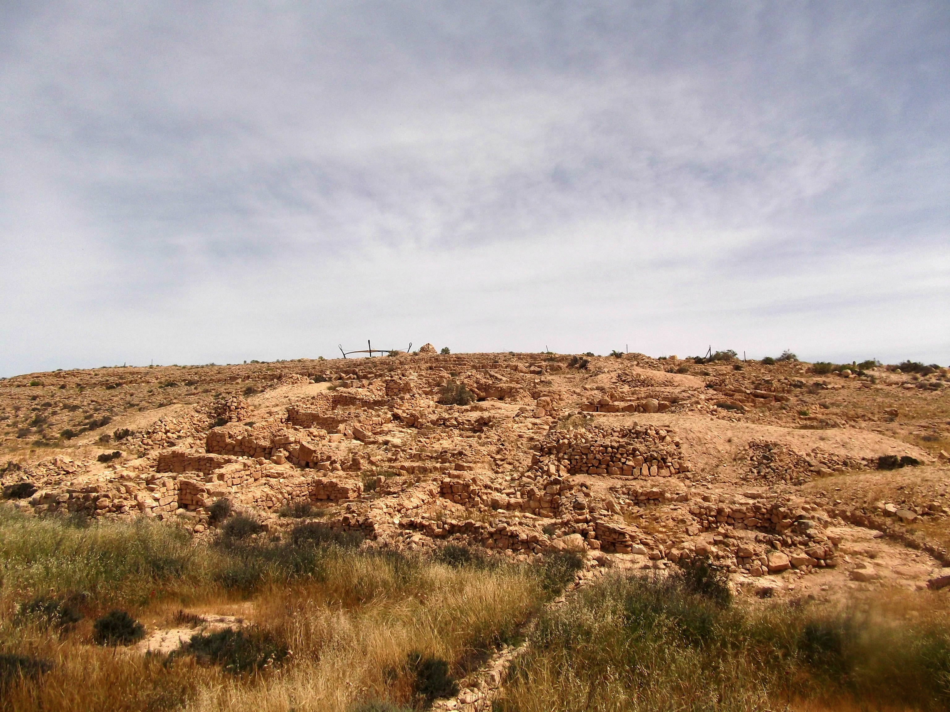
I saw that there are ruins of an ancient mosque, built some 1,200 years ago approximately, but I didn’t want to wander too far off so I decided to cross the road and search for a different ruins; a fortress said to be from the time of the Jewish kings. I came across these low stone walls, thought it might be the meagre remains, but found out later that I hadn’t found the Haluqim Ruins after all… so I don’t know what these walls and small ashlars are, perhaps a continuation of the “Lost City”. Maybe I’ll find the Haluqim Ruins next time…

Unmarked ruins
The third site of interest is an old British Mandate police station located across from Rahat (the largest Bedouin city in Israel), not far from Be’er Sheva. It was at this station, the Rider Police Station, where the local gendarmerie (a military force charged with police duties) was located. I had passed the building many times and had finally decided to stop, but unfortunately, someone had bricked in all the doors and windows, so exploration was quite limited.

The Rider Police Station
That basically concluded my exploration for the day, although I ended up driving to the upper Golan, clocking in about 350 miles of driving that day alone!

Just wanted to say that I really enjoy your blogs, especially about the less known and out of the way places, which give me plenty of ideas for the family tiyulim! Keep blogging!
Thank you Michael! Glad to hear such positive feedback!
[…] where the waters are mixed and sent to either the Tel Aviv area or further south to provide the Negev with water. The whole infrastructure is very interesting and was an incredible undertaking and […]
[…] Festival which is held in two very different locations every year – the Gilboa area and the Negev. I walked through the pine tree forest on Mount Shaul, passing small plaques with biblical verses […]
[…] of a field, located not far from the old British Rider Police Station which I visited in the post The Negev: Roadside Attractions. From there we had a view of Tel Sera in the distance, an ancient Egyptian, Philistine and […]
[…] The other week I participated in the annual two-day hiking trip (known as the “Campushetach”) provided by my Land of Israel Studies and Archaeology department at Bar Ilan University. Geared towards relatively fit hikers, this trip takes a rugged approach to geography, history and archaeology and is offered to both students and staff of the department. Last year we spent two days in the Wadi Qelt area (posts I and II), and this year we spent the two days in two different places: the first day in the Mount Hevron area, and the second day at Nachal Kina in the Negev. […]
[…] on the adventure opportunity, I planned a nice trip with Adam to visit the northwest section of the Negev, which can be delightful in winter months – quite unlike the bombed and burnt version it is […]