During the past few weeks, due to the ground operations of Operation Protective Edge, I found myself at the Gaza border with infantry and armoured units. One day, I went to explore my surroundings and found that I was at the edge of the southern Be’eri Forest and that there were many interesting sites to be seen. The following is a summary of two hikes I made of the area, all just a few kilometres from Gaza.
Mador Ruins
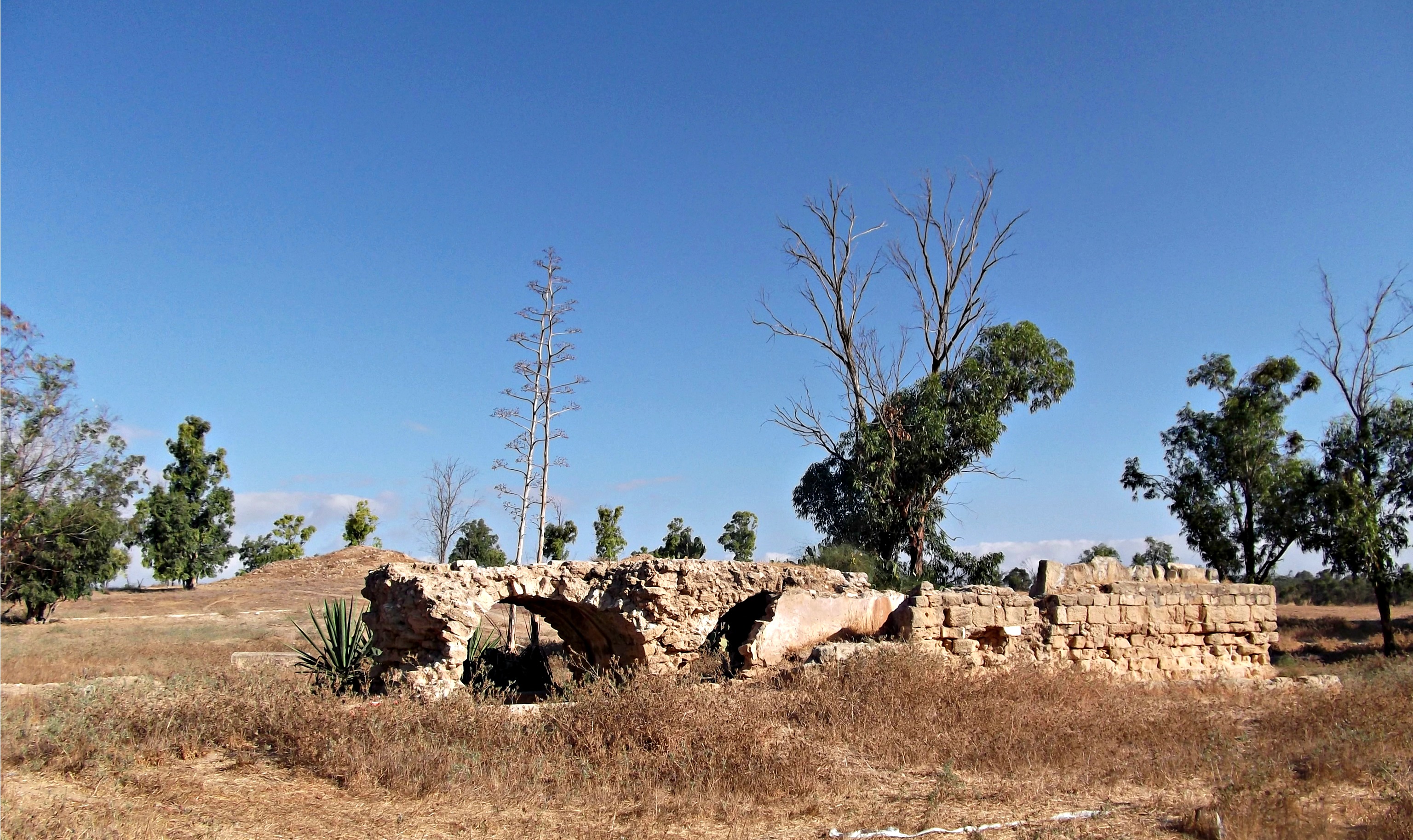
The very first site I came upon was the Mador Ruins, a collection of Byzantine, Ottoman and British remnants just off Nachal Grar. I approached the main structure, and peered under the outer arched ceiling – to look into a seemingly bottomless well. A little research online and I discovered that this was an Ottoman “saqiya” well refurbished by the British – 26 metres (85 feet) deep.

26 m (85 ft) deep
Beside the well I found a mysterious sarcophagus of sorts, unmentioned in the Israel Antiquities Authority’s report of their June 2011 survey.

Mystery sarcophagus
Seeing stone mounds in the distance, I kept walking on what became apparent as the Water Systems Trail. I passed a strange partially-covered concrete that looked like a buried vase, and then this, an IDF warning leaflet that was dropped over Gaza before a bombing run and had since blown over the border:

Warning leaflet
Walking north-west towards Gaza, I came upon the ruins of a British flour mill from WWII. According to the plaque, the British army set up a large camp to store supplies and ammunition for the battles against the Germans under General Erwin Rommel, the “Desert Fox”. After the war, the camp was dismantled and the buildings abandoned.
British flour mill
Following some examinations of the several British ruins nearby, I heard a boom coming from Gaza and noticed that a terror tunnel had just been blown up by the IDF forces within Gaza. Here’s a photo of the immediate aftermath:

Gaza tunnel being blown up
With that, I looped back to our camp and was temporarily finished with my exploratory hikes. However, at about 4pm on Tuesday the 28th of July, I embarked on another exploratory hike, this time heading slightly southwest. Walking through the thick powdered dirt (created by tanks and APCs) I crossed the dry Nachal Grar and came upon the Re’im parking lot, but not before finding this skink.
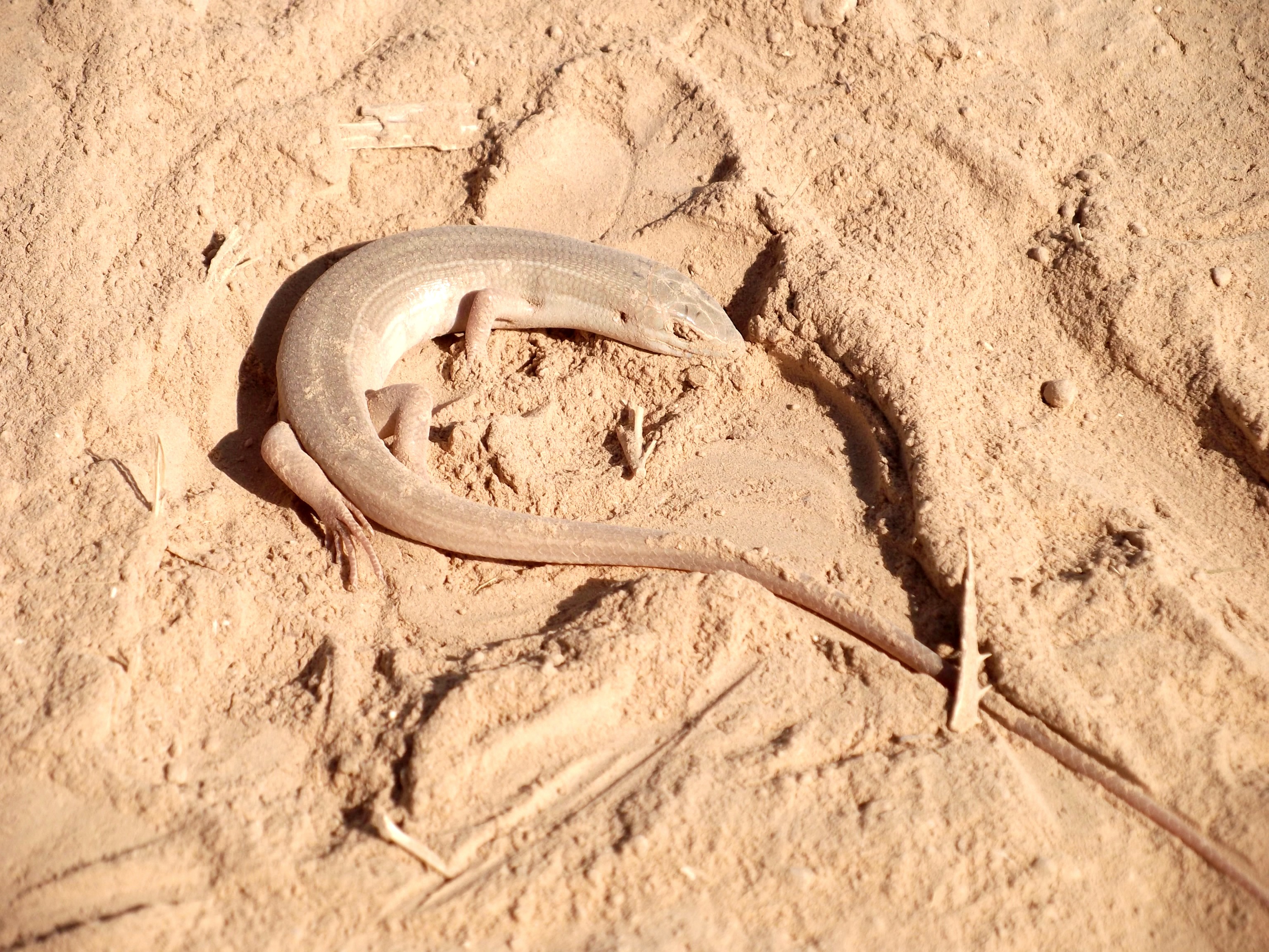
A skink in the powdered dirt
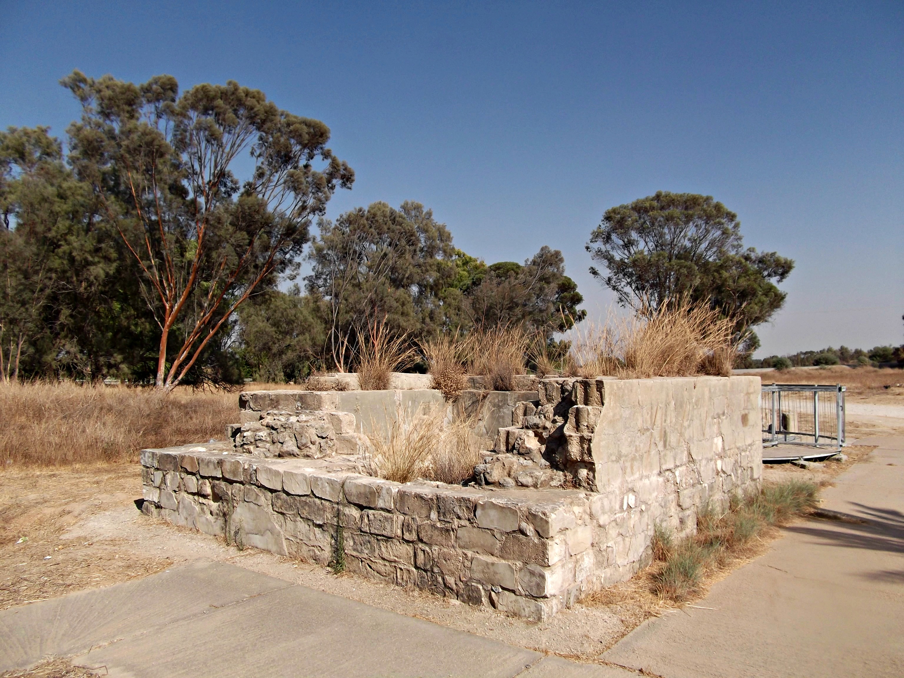
At the official entrance to the recreational park (which includes picnic grounds, biking trails and more), there is this British well and storage pool. The British dug out and/or renovated dozens of wells in the area and this particular one had a diesel pump and a concrete-coated storage pool.
British well and storage pool
Consulting the site map, I decided to walk east with the Se’ora Ruins as my goal. I set out and came across the first oddity quite quickly. The ground in the area near Nachal Grar had collapsed and thus there are numerous cliff edges in unlikely places. My theory is that the underground water tables have dried and so the land collapsed. We know that this area was sought after for its water even back to the times of Abraham, where he watered his flocks. So, thinking of all the people and all the animals that were supplied water from these underground water tables, I think it seems reasonable that the land should collapsed down on the emptied pockets.

”Danger! Abyss”
Even now the ground sinks, as can be seen here on the trail. I just wonder how much more will collapse.
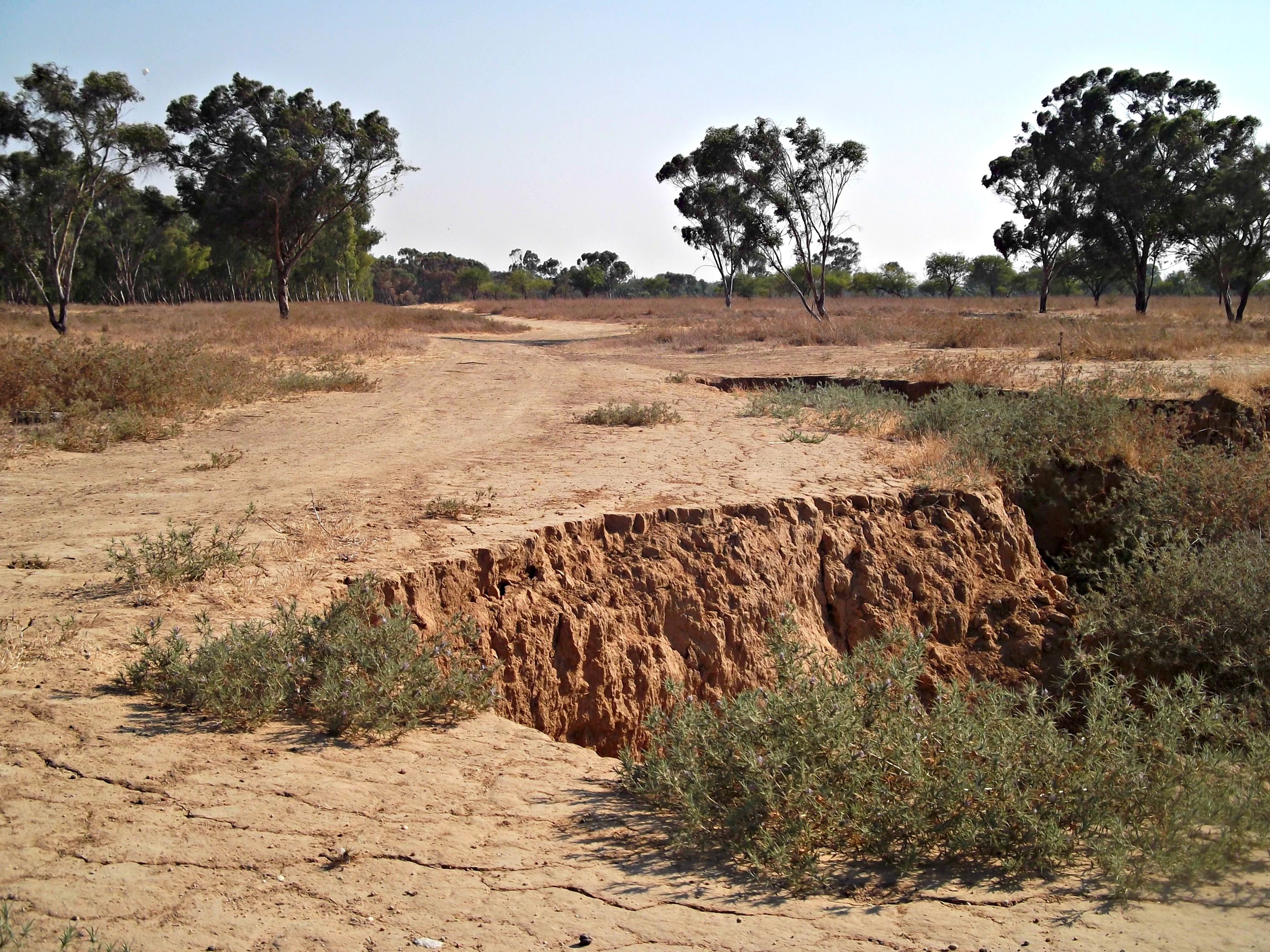
The path are a’crumblin’
After recrossing Nachal Grar, I came upon the edge of the forest and had to walk in the sun – being about 5:20pm. I kept walking, passing a large amount of discarded sheep wool and then a seemingly abandoned Bedouin encampment. As I worked my way towards this ruins I saw, I heard a loud whistling sound followed by a BOOM in the direction of our army camp. I had a sense of dread and kept checking the news sites to see what had happened. There was a gag order of sorts, as at first nobody reported the mortar that landed in middle of our camp – killing four soldiers and injuring more. It was a miracle that I wasn’t there at the time; I may have not been in the path of the mortar but simply being spared the sights of carnage is a blessing enough. Back on the hike, I wasn’t sure just what had transpired so when I did make it to the Se’ora Ruins I wasn’t as interested as I would’ve been ordinarily. I had a quick look, again seeing a “bottomless” well, and then headed back to my camp.
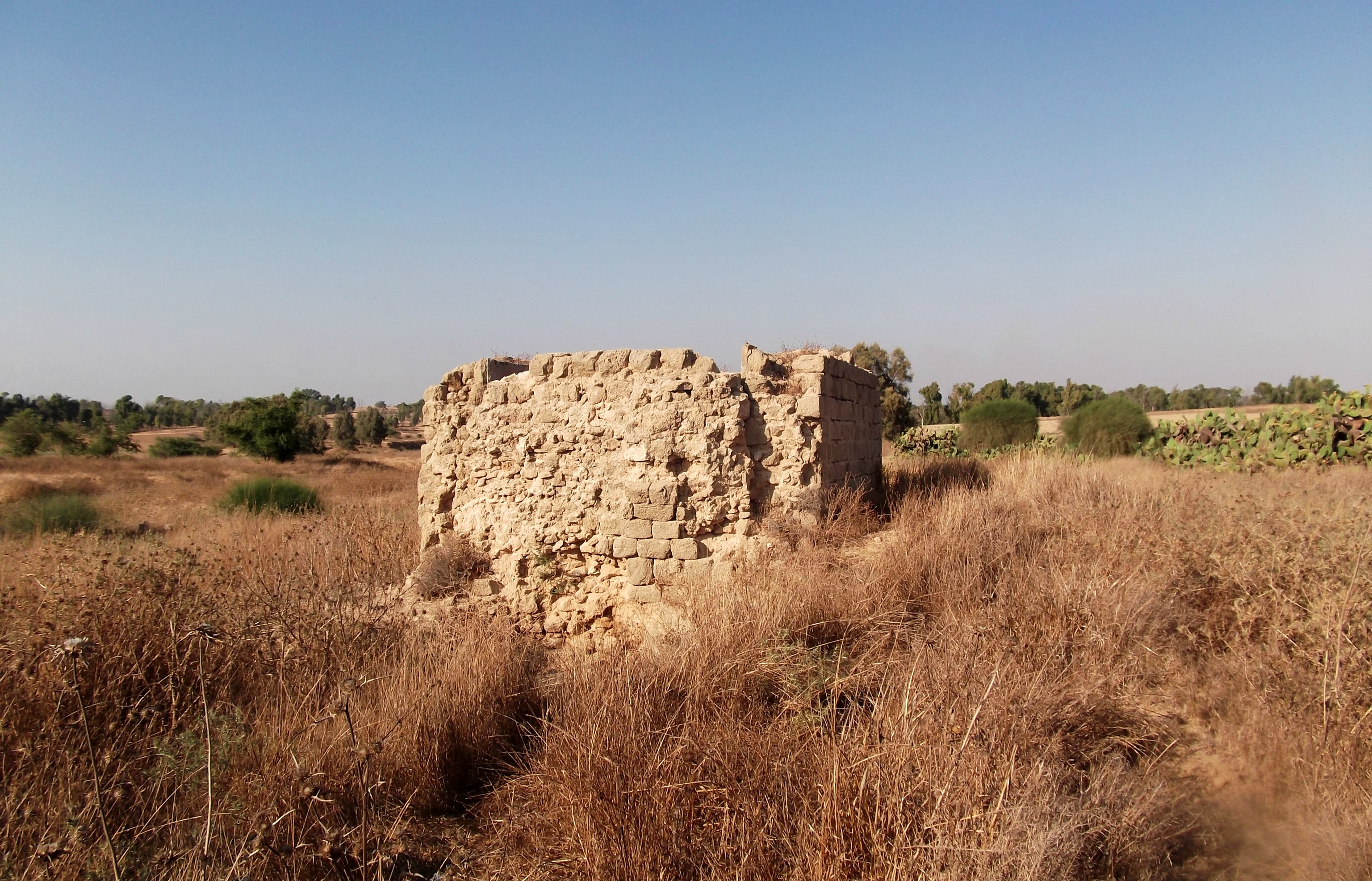
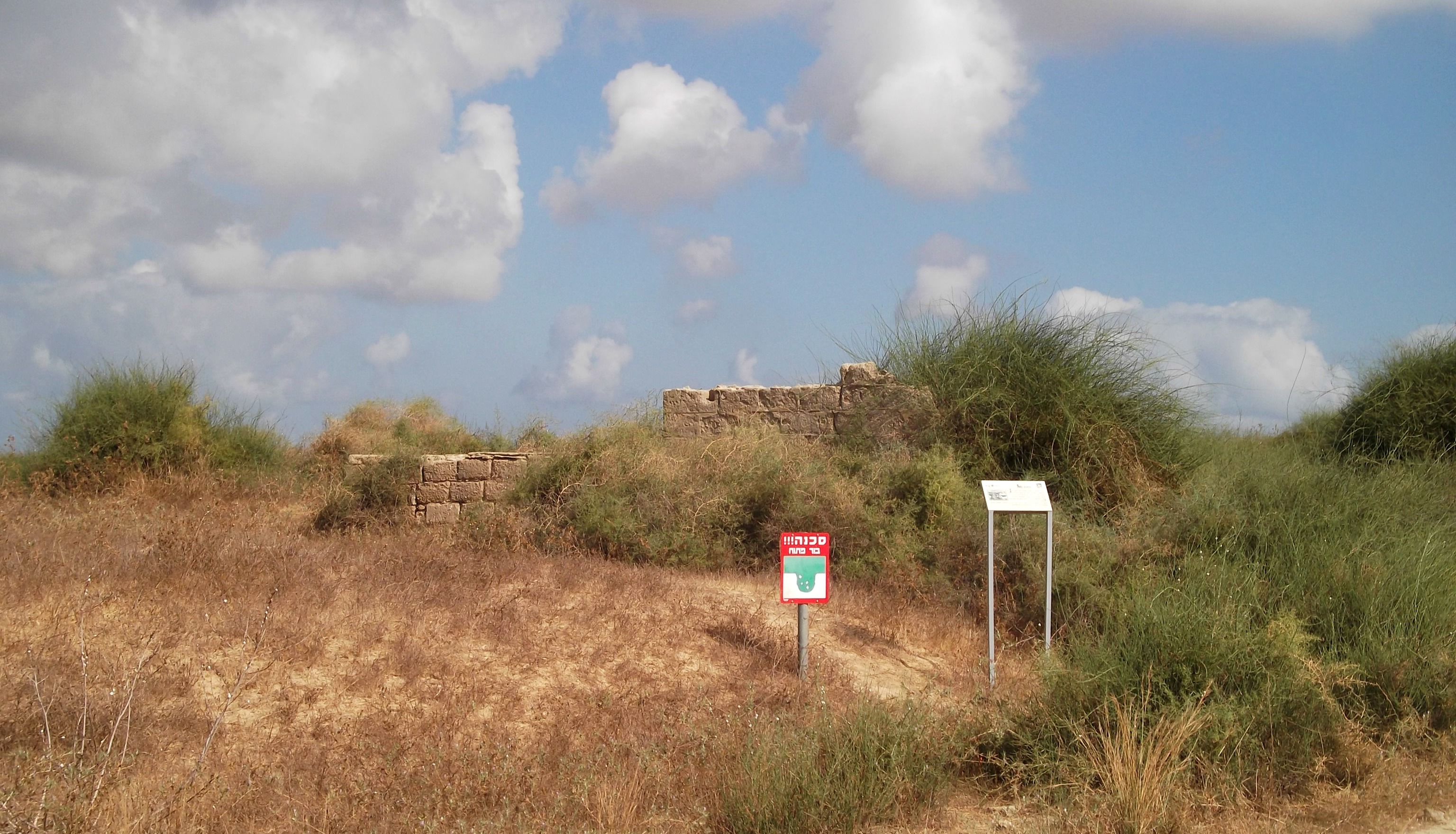
Se’ora Ruins
It wasn’t long before we moved out and so I haven’t had the chance to explore the northern Be’eri Forest, but one day I shall. I’d like to end this post with a photo I took of the first Iron Dome interception I saw, the very first day I spent on the frontlines.

Iron Dome interceptions
Until next time, and may we have only good thing to share! (A more in-depth and personal account of the mortar attack can be found HERE)

Were anywhere near Keren Shalom? My stepson was stationed there for 30 days. He is a APC mechanic and driver. They had some close calls, but TG no deaths or injuries, just miracles.
Not too close to Kerem Shalom, although always nice to hear about miracles rather than tragedy. Thanks for commenting.
It’s so surreal reading about your exciting adventure discovering British wells and skinks while the war was going on in the background. In the ’70s there was this popular song “Only in Israel”. I think what you wrote sums that up.
Yes, in retrospect “surreal” is a good description. Thanks for reading and commenting!
Great photos and nice write-up of this most interesting place. I especially liked the photo of that well. Those drop-offs were also quite scary. Thanks for sharing this. Be careful out there!
Thanks Duke!
Its really nice to hear that someone could enjoy the archeology and the history of this area on that particular time!
As one that originally from Beeri I want to encourage you to come back to the area.
There is much more to see that it will be a shame to miss 🙂
Yes, Alon, I have the entire northern Be’eri Forest to see. One day…
[…] was about Abraham settling in the Nachal Grar area (I have previously written about this in the Be’eri Forest post). Another notable Biblical period was the time of King Solomon, when he ruled […]
[…] camp during Operation Protective Edge in 2014 were probably on that wall (for the war story see HERE). I scoured the most recent names and my eyes fell upon their names listed one after the next; […]
[…] just three kilometres southwest of where I posted during Operation Protective Edge (see blog post HERE), it was an unusual feeling revisiting the area under such different […]