Following my visit to Migdal Afeq (Mirabel) and then Tel Afeq (Antipatris), I continued on to the Yarkon National Park – the source of the Yarkon River. Being that Tel Afeq is a part of this park, I was able to just slip out the back gate and walk through a field to visit the Yarkon section. Parallel to the trail is a canal which helps direct spring water to the start of the Yarkon, which eventually drains into the Mediterranean Sea some 28 kilometres (17 miles) downstream, at the northern end of Tel Aviv proper.

Map of Tel Afeq (Antipatris) and Yarkon National Park
Along the way I stopped at the water lily ponds where various fish, including catfish, and waterfowl live – the one egret I saw flew off when I got too close. Camera ever-ready, I also scoured the ponds for coypu and mongooses along the water’s edge, but didn’t see any.

Fish in a water lily pond
After the lily ponds is the industrial Yarkon pumping station of the Mekorot water company, which has a visitors centre open for groups (free). Supplying the whole Mercaz area of the country with water, the bulk of the Yarkon’s water discharge goes to the pipelines for agricultural and domestic consumption. Only a surprising 0.2% of the springs’ water flows into the Yarkon River – from a total of 200 million cubic metres of water a year.
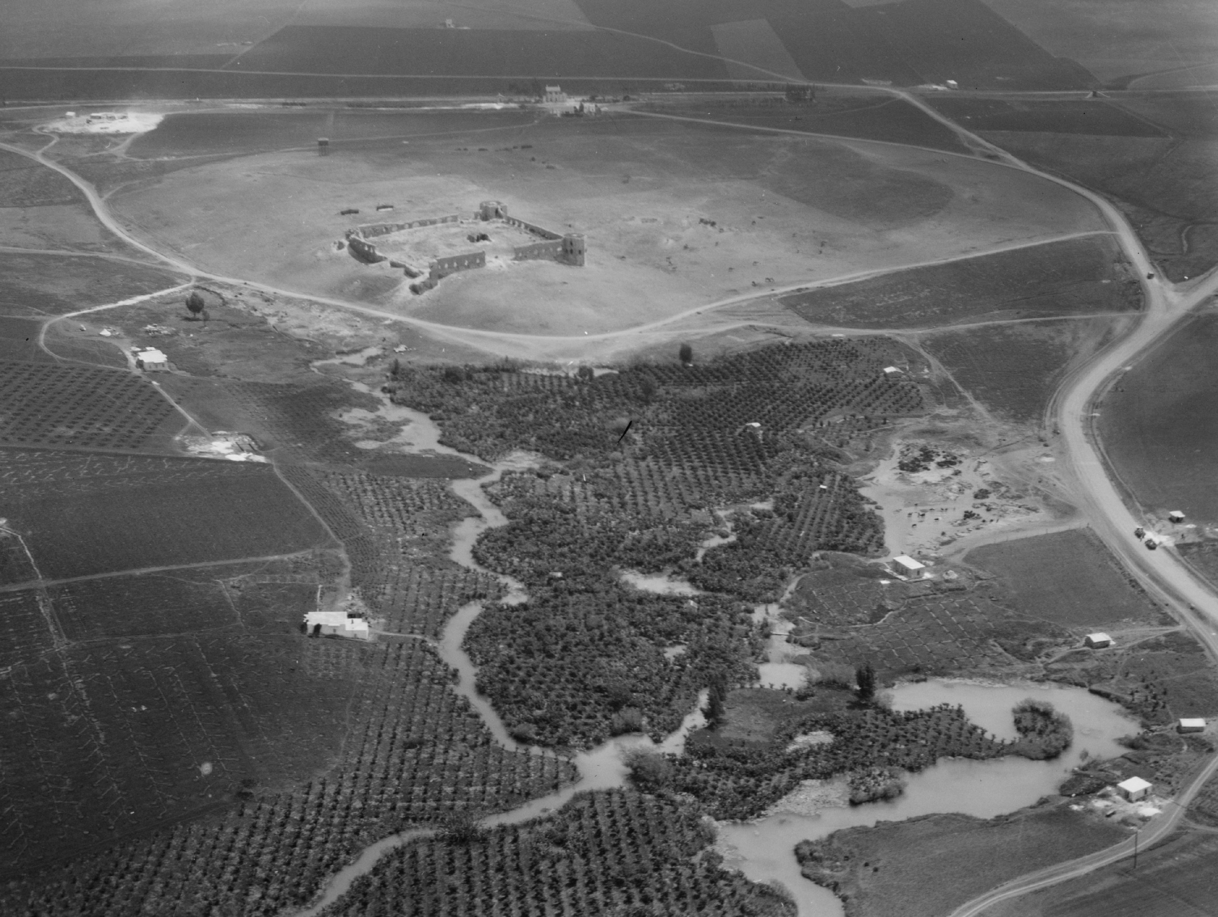
The Yarkon springs with Tel Afeq from the early to mid-1900’s (photo: Library of Congress)
The water from the Jordan River, which originates in the Upper Galilee’s springs and the annual winter runoff from the mountains (especially Mount Hermon), flows into the Kinneret (Sea of Galilee) which acts as a natural reservoir. A percentage of that water is then pumped up at the Sapir Pumping Station not far from Capernaum, and then sent along its south-bound path via pressure pipes and the Jordan Canal. Passing several reservoirs, pumping and filtration stations and canals, the water then makes its way to the Yarkon pumping station where the waters are mixed and sent to either the Tel Aviv area or further south to provide the Negev with water. The whole infrastructure is very interesting and was an incredible undertaking and learning all about this actually inspired me to read up on aquifers and water sustainability on my train ride home.
British pillbox
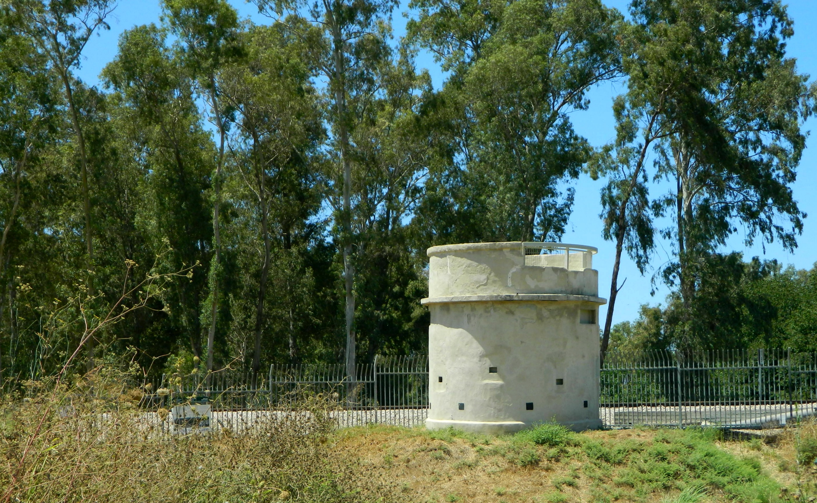
Just beyond the pumping station is the back entrance to the Yarkon park, bordering the south side by still-operational train tracks, with the trail passing under an old bridge. Built in the early 1920’s, the railroad was an important regional development, helping the farmers of nearby Petach Tikva to send citrus harvests to Yafo (Jaffa) for export. In the mid to late 1930’s the British were forced to build a pillbox to guard over the tracks and the bridge from Arab attacks. Today the pillbox is vacant, but the trains thundering by were numerable to say the least.

Passenger train crossing the bridge
Entering the Yarkon section, I began by walking along the fledgling river and then laid down for a spell to read the park pamphlet I had received earlier and to enjoy the quiet nature resuming life all around me. I scoured the tall eucalyptus and bald cypress trees overhead, hoping to spot a sleeping owl (without success) and then turned my attention to a fish mulching about in the pondweed and hornwort. Following the meandering river, I next came upon two ruins from the Ottoman era along the river bank – a house and a pump structure.
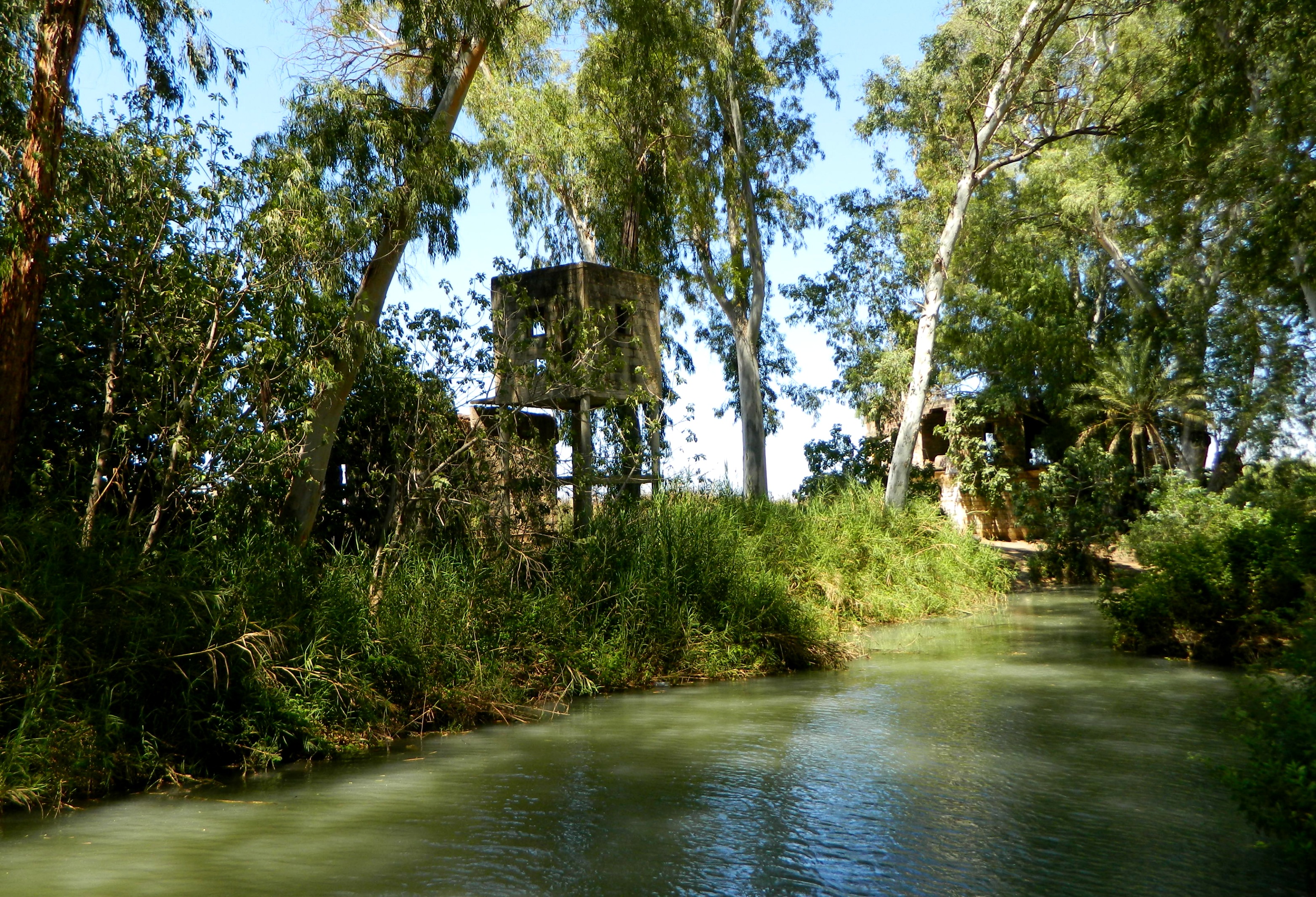
Ottoman house and pump structure along the river
I then looped around the northern end of the park and temporarily left the park via the “Romantic Trail” to go see the Concrete House which was the very first building in Israel to be built of reinforced concrete. Walking on a dirt path next to the Baptist Village I came upon the remains of a concrete house with rebar clearly visible. I naturally assumed that this was the Concrete House marked on the map, took pictures and returned to the park. However, I had stopped at the wrong place, the real Concrete House being some 700 metres (2,300 feet) further along the trail – 0h well. Back at the park, I next visited the al Mir flour mill, one of the largest old mills in the country which operated thirteen pairs of millstones during the Ottoman era.
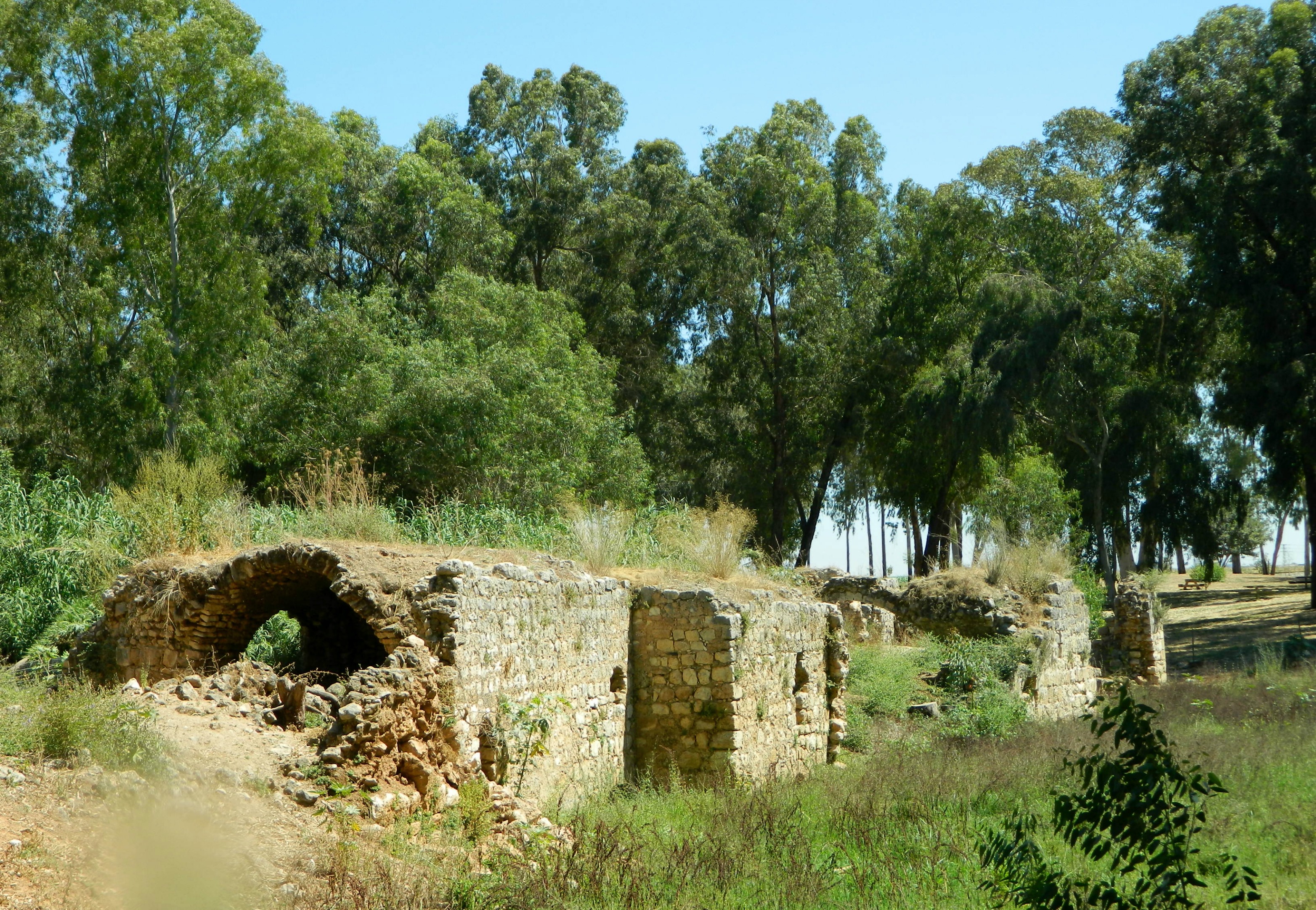
The al Mir flour mill
With a quick stop at the Yarkon bleak pool, I was unable to find any of the endangered Yarkon bleak fish in the murky waters and so continued on to the last of the park’s sites: the Qa’sar farm. The farm was originally owned by an Egyptian man in the early to mid-1800’s and then sold to Salim Qa’sar of Jaffa who, in turn, sold it to the Baron Rothschild in 1895 for the benefit of Jewish farmers. Seeing just four stone walls remaining, I made friends with three nice donkeys while I waited for a ride from a gracious park worker to the nearby train station.

Friendly donkeys at the Qa’sar farm
And that is the end of my exciting trip to some very interesting sites in the centre of the country, a region I hardly explore. Next adventure here I come!

[…] installed a water level surveyor on the boardwalk to publicly display the current level. Last post (Yarkon National Park) mentioned how most of the country gets its water, and it’s at the Kinneret where the […]
[…] to the Tel Aviv Port to watch the sunset and explore the area for the first time. Crossing the Yarkon River, I walked along the water taking pictures of the various birds hanging about. I saw kingfishers, […]
[…] all about the source of the Yarkon River and its initial tributary streams in my post about the Yarkon National Park – the Ayalon is the last of these to join the decantation into the sea. Continuing along the […]
[…] Yarkon River and other streams in the area. I remember reading about the fish when I visited the Yarkon National Park, so here was an exciting window into the background of this fishy success […]