Wrapping up a trio of posts stemming from a three-day trip to the Galilee and Golan with 9th graders belonging to the school where I work, we awoke mosquito-bitten and hot at Tzemach Beach at the southern tip of the Kinneret. We went through the morning routine and before long we were ready for the first activity of the day, lunches packed away for later. Due to the heat, the powers that be adapted our schedule to reduce heat stroke among the masses and our hike was to be a shaded one, in the wooded ravine of Nachal Kedesh in the Upper Galilee, not far from Tel Kedesh. But first we stopped at the kever (grave) of Choni HaMa’agal, a Jewish sage from the Roman era, in Hazor next to Rosh Pina. Continuing on to the hike, the buses deposited us at the trailhead near Yesha Junction where our guide gave us a short talk on geography and off we went into the ravine.

Game of light and shadow at Nachal Kedesh
Quite a shaded area, but still hot and surprisingly humid, there wasn’t much to do except for hiking which turned out to involve some scrambling and dropping off rocks to follow the winding trail. We walked along the dry and rocky streambed, our bodies drenched with sweat, but it went by quickly. Before long we emerged from the shade of the trees and we were walking along the tri-colour-marked Israel National Trail with a lovely view of the Naftali mountains.
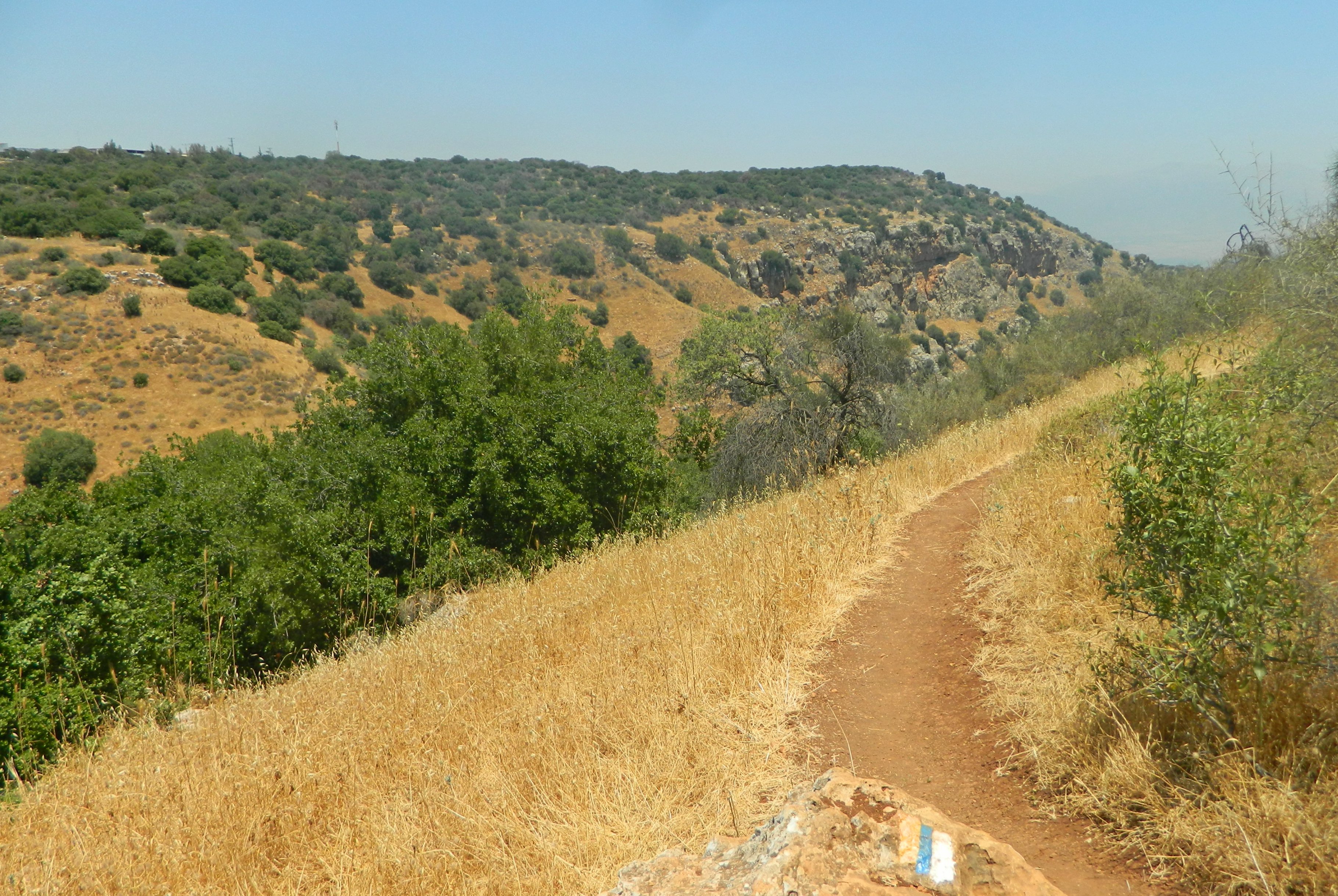
Israel National Trail
I kept a sharp eye out for wildlife but it was simply too hot and the only thing of interest that I saw were wild carrot flowers, which I’ve been seeing everywhere these past few weeks. We approached a copse of pine trees and our trail turned south, affording a great view of the Hula Valley and the golden plateau of the Golan beyond.
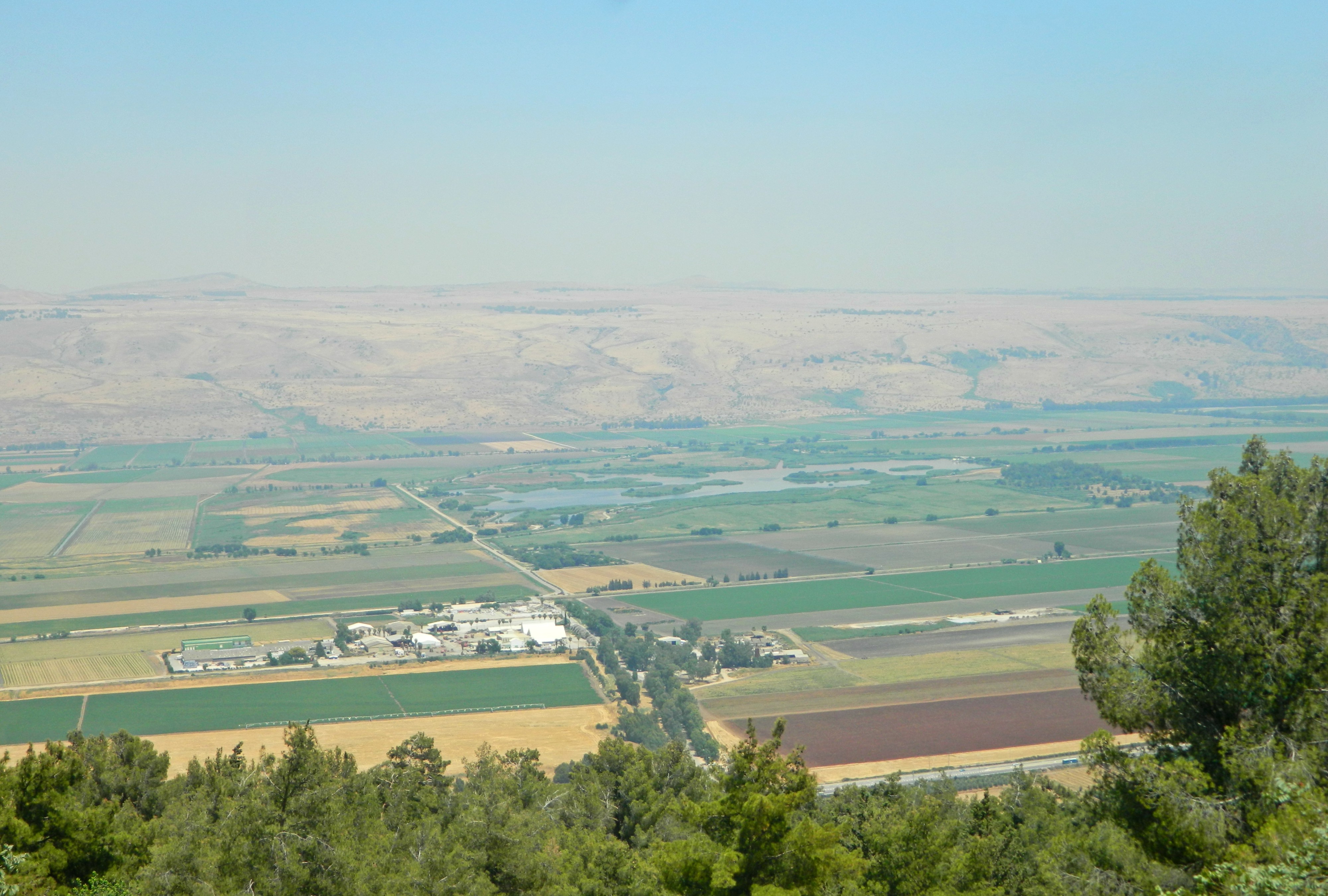
View of the Hula Valley and the Golan
The trail marker turned red and there was a sign marking a grove of trees plants in memory of the soldiers that we were soon to learn about. Up ahead, just beyond the trees, was Metzudat Koach, a British-built police station that was occupied by Arab forces upon the British withdrawal in 1948. Jewish attempts at conquering the strategic fortress were costly and, despite eventual success, twenty-eight soldiers were killed. The name “Koach” means “strength” in Hebrew, as well as having the numerical value of 28 in correspondence to the soldiers who fell. As we approached this fortress we passed over an old bunker than played a part in the battle for the station. Beside the fortress we found a small museum, newly opened, which had both welcoming air-conditioning as well as a plethora of maps, explanations, antiquities and more from the birth of Israel as we know it today. HaReut Museum, which translates to “comradeship”, offers a brief yet illuminating glimpse at the history of the battles that took place.

HaReut Museum
The British, wanting to control the border, built a series of small pillboxes along the Old Northern Road, one of which is still standing today near Tel Kedesh. However, they still needed police stations so they constructed this one at what is/was called Nabi Yusha (a nearby Arab shrine to the prophet Joshua), as well as others further westward. As mentioned above, the fortress changed hands from the British to the Arabs to the Israelis and today it belongs as a Israeli Border Police base, a fitting use.

Museum’s permanent guests
When I had finished perusing the museum I opened the guestbook and inscribed a message of my own, kindly informing potential readers that I was to write a blog post about my impromptu visit. When the docent heard of my note he showed us other visitors’ messages, some laminated, which were interesting in and of themselves. I asked him when I was to expect my note to be laminated and, smiling genially, he was unable to confirm any date for me. With the group of lads outside, we at last returned to our duties and, a half hour or so later, found our way to the buses where we were to be taken to the last attraction of the three-day trip: “kayaking” or rafting on the Jordan River.
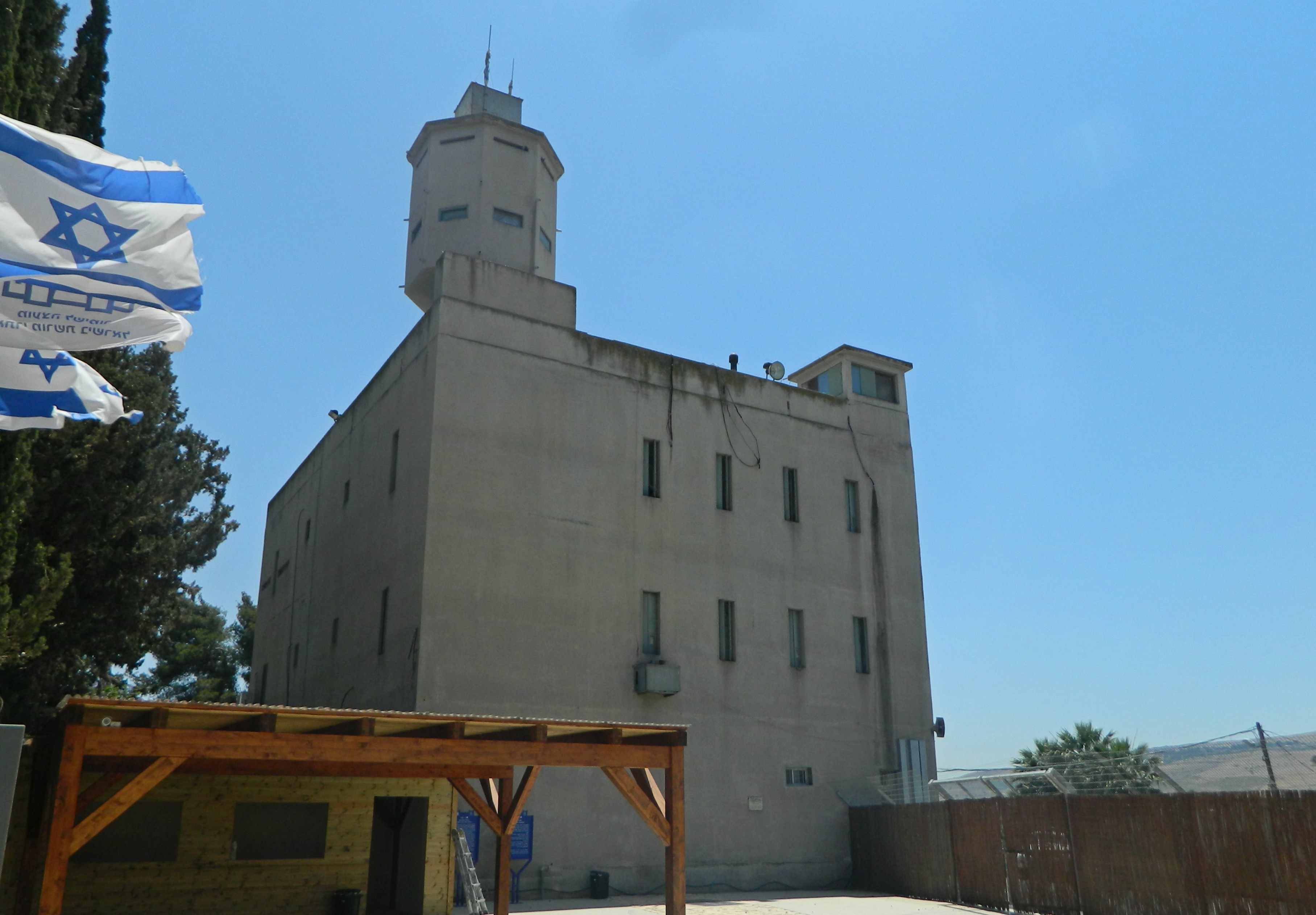
Metzudat Koach
Previously I had been rafting a few times but only at the northern end of the Jordan, where the Hermon, Snir and Dan streams combine. The rafting place we were visiting now is located just north of kibbutz Gadot, north of the historically important B’not Ya’akov bridge. Two fellow instructors and I shared a raft and we took turns splashing and fending off the boisterous 9th graders, while snatching brief moments to relax in the river’s gentle current. At one point I spotted a baby turtle that had come up for air and then, a few minutes later, we drifted right up next to a dainty grey warbler that made its way to the water’s edge for a quick drink – if only I had brought my camera along! At last, after some minor rapids, we reached the end of our alloted rafting course at the southern end of Chastellet (Jacob’s Ford), an important Crusader castle that was destroyed by Muslim sultan Saladin. From there we were taken back to the boat launch area and waited about until our buses took us back to Givat Shmuel, bringing an end to an action-packed three-day adventure. But I was not to rest too long, for I had a BIU Archaeology trip the following morning…
