The week before last, Bar Ilan University’s campus chapter of the Society for the Protection of Nature in Israel (SPNI) offered a free birding tour. Naturally, I went along, and experienced the unexpected, much to my satisfaction. Being that BIU’s campus is situated in a very urban area, tucked between Ramat Gan, Bnei Brak and more, I wasn’t expecting to see anything other than what I see on a semi-frequent basis walking around. In due time we were introduced to our birder tour guide, Shuki Cheled, and we set off to explore the campus, with its overcast skies.
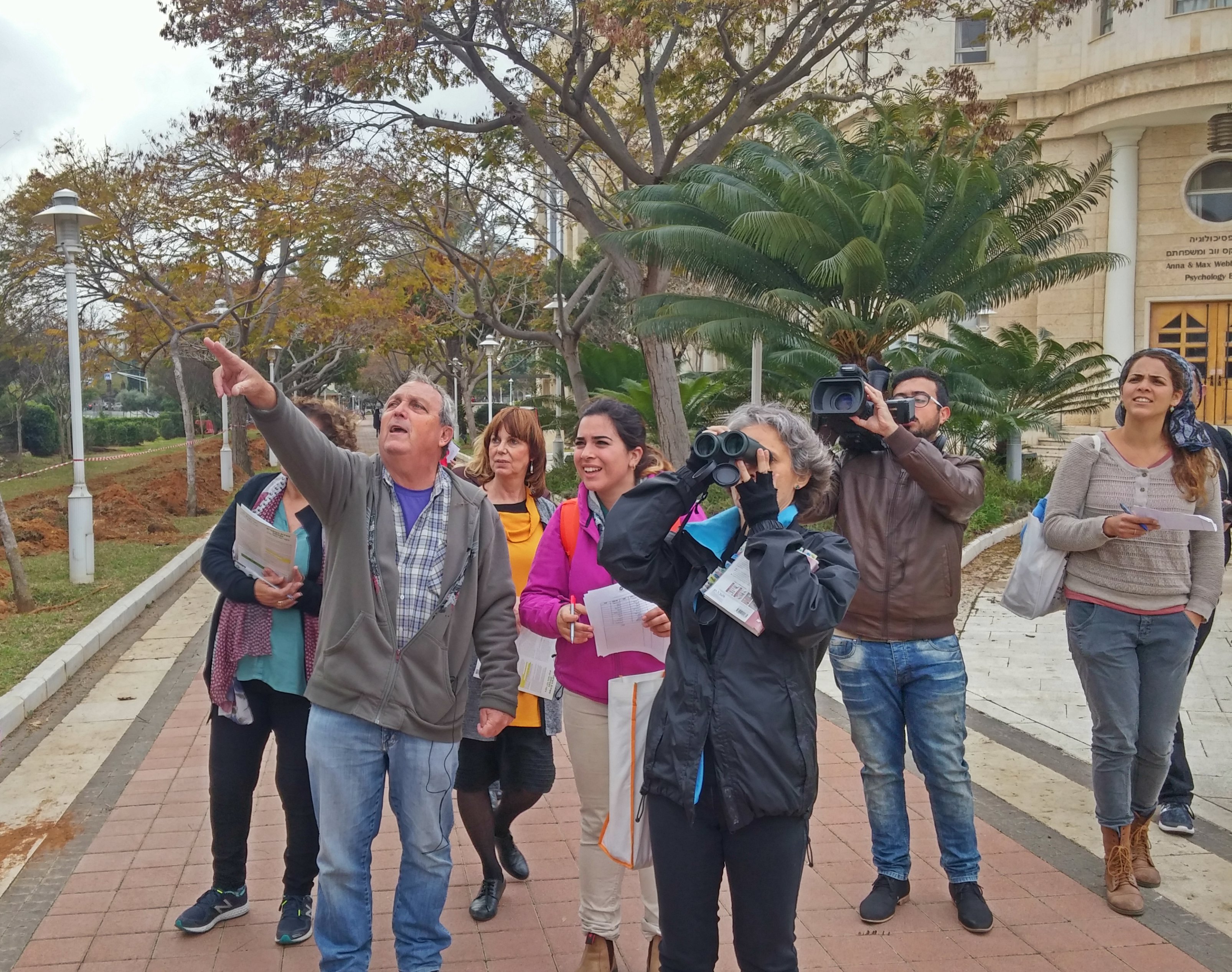
Birding outside the Psychology building
While some of us were equipped with cameras and binoculars, Shuki used just his eyes and ears to identify birds in the vicinity. At first pickings were poor, with common and invasive species such as hooded crows, laughing doves, house sparrows and common mynas. But then, a few stonechats were spotted, posing as they do, and then an uncharacteristically-bold hoopoe – Israel’s national bird.
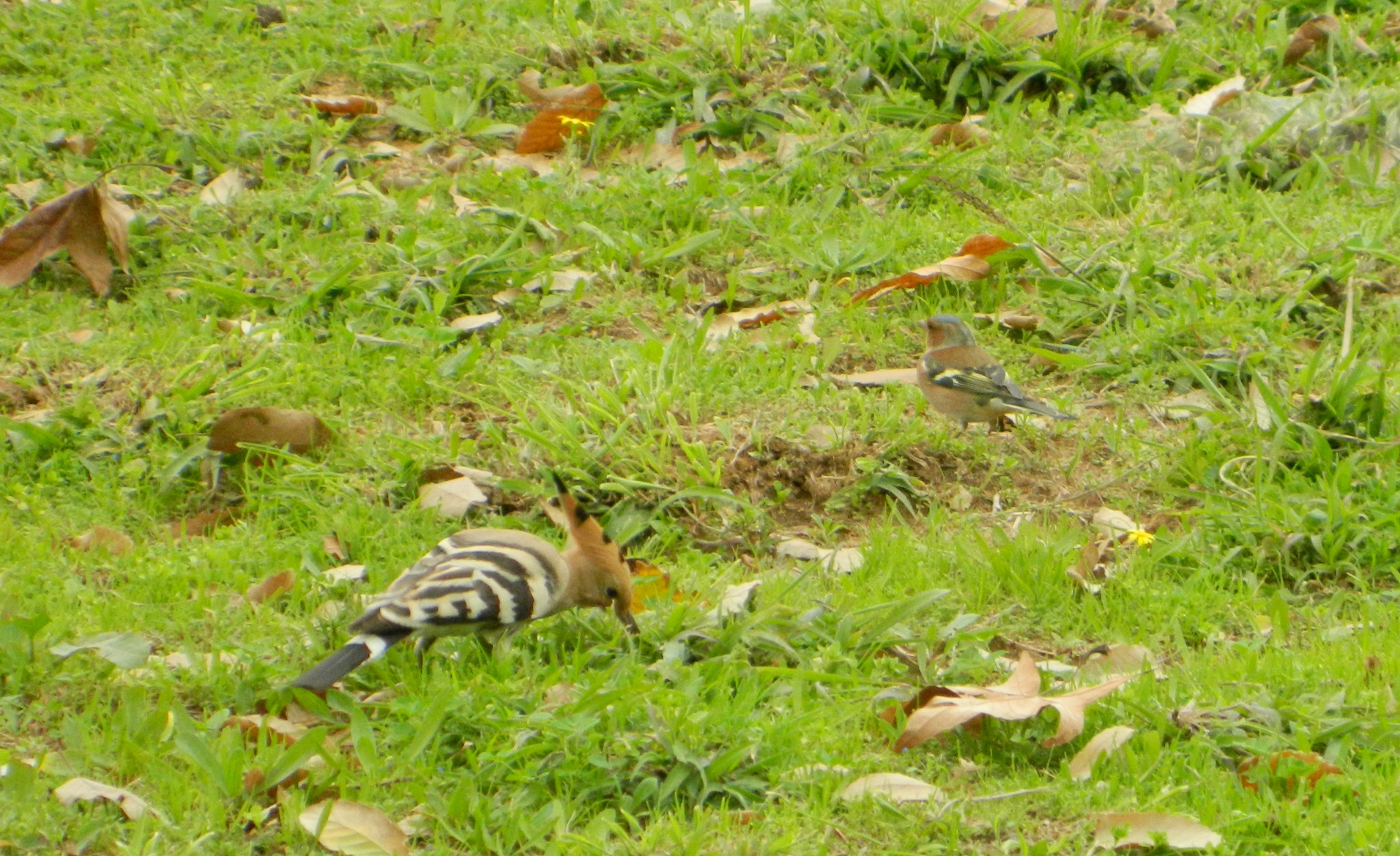
Hoopoe & Chaffinch
Pausing at the Brain Research Centre, we spotted an unusual species perched on a rock some ten or so metres away. Shuki seized binoculars and I ventured into risky digital zoom to discover what was determined to be a dunnock (or hedge warbler, as I’ve heard from my Hula Valley Birding Tour experience). Flitting restlessly overhead was a chiffchaff, a tiny bird weighing only about seven grams (or .30 oz). I was able to catch him taking a tiny break on the trunk of a palm tree:
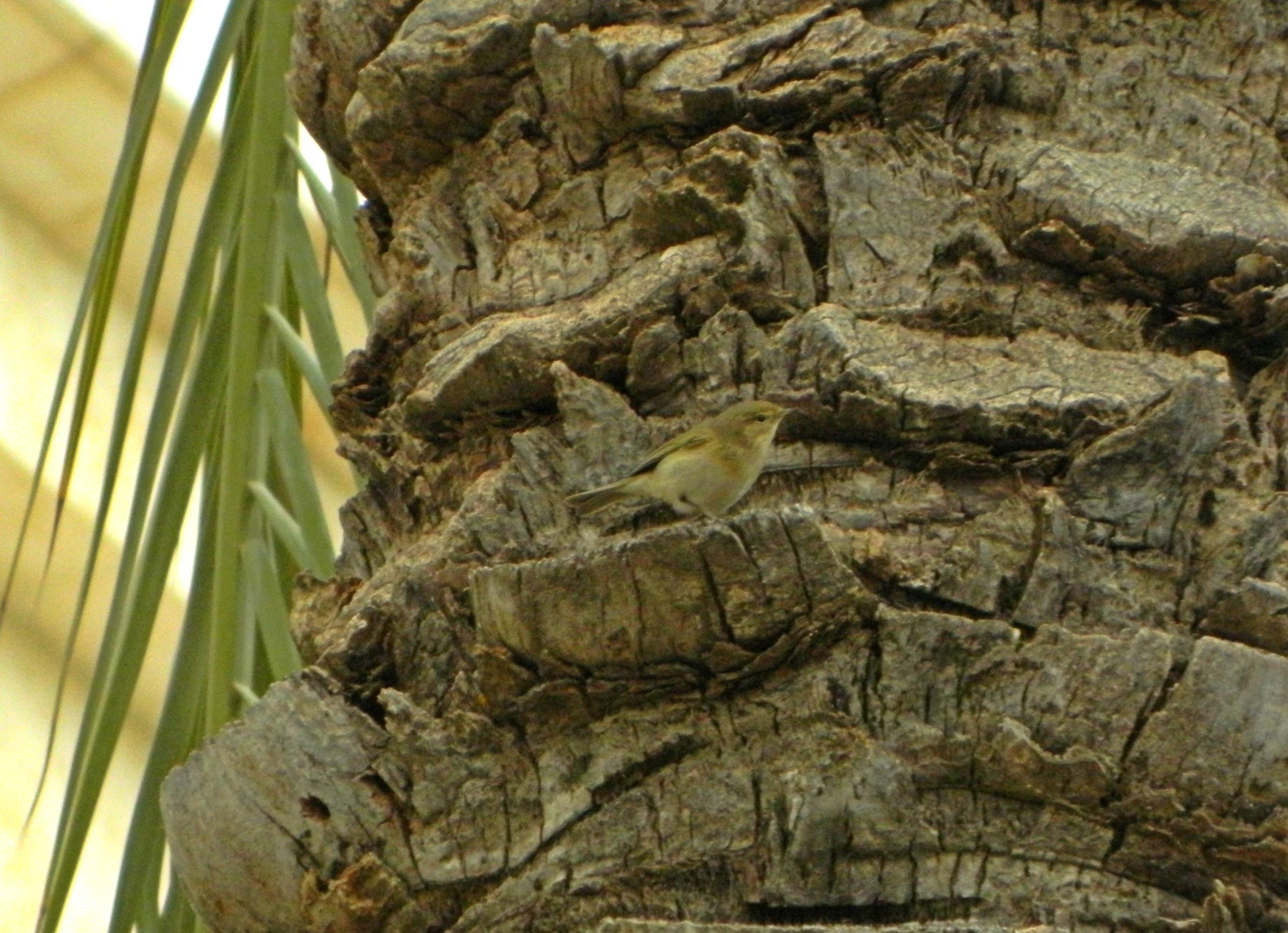
Chiffchaff
Entering the Dahan park, with its fruit trees and flowing water, we were greeted by a number of bird species. Highlights included chaffinches, greenfinches, monk parakeets and small flocks of starlings – a seemingly simple bird, but with stunning plumage up-close. While the group exchanged birding thoughts and observations I nipped over to an orange tree and picked a juicy orb, which turned out being exceedingly tart.
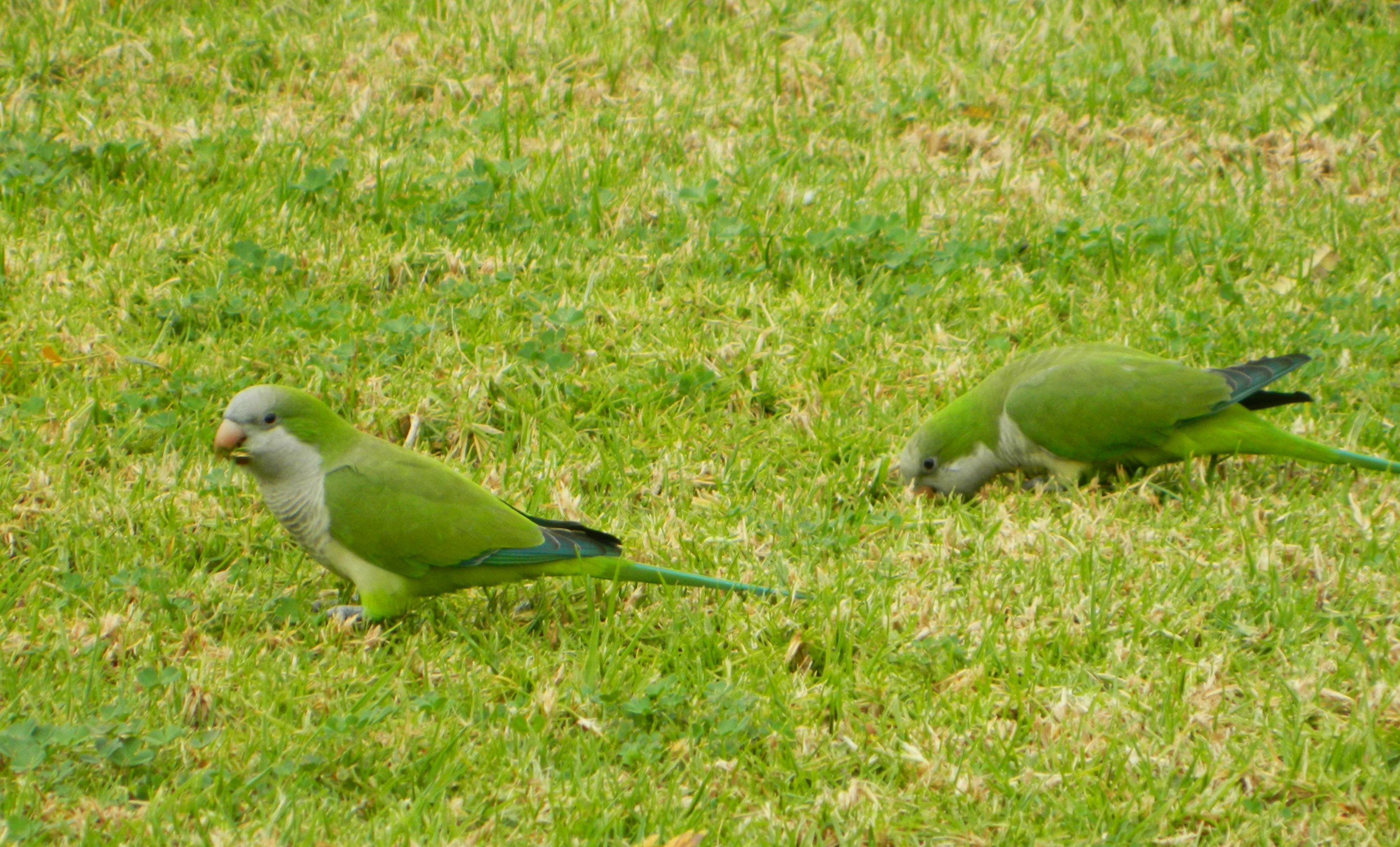
Monk parakeets
With the tour reaching its hour-long time limit, the official tour ended and only a few stayed on with Shuki, including your truly. But first, an amazing photo capturing a wide range of activities and emotions by Faith Baginsky.
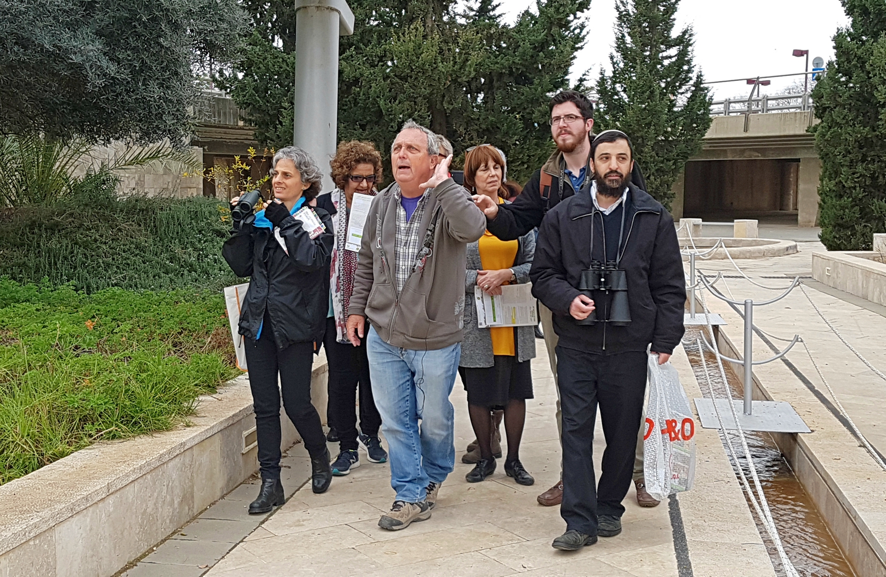
Hark! (photo Faith Baginsky)
We next paused at the gravelly parking area in the Engineering and Technology regions, spotting a group of jackdaws (which I automatically assumed were “boring” hooded crows). Next, taking a few steps forward, I flushed out a whole bunch of stone curlews who were standing mere metres away yet completely camouflaged. Here I caught one trying to hide behind a lamppost:
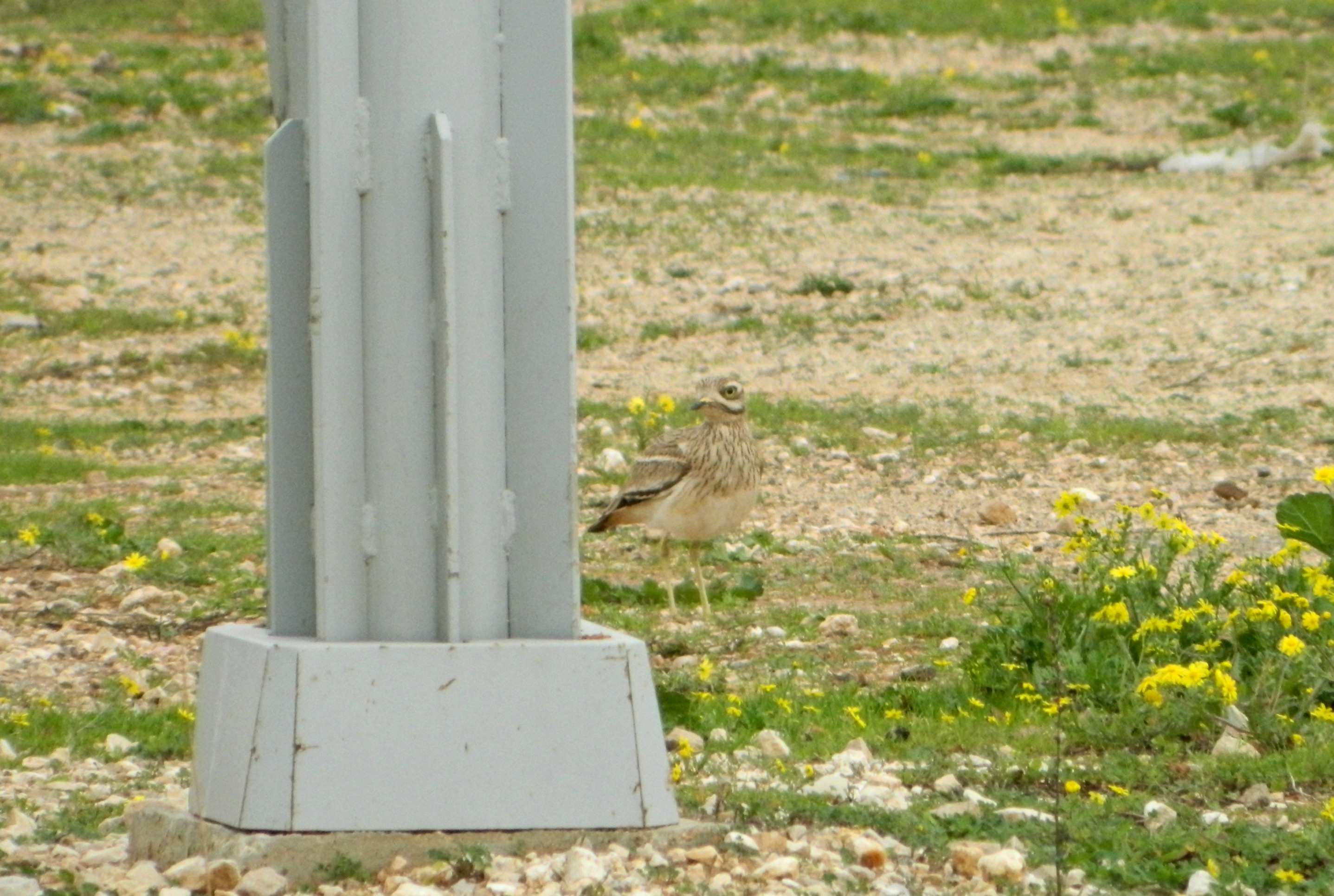
Stone curlew
Continuing along the campus road, we saw a whole assortment of birds I would have never noticed beforehand, despite the fact that I consider myself an amateur birder. Standing behind some tall bushes we were able to watch chaffinches (the males have really nice plumage) and hoopoes from an eye-level vantage point. Then, as the tour continuation was coming to an end we saw what seemed to be Spanish sparrows and then another invasive species from India, the vinous-breasted starling, far less prevalent than its cousin, the common myna. I was able to procure this stellar photograph of the starling perched on a barbed wire fence by fellow tour participant Ami Vardi.
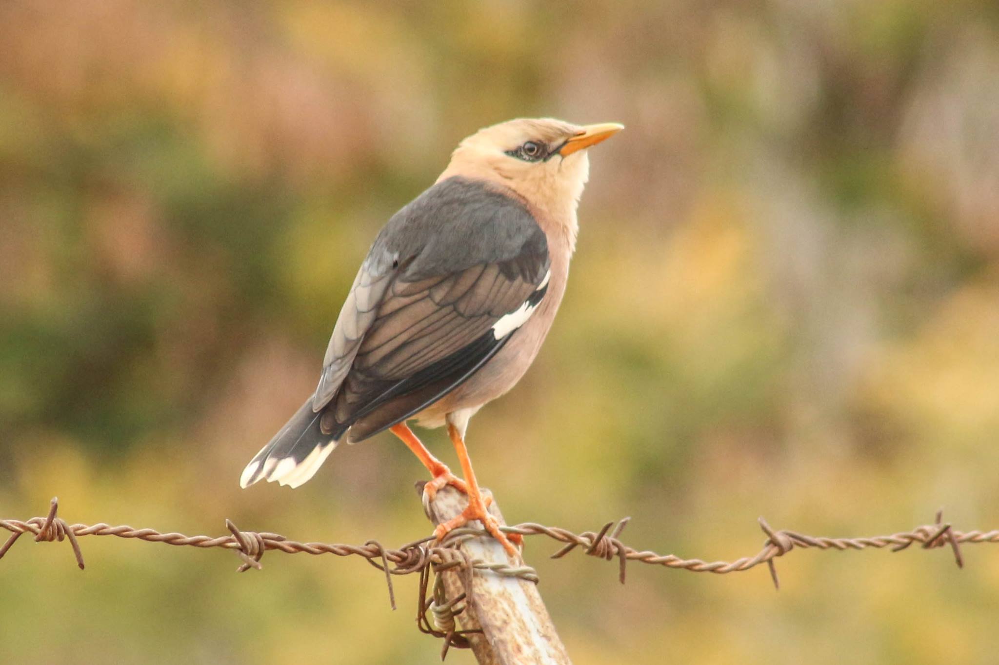
Vinous-breasted starling (photo Ami Vardi)
The overcast skies had darkened and the first drops of rain began to fall upon us, threatening our birding equipment. Content with the twenty-something species we’d seen and identified, I bid farewell to the remaining members and set off to my next activity of the day, bottling my latest batch of beer, IPAeus I.

Shortly after the writing of this blog, a video of our birding tour was publicised by the Bar Ilan University Spokesman office, just click on the photo above or see the video HERE.