It has been difficult not going on any field trips offered by my Land of Israel Studies and Archaeology department in the past year and a half or so. The last one I had attended was to Tel Arad and Tel Be’er Sheva with Prof Aren Maeir, and the time had come to once again embark on a group tour of some exciting places that I wouldn’t ordinarily be visiting on my own. This time, towards the end of December, I set out on a trip to four archaeological sites in the Nachal Tirza area with Prof Shawn Zelig Aster and Dr Dvir Raviv, the latter being one of my thesis advisors.

The region of our adventure
With our target destination being located in the Jordan River Valley area of the country, it was quite a drive to get there coming from Bar Ilan University. Although, on the way, we passed el-Jenab Cave, which I happen to be researching for my thesis and thus pleased me deeply. That, and the breathtaking views of the mountains and wadis on the eastern side of the watershed made the trip already exciting. Before we arrived at our first stop, we had a quick break at a rest stop near Pazael, where I found hundreds of black kites still resting before taking to the skies.

Roosting black kites
When we were back in the bus and headed for our first site – Khirbet el-Makhruk – we drove past staggering numbers of both black kites and starlings flying in the vicinity of local garbage dumps. I’d estimate that there were tens of thousands of each, and an additional couple hundred white storks to complete the spellbinding picture. However, this trip was about geography and archaeology and so the bus let us out near Adam Junction and we began the short hike to Khirbet el-Makhruk.
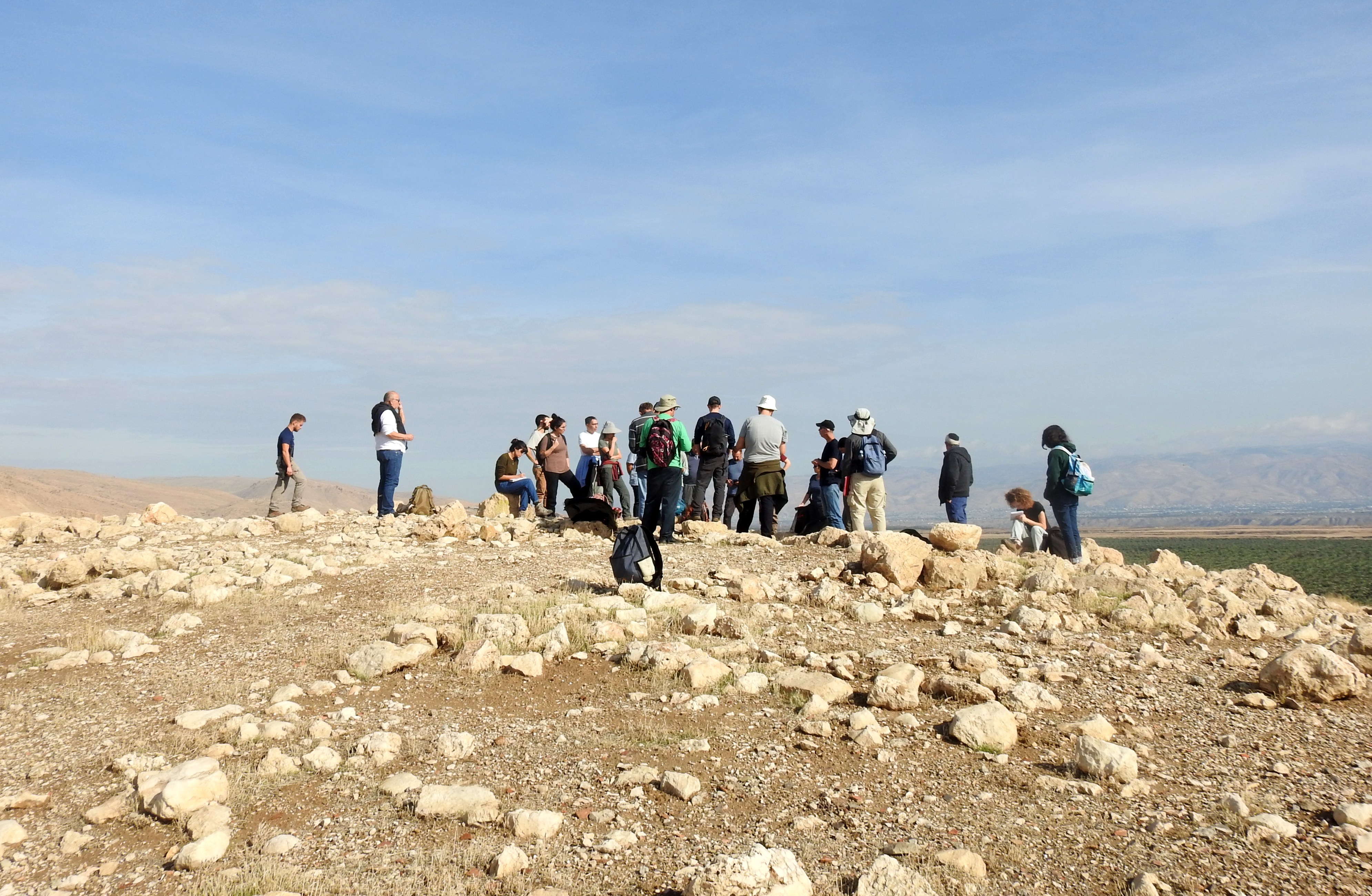
Atop the eastern fortress at Khirbet el-Makhruk
Since we had just experienced a week-long storm, even the arid Jordan River Valley region had received rainfall which was the catalyst for a very exciting event in the circle of life. After the rains, termites come out of their underground complexes and those with wings take to the skies. We swatted the drone-like termites as they flew past, one of them finding its way into my shirt, but then we noticed something incredible. When we had reached the eastern fortress of the ancient site, we saw Israeli gold scorpions running about in broad daylight, nabbing the confused termites and quite literally eating them on the go. Unfortunately, I don’t have the proper macro equipment to capture this moment the way it needs to be, but to witness it was astounding.

An Israeli gold scorpion running off with a termite
Khirbet el-Makhruk is a complex of small fortresses dating to the Iron Age, or when the Israelites were active, built atop the ruins of an Early Bronze Age city. Not much remains of the ruins, but back then the site was vitally important in its task of keeping the settled hinterland safe. While looking around the eastern hilltop, I found evidence of recent artefact looting, as well as a freshly broken rim of what appears to be an Iron Age jug.

Exploring the circular tower
We continued up to the small circular tower which effectively guarded the southern side of the complex. There, in the jumbled ruins, I found a painted sherd that either dates to the Late Bronze Age or the Mamluk period, depending on who you ask.

Late Bronze Age or Mamluk painted pottery
From there we continued on to the northern fortress which was most recently ravaged by IDF fortification trenches, although Ottoman bunkers dating to WWI can also be found in the vicinity. Here we found a recently exposed mud brick wall, beautifully intact and utterly raw evidence of the construction efforts that went into this key site.
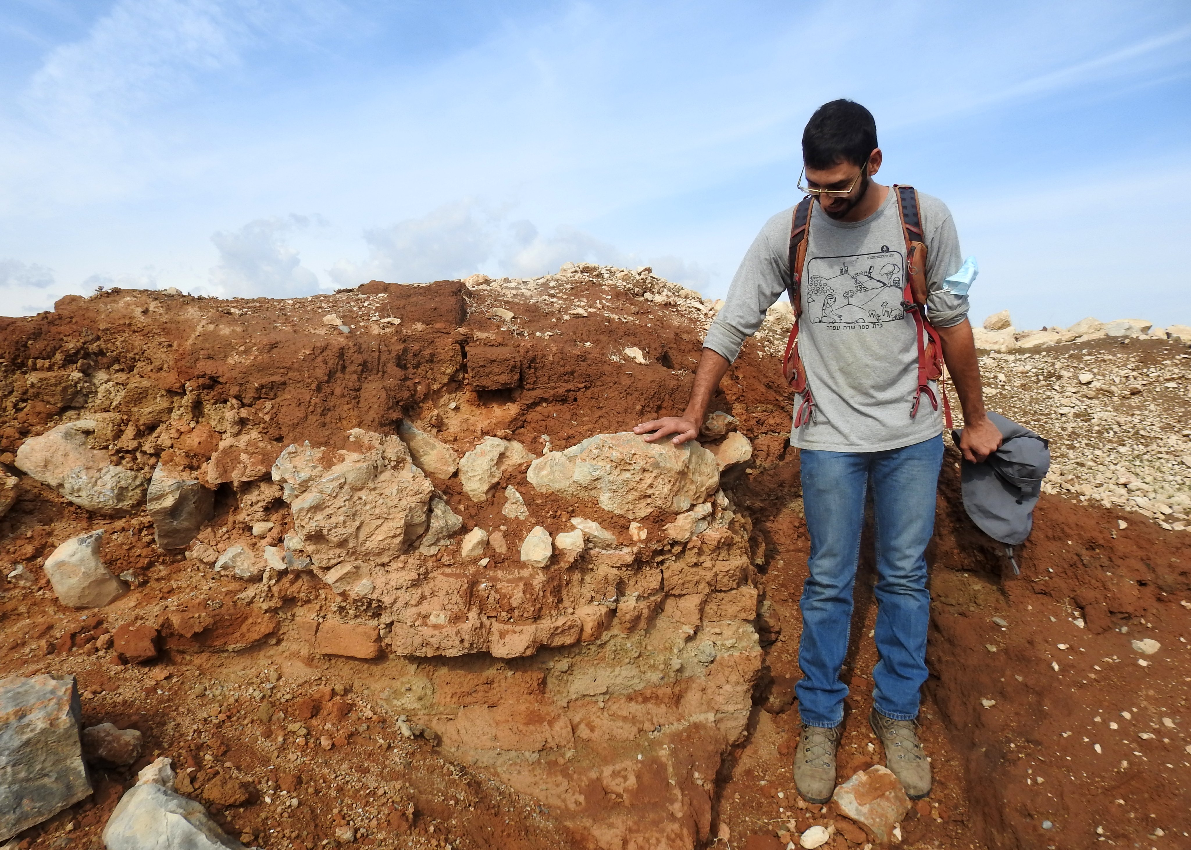
Freshly exposed ancient mud brick wall
We documented it fully, and began the hike back down to the waiting tour bus. Along the way, I had some pleasing birding moments, including some beautiful green bee-eaters, a flushed sand partridge and my very first Namaqua doves.
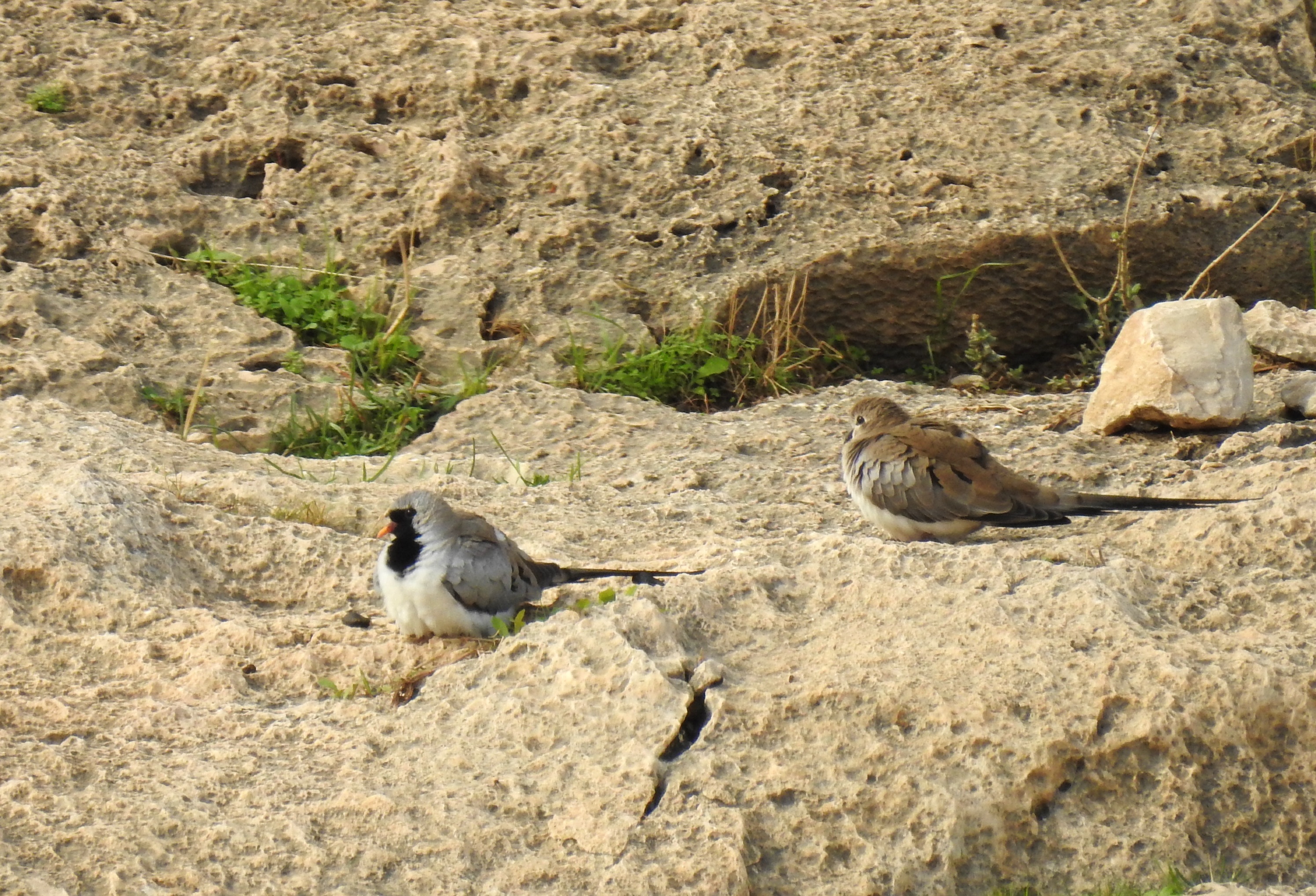
My very first Namaqua doves
Our bus driver deposited us next outside a date plantation just south of Argaman, where we hiked along the wadi to our next site of interest, Bedhat esh-Sha’ab. Also referred to as Gilgal, this is a unique site attributed to ceremonial usage during the Iron Age. The late archaeologist Adam Zertal suggested that Bedhat esh-Sha’ab was one of the first places the Israelites camped upon crossing into the Holy Land. The other possible candidates also share a distinct footprint-shaped outline, which may connect to biblical terminology concerning conquest.
Bedhat esh-Sha’ab or Gilgal
At any rate, this site is located at the foot of a stepped slope which served as an amphitheatre of sorts during our visit there. Nummulite fossils can be found on these rocks, and sure enough we found some as we searched about. Indeed, I had even quite accidentally photographed a nice grouping of the orange, coin-shaped fossils when taking a picture of a nearby blackstart.

A blackstart perched on a nummulite-dotted rock
In more recent years, there were efforts to make Bedhat esh-Sha’ab/Gilgal a proper tourist attraction, and a gigantic megalithic tower was erected. While there’s really not much to see inside the beast, we did notice some local lads climbing up to the top to enjoy the lofty views.
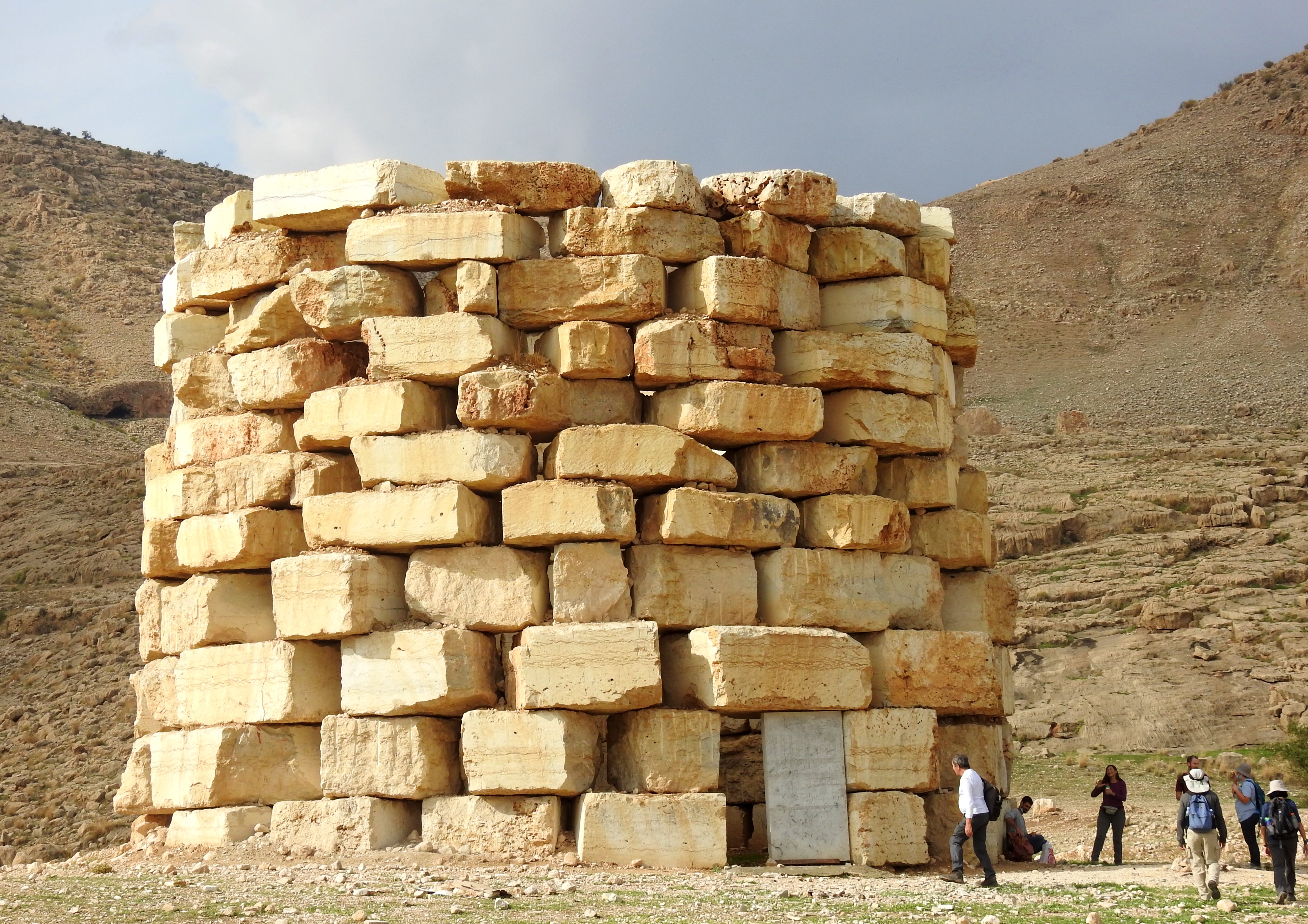
The behemoth of a tourist attraction
We hiked back to the bus and were shuttled over to the next site on our itinerary, the Roman hilltop fortress known now as Horvat Heraf. Located just north of Argaman, a mere two and a half kilometres from Bedhat esh-Sha’ab, this was a permanent military camp for the Roman army in the Jordan River Valley region. Interestingly enough, this quite noticeable site wasn’t documented by early archaeologists, nor by the British surveyors. It was discovered in 1968, during an emergency survey after the Six Day War, and was, only then, properly analysed and named.

Making our way up to the Roman army camp fortress
A fortress of large proportions, the inner section measures a whopping 3,400 square metres, with an additional “lean-to” constructed on the southern side. Three entrances are built into the roomed walls, and a praetorium (officer’s headquarters) in the very centre – see an aerial image of the camp HERE. We were quite understandably impressed by this visibly authentic site, and set about looking for interesting ceramic fragments and maybe even ancient Roman coins (of which we found none).

The ruined praetorium in the centre of the complex
What made this extra titillating for me was the fact that this fortified camp was constructed during the reign of Emperor Hadrian, in connection with the Bar Kokhba Revolt (132–136 CE). The evening before, friends Adam and Vered, Bracha and I watched Thermae Romae, a quirky Japanese movie about a Roman architect trying to improve upon the existing Roman bathhouses under the behest of none other than the very same Hadrian. It’s interesting to compare narratives of such a famous, or infamous, historical figure.
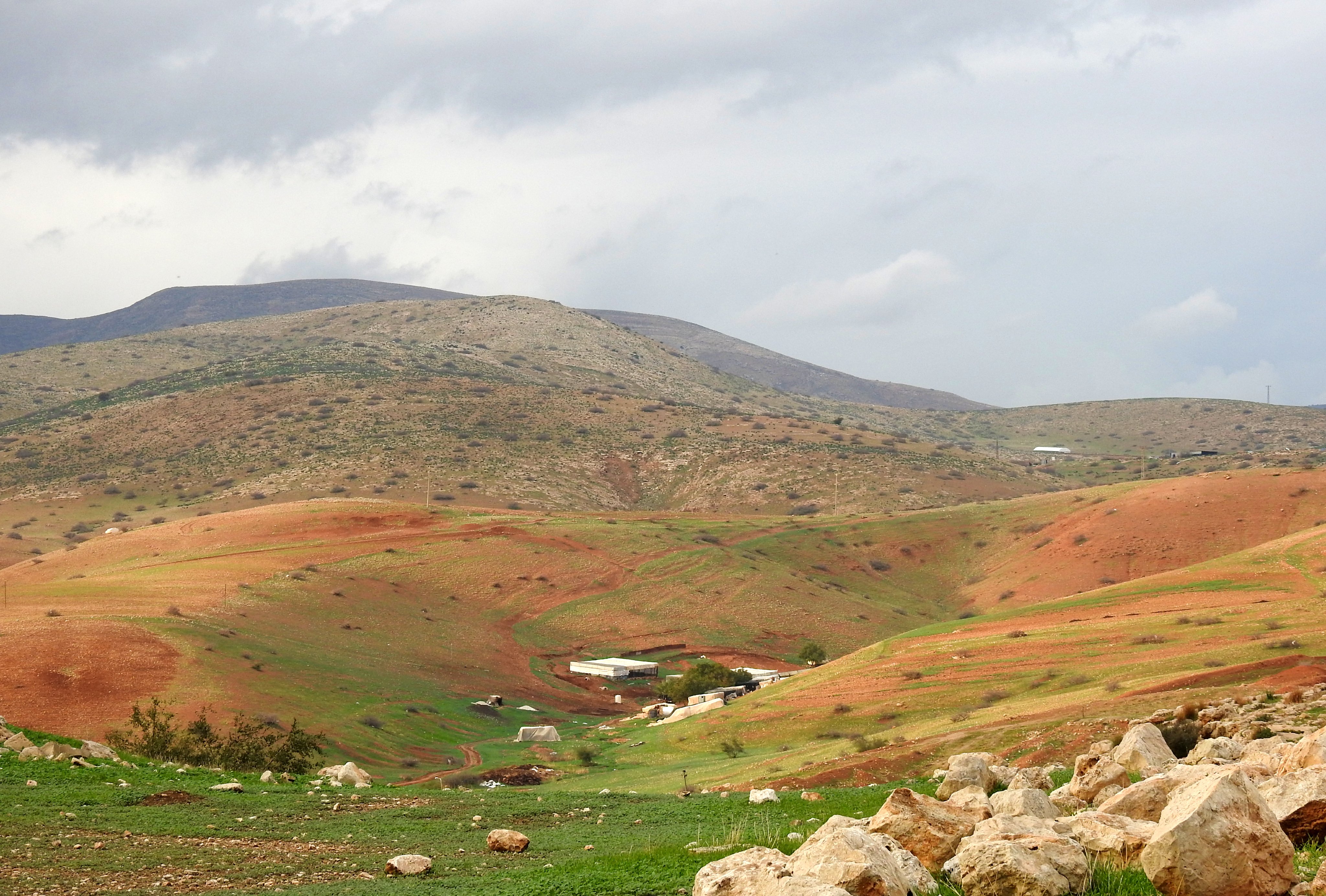
Beautiful shades of topography
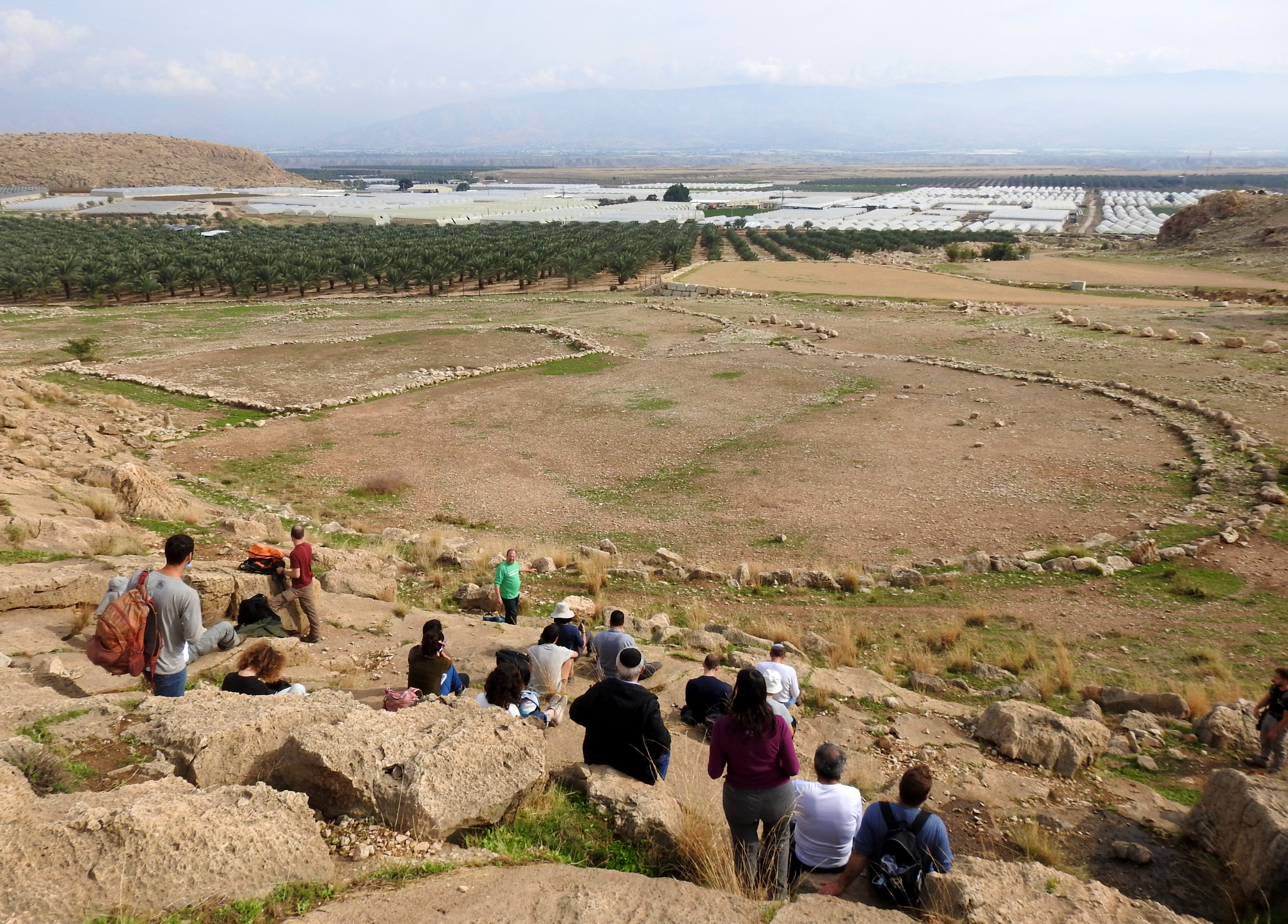
After a light drizzle, we headed back down the mountain and back into our awaiting bus to be taken to the final site for the day. This one was located a bit further upstream, and should be referred to as Khirbet Merah al-‘Enab (Hums a-Tahta), following the advice of Prof Aster. This site is the ruins of an Israelite fortress which helped defend the natural topographical roads that led into the heart of Samaria.

Part of the Israelite fortress at Khirbet Merah al-‘Enab
We arrived on location to see that the site is the literal backyard of a local Arab family, whose patriarch watched us keenly as we enjoyed their hospitality. Our lecturers gave a brief rundown of the site and its importance to the region, and when we left, Prof Aster had a quick conversation with our host in Arabic and it turns out that the both remembered each other from a previous occasion some years back – always charming. With that we made one final hike back to our bus, and off we went back in the direction of Bar Ilan University, bringing yet another field trip to a successful end.

Thank you for taking me along!
Dave *Elijah and Friends *
On Sun, Jan 16, 2022 at 2:15 AM Israel’s Good Name wrote:
> Israel’s Good Name posted: ” It has been difficult not going on any field > trips offered by my Land of Israel Studies and Archaeology department in > the past year and a half or so. The last one I had attended was to Tel Arad > and Tel Be’er Sheva with Prof Aren Maeir, and the time had c” >
[…] on the coattails of my excursion to some fascinating sites around Nachal Tirza, I embarked on another trip with my university department at the very end of December. This was to […]
[…] first real stop of the adventure was at an unassuming rest stop near Paza’el, where a hidden attraction can be found. Just south of the gas station, there is an old, abandoned […]