Exactly one year ago, the day after our second wedding anniversary, Bracha and I embarked on a short day trip to Jerusalem. Our adventure began with a gourmet lunch at famed pizzeria La Piedra, joined by our friends Adam and Vered. From there we journeyed to the main destination of the day, the Museum for Islamic Art, located in central Jerusalem not too far from the famed Israel Museum. I had been wanting to visit this alluring-sounding museum for quite some time, so it was a joy to finally carve some time out of our schedule for a nice visit. But first, dessert in the form of an ice cream cone from the popular Mousseline ice cream parlour, found just around the corner.
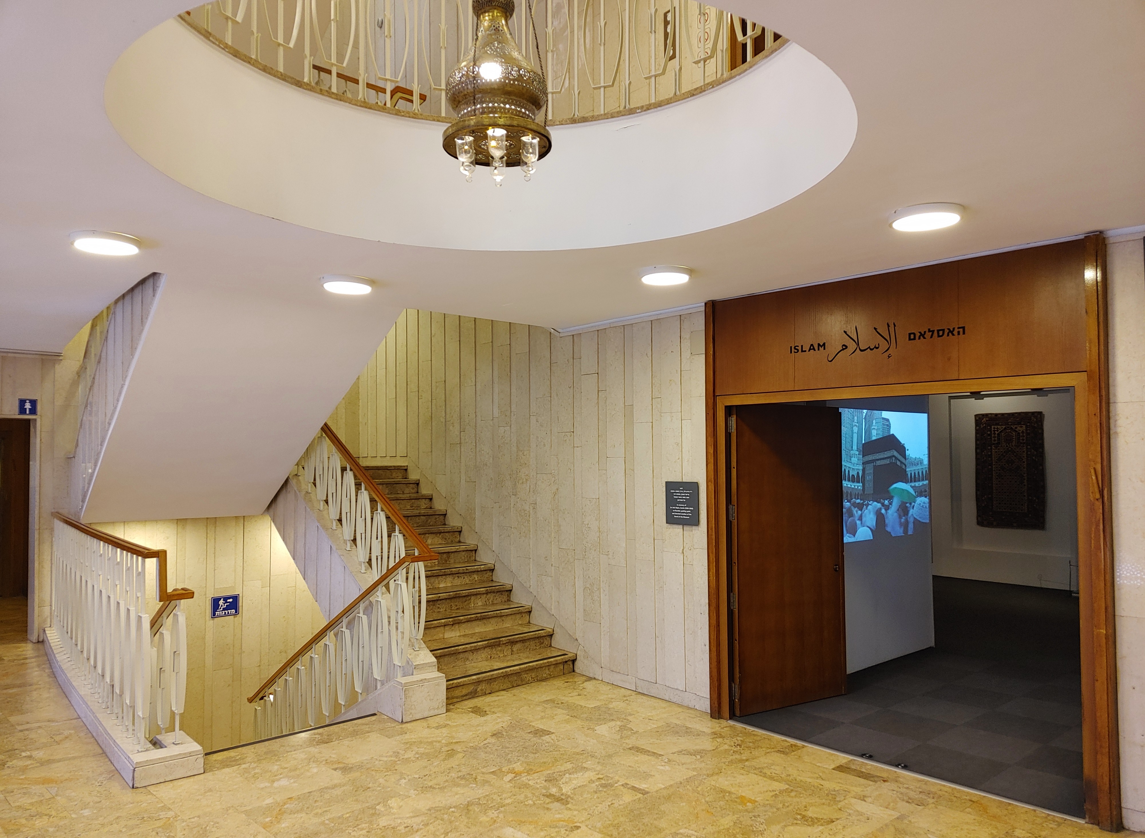
The museum’s foyer
Admiring the large building on approach, we learned that the museum was created by Vera Bryce Salomons, who ultimately passed away before the museum’s opening in 1974. Its goal was to preserve and present collections of art and archaeological artefacts that represent the Islamic world. Eight permanent and one temporary exhibitions awaited us as we pulled open the glass front door, thus beginning our tour.
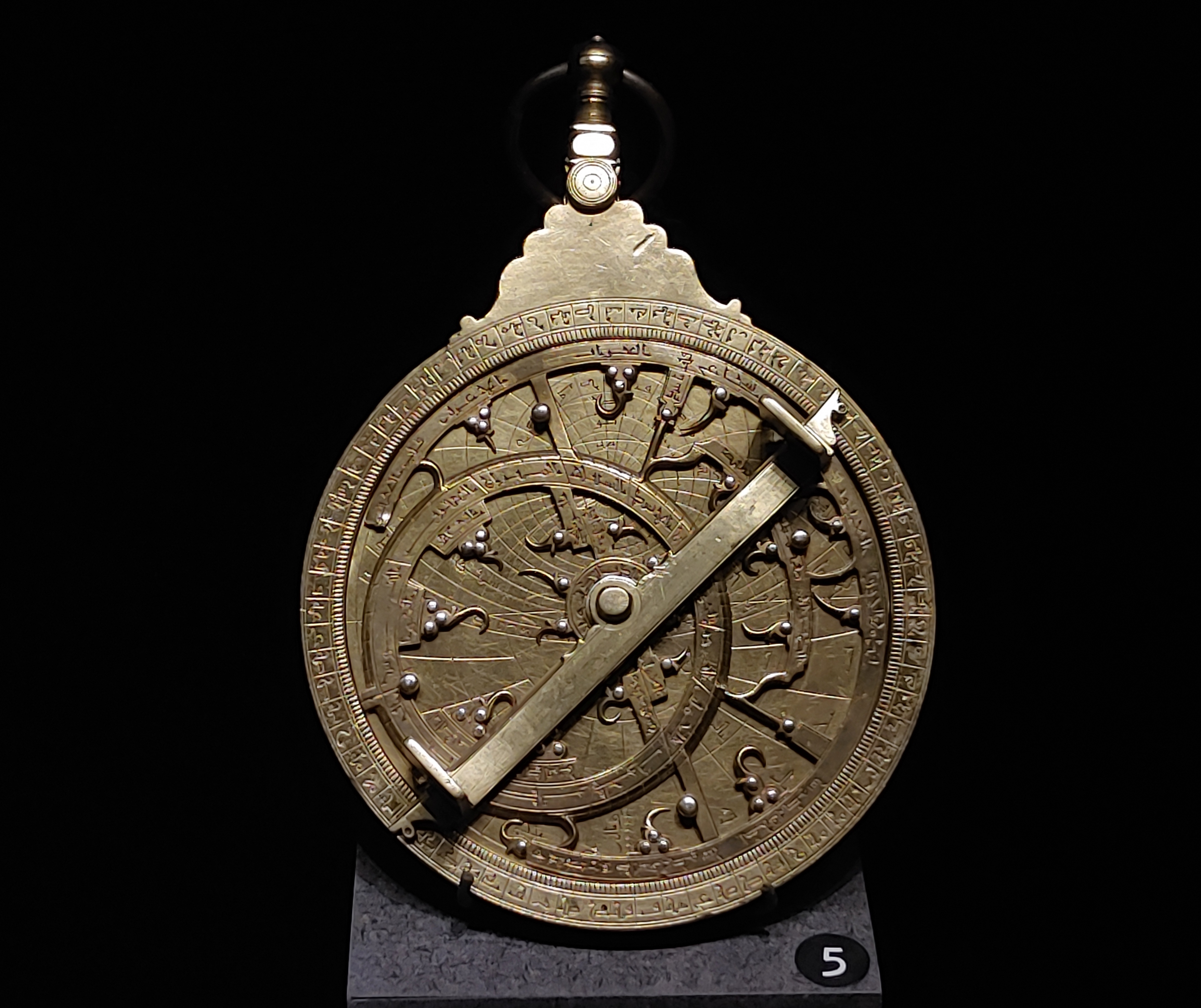
North African astrolabe from 1727
After confirming our tickets and hanging up our coats, we left the agreeable foyer and began exploring the first exhibit at hand – that of the early Islamic art. Now with my field of interest being the medieval periods, and my ongoing research dealing with the material (and written) evidence of the time, I naturally had quite the desire to align my archaeological knowledge with the physical displays of art that we were just about to see. While the more localised content interested me more, there was certainly a vast trove of foreign antiquities which delighted the eye. I can but point out some of the more interesting items that we were presented with, in hopes of giving justice to the experience that we had.
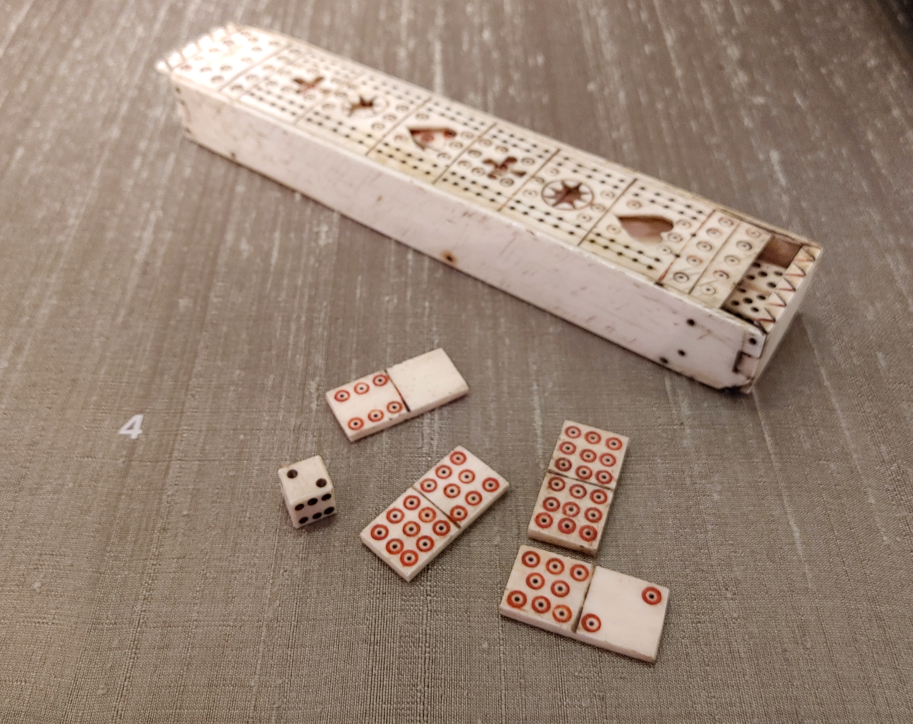
An ancient ivory domino set
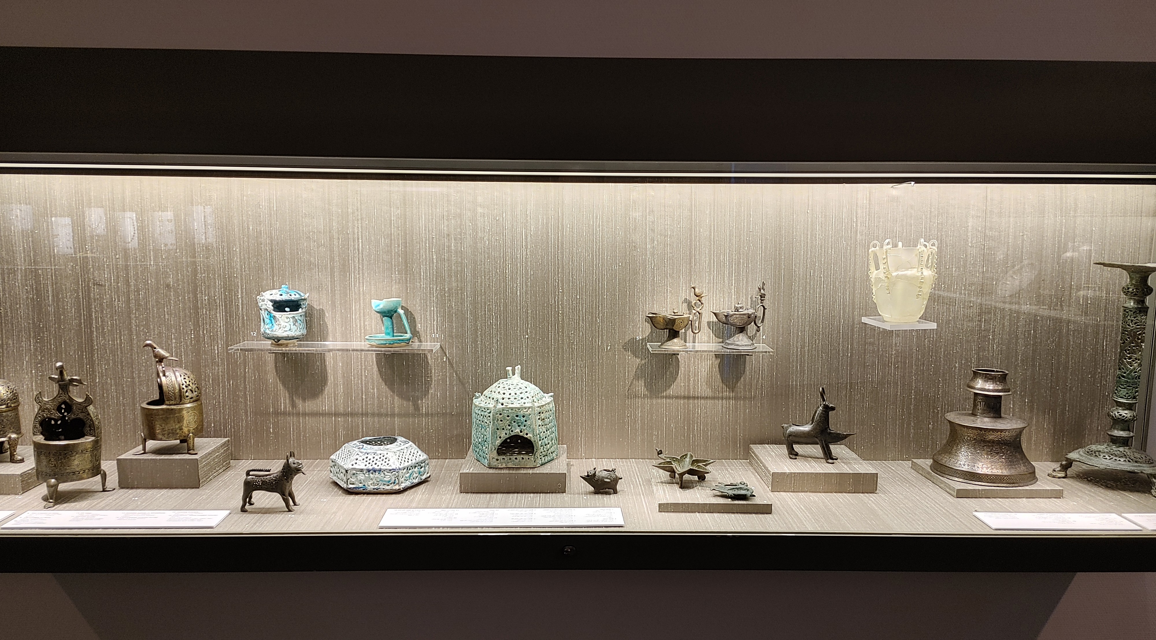
The first collection of items belonged to the Islamic empires that controlled the lands to the east, such as Persia/Iran, Iraq and more, and then slowly merged westward, covering the Islamic periods and communities from Asia Minor, the Levant and North Africa. Some notable artefacts include a leopard-painted ceramic bowl from eastern Iran, a collection of relatively simple oil lamps (quite similar to those I research), and a 6th-8th century ivory box of dominoes.
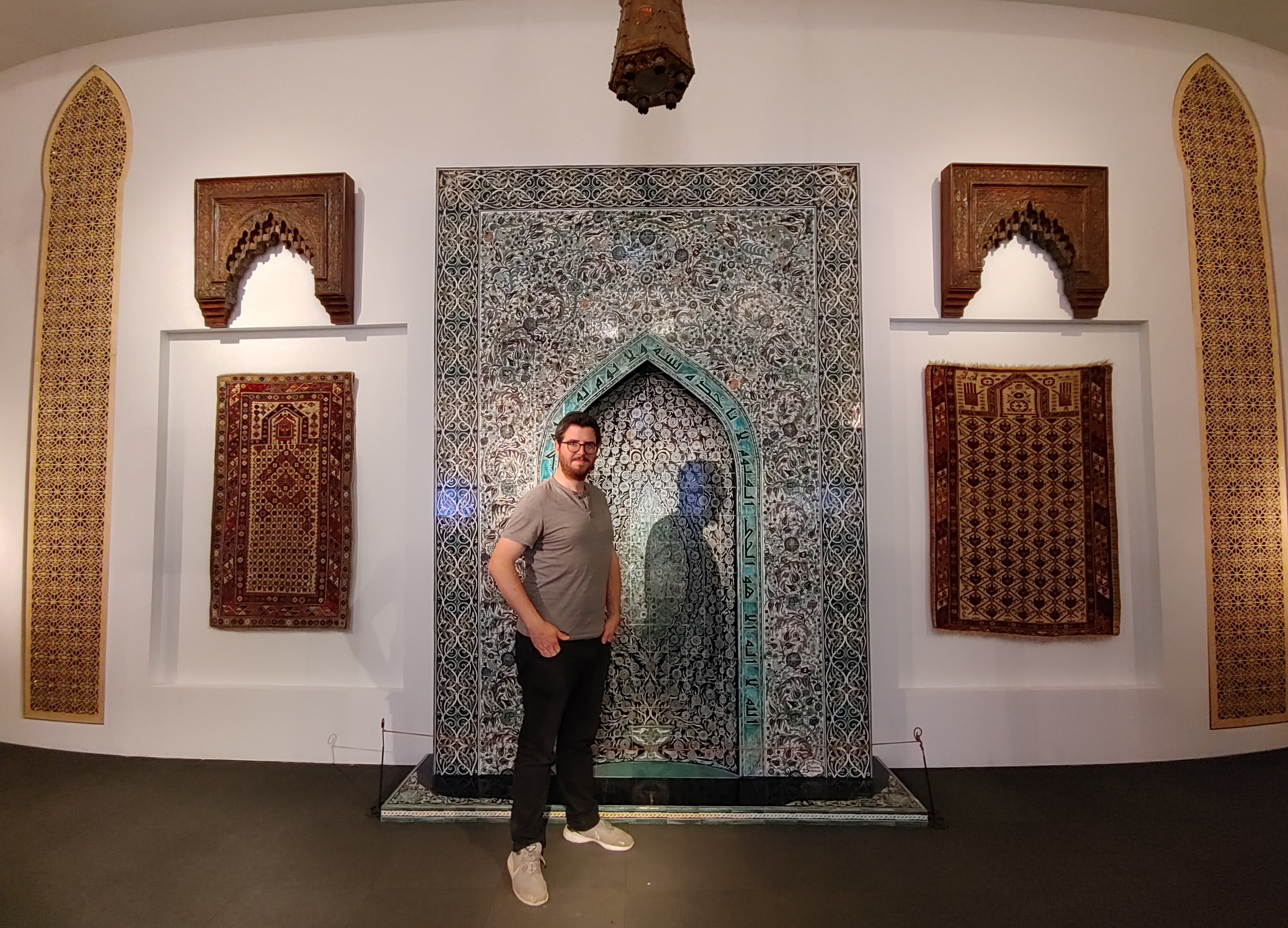
Posing at the mihrab
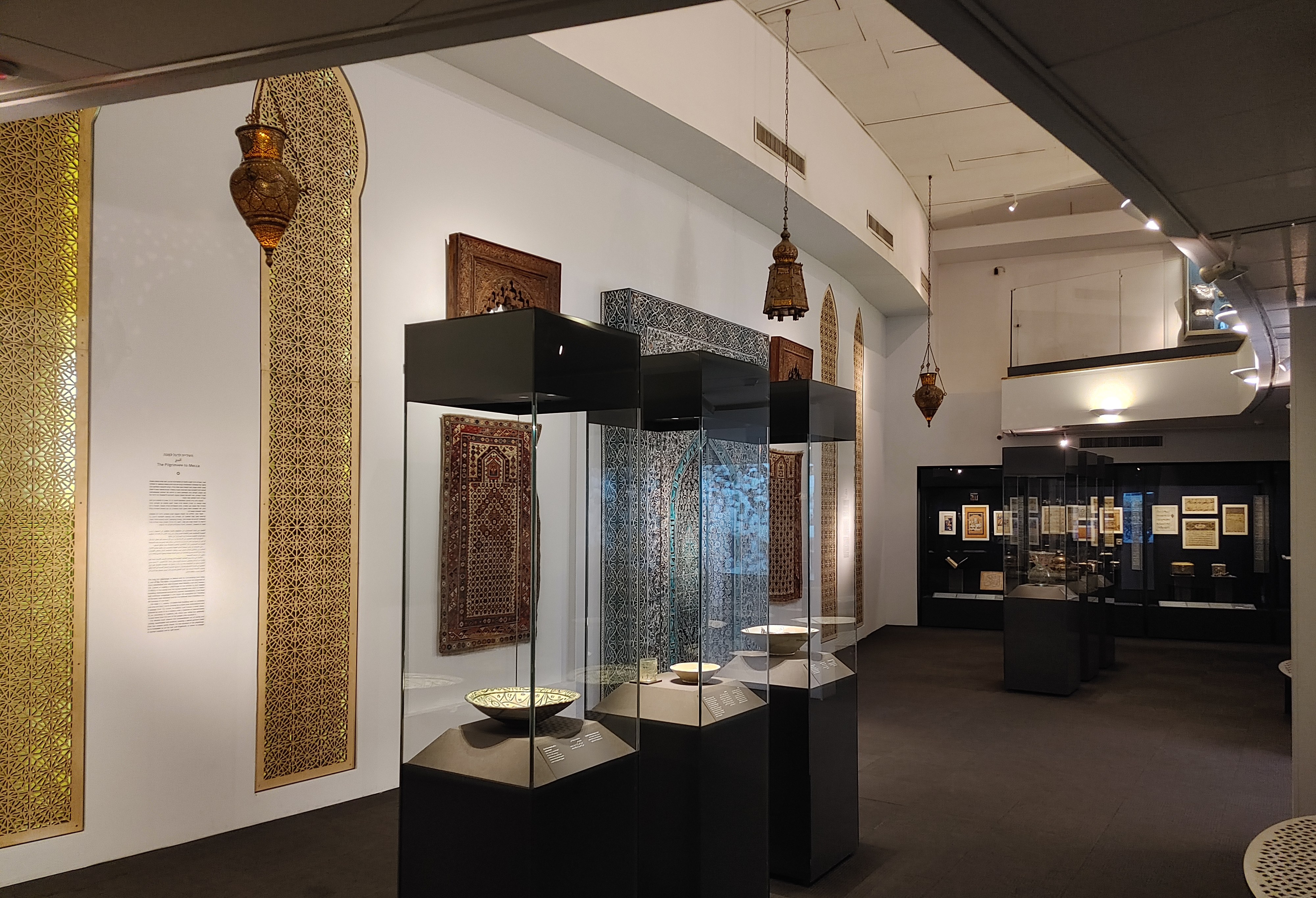
Moving on to an exhibit about artistic Islamic architecture, we admired a modern mihrab (prayer niche) flanked by 15th-16th century Spanish wooden architectural pieces and mid-19th century Daghestani prayer rugs. Next, I quite enjoyed inspecting a 13th century Syrian manuscript and 12th century Iraqi translations of the Greek Materia Medica. But it was the open pages of an ancient map from a 17th century manuscript that really tickled my fancy, filling me with hopeless wanderlust.
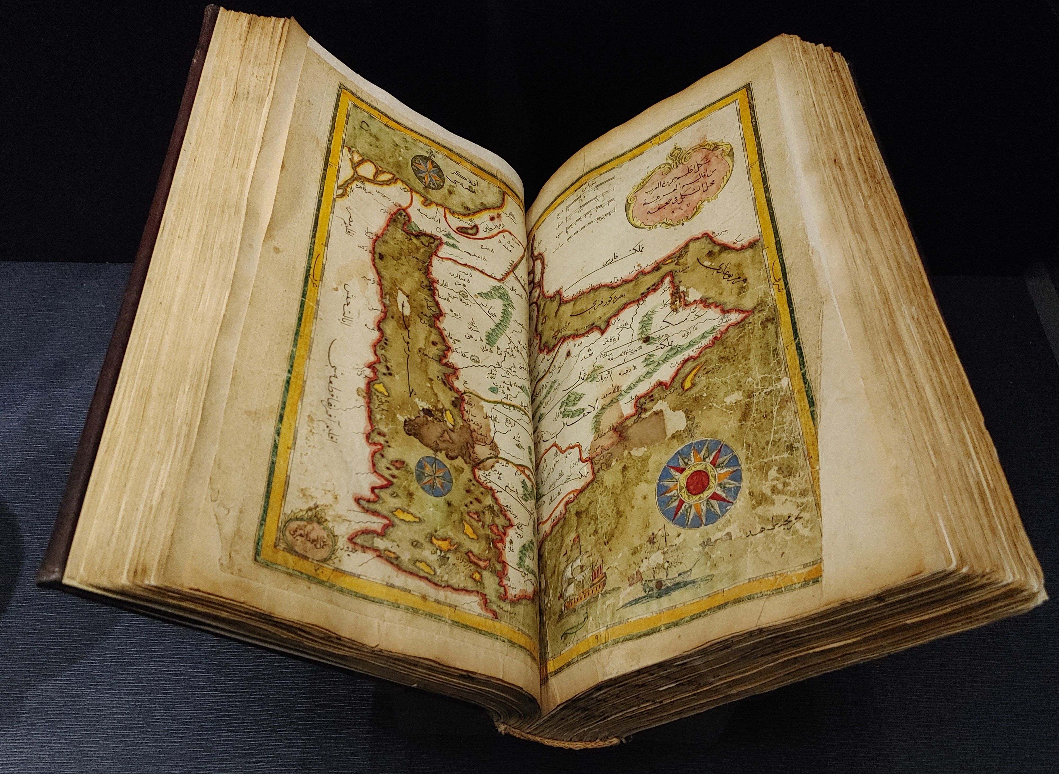
17th century Ottoman book of travels manuscript
Many art pieces and manuscripts later we found ourselves in a quieter room with some exhibits on Islamic cultures from the Middle Ages. A few artefacts that gave me a reflective pause included a glazed and painted Mongol bowl from the 14th century, Egyptian Fatimid period carved bone dolls and ornate pottery, and a large collection of Fatimid jewellery.
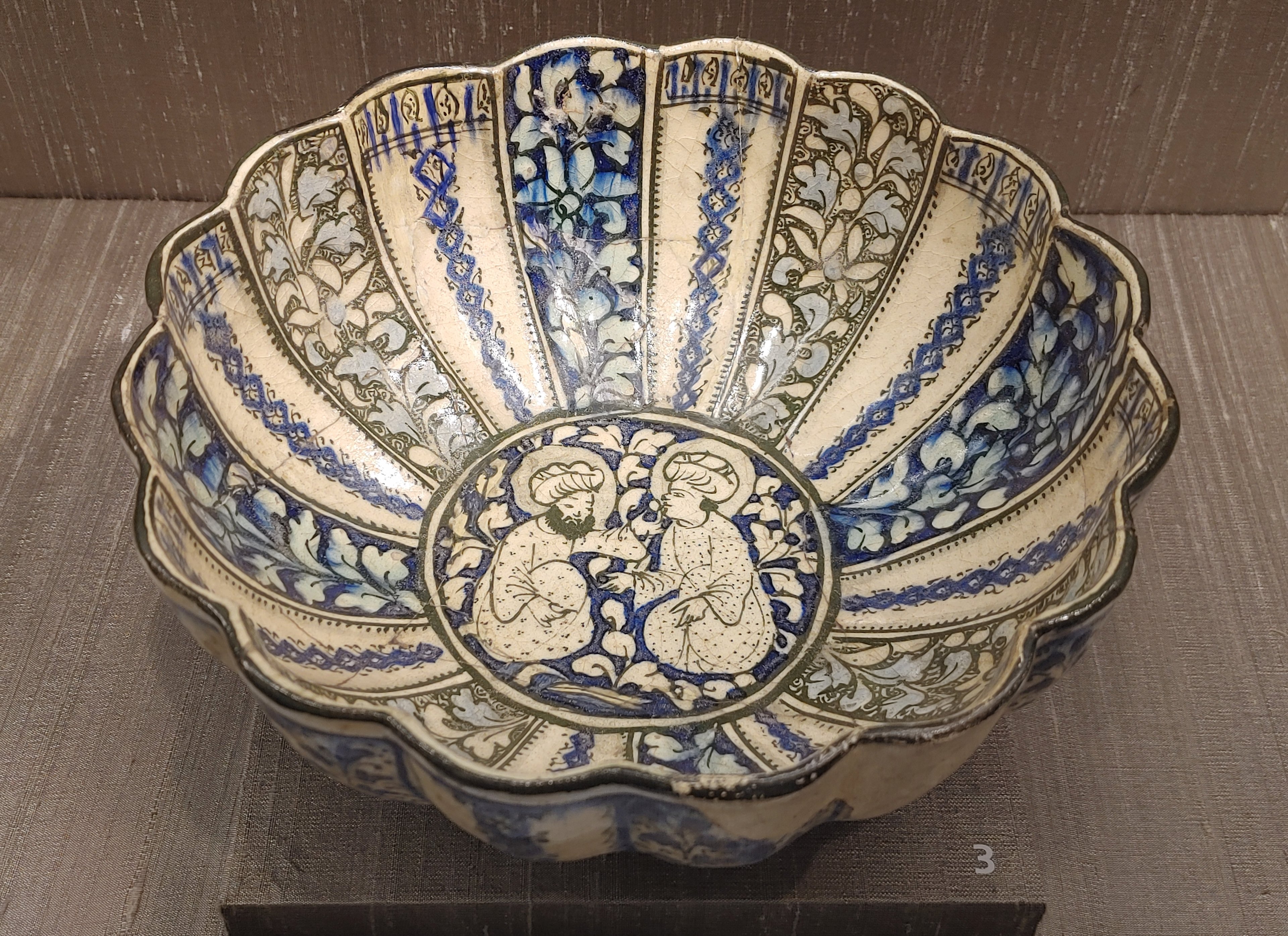
Mongol glazed bowl from the 1300s
Next, I was excited to see the Mamluk period addressed, as the majority of the ceramic finds in my research date to the Mamluk period. There is one key difference though, the finds I handle are generally simple, and often handmade, pottery pieces, whereas the museum showcases only the finest painted and glazed whole vessels. Nonetheless, it was interesting to set my eyes on the finer wares that the upper crust of Mamluk society would have been using in their day to day life.
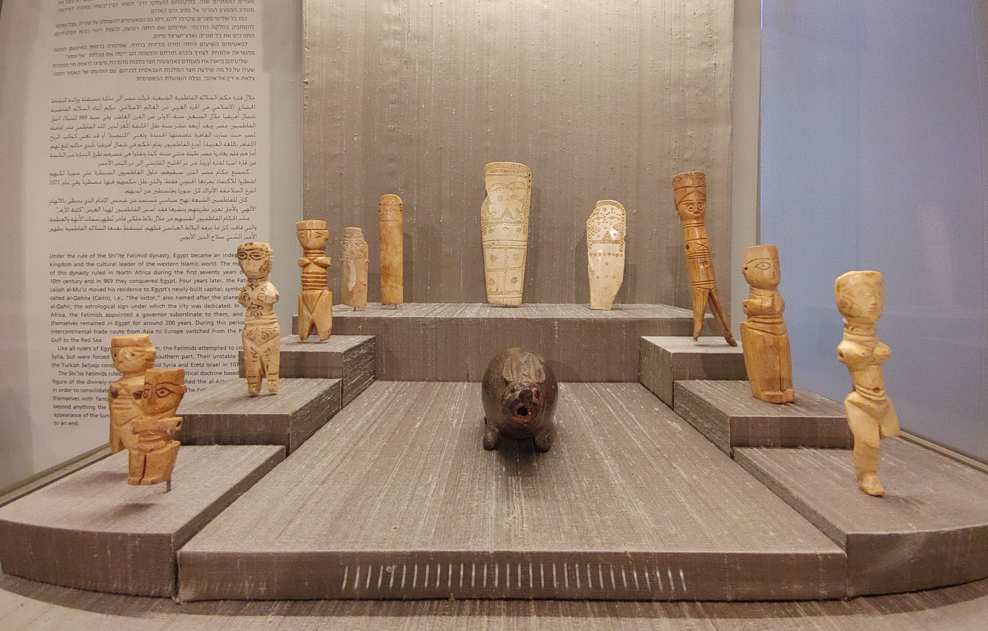
Fatimid bone and ivory dolls and a rabbit
There was one vessel that struck me as rather strange. A brass and silver bowl, engraved with the coat of arms of Hugh IV of Lusignan (who died c. 1026), was listed as from Syria or Egypt and dating from the 14th century. I truly wonder what the history is behind that particular piece. Regardless, we continued by browsing some Ayyubid and Mamluk brass vessels and then made our way to the staircase.
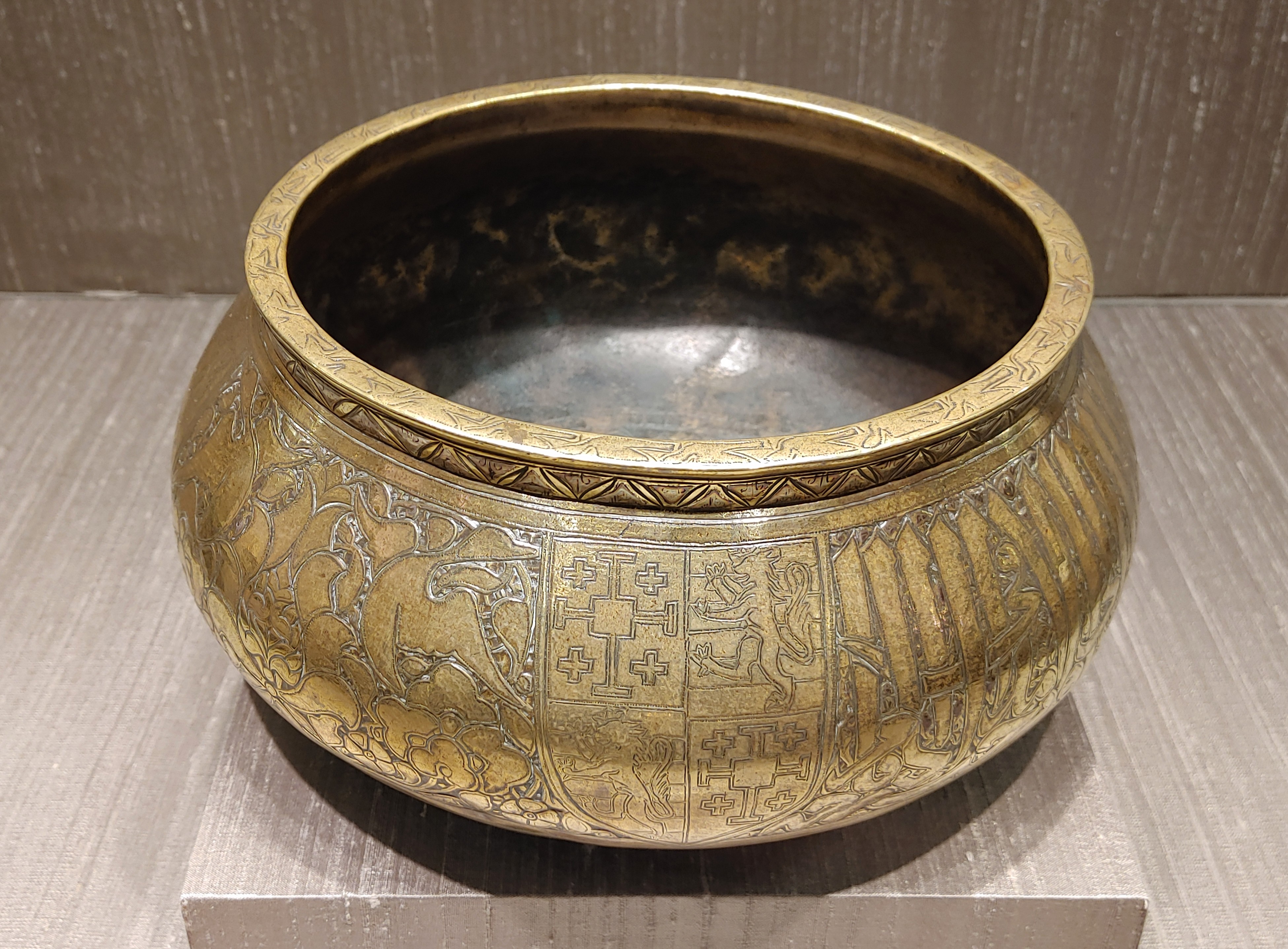
Mysterious bronze bowl
Continuing chronologically, we resumed our tour upstairs in the hall dedicated to Ottoman (or Turkish) art. The exhibit covered glazed tiles and finely decorated pottery vessels, jewellery and art pieces, and of course, ornate Turkish articles of clothing. Thereafter, we had a quick look at intricate Damascus wooden furniture, taking me back to my visit to Akko’s Treasures in the Walls museum a decade prior.
A display of Seljuq craftsmenship
Our tour resumed with an overview of Islamic art from the Moghul period, far east in the Indian subcontinent. Similar stylistically to the Ottoman art, at least to my untrained eyes, it was interesting to see such opulence in the form of fine jewellery, finely-carved and detailed boxes and even a painted wooden palace window frame from Gujarat, India.
Exploring the museum
From there we moved on to our last permanent art exhibit, belonging to the late Iranian period. At this point Bracha was feeling somewhat fatigued, being in the early stages of pregnancy with our son, Amir. We breezed through this section, pausing here and there to have a closer look at the displays, and then we headed for the ground floor to see the temporary exhibit titled “Coffee: East and West”.
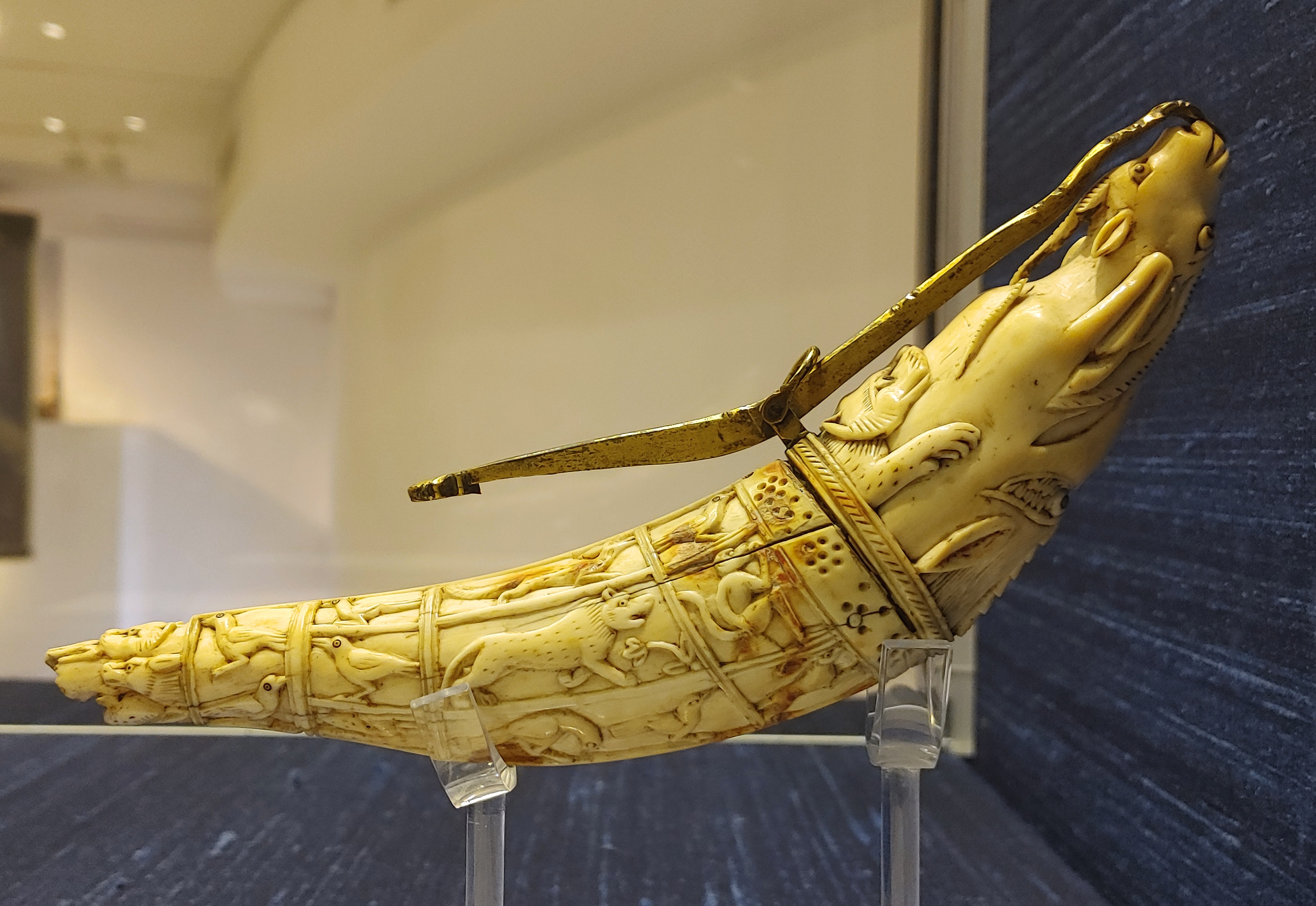
A carven ivory powder horn
What I had anticipated in being a cute, symbolic exhibition turned out to be a full-fledged, comprehensive study of all things coffee. We started with a collection of coffee cups and sets, including one particularly charming 19th century European mug that featured a fantastic Ottoman scene of a horse and rider in the desert. The sheer magnitude of the displayed pieces was overwhelming, but there were a few other pieces that shined. One such example was a trio of restored Ottoman coffee mugs that were found in an archaeological excavation at Khirbet Hamsa.
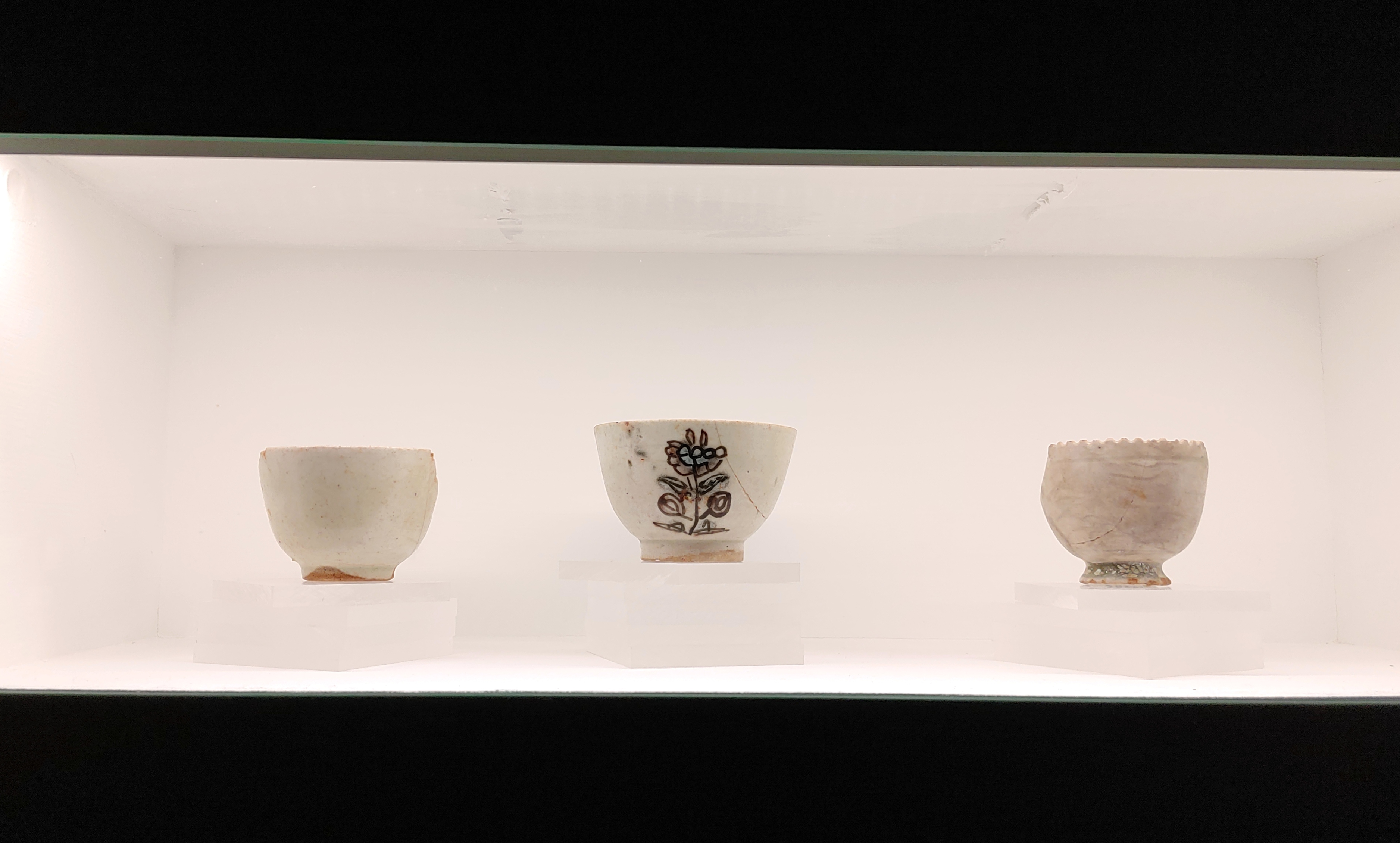
Excavated Ottoman coffee cups from Khirbet Hamsa
A large collection of coffee machines filled one end of the room, many of them vintage and retro appliances that were made in Italy. Some were examples of mankind’s clever attempts at gadgetry, with fantastical spouts and vents. A look at coffee in Israel’s early days, and the production of coffee-related accoutrements, gave me a greater appreciation for the times that are now chapters in the history books.
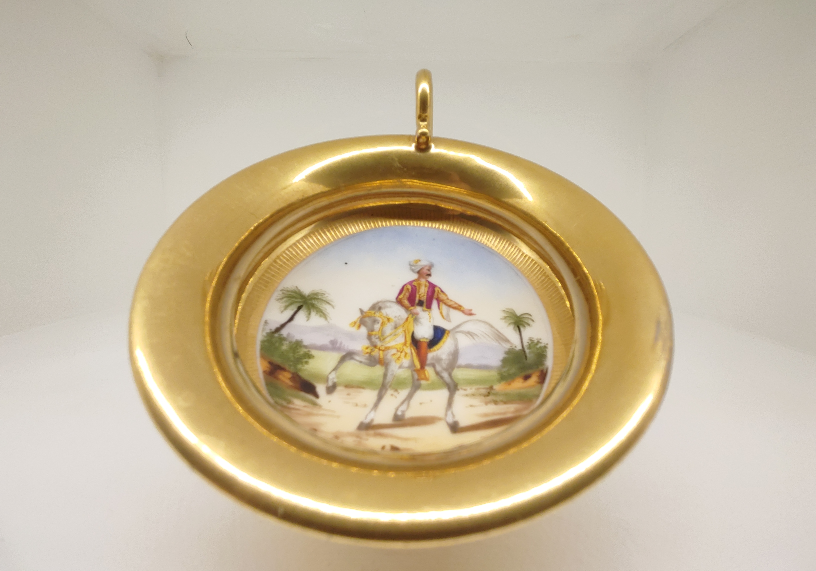
Elegant European coffee mug from the 1800s
Once we had sufficiently browsed all that there was to see, it was time to see the final exhibit that the museum has to offer: The Sir David Salomons Collection of Watches and Clocks. This timeless treasure trove of timepieces was so tantalising that I knew it must be a blog post of its own, and so it shall be. In the meantime, this concludes the visit to a very unique and interesting museum, one that sheds light on the artistry of the Islamic days of old.


