Israel's Good Name

Archive for the ‘Negev’ Category

Ein Bokek & Ami’az Plateau

In Dead Sea, Israel, Negev on March 25, 2018 at 7:31 AM

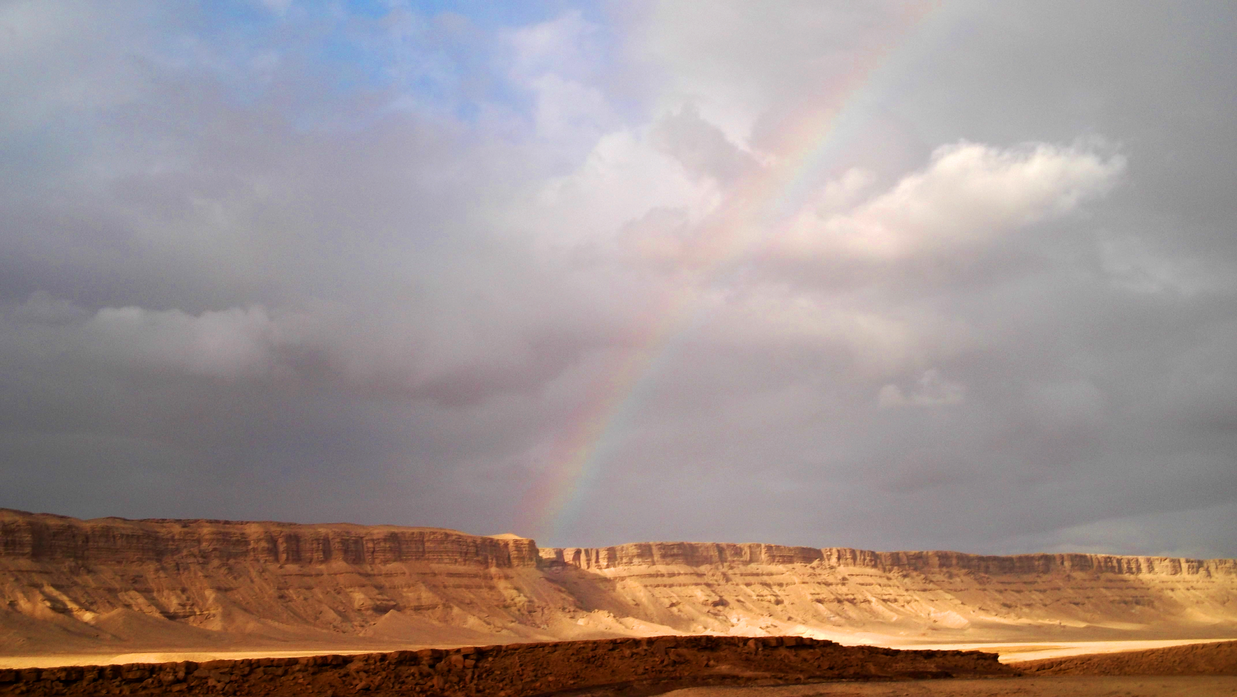
Following our trip day with the schoolchildren to Ein Gedi, the new day began with sunrise at the Hazeva Field School. We prayed, ate and packed our belongings onto the bus, ready to continue the fun. Driving up Road 90 from the Arava, we reached the region of the Dead Sea and began seeing interesting things, such as the magnesium production plant with its mountains of harvested minerals and Mount Sodom, which is more of a ridge than a lone peak.

Entrance to Ein Bokek

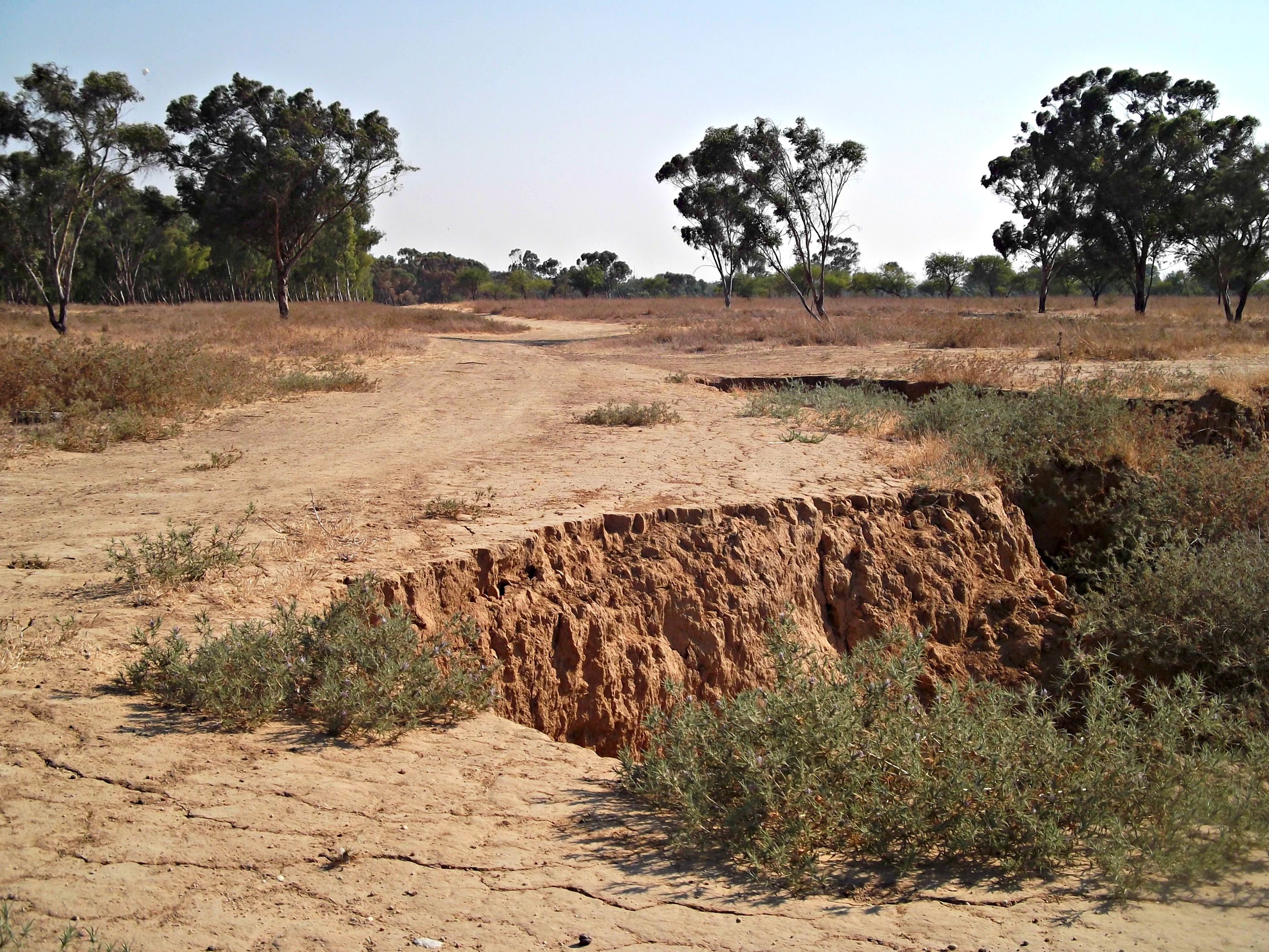
The southern half of the Dead Sea is comprised of shallow pools that were divided by dirt banks and used in the harvesting of salts and minerals by means of evaporation. It was my first time seeing this part of the Dead Sea and I found it quite fascinating. Unfortunately, there was no time to be spent at the sea, and we continued on to our first destination of the day: Ein Bokek.

Nachal Bokek flowing gently

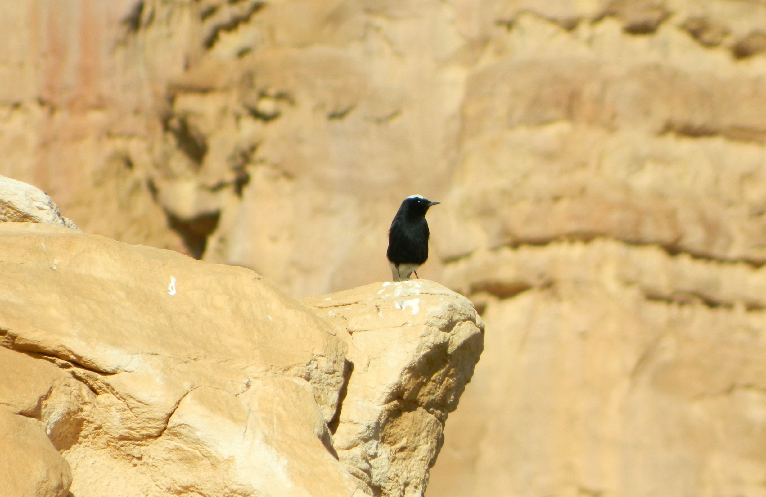
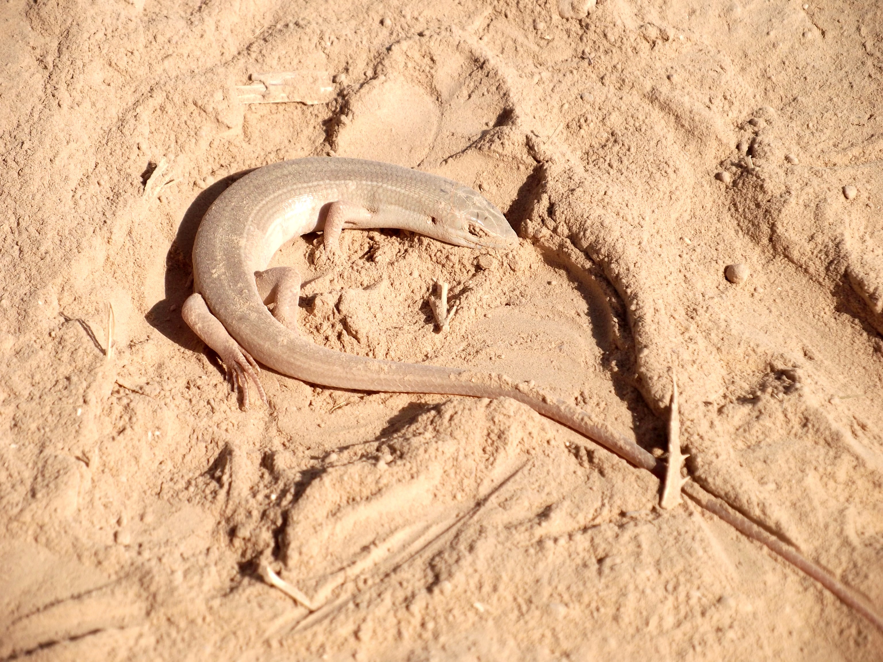
After a quick drive around the tourist area with the hotels and spas, our bus pulled up at the side of the road at the trailhead for the Ein Bokek hike. We disembarked and followed our tour guide as we walked along the vegetation-lined stream, the calm waters gurgling along peacefully. I was hoping to see some interesting birds, perhaps some interesting warblers in the shrubbery or some eagles over the cliffs that surround us, but I found nothing of the sort.
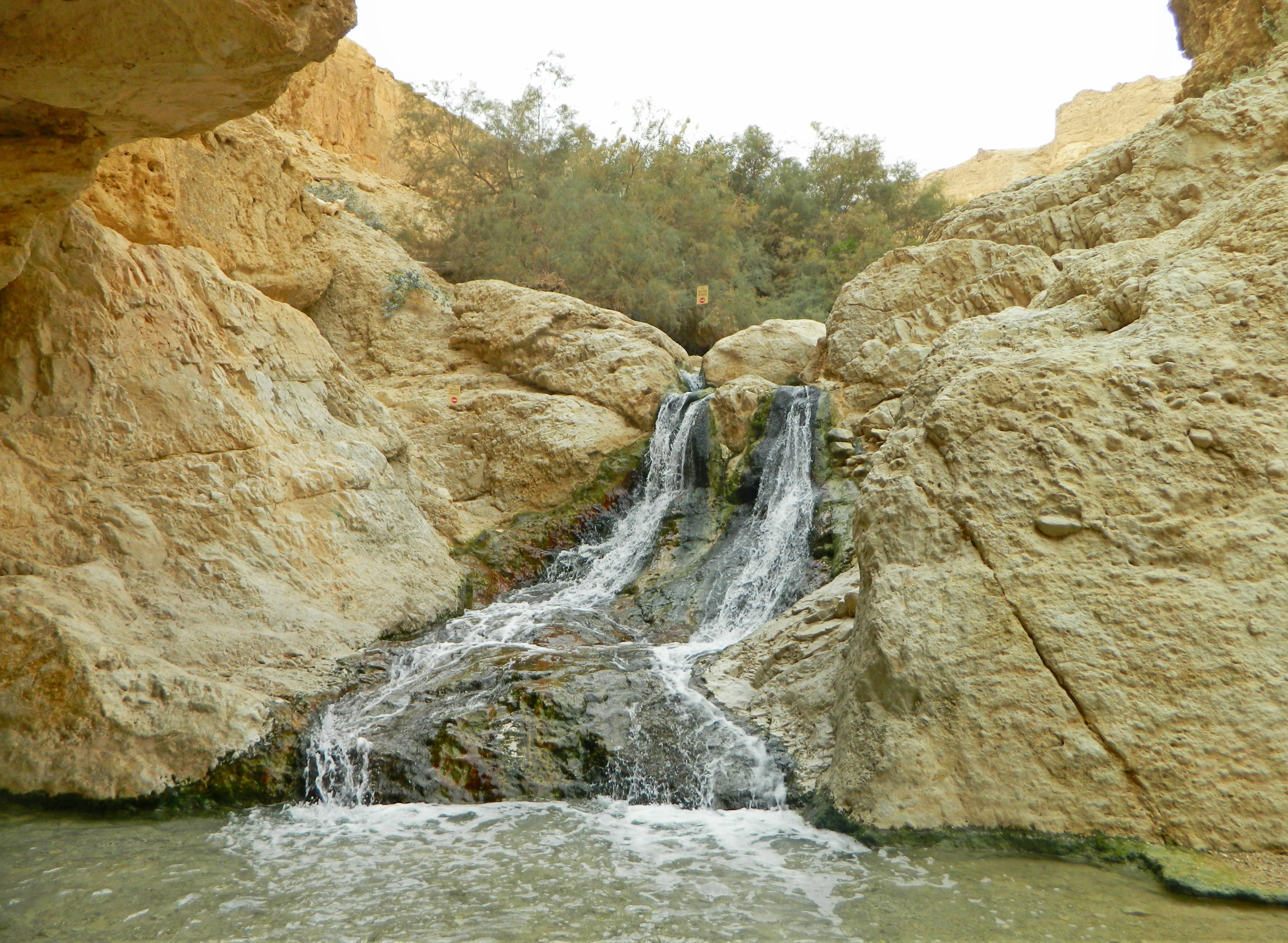
The waterfall

Before long we reached the first tiny waterfall, and stuck around for a few minutes to enjoy it before continuing on. A few more minutes of streamside walking brought us to the end of our trail, where a pool and waterfall awaited us. Several of the lads waded into the cold waters, but I sufficed by standing on a rock island and photographing the sight.
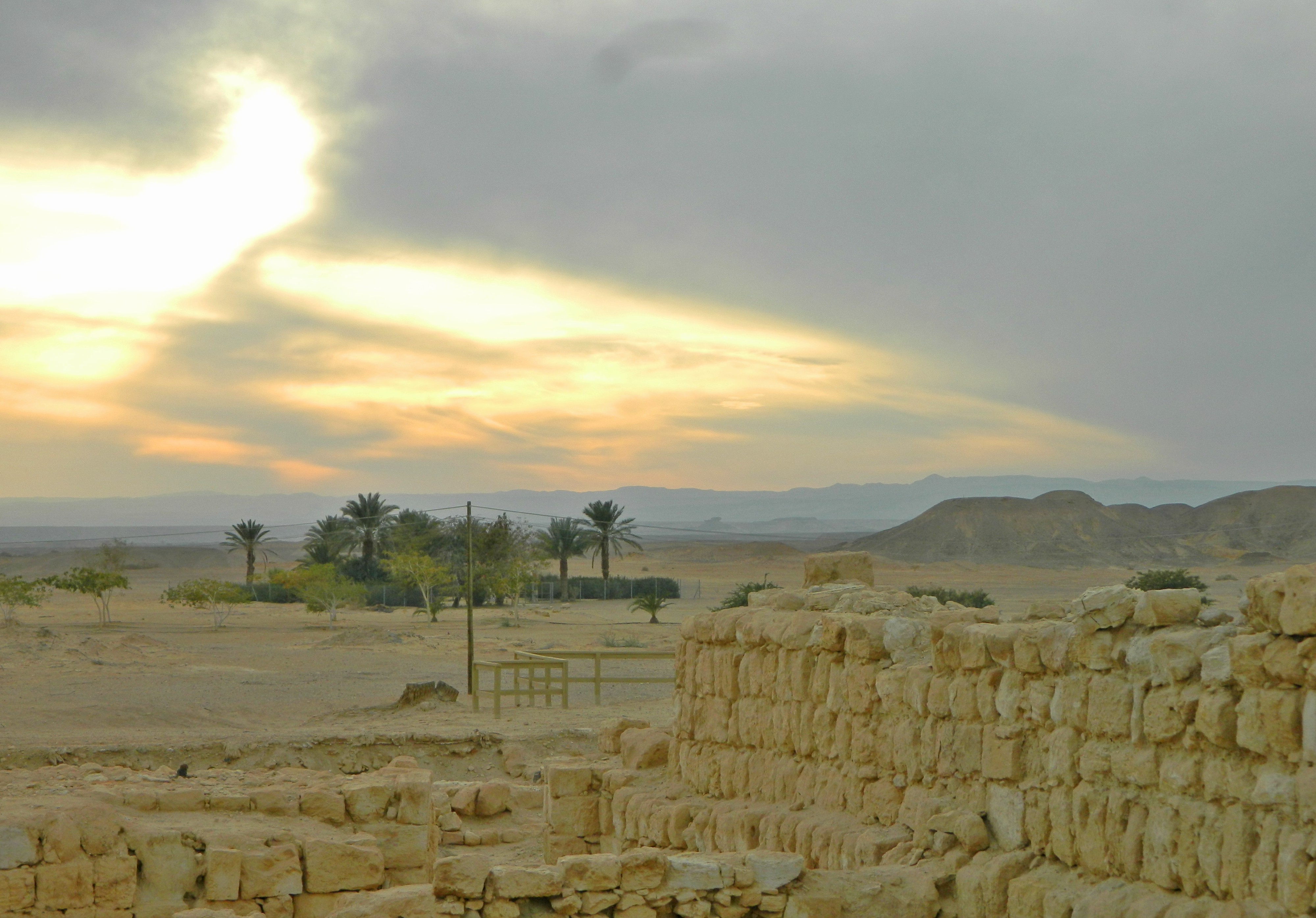
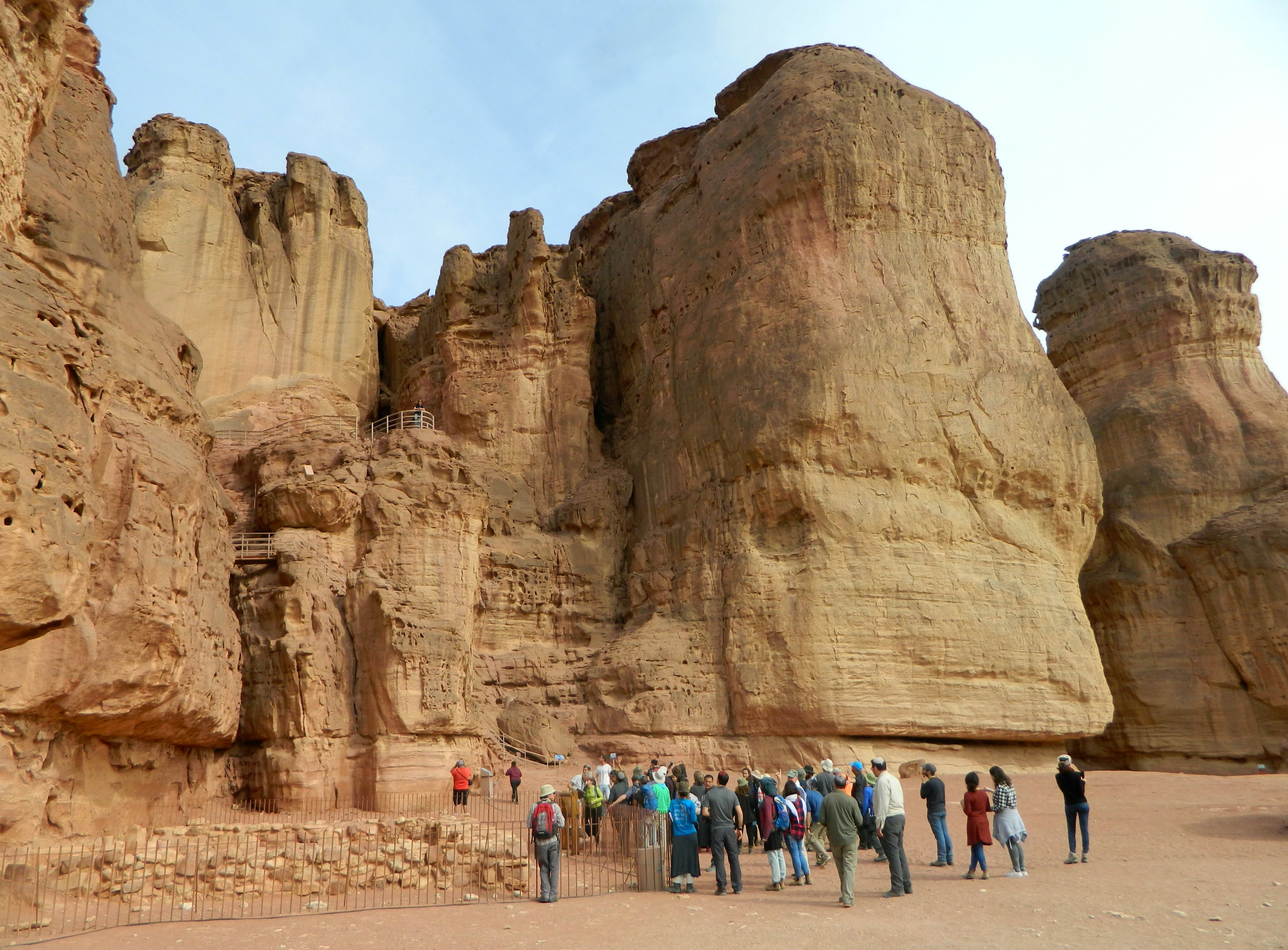
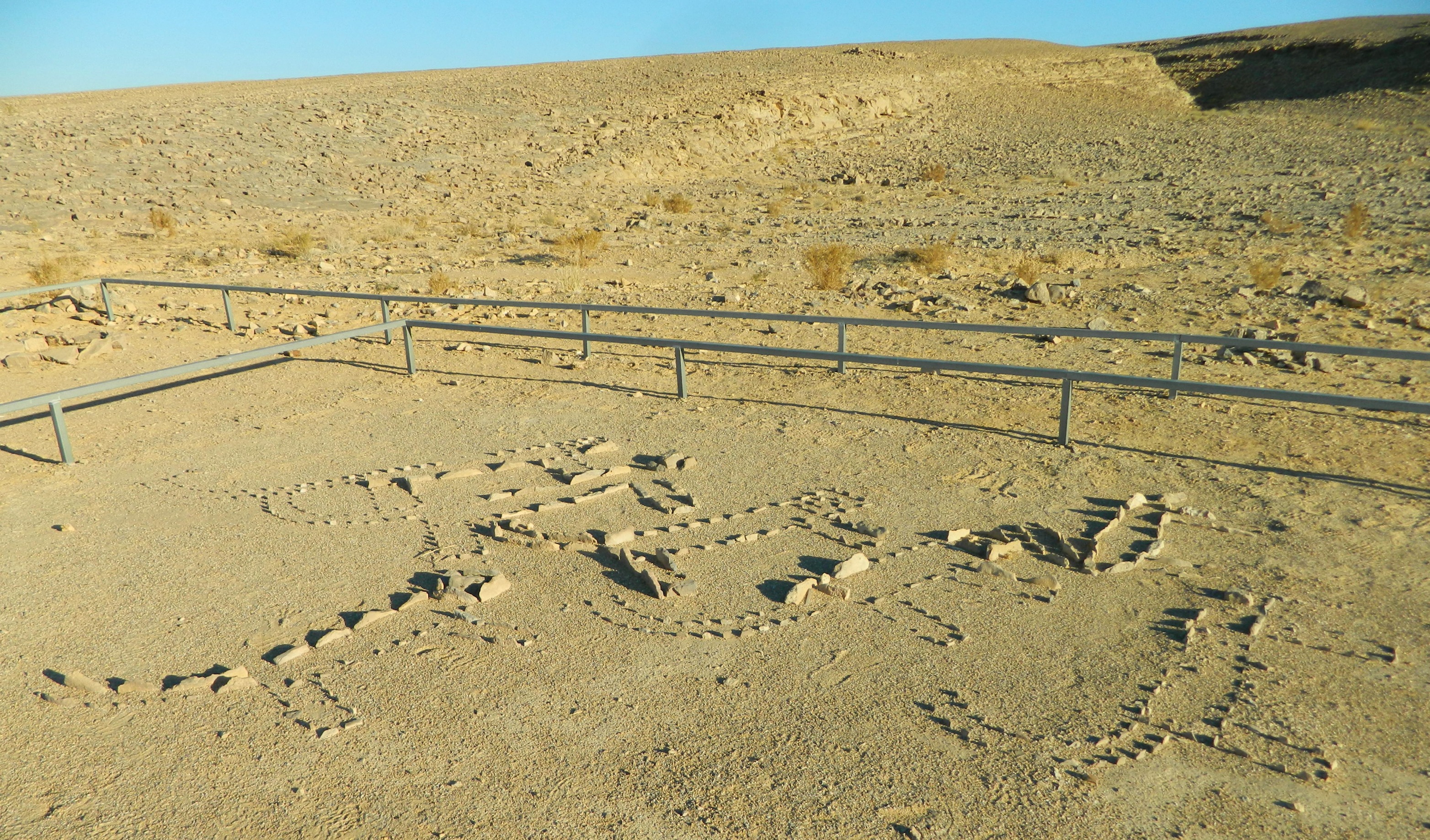
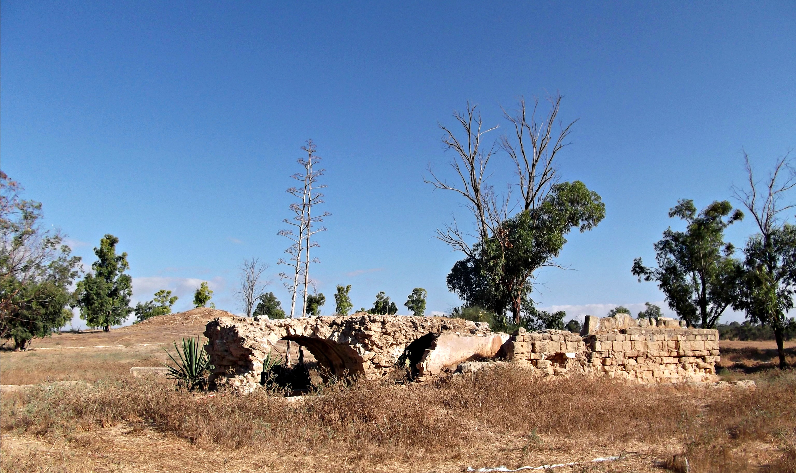
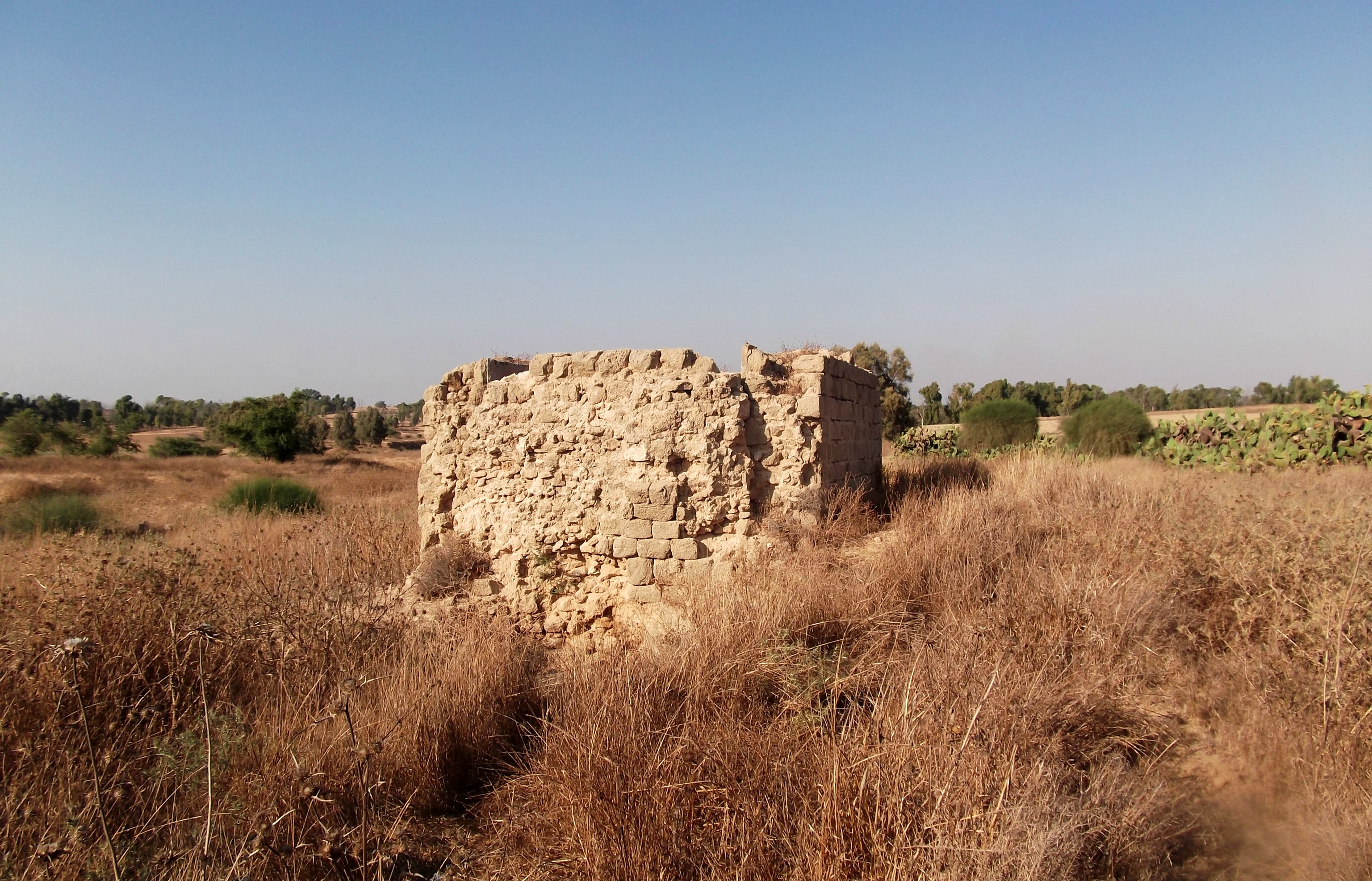
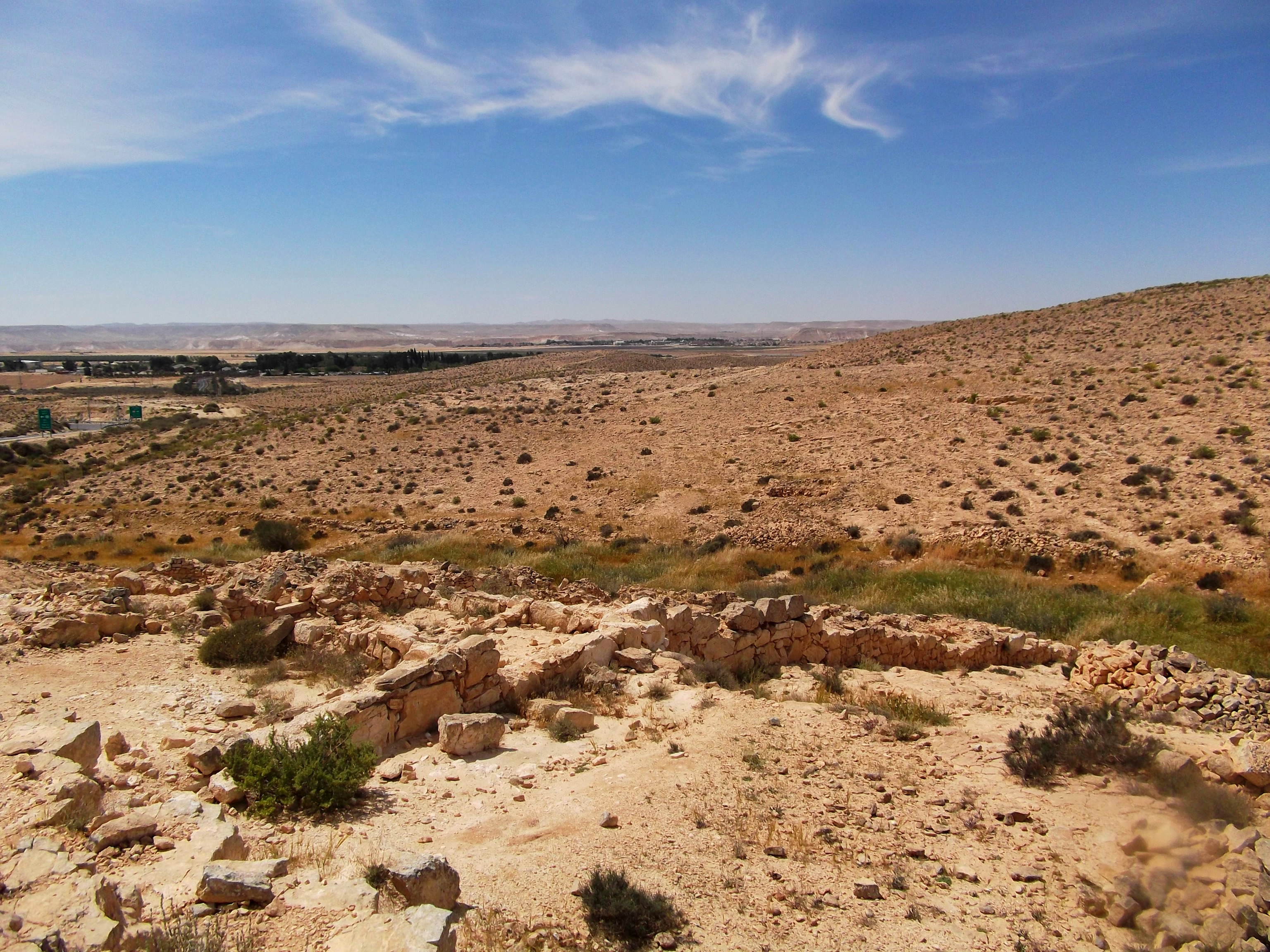
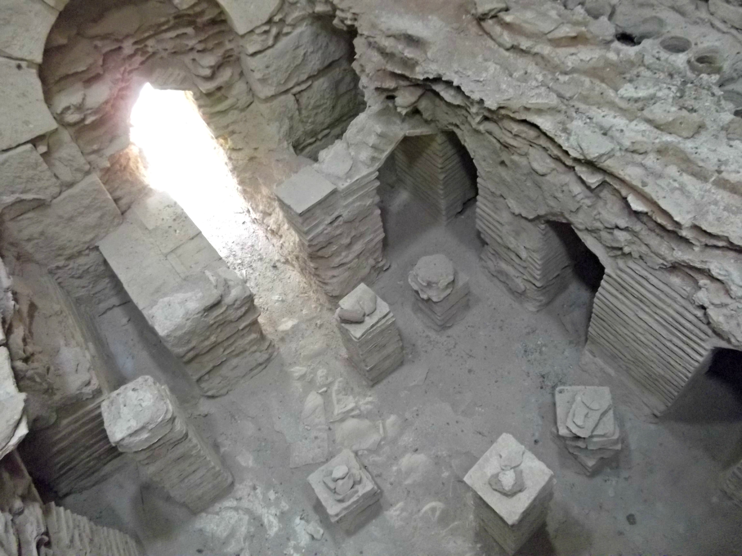
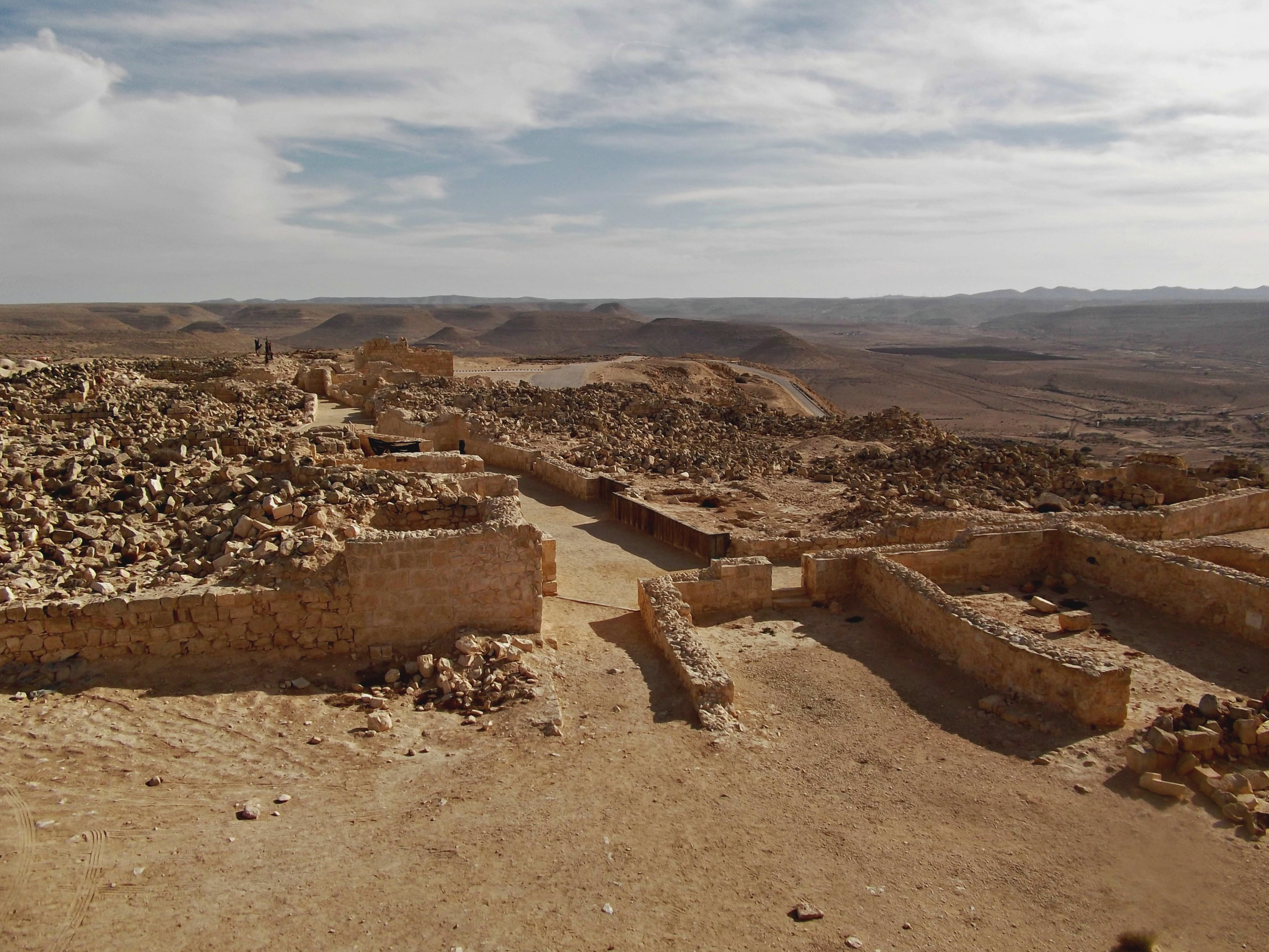
Bokek Fortress

Recalling the start of our trail, I had seen the ruins of an ancient fortress on a low peak overlooking the stream and I decided it was worth visiting on my own whilst the lads played. Checking with the tour guide and some rangers, I struck out on my own and reached the ruins after a short hike uphill. What I found was a Byzantine fortress dating to the 300s CE built to guard over the roads in the frontiers of the empire. According to the archaeological evidence, Bokek Fortress has four levels of construction, all dating to the Byzantine period. The fortress was abandoned in the Early Arab period and, in recent years, was cleaned up and partially restored. Unfortunately, several weeks after my visit, there was a news article about graffiti vandalism on its southern walls.

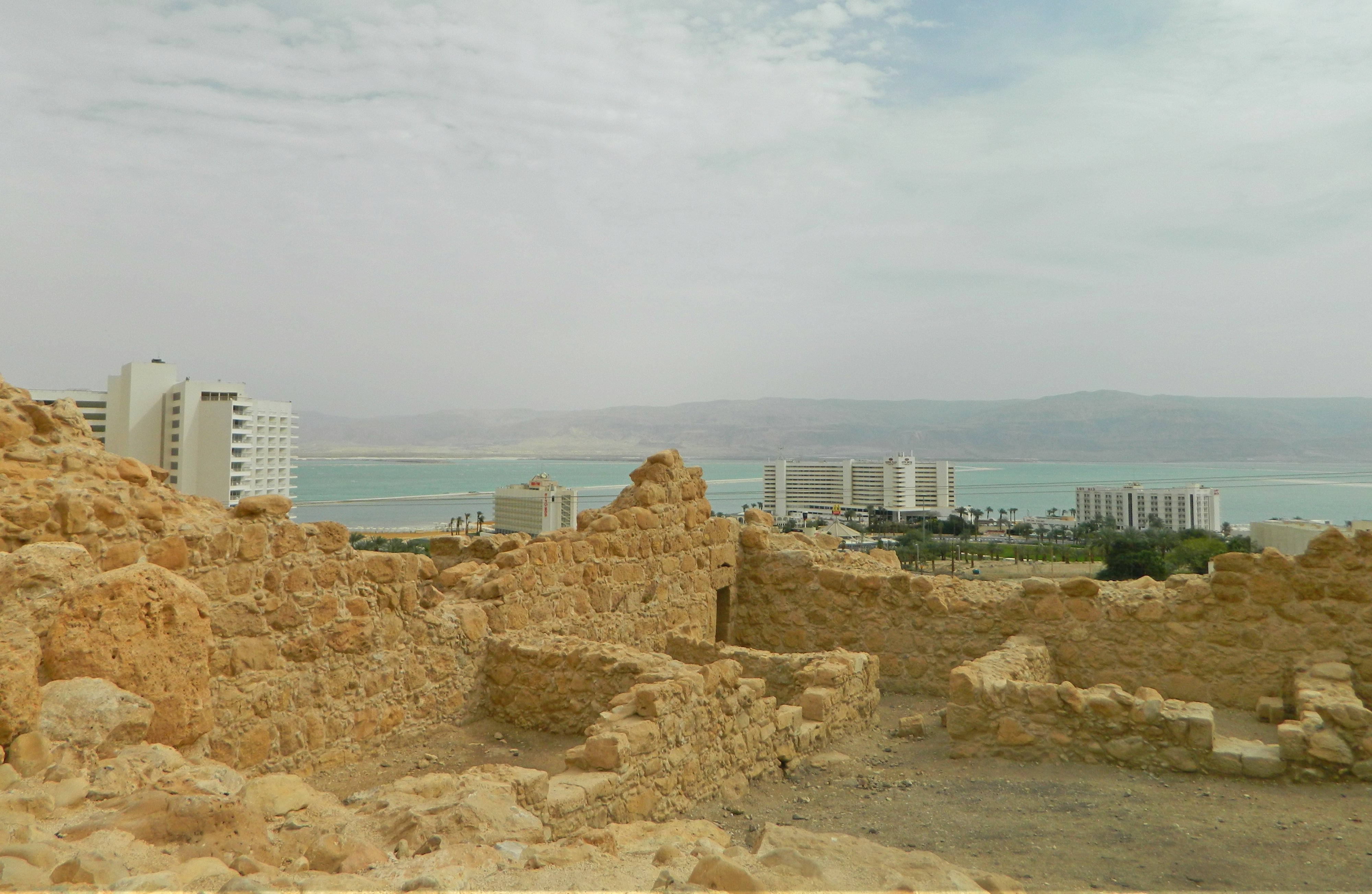
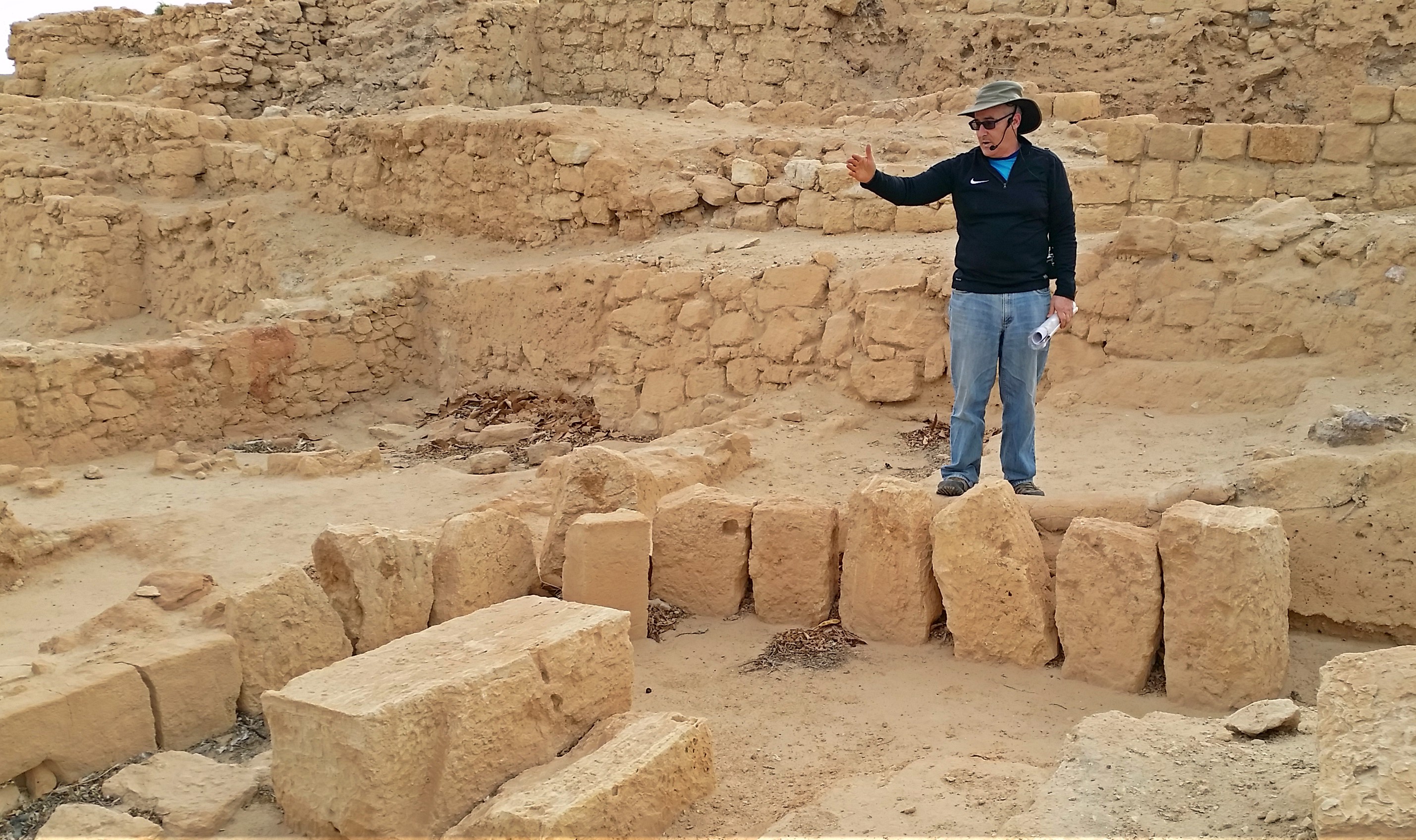
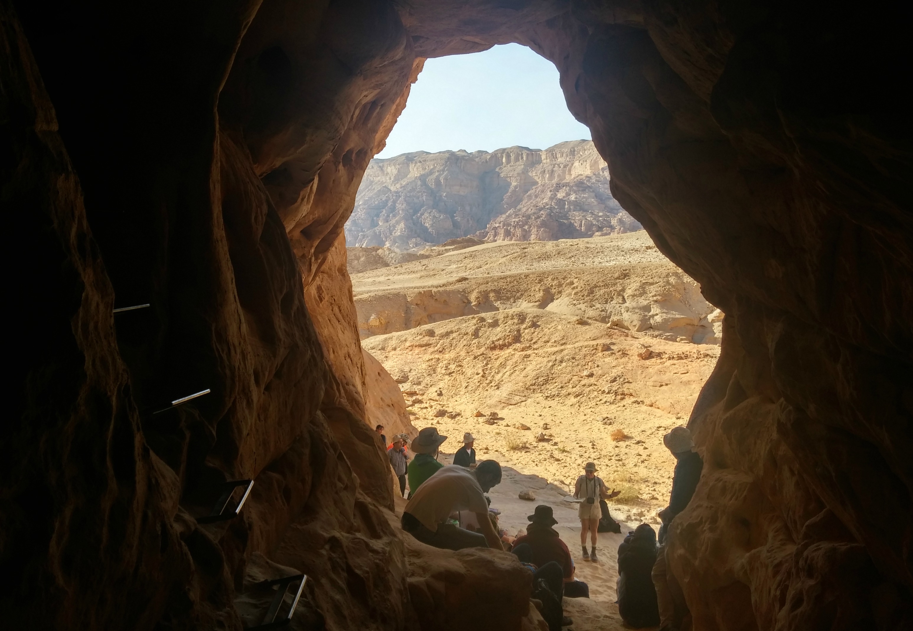
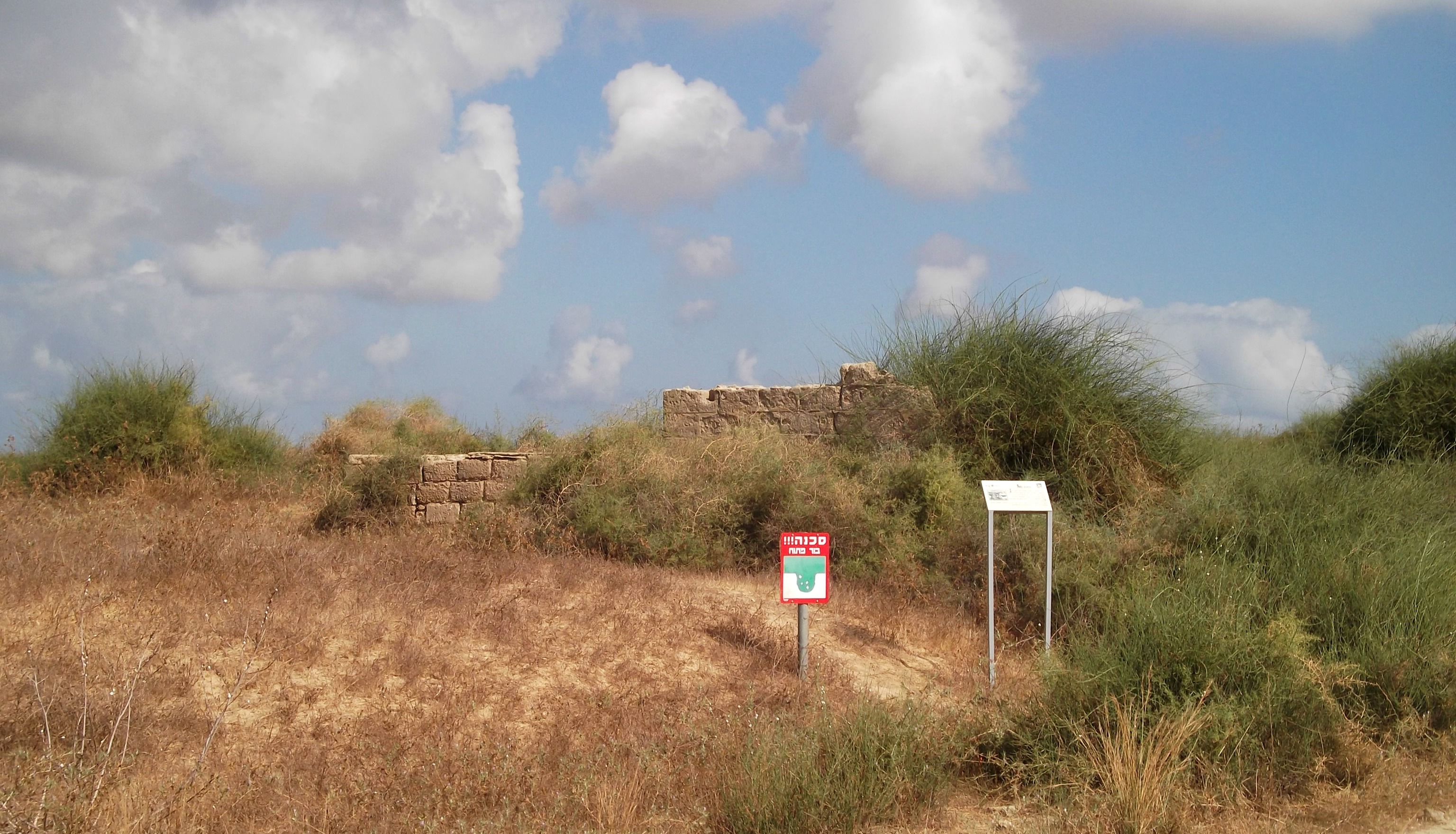
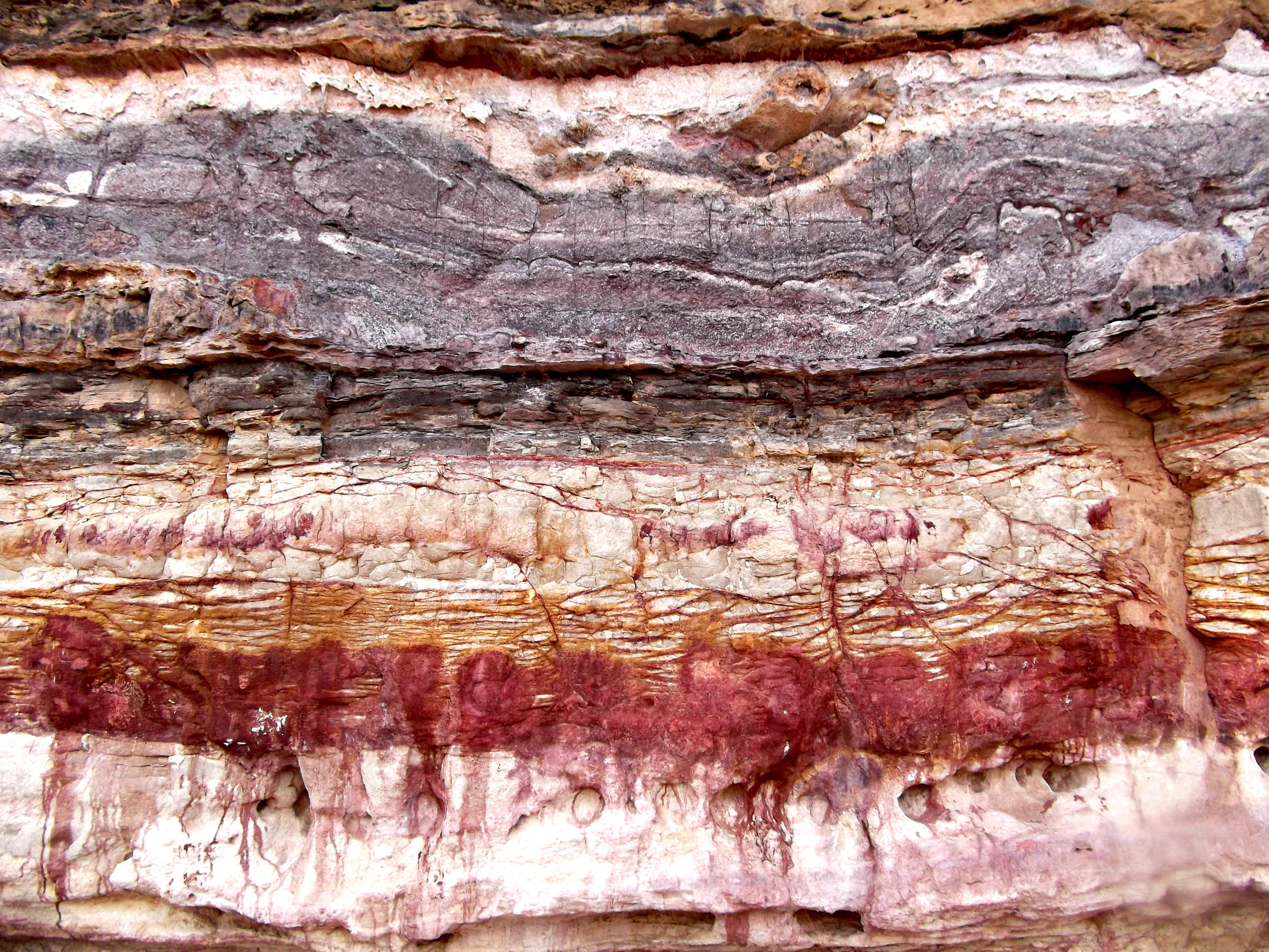
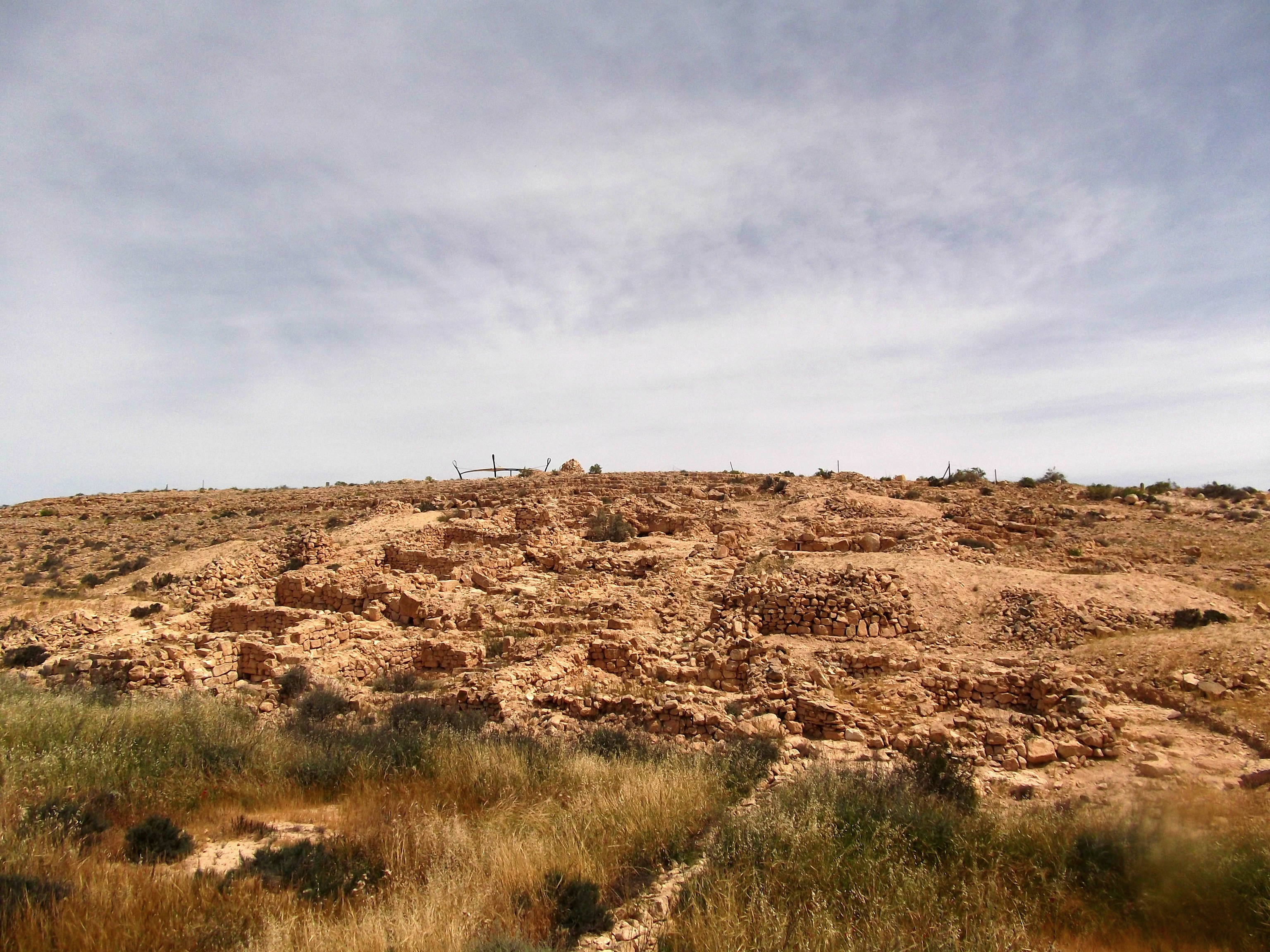
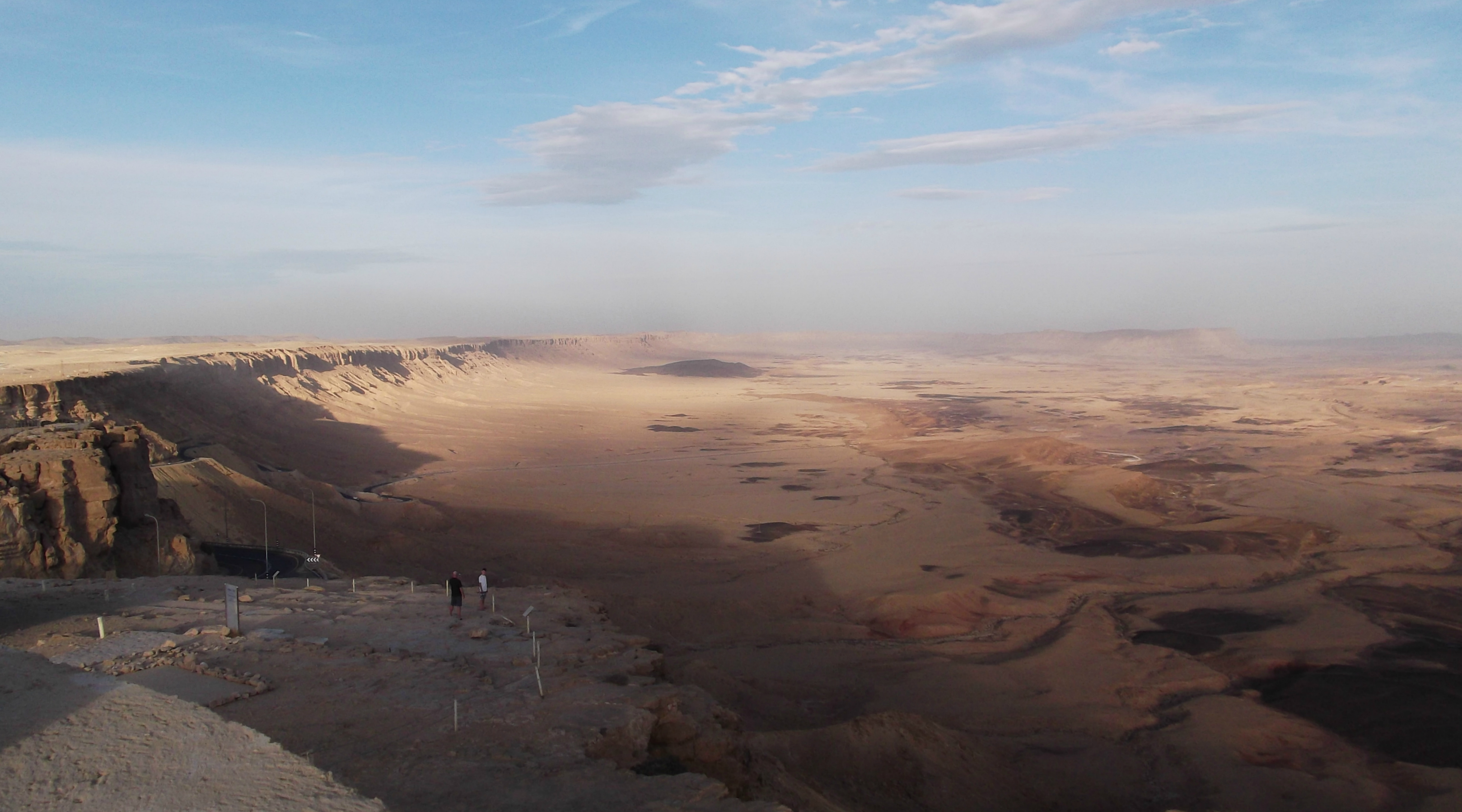
View from the fortress

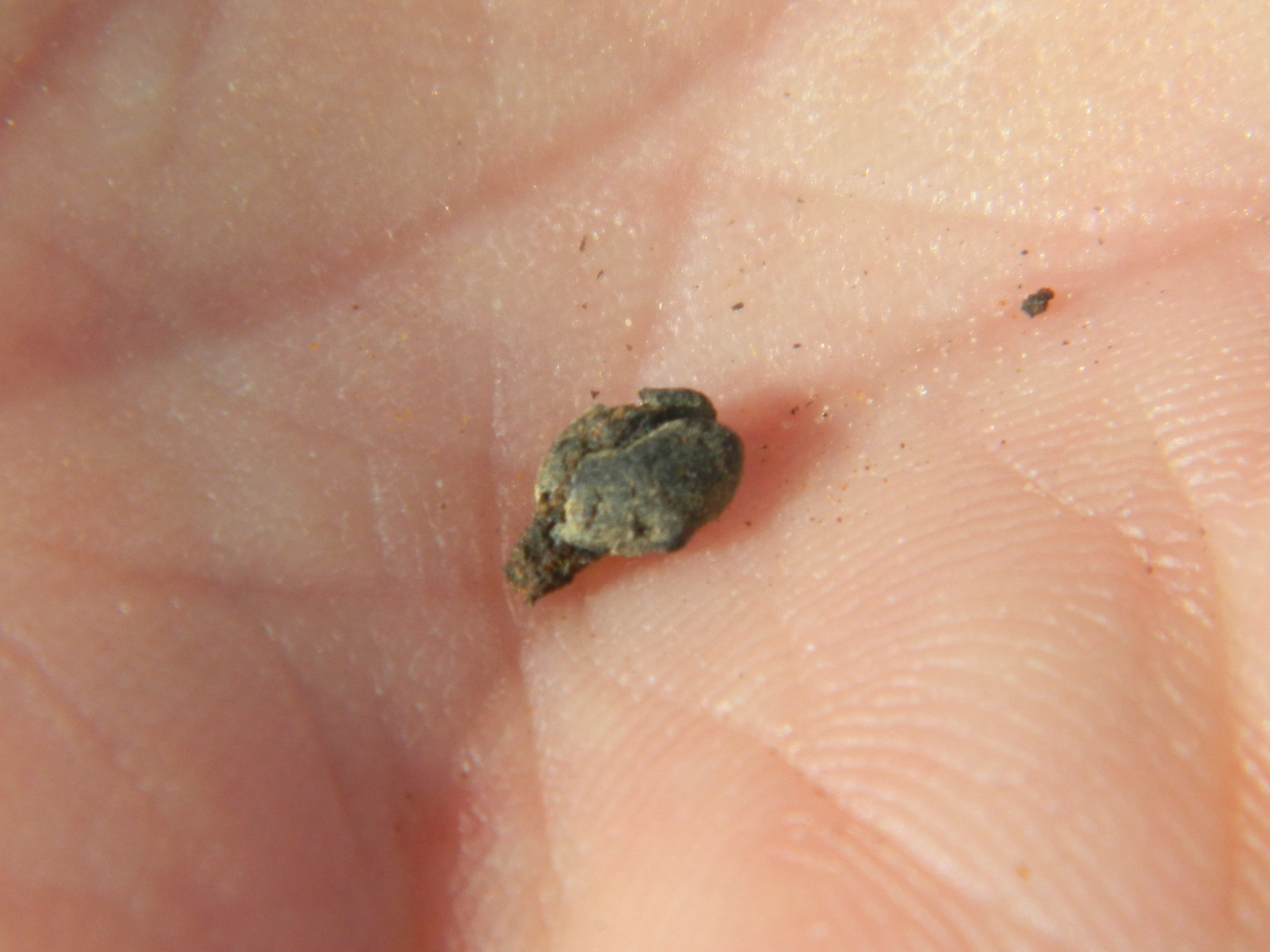
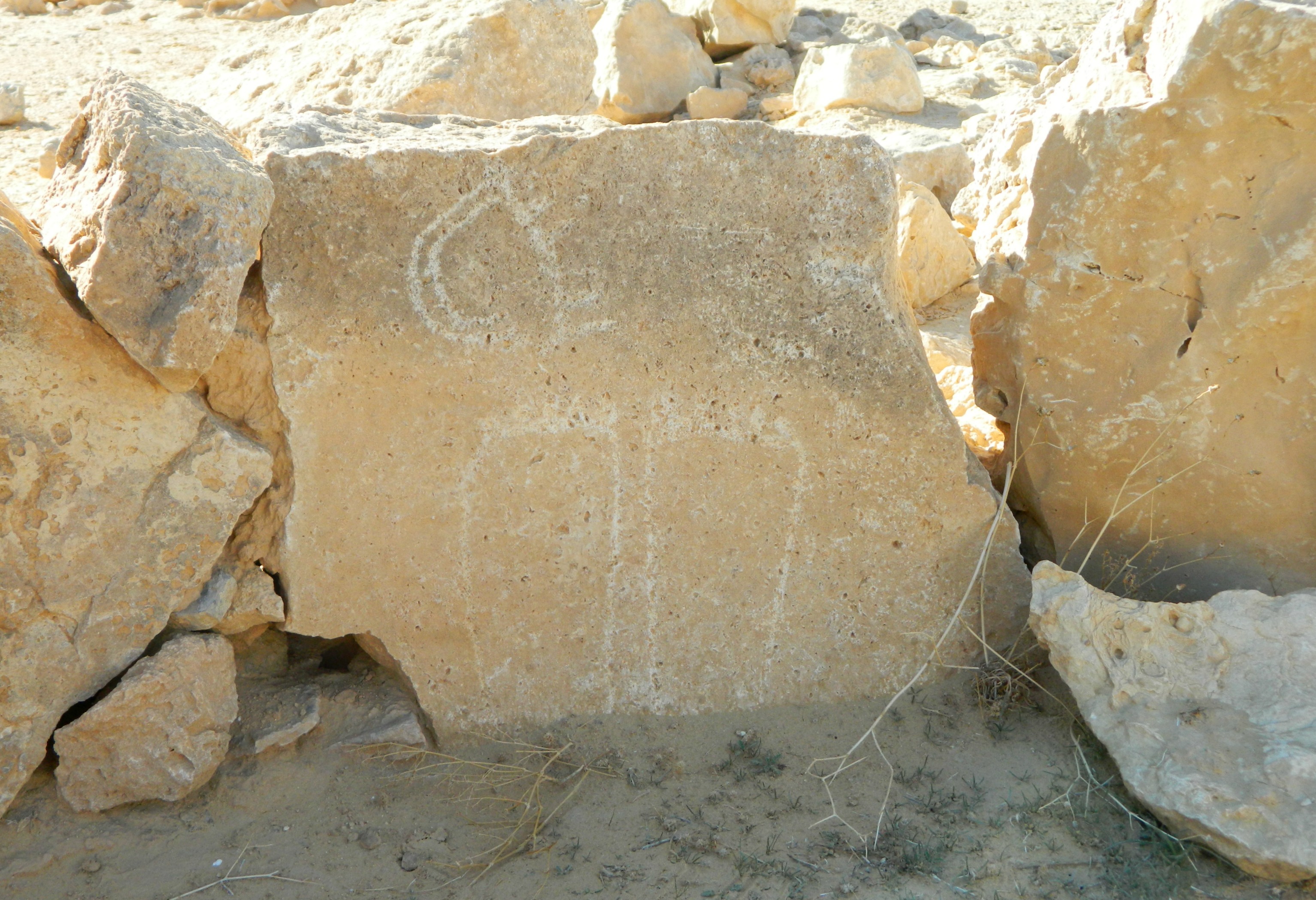
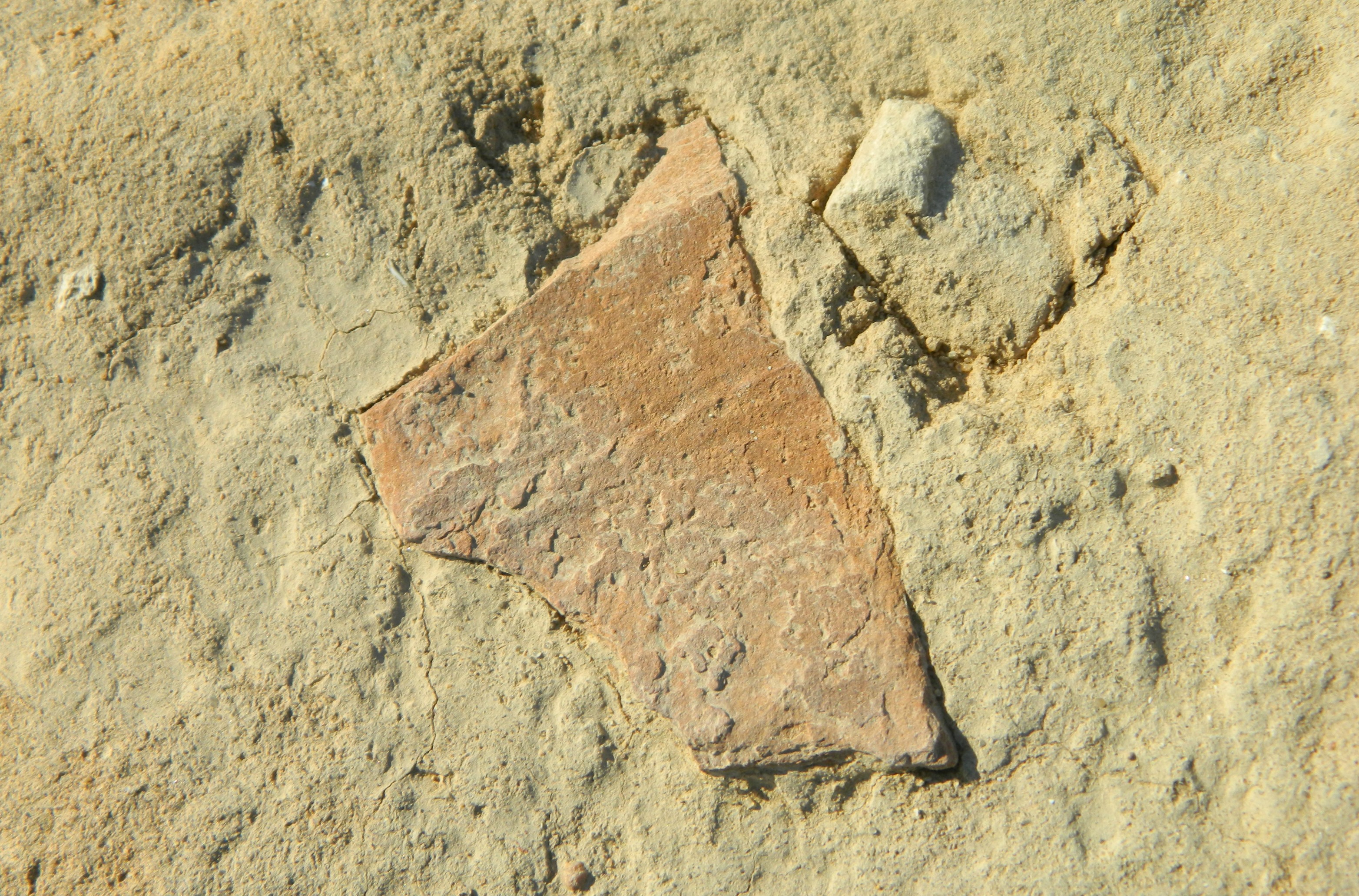
I looped around the west side of the fortress, and entered it from the south, admiring the stonework. I found a burnt potsherd on the ground, perhaps part of an old oil lamp. Inside, the view of the cliff on one side and the view of the sea on the other added to the charm of the ancient ruins. One particular aspect that sparked my interest was a series of bone-dry wood sticks bridging the top of a doorway. I stopped for a minute and stared, wondering for how long they had been been lying there.

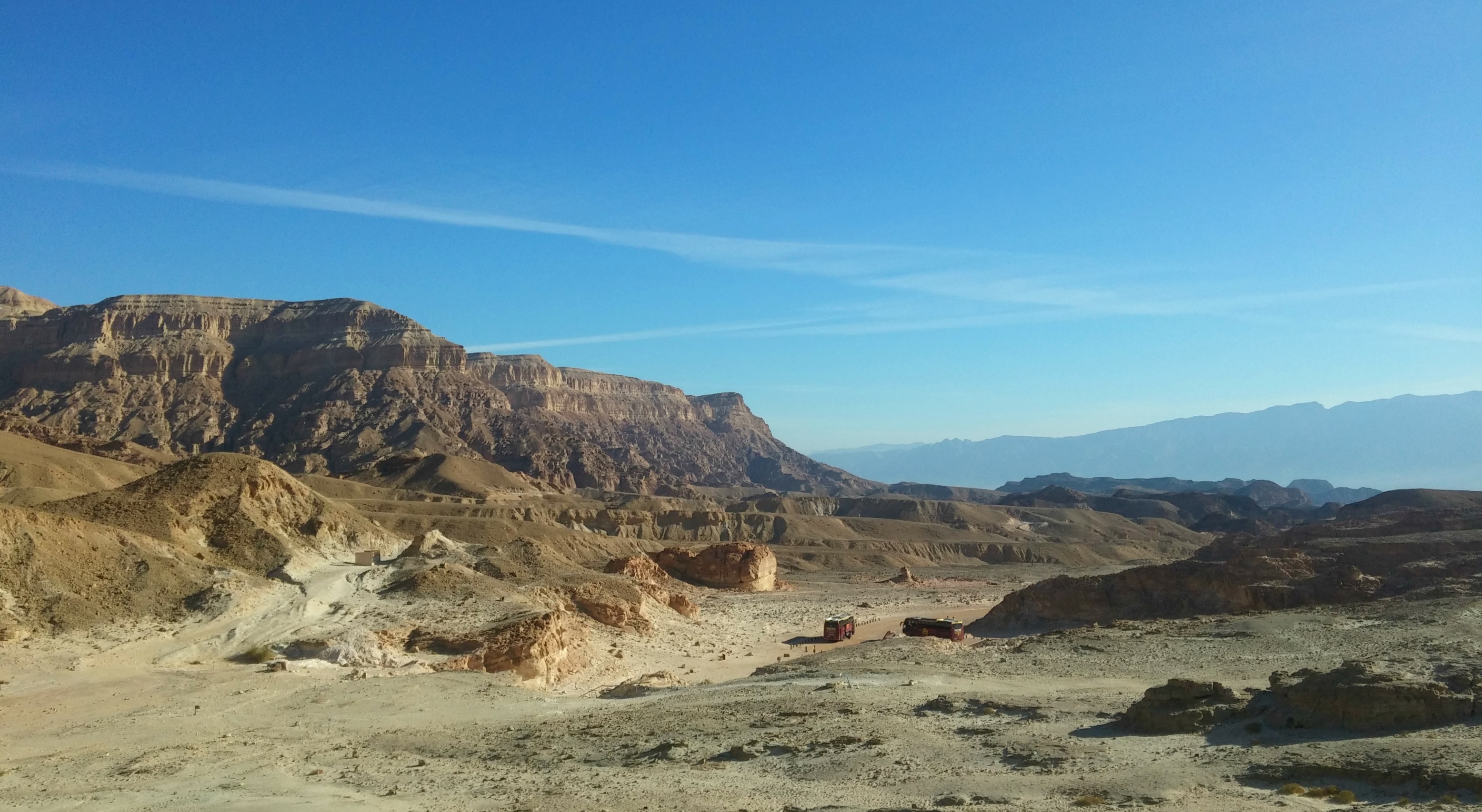
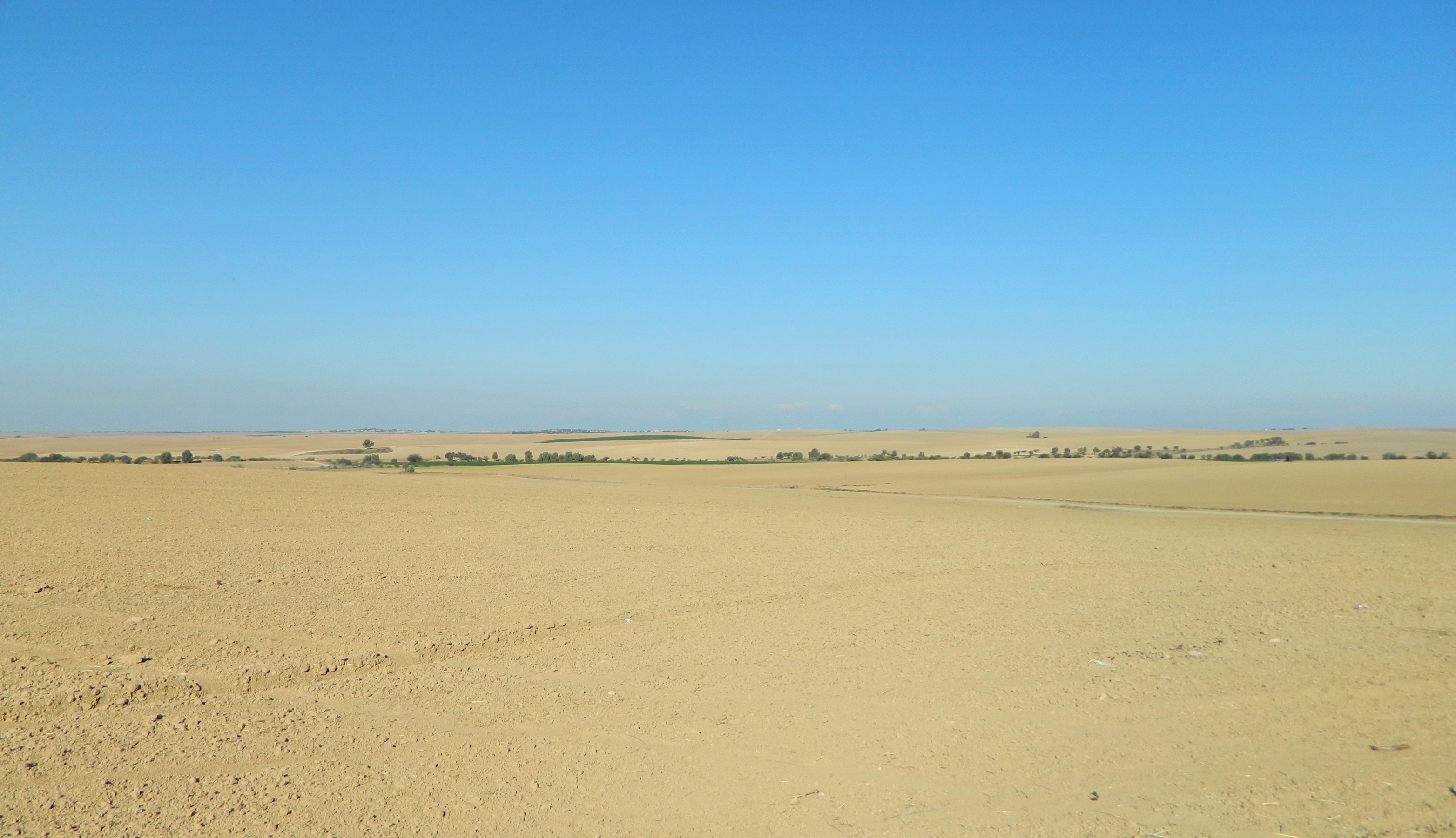
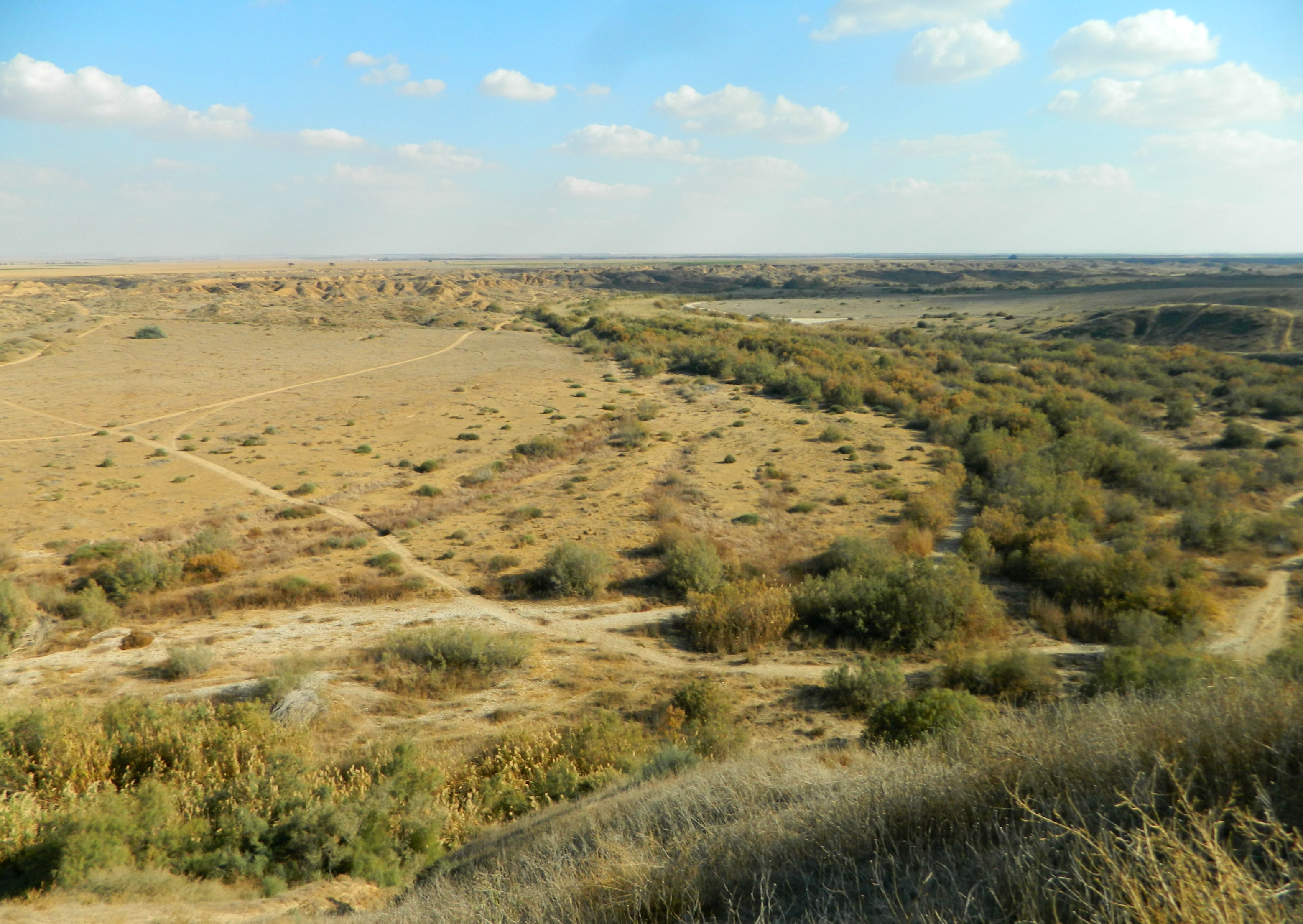
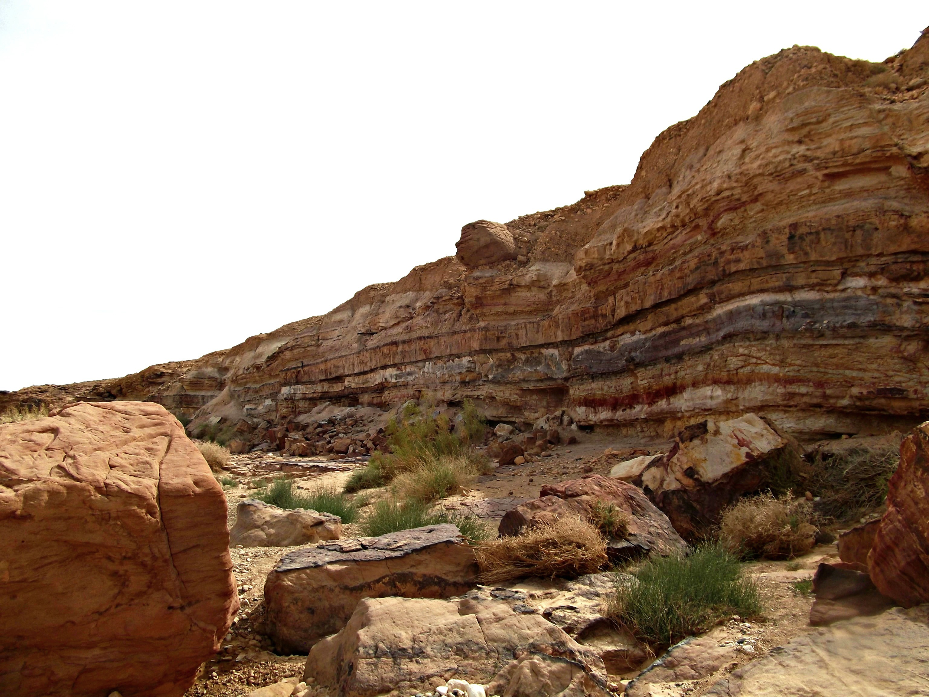
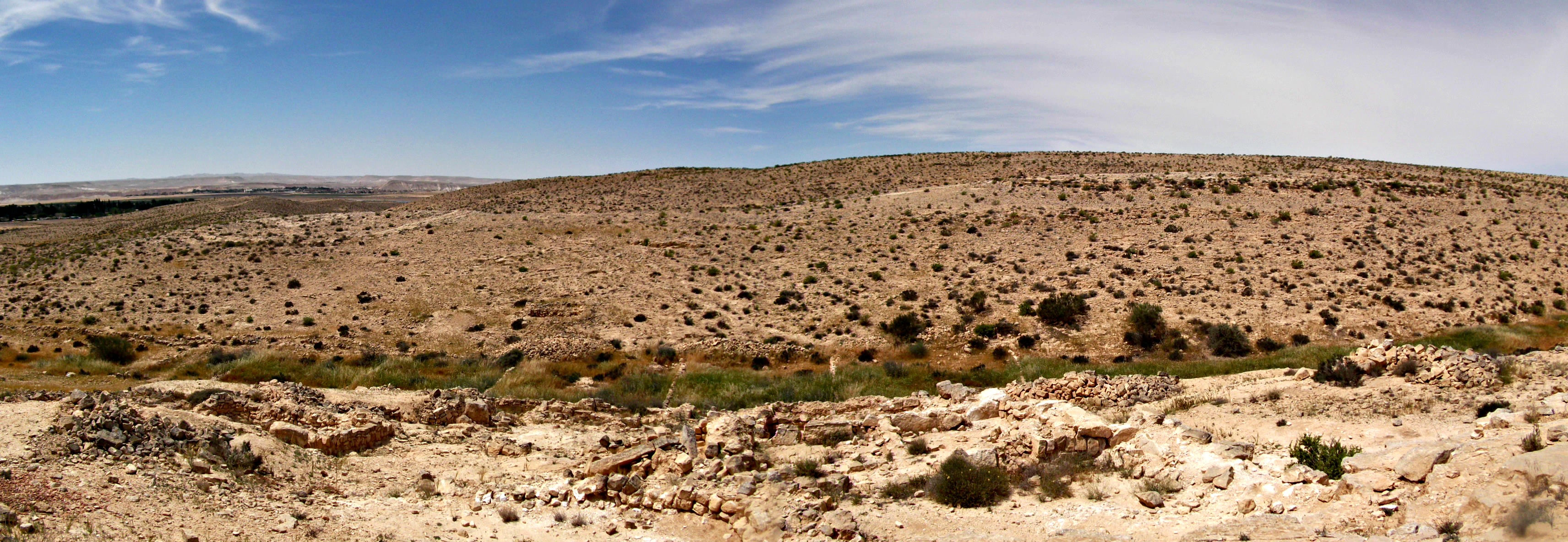
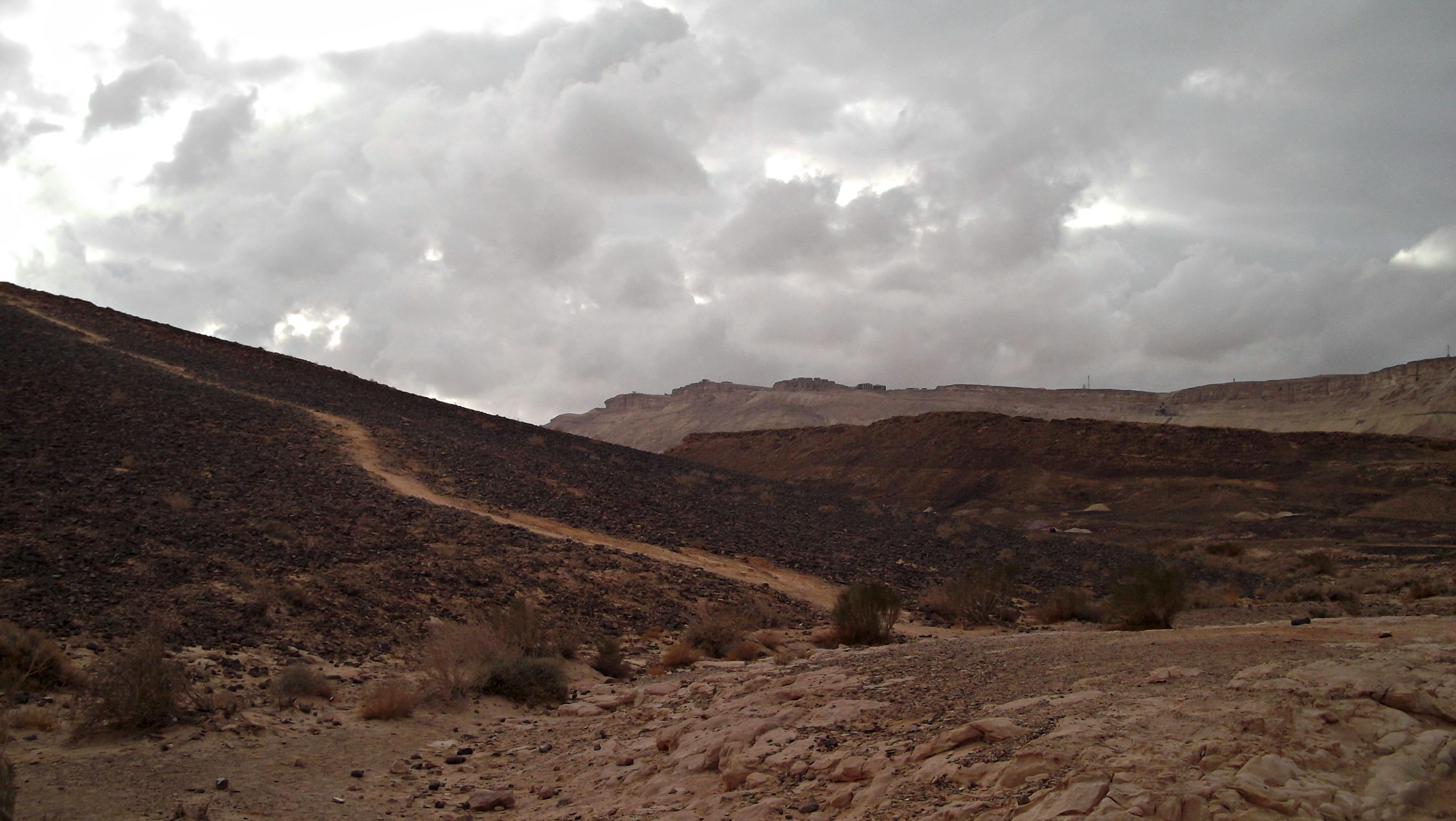
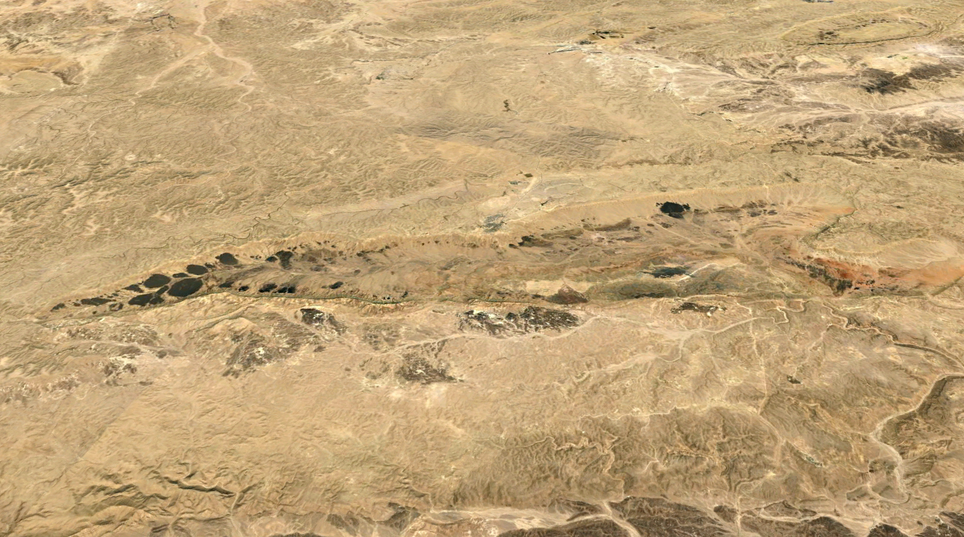
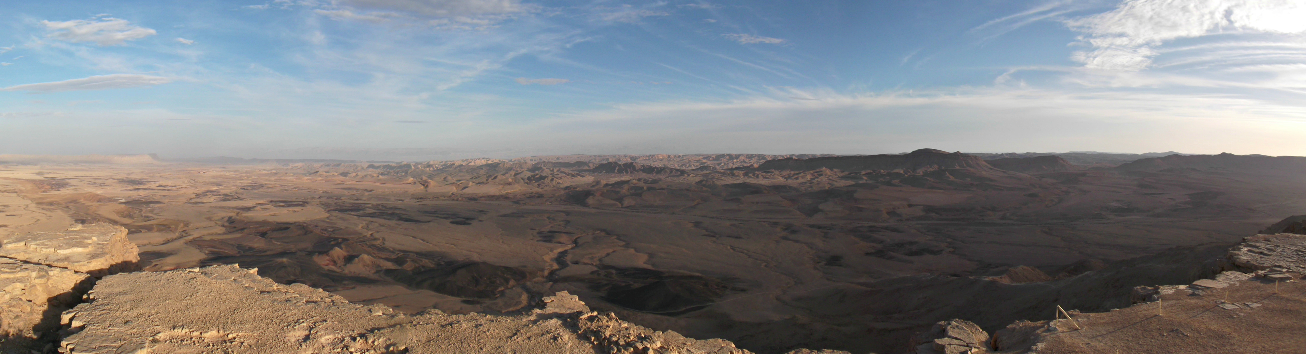
Desert landscape on the plateau

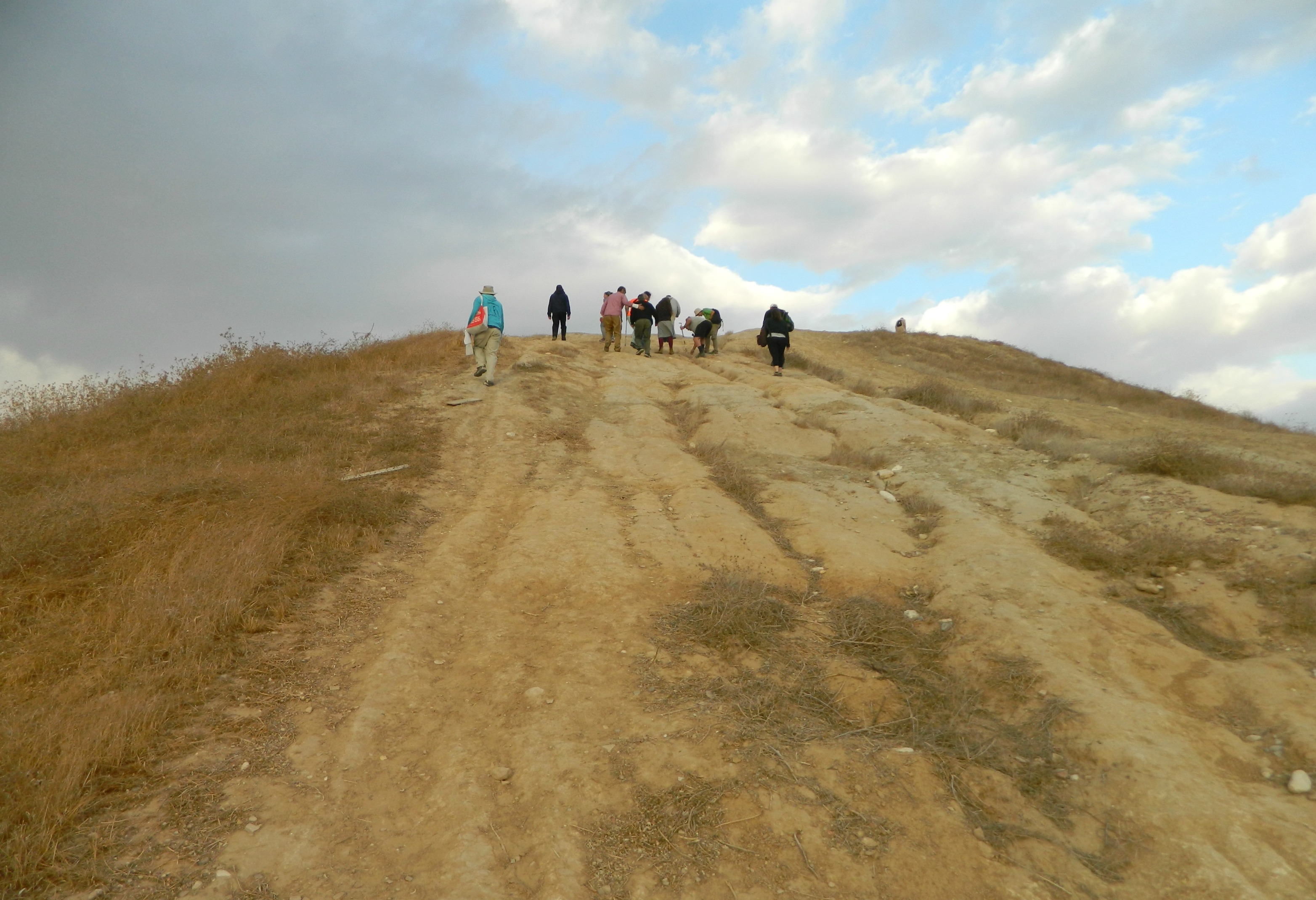
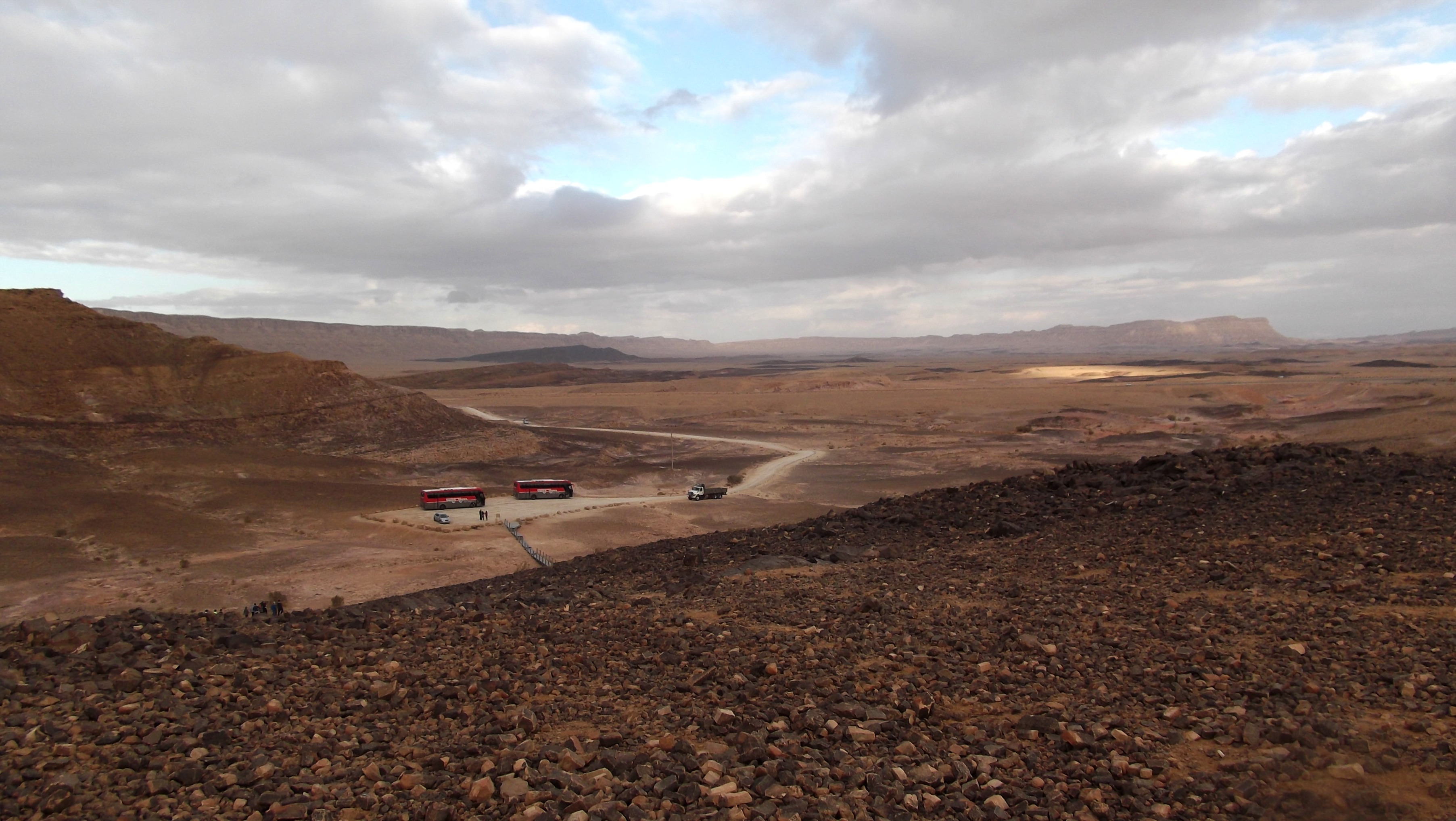
Leaving the fortress, I rejoined my group as they left Ein Bokek, and together we made our way to our bus. Our next location was just a few kilometres away and we were excited to get there. We were headed to the Ami’az Plateau while hired bicycles waited for us to take us on some off-road biking. Disembarking, we gathered around the guides and were briefed before setting out. I was given the guide’s bike, a yellow, black and grey GT Aggressor, and pedaled off at a comfortable 6th speed with the rest of the lads.
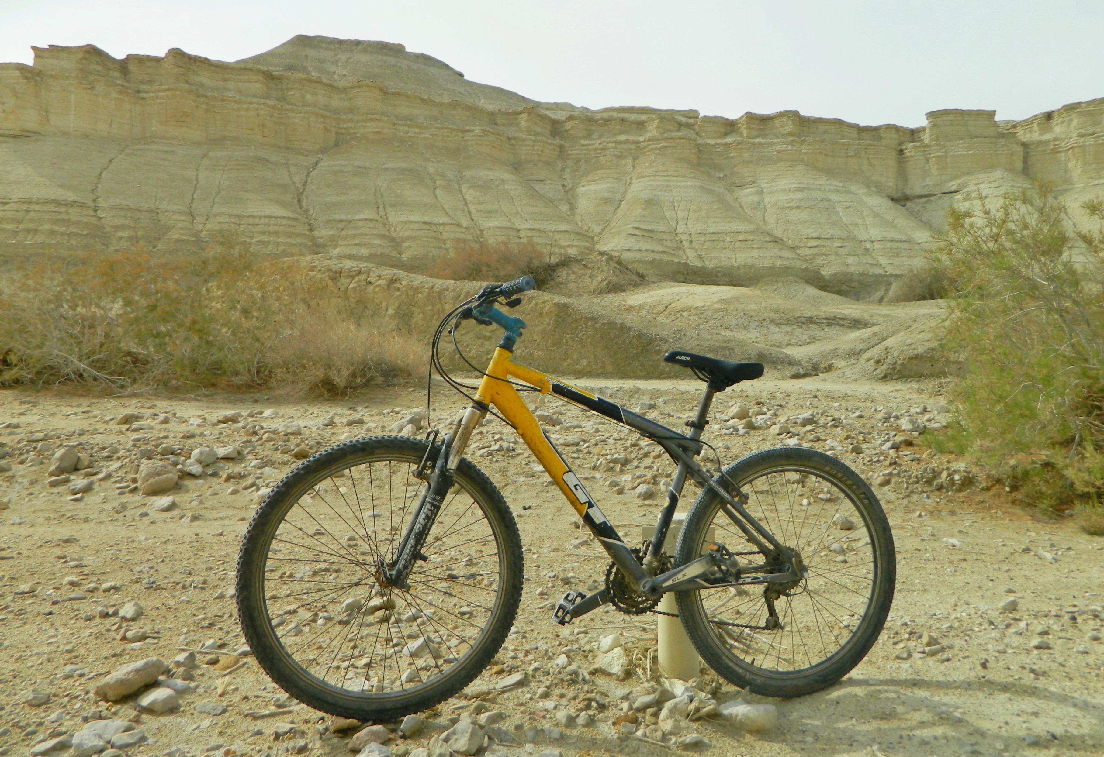
The bike I used

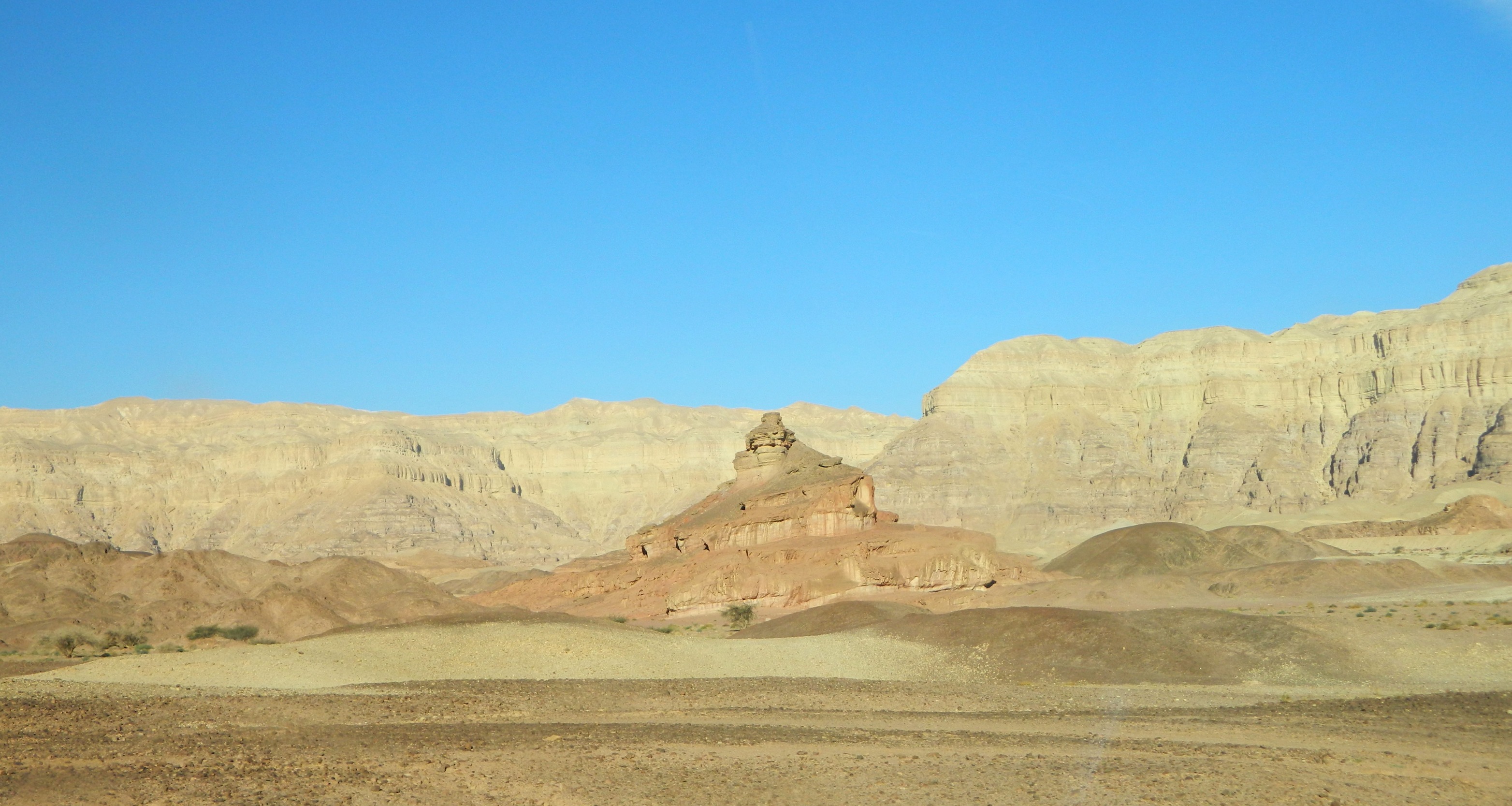
Within minutes the terrain went from a rather dull, rocky landscape to a really picturesque scene, with flat open stretches and interesting, wind-shaped hills. I kept my eyes out for birds, especially birds of prey which, when soaring above, are less likely to be disturbed by our group. I saw nothing interesting, but the location’s beauty kept me entertained.

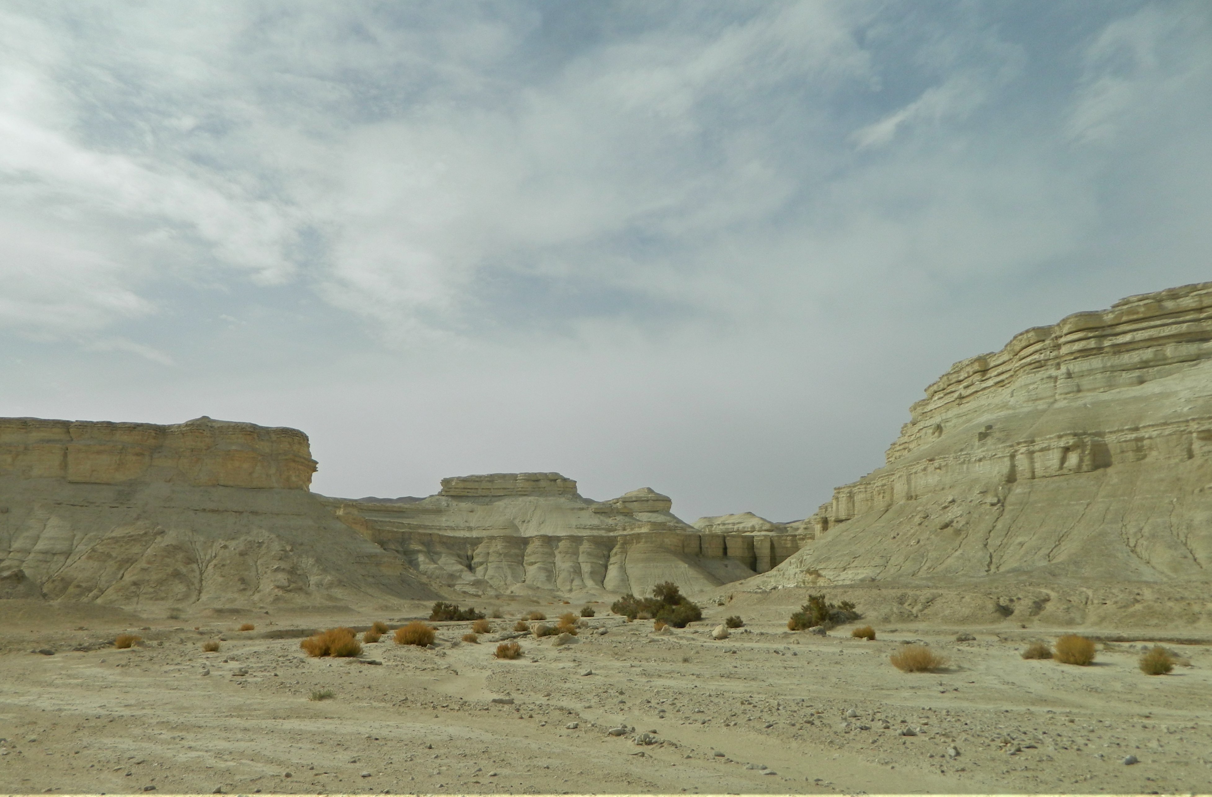
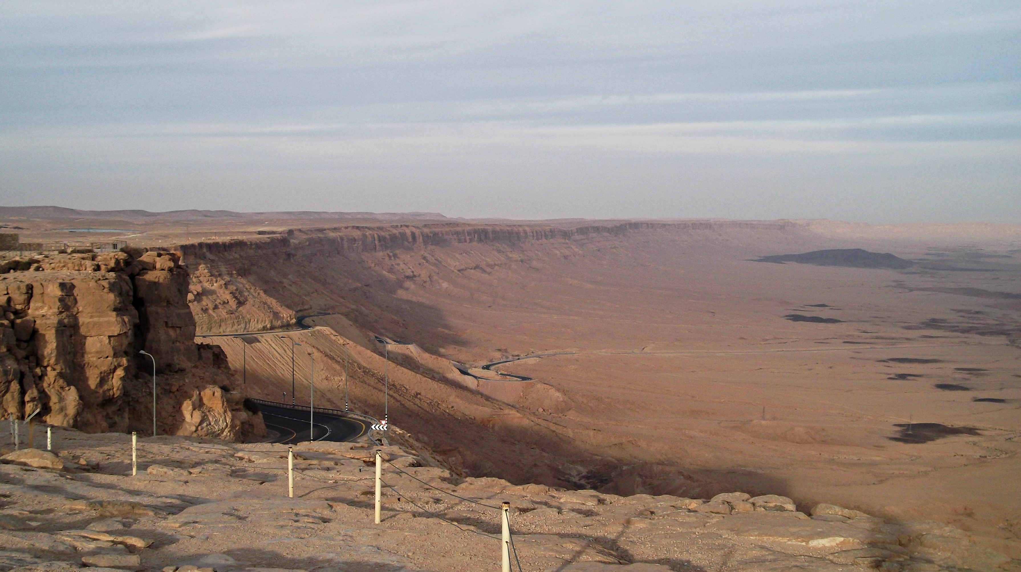
The beauty of the desert

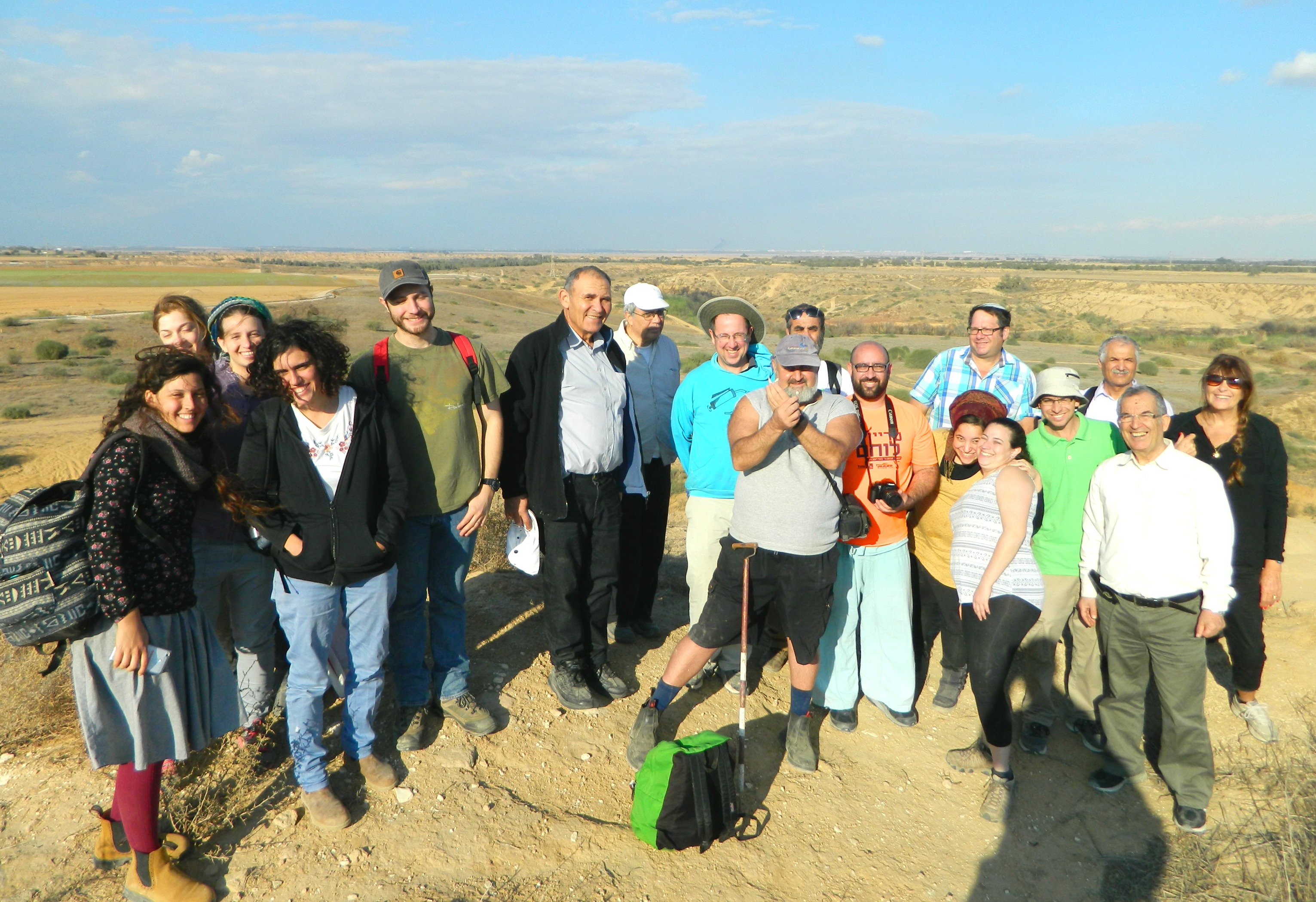
Along the way we passed several dry streambeds, including Wadi Hemar, Wadi Lot and Wadi Pratsim, and we kept pedaling after our guide. After nearly an hour we reached the end of our allotted trail, and turned around. I took the opportunity to ask some lads to take my photo, and then began the ride back.

Me

We all made it back safely to the starting place and returned our trusty metal steeds to the rightful owners. After praying mincha (afternoon prayer) we boarded our tour bus again and began the long drive back to Givat Shmuel, taking a short break in Arad for food and restrooms. Thus ended yet another fun trip with the school where I work.

University Trip: Arava III

In Israel, Negev on January 29, 2017 at 11:40 AM

Wrapping up our two-day trip to the Arava (I & II) under the behest of Bar Ilan University’s Archaeology department, we found ourselves leaving the gorgeous Timna Park and headed for our next destination: Tamar. A slightly obscure site that still found itself maintaining importance for thousands of years, Tamar is located alongside the kibbutz-cum-settlement of Ir Ovot in the northern part of the Arava (20km from the Dead Sea). Arriving sleepily at Tamar after the bus ride, we disembarked and prepared ourselves for a long tour of the site. We started at the northern corner, a corner tower of the ancient Israelite fortress.

Tamar the desert fortress

Tamar the desert fortress

Just to give a quick historical summary: Tamar was first established as an fortress by the Israelites, becoming a site of regional importance due to its strategic location and control over the freshwater spring. Tamar was expanded from fortress to fortified city over the following two hundred years or so. The city was abandoned after the Babylonian conquest of the Holy Land, to be taken control of by the Nabatean hundreds of years later, using it as a fortified stop on their Incense Route. In the 200-300s CE the Romans built their own fortress and bathhouse on the site, among other buildings.

Prof Aren Maeir speaking from within the ruins

Prof Aren Maeir speaking from within the ruins

There was then a period of general disuse and eventually the site became the location for a British Mandate police station; a drinking trough built to water their horses coming in from dry desert rides. In modern times, a group came to settle the south and built a small community next to the expansive ruins, naming it Ir Ovot. An organisation named Blossoming Rose, a non-profit based out of the USA, has undertaken restoration and conservation efforts to make the site the pleasant place it is to visit today.

Yours truly exploring the ruins (photo Yehushua Lavy)

Yours truly exploring the ruins (photo Yehushua Lavy)

Leaving my group to explore on my lonesome, I walked from the northern corner to the western corner, under the waving Israeli and American flags. On the way, I entered the modern military bunker, with explanatory photographs and maps on the walls in the simple underground room. From the western corner I swung southeast along the excavated city walls. I paused briefly to photograph a small drab bird that was flitting about a tree – a streaked scrub warbler. Dropping down a level I found myself looking at a large, impressive jujube tree.

Ancient jujube tree

Ancient jujube tree

Despite the popular rumours that this particular tree is over 2,000 years old, the tree is indeed old, but a more logical 500 or so years old, or so I believe. Skirting the decked trunk, I walked out the see the Roman bath ruins, reminding me of the intricate ruins at Bet Shean and Caesaria that I’d seen the previous years.

Roman bathhouse floor

Roman bathhouse floor

From the Roman ruins I walked over to a model version of the Israelite mishkan (temporary temple before the First Temple), a tribute to the possibility that the mishkan once stood at this very site (biblically known as Ovot). From the mishkan model I found myself approaching the British Mandate concrete drinking trough with its engraved Arabic graffiti; water being fed in via a duct stemming from the large well metres from the jujube tree.

Water for the British horses

Water for the British horses

Passing the through fortress ruins I spent a few futile minutes trying to photograph sunbirds feeding on a flowering bush with the blurred backdrop of the tour company.

Waiting for sunbirds...

Waiting for sunbirds…

Walking back out to the site’s perimeter, I retraced the steps of my colleagues and entered the main gate of the Israelite fortress. From the Israelite fortress I examined the ruins of a Roman cistern and interesting building strata. Rejoined with the group at the British police station, I enjoyed their company until we ended the tour, heading back to the buses for a quick drive over to the final stop on our two-day trip: the Vidor visitor centre at Moshav Hatzeva.

Vidor visitor centre

Vidor visitor centre

Being that the Arava is an unlikely yet highly successful agricultural centre in Israel, a visitor centre was opened to educated the general public as to the techniques and tribulations of desert agriculture. We learned that these days Russia is the biggest importer of Arava-grown citrus fruits, which are interestingly sweeter due to the slightly salty water pumped from desert wells (a form of compensation of sorts). At the culmination of the slide-show lecture we were taken outside to the greenhouses to be taught more, with demonstrations of flower genders and talks of pollination.

Learning about blossoms at dusk

Learning about blossoms at dusk

Unfortunately, the sun was slowly sinking over the horizon and it was hard to get many decent photos of the greenhouse fun that we had. With the classic desert night chill setting in, the Archaeology department’s volunteer hero swooped in with hot drinks and soups to both warm and nourish us before our long drive back to the Tel Aviv area, the end of yet another successful educational trip provided for us by Bar Ilan University.

University Trip: Arava II

In Israel, Negev on January 22, 2017 at 11:45 AM

Continuing with Day 2 of the Archaeology department of Bar Ilan University’s annual two-day trip to the Arava, we awoke in the desert just after dawn. I set my alarm clock a tad earlier than everyone else in my room to snatch some early morning birding. And the birding inside Kibbutz Elifaz didn’t disappoint – I spotted a good twelve species, including some highlights: red blackstart, blackstart, chiffchaff and a whole bunch of Spanish sparrows.

Spanish sparrow

Spanish sparrow

After morning prayers and breakfast (and chancing upon the kibbutz’s Druze members) we boarded the tour buses to start a long day of desert touring. Our first stop was mere minutes away, Timna Park, with its breathtaking landscape and intriguing historical remains.

Timna views

Timna views

Entering the park we parked outside the copper mines area, where I saw a bold white-crowned wheatear and a desert lark.

White-crowned wheatear

White-crowned wheatear

What caught my eye next was beautifully compelling; oxidised copper residue streaking through the erosion-sculpted yellow and pink sandstone. All over I’d find these eye-popping green traces, sometimes in the form of grainy pebbles.

Oxidised copper in the stone

Oxidised copper in the stone

Walking along the trail, I marveled at the ancient mining shafts that were pointed out to us, remains of some of the world’s oldest mines. Originally these mines were thought to belong to King Solomon, and were named as such, but recent developments shed light on evidence that the mines were, in fact, Egyptian, dating back to the 12th and 13th centuries.  In the vertical shafts, hand and footholds were scraped out of the grainy rock walls, enabling miners to safely descend tens of metres into the rock strata to reach the veins of copper. Baskets were lowered into the mine shafts to remove both copper ore and waste materials.

Horizonatal mineshaft

Horizonatal mineshaft

Hiking up, down and around the irregular landscape, we then arrived at what is known as the Miners Cave. A natural cave with a mine shaft excavated within the cave itself, we settled down to listen to Dr Uzi Avner.

From within the Miners Cave

From within the Miners Cave

One of the mine shafts at the cave, located just outside the entrance, was filled in for likely religious reasons – to pacify the Egyptian gods (perhaps Geb, god of the Earth). Climbing the opposite hill, we were soon to see many filled-in shafts, identifiable by their plate-like appearance on the otherwise grainy, gravel-strewn ground. There are thousands of these mine shafts, mostly filled in, in the Timna area – an impressive operation.

Timna's screw-like Spiral Hill

Timna’s screw-like Spiral Hill

Spotting a brown-necked raven perched on a ridge far away, I reluctantly abandoned the bird to follow the group towards the next site of interest: a complication of mines from various periods located around a wadi. Seizing adventure where I could, I entered and exited each of the caves and mine shafts that I deemed worthy of exploring, before we headed back to the buses.

Mushroom and Smelting Camp

Mushroom and Smelting Camp

No, our tour at Timna wasn’t over yet – in fact, it was just beginning. We were then driven to a site known as the Smelting Camp and nearby geological oddity, the Mushroom (seen in the centre of the background in the above photo). Standing on the lookout over these two sites, we heard more from Dr Avner, watched sunbirds frolic in the sparse desert flora and then got back into the buses to be taken to the next location: Solomon’s Pillars.

Solomon's Pillars by Hathor's Temple

Solomon’s Pillars by Hathor’s Temple

Now, the area of Solomon’s Pillars was jaw-droppingly awesome; the smooth, reddish-pink sandstone cliff edge of Mount Timna. Stricken by the natural beauty, I walked quickly across the sandy ground towards the cliff base, where an ancient Egyptian (and later, Midianite) temple was excavated. Called Hathor’s Temple, or the Miners’ Temple, this house of worship was built by Egyptian mining expeditions to service the goddess of miners, Hathor.

Hathor's Temple

Hathor’s Temple

Climbing up the cliff with the aid of carven stairs in the pink sandstone, my eyes were beset by a glorious desert view and then the curious ancient Egyptian wall engraving. Scratched into the rock, the engraving is from the 12th century BCE featuring Ramses III (left) making an offering to the goddess Hathor with an inscription below in hieroglyphics that reads: “The Royal Butler the Justified Ramessempre”. Because the detail is hard to see in the photo below, here is an illustration of the engraving from the Biblewalks website: see HERE.

Egyptian wall engraving

Egyptian wall engraving

This compelling rock engraving reminds me of the the life-size Roman soldier in regalia carved into the cliff wall at Nachal Kziv – something not many people know about (which can be seen HERE). Leaving the heights with its incredible view I looped back around the bottom of the cliff to rejoin the group, and then off to photograph a wee bit of free-climbing.

A bit of free-climbing

A bit of free-climbing

Across from Solomon’s Pillars is a small butte of sorts by the name of Slaves’ Hill, where archaeological work was done. On the short hike over, some of our party quenched their thirst on the sweet juice of pomelos gifted to us by the kibbutz; one of their agricultural exports. We climbed the hill to take in the views, and to watch ravens patrolling the adjacent cliff edge. Remains of what seems to be a gate and walls were uncovered, as well as organic materials – including an ancient grape seed that was found by Uri, a prominent member of our party.

Ancient grape seed

Ancient grape seed

As interesting as a preserved grape seed is, there was something even more interesting – a littering of slag (copper ore waste, in this case) covering the ground from the smelting actions done thousands of years ago.

Slaves' Hill lecture

Slaves’ Hill lecture

Descending from Slaves’ Hill, we made the trek back to the buses. But first, a posed photo of me:

Posing at Solomon's Pillars

Posing at Solomon’s Pillars

We were to leave Timna, sadly, without having seen all the magnificent sights as we had to head to the next site on the list: Tamar.

University Trip: Arava I

In Israel, Negev on January 15, 2017 at 11:45 AM

Not too long ago Bar Ilan University’s Archaeology department hosted its annual two-day trip to a specific region for some intense tours mixed with informative lectures both on-site and off. Last year we took a grand tour of the Kinneret area (posts I, II and III), and this year we headed south, not unlike a migratory bird. Starting early Wednesday morning, our two buses drove southbound passing Yerucham Fortress (a Roman Era stronghold) and the Lost City before reaching the rest stop under the Nabatean ruins of Avdat. As incredible place as Avdat is, we were quickly back on the road heading for the Arava, a particularly dry stretch of the Negev. Entering Mitzpe Ramon, we dropped down into the breathtaking Ramon Crater and persisted southward for another hour of so until we reached our first destination – a lookout at the desert settlement of Shacharut.

Lookout at Shacharut

Lookout at Shacharut

Disembarking, we marveled at the view of the eastern Negev and the red mountains of neighbouring Jordan. We were then introduced to our primary guide for the trip, Dr Uzi Avner, a veteran archaeologist who began his acquaintance with the desert in 1969 as a Field School guide.

Our guide Dr Uzi Avner

Dr Uzi Avner

Whilst walking around taking pictures I noticed an interesting item among the jagged sand-coloured rocks – a crafted flint tool with nicked serrations. Depending on who you ask, this very well might have been a knife used thousands of years ago!

A possible flint knife

A possible flint knife

It was at this lookout that we learned of the first of many desert temples or sites of worship, Dr Avner’s expertise. Continuing on, we were then driven to our next series of destinations in a valley running parallel with Uvda Airbase along the Israel National Trail. Minutes before disembarking once again, we spotted a fox in its grey winter fur running away from the approaching buses.

Gathered at an ancient temple

Gathered at an ancient temple

What we saw next were various remains of numerous ancient, likely prehistoric, desert cultic sites and temples, some with interesting rock carvings decorating what are believed to be ritual altars. I prefer more substantial ruins from more recent periods (especially Crusader) but alas, there was just one building.

Nabatean ruins

Nabatean ruins

This structure was Nabatean, belonging to a group Arab traders who built cities and fortresses in the desert along the ancient Incense Route, including the iconic Petra in Jordan and the aforementioned Avdat. These Nabateans ended up converting to Christianity during the Byzantine era, leaving behind magnificent desert edifices.

Cultic stone carvings

Cultic stone carvings

But we didn’t only learn about ancient religious sites, Professor Ehud Weiss (BIU’s archaeobotanist) showed us an interesting plant called a rose of Jericho (Anastatica hierochuntica). This plant is a resurrection plant, meaning that after the rainy season it curls and dries up to hibernate, dead-like, protecting the seeds inside for years until the next rainy season. When that happens the plant that comes back to life, releasing the seeds and then begins the process anew.

Rose of Jericho

Rose of Jericho

Another interesting plant, which I somehow missed out on, was a wild watermelon found in deserts, tiny and practically inedible due to its bitterness. One thing that I didn’t miss out on, and continued to fascinate me throughout the trip, was the never-ending supply of interesting rocks and potsherds scattered all over the place. In between all these interesting sights and moments were the roaring aerial acrobatics of Air Force pilots from the airbase beside us, a fun distraction for some.

Stone leopards at Namerim Temple

Stone leopards at Namerim Temple

Next we saw the most famous of the sites, the Namerim Temple, which was excavated by Dr Avner himself in the 1980s. Believed to be in use from the Neolithic to Bronze Age, this symbolic temple contains many stone depictions of symbolic scenes mostly involving what appear to be leopards – thus the name (namer = leopard). Dr Avner told us an interesting story about how an officer in the Armoured Corps directed tank traffic over the temple remains, crushing some of the leopard designs, and was chastised vis-à-vis his unintentional actions by our Dr Avner. This incident sparked a new interest in the officer and some years later he joined the Antiquities Authority, eventually becoming Dr Avner’s boss, of all people.

Birding in the low shrubbery

Birding in the low shrubbery

Interesting stories aside, it was at the Namerim Temple that the side activity of birding kicked in, with a grand total of three participants. We edged our way into the low, dry shrubbery flushing out streaked scrub warblers, blackstarts and a very bold bluethroat. Unfortunately all of my bird photos came out rubbish, but here’s one that fellow birder Nesia allowed me to use, an amazing shot:

Blackstart (photo Nesia Alon)

Blackstart (photo Nesia Alon)

Wrapping up at Namerim Temple, we gathered ourselves up and headed back to the buses, ready to be taken to the next site on our itinerary: Kibbutz Ketura, to take a look at Methuselah. When excavations were done at Masada in the 1960s by archaeologist Yigal Yadin, a preserved seed of a date palm was found, likely from the food stores of the besieged Jews holding out against the Roman army. This 1,950-year old preserved seed was then germinated, producing a seedling which was eventually planted in the kibbutz, dubbed Methusaleh after the longest-living Biblical character.

Prof Aren Maeir speaking at Methusaleh

Prof Aren Maeir speaking at Methusaleh

From Kibbutz Ketura we drove to our final destination of the day, Kibbutz Elifaz, where we were to spend the night. Once safely inside the kibbutz we rejoined in the dining room for dinner and then headed out for a quick star-gazing tour just outside the kibbutz, in the desert darkness. Powerful green lasers were used first for orientation and to point out celestial marvels and then, when the tour ended, faux lightsaber battles were recreated (including sound effects by the more excitable participants).

Evening in the Arava

Evening in the Arava

Back in the kibbutz we gathered once again to listen to a lecture on acacia trees, and the great effort imparted to sustain the iconic desert plant. Following the lecture was a hard game of trivia in which I went from a very brief 1st place to finish off in a shameful 14th place. Retiring to our country lodging suites, I took a short walk around the area with my friend Itamar and we spotted a barn owl flying about with some fruit bats. The barn owl gave a single “hooo!” and vanished into the night, and I was to see no more birds until the following morning after a hot shower and restful sleep.

University Trip: Northwest Negev

In Israel, Negev on December 18, 2016 at 1:44 PM

Two week ago, on Wednesday, I had an exciting day brewing my first beer – a slightly smoked stout – with my friend Ben from university. Riding on that high come Thursday morning, we then headed off on a university trip to several sites in the northwest region of the Negev led by Dr Shawn Zelig Aster. The first order of business after a quick stop at Beit Kama junction was a lookout across the road from Rahat, the large Bedouin city in the Negev.

Contrast of yellow dirt and blue skies

Contrast of yellow dirt and blue skies

The tour bus took a nice dirt road to the edge of a field, located not far from the old British Rider Police Station which I visited in the post The Negev: Roadside Attractions. From there we had a view of Tel Sera in the distance, an ancient Egyptian, Philistine and Israelite site of mostly agricultural importance, as well as its proximity to Gaza, a major coastal city. Looking about at the expanses of yellow dirt, I spotted movement off in the distance and it wasn’t long before I had a crested lark on the screen of my camera. Next, a darkling beetle made an appearance and the reassuring presence of black kites wheeling overhead – a common sight.

Group photo

Group photo

Moving on, we then pulled into a dirt road on the far side of Tel Sera for get a lay of the land and then crossed Road 25 to enter KKL/JNF’s Nachal Gerar park where we walked to the next tel on our list (a tel being an archaeological mound of layered human settlement). As I’ve become more and more interested in birding, my eyes scanned the area as I spotted various species in Nachal Gerar including stonechats, a Syrian woodpecker, a great tit, my first ever black redstart and some sort of sandgrouse in flight, to name just the highlights.

Bluethroat

Bluethroat

Getting back to the archaeological aspect of the trip we climbed up Tel Haror, a Bronze Age site which also goes by the names Tel Abu Hurairah (literally “Father of the Kitten”) and the famous Biblical Tel Gerar, a story of well-digging and Philistine peace pacts. The remains of a mud-brick temple, built some 3500-4600 years ago, have been uncovered for humanity’s viewing pleasure.

Mud-brick wall at Tel Haror

Mud-brick wall at Tel Haror

Atop the hill is the remains of a recently-destroyed mausoleum believed by the local Bedouins to be the grave of the aforementioned Abu Hurairah, a companion of Islam’s Muhammad; buried around the site are the unmarked graves of Turkish soldiers who fell in battle during WWI.

Tel Sharuhen

Tel Sharuhen

Heading back down to the bus, we were then driven to Nachal Besor, a park with a Jurassic Park feel to it in terms of flora and topography. With Tel Sharuhen (or Tel el-Farah) being our next destination, we drove through the alternating lush streambed and the sandy badlands of Nachal Besor for ten minutes or so, a rather bumpy ride. At last we arrived at the foot of Tel Sharuhen and I spotted a bird far off perched atop a bush – a great grey shrike.

Your humble servant (photo Ogen Drori)

Your humble servant (photo Ogen Drori)

We read about the ANZAC trail named after the Australian and New Zealander troops who, during WWI, traveled this route on their way to conquer Be’er Sheva and then Gaza from the hands of the Ottomans. Finished with the recent history, we climbed the tel to learn about the ancients: Canaanites, Egyptians and Israelites.

Remains of what might have been the city gate

Remains of what might have been the city gate

Partway up the hill, remains of what seems to be the city gate area constructed of mud bricks is clearly visible. At the western end of the tel is some remains of another structure of mud bricks partially buried in the dirt. A bit of scratching around at a burnt corner revealed interesting findings: broken animal bones and pieces of flint which were likely used to cut meat, remains of an ancient kitchen frozen in time.

Ancient kitchen at Tel Sharuhen

Ancient kitchen at Tel Sharuhen

It was there that we tasted from the saltbush identified by one of the members of our party. At the northern end of the tel, a great expanse of interesting land including loess badlands was to be viewed and appreciated.

Nachal Besor

Nachal Besor

Whilst walking atop the tel, the broken rim of a carved stone vessel caught my eye and when I took it to experts at BIU the following week, I was told that it might very well be from the Second Temple period (2,000 years ago) – a fun find!

Potsherd stuck in the dirt

Potsherd stuck in the dirt

As exciting as our finds were, there was a schedule to keep and so our bus took us to our final destination: Tel Gamma (or Tel Jemmeh). Located just three kilometres southwest of where I stationed as a soldier during Operation Protective Edge (see blog post HERE), it was an unusual feeling revisiting the area under such different circumstances.

Stormy skies

Stormy skies

With storm clouds darkening the skies, we hurriedly climbed the steep tel and surveyed our surroundings, including Nachal Besor to the north.

Tel Gamma the Steep

Tel Gamma the Steep

Archaeological digs uncovered remains that pointed to the Egyptians, Philistines and even the Assyrians who conquered the area some 2,700 years ago. With broken pieces of ceramic vessels and bones littering the excavated area, we couldn’t help but give the burnt wall area a quick surface scratching, revealing some rather large and impressive bones.

Wall-scratching at Tel Gamma

Wall-scratching at Tel Gamma

At last rain began to trickle down and so we headed back to the bus, our tour of the northwest Negev coming to an end. Just to recap, these were ancient cities that were mostly abandoned long, long ago – before the time of Alexander the Great, to give perspective. Also, to simplify my narrative of our trip, there are many interesting historical and archaeological anecdotes that would delight some readers, but, alas, I aim to keep all readers adequately entertained.

Raindrops on the window

Raindrops on the window

With that been said, there is little material evidence of the cities’ prior glory and might to be seen with the naked eye; it takes a bit of imagination to envision what these sites once were.

Be’eri Forest

In Israel, Negev on August 10, 2014 at 4:44 AM

During the past few weeks, due to the ground operations of Operation Protective Edge, I found myself at the Gaza border with infantry and armoured units. One day, I went to explore my surroundings and found that I was at the edge of the southern Be’eri Forest and that there were many interesting sites to be seen. The following is a summary of two hikes I made of the area, all just a few kilometres from Gaza.

Mador Ruins

Mador Ruins

The very first site I came upon was the Mador Ruins, a collection of Byzantine, Ottoman and British remnants just off Nachal Grar. I approached the main structure, and peered under the outer arched ceiling – to look into a seemingly bottomless well. A little research online and I discovered that this was an Ottoman “saqiya” well refurbished by the British – 26 metres (85 feet) deep.

26 m (85 ft) deep

26 m (85 ft) deep

Beside the well I found a mysterious sarcophagus of sorts, unmentioned in the Israel Antiquities Authority’s report of their June 2011 survey.

Mystery sarcophagus

Mystery sarcophagus

Seeing stone mounds in the distance, I kept walking on what became apparent as the Water Systems Trail. I passed a strange partially-covered concrete that looked like a buried vase, and then this, an IDF warning leaflet that was dropped over Gaza before a bombing run and had since blown over the border:

Warning leaflet

Warning leaflet

Walking north-west towards Gaza, I came upon the ruins of a British flour mill from WWII. According to the plaque, the British army set up a large camp to store supplies and ammunition for the battles against the Germans under General Erwin Rommel, the “Desert Fox”. After the war, the camp was dismantled and the buildings abandoned.

British flour mill

British flour mill

Following some examinations of the several British ruins nearby, I heard a boom coming from Gaza and noticed that a terror tunnel had just been blown up by the IDF forces within Gaza. Here’s a photo of the immediate aftermath:

Gaza tunnel being blown up

Gaza tunnel being blown up

With that, I looped back to our camp and was temporarily finished with my exploratory hikes. However, at about 4pm on Tuesday the 28th of July, I embarked on another exploratory hike, this time heading slightly southwest. Walking through the thick powdered dirt (created by tanks and APCs) I crossed the dry Nachal Grar and came upon the Re’im parking lot, but not before finding this skink.

A skink in the powdered dirt

A skink in the powdered dirt

At the official entrance to the recreational park (which includes picnic grounds, biking trails and more), there is this British well and storage pool. The British dug out and/or renovated dozens of wells in the area and this particular one had a diesel pump and a concrete-coated storage pool.

British well and storage pool

British well and storage pool

Consulting the site map, I decided to walk east with the Se’ora Ruins as my goal. I set out and came across the first oddity quite quickly. The ground in the area near Nachal Grar had collapsed and thus there are numerous cliff edges in unlikely places. My theory is that the underground water tables have dried and so the land collapsed. We know that this area was sought after for its water even back to the times of Abraham, where he watered his flocks. So, thinking of all the people and all the animals that were supplied water from these underground water tables, I think it seems reasonable that the land should collapsed down on the emptied pockets.

''Danger! Abyss''

”Danger! Abyss”

Even now the ground sinks, as can be seen here on the trail. I just wonder how much more will collapse.

The path are a'crumblin'

The path are a’crumblin’

After recrossing Nachal Grar, I came upon the edge of the forest and had to walk in the sun – being about 5:20pm. I kept walking, passing a large amount of discarded sheep wool and then a seemingly abandoned Bedouin encampment. As I worked my way towards this ruins I saw, I heard a loud whistling sound followed by a BOOM in the direction of our army camp. I had a sense of dread and kept checking the news sites to see what had happened. There was a gag order of sorts, as at first nobody reported the mortar that landed in middle of our camp – killing four soldiers and injuring more. It was a miracle that I wasn’t there at the time; I may have not been in the path of the mortar but simply being spared the sights of carnage is a blessing enough. Back on the hike, I wasn’t sure just what had transpired so when I did make it to the Se’ora Ruins I wasn’t as interested as I would’ve been ordinarily. I had a quick look, again seeing a “bottomless” well, and then headed back to my camp.

Se'ora Ruins

Se’ora Ruins

It wasn’t long before we moved out and so I haven’t had the chance to explore the northern Be’eri Forest, but one day I shall. I’d like to end this post with a photo I took of the first Iron Dome interception I saw, the very first day I spent on the frontlines.

Iron Dome interceptions

Iron Dome interceptions

Until next time, and may we have only good thing to share! (A more in-depth and personal account of the mortar attack can be found HERE)

The Negev: Roadside Attractions

In Israel, Negev on May 11, 2014 at 3:31 AM

A few weeks back I was way down in the southern Negev, about an hour’s drive from Eilat, and was called back north for a driving mission. On the way up I decided to take my time and explore roadside attractions. I often stop off places to explore, but usually don’t have enough material to make a blog post about (sites such as the Mazor Mausoleum, the Maqam of Nabi Musa and the Ayit Waterfall). This particular time I had the chance to visit three interesting sites.

Close-up of the coloured sandstone wall

Close-up of the coloured sandstone wall

The first I came across was Wadi Ramon in the Ramon Crater, one of two streams which drain the enormous erosion crater. I had heard about some very interesting “coloured rock” formations, and that they are just a few minutes from the road. Leaving my truck, I climbed down into the dry streambed with just my camera and gun and began walking. Wondering if I’d see any snakes or scorpions, I scoured the sandy streambed with my camera ready as I tread. True to my source’s word, the coloured sandstone rock wall was very visible after just a minute walk.

Coloured wall of Wadi Ramon

Coloured wall of Wadi Ramon

Researching more online, I found a fascinating fact about the Ramon Crater: gypsum, a mineral, is heavily mined in the crater and there are underground galleries stretching out for 16 miles – that I’d like to see!

Looking down at the ''Lost City''

Looking down at the ”Lost City”

Driving further north, I stopped just after Sde Boker (where Ben Gurion lived and died) and happened upon a place I’ve never even heard of: the “Lost City”. What I’ve gleaned from online sources (including my absolute favourite: Biblewalks) is that this “Lost City” was a late Byzantine farming settlement dating back to the 6th-9th centuries CE. However, its history and identification was a mystery for many years, thus earning the name “Lost City”.

The ''Lost City''

The ”Lost City”

Being on the ancient trade route, this farming village would have had prime access to the Levantine, Arabian and perhaps even further markets. After extensive excavations, and a little reconstruction, the “Lost City” is comprised of some 350 rooms along a little valley where vegetation would grow, irrigated by a rudimentary terraced construction aimed to preserve as much of the scarce water as possible. In this slightly panoramic shot, the ruins and agricultural terraces can be seen:

Panoramic of the ruins and the agricultural terraces

Panoramic of the ruins and the agricultural terraces

I saw that there are ruins of an ancient mosque, built some 1,200 years ago approximately, but I didn’t want to wander too far off so I decided to cross the road and search for a different ruins; a fortress said to be from the time of the Jewish kings. I came across these low stone walls, thought it might be the meagre remains, but found out later that I hadn’t found the Haluqim Ruins after all… so I don’t know what these walls and small ashlars are, perhaps a continuation of the “Lost City”. Maybe I’ll find the Haluqim Ruins next time…

Unmarked ruins

Unmarked ruins

The third site of interest is an old British Mandate police station located across from Rahat (the largest Bedouin city in Israel), not far from Be’er Sheva. It was at this station, the Rider Police Station, where the local gendarmerie (a military force charged with police duties) was located. I had passed the building many times and had finally decided to stop, but unfortunately, someone had bricked in all the doors and windows, so exploration was quite limited.

The Rider Police Station

The Rider Police Station

That basically concluded my exploration for the day, although I ended up driving to the upper Golan, clocking in about 350 miles of driving that day alone!

Ramon Crater: The Carpentry Shop

In Israel, Negev on January 5, 2014 at 4:30 AM

Just a little while back I was driving, once again, down south in the Negev Desert. This time I was crossing the Ramon Crater – Road 40 cutting across the crater floor. I had plenty of time for adventure and I had read earlier that a site called “The Carpentry Shop” was just a few hundred metres off the road. So, when I reached it, facing the northern rim of the crater, I turned in and stopped my truck at the entrance.

Entrance to The Carpentry Shop

Entrance to The Carpentry Shop

As I was contemplating driving to the little parking lot or leaving my truck at the side of the road I turned, looked out my window and saw an amazing rainbow against the iconic Ramon Crater rim. Feast your eyes!

Rainbow over Ramon Crater

Rainbow over Ramon Crater

I parked my truck in the little lot, got out and lingered behind a school group waiting for a bit of peace and quiet before climbing the hill that is The Carpentry Shop. As I stood at the base of the hill, hoping the angry clouds don’t empty themselves just as I start my tour, I noticed Mitzpe Ramon way up on the crater ledge and wondered if I’d be able to pinpoint this Carpentry Shop site from way up way.

The Carpentry Shop on the left with Mitzpe Ramon in the distance

The Carpentry Shop on the left with Mitzpe Ramon in the distance

At last the group was far enough uphill so I began climbing. In effort to preserve the site, a special set of stairs has been constructed over the rocks to the top of the hill. As I climbed I noticed the specialness of the site more acutely. The rocks are all like bricks, rectangle and dark.

A huge pile of natural bricks

A huge pile of natural bricks

The scientific explanation for this great pile of natural bricks is that this whole hill was originally sand, the sand was heated from below and then cooled after being turned into a liquid, creating these “bricks” as I see them. The term “Carpentry” was dubbed after someone decided that the bricks looked like wood pieces used in a real carpentry shop. They must have never seen bricks before… Regardless, the interesting thing is that this hill, in this unique erosion crater, is the only place in the world where these molten rock formations can be found.

The Ramon Crater from space

The Ramon Crater from space

I reached the top of the hill and took this picture of the jagged crater floor and signs of humanity down below, including my truck:

Looking down from the hilltop

Looking down from the hilltop

Once I had finished looking at the great pile of natural bricks I headed back down and examined some sand patches. It is amazing how throughout the crater floor there are these patches of coloured sand, in all different colours. I found an orange patch and a pink-lavender patch just a few feet from one another. With that I got back into my truck and hit the road, just one of the Ramon Crater’s interesting features under my belt… with many more to be seen.

A special thank you to Mandy Detwiler for photographic help currently beyond me!

Mitzpe Ramon

In Israel, Negev on December 22, 2013 at 4:26 AM

Returning to the desert trilogy of blog posts… After visiting Sde Boker, Midreshet Ben Gurion and the ancient ruins of Avdat I pushed southwards and stopped at Mitzpe Ramon. A town on the northern ledge of Ramon Crater, Mitzpe Ramon is where the Parks Authority office is, as well as other sites of interest.

Mitzpe Ramon Visitors Centre on the rim of the Ramon Crater

Mitzpe Ramon Visitors Centre on the rim of the Ramon Crater

After parking the truck I headed into the Visitors Centre and found out that I had missed the last opening of the day, that I’d have to come back another day but that I was free to look around outside. Here is the view of the northern ledge of the Ramon Crater that I photographed that day:

The crater edge

The crater edge

Not left with many options, the sun gradually sinking over the horizon, I called it a day and made up my mind to try to come back. Two days later, after a nice night in the desert where I had a near run-in with a dangerous little yellow scorpion, I found myself with plenty of free time and so popped on a bus to Mitzpe Ramon.

Nubian ibex

Nubian ibex

The first thing I noticed was the abundance of Nubian ibex wandering around the town. I overheard someone comparing ibex in Mitzpe Ramon to cats in the rest of Israel, that they are all over the streets. It’s true. Next I entered the Visitors Centre and booked myself for an afternoon tour. With some time to kill, and the spirit of adventure coursing through my veins, I visited Bio Ramon. A side attraction attached to the Ramon Crater (also known as Makhtesh Ramon), Bio Ramon is a small “desert zoo” hosting both wildlife and flora. Here is a horned viper (Cerastes cerastes), found in the Ramon Crater as well as other areas of the Negev:

A horned viper in Bio Ramon

A horned viper in Bio Ramon

After a partially-guided tour of Bio Ramon I had lunch and then eventually, as the hour of my Visitors Centre appointment approached, I made my way to the edge of the crater. The Ramon Crater is a whopping 38 kilometres long, 4-10 kilometres wide – the largest of Israel’s erosion craters. Along with the Small Crater and Large Crater to the north and two mini-craters at Mount Arif, the Ramon Crater joins two Egyptian craters in the Sinai Peninsula as being the only erosion craters on Earth.

Ramon Crater

Ramon Crater

Shaped like an elongated heart, the Ramon Crater has interesting rockforms, and a great variety of wildlife that come out mostly at night. Animals of interest include ibex, wild asses, gazelles, foxes, wolves, striped hyenas and even leopards. While the wildlife are hard to spot, the natural beauty is not, and from this balcony lookout, one can look straight down at the crater floor:

''Balcony lookout''

”Balcony lookout”

I had someone take my picture while I stood on the wooden planks separating me from the crater floor way down below; here it is:

Defying death

Defying death

At last I was admitted into the Visitors Centre and the tour began with Israeli hero Ilan Ramon, a colonel in the Israeli Air Force and Israel’s first astronaut. I remember reading in the papers shortly after I moved to Israel about the death of Ilan’s son, Asaf Ramon, who was killed in a plane crash – himself an IAF pilot as well.

Ilan Ramon as an IAF fighter pilot

Ilan Ramon as an IAF fighter pilot

Ilan Ramon was a crew member of NASA’s Columbia space shuttle and was killed tragically, to the world’s horror, as the shuttle disintegrated upon re-entry into Earth’s atmosphere on February 1, 2003 just sixteen minutes before their scheduled landing. I never thought much about the story, nor the man involved, but I must say, the Visitors Centre did a great job at opening a window into the life of Ilan Ramon. But before Ilan became an astronaut, he was a fighter pilot in the IAF and was the youngest of the eight pilots to take part in Operation Opera – the daring bombing of Iraq’s unfinished Osiraq nuclear reactor in 1981.

Operation Opera in the video

Operation Opera in the video

The film that led us into the life of Ilan Ramon came to a close with his death, showing footage from both the shuttle and NASA’s “Houston” space centre. Concluding with a connection of the Ramon Crater and space (Israel’s research telescopes are stationed on the rim of the crater), the curtains opened up and bright desert light filled the room, the vast crater directly before us:

The curtains open to reveal the crater

The curtains open to reveal the crater

After an exhibition on the creation of the erosion crater, including hands-on activities and a great flexible rubber model of the crater area, we headed on up to the roof for an even better view of the Ramon Crater.

The crater edge from higher up

The crater edge from higher up

And last but not least, a panoramic of the Ramon Crater:

Panoramic of the Ramon Crater

Panoramic of the Ramon Crater

And so ended my adventurous week in the desert.

Avdat

In Israel, Negev on December 15, 2013 at 4:41 AM

After visiting Sde Boker and Midreshet Ben Gurion, the home and burial place of Israel’s first Prime Minister David Ben Gurion, I drove a few kilometres south to Avdat, a national park preserving an ancient mountain-top city. I had once passed this extraordinary ruins, seeing it from the road, and now I had the time and opportunity to explore it.

The mountaintop city from the road

The mountaintop city from the road

Using my handy “year park pass” I gained entrance and watched an interesting video about the site and about the Incense Route, an ancient trade route extending from the southern Arabian Peninsula (Yemen and Oman on our maps) and ending in Gaza, a port city on the Mediterranean Sea.

The Incense Route

The Incense Route

The Nabateans, a nomadic people which expanded into a powerful kingdom, ruled the area of the Incense Route some 2,200 years ago. As they became more and more organised they built fortresses and waystations for the convoys making the journey from the Arabian Peninsula to the Mediterranean Sea. After Petra, the famous tourist destination in Jordan (also the filming location of key parts in Indiana Jones and the Last Crusade), Avdat was one of the most important stop along the Incense Route – station #62. As such, the city was further expanded and built up by the Romans and Byzantines after the Nabateans were annexed by the Roman Empire, polytheism turning to Christianity.

Bathhouse ceiling

Bathhouse ceiling

With nothing but my gun swinging at my side, I started my journey at the Byzantine bathhouse. There I found an nearly fully intact structure with a great domed ceiling (above) and these reconstructed tile pillars arranged on the depressed floor:

The floor of the bathhouse

The floor of the bathhouse

Next I trekked up the mountain to the base of the ancient Nabatean city, which was believed to have been called Ovdat or Obodat named after the Nabatean king Obodas II. Half-way up I came across the first tier of ruins, a Byzantine house likely belonging to a middle-class citizen, perhaps a wine merchant.

Byzantine house

Byzantine house

After winding in and out of the ruins, passing through and around little caves in the bedrock, I climbed further upwards and made my way through some more Byzantine ruins up to a Nabatean temple, the pillared edge of the acropolis. Here is looking down at the aforementioned Byzantine ruins, the desert and Road 40 down below:

Looking down at the ruins

Looking down at the ruins

The main expanse, a developed plateau comprised of numerous houses of worship and more, starts with the Nabatean temple on the western edge and continues eastward to the two Byzantine churches (St. Theodoros’ Church and the “northern church”). Here are the pillared ruins of the “northern church” and then the pillars of the Nabatean temple in the background:

The ''northern church'' and the Nabatean temple behind

The ”northern church” and the Nabatean temple behind

As I passed through, crossing over from Byzantine to Nabatean and Roman, I became well-aware of the midday desert sun beating down on me. I walked in the shade of the great walls and entered the city fortress. A large open plot (just under 30,000 sq. feet), the inhabitants during the Byzantine era used the fortress for numerous purposes – a prayer chapel was even constructed on the north side. In the centre of the fortress is a cistern, fed by runoff channeled through the floor, and outside a little ways northeast is an large army camp (110,000 sq. feet). Here is the fortress and the temples/churches complex beyond the wall, as seen from the guard tower:

The city fortress

The city fortress

Having finished exploring the northern complex I moved on over to the southern complex, partially seen here:

The Byzantine Quarter

The Byzantine Quarter

I walked through the Byzantine Quarter, a residential area first built during the Roman period. Mostly fallen ruins, the neighbourhood was basically destroyed in an earthquake sometime around 630 CE. I climbed the Roman Tower, complete with Greek inscriptions, and then, after a quick drink from a faucet, headed for the Roman Villa. Seeing the acropolis from the south, I took this photo:

Avdat acropolis

Avdat acropolis

After the Roman Villa I entered the Roman burial cave, dug into the bedrock and containing more than twenty burial niches. Here is the entrance, with depictions of the sun, moon and an altar on the lintel (and a glimpse of the burial niches inside):

Roman burial cave

Roman burial cave

After leaving the cave I walked the rest of the way down the mountain and headed back for my truck. Next stop, Mitzpe Ramon!